On South High Street north of Chambersburg Street, on the right when traveling south.
Agriculture has always been a part of the culture of the South Mountain area. Settlers were originally drawn to a wild land to cultivate the soils and raise crops, and today agricultural and community leaders to work together to inspire a new . . . — — Map (db m159876) HM
On Lincoln Highway (Old U.S. 30) at Flohrs Church Road, on the right when traveling west on Lincoln Highway.
Advancing Thunder
In late June 1863, the Confederate Army of Northern Virginia, commanded by General Robert E. Lee, advanced over South Mountain to the village of Cashtown. Tens of thousands of men, horses, cannons and wagons rumpled over . . . — — Map (db m137364) HM
On Cavalry Field Road (Gregg Avenue), on the right when traveling west.
(Around the Base): First Brigade Second Division Cavalry Corps Army of the Potomac (Back Inscription):July 2nd 1863 Reached the field at noon from Hanover engaged dismounted a Confederate brigade of infantry on Brinkerhoff's Ridge from . . . — — Map (db m9273) HM
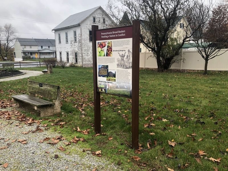
On Chambersburg Road (Old U.S. 30) at High Street, on the right when traveling west on Chambersburg Road.
After a stunning victory at Chancellorsville in May 1863, Confederate Gen. Robert E. Lee led the Army of Northern Virginia through Maryland into Pennsylvania, marching east to threaten Philadelphia, Baltimore, and Washington, D.C. The Army . . . — — Map (db m27034) HM
On Chambersburg Road (U.S. 30), on the right when traveling west.
Crossing South Mountain from Chambersburg, Gen. Hill's Corps of Lee's army assembled here on June 29-30, 1863. On July 1, his advance guard moved up from near Marsh Creek and met Union Troops west of Gettysburg. — — Map (db m5814) HM
On Chambersburg Road, 0.1 miles west of High Street, on the right when traveling west.
Army of Northern Virginia Stuart's Cavalry Division Imboden's Brigade 18th Virginia Cavalry, 62nd. Virginia Infantry Virginia Partisan Rangers and Virginia Battery July 3 Command guarding trains. Reached the field at noon and retired with the . . . — — Map (db m11622) HM
On Main Street (U.S. 30) 0.2 miles west of High Street, on the right when traveling west.
The historic Cashtown Inn has been offering lodging and dining to weary travelers since the turn of the 19th Century. Roads were important to town development, just as the automobile was important to their prosperity. As roads brought travelers . . . — — Map (db m167235) HM
On West King Street (Pennsylvania Route 234) east of 6th Avenue, on the right when traveling east.
Historic Gettysburg
Lion and the Lamb
1810
Adams County
Honored 1990
This property has been listed on the National Register of Historic Places by the United States Department of the Interior — — Map (db m217257) HM
On Main Street (State Highway 116) at Miller Street on Main Street.
First Corps marched from Gettysburg to Emmitsburg. Fifth Corps from Marsh Run to Moritz's Cross-Roads. Sixth Corps from Fairfield to Emmitsburg except the Third brigade, Second Division which in conjunction with the First Brigade, Second Cavalry . . . — — Map (db m10770) HM
On West Main Street (State Highway 116) at Spring Street, on the right when traveling west on West Main Street.
(Preface): After Confederate Gen. Robert E. Lee's stunning victory at Chancellorsville in May 1863, he led the Army of Northern Virginia west to the Shenandoah Valley, then north through central Maryland and across the Mason-Dixon Line . . . — — Map (db m60301) HM
On Main Street (State Highway 116), on the right when traveling south.
Wounded of the Sixth U.S. Cavalry and Sixth Virginia Cavalry C.S.A. were cared for in this church building after a severe engagement that took place two miles north of here on July 3, 1863. — — Map (db m10773) HM
On Old Waynesboro Road north of Iron Springs Road, on the left when traveling north.
On June 22, 1863, a skirmish erupted at Monterey Pass when Company D of the 4th Virginia Cavalry attacked portions of Union cavalry under the command of Captain Robert Bell, Captain Samuel Randall, and several members of the Gettysburg Home Guard. . . . — — Map (db m148604) HM
On Old Waynesboro Road at Iron Springs Road, on the right when traveling north on Old Waynesboro Road.
Fountain Dale is located between Jack's Mountain and Beard's Hill, and is also connected to two major mountain gaps, Monterey Pass and Fairfield Gap, which would prove to be fighting ground all of it's own. Troops on both sides needed to keep the . . . — — Map (db m8512) HM
On 1340 Old Waynesboro Road, on the right when traveling south.
On the morning of July 4, Union General Judson Kilpatrick's Cavalry Division consisting of General George Custer and Colonel Nathaniel Richmond's Brigades were ordered from Gettysburg to attack the wagon trains that were moving on the road between . . . — — Map (db m30968) HM
On Old Waynesboro Road north of Iron Springs Road, on the left when traveling north.
On the afternoon of July 4, Union General Judson Kilpatrick left Emmitsburg with three brigades of cavalry, supported by three batteries of rifled artillery. Kilpatrick was ordered to locate and attack a Confederate wagon train that was moving over . . . — — Map (db m104827) HM
On Jacks Mountain Road at Old Waynesboro Road, on the right when traveling north on Jacks Mountain Road.
At this site, on December 8, 1842, the Lutheran Church of Fountaindale was consecrated by pastor Solomon Sentman. The church was built on land owned by Joseph and Isaac Baugher, and previously owned by Daniel Sprenkle. In 1842, there were 55 . . . — — Map (db m134154) HM
On Carlisle Street (Business U.S. 15) at Chambersburg Street (U.S. 30), on the right when traveling south on Carlisle Street.
On the afternoon of June 26, 1863, Confederate cavalry dashed up Chambersburg Street and into the square. Shocked and frightened citizens fled the streets. Sara Broadhead recorded in her diary: "They came with such horrid yells that it was enough to . . . — — Map (db m32437) HM
On North Washington Street at Delap Alley, on the right when traveling south on North Washington Street.
"We will close...you know nothing about the lesson anyhow." With those words, Pennsylvania College Professor Michael Jacobs reluctantly gave in to the distraction of mounting cannon and musketry fire on the morning of July 1, 1863, and dismissed his . . . — — Map (db m32375) HM
On Chambersburg Street (U.S. 30), on the right when traveling west.
In 1863 this building was the home of the John and Martha Scott family, and Martha's sister, Mary McAllister. On the morning of July 1st, Mary McAllister went across the street to the Christ Lutheran Church to volunteer as a nurse. During the . . . — — Map (db m18117) HM
On E High Street at S Stratton Street, on the left when traveling east on E High Street.
The original German Reformed Church located here in 1814, served as a “Union brick church” with the town’s Lutheran congregation until 1848. The core of the present building, erected in 1851, was newly refurbished at the time of the battle. On . . . — — Map (db m65780) HM
On West High Street at South Washington Street, on the right when traveling east on West High Street.
The students of Rebecca Eyster's Young Ladies Seminary were studying in this "old Academy Building" on June 26, 1863. One of those students, Tillie Pierce, described the arrival of the Confederate troops from Seminary Ridge in her book, At . . . — — Map (db m12003) HM
On Baltimore Street (Business U.S. 15) at West Middle Street, on the right when traveling south on Baltimore Street.
Four years after Gettysburg became the county seat in 1800, the first Adams County Courthouse was placed in Lincoln Square (one block to your right). In 1859 this larger building was erected to serve the growing populace. The arrival of the Union . . . — — Map (db m19251) HM
On Baltimore Street (Business U.S. 15) at West Middle Street, on the right when traveling south on Baltimore Street.
On July 8, 1863, the U.S. Sanitary Commission commandeered the three story Fahnestock Bros. buildings as their "stone house" for food and other supplies. From here these critical provisions were distributed daily to the many field hospitals in and . . . — — Map (db m32509) HM
On Chambersburg Street (U.S. 30) just east of South Washington Street, on the right when traveling east.
Completed in 1836, Christ Evangelical Lutheran Church's building is the oldest in Gettysburg used continuously for religious worship. During the battle of Gettysburg it became a haven for serving humanity. When the first wounded appeared along . . . — — Map (db m18121) HM
On West Middle Street (State Highway 116) at South Washington Street, on the right when traveling west on West Middle Street.
This building was the Professor Michael Jacobs residence which remained in the family from 1834 until 1901. One of the town's leading citizens, Professor Jacobs was a member of the Gettysburg College faculty from its foundation in 1832 until his . . . — — Map (db m168189) HM
On York Street (U.S. 30) at Carlisle Street (Business U.S. 15), on the right when traveling west on York Street.
On July 1, 1863, Gettysburg's center square was the eye in the storm of panic and confusion that swirled in the town's streets and alleys as the routed Union 1st and 11th Corps fled toward the safety of Cemetery Hill. Some Union soldiers rallied . . . — — Map (db m32458) HM
On Steinwehr Avenue (Business U.S. 15) 0 miles north of Culp Street, on the right when traveling north.
The rare image reproduced at right, courtesy of William A. Frassanito, Gettysburg Then & Now (Thomas Publications), is one of only 9 photos known to have been taken of the dedication ceremonies in Gettysburg on Nov. 19, 1863, during which . . . — — Map (db m19064) HM
On York Street (U.S. 30) at Carlisle Street (Business U.S. 15), on the right when traveling west on York Street.
This was the site of the GLOBE INN, one of Gettysburg's oldest hotel-taverns, originally owned and operated in 1798 by townfounder James Gettys, and traditionally the unofficial headquarters for the local Democratic party. Such political . . . — — Map (db m32474) HM
On Lefever Street at Baltimore Street, on the right when traveling north on Lefever Street.
Here was the yard and the site of the Samuel McCreary house, along the extreme advance of the Confederate skirmish line before Cemetery Hill. The 1863 McCreary residence, along with its architectural twin, the Winebrenner house (standing to your . . . — — Map (db m66435) HM
On Carlisle Street (Business U.S. 15) at Racehorse Alley, on the right when traveling north on Carlisle Street.
During the retreat on July 1st by the Union 11th Corps, this area was a mass of demoralized troops and military vehicles frantically trying to escape pursuing Confederate rifle fire. Captain Fred Winkler, 26th Wisconsin Regiment, stood here and . . . — — Map (db m32436) HM
On Steinwehr Avenue (Business U.S. 15) 0 miles north of Culp Street, on the left when traveling north.
On July 1-4, 1913, the 50th Anniversary of the Battle of Gettysburg was celebrated with the first joint reunion for all Union and Confederate veterans, many of whom fought here in 1863.
53,407 veterans attended. 44,713 Union and 8,694 . . . — — Map (db m19063) HM
Near Emmitsburg Road (Business U.S. 15) at Long Lane, on the right when traveling south. Reported permanently removed.
"I received an order... to move my regiment...to the front of our position...and to hold my line to the last man." Lt. Col. Franklin Sawyer, 8th Ohio At 4:00 p.m. on July 2nd the 209 men of the 8th Ohio were ordered to advance and hold this . . . — — Map (db m15122) HM
On Baltimore Street (Business U.S. 15) at High Street, on the right when traveling north on Baltimore Street.
Following the retreat of Union forces to Cemetery Hill on the afternoon of July 1, 1863, the Confederates occupied the town of Gettysburg until early morning, July 4th. The main Confederate battle line facing the Union forces on Cemetery Hill ran . . . — — Map (db m18129) HM
On W High Street west of Washington Street, on the right when traveling west.
Erected in 1853, this church served as a field hospital during and after the Battle of Gettysburg in 1863. While the church was substantially altered in 1925, much of the original Civl War era structure remains intact. Within its walls some 200 . . . — — Map (db m65783) HM
On Washington Street at High Street, on the left when traveling north on Washington Street.
In 1863 this was the home of James and Catherine Foster and their daughter, Catherine. Prior to the battle the town was cut off from communications, and rumors of approaching “Rebels” and the whereabouts of the Union army prompted the . . . — — Map (db m16353) HM
On Baltimore Street (Pennsylvania Route 97) when traveling north.
On the morning of July 1st, Gettysburg resident Jennie Wade and her family fled their town home to this brick double house shared by her sister Georgia McClellan, to distance themselves from the fighting. The Union retreat to Cemetery Hill soon . . . — — Map (db m37616) HM
On E High Street west of S Stratton Street, on the left when traveling east.
The High Street or “Common” School was Gettysburg’s first consolidated public school building. Prior to its erection in 1857 classes were held in individual buildings, often the home of the teacher. Like the rest of the town’s public facilities . . . — — Map (db m65781) HM
On Baltimore Street at Breckenridge Street, on the right when traveling south on Baltimore Street.
This building was the home of the James Pierce family during the Battle of Gettysburg. Tillie Pierce, a 15 year old school girl at the time, provided a vivid account of events from those days. The alarm that “The Rebels Are Coming!” . . . — — Map (db m155307) HM
On Baltimore Street (Pennsylvania Route 97), on the left when traveling north.
This building was constructed in 1869 as a dormitory for “The National Homestead at Gettysburg,” a school for soldiers’ orphans established in 1866 in the brick building to your right. Among its first students were Alice, Frank and . . . — — Map (db m37620) HM
On Baltimore Pike (State Highway 97), on the right when traveling north.
(Top):Position held by the 106th Regt. P.V. 2nd Brig. 2nd Div. 2nd A.C. July 3, 1863. (Bottom):Organized Aug. 21, 1861 Mustered out June 30, 1865 From Balls Bluff to Appomattox "Your batteries can be withdrawn when that regiment . . . — — Map (db m17152) HM
On Baltimore Pike (State Highway 97), on the right when traveling north.
(Front):134th New York Infantry, 1st Brigade, 2nd Division, 2nd Division, 11th Corps. (Back):July 1st 1863 This Regiment was engaged about one quarter mile east of Gettysburg near York Road July 2d and 3d held this position . . . — — Map (db m17151) HM
On Coster Avenue at North Stratton Street, on the right when traveling east on Coster Avenue.
Lieut Colonel A. H. Jackson Commanding 1st Brigade Colonel Charles R. Coster 2d Division Brigadier General A. Von Steinwehr 11th Corps Major General O.O. Howard July 1st, 1863 The regiment with the brigade was thrown forward to check the rapid . . . — — Map (db m11039) HM
On Howard Avenue, 0.2 miles west of Carlisle Road (Pennsylvania Highway 34), on the right when traveling east.
13th New York Indpt. Light Battery (Wheeler's) Artillery Brigade 11th Corps ——— July 1, 1863. Engaged here. July 2. On Cemetery Hill. July 3. At repulse of Pickett's Charge — — Map (db m11155) HM
On Coster Avenue at North Stratton Street, on the right when traveling east on Coster Avenue.
(Front): 154th New York Infantry 1st Brigade, 2nd Division, 11th Corps, July 1, 1863 (Left):July 2nd and 3rd occupied position on East Cemetery Hill. (Back):Casualties. Killed, Men 1, Wounded, Officers 1, Men 20, Captured or . . . — — Map (db m11038) HM
On Howard Avenue at Carlisle Road (Pennsylvania Highway 34), on the right when traveling east on Howard Avenue.
(Front):157th New York Infantry 1st Brigade 300 yards in advance of this position were killed 4 officers, 23 men - 27 wounded 8 officers, 158 men - 166 captured 6 officers, 108 men - 144 total casualties 307 July 1st 1863. . . . — — Map (db m11070) HM
On Howard Avenue at Mummasburg Road, on the right on Howard Avenue.
(Front):Erected by the Survivors of the 157th Reg't New York Vol's in Memory of their Gallant Comrades Who Fell Here, July 1, 1863 1st Brigade, 3rd Division, 11th Corps (Back):Gettysburg ——— Lost here 18 Officers . . . — — Map (db m14023) HM
On Baltimore Street (Business U.S. 15) south of Wade Avenue, on the right when traveling south.
This home was built in 1834 by George Heck. It was originally a "large, two story brick home, 1 room deep, with a framed kitchen and dirt basement" (most likely a four room house with lean-to kitchen on the back). The original 2" x 16" oak flooring . . . — — Map (db m75565) HM
On Chambersburg Pike (U.S. 30) near West Street, on the right when traveling east.
(Left Side):26th Pennsylvania Emergency Infantry Organized at Harrisburg and volunteered for the emergency Mustered into United States service June 22 1863 Mustered out July 30 1863 Co. A recruited from Pennsylvania College and Gettysburg . . . — — Map (db m15147) HM
On Baltimore Pike (State Highway 97), on the right when traveling north.
(Front):July 1, 1863. The Regiment moved with the Brigade in the afternoon to N.E. side of Gettysburg where it became actively engaged covering the retreat of the Corps. It then withdrew to this position where after dark of the 2nd it . . . — — Map (db m17144) HM
On Howard Avenue at Mummasburg Road, on the right when traveling east on Howard Avenue.
(Front):45th N.Y. Infantry 1st Brig. 3rd Div. 11th Corps. July 1, 1863 (Left):The regiment went into action about 11.30 a.m. July 1st, 1863, by deploying four companies as skirmishers under Captain Irsch about one hundred yards to the . . . — — Map (db m11113) HM
On Baltimore Pike (State Highway 97), on the right when traveling north.
(Front):4th Ohio Infantry. 1st Brigade, 3rd Division, 2nd Corps. Carroll's Brigade. Ohio's Tribute. (Left):On the evening of July 2, 1863. Carroll's Brigade was sent from its position with the 2nd Corps to re-enforce this position of . . . — — Map (db m16945) HM
On Steinwehr Avenue (Business U.S. 15) at South Washington Street (Pennsylvania Route 134), on the right when traveling north on Steinwehr Avenue.
(Front):55th Ohio Infantry 2d Brig. 2d Div. 11th Corps. Erected by the State of Ohio. (Left):55th Ohio Infantry Arrived at 2:20 pm. July 1, in this position, which it held throughout the battle. With severe loss, its skirmishers . . . — — Map (db m12191) HM
On Howard Avenue, 0.2 miles east of Mummasburg Road, on the right when traveling east.
(Front):The 61st Ohio Infantry ———On arriving from Emmittsburg about one o'clock p.m., July 1st 1863, was deployed as skirmish line in advance of its Brigade and moved towards Oak Hill. Later it supported as section of . . . — — Map (db m11132) HM
On Baltimore Pike (State Highway 97), on the right when traveling north.
(Front):73rd Penna Infantry July 2nd in the morning took position in the cemetery. At dusk moved hastily to this position and in a severe contest assisted in repulsing a desperate assault on these batteries. (Left):11th Corps. . . . — — Map (db m17254) HM
On Howard Avenue, 0.2 miles east of Mummasburg Road, on the right when traveling east.
(Front):74th Penna Infantry German Regiment 1st Brig. 3d Div. 11th Corps. July 1st fought here from 2 p.m. until the Corps fell back. July 2 & 3 in line with Division in front of cemetery. (Back):Recruited at Pittsburgh and . . . — — Map (db m11130) HM
On Baltimore Pike (State Highway 97), on the right when traveling north.
(Front):Sons of the Mountains 7th W Va Veteran Romney to Appomattox 1st Brigade Carroll 3rd Division 2nd Corps. At dusk July 2nd Carroll's Brigade was ordered by General Hancock to this point. On arriving there we found the Battery about to . . . — — Map (db m17255) HM
On Howard Avenue, 0.1 miles west of Carlisle Road (Pennsylvania Highway 34), on the right when traveling east.
(Front):1st. Brigade. 3rd. Division. 11th Corps. First Line of Battle, July 1, 1863. (Right):Moved in retreat to Cemetery Hill. July 1, 1863. (Left):Occupied the crest of Cemetery Hill. July 2 & 3. 1863. . . . — — Map (db m11157) HM
On November 19, 1863, four and a half months after the Battle of Gettysburg, President Abraham Lincoln attended the dedication of the Soldiers' National Cemetery. Edward Everett, the principal speaker and one of the greatest orators of his time, . . . — — Map (db m165776) HM
On West Lincoln Avenue, on the right when traveling west.
"There was no one among us who had the smallest comprehension of all that an invasion of our soil could mean." - Henry Eyster Jacobs, Class of 1862
When the Confederate army advanced into Pennsylvania in June 1863, no person or place went . . . — — Map (db m76071) HM WM
On S Stratton Street at York Street (U.S. 30), on the right when traveling south on S Stratton Street.
Members of the beaten Union 11th Corps fled pursuing Confederates along this portion of Stratton Street in the late afternoon of July 1, 1863, seeking the protection of friendly lines on Cemetery Hill, a quarter mile beyond the crest in the . . . — — Map (db m167727) HM
On York Street (U.S. 30) at Stratton Street, on the right when traveling west on York Street.
In 1863 one of Gettysburg's earliest weatherboarded buildings stood at this corner, the home of Judge Samuel Russell. After the battle the body of an unidentified soldier was found in the side yard to its left clutching a photograph of three young . . . — — Map (db m32476) HM
On Steinwehr Avenue (Business U.S. 15), on the right when traveling south.
When Abraham Lincoln prophetically spoke of a "house divided", he might well have referenced the sons of Easias Jesse and Margaret Sutherland Culp. Both boys, William E. "William", (b. 1831) and John W. "Wesley", (b. 1839), grew up in Gettysburg and . . . — — Map (db m66431) HM
On Baltimore Street (U.S. BUS 15) south of Breckenridge Street, on the right when traveling south.
In 1863, this building to your right, was the home and cabinetmaker’s shop of Henry Garlach and family. Cut off during the Union retreat to Cemetery Hill, General Alexander Schimmelfennig was able to avoid capture by the Confederates, when he hid . . . — — Map (db m6176) HM
On West Middle Street at Baltimore Street (Business U.S. 15), on the right when traveling east on West Middle Street.
Formed January 22, 1800 out of York County. The name honors President John Adams. Important center of fruit growing industry. County seat of Gettysburg, incorporated 1806, was site in 1863 of key Civil War battle and President Abraham Lincoln's . . . — — Map (db m19252) HM
On North Stratton Street, on the right when traveling north.
Near this spot on July 1, 1863 a Union soldier fell mortally wounded. When a local resident found the unidentified body, he also discovered a photograph of three children. News of this poignant find was soon widely covered by the press, and copies . . . — — Map (db m17964) HM
On Baltimore Street at Breckenridge Street, on the right when traveling north on Baltimore Street.
Confederate sharpshooters in this area built a barricade across Baltimore Street at the intersection with Breckenridge Street to gain an open field of fire towards the Federal troops on Cemetery Hill. From behind this barricade and from windows of . . . — — Map (db m65779) HM
On West Confederate Avenue, on the right when traveling south.
Headquarters of the Army moved from Greencastle to Chambersburg Penna. Rodes's and Johnson's Divisions Ewell's Corps arrived at Carlisle. Early's Division marched from Mummasburg via Hunterstown, New Chester and Hampton to Berlin. Gordon's Brigade . . . — — Map (db m11823) HM
On West Confederate Avenue, on the right when traveling south.
Rodes's and Johnson's Division Ewell's Corps were at Carlisle. Jenkins's Cavalry Brigade was sent to reconnoitre the defenses of Harrisburg. Early's Division Ewell's Corps marched from Berlin by way of Weiglestown to York. Gordon's Brigade Early's . . . — — Map (db m11824) HM
On West Confederate Avenue, on the right when traveling south.
Heth's Division Hill's Corps marched from Fayetteville to Cahstown. Pender's and Anderson's Divisions remaining at Fayetteville. Johnson's Division Ewell's Corps countermarched from Carlisle to Greenville Penna. Rodes's Division Ewell's Corps . . . — — Map (db m11825) HM
On West Confederate Avenue, on the right when traveling south.
Heth's Division Hill's Corps at Cashtown. Pettigrew's Brigade Heth's Division marched nearly to Gettysburg but was recalled. Pender's Division Hill's Corps marched from Fayetteville to Cashtown. Anderson's Division Hill's Corps remained at . . . — — Map (db m11827) HM
On West Confederate Avenue, on the right when traveling south.
McLaws's and Hood's Divisions Longstreet's Corps marched from Marsh Creek to the field at Gettysburg. Law's Brigade Hood's Division marched from New Guilford to Gettysburg arriving about noon. Pickett's Division Longstreet's Corps marched from . . . — — Map (db m11830) HM
On West Confederate Avenue, on the right when traveling south.
Pickett's Division Longstreet's Corps arrived on the field early in the morning. Robertson's and Jones's Brigades Stuart's Cavalry Division marched from Chambersburg via Cashtown and Fairfield to a position on the right flank of the Confederate . . . — — Map (db m11831) HM
On West Confederate Avenue, on the right when traveling south.
Ewell's Corps marched before dawn from the base of Culp's Hill and the streets of Gettysburg to Seminary Ridge and the Army remained in position on that Ridge throughout the day. Soon after dark Hill's Corps withdrew and began the march via . . . — — Map (db m11832) HM
On West Confederate Avenue, on the right when traveling south.
The Army on the march to the Potomac. Hill's Corps had the advance. Longstreet's the centre. Ewell's the rear. Hood's Division Longstreet's Corps started after sunrise. Early's Division Ewell's Corps started near noon and formed the rear guard. Fitz . . . — — Map (db m11833) HM
On West Confederate Avenue, on the right when traveling south.
Heth's and Pender's Divisions Hill's Corps marched from Cashtown to Gettysburg. Anderson's Division Hill's Corps marched from Fayetteville via Cashtown to near Gettysburg. Rodes's Division Ewell's Corps marched from Heidlersburg via Middletown to . . . — — Map (db m168019) HM
On West Confederate Avenue, on the right when traveling south.
Headquarters of the Army with Hood's Division Longstreet's Corps crossed the Potomac at Williamsport Md. and marched to Greencastle Penna. McLaw's Division Longstreet's Corps crossed the river and encamped near Williamsport. Pickett's Division . . . — — Map (db m202868) HM
On Baltimore Pike (State Highway 97), on the right when traveling north.
Headquarters of the Army moved from Gettysburg to Frederick. First Corps marched from Emmitsburg to Hamburg. Second Corps from Two Taverns to Taneytown. Third Corps from Gettysburg via Emmitsburg to Mechanicstown. Fifth Corps from Moritz's . . . — — Map (db m15548) HM
On Baltimore Pike (State Highway 97), on the right when traveling north.
First Corps marched from Gettysburg to Emmitsburg. Fifth Corps from Marsh Creek to Moritz's Cross-Roads. Sixth Corps from Fairfield to Emmitsburg except the Third Brigade Second Division which in conjunction with the First Brigade Second Cavalry . . . — — Map (db m15549) HM
On Baltimore Pike (State Highway 97), on the right when traveling north.
Second Corps marched from Gettysburg to Two Taverns. Fifth Corps to Marsh Creek. Sixth Corps to Fairfield. Eleventh to Rock Creek. Twelfth Corps to Littlsetown. First Brigade Second Cavalry Division to Emmitsburg and the Artillery Reserve to . . . — — Map (db m15551) HM
On Baltimore Pike (State Highway 97), on the right when traveling north.
First and Second Brigades First Cavalry Division marched from Westminster. The Reserve Brigade First Cavalry Division from Gettysburg en route to Frederick. Second Brigade Second Cavalry Division from Westminster via Emmitsburg to Monterey. The . . . — — Map (db m15552) HM
On Baltimore Pike (State Highway 97), on the right when traveling north.
First and Second Brigades First Cavalry Division marched from Taneytown to Westminster. The Reserve Brigade First Cavalry Division from Emmitsburg to the field of Gettysburg and the Second Brigade Second Cavalry Division from Manchester to . . . — — Map (db m15553) HM
On Baltimore Pike (State Highway 97), on the right when traveling north.
Headquarters of the Army moved to Gettysburg. Second, Fifth and Sixth Corps, Lockwood's Brigade from the Middle Department, First and Third Brigades Second Cavalry Division, Third Cavalry Division and the Artillery Reserve reached the field. First . . . — — Map (db m15554) HM
On Baltimore Pike (State Highway 97), on the right when traveling north.
Headquarters of the Army at Taneytown. First Corps marched from Marsh Creek to Gettysburg. Eleventh Corps from Emmitsburg to Gettysburg. Second Corps from Uniontown via Taneytown to near Gettysburg. Third Corps from Bridgeport via Emmitsburg to the . . . — — Map (db m15555) HM
On Baltimore Pike (State Highway 97), on the right when traveling north.
Headquarters of the Army moved from Middleburg to Taneytown. First Corps marched from Emmitsburg to Marsh Creek. Third Corps from Taneytown to Bridgeport. Fifth Corps from Liberty via Johnsville, Union Bridge and Union to Union Milles. Sixth . . . — — Map (db m15556) HM
On Baltimore Pike (State Highway 97), on the right when traveling north.
Headquarters of the Army moved from Frederick to Middleburg. First and Eleventh Corps marched from Frederick to Emmitsburg. Second Corps from Monocacy Junction via Liberty and Johnsville to Uniontown. Third Corps from near Woodsborough to Taneytown. . . . — — Map (db m15557) HM
On Howard Avenue, 0.2 miles west of Carlisle Road (Pennsylvania Highway 34), on the right when traveling east.
Army of the Potomac Eleventh Corps Artillery Brigade Major Thomas W. Osborn 1st New York Battery I Six 3 inch rifles Capt. Michael Wiedrich New York 13th Battery Four 3 inch rifles Lieut. William Wheeler 1st Ohio Battery I Six 12 pounders Capt. . . . — — Map (db m11140) HM
On Baltimore Pike (State Highway 97), on the right when traveling north.
Army of the Potomac First Corps Artillery Brigade Col. Charles S. Wainwright Maine 2d Battery B Six 3 inch Rifles Capt. James A. Hall Maine 5th Battery E Six 12 pounders Captain Greenleaf T. Stevens, Lieut. Edward K. Whittier 1st New York . . . — — Map (db m204712) HM
1955 entries matched your criteria. The first 100 are listed above. Next 100 ⊳