On Market Street near South Street, on the left when traveling west.
Known as the Scott Hall Cemetery, it dates from the late 18th century. Here will be found the grave of Commodore Whaley of the Maryland Navy who was killed in the Battle of the Barges in the Chesapeake Bay near the mouth of Onancock Creek in . . . — — Map (db m7681) HM
On US 13 at W. Main Street, on the left when traveling north on US 13.
Two miles west is Onancock, founded in 1680. A courthouse was then built and used for a few years. Militia barracks were there in the Revolution. From Onancock, Colonel John Cropper went to the aid of Commodore Whaley in the last naval action of the . . . — — Map (db m7673) HM
Landowner, successful business woman manager, champion of American Independence. Daughter of Naomi and Francis Makemie, founder of organized American Presbyterianism. — — Map (db m7835) HM
On Gordonsville Road (Virginia Route 231) 1.5 miles Virginia Route 640, on the left when traveling north.
The original house was built in 1765 by Thomas Walker, explorer and pioneer. Tarleton, raiding Charlottesville to capture Jefferson and the legislature, stopped here for breakfast, June 4, 1781. This delay aided the patriots to escape. Castle Hill . . . — — Map (db m22439) HM
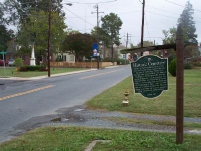
On Stony Point Road at Winding River Lane, on the right when traveling north on Stony Point Road.
George Rogers Clark was born a mile northeast of here on 19 Nov. 1752. He grew up on a farm in Caroline County. Clark explored the Ohio River Valley, fought in Dunmore's War in 1774, and helped convince the General Assembly to organize Kentucky as a . . . — — Map (db m165405) HM
Near Thomas Jefferson Parkway (Virginia Route 53) west of James Monroe Parkway (County Route 795), on the right when traveling east.
Here in 1774, Thomas Jefferson and Philip Mazzei planted Virginia's first commercial vineyard, intending to export their wine back to Europe. The Vineyard was abandon in 1776 with the advent of the Revolutionary War. Jefferson's efforts to grow . . . — — Map (db m188548) HM
On Ivy Road (Business U.S. 250) near Colonnade Drive.
Jesse Pitman Lewis (d. March 8, 1849), of the Virginia Militia, and Taliaferro Lewis (d. July 12, 1810), of the Continental Line, two of several brothers who fought in the War for Independence, are buried in the Lewis family cemetery 100 yards south . . . — — Map (db m3994) HM
Near Monticello Loop, 0.3 miles east of Thomas Jefferson Parkway, on the right when traveling east.
The greatest advocate of human liberty
Opposing special privileges
He loved and trusted The People
To commemorate his
Purchase of Louisiana
Erected by
The Jefferson Club
of St. Louis MO
on their pilgrimage Oct 12, 1901
to . . . — — Map (db m99849) HM
On University Avenue (Virginia Route 250) east of McCormick Road, on the left when traveling west.
Proclaim Liberty throughtout the land unto the inhabitants thereof —Leviticus XXIV.
This monument to Thomas Jefferson was presented to the people to perpetuate the teachings and examples of the Founders of the . . . — — Map (db m8805) HM
On Barracks Farm Road (County Route 658) east of Garthfield Lane, on the right when traveling east.
In Jan. 1779, during the American Revolution, 4,000 British troops and German mercenaries (commonly known as “Hessians”) captured following the Battle of Saratoga in New York arrived here after marching from Massachusetts. It was called . . . — — Map (db m55784) HM
On Ivy Farm Road (County Route 1015), on the left when traveling east.
"In 1779 4,000 prisoners, British and their German auxiliaries, captured at the Battle of Saratoga in 1777, marched over 600 miles to quarters, called 'The Barracks', situated a half mile north of this site. Traditionally, some of these prisoners . . . — — Map (db m37586) HM
On Louisa Road (Virginia Route 22) 0.2 miles east of Cobham Station Lane (Virginia Route 640), on the right when traveling north.
After reinforcements from Brig. Gen "Mad" Anthony Wayne arrived on 10 June 1781, the Marquis de Lafayette moved south from his camp on the Rapidan River to prevent further raids by Gen. Charles Cornwallis British troops encamped at Elk Hill. By 13 . . . — — Map (db m22617) HM
On Louisa Road (Virginia Route 22) 0.1 miles west of Whitlock Road (Virginia Route 616), on the left when traveling west.
Albemarle County. Albemarle County was formed in 1744 from Goochland County and named for William Anne Keppel, the second Earl of Albemarle, titular governor of Virginia from 1737 to 1754. A portion of Louisa County was later added to . . . — — Map (db m22780) HM
On James River Road (Virginia Route 742) 0.2 miles east of Warren Ferry Road, on the right when traveling east.
Just to the south was Mount Warren, the home of Wilson Cary Nicholas. He served in the Continental army, represented Albemarle County in the General Assembly (1784–1789, 1794–1799), and was a delegate to the Virginia Convention of 1788 . . . — — Map (db m19406) HM
On Richmond Road (U.S. 250) east of Exit 124 (Interstate 64), on the right when traveling east.
Thomas Jefferson—author of the Declaration of Independence, third president of the United States, and founder of the University of Virginia—was born near this site on 13 April 1743. His father, Peter Jefferson (1708–1757), a surveyor, planter, and . . . — — Map (db m17306) HM
On Thomas Jefferson Parkway (Virginia Route 53) just south of Colle Lane, on the right when traveling south.
Philip Mazzei, a Tuscan merchant and horticulturalist, arrived in Virginia in 1775 and was persuaded by Thomas Jefferson to settle here. Jefferson gave him 193 acres of land, and Mazzei named his property Colle (meaning "hill"). He built a house ca. . . . — — Map (db m170655) HM
Near North Union Street east of Fayette Alley, on the right when traveling north. Reported missing.
13,000 years ago
The Paleoindian Period
A Native American hunter during the Paleoindian period discards a broken spear point, on a bluff overlooking a tributary to the Potomac River at the southern edge of present-day Alexandria. . . . — — Map (db m166409) HM
On Cameron Street east of North Royal Street, on the right when traveling east.
Wording on stone tablet to left:
Alexandria, Virginia
County seat of Fairfax 1742-1800
Organized 13th July, 1749
Incorporated by the Assembly of Virginia 1779
Ceded to the Federal Government 1789
First boundary . . . — — Map (db m167068) HM WM
On Prince Street just east of South Fairfax Street, on the right when traveling east.
This house was built between 1784-1786 by Colonel Michael Swope, a Revolutionary War Battalion Commander, and his wife, Eva Kuhn Swope. Originally from York, PA, Colonel Swope was taken prisoner by the British at the beginning of the war and was . . . — — Map (db m149717) HM
On Cameron Street just west of North Fairfax Street, on the right when traveling west.
On December 31, 1783, George Washington was feted here by the Gentlemen of Alexandria celebrating his triumphant return from the Revolutionary War. — — Map (db m191971) HM
On King Street near North St Asaph Street, on the right when traveling west.
George Washington considered Alexandria his hometown after its founding in 1749, and it is here that he came to do business, learn the events of the world, pick up mail, and visit friends. His first association with the town was probably as a 17 . . . — — Map (db m115747) HM
On Duke Street east of South Fairfax Street, on the right when traveling east.
Close personal friend and family physician of Washington. Surgeon in Braddock's campaign, also with Washington throughout the Revolutionary War. Was at his bedside when he died and received his last messages. — — Map (db m167158) HM
Home of
George Gilpin 1740-1813
Member, Fairfax Committee of Safety
Colonel, Virginia Regiment Fairfax Militia,
Served with General George Washington
in New Jersey campaign and Battle of Germantown
Surveyor of the Town of . . . — — Map (db m115764) HM
On Cameron Street east of North Washington Street, on the right when traveling west.
Famous Revolutionary Soldier, Father of Robert E. Lee. Was ardent supporter of Federalists. Defended Washington in political contests and delivered eulogy before Congress at Washington's Death in which he used the now famous phrase:
"First in . . . — — Map (db m72316) HM
This building was the warehouse of John Fitzgerald, Alexandria merchant and officer of the third Virginia Regiment of the Continental Line.
Colonel Fitzgerald was a close friend of General George Washington and he was his secretary and aide-de-camp . . . — — Map (db m81247) HM
On King Street at North Washington Street (Virginia Route 400), on the right when traveling west on King Street.
Revolutionary War hero Henry "Light Horse Harry" Lee, father of Confederate General Robert E. Lee, purchased several lots on North Washington Street in Alexandria soon after the War for Independence. He lived with his family in a house on Cameron . . . — — Map (db m115721) HM
Near North Union Street south of Cameron Street, on the right when traveling north. Reported permanently removed.
Discover the spirit of Alexandria that has been making history for well over two centuries
Founded in 1749, Alexandria was the center of commercial and political activity for early patriots such as George Washington as the seeds of the . . . — — Map (db m115776) HM
Near North Columbus Street just south of Cameron Street, on the right when traveling north.
Lieut. Col U.S.A., Revolutionary War
1st Battalion, Lancaster County
Pennsylvania Associators, 1777
Assistant Deputy Quartermaster General
Member of
The Pennsylvania Constitutional Convention, July, 1776
Original stone removed . . . — — Map (db m195645) HM WM
On Oronoco Street just east of North Washington Street, on the right when traveling west.
This Federal-style townhouse and its adjoining twin were built ca. 1793. Original owner John Potts, Jr., secretary of the Potomac Company, deeded the house in 1799 to William Fitzhugh of Chatham, member of Virginia's Revolutionary Conventions and . . . — — Map (db m188751) HM
On South Fairfax Street south of Prince Street, on the right when traveling north.
Physician General and Director of Hospitals, Middle Department, Continental Army, Charter member, Society of the Cincinnati. Author of the first American Pharmacopoea. President of Board of Trustees of Alexandria Academy, at General Washington's . . . — — Map (db m71757) HM
On King Street (Virginia Route 7) at North Washington Street (Virginia Route 400), on the right when traveling east on King Street.
One block south is The Alexandria Lyceum, formed as a public education organization in 1834 by Quaker schoolmaster Benjamin Hallowell and other civic leaders. In 1839, the founders joined with the Alexandria Library Company to construct a . . . — — Map (db m115718) HM
Near Jones Point Drive, 0.2 miles South Royal Street, on the right when traveling east.
From the late 1700s into the 1800s, the pastoral calm of the Point was interrupted repeatedly—by soldiers manning cannon emplacements, by surveyors laying out the boundaries of the nation's capital, by workers at a ropewalk and the lighthouse, . . . — — Map (db m62029) HM
On North Royal Street south of Cameron Street, on the right when traveling south.
The Memorial Fountain in this garden rededicated on June 2, 1967 by The Mount Vernon Chapter National Society of The Daughters of the American Revolution on the occasion of the Dedication of tavern square the fountain was previously located at the . . . — — Map (db m241669) WM
On South Union Street just north of Gibbon Street, on the left when traveling north.
Now a city park, Windmill Hill got its name from the windmill built here on Miller's Cliff by inventor John R. Remington in 1843. With soothing winds and a grand view of the busy port, the hill was the scene of fashionable promenades and numerous . . . — — Map (db m143377) HM
On North Washington Street (Virginia Route 400) at Oronoco Street, on the right when traveling south on North Washington Street.
Eminent lawyer, he lived here until 1837. His son, Cassius Francis Lee until 1865. Edmund Jennings Lee served as Vestryman and Warden of Christ Church, whose Glebe lands he successfully defended from confiscation after the Revolutionary War. Major . . . — — Map (db m8566) HM
On Oronoco Street at North Washington Street (Virginia Route 400), on the right when traveling east on Oronoco Street.
Built by Philip Richard Fendall in 1785 on land purchased from Henry (Light Horse Harry) Lee. Lee was a brilliant cavalry officer in the Revolution, close friend of George Washington, Virginia Assemblyman, member of Congress and Governor of . . . — — Map (db m128768) HM
On Oronoco Street at North Washington Street (Virginia Route 400), on the right when traveling east on Oronoco Street.
“Light Horse Harry” Lee, Revolutionary War officer, owned this land in 1784. The house was built in 1785 by Phillip Fendall, a Lee relative. Renovated in 1850 in the Greek Revival style, the house remained in the Lee family until 1903. . . . — — Map (db m8567) HM
On Oronoco Street at North Washington Street (Virginia Route 400), on the left when traveling east on Oronoco Street.
Most of the American and French armies set sail from three ports in Maryland—Annapolis, Baltimore, and Head of Elk—in mid-Sept. 1781 to besiege the British army in Yorktown. The allied supply-wagon traln proceeded overland to Yorktown, . . . — — Map (db m8570) HM
On Hamilton Avenue south of Wilkes Street, on the right when traveling south.
In this cemetery rest the earthly remains of Patriots in the Revolutionary War, many of whom were of Scottish ancestry.
These Patriots, along with many Presbyterians from Alexandria, fought for the cause of Liberty and assisted the Soldiers . . . — — Map (db m129163) HM
On Richmond Highway (U.S. 460) at Village Highway (Virginia Route 24), on the right when traveling east on Richmond Highway.
Appomattox County. Appomattox County was named for the Appomattox River, which runs through the county. The river is named for the Appamattuck tribe, which lived near the mouth of the river. The county was formed from parts of Buckingham, . . . — — Map (db m74018) HM
Near North Harrison Street north of Fairfax Drive, on the right when traveling north.
Five generations of the Southern, Shreve, and related families are interred in this burial plot. The Shreve family in Arlington dates from the arrival of Samuel Shreve from New Jersey about 1780. Shreve purchased a tract of land near Ballston in . . . — — Map (db m64878) HM
On Sherman Drive north of Sheridan Drive, on the right when traveling north.
When the Civil War broke out, the Potomac River—to your right—became the dividing line between North and South. Shortly after Robert E. Lee resigned from the US Army in 1861, Union soldiers seized Arlington House.
Sixty years later, a nation . . . — — Map (db m204431) HM
On Humpherys Drive, on the right when traveling north.
In Memory Of
The Men of the Lexington Militia
Killed In Action • 19 April 1775
During the First Battle of the American Revolution
John Brown Robert Munroe
Samuel Hadley Isaac Muzzy
Caleb Harrington Jonas Parker . . . — — Map (db m62373) WM
Revolutionary Soldier, 1775-1783
Pierre Charles L’Enfant
Engineer, Artist, Soldier
under the direction of George Washington, designed the plan for the Federal City
Major US Engineer Corps 1782
Charter member of the Society of the . . . — — Map (db m224006) HM
On Sheridan Avenue at Reba Place, on the right when traveling north on Sheridan Avenue.
This oak tree was dedicated by the Honorable George Bush, President of the United States, on August 7, 1989, to commemorate the Bicentennial of the establishment of the War Department under the United States Constitution. It honors the men and . . . — — Map (db m71034) WM
Although it is no longer legible, this monument marks the northernmost point of an approximately 1200-acre tract of land that George Washington purchased in 1775 prior to the American Revolution. Washington used an oak tree that stood on this site . . . — — Map (db m56480) HM
On North Old Glebe Road south of North Randolph Court, on the right when traveling north.
The earthen mounds that surround you are the remains of the fort's construction.
The model behind you re-creates Fort Ethan Allen as it was depicted in U.S. Army engineering drawings published after the Civil War. Use the drawing and model . . . — — Map (db m129237) HM
On Marshall Drive near Richmond Highway. Reported permanently removed.
The United States Marine Corps War Memorial stands as a symbol of our nation's high regard for the honored dead of the Marine Corps. Although the statue depicts one of the most famous events of World War II, the memorial is dedicated to all Marines . . . — — Map (db m129450) HM
John Parke Custis was the adopted stepson of George Washington and had been raised at the nearby Washington estate of Mount Vernon. He and his wife, Eleanor Calvert, lived in New Kent County with their first two daughters. However, Custis wanted to . . . — — Map (db m8380) HM
On Marshall Drive near Richmond Highway. Reported permanently removed.
Marines have been fighting and dying in defense of freedom since the United States Marine Corps inception in November, 1775. The names of principal campaigns engraved on the memorial are a testament to the sacrifices Marines have made in their . . . — — Map (db m129448) HM
On Washington Boulevard, on the right when traveling west.
This is one of Arlington’s oldest family burial grounds. Ensign John Ball (1748- 1814), a veteran of the American Revolution (Sixth Virginia Infantry), is buried here. John Ball was the son of Moses Ball, who was one of the pioneer settlers in the . . . — — Map (db m56482) HM
On MIddle River Road (County Route 736) north of Union Church Road (County Route 732), on the left when traveling north.
George Moffett (1735–1811), a prominent regional military and civic leader, had joined the Augusta County militia by 1758. He participated in the French and Indian War (1756–1763), led a militia company at the Battle of Point Pleasant in . . . — — Map (db m30460) HM
On East Side Highway (U.S. 340), on the left when traveling north.
Five miles east, formerly known as Woods’ Gap. Michael Woods, his three sons and three Wallace sons-in-law (Andrew, Peter, William), coming from Pennsylvania via Shenandoah Valley, crossed through this pass into Albemarle County in 1734 – . . . — — Map (db m16644) HM
On Lee Jackson Highway (U.S. 11) at Howardsville Road (Virginia Route 701), on the right when traveling south on Lee Jackson Highway.
Two miles west. The first church was built by Colonel Robert Doak in 1779. Captain James Tate, an elder, led in the battles of Cowpens and Guilford Courthouse (1781) a company drawn mainly from this church. In the churchyard 23 Revolutionary . . . — — Map (db m32104) HM
On Lee Jackson Highway (U.S. 11) at Spottswood Road (Virginia Route 620), on the right when traveling south on Lee Jackson Highway.
Two and a half miles northwest. As early as 1748 a log meeting house stood there. In 1793 a stone church (still standing) was built. In 1859 it was succeeded by a brick church, which gave way to the present building in 1918. In the graveyard rest . . . — — Map (db m23759) HM
On East Main Street (Business U.S. 460) at Court Street, on the right when traveling west on East Main Street.
Oct. 10, 1774
In memory of
Bedford’s Volunteer Company
which fought in
The Battle of Point Pleasant
Thomas Buford, Captain
Thomas Dooley, Lieut.
Sergeants
Jonathan Cundiff, Ensign
Nicholas Mead • William Kennedy • John . . . — — Map (db m43717) HM
On Lynchburg Highway (U.S. 460) at County Route 649, on the right when traveling east on Lynchburg Highway.
Bedford County was probably named for the English statesman John Russell, fourth duke of Bedford. Russell, as secretary of state for the Southern Department from 1748 to 1751, had general supervision of colonial affairs. Bedford was formed from . . . — — Map (db m234611) HM
On Roanoke Road (U.S. 220) south of International Parkway, in the median.
Half a mile west stood Greenfield, the home of Col. William Preston. According to local tradition, Stephen Rentfroe constructed a fort there in the 1740s. In 1759, Preston bought the property from Rentfroe and soon built a house that evolved into a . . . — — Map (db m62983) HM
On Cumberland Street (Business Virginia Route 113) at Lee Street on Cumberland Street.
Dedicated to the hundreds of patriots from this area who fought in the American Revolution (1775 - 1783).
When the war in the north came to a stalemate by early 1780, the British turned their military strategy to the South. They believed that . . . — — Map (db m32611) HM
On Lee Highway (U.S. 11/19) 0.1 miles west of Forsythe Road, on the right when traveling west.
Col. Robert Preston (1750-1833) acquired 720 acres here in the 1780s and established Walnut Grove. Preston had emigrated from Ireland in 1773 and worked as assistant surveyor under his relative William Preston, who laid out vast areas of western . . . — — Map (db m210159) HM
On Old Stage Road, 0.4 miles south of Smoky Ordinary Road.
The ordinary that stood on this site catered to travelers on the north-south stage road as early as 1750. During the American Revolution local warehouses were burned by British Colonel Tarleton, and legend says that it was from that occurrence that . . . — — Map (db m20164) HM
On James Madison Highway (U.S. 15) at Francisco Road (County Route 626), on the right when traveling south on James Madison Highway.
Four miles west is the site of New Store Village, in early times an important stop on the stage coach road between Richmond and Lynchburg. Philip Watkins McKinney, governor of Virginia 1890-1894, was born here in 1832. Peter Francisco, Revolutionary . . . — — Map (db m29166) HM
On Main Street (Business U.S. 29) at Wards Droad (U.S. 29), on the left when traveling south on Main Street.
During the Revolutionary War, loyalists in the
Virginia backcountry periodically conspired
against the Revolutionary authorities. Colonels
Charles Lynch, James Callaway, and other militia
officers and county justices formed extralegal
courts to . . . — — Map (db m65382) HM
On Red Hill Road (County Route 677) 1 mile south of Staunton Hill Road (County Route 619).
The double box tomb on the north side of the path marks the graves of Patrick Henry and his second wife, Dorothea Dandridge. Patrick Henry died at home on June 6, 1799, after a long illness. Dorothea died on Valentine's Day 1831 at Seven Islands, . . . — — Map (db m128643) HM
On Wickliffe Road (Virginia Route 40) at Mt. Calvary Road (County Route 600), on the right when traveling east on Wickliffe Road.
Five miles southeast Is Red Hill the last
home and burial place of Patrick Henry,
governor of Virginia and the great orator
of the American Revolution. Henry is
especially famous for his “Liberty or Death”
speech made in 1775 in Saint John’s . . . — — Map (db m64382) HM
On Main Street south of East Rush Street (County Route 1103), on the right when traveling south.
Five miles east is Red Hill, last home and grave of Patrick Henry, orator of the Revolution. He moved there in 1796 and died there, June 6, 1799. Henry is especially famous for his “Liberty or Death” speech made in 1775 at the beginning of the . . . — — Map (db m64431) HM
On Lusardi Drive (U.S. 501) at Rush Street when traveling north on Lusardi Drive.
Five miles east is Red Hill, the last home and
gravesite of Patrick Henry, the great orator
of the Revolution. Henry is especially famous
for his “Liberty or Death” speech made in
1775 in St. John’s Church in Richmond. Henry
moved . . . — — Map (db m64434) HM
On Richmond Highway (U.S. 460) 0.3 miles west of Mount Athos Road (County Route 726), on the right when traveling east.
Two miles north stand massive sandstone walls and four chimneys, the ruins of Mount Athos, overlooking a bend of the James River. The house was built about 1800 for William J. Lewis (1766-1828) on land that had been patented in 1742 by John Bolling . . . — — Map (db m42896) HM
On Alum Springs Road (County Route 858) at Town Fork Road (County Route 623), on the right when traveling east on Alum Springs Road.
This place, on the old stage road, was the first county seat of Bedford; the first courthouse, built in 1755, was standing until 1856. In 1781, New London was raided by the British cavalryman, Tarleton, seeking military stores. It came into Campbell . . . — — Map (db m65383) HM
On Dawn Boulevard (Virginia Route 30) 0.8 miles west of Calno Road, on the right when traveling east.
Caroline County. Area 529 Square Miles. Formed in 1727 from Essex, King and Queen, and King William. Named for Queen Caroline, wife of King George II. George Rogers Clark, conqueror of the Northwest, passed his youth in this . . . — — Map (db m17789) HM
On Richmond Turnpike (U.S. 301) at Mt Gideon Road, on the left when traveling north on Richmond Turnpike.
Caroline County. Area 529 Square Miles. Formed in 1727 from Essex, King and Queen, and King William. Named for Queen Caroline, wife of King George II. George Rogers Clark, conqueror of the Northwest, passed his youth in this . . . — — Map (db m22269) HM
On Richmond turnpike (U.S. 301) 0.2 miles north of Sparta Road, on the right when traveling north.
Six miles southeast is the site of Edmundsbury, home of Edmund Pendleton. Pendleton, born September 9, 1721, was in the House of Burgesses; a delegate to the Continental Congress; chairman of the Virginia Committee of Safety, 1775-6; president of . . . — — Map (db m22259) HM
On U.S. 17, 0.5 miles south of Ware Creek Road, on the right when traveling south.
This is the ancient Woodford Estate. Governor Spotswood and the Knights of the Golden Horseshoe stopped here on their way to the mountains, August, 1716. Here General William Woodford was born, October 6, 1734. He defeated Governor Lord Dunmore at . . . — — Map (db m22577) HM
On Tidewater Trail (U.S. 17) 0.1 miles north of Hazelwood Lane (Virginia Route 675), on the right when traveling north.
Hazelwood was the home plantation of John Taylor of Caroline (1753-1824), agricultural reformer and political theorist. Taylor studied law under his uncle, the jurist Edmund Pendleton, and was an officer in the Revolutionary War. He served in the . . . — — Map (db m186681) HM
On Jefferson Davis Hwy (U.S. 1), on the right when traveling north.
Spotsylvania County. Straddling the fall line, Spotsylvania County was formed from Essex, King William, and King and Queen Counties in 1720. It was named for Alexander Spotswood, lieutenant governor of Virginia from 1710 to 1722. The Civil War . . . — — Map (db m3319) HM
Near Harrison Landing Road, 0.7 miles south of Westover Road (Virginia Route 633), on the right when traveling south.
A short distance south. The place was first settled in 1619 but was abandoned. It was repatented in 1636. Benjamin Harrison, signer of the Declaration of Independence, lived here; his son, William Henry Harrison, President of the United States, was . . . — — Map (db m30225) HM
On John Tyler Memorial Highway (Virginia Route 5) at Kimages Road, on the right when traveling east on John Tyler Memorial Highway. Reported permanently removed.
A short distance south, it was first settled in 1619, when the first Thanksgiving was held here. The present mansion, built in 1726, was the birthplace of Benjamin Harrison, signer of the Declaration of Independence, and President William Henry . . . — — Map (db m9284) HM
On John Tyler Memorial Highway (Virginia Route 5) 0.2 miles east of Kimages Road (Virginia Route 658), on the right when traveling east.
English settlers established Berkeley Hundred just south of there in 1619. Benjamin Harrison III, a merchant and planter, purchased the property in 1691. A Georgian-style house was built in 1726 for Benjamin Harrison IV and his wife, Anne Carter. . . . — — Map (db m175928) HM
On John Tyler Memorial Highway (Virginia Route 5) at Courthouse Road (Virginia Route 155), on the right when traveling west on John Tyler Memorial Highway. Reported permanently removed.
In 1702 Charles City County, which then included both sides of James River, was divided; the courthouse here was built about 1730. Here Simcoe's British Cavalry surprised a party of militia, January 8, 1781. Here Grant's Army passed on its way to . . . — — Map (db m9557) HM
On Courthouse Road (Route 644) at John Tyler Memorial Highway (Virginia Route 5), on the right when traveling north on Courthouse Road.
Charles City County, named for King Charles I, was one of Virginia's eight original shires formed by 1634. It encompassed land south of the James River until 1702, when Prince George County was established. The courthouse was completed here in 1757. . . . — — Map (db m175947) HM
Near Courthouse Road (Virginia Route 155) at Watermelon Fields Road.
Charles City Courthouse was an eye witness to the American Revolution (1775-1783). Soldiers enlisted here before marching off to join the Continental Army. Local militia encamped on the grounds, and armies marched by throughout the course of the . . . — — Map (db m17758) HM
On John Tyler Memorial Highway (Virginia Route 5) 0.2 miles east of Sturgeon Point Road (Virginia Route 614), on the right when traveling west.
Located 1 ½ miles south of the James River is Kennon's Landing. Richard Kennon married Anne Hunt about 1735 and lived there until his death in 1761. Anne Hunt's father was Captain William Hunt whose father William Hunt, a supporter of Nathaniel . . . — — Map (db m86171) HM
Near Harrison Landing Road, 0.7 miles south of Westover Road (Virginia Route 633), on the right when traveling south.
Lane to Site of First Thanksgiving in America. First whiskey distillery 1621. One of the first ship yards in the New World. 18 gun man of war was constructed here for the Revolutionary War. Lincoln landed here in 1862 to confer with General . . . — — Map (db m175925) HM
On John Tyler Memorial Highway (State Highway 5) 2.8 miles east of Wilcox Wharf Road (County Route 618), on the right when traveling east.
Since the establishment of the Court House during the mid-eighteenth century, this area has served as a community center for the entire county. During the Revolution and Civil War the area was the site of military encampments. A tavern built in the . . . — — Map (db m9429) HM
On John Tyler Memorial Highway (Virginia Route 5) at Kimages Road, on the right when traveling east on John Tyler Memorial Highway.
In 1619 the first settlement was made at Westover, about 2 miles southeast. Two settlers died in the Powhatan uprising of 1622. Theodorick Bland bought Westover in 1666; William Byrd I acquired it in 1688. About 1730 his son, Colonel William Byrd . . . — — Map (db m9285) HM
On John Tyler Memorial Highway (Virginia Route 5) 0.4 miles east of Barnetts Road (Route 609), on the right when traveling east.
Early colonists in Jamestown migrated westward, bringing Anglican worship there as early as 1613. Westover Parish was recognized in 1625 by the House of Burgesses. A church built in 1630 at Westover Plantation was moved to its present site in 1731. . . . — — Map (db m221020) HM
On John Tyler Memorial Highway (Virginia Route 5) at Sandy Point Road (Virginia Route 613), on the right when traveling east on John Tyler Memorial Highway.
Originally home to the Paspahegh Indians, Sandy Point was settled in 1617 as Smith's Hundred and after 1619 known as Southampton Hundred. St. Mary's Church was established here prior to the Powhatan Uprising of 1622. During the Revolutionary War . . . — — Map (db m9467) HM
On John Tyler Memorial Highway (Virginia Route 5) 0.1 miles east of Virginia Route 156, on the right when traveling east.
Benjamin Harrison (1726-1791) - Virginia planter, politician, and signer of the Declaration of Independence - was born at nearby Berkeley plantation. He first served in the Virginia House of Burgesses in 1752, though elected in 1749, and remained in . . . — — Map (db m86174) HM
Near Red Hill Road (County Route 677) 1 mile Staunton Hill Road (County Route 619).
After three decades of public service, Patrick Henry retired in 1794 to Red Hill plantation in Charlotte County, which he regarded as "one of the garden spots of the world." He purchased the 700-acre estate and simple story-and-half house in 1794 . . . — — Map (db m128698) HM
Near Red Hill Road (County Route 677) 1 mile Staunton Hill Road (County Route 619).
Text Box #4)
The flags of the Commonwealth Courtyard honor Patrick Henry's election as the first governor of Virginia on June 29, 1776, when the boundaries of the commonwealth extended from the Atlantic Ocean to the Mississippi River. The Grand . . . — — Map (db m128702) HM
On Red Hill Road at Staunton Hill Road (County Route 619) on Red Hill Road.
One mile to the south is Red Hill, Patrick Henry’s last home and burial place. The marble stone covering his grave carries the simple inscription, “His fame his best epitaph.”
Henry came here in 1794 and died at his beloved Red Hill . . . — — Map (db m65398) HM
On George Washington Highway (Virginia Route 40) at Greenfield Road (County Route 656), on the right when traveling west on George Washington Highway.
Three miles north is Edgehill, home of Clement Carrington. He ran away from Hampden-Sydney College to join the Revolutionary army, served in Lee's Legion, 1780-81, and was wounded at Eutaw Springs, September 8, 1781. — — Map (db m31023) HM
799 entries matched your criteria. The first 100 are listed above. Next 100 ⊳