Near Bermuda was the home of Jeremiah Austill, who won fame in the canoe fight on the Alabama River during the Creek Indian War. His first wife, Sarah, died of injuries from falling off a fence during an Indian raid. — — Map (db m81280) HM
Evergreen, the county seat of Conecuh County, is located in the central part of the county on the Louisville & Nashville Railroad. Founded in 1819 by James Cosey, George Andrews and the Clough Brothers, Evergreen was originally known as "Cosey’s . . . — — Map (db m81287) HM
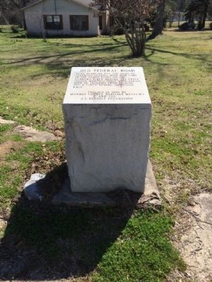
Midway was one of the first settlements established in Conecuh County along the Post Road which later became the Old Federal Road. Long serving as a hub for Indian trails branching out to the north, northeast and northwest, the Midway town site once . . . — — Map (db m81277) HM
Andrew Jackson in Seminole War
with an army of 1200 camped here
in May 1818
enroute westward from Fort Gadsden
to subdue marauding Indians
abetted by Spaniards at Pensacola.
Jackson determined to seize Pensacola . . . — — Map (db m99237) HM
Daleville, originally called Dale, was the county seat of Dale County from 1831-1841. William Harper was probate judge of Dale County, which was originally included in present-day Coffee County until 1841, present-day Geneva County until 1868, and . . . — — Map (db m41145) HM
Sam Dale (1772-1841) - Indian trader / wagoner Scout and trader, he explored Alabama wilderness, was called Big Sam "Tholocco" by the Indians later led settlers from Georgia to lands in Tombigbee Alabama River basins.
Gen. Sam Dale Indian . . . — — Map (db m220901) HM
Site of Alabama's first permanent capital 1820-26. County seat Dallas County, 1820-66. Prison for Union soldiers during the War Between the States 1863-65. Indians were the first inhabitants over 4000 years ago. Their large fortified village could . . . — — Map (db m75779) HM
Waist-high grasses billowing in the
wind. Rolling prairie expanses. Most
people connect these images with the Midwest's Great Plains. But for
thousands of years, tallgrass
soils of Alabama's Black Belt. Along
prairie—25 miles across at its . . . — — Map (db m112692) HM
Two Ghost Towns?
Long before Cahawba was built as
Alabama's first state capital, there was
another village at this location. Just like
Cahawba, it thrived for about 50 years,
then disappeared.
About the year 1500 a group of . . . — — Map (db m112450) HM
In 1818, Alabama's first governor
carved the capital city of Cahawba
out of the wilderness. In less than 50
years, Cahawba grew from a frontier
capital full of log cabins to one of
America's wealthiest communities,
with some of the . . . — — Map (db m112690) HM
Between AD 1500 and 1600, the
indigenous inhabitants of the area around
the confluence of the Cahaba and
Alabama Rivers built a flat-topped mound
measuring about ½ acre in size. The
mound was the central feature of a
semicircular village . . . — — Map (db m150834) HM
Under the provisions of the Cherokee Removal Act of 1830, a log stockade was built, “Two hundred yards Northeast of Big Spring.” The spring supplied abundant water for the Cherokees, the soldiers and livestock. Fort Payne was used as . . . — — Map (db m36743) HM
In 1837 Federal Troops arrived in this area to select a fort location for the collection, holding and removal of the Cherokee. Part of a much larger compound, this site contained a cabin seized by the troops for use as part of the fort. Today a . . . — — Map (db m100286) HM
The fort, consisting of a log house and large stockade, was built in 1838 by order of General Winfield Scott, commander of military forces responsible for the removal of Cherokee Indians.
Soldiers occupying the fort were commanded by Captain . . . — — Map (db m28030) HM
Little River Canyon has been attracting humans for over 10,000 years. Ancestors of the American Indians came here to hunt, gather fruits and nuts, and create temporary settlements. In 1540 Hernando DeSoto and his army of Spanish soldiers passed . . . — — Map (db m196858) HM
Born in Tennessee, Sequoyah moved to Wills Town (DeKalb County, Alabama) area of the Cherokee Nation in 1818.
Here, in 1821, he invented an 86 symbol alphabet providing the Cherokees with the only written Indian language in the United States. . . . — — Map (db m28033) HM
Panel 1
1819-1838
(partially broken)
?on - During the middle 1700s, the Cherokee
?south into present day Alabama and
?important village of Willstown. Sequoyah
?kee syllabary while living in the area. In
?e Nation officially . . . — — Map (db m224648) HM
The first detachment of 1,103 Cherokees to emigrate under their own officers, prior to leaving for the west held a final council at Rattlesnake Springs (near present-day Charleston, TN) and, by unanimous vote, declared their intentions to continue . . . — — Map (db m113846) HM
In 1838 U. S. soldiers and local militia rounded up over 1,100 men, women, and children in the Little River area during the forced removal of the Cherokee and Muscogee (Creek) Indians. Soldiers held some of them at Fort Likens and Fort Lovell east . . . — — Map (db m196860) HM
The mission was established in 1823 by the American Board of Missions to further education and Christianity among the Cherokee Indians. Mission operated until the Indian removal in 1838.
Grave site of Reverend Ard Hoyt, first superintendent, . . . — — Map (db m28035) HM
A Cherokee town founded 1770. Situated on Big Wills Creek, named for a half-breed chief, Red-Headed Will. A place of importance in the Cherokee Territory, it was the home of Sequoyah, inventor of the Cherokee Alphabet; John Ross, the last chief of . . . — — Map (db m213367) HM
Here stood
The giant Black Spanish Oak
Under which
Traditionally
Sequoyah
Taught his newly invented
Alphabet
Tree felled by a storm
1934 — — Map (db m28036) HM
Side 1:
Clear, bubbling springs have enticed people to this vicinity for thousands of years. Native American hunting paths led to them and after the defeat of the Creek Indians by the United States in 1813, old trails became the Jackson and . . . — — Map (db m71177) HM
(north side)
Tukabatchee
On this bend of the Tallapoosa River, stretching out before you, lay one of the ancient towns of the Muscogee Creek People, called Tukabatchee. Tukabatchee is one of the original four mother . . . — — Map (db m92945) HM
Here stood
Fort Toulouse
A defense against
the Indians
Built by
Bienville
1714
The Alabama Society
of Colonial Dames
preserves the memory
of faithful service
1912 — — Map (db m69567) HM
Here lived Lachlan Mc Gillivray,
a Scotch trader among the Indians.
His wife, Sehoy, was the daughter of
the French Captain, Marchand and
Sehoy of the Creek Tribe of the Wind.
Here was born their son, General
Alexander McGillivray, who went . . . — — Map (db m242547) HM
This earthen mound and an adjacent
village were built by people of the
Mississippian culture who likely had
some relationship to the major mound
center at Moundville near present-day
Tuscaloosa. The Mississippian culture is
believed to have . . . — — Map (db m145084) HM
(obverse)
The land area which now comprises the City of Wetumpka was inhabited by various Indian cultures prior to the inward migration of the white man at the turn of the 19th century. The largest Indian village near here was located on . . . — — Map (db m67936) HM
Fort Crawford was established in 1816 by elements of the 7th U.S. Infantry under orders from Major General Andrew Jackson. Purpose was to monitor Spanish activities in West Florida and curtail hostile Creek Indian activities.
Named after . . . — — Map (db m84373) HM
For thousands of years, two important Indian trade routes ran across what was to become Etowah County. The “High Town Path” ran from Charlestown, S.C. west to the Mississippi River, near Memphis, TN. The “Creek Path” begins . . . — — Map (db m39226) HM
White settlers in the hills of Virginia, Kentucky, Tennessee, North Carolina, and South Carolina pushed the Cherokee Indian tribes into North Alabama. The Cherokee in turn encroached upon Creek Territory. There were sporadic battles between the . . . — — Map (db m83738) HM
The surrounding area and this well was part of Turkey’s Town, once a capital of the proud Cherokee Nation. Chief Turkey was the principal chief during the late 1700’s.
On October 25, 1864, the Turkey Town Valley Expedition of the XV Corps Union . . . — — Map (db m83740) HM
Named for Revolutionary hero,
General Nathaniel Greene,
who drove British from Southeast.
Area explored by DeSoto, 1540.
Claimed as French Louisiana, 1699.
Ceded to England, 1763.
Ceded by Choctaw Nation, 1816.
Made a territorial . . . — — Map (db m37962) HM
In 1838, Greene County citizens voted to change the town seat from Erie to Eutaw. The City of Eutaw, Alabama was incorporated as a town by an act of the State Legislature on January 2, 1841. Greene County had been named for General Nathaniel Greene. . . . — — Map (db m83752) HM
Imagine a clan chief 800 years
ago standing exactly where
you are. It's possible he would
see something resembling this
artist's rendering. Larger
mounds, like this one, dotted
the plaza's perimeter, serving
as elevated platforms for . . . — — Map (db m144752) HM
Before you is Mound V, a broad, low, rectangular platform that forms an apron to Mound B at your left. Until recently, scientists knew only that Mound V's function was somehow intimately tied to Mound B upon which the principal chief's house stood. . . . — — Map (db m144777) HM
At least 29 mounds were built and used as platforms for important structures at Moundville. Their rectangular arrangement, roughly aligned with the four directions around a central plaza, shows us that these people planned this site before they . . . — — Map (db m144811) HM
The mound in front of you probably once served as a platform for the principal chief's house. The noble who lived there was an extremely important political and religious figure. It is likely that this chief claimed to have divine relationships with . . . — — Map (db m144808) HM
Site of a prehistoric Native American political and ceremonial center from about A. D. 1100-1500 that, at its height in the 13th century, was America’s largest community north of Mexico. Between 1,000 and 3,000 people lived in this town fortified . . . — — Map (db m30700) HM
I do not think in the Southern States there is a group of Mounds to compare to Moundville, in the arrangement and state of preservation of the mounds.
- Clarence B. Moore, amateur archaeologist, 1910
Spanning more than . . . — — Map (db m144745) HM
Welcome to Moundville Archaeological Park, the best preserved site of its kind in
North America. At its height, Moundville was the largest and most powerful political
and religious center in the Southeast. Nobles at Moundville ruled over thousands . . . — — Map (db m144759) HM
The mounds you see here were built in a very orderly arrangement over the course of about 100 years. Surrounding them was an immense wall constructed from tens of thousands of logs. How did the rulers harness the manpower and allegiance of the . . . — — Map (db m144774) HM
The mounds you see here were built in a very orderly arrangement over the course of about 100 years. Surrounding them was an immense wall constructed from tens of thousands of logs. How did the rulers harness the manpower and allegiance of the . . . — — Map (db m144809) HM
Rival Mississippian chiefdoms constantly threatened one another. Warfare was a way of life for most men. By proving their valor militarily, warriors probably increased their overall status as they were promoted up through the ranks. One theory . . . — — Map (db m144815) HM
The Civilian Conservation Corps was born during the turmoil of the Great Depression. Hundreds of thousands of young men were out of work, and wasteful exploitation of the environment had devoured millions of acres across America. In 1933, as part of . . . — — Map (db m144813) HM
The now dead town of Little Rock stood here, along a vital Native American trading route which joined northeast Henry County to the Gulf. A U.S. Post Office opened here on April 10, 1820. Amos Wheeler was the first postmaster,succeeded by Henry . . . — — Map (db m213979) HM
The Treaty of Fort Jackson on August 9, 1814 by Major General Andrew Jackson on behalf of the President of the United States of America and the Chiefs, Deputies and Warriors of the Creek Indian Nation, established a boundary line between the . . . — — Map (db m71836) HM
The Treaty of Fort Jackson on August 9, 1814 by Major General Andrew Jackson on behalf of the President of the United States of America and the Chiefs, Deputies and Warriors of the Creek Indian Nation, established a boundary line between the . . . — — Map (db m71838) HM
Site of the 1831 Irwin homeplace where over 50,000 acres of land was owned by Major General William Irwin (1794-1850). He was an Indian fighter, farmer, politician, statesman and considered one of the nation’s richest and most influential men. A . . . — — Map (db m242474) HM
The frontier village of Franklin was established here by Colonel Robert Irwin in 1814 on the site of the Indian town of Cheeska Talofa. It was the first colonial village in east Alabama. Fort Gaines, Georgia, was constructed in 1816 to protect the . . . — — Map (db m71844) HM
Near where you stand lies Omussee Creek Mound, the southernmost
platform mound along the Chattahoochee River, occupied
approximately 1300 to 1550 A.D. as part of an important
Native American settlement. This region of southeastern Alabama and . . . — — Map (db m115032) HM
We do not know the exact date that residents of the community of which Omussee Creek Mound was a part abandoned the mound, but by around 1550 it was definitely in decline. Many believe this may have been part of a broader, regional depopulation due . . . — — Map (db m115034) HM
The original builders of the Omussee Creek mound
had abandoned the site by around 1550, but the
area continued to be occupied by Native American
groups well into the early nineteenth century. As early as
the 1630s, Spanish missionaries from . . . — — Map (db m115037) HM
Located near this marker is the Poplar Head Spring which served as a meeting place for Indian traders prior to the arrival of the white and black settlers. The Alibamu Indians of the Chattahoochee River basin met the Creeks of the Choctawahatchee . . . — — Map (db m41141) HM
May 23, 1838 the deadline for the Cherokee to move west to Oklahoma, Gen. Winfield Scott was sent in to AL, TN and GA to round up the Cherokee and place them in stockades near what is now Chattanooga, TN and Ft. Payne, AL. In June of 1838 about . . . — — Map (db m197505) HM
In May 1838 soldiers, under the command of U.S. Army General Winfield Scott, began rounding up Cherokee Indians in this area who had refused to move to Indian Territory in Oklahoma. About 16,000 Cherokees were placed in stockades in . . . — — Map (db m18047) HM
Side A One of the Five Lower Towns established by the Chickamauga Cherokees in 1782 under the leadership of Dragging Canoe. Territorial Governor William Blount reported to the Secretary of War in 1792 that: “Crow Town lies on the north . . . — — Map (db m28473) HM
The Bessemer Site was the largest
indigenous mound site in what is now
Jefferson County, and it once dominated
a large territory in what became
north-central Alabama. Occupied from
about AD 1150 to 1250 during the early
Mississippian period, . . . — — Map (db m144908) HM
Red Mountain, where you are standing, and Jones Valley, which stretches before you, were sites of human activity long before Birmingham's founding in 1871.
Native American presence
Recorded history and archaeological evidence indicate the . . . — — Map (db m83805) HM
The Creek Indian Cession of 1814 opened this section of Alabama to settlement. At the time of statehood in 1819 many pioneer families had located here in what later became known as Jones Valley. By 1820 the area was called Ruhama Valley as a result . . . — — Map (db m26680) HM
(side 1)
Center Star was spelled Centre Star into the 1900s. The name evolved from the US Postal Service, which served remote areas by "star routes." The Post Office here, which existed from 1850 to 1914 (except between 1902 and 1913), . . . — — Map (db m82398) HM
About 1800 Doublehead located his village at this site, where his brother-in-law Tahlonteeskee had previously lived. Doublehead's log house was built along the same style of those of the white settlers. Chief Doublehead had previously led raids . . . — — Map (db m83942) HM
The Chickasaw lived in an area of Indian Territory bordered on the east by the Choctaw and on the west by the Comanche and other tribes. The United States government admitted that it could not protect the Chickasaw from the raiding by the . . . — — Map (db m212217) HM
Construction of this road, as ordered by General Andrew Jackson, began in May 1817 by troops of the U.S. Army for national defense purposes. Beginning near Nashville, Tennessee and continuing to Madison, Louisiana, it shortened the distance from . . . — — Map (db m80321) HM
Toward the end of the 19th Century, the U.S. government decided that Native Americans should integrate into American culture and give up tribal sovereignty.
The Dawes Allotment Act forced Native Americans to register on what became known as . . . — — Map (db m212215) HM
The Chickasaw are a strong people, unconquered in battle and unconquerable in spirit. They arrived in what is now Mississippi, Alabama, Tennessee and Kentucky from the west, and this area became their homeland. The Chickassaw built large villages, . . . — — Map (db m212214) HM
Through negotiation with President George
Washington, Chief Doublehead owned all
lands between Bluewater and Cypress Creeks.
The land became federal property after 1807,
allowing a corporation to purchase
5,515 acres to establish Florence. . . . — — Map (db m219328) HM
The Trail of Tears led groups of Cherokee up the Tennessee River here. The Cherokee are one of southeastern tribes who were relocated to Oklahoma due to the US Indian removal policy in the 1830s.
During removal, most Cherokee went by land, but . . . — — Map (db m107267) HM
The Florence Indian Mound was the heart of a largely indigenous cultural center that existed along this section of the Tennessee River Valley centuries ago. A map was drawn by E. G. Squier and Edwin Davis in 1848 showed the mound as originally . . . — — Map (db m191412) HM
Cavalry Commander under Andrew Jackson throughout War of 1812:
(Creek War, Pensacola, New Orleans).
Negotiated many treaties ceding Indian lands to U.S.
Made original surveys of Tennessee Valley. — — Map (db m35259) HM
This is the highest domiciliary mound in the Tennessee Valley. It was probably built between 100 B.C. and 400 A.D. by a prehistoric people of the ancient Woodland Culture. Such mounds served as bases for ceremonial temples or chief's houses. This . . . — — Map (db m28457) HM
Side A This area near the mouth of Cypress Creek was inhabited by Archaic People as early as 8,000 B.C. Their main food consisted of freshwater mollusks from the river.
(These mussels were the origin of the name "Muscle Shoals.")
The . . . — — Map (db m84044) HM
The American government wanted the Chickasaw land to grow cotton. The Chickasaw began negotation with the United States government in 1786 and within 50 years their ancestral homeland and hunting grounds were cederd to the American government. As . . . — — Map (db m212216) HM
Known for its mineral springs and prominent grist mill, this estate was part of the large reserve set aside by the 1798 Tellico Treaty for Cherokee Indian Chief Doublehead. John Reuben Hough was an early settler of Major Donelson’s party and . . . — — Map (db m141954) HM
Gabriel Butler “Ole Gabe” was born in the Carolinas in 1779, about the time of the Revolutionary War. His name is on records in Kentucky in the 1800s. He married his first wife, Sarah Whitesides, in Warren County, KY, on December 26, 1803. Gabe . . . — — Map (db m216372) HM
Side A
The settlement of what is now eastern Lauderdale County (known as "Over Elk)" by non-Native Americans commenced by 1807.
Federal land sales were held in Huntsville during the spring of 1818.
Although much of the land was described . . . — — Map (db m84296) HM
(Side 1)
From about 1775 until his death on August 9, 1807, Chickamauga Cherokee Chief Doublehead controlled the Muscle Shoals of the Tennessee River. Two major Indian trails, Sipsie Trail and an east-west trail, intersected in the . . . — — Map (db m99972) HM
Thousands of Cherokee Indians passed through Waterloo in the 1830s when they were forced by the U.S. government to move West on the "Trail of Tears". Most came by boat from Tuscumbia and camped here to await transfer to larger steamboats. During the . . . — — Map (db m84301) HM
Created by Territorial Legislature
in 1818 from lands ceded by
Cherokee and Chickasaw Indians
Named for U.S, Navy hero of War of 1812
Capt. James Lawrence
Fatally wounded, his famous command was
"Don't Give Up The Ship"
County . . . — — Map (db m69672) HM
The High Town Path was an Indian Trail extending from Charles Town, SC to
Chickasaw Bluffs at Memphis, TN. The Path was named after High Town located at the forks of the Etowah and Oostenalla Rivers near
Rome, Georgia.
The path traversed the . . . — — Map (db m179053) HM
This area was the home to Indians, settlers, people of mixed ancestry and their descendants. Local bluff shelters contain evidence of occupation from Paleo Indian (10,000 BC) through the Mississippian Period (1540 AD). Chief Tuscaloosa (Black . . . — — Map (db m84313) HM
The Oakville Indian Mounds Museum is based on a seven sided Cherokee council house. This type of council house was used during the cooler months and an open sided rectangular pavilion during warmer weather. The descriptions used for the museum's . . . — — Map (db m84314) HM
In the early 1800's Cherokees of this area were under the leadership of Doublehead and Tahlonteskee. After Doublehead's assassination in 1807, Tahlonteskee notified President Jefferson that he and his people were ready to move west. In 1808 . . . — — Map (db m36030) HM
Copena Indians built this mound with baskets of dirt some 2000 years ago. The Copena name was derived from their use of copper and galena (lead ore) found in their burials along with gorgets and celts. The mounds were a burial site with the dead . . . — — Map (db m84315) HM
Black Warriors' Path played a critical role as a route for Creek Removal. On December 19, 1835, some 511 Creek emigrants passed along the path through present ~ day Oakville Indian Mounds Park. In September 1836, a group of Creeks left Tallassee in . . . — — Map (db m36027) HM
Doublehead, (c1744-1807), aka Dsugweladegi or Chuqualatague, was the son of Great Eagle (Willenawah) and grandson of Moytoy. Among his siblings were Pumpkin Boy, Old Tassel and the unnamed grandmother of Sequoyah. After his sister's son John Watts . . . — — Map (db m84316) HM
Five Historic Indian tribes lived in this area. By 1701, The Yuchi were living at the shoals on the Tennessee River. In early 1700s the Yuchi left, some moving to the Cherokee Nation on the Hiwassee River, TN and others to Chattahoochee River, GA. . . . — — Map (db m36040) HM
Rising 27 feet high, this is the largest woodland mound in Alabama, with a base covering 1.8 acres and a flat top of over one acre. Built by prehistoric Copena Indians, the mound is 2,000 years old and constructed from earth probably carried one . . . — — Map (db m84317) HM
Based on the large number of local mounds and artifacts, this site shows evidence of Indian occupation over 2000 years ago. According to tradition about 1780, Oakville became a Cherokee town located on Black Warriors' Path. By the early 1820's, . . . — — Map (db m36036) HM
Form the late 1700's to 1807 a Cherokee Chief named Doublehead guarded this area, that was claimed by both the Cherokee and Chickasaw Nations as sacred hunting grounds against encroachment of white settlers.
Chief Doublehead had the reputation . . . — — Map (db m84646) HM
Settled by Judge J. J. Harper and others from Harris County, Georgia, in 1836.
This region was opened to settlement
in 1836-37 by the removal of the
Creek Indians to lands west
of the Mississippi River.
Erected by
The Alabama . . . — — Map (db m39830) HM
Following the signing of the Creek Treaty in 1832, the early white settlers constructed a 16 by 30 foot hand hewn log fort for protection against a possible Indian uprising from Cussetaw Indian Village on Osanippa Creek just north of here. Walls of . . . — — Map (db m71643) HM
One of the larger settlements of the Upper Creeks at the time of Indian removal to the west, 1835-1837. Their last council fire was held here before their forced migration to Oklahoma. Pioneer families began pouring in after 1836. Today's cemetery . . . — — Map (db m85169) HM
created Feb. 6, 1818 by Alabama Territorial Legislature from lands ceded by Cherokee Nation 1806 and by Chickasaw Nation in 1816. Named for creek (and its limestone bed), which runs through county.
Few settlers here until Indian treaties.
Athens . . . — — Map (db m29109) HM
This burial mound is one of hundreds constructed during the Middle Woodland period between 100 BC and AD 500 by native people who shared burial practices with other similar cultural groups extending from the Gulf and Atlantic coasts to Canada. . . . — — Map (db m154232) HM
Approx. ¼ mile North is the site of Ft. Hampton, built in 1810 and named in honor of
Brig. General Wade Hampton of Revolutionary War fame. Two Companies of soldiers were
stationed here in log buildings. The purpose of the fort, and its garrison . . . — — Map (db m154231) HM
Lucy's Branch This site is named for Lucy Bedingfield, daughter of a slave and a Cherokee Indian. She was born 1832, and her Indian name was Finch. She married Meredith Bedingfield, a slave and had 9 children. Lucy was an astute and avid . . . — — Map (db m85421) HM
Side A
A church older than the county and state. First meeting house built in the fall of 1816, on Indian land, a few miles south of here along Round Island Creek. The first Govt. Land sales were in Feb. 1818 after treaties with the . . . — — Map (db m85422) HM
335 entries matched your criteria. Entries 101 through 200 are listed above. ⊲ Previous 100 — Next 100 ⊳