General Anthony Wayne and the Legion of the United States passed this way on October 30, 1794, in route from Fort Wayne to Fort Greenville, ending the western campaign against the Indian Confederacy. The Legion spent the previous night camped 2.6 . . . — — Map (db m29620) HM
The confluence area of the Three Rivers was known to the native people since as early as the end of the last Ice Age, more than 10,000 years ago. As the glaciers melted and receded, they paused here creating a high point in the topography of the . . . — — Map (db m17064) HM
Miami Chief Mishikinakwa or Me-she-kin-no-quah, known to the Euro-Americans as Little Turtle, born circa 1747, played a significant role in the settlement of the area surrounding the confluence of the Three Rivers. He was the most successful Native . . . — — Map (db m197057) HM
Only land barrier
on shortest trade route
between Quebec and
New Orleans.
Eastern landing of eight-
mile carry from St. Mary's
to Little River. Used by
Indians, French, British
and American traders. — — Map (db m21061) HM
Long before settlers appeared on the scene, the American Indian people here used the sandhill crane as a symbol for their tribe. Early British and American officials referred to the people we know as Miami as “Twightwees” in various . . . — — Map (db m17068) HM
Most often the rivers here brought prosperity. They are the reason humanbeings settled here; established a land portage to connect with the Wabash River system; and attracted the canal followed by rails, highways, industry, and homes. They brought . . . — — Map (db m17030) HM
An ancient Indian trail, through Pottawattomie country, variably called the Dragoon, White Pigeon, Great Northwestern and Fort Dearborn Road. After 1795 used for mail delivery between Fort Wayne and Fort Dearborn. Captain Wells, Wayne spy, was slain . . . — — Map (db m20782) HM
The Last Two American Forts
In 1798, Col. Thomas Hunt began construction on this site of the second American fort at the Three Rivers. this fort, which was completed in 1800, replaced the first, hastily built one erected nearby to the . . . — — Map (db m21219) HM
It was the first United States fort near "Three Rivers". This fort commanded the shortest portage between the St. Lawrence and Mississippi systems a portage known to the Indians as "Glorious Gate" and a strategic cross-roads in early trade and . . . — — Map (db m21020) HM
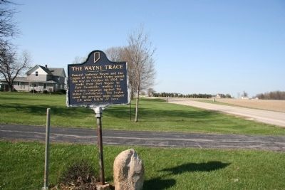
Wayne Trace
Once the Indian trail to Cincinnati
The route
Of General Harmer's Army in 1790
Of General Wayne's
When leaving the stockade
Christened by Major Hamtramck
"Fort Wayne" in 1794
Also of General Harrison's Army . . . — — Map (db m52749) HM
This area of the Three Rivers was a site of settlement of Native Americans for as much as 10,000 years. The collection of villages known as Kekionga, located in the present-day Lakeside neighborhood, was a center of the Miami nation in historic . . . — — Map (db m21501) HM
To the Memory of
Major John Wyllys
And His Brave Soldiers Who
Were Killed Near this Spot
In The Battle of
Harmar's Ford
Oct. 22, 1790
With the Indians Under
Chief Little Turtle — — Map (db m21358) HM
The Battle of Kekionga in October 1790 was the first battle fought by the United States Army after the War for Independence. The campaign had been ordered by President Washington against the Miami settlement of Kekionga, the center of Indian . . . — — Map (db m21497) HM
ME-SHE-KIN-QUAH, Chief
of the Miami Indians
Teacher of his people
Friend of the United States
His endeavors toward peace
should serve as an inspiration
for future generations
This plot of ground, the last
resting place of Chief . . . — — Map (db m21066) HM
Chief Little Turtle was one of the most feared and respected leaders during the frontier wars of the 1780s and 1790s when Fort Wayne was born. Known to his people as Meshekinnoquah, Little Turtle is thought to have been born in 1752 in a village . . . — — Map (db m21503) HM
The Saint Mary's River and the St. Joesph River converge in Fort Wayne to form the Maumee River. The most important geographical feature of the area is the short distance overland between the Three Rivers system, which eventually flows to the . . . — — Map (db m239133) HM
A tract of 320 acres of land extending west of the St. Joseph River (the modern Bloomingdale and Spy Run neighborhoods) was set aside by an act of Congress in 1808 for the Indian agent William Wells in recognition of his many services to the U.S. . . . — — Map (db m168274) HM
Oldest church structure in continuous use in Fort Wayne area and seat of Catholicism in northern Indiana.
Christianity carried to this part of the New World in 1600's by Catholic missionaries. Land formerly part of burial ground for Miami . . . — — Map (db m45024) HM
Commandants 1680-1697; Jean Baptiste Vissat, Sieur DeVincnnes, Francois-Margane, Sieur DeVincennes. 1725; Ensign Douville,. 1734; Ensign DuBuison.
In 1747, savages burned the fort but it was rebuilt. M. DeRaimond was commandant in 1748.
. . . — — Map (db m232369) HM
Once an Indian trail directly through these school grounds, the route followed by General Anthony Wayne's army in its departure from the fort in 1794 and the way by which General William Harrison's troops came to the relief of the garrison at Fort . . . — — Map (db m211614) HM
Colonel John Hardin, of the Kentucky Militia, with 180 men and Captain John Armstrong, U.S. Army, with 30 men, were routed here on October 19, 1790, by Indians under Miami Chief Little Turtle during General Harmar's Campaign. — — Map (db m232339) HM
(Tablet 1)
This boulder marks a boundary line between United States territory and Indian lands which existed for fourteen years.
At St. Mary's Ohio on October 2, 1818, a treaty was made and concluded between Jonathan Jennings, Lewis . . . — — Map (db m71919) HM
In October 1818, Purchasing Commissioners Lewis Cass, Benjamin Parke and Governor Jonathan Jennings acquired Indian claims on the land shown on this marker. About one-third of modern Indiana, was involved in this transaction. — — Map (db m21517) HM
Reserved by U.S. to Chief Francois Godfroy of the Miami Nation of Indians by treaty at St. Mary's, Ohio, 6 October 1818, 3,840 acres on Salamonie River at La Petite Prairie, Harrison Township, Blackford County; reserve lands sold 1827, 1836. — — Map (db m63825) HM
Ka-wi-a-ki-un-gi Village "Place of Thorns" (Thorntown) was center of 64,000 acre Thorntown Indian Reserve. Granted to Eel River Miamis in 1818, ceded to U.S. in 1828. — — Map (db m21352) HM
Laid out in 1828 by David Stipp. Promoted for seat of a new county to be made partly from the Great Miami Reserve, which began two mile east. The Lafayette & Muncie Road crossed the Great Michigan Road here. It was an important stage stop, mill . . . — — Map (db m42709) HM
Surveying: A Canal could not proceed along the upper Wabash until title to Miami and Potawatomi lands were transferred to the State. At the 1826 Treaty of Paradise
Springs the title was conveyed.
A corps of U. S. engineers was sent to Fort . . . — — Map (db m163309) HM
In October 1818, Purchasing Commissioners Lewis Cass, Benjamin Parke and Governor Johnathan Jennings acquired Indian claims on the land shown on this marker. About one-third of modern Indiana was involved in this transaction. — — Map (db m1152) HM
Here at Chief Winamac's old village, about 900 Potawatomi Indians camped on their forced removal from Indiana to Kansas. A child and a man died here during the encampment. They also left behind 24 too sick to continue. — — Map (db m35399) HM
On September 11, 1838, about 850 Potawatomi Indians camped at Pleasant Run, having traveled 17 miles that day on the forced removal from Indiana to Kansas. — — Map (db m35400) HM
Pyrmont. John Wagner built a dam, race and saw mill about a mile South in 1833 and added a grist mill. He sold to John Fisher who sold to John Fetterhoff who built a large frame mill. Joel Wagoner, James Allen, Elias Morkert, J. J. Cripe, Wm. . . . — — Map (db m40455) HM
The sycamores here line the sides of the Michigan Road, which connected the Ohio River with Lake Michigan and further opened Indiana for white settlement and trade. Under intense military and economic pressure, Potawatomi leaders ceded the land for . . . — — Map (db m201388) HM
On terrace to south, during 18th century, was a 3-mile row of little wooden shacks, metropolis of the E.R. Miami. Old records, maps show it as ye Olde Towne, Kenapaco-maqua (Snakefish), Eel River Town, L'Anguille.
Among Olde Towne's . . . — — Map (db m224634) HM
Wilkinson's Expedition. 525 Kentuckians burned Olde Towne: after a skirmish in Bloody Hollow and an Aug. 8. 1791 battle here had killed ten Indians and two soldiers, including John Bartlett; and wounded John Stafford. 34 of the . . . — — Map (db m224655) HM
Since the beginning of history, people have been drawn to the river for water, food and transportation.
1. The Earliest People Several archaeological sites at Charlestown reveal stories of temporary camps. Mounds in this region date from the . . . — — Map (db m206831) HM
In memory of
Col. Archibald Lochry
and the members of the Westmoreland County, Pennsylvania
Militia, who were defeated near here August 24, 1781
by Chief Joseph Brant and a coalition of Ohio Indians.
Killed
Col. Archibald Lochry . . . — — Map (db m222279) WM
In memory of
Colonel Archibald Lochry
and his command who were massacred by the Indians and
British near this site August 24, 1781
Major Creacroft • Adjt Guthrie • Quartermaster Wallace • Capt. Campbell • Capt. Thomas Stokely • Capt. . . . — — Map (db m244090) WM
Col. Archibald Lochry and his regiment were defeated near this site on August 24, 1781 by Chief Joseph Brant and a coalition of Ohio Indians. — — Map (db m222287) HM
The first school house in Delaware County was erected in a trackless forest one half mile west of this site. “Indian Jim,” the last of the Delaware tribe remaining in this county, a highly respected resident
hewed the black walnut logs . . . — — Map (db m141163) HM
Several principal Indian and Pioneer Paths cut across Indiana and Delaware County
connecting trading and warrior routes of ancient times. First made by migrating large animals searching for salt, followed by Native Americans for food, trade and . . . — — Map (db m141410) HM
This boulder marks the traditional
site of Wah-Pe-Kah-Me-Kunk
the White River Town of the Muncee Clan of Delaware Indians.
It is, also, a memorial to Joshua, a Christian Indian, who was burned by the tribe, March 1806, a martyr to his . . . — — Map (db m141131) HM
This statue "The Passing of The Buffalo" was created by Cyrus E. Dallin in 1929. It portrays a Native American Chief in full Regalia with a bow in his hand - his foot resting on the skull of a buffalo contemplating not only the last of the . . . — — Map (db m222322) HM
Settling at Vincennes about 1780, Toussaint Dubois, a friend of William Henry Harrison, became a merchant, trader with Native Americans, soldier, and politician. His holdings included a land tract purchased from the United States Government on May . . . — — Map (db m195491) HM
The old Indian trail which followed the Elkhart River, turned here to the northwest, and connected the “Miamis Fort” with “Fort St. Joseph”.
From the time of the French and Indian War in 1755 to 1763, up to the settlement of this section in . . . — — Map (db m200295) HM
The Early Inhabitants of the Valley
Centuries before the area was settled by whites, at least two different native tribes inhabited the St Joseph Valley.
The Miami
The Miami were the first recorded tribe known to have lived in . . . — — Map (db m69777) HM
Near this spot stood the village of the
Potawatomi War Chief Five Medals, whose
Indian name was Onaska. This chief ceased
hostilities against the United States
government after signing the Greenville Treaty, 1795.
He met with Presidents . . . — — Map (db m30172) HM
1801 Licensed to trade with the Indians in pelts.
1808 Established here a fur trading post.
1812 Interpreter and guide for Gen. William Henry Harrison prior to and during The War of 1812.
1813 Founded . . . — — Map (db m152032) HM
This plaque marks the western border of the twelve mile cession negotiated by Governor William Henry Harrison with the Miami, Potawatomi, and Delawares, Treaty of Fort Wayne, September 30, 1809. — — Map (db m44770) HM
American Bison, migrating in great herds, created a cluster of paths along the natural topography between Illinois prairies and salt licks in Kentucky. These paths, called the Buffalo Trace, used by Native Americans and became premier travel route . . . — — Map (db m71282) HM
American Indians frequented this area, rich in natural resources. The ravine provided water from natural springs, marl for lime, and clay for bricks for nineteenth-century residents of Attica, platted 1825. City became owner of ravine 1906 when . . . — — Map (db m3311) HM
One mile south is intersection of western boundary line of Treaty of Greenville, Ohio (1795) and Treaty of Grouseland, near Vincennes (1805), northeastern boundary line. By these treaties, Native American tribes ceded land to the United States . . . — — Map (db m66866) HM
This is the point on the line
established by the Treaty of
Greenville, August 8, 1795,
between General Anthony Wayne
and the Indian tribes of the
Northwest Territory. This treaty
opened southern Ohio and eastern
Indiana to white settlement. — — Map (db m79692) HM
Rev. Benjamin Marie Petit, of the City of Rennes, France, arrived as the Catholic missionary to the Potawatomi Indians in northern Indiana in November 1837. By June 1838, he had learned much of their difficult language and their culture, and had . . . — — Map (db m35500) HM
Title: Ga bgojwébnegéjuk
Potawatomi for: Those that were uprooted from their natural place
This mural is to honor the Native Americans who were forced from their lands in this area to reservations located in Kansas. This removal took . . . — — Map (db m240943) HM
Extending from Michigan City to the Ohio River at Madison. Begun by the state in 1832 with funds obtained from sale of land granted by the Potawatomi Indians. Opened northern part of state to settlers. — — Map (db m35346) HM
On September 5, 1838, nearly 850 Potawatomi Indians marched single file through Rochester on the forced removal from Indiana to Western Territory (Kansas). Three chiefs were transported in a jail wagon: Menominee, Black Wolf, and Pepinewa. There . . . — — Map (db m35501) HM
Built in 1834 by William Polke, first white settler in Fulton County, this is the oldest and first frame house in the county and the first frame house built north of Wabash River. It was called the White House and was a stagecoach inn on the . . . — — Map (db m35327) HM
William Polke was Fulton County's first white settler, coming
in 1830 to survey the Michigan Road. In 1831 he built a log
cabin trading post on south bank of the Tippecanoe River. He was post master of county's first post office called Chippeway, . . . — — Map (db m231180) HM
Princeton abounds in fertile soils from the seasonal flooding of the Wabash, Patoka & White Rivers. Fertile silts were deposited in the riverbeds by glacial outwash at the end of the last glacial period. Archeological records indicate that Native . . . — — Map (db m190588) HM
Immigration to the Princeton area began to explode after the Northwest Territory was formed in 1787. Young settlers came seeking a place to start their own homestead. They often arrived by way of the Red Bank Trail & Patoka Trace, traveling either . . . — — Map (db m190587) HM
Many Native American tribes have inhabited the Princeton area over the centuries, including the Piankeshaw, Wea, Shawnee, Deleware, Sac, Fox, Kickapoo, Miami & Pottawatomi tribes. These peoples fished the area's rivers & streams, hunted for buffalo, . . . — — Map (db m207981) HM
In remembrance
of our
ancestors
A compilation
of all individuals
known to have been
interred
in the
Miami Indian Cemetery
Aw-Taw-Waw-Taw, 1879 •
Aw-Taw-Waw-Taw, Camillius, 1895 •
Aw-Taw-Waw-Taw, Takeequah, 1879 • . . . — — Map (db m161471) HM
After 1838 land on this side of the river was in the Mississinewa Reservation and Indian land Smith Gilbert established a trading post at the ford. Now seen as smooth rock bottom, in 1823. The year 1849 saw much white activity across the river: . . . — — Map (db m208563) HM
The largest Indian cemetery in Indiana. Few graves are marked. The Indians buried here are largely descendants of Chief Metocinya and include Meshingomesia and his family. The first burial was probably in 1873. Burial was contrary to Indian . . . — — Map (db m182607) HM
Site of battle fought Dec. 18, 1812, in which British-allied Miami Indians were defeated by U.S. troops and Militia under Col. John Campbell. — — Map (db m208561) HM
On Dec. 17, 1812, Lt. Colonel John B. Campbell with 600 mounted troops arrived at this site under orders to destroy the Miami Indian Villages along the Mississinewa River from here to the present site of Peru.
The destruction of the village on . . . — — Map (db m1512) HM
In October 1818, Purchasing Commissioners Lewis Cass, Benjamin Parke and Governor Jonathan Jennings acquired Indian claims on the land shown on this marker. About one-third of modern Indiana was involved in this transaction. — — Map (db m1500) HM
A tribute to those who, in December 1812, displayed the courage to protect their culture and the compassion to embrace another as they departed the battlefield of the Mississinewa. Following the battle, the American commander ordered that captured . . . — — Map (db m233756) HM
We have recreated a large full-scale archaeological
excavation out of concrete. You can see the
stratigraphy in the levels of the soil by noticing the
different colors of the concrete. See if you can identify
these archaeological . . . — — Map (db m163109) HM
We have uncovered multiple dwelling structures,
stockade walls, hearths, storage pits, middens
(trash pits), and thousands of artifacts. Many of the
material cultural items have long since decomposed,
but fragments remain.
Notice the . . . — — Map (db m163108) HM
Welcome to the mock archaeological excavation.
Archaeology is one way we learn about the past life ways
of the people who once lived here. Archaeology is the
scientific study of man's material culture. Archaeologists
study artifacts and other . . . — — Map (db m163107) HM
The park's name evokes its natural prairie environment and pays homage to Native American people who once occupied this site. This unique
environment, nurtured by the White River, has served as an ecological and cultural crossroads throughout . . . — — Map (db m163111) HM
Although much of the day-to-day living was done outside of the home, the family home played an important role in the lives of Strawtown's early Native American communities. The family resided in the home and many of their food items and personal . . . — — Map (db m216812)
Community buildings, as the name implies, belonged to the community and served a different purpose and were larger than a single family home. Community buildings could have served as the meeting place for discussing issues within the tribe. These . . . — — Map (db m216807)
The Oliver Phase people once built a village here at Strawtown Koteewi Park. The Oliver Village site (A.D. 1200-1450) located at Strawtown Koteewi Park is thought to be the beginnings of the Oliver Phase peoples. Based on archaeological evidence, . . . — — Map (db m216817)
This stockade wall and ditch are representative of what was found at Strawtown Koteewi Park. The Oliver Village is often referred to as the Strawtown Enclosure because the village was "enclosed" by a stockade wall and ditch. The ditch was well . . . — — Map (db m216795)
People from many interesting cultures made the area of Strawtown Koteewi Park their home. As you explore this exhibit you will see recreated structures from the Late Woodland time period. Although these structures are not exact replicas of the ones . . . — — Map (db m216792)
The Miami Indian village of Ma shock o mo was in this vicinity. Before 1848 the Miamis had sugar camps in the area, where they made sugar and syrup from the maple trees which were abundant. — — Map (db m235188) HM
Few facts are known about “Chief” Kokomo. Even his name is variously translated as Black Walnut, She Bear, The Diver or Old Woman. David Foster is said to have called him “the orneriest old Indian I ever knew.” This 1962 . . . — — Map (db m166536) HM
The bronze sculpture of a Miami Native American maiden was dedicated Jan. 22, 2009. The sculpture was named Manetoowa, which is “spirit” in Miami language. Brian Buchanan, chief of the Miami Nation, and other members of the Miami Nation . . . — — Map (db m166448) HM
This stone marks the burial place of Kokomo, War Chief of the Miami Indians the former owners of the land along this river, and from whom this city derives its name.
In memory of the early pioneers and settlers of this region who lie in . . . — — Map (db m230883) HM WM
In 1840 the Miami Indians agreed to move from the upper Wabash area to eastern Kansas. Francis La Fontaine was his tribe’s last principal chief. After leading his people west in 1846, he died at Lafayette, Indiana, en route to his home. The body was . . . — — Map (db m76449) HM
The junction of the Wabash and Little rivers, 100 yards south, was the western terminus of the Maumee-Wabash long portage and, in 1835, of the first section of the Wabash and Erie Canal. During the 18th century French and English traders passed this . . . — — Map (db m45118) HM
Jean Baptiste Richardville
(Pe-she-wah), 1761-1841
last great chief of the Miamis, made the forks of the Wabash his principal residence. His mother was the influential Tau-cum-wah sister of Chief Little Turtle. — — Map (db m7541) HM
(Side 1)
Huntington's Ford and First Bridge
Pioneers forded Little River From Charles Street diagonally across just below the Island to the Court House. A dugout canoe, when hailed, carried pedestrians across for 50 cents. . . . — — Map (db m65224) HM
This stone is from the first grist mill constructed by U.S. Govt.; circa 1833, for the use of the Miami Indians in this locality. It was built on Rock Creek 3/4 of a mile up stream from the Wabash River.
Presented to the Markle Area Historical . . . — — Map (db m76481) HM
(Front Side)
Born 1810 in what is now Huntington County. She was a granddaughter of Miami Chief Little Turtle. Her second husband was Antoine Revarre; her son Anthony Revarre, lived with her near Roanoke and acted as interpreter since . . . — — Map (db m61120) HM
10 O'Clock Indian
Treaty Line
Est. 1809 Inset.
Grouseland Treaty
Line Est. 1805 at
A Buried Stone (illegible)6 feet, N 4(illegible)
From This (illegible)
Indiana Centen-
ary Marker
Erected by the . . . — — Map (db m74057) HM
800 feet northwest is the point which marks the junction of the Grouseland Treaty line of 1805 with the Fort Wayne Treaty line of 1809. These and other treaties permitted early white settlement of Indiana. — — Map (db m74056) HM
Site in town of stockade built in 1812 on old Indian trail for protection of the settlers in this area. Garrisoned by Maj. John Tipton and his militia Rangers in 1813. Marker on the site. — — Map (db m167022) HM
General Robert H. Milroy, 1816–1890, was appointed colonel of the 9th Indiana Infantry, later promoted to brigadier and major general. He saw extensive action in western Virginia. After the war he served as Indian agent in State of Washington. — — Map (db m2312) HM
Erected by the Bureau of Catholic Indian Missions with funds from Katharine Drexel and operated by the Society of the Precious Blood with federal funds, 60 Indian boys from distant reservations were annually trained here. — — Map (db m2311) HM
247 entries matched your criteria. The first 100 are listed above. Next 100 ⊳