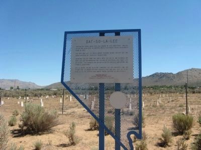
“Myriads of Stars shine over the graves of our ancestors.” Dat-So-La-Lee had seen some 96 winters, mostly in Carson Valley, when death came in 1925.
She was the last of those Washoe weavers whose ancient art had been practiced by countless . . . — — Map (db m20801) HM
In May, 1860 Major William Ormsby was killed in an ambush by Paiutes at Pyramid Lake. In June, 1860 William Allen, a scout, was the last of some 40 white men killed in the ensuing war. Both were interred here, but Ormsby was later reburied in N.Y.. . . . — — Map (db m175808) HM
Originally known as the Carson Indian Training School. Stewart Indian School, operated by the U.S. Bureau of Indian Affairs, provided vocational training and academic education for American Indian students from throughout the west for nearly a . . . — — Map (db m20796) HM
For hundreds of years prior to the
White Man the Washoe and Paiute
Indians used this site as a recreation area and played a type of
ball game here. Later, in the year
1872, the area became the freight
vards of the historic Virginia &
Truckee . . . — — Map (db m136166) HM
Replacement Marker
Abundant grass and brush found near springs and intermittent streams in Edwards Creek Valley were important ecological areas for Native Americans. Shoshone Indians wandered seasonally to gather wild seeds and small . . . — — Map (db m67146) HM
On the mountain slopes in the distance, you can see a series of horizontal lines or terraces etched into the side of the range. These beach lines are left by waves of ancient Lake Lahontan. Over 12,000 years ago, the lake reached a maximum depth of . . . — — Map (db m165833) HM
According to anthropologists, many hunter-gatherer societies, such as those who lived here, had a spiritual leader called a shaman. During the hunt, the shaman was called on to perform rituals to ensure success. One theory is that some of the . . . — — Map (db m165835) HM
Grimes Point, one of the largest and most accessible petroglyph sites in northern Nevada, contains about 150 basalt boulders covered with petroglyphs. Nevada petroglyphs were of magico-religious significance in insuring the success of large game . . . — — Map (db m127115) HM
[side 1] The Cattail-Eater People (Toidikadi) Stillwater Marsh is located in the basin northwest of Grimes Point. When the first non-native explorers entered the area, it was the home of the Northern Paiute people, known as the . . . — — Map (db m165830) HM
The crater-like depressions and elongated grooves, seen on the boulder before you, possibly date back 7,000 years or more. This "Pit and Groove" petroglyph style is believed to be the oldest at Grimes Point. Depressions were made by striking the . . . — — Map (db m165831) HM
Rock art in the Great Basin has often been linked to prehistoric game trails. While this seems strange for this barren scene, consider what this area was like thousands of years ago. Grimes Point would have been a peninsula surrounded by water, and . . . — — Map (db m165834) HM
While petroglyphs were etched or scratched into the rock surface, pictographs were painted, using natural materials as pigments. One of the oldest petroglyph styles can be seen as circular and wavy lines and may be almost 3000 years old. The . . . — — Map (db m165832) HM
The ten foot wide flat at the base of the cliff is the site of Wagon Jack Shelter. The name comes from the Shoshone Indian, Wagon Jack, who camped here about 1900, while working on an Eastgate Ranch. He was a leader of Indian rabbit drives in Smith . . . — — Map (db m69650) HM
Little known at the time, except as a stage stop, Williams Station was destined to be remembered in Nevada history as the incident that ignited the Pyramid Lake War of 1860.
Williams Station was named for three brothers, James O., Oscar, and . . . — — Map (db m168508) HM
Stretching before you are two vast sinks, terminal areas of the Humboldt and Carson River drainage systems. The marshey remnant of Lake Lahontan, between you and the distant Humboldt Range, served as a life sustaining resource of wildlife for . . . — — Map (db m67352) HM
Originally a Native American trail, Bootleg Canyon – also called the Hooch Highway was a well-known backdoor into Boulder City and the Hoover Dam construction site during prohibition. Bootleggers brewed illegal alcohol in stills hidden in . . . — — Map (db m29324) HM
Eldorado Canyon runs east from here to the Colorado River and was the site of one of Nevada's mining booms. Prospectors began digging for gold and silver here, about 1859, forming the Colorado Mining District. The three largest mines, the . . . — — Map (db m29328) HM
The Bureau of Indian Affairs (BIA) bought this ten-acre site in 1911 from Helen J. Stewart, former owner of the Las Vegas Ranch, to provide a home for the Southern Paiute Indians living in and near Las Vegas. With this purchase, the government . . . — — Map (db m51055) HM
Until 1914, when the railroad donated land for a city cemetery, people buried the dead in small family plots or on public land just north of the railroad-owened Las Vegas Ranch, east of Las Vegas Boulevard.
In pre-railroad times, the Paiute . . . — — Map (db m51056) HM
Tule Springs is one of the few sites in the U.S. where evidence suggest the presence of man before 11,000 B.C.
Scientific evidence shows this area, once covered with sagebrush and bordered with yellow-pine forests, had many springs. These springs . . . — — Map (db m29960) HM
For centuries before the Spanish arrived in the Southwest, native peoples traded goods across the network of routes that became the Old Spanish Trail. The Spanish called all the first people "Indians", later identifying them as Pueblos, Apaches, . . . — — Map (db m241719) HM
In first times, there was chaos, and from the union of earth and sky was born the Great Spirit Matavilya.
Before he could teach his people all they needed to know about their world, he was killed by his sister, Frog Woman. It was then that his . . . — — Map (db m40308) HM
Seeking to open a land route between the Missions of Sonora and California, Fray Francisco Hermenegildo Garcés, OFM, a Franciscan Missionary priest and explorer, was the first European to enter the present boundaries of Nevada. He departed Mission . . . — — Map (db m84277) HM
Existing today as a 30-mile series of adobe ruins, this “Lost City” was once the home of an ancient Anasazi Indian civilization. Beginning with the basketmakers (300 B.C.-A.D.700) & followed by the Pueblos (A.D.700-1150) this valley was . . . — — Map (db m145957) HM
The Techatticup Mine, located in 1861, was the most important mine in El Dorado Canyon. It produced millions of dollars in gold ore, and was originally served by steamboats on the Colorado River. The mine's name is taken from two Paiute words . . . — — Map (db m29331) HM
In 1940, Charley Kenyon and Art Schroeder located a cave above the Colorado River, about twelve miles northeast of this spot. In it were the remains of southern Nevada's last great renegade, Queho, who had been dead about six months. Queho had grown . . . — — Map (db m29332) HM
Fay Perkins Sr., was born in Overton, Nevada and spent his entire life in Moapa Valley. In 1924, Fay Perkins and his brother John Perkins reported to Governor James G. Scrugham that many ancient Indian ruins existed in the Moapa Valley. Governor . . . — — Map (db m145958) HM
This property is listed on the National Register of Historic Places. The Museum was built in 1935 by the Civilian Conservation Corps to display artifacts of prehistoric Native American cultures. — — Map (db m145956) HM
Indians of a highly developed civilization lived throughout Moapa Valley from 300-1100 A.D. Several hundred ancient pithouses, campsites, rockshelters, salt mines and caves of "Anasazi" people make up what is commonly known as "Lost City." These . . . — — Map (db m241139) HM
Double Springs was the notorious Round Tent Ranch, or Spragues, another station on the road to Esmeralda. Here, James C. Dean, one of the owners and Justice of the Peace in the district in 1864, murdered his wife. This station was connected by the . . . — — Map (db m69467) HM
In 1917 State Senator Wm. F. Dressler gave this 40 acre tract to Washo Indians, then living on ranches in Carson Valley. After a school was opened in 1924, it became a nucleus of settlement.
Before the intrusion of Caucasians in 1848, Washos . . . — — Map (db m3190) HM
In early June, 1850, a party of Mormons led by Abner and Thomas Blackburn, Hampton S. Beatie and Joseph Dumont, established a trading post about a mile to the north of this site. In September, as they returned to Salt Lake City, a party of Bannock . . . — — Map (db m20698) HM
Northern Nevada has been inhabited
for nearly 10,000 years. The Newe or
Western Bands of the Western Shoshone
Nation called this area home. The Newe
had seasonal campsites throughout
northern Nevada. During the spring,
they dispersed from the . . . — — Map (db m142657) HM
Centuries of water runoff from mountain peaks cut channels through Nevada's mountain formations and deserts, creating river corridors that support a variety of wildlife and plants. One such river is the Humboldt, which flows across most of northern . . . — — Map (db m146801) HM
You are at the entrance to The National California Emigrant Trail Interpretive Center. The purpose of the center is to gather and display historical knowledge about the emigrants who made the trek to California in the 1840s, 1850s, and 1860s. . . . — — Map (db m67509) HM
Established in 1865, Fort McDermitt was originally called Quinn River Camp #33 on the East Fork, then renamed in honor of Lt. Col. Charles McDermitt who died while fighting American Indians. The fort consisted of several adobe, stone, and frame . . . — — Map (db m207501) HM
The Northern Paiute name Thocmetony (Shell-flower) was bestowed on this valiant daughter of Chief Winnemucca, and grandchild of the redoubtable Captain Truckee -- a friend and supporter of General John C. Fremont. Sarah sought understanding between . . . — — Map (db m59257) HM
Overlooking the Old California Emigrant Trail, Valmy was named after the Battle of Valmy in France. Established in 1910 by the Southern Pacific Railroad Company as a section point, Valmy served during the steam era as a water and fuel stop for . . . — — Map (db m10090) HM
The Humboldt River is the only natural east-west water corridor across the Great Basin. It has been a conduit for travel, trade and communication from prehistoric times to the present. From its headwaters near Wells, Nevada, the river slowly . . . — — Map (db m141454) HM
About one mile northwest lies a natural pass between two low buttes which, prehistorically, the aborigines may have used as a site of ambushing migratory deer herds. Three petroglyph panels are located in this pass. Concerted, cooperative efforts of . . . — — Map (db m14615) HM
The Pony Express Trail passed four miles north of Austin through Jacobsville, Simpson's Park and Dry Creek Station. During the Paiute Indian War the stations were burned and two station tenders at Dry Creek were killed and buried there.
. . . — — Map (db m14607) HM
East of the summit, north of the highway, and under a basalt flow lies Toquima Cave. Red, white, and yellow aboriginal drawings (pictographs) decorate its walls.
Usually located near springs, as here, and on migratory big game trails, painted . . . — — Map (db m62126) HM
The legendary Paiute Leader; friend and guide to pioneers; breveted a "Captain" by John C. Fremont; gave his name to a valley, river and town; died near here in 1860.
Dedicated July 20, 1974
By E Clampus Vitus
Julia C. Bulette . . . — — Map (db m30865) HM
The Carson and Colorado Railroad (C&C) The Carson and Colorado Railroad (C&C), completed in 1881, operated on a 3-foot narrow-gauge track. Nicknamed the "Slim Princess," it provided transportation from Mound House, Nevada to Keeler, California . . . — — Map (db m160798) HM
Built in 1893 by Dr. Granville I. Leavitt, a local doctor and Indian reservation doctor. The upstairs was used as the Masonic Lodge meeting hall; downstairs was the Kash & Karry Unified Grocery until the late 1950’s. The hall was used by Hope Lodge . . . — — Map (db m138026) HM
Wilson Canyon and the Wilson Mining District were named for brothers David and “Uncle Billy” Wilson. David Wilson (born 1829) came west in 1850 during the California Gold Rush. He returned to the Midwest in 1853, married, and joined the . . . — — Map (db m143611) HM
Although the area around Walker Lake in the Utah Territory was set aside for “Indian purposes” in 1859, it was not until 15 years later that President Grant signed the executive order formally establishing the Walker River Indian . . . — — Map (db m45076) HM
Why are there holes in the
limestone? They're not old fence posts, or
dinosaur footprints, but the place where Native
Americans ground mesquite beans into flour. The whole
pod was ground up and pounded to powder with a blunt
sturdy piece of . . . — — Map (db m184850) HM
Once visited by prehistoric man, Shoshone Indians also used this site for jackrabbit drives and for celebrations.
Silver ore discoveries in 1865, the convenience of wood and water and a naturally fine location resulted in the attractive . . . — — Map (db m86419) HM
Testing of devices for defense and for peaceful uses of nuclear explosives is conducted here. The nation's principal nuclear explosives testing laboratory is located within this 1,350 square mile, geologically complex, area in the isolated valleys . . . — — Map (db m32982) HM
Chief Tecopa was a young man when the first white man came to Southern Nevada. As the leader of the Southern Paiute Tribes, he fought with vigor to save their land and traditional way of life. He soon realized, however, that if his people were to . . . — — Map (db m89415) HM
This site contains natural springs that were once used by the Tribe for cultural purposes. The springs have been destroyed from years of accumulated mine waste. The mine was active in the 1920s with low metal production. It has been abandoned since . . . — — Map (db m97605) HM
America's most beautiful desert lake is a remnant of ancient Lake Lahontan, which covered some 8,450 square miles in western Nevada during the Ice Age. Caves and rock shelters along its shore have yielded evidence of Numu (Paiute) people living . . . — — Map (db m97602) HM
You are standing at a crossroads of human history that goes back to the time of the mammoth hunters. This passage over the Sierra Nevada was a key route for Native Americans, mountain men, wagon-train pioneers, miners, stage coaches and travelers . . . — — Map (db m94301) HM
In prehistoric and early historic times, the Truckee Valley in the vicinity of Verdi, was occupied by the Washoe Indians. Their camps were on these flats near the river. Many fish blinds were located nearby for their use in this important . . . — — Map (db m238337) HM
Before Schellbourne: Before the Lincoln Highway, before the Pony Express, and before wagon trains rolled across the plains, the Kusiutta people (the Goshute people) lived here. This desert home has made survival difficult, but the extreme . . . — — Map (db m67832) HM