This area of southeast Wyoming is rich in history, geology and recreational activities. Within a short distance from this point, sites abound of early day events that have shaped the western heritage of this area, including the Arapaho and . . . — — Map (db m68052) HM
This bronze sculpture captures the moment when Chief Washakie first raises his lance challenging Crow Chief Big Robber to a duel.
The Battle of Crowheart Butte was ignited when Crow Chief Big Robber and his braves refused to leave an area . . . — — Map (db m95342) HM
The history of the American West recognizes Washakie as one of its most remarkable leaders. Revered for statesmanship and respected in battle, he united his people into a significant political and military force. A skilled orator and charismatic . . . — — Map (db m95347) HM
For at least 10,000 years, the area where Medicine Lodge Creek flows out of the Bighorn Mountains has provided a home for humans.
Discovering Ancient Cultures In 1968, the University of Wyoming began an eight-year archaeological . . . — — Map (db m163208) HM
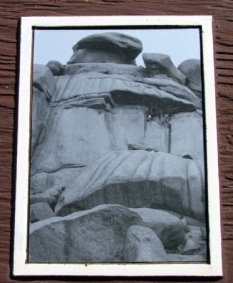
Petroglyphs and pictographs often preserve the only known records created by our human predecessors. The rocks are found at Medicine Lodge, some believe to be as old as 2500 years, has barely wasted the affects of time and weather. Mosaic of . . . — — Map (db m163206) HM
Several of the prehistoric trails that led through the Big Horn Mountains intersect here. The first people using these trails may have entered the area on the very same path you are now using, as long as 10,000 years ago! Over time, possibly due to . . . — — Map (db m91307) HM
Medicine Mountain to your left, was named for the Medicine Wheel, a stone circle that lies atop a ridge below its summit. Designated a National Historic landmark, this symbol remains a mystery as the builders and purpose of the Medicine Wheel remain . . . — — Map (db m91319) HM
Thousands of stone circles lie scattered over the Northern Plains and Rocky Mountains. What were they used for?
Over 100 of these stone circles are known as Medicine Wheels. The Bighorn Medicine Wheel is probably the most well known and sacred . . . — — Map (db m169029) HM
The white man called it the Medicine Wheel, but to many Native Americans Indians it is, "The Place Where the Eagle Lands." To many people it is a sacred place, and there are few that leave without experiencing something outside the ordinary.
It . . . — — Map (db m169030) HM
"Eventually one gets to the Medicine Wheel to fulfill one's life." -- Old Mouse, Arikara
High in the Big Horn Mountains at nearly 10,000 feet above sea level, lies the Medicine Wheel - a place of worship, a National Historic Site, and an . . . — — Map (db m169026) HM
A National Historic Landmark
Located on Medicine Mountain, the Medicine Wheel is one of North
America's most important and well preserved Native American
sacred landscapes which has played and continues to play an
essential role in the . . . — — Map (db m169033) HM
The presence of humans in the Big Horn Basin goes back more than 10,000 years. Evidence suggests that the prehistoric people were nomadic hunters and gatherers. Indians inhabited this area until 1878. In the late 1870s settlers, ranchers, and . . . — — Map (db m88172) HM
Water is a scarce commodity in the arid west. Wherever streams and rivers flow, you will find the pathways of early exploration and travel, the magnets of human settlement. Shell Creek is no exception. Archaeologists discovered evidence that . . . — — Map (db m88186) HM
The area near the Wagonhound Rest Area has played an important role in western transportation since the earliest days of human activity in the Rock Mountain west. The area has provided Wyoming's earliest inhabitants, explorers, westbound settlers, . . . — — Map (db m47142) HM
The stone circles of "Tipi Rings" as this site mark the location of a prehistoric Native American campsite. The stones were probably used to anchor the skins of conical tents known by the Sioux word "Tipi". the stones were placed around the base of . . . — — Map (db m47141) HM
The south central portion of Wyoming has long been a travel corridor for prehistoric and historic people. Native American tribes from the Great Basin region to the west crossed this area to hunt buffalo on the eastern plains.
From 1810 . . . — — Map (db m67988) HM
One of the first two stations built to supply the Mormon emigrants and mail station to accommodate the mail service by virtue of the mail contract awarded to Hyrum Kimball agent of the BYX.
Abandoned in 1858 due to the actions of the United . . . — — Map (db m151835) HM
Plains Indians depended upon buffalo for many of their material needs - food, shelter, clothing, tools, fuel, ceremonial objects, even toys. Prior to acquiring horses in the 18th century, hunting individual animals on foot with bows and arrows was . . . — — Map (db m45545) HM
The enormous task of butchering began immediately after the kill. Adult men and women worked in teams to rapidly skin carcasses and begin cutting them into pieces small enough to be carried out of the sinkhole, possibly by adolescents. Meat . . . — — Map (db m113174) HM
The Vore site was discovered during the construction of Interstate Highway 90. A crew of archaeologists from the University of Wyoming spent two summers (1970 and 1971) determining the horizontal and vertical extent of the cultural materials . . . — — Map (db m113173) HM
Plains Indians required large quantities of meat and hides for food, shelter, clothing, and other material needs. Harvesting as many buffalo as needed by hunting on foot in the severe winter weather would be nearly impossible. Therefore, northern . . . — — Map (db m98094) HM
Look around you! This valley was an excellent habitat for buffalo. The herd-gathering area was open grassland north, west, and southwest of the sinkhole. Natural drainage supplemented by man-made structures provided drivelines. The sinkhole was an . . . — — Map (db m98095) HM
Indians used a combination of drivelines, controlled harassment, and decoys to move the herd toward the intended trap. Here at the Vore site, drainages were probably used to keep the herd together and headed in the desired direction. In . . . — — Map (db m113175) HM
Buffalo are fast, strong, and often unpredictable animals, but Indians understood bison behavior and used this knowledge effectively. For example, the Indians knew that manipulating herds of buffalo was easier than controlling individual animals. In . . . — — Map (db m98096) HM
The vast valley below was once an overflowing bounty of resources. The rich grasslands and forest flooded often with fresh water, attracting elk and bison to graze. The sacred bison gave life with every part of its body, providing food and shelter . . . — — Map (db m202617) HM
The Tower boasts a rich and colorful climbing history. In 1893 two local ranchers first climbed the Tower using a wooden stake ladder (below). Forty-four years later, Fritz Wiessner made the first ascent using ropes and modern techniques.
The . . . — — Map (db m202612) HM
Devils Tower, known as Bear's Lodge to Northern Plains Tribes, rises high above the Belle Fourche River, grasslands, and ponderosa pine forests. This major landmark of the Northern Great Plains has attracted people for thousands of years. Today, it . . . — — Map (db m34463) HM
The Tower and Black Hills area have been a gathering place and home to many people. Archeological discoveries show that native people lived here 10,000 years ago. As time passed, Arapaho, Cheyenne, Crow, Kiowa, Lakota, and Shoshone all developed . . . — — Map (db m72587) HM
Though rising only 600 ft above the floor of the plains, Inyan Kara Mountain stands
as one of the most important cultural and historical landmarks of the Black Hills. Inyan
Kara forms an important part of the sacred geography of the Black Hills . . . — — Map (db m98275) HM
Also known as "Temple of the Sioux," Sundance Mountain rises majestically in the southwest. It belongs to the Bear Lodge Mountain Range, which defines the northwestern edge of the Black Hills. It was named for the Plains Indians' religious . . . — — Map (db m45541) HM
Lieutenant Colonel George A. Custer's Black Hills Expedition crossed northeastern Wyoming from July 17-25, 1874, camping within three miles of this location. forged by 1000 men (cavalry, infantry, teamsters, scientists, miners, newspaper reporters, . . . — — Map (db m45381) HM
In March, 1866, a battle was fought in this vicinity between Shoshone and Bannock Indians on one side and Crow Indians on the other.
The contest was waged for the supremacy of hunting grounds in the Wind River basin. Crowheart Butte was so named . . . — — Map (db m96243) HM
(Three monuments are treated here as one marker:)
Sacajawea Died April 9, 1894
A guide with the Lewis and Clark Expedition
1805-1806
Identified, 1907 by Rev. J. Roberts who officiated at her burial
Dedicated in the . . . — — Map (db m96168) HM
Burial Register on File at Roberts Mission Pages 114-115 Day: 1884 • Date: April 9 • No.: 10 • Names: Bazil's Mother (Shoshone) • Age BCC: 100 • Residence: Shoshone Agency • Cause of Death: Old Age • Place of Burial: Burial ground Shoshone Agency • . . . — — Map (db m96203) HM
This school was founded by the Reverend John Roberts. Born in Wales, in 1853, Roberts was for 66 years a missionary to the Shoshones.
"Our hope is in the children and the young people, the old people can't hear!" So spoke Washakie, Chief of . . . — — Map (db m96167) HM
The Great Shoshone Chief, a skilled hunter, strategist, and warrior against his tribal enemies was noted for his friendship towards the white man. He united his people. He was born about 1804 and died February 20, 1900. Shoshone Indian Reservation . . . — — Map (db m96204) HM
A famous natural landmark used by Indians, trappers, and emigrants on the Oregon Trail. Site of Split Rock Pony Express 1860-1861, stage and telegraph station is on the south side of the Sweetwater. Split Rock can be seen as a cleft on the . . . — — Map (db m67007) HM
Viewed from Beaver Rim, the Wind River Mountains, part of the Rocky Mountain chain, boast 53 granite peaks over 13,000 feet high. The Continental Divide runs the length of the Wind River Range. Water on the east side of the Continental Divide flows . . . — — Map (db m67012) HM
Boysen Dam, completed in 1951, marks the southern margin of the east-west trending Owl Creek Mountains and the Wind River Canyon. Drained by the north flowing Wind River, the canyon is 14 miles long, 1.3-2 miles wide and 2,400 feet deep where it . . . — — Map (db m70611) HM
The modern burg of Sweetwater Station is at the intersection of U.S. Highway 287 and State Route 135 in central Wyoming along the Sweetwater River. It is a place of scenic beauty and historic significance. Prehistoric groups camped along the . . . — — Map (db m95745) HM
Some days since I received a messenger from [Sinte Gleska], head chief of the Brule Sioux, saying that his daughter had died on the way here and had begged her Father to have her grave made with the whites . . . Wishing to do him honor . . . . — — Map (db m87041) HM
“French, Spanish and Indian and mixed are very common here and all languages are being jabbered in promiscuous interchange.”Charles B. Darwin, Fort Laramie, June 28, 1849 Métis (ma-tes’) – of mixed race, particularly, . . . — — Map (db m87012) HM
As the main outpost of the U.S. Government on the Northern Plains, Fort Laramie served as an official meeting ground between the United States of America and the sovereign tribes of the Northern Plains. The first great treaty negotiation, the . . . — — Map (db m86984) HM
In the foreground across the river are the Rainbow Terraces formed of mineral deposits called travertine. The Big Spring produces 127° mineral water and as it makes its way down the terraces the water temperature changes and different colors of . . . — — Map (db m86916) HM
There are several stories surrounding the Crazy Woman legend. The most enduring involves the Crow Indian Tribe, the early traders and a woman who goes mad following a tragedy that was inflicted upon her family. She was left alone to survive in the . . . — — Map (db m228721) HM
Two legends give rise to the name of Crazy Woman Creek. Both are based on tragic events. In one, a young woman is left alone after an attack on her village. She lived in a squalid wickiup and on moonlit nights could be seen leaping from rock to rock . . . — — Map (db m225247) HM
In the months following Custer's defeat at the Battle of the Little Big Horn, a group of Native American members of the Northern Cheyenne Tribe left their allies along the Little Big Horn River and traveled south to encamp for the winter. Led by . . . — — Map (db m91561) HM
There are six plaques on this rather large monument. Prehistoric Cheyenne
Those First to Life Here
There is evidence of prehistoric man living in Wyoming more than 12,000 years ago before present (YBP). These early . . . — — Map (db m96408) HM
The scene depicts a typical meeting of the Indian and the Mountain Man on the open plains of Wyoming during the time of western discovery and exploration in the early 1800’s.
At such meeting the offering of friendship would take place. The . . . — — Map (db m94225) HM
To the Shoshone Indian, this river was the Seeds-Kee-Dee Agie (Prairie Chicken River). On Sept. 16 1811, the Astorians near its headwaters termed it the Spanish River. To the Spaniards, far to the south, it was the Rio Verde (Green River). Jedediah . . . — — Map (db m36659) HM
At the time of the great migration of emigrants through Wyoming to the Pacific coast and Utah, Indians were the largest group of residents in Wyoming. Many of these tribes such as Utes and Blackfeet, were semi-permanent and nomadic, traveling in and . . . — — Map (db m164504) HM
Three panels make up this marker.
(panel 1:)
For thousands of years the fertile Wallowa Valley was home to many Nimiipuu, or Nez Perce people. A treaty in 1855 affirmed Nez Perce ownership of this homeland. Competition for . . . — — Map (db m167146) HM
Off in the distance in front of you, a large red butte lies against a much larger mountain, Rattlesnake Mountain. Flowing down the valley is Trail Creek, named for the ancient Indian trail that crosses the Shoshone River at the Indian ford in the . . . — — Map (db m87571) HM
Cedar Mountain, the mountain in front of you to the left of the canyon, was known to the Crow Indians as “the mountain of spirits.” Early settlers told of finding Indian tree burials on its northeast slope. Unfortunately, those sites . . . — — Map (db m87566) HM
September 9, 1877. The Nez Perce knew that General Howard was at least a day behind the and Colonel Sturgis had moved his forces to the Stinking Water (Shoshone River).
The Nez Perce, led by Lean Elk and Joseph, sensed an opportunity to escape. . . . — — Map (db m190076) HM
Looking west is the Shoshone Canyon, named for the Shoshoni Indians, who hunted in the region. However, most of the Big Horn Basin had been Crow territory until the Fort Laramie Treaty of 1868. West of the canyon, the north and the south forks of . . . — — Map (db m87558) HM
The ridge you are standing on was the last significant barrier for more than 600 Nez Perce Indians and their 2,000 horses as they fled the pursuing U.S. Cavalry. After the battle of the Big Hoel a month earlier, they drew knew the Army did not . . . — — Map (db m190091) HM
On both sides of the Shoshone River there are many circles made of stones built by the Indians who frequented this area. Some of the sites are simply circles with no doorways, believed to be religious symbols associated with the circle of life or . . . — — Map (db m87575) HM
Look to your left and you will see the canyon cut by the Shoshone River. The mountain to the left of the canyon is Cedar Mountain. To the right of Shoshone Canyon you can see Rattlesnake Mountain. The red butte (to the right of Rattlesnake Mt.) is . . . — — Map (db m87565) HM
The Mummy Cave rock shelter was home to Native Americans for nearly 10,000 years. The rock shelter formed when the Shoshone River undercut a vertical cliff and then migrated south. The shelter began filling with sediment and slopewash. The shelter's . . . — — Map (db m228370) HM
This valley has sustained life for thousands of years. Early Native Americans were drawn here to hunt buffalo, elk, deer, moose, sheep and bear. It has always been considered a unique place. The establishment of the nation’s first park and . . . — — Map (db m89027) HM
About 3,000 years ago, small groups of people camped here for a short time. In 1985, archaeologists found stone tools and thousands of bone fragments associated with two fire hearths. The excavation revealed that in winter, the people subsisted . . . — — Map (db m228459) HM
This "living room floor" of the Pagoda Creek archaeological site was perfectly preserved. More than 4,000 artifacts of chipped stone flakes, tools, and bone fragments were found where they had lain for nearly 3,000 years. The site was buried when . . . — — Map (db m228585) HM
During their fighting retreat toward freedom in Canada, the non-treaty Nez Perce passed directly through Yellowstone National Park in August, 1877. Their route followed this creek. When outriders encountered a party of sightseers camped nearby, the . . . — — Map (db m39455) HM
Across the meadow, a fire burned in the campsite of nine tourists on the night of August 23, 1877. The Cowan party had unknowingly camped near hundreds of Nez Perce men, women, and children who were under violent pursuit by the United States Army. . . . — — Map (db m86788) HM
Yellowstone Plateau glowed red from volcanic activity, with molten rock welling up and spreading from numerous fissures. Obsidian Cliff, a 180,000-year-old lava flow, is part of the evidence. Cooling and shrinking, the lava solidified into large . . . — — Map (db m123356) HM
This cliff was named for the Shoshone Indians who lived throughout this mountainous region.
Their use of bighorn sheep earned them the name "Tukadika" or "Sheepeaters".
The cliff is basalt lava that formed "columnar joints" when it cooled nearly . . . — — Map (db m123357) HM
North Platte River: Gateway Corridor
Currents of History Travel Alongside the North Platte River
Routes along the river originally used by Native Americans were later adopted by fur traders. Beginning as a trickle, . . . — — Map (db m164747) HM
. . . you dress lightly because the weather is clear. You are carrying your recently issued seven shot Spencer repeater and a saber. Lt. Grummond will command and he carries a saber and revolver. Wheatley and Fisher, who are with you, carry 15 . . . — — Map (db m87522) HM
. . . your preparations for the battle began two weeks ago when some leaders, including Red Leaf, High Back Bone and Black Leg, determined that the soldiers from the Buffalo Creek Fort could be ambushed. At your main camp on the Tongue River two . . . — — Map (db m87526) HM
… the command retreats up the hill to this point, stopping only once or twice to fire at the pursuing warriors. Civilians Wheatley and Fisher, along with some non-commissioned officers, are making a stand 250 yards to the north, slowing the . . . — — Map (db m87523) HM
. . . you and fellow warriors prepare for battle. You wear your fines dress which includes your war shirt. The war pony you selected is painted and readied for battle as well. All of this preparation will give you spiritual strength and . . . — — Map (db m87528) HM
. . . one of the Cheyenne members of the decoy party, is with you. He is riding a black horse belonging to Little Wolf, his brother, and is wearing Sweet Medicine Chief’s scalp shirt. His horse, tired from decoying the soldiers, stumbles . . . — — Map (db m87524) HM
. . . like you, will die today. History will record that he is of German descent and a combat veteran of the Civil War and Plains Indian Wars. Two weeks ago, on December 6th, he helped Col. Carrington rescue Lt. Grummond from certain death. . . . — — Map (db m87525) HM
The Land
The land under view where the Great Plains meets the Rocky Mountains was once the Red Man's land of milk and honey, then as now teaming with wildlife. It was a most productive--thus favorite--hunting ground. But it was also a . . . — — Map (db m153150) HM
. . . the soldiers are surrounded and defeated. You begin gathering used arrows, soldier weapons, loose horses and tending your injured. Some warriors were hit by accident when warriors attacked from both sides of the trail. Other warriors . . . — — Map (db m87531) HM
< Marker #1 : >
By 1866, Twenty Years of Confrontation . . . . . . had occurred on the Northern Plains. Indian tribes clashed over the vast resources of food, water and grass. European Americans pressured all the tribes on the quest . . . — — Map (db m87421) HM
Plains Indian warriors varied in age from teens into their thirties. Being superb horsemen and skilled marksmen with bow and arrow, these warriors used their athletic skills and knowledge of the terrain to trap their enemies. Although they often . . . — — Map (db m87515) HM
Upon hearing rifle volleys north of Lodge Trail Ridge, Col. Carrington sent Captain Tenodor Ten Eyck with a relief column of 75 men to assist Fetterman. After the battle, Ten Eyck’s testimony described the discovery of a valley full of Indians in . . . — — Map (db m87532) HM
The Fetterman Fight was a clash of forces using different warfare tactics. In 1866, the military used Civil War tactics of massed soldiers formations under a central command using concentrated gunfire. The skirmish lines had men placed at . . . — — Map (db m87517) HM
Officers generally carried Models 1860 Colt or 1858 Remington .44 caliber revolvers. They also carried M-1860 Light Cavalry sabers, like the cavalry. An Infantry Soldier carried a Springfield Model 1863 rifle-musket, .58 caliber. He was . . . — — Map (db m87518) HM
. . . the soldiers from Peno Creek. They retreat south up the hill along their road. A small group of them stop among some rocks to the north. Their fast shooting guns slow the attack, causing many casualties. The remaining soldiers retreat . . . — — Map (db m87529) HM
In 1865 General Patrick E. Connor led the “Powder River Expedition” into this area. This expedition was a part of a broad military program to bring the Indians north of the Platte River under control and halt their depredations along the . . . — — Map (db m92720) WM
Here Aug. 29,1865, troops and Indian scouts commanded by Gen. P.E. Connor destroyed an Arapahoe Indian village. Erected by The Historical Landmark Commission of Wyoming 1936 — — Map (db m86892) HM
The abundance of Rocky Mountain bighorn sheep led the Indians to name this mountain range after these majestic animals. The Big Horn Mountains are a wildlife viewing paradise. Several native Indian tribes competed with each other and later with . . . — — Map (db m89010) HM
Inside the corral the small body of soldiers expected defeat and the same fate as Fetterman’s command. As they took up positions of their choosing, between, behind, or inside the wagon boxes, the men prepared for the worst. Some removed their shoe . . . — — Map (db m87381) HM
By 1868 the Union Pacific Rail Road had been completed through southern Wyoming and northern Utah and a new shorter road ran north to the southwestern Montana gold fields. The Bozeman Trail became obsolete. The U.S. Government once again sought . . . — — Map (db m87399) HM
By the end of the fight the Indians, through the heroics of fellow warriors, managed to remove all but one or two of their dead and wounded from the battlefield. These were taken to a spring near the present day Fish Hatchery for cleansing and . . . — — Map (db m87396) HM
On August 2, 1867, 51 men of Company C, 27th Infantry under the command of Captain James Powell and Lieutenant John Jenness are assigned to the wood cutting detail. Fourteen of these men escort a wood train toward the fort. Another 13 are . . . — — Map (db m87375) HM
Over the years a controversy has arisen about the exact location of the Wagon Box Corral, Indian casualties and the length of the battle. The most disputed fact is the location of the corral. In the early 1900’s area residents brought survivors of . . . — — Map (db m87398) HM
The Indian leaders had hoped the soldiers would pursue a small decoy party of warriors led by Hump into an ambush, but the soldiers refused to follow, and the last pickets retreated safely into the corral after wounding the Ogalala warrior . . . — — Map (db m87385) HM
Before you stands a monument dedicated to the courage and bravery of the defenders in the Wagon Box Fight of August 2, 1867. This monument was built in 1936 by the Civilian Conservation Corps. The legend was written by local historians and although . . . — — Map (db m87401) HM
During construction of Highway 191 in the early 1990s, the oldest known pronghorn kill processing site in Wyoming was discovered and excavated on the ridges below. Three intact cultural layers were uncovered with radiocarbon dates ranging from 4690 . . . — — Map (db m180303) HM
(Two panels make up this marker)
Hundreds of trappers and traders and thousands of Indians met on the banks of the Green River in front of you for the rendezvous of 1833, 1835, 1836, 1837, 1839, and 1840 to exchange a year's worth of . . . — — Map (db m180108) HM
has been designated a
Registered National
Historic Landmark
under the provisions of the
historic sites act of August 21, 1935
This site possesses exceptional value
in commemorating and illustrating
the history of the United . . . — — Map (db m180104) HM
Relations between emigrants using the trails and the Indians were inconsistent during the migration period. While hostile acts and violent confrontation did occur, they have been overemphasized in trail history. During the early migration period of . . . — — Map (db m67049) HM
Jenny Leigh, a Shoshone Indian, assisted the 1872 Hayden Survey. The expedition named this lake in her honor. Jenny and her husband Richard were expert guides who knew Jackson Hole well from summers spent hunting, trapping, and gathering native . . . — — Map (db m123283) HM
109 entries matched your criteria. The first 100 are listed above. The final 9 ⊳