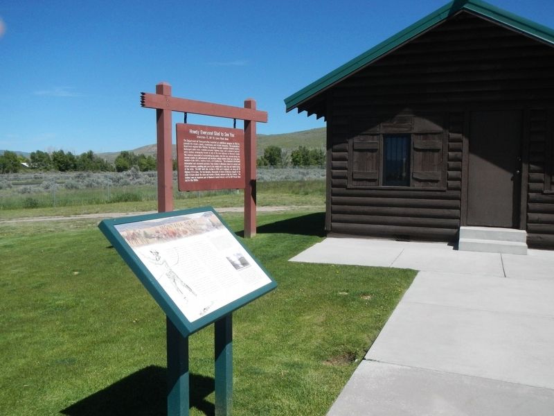
This area once echoed with the sound of creaking wagon wheels, cracking whips, and profanity so intense the mountains vibrated with sulfur! The old wagon road between Montana and Utah passed very close to this rest area. It first saw use in the . . . — — Map (db m124336) HM
Hardin’s first railroad depot was moved from Fort Custer after being cut into small sections and transported by train over the Big Horn Bridge. That depot was expanded in 1909, but was deemed inadequate after the homestead boom dramatically . . . — — Map (db m189370) HM
A 30-car cross-country extravaganza, has been called "Montana's greatest publicity stunt". The Centennial Train, which commemorated creation of Montana Territory, also honored 75 years of statehood. The State commissioned Lyman Rice to paint 150 . . . — — Map (db m189445) HM
Once upon a time, railroads ruled Montana's transportation landscape. When the first railroad reached Montana in 1881, it began a process where, by 1916, over 5,200 miles of steel track criss-crossed the state. The railroad transformed some . . . — — Map (db m189446) HM
Shortly after this area was removed from the Crow Reservation in 1892, homesteaders settled along the fertile Clarks Fork River to raise wheat. The discovery of rich coal deposits along Bear Creek, seven miles to the west, generated interest among . . . — — Map (db m167143) HM
The Gebo Mine, founded in the Clarks Fork Valley in the late 1890s, brought the tracks of the Northern Pacific to this area. The railroad, however, bypassed the coal mine and the town of Gebo that flourished near it because of difficult . . . — — Map (db m166879) HM
The Chicago, Milwaukee and St. Paul Railway was constructed between 1907 and 1909, the last transcontinental railroad to cross Montana. Its service to Great Falls during the homestead boom supported the city’s establishment as a major urban center . . . — — Map (db m141948) HM
A close look at the Woolworth Building’s upper floors makes evident that it was originally two separate, but closely related edifices. Connecting arches over second-story windows, a decorative metal cornice, and a crowning brick parapet distinguish . . . — — Map (db m143769) HM
An eclectic cultural landscape has long characterized the West Bank. Separated from downtown Great Falls by the broad Missouri River, the larger neighborhood has hosted a varied mix of industrial, residential, and commercial development since the . . . — — Map (db m143758) HM
An eclectic cultural landscape has long characterized the West Bank. Separated from downtown Great Falls by the broad Missouri River, the larger neighborhood has hosted a varied mix of industrial, residential, and commercial development since the . . . — — Map (db m143676) HM
For Meriwether Lewis in 1805, the falls were an obstacle on the journey to the Pacific. To Paris Gibson (near right) the falls were a source of great opportunity. As Gibson laid out the townsite of Great Falls he envisioned dams to harness the falls . . . — — Map (db m126545) HM
The discovery of silver in 1879 in Galena Creek southwest of here created a real transportation challenge for the miners of the early 1880's - how to bring in mining supplies and how to haul their precious ore out to distant railroads and markets.
. . . — — Map (db m108776) HM
Across the levee on the corner stood the two-story house built by the sheep man Paris Gibson who was the founder of Great Falls. He later became a promoter for James J. Hill's railroad. In 1887 while negotiating the entry of the railroad into Fort . . . — — Map (db m161589) HM
The railroad grade you see before you was the St. Paul, Minneapolis and Manitoba Railroad, the precursor of the Great Northern Railway. In 1887, nearly 9,000 men constructed 550 miles of track across Montana's northern Great Plains between Minot and . . . — — Map (db m142486) HM
On the Bismarck-Ft Keogh Trail, at various time periods trail was known as Sandstone Bismarck - Ft Keogh Ft Lincoln - Ft Keogh Army Trail during 1879 - 1881
(?) 1873 by civilian freighters and used until the building of Northern Pacific R.R. and . . . — — Map (db m164543) HM
High maintenance steam engines required railroads to locate large repair shops every two hundred miles. After the Chicago, Milwaukee, St. Paul and Pacific Railroad chose Miles City for a division point in 1907, the town grew rapidly. Population . . . — — Map (db m164145) HM
Sometimes called “labor’s aristocracy,” locomotive engineers were the highest paid workers on the railroad. That fact gave William Kelly, an engineer for the Milwaukee Road, the means to purchase this one-story home. In 1920 he lived here with his . . . — — Map (db m164172) HM
Determined to bring the Chicago, Milwaukee, and St. Paul Railroad to Miles City, land developer, cattleman, and banker Lorenzo Stacy organized his fellow businessmen to secure and donate property for the railroad’s right-of- way. In 1908, the . . . — — Map (db m164147) HM
The settlement of Old Scobey relocated here from the Poplar River flats to greet the approaching Great Northern Railway branch line in 1913. By the time the first train arrived on Thanksgiving Day, the two-story Commercial Hotel—today the south . . . — — Map (db m202833) HM
Tired of exorbitant freight rates, copper king Marcus Daly decided to build his own railroad in 1892 to haul ore from the Butte mines to his Anaconda smelter. Daly envisioned the Butte, Anaconda and Pacific Railway extending to the Pacific Ocean. . . . — — Map (db m205592) HM
The fortunes of copper mining and smelting and associated enterprises were subject to the boom and bust cycles typical of metals-based industries. World and national events affected rapid fluctuation in the supply, demand, and price of copper. . . . — — Map (db m128134) HM
Rail transportation in the early twentieth century brought homesteaders to Fergus County and cemented Lewistown’s role as a regional commercial center. The General Brokerage Company of Grand Rapids, North Dakota, financed this stunning warehouse for . . . — — Map (db m143355) HM
(Three panels, presented left to right, make up this marker)panel 1:
The railroad era in Lewistown ended in 2003. Subsequent to the end of rail service, the BNSF Railway Company negotiated an interim trail use and . . . — — Map (db m143508) HM
Essex, with its multi-tracked train yard, owes its existence to the Great Northern Railway. The steep grade on the west side of Marias Pass necessitated a train yard sufficient in size to allow "helper engines" to idle and wait for the heavy . . . — — Map (db m161117) HM
Founded in 1891 by the Great Northern Railway, Kalispell boasted 651 residents in its first year, growing to 2,500 people by 1900. Confident of finding tenants in the booming community, bricklayer John Lundberg built a one- and-one-half story duplex . . . — — Map (db m160390) HM
A pattern book likely provided the plans for this charming American four-square cottage built by Great Northern Railroad employee Frederick Ferguson. A boilermaker by trade, Ferguson immigrated to Chicago from his native England and became a United . . . — — Map (db m160720) HM
Minnesota merchant brothers Tom, John, and William Elliott moved to Kalispell in 1911, after buying James Conlon’s successful mercantile. They expanded into the wholesale grocery business in 1914, building this two- story brick warehouse near the . . . — — Map (db m160775) HM
As the tracks of the Great Northern Railway inched westward from St. Paul to Seattle, Flathead Valley towns vied for designation as the railway’s division point. In the spring of 1891, however, railroad officials purchased land from the Reverend . . . — — Map (db m160483) HM
In 1892, a year after the Great Northern Railway established Kalispell, a stone foundation stood on this corner. Construction soon stalled, however, likely a casualty of the national economic depression known as the Panic of 1893. An 1894 map shows . . . — — Map (db m160477) HM
Described by the Flathead Herald-Journal as “an elegant mansion” in the “colonial style,” this residence’s overall symmetry and small gabled front dormers are typically Colonial Revival. However, the two-story turret, elaborate stained glass . . . — — Map (db m160336) HM
In 1901, Great Northern Railway tycoon James J. Hill and local businessman John O'Brien joined forces to build and operate a 11-mile railroad line to a saw-mill on the north shore of Flathead Lake. Hill built this spur line in record time and . . . — — Map (db m127683) HM
For most of the 20th century, this corner was the site of the Cadillac Hotel. The Cadillac was not the first hotel in town; that distinction went to the Dodge Hotel, on Central Avenue between First and Second Streets. But with its proximity to . . . — — Map (db m160029) HM
This staid old brick building has a rich and colorful history.
The Duncan Samson Block, built in 1910 at a cost of about $32,000, was the third or fourth brick building in the fledgling town of Whitefish. Mrs. Jemima Duncan, a widow who had . . . — — Map (db m160000) HM
Whitefish served as a division point for the Great Northern Railway from its founding in 1904 until 1955. In 1925, one railroader called it “the most distinctively railroad town on the whole Great Northern system.” The second floor of . . . — — Map (db m159944) HM
The Bruck, a custom-designed bus-truck, has a unique place in the history of Whitefish and of the Great Northern Railway, an important residence in the life of the town.
Because the Empire Builder and Westerns Star passenger trains . . . — — Map (db m159945) HM
Built by the Great Northern Railway in 1927, the Whitefish Depot is not only a local landmark but is recognized fondly by hundred of thousands of people who have passed through Whitefish by train over the years. The building’s chalet-style . . . — — Map (db m49491) HM
Open air porches, a half-hexagonal bay window, stained glass, and an irregular roofline make this late-nineteenth-century residence a classic example of the Queen Anne style. Built in the mid-1890s likely from pattern book plans, the substantial . . . — — Map (db m192377) HM
Sacajawea, the Shoshone woman who guided portions of the Lewis and Clark Expedition led Captain Wm. Clark and his party of ten men over an old buffalo road through this pass on July 15, 1806. They were eastward bound and planned to explore the . . . — — Map (db m162423) HM
A Northern Pacific spur line ran in front of this warehouse, originally railroad owned and built in the 1880s for the cold storage of produce. The brick walls are four layers thick with a central air space to maximize insulation; a chute conveyed . . . — — Map (db m192448) HM
Arrival of the Milwaukee Railroad caused Three Forks to move (1908-1910) one mile up the Missouri River from its 1863 townsite, as happened with many sister towns in the developing West. Milwaukee Railroad purchasing agent John Q. Adams saw need for . . . — — Map (db m141722) HM
A Celebration that Rolled on the Rails
1964 marked 100 years since Montana was established as a territory. How would the state celebrate this milestone? The challenge to develop a unique showpiece led to the idea of a train that would tour the . . . — — Map (db m239711) HM
Named for the year it was built, the Oregon Short Line 1903 was constructed for $16,685 as an executive rail car for the Vice President of the Union Pacific. In reference to E.H. Harriman's Presidential rail car, the Arden, which was built in 1900, . . . — — Map (db m123346) HM
In 1905 Union Pacific officials began construction of a branch line in the pine-forested wilderness from Ashton, Idaho, to the western edge of Yellowstone Park. As the final tracks were laid in 1907, Samuel P. Eagle, Alex Stuart, Charles Arnet and . . . — — Map (db m123342) HM
Prior to 1936, the roads leading from West Yellowstone were not plowed during the winter months, isolating the town from the rest of the world.
Even the Train Stopped Running
The Union Pacific Railroad provided passenger service to West . . . — — Map (db m126999) HM
This Property
Contributes To The
West Yellowstone Oregon
Shortline Terminus
Historic District
Listed In The
National Register
of
Historic Places
By the United States
Department
of
Interior
In Cooperation With
The . . . — — Map (db m103600) HM
Arriving at East Glacier depot, tourist in the 1920s could gaze at the glaciated peaks looming beyond their first night's lodging. The hotel appeared to be their last taste of civilization before riding horseback into the primitive backcountry of . . . — — Map (db m45055) HM
Alexander “Nosey” D. Smith came to Havre as a Great Northern Railroad conductor when the first trains came through town in the mid-1890s. He purchased two lots for $5 in 1897 and built this late Victorian Folk style home in 1902. . . . — — Map (db m142676) HM
"Range life in 1900 was a grueling occupation and especially so in in the Alice
Creek area where early snows and long winters made for a very short summer
work period. When Alberta [Patterson] was twenty-one months old her
mother told of . . . — — Map (db m220035) HM
The Great Northern Railway spread its tracks along the windswept Montana Hi-Line in the 1890s and the settlement of Chester emerged, named for the first telegraph operator’s Pennsylvania hometown. The rail line was straightened in 1907 and Chester . . . — — Map (db m161478) HM
The land around Kootenai Falls has been explored and used for thousands of years by the Kootenai or Tunaxa People. The Kootenai tribe made up of seven bands, two in U.S. and five in Canada.
European traders and surveyors were lured to the region . . . — — Map (db m127287) HM
The tracks of the Northern Pacific Railroad never really came to Virginia City. Although the town was the first overland transportation hum in the Territory of Montana and an important regional supply center, this status predates the railroad era. . . . — — Map (db m206347) HM
The Montana Heritage Commission’s state-owned collection of railroad equipment represents the construction era of railroads in Montana. The wooden Soo Line cars representative of cars used by the Northern Pacific, Great Northern and Union Pacific . . . — — Map (db m128402) HM
In 2009, the Friends of the Cumbres & Toltec Scenic Railroad (the Friends) and the Montana Heritage Commission (MHC) engaged in partnership whereby the MHC loaned some unused railroad trucks (axles, wheels, and suspensions systems of rail cars) to . . . — — Map (db m128403) HM
Competition between railroads to get into the Redwater Valley ended with the Interstate Commerce Commission giving the Northern Pacific permission to build the 62 mile line from Glendive to Circle/Brockway. This happened on May 27, 1927 with Foley . . . — — Map (db m143262) HM
During the last ice age about 15,000 years ago, an enormous glacier pushed down from British Columbia and blocked the Clark Fork River in northern Idaho. The glacier functioned as an ice dam creating the largest glacial lake known to have existed, . . . — — Map (db m123059) HM
“Fires of yesterday and last night have swept practically all the country from Avery to St. Regis. Nothing could have lived in the mountains last evening except for the tunnels.” - E. J. Pearson, Chief Engineer, Puget Sound . . . — — Map (db m45511) HM
“The whole twenty-five miles of railroad…between Avery and the Taft Tunnel was swept by a consuming blast of fire, so hot that pick handles lying in the open beside the track were utterly consumed.” - Elers Koch, Forest . . . — — Map (db m45510) HM
Just getting groceries up here could be a challenge
Deep winter snow sometimes made getting to school, going to the doctor, or buying food an adventure.
Families living at the top of the Bitterroot Mountains, here at East Portal and . . . — — Map (db m45544) HM
The Milwaukee Road faced the daunting task of drilling a tunnel 23 feet high, 16 feet wide and 1.7 miles long into Idaho.
It was a damp, dark, dirty dig. After the approaches were prepared in 1906, and a faltering start in 1907, work . . . — — Map (db m45550) HM
Once a critical part of the longest electrified railroad in the world, the broken concrete foundation to your left is all that remains of the two-story, brick East Portal Substation.
Essentially a gigantic electric vault, East Portal was . . . — — Map (db m45542) HM
The Last Transcontinental Railroad
The Chicago, Milwaukee and St. Paul Railway’s Pacific Extension survived for 71 colorful years. Racing silk trains sped along the route, and long, rumbling troop trains carried men and materiel through . . . — — Map (db m45548) HM
…and Historians Trace the History along the Trail.
When the Milwaukee Road abandoned its route over the Bitterroot Mountains, salvage companies stripped the line of all the rails, ties, signals, posts and everything else of value. The . . . — — Map (db m45549) HM
Buried beneath busy Interstate 90 in the valley below are the bones of what the Chicago Tribune in 1909 named “the wickedest city in America”.
This “den of iniquity” sprouted up when the Chicago, Milwaukee and St. . . . — — Map (db m45552) HM
By 1900 the Big Blackfoot Milling Company had largely depleted its nearby timber supplies and moved further up the Blackfoot. The mill, now owned by the Anaconda Company, got most of its timber from logs cut and dumped into the river and floated . . . — — Map (db m123103) HM
Railroad logging was an important facet of the history of Montana's lumber industry. The Big Blackfoot Railroad was one of several logging railroads created to sustain the Anaconda Copper Mining Company's sawmill at Bonner. Built by the Chicago, . . . — — Map (db m144065) HM
Shuttle cars were used to haul men to the logging operation in the woods. The car was a self-propelled unit with an interior engine powering the rear wheels with a chain drive. With a window on either end, it could travel in either direction and . . . — — Map (db m123282) HM
One hundred thirty-seven Missoulians—mostly railroad workers—lived in the Ross House, a large hotel complex that occupied half this block in 1890. Ten years later, a covered walkway still connected the two-story wooden building on this . . . — — Map (db m144493) HM
Neoclassical influences complement the Queen Anne style in this striking transitional home built between 1905 and 1907. A polygonal two-story bay, hipped roof with intersecting gables and wrap around porch lend visual asymmetry characteristic of the . . . — — Map (db m130297) HM
When the tracks of the Northern Pacific reached Missoula in 1883, it was possibly the most significant event in the town’s history. Reliable transportation transformed the minor trade and lumber center to a major economic and commercial distribution . . . — — Map (db m144771) HM
Generations of Northsiders have grown up in the shadow of the railyards since the Northern Pacific Railroad’s arrival in 1883 transformed Missoula into a modern city. Accepting land as an enticement from A. J. Urlin and other leading businessmen, . . . — — Map (db m144560) HM
When the Northern Pacific Railroad announced plans to build a branch line to Yellowstone National Park in the early 1880s, the small town of Gardiner quickly emerged as a "wild west" town. Early accounts labeled it "a veritable Shantyville . . . an . . . — — Map (db m227576) HM
As the Northern Pacific Railroad made its push across the upper tier of the western states in the early 1880s, Livingston grew to serve its passengers and crews. Convenient to the shops and yards, the Eastside especially was home to the many blue . . . — — Map (db m191727) HM
(Left panel:)
Early Exploration and Settlement:
John Colter, member of the 1804-1805 (sic) Lewis and Clark Corps of Discovery, in 1807 was the first known white man to have traversed through the area known as Yellowstone . . . — — Map (db m191799) HM
The old West produced some tolerably lurid gunslingers. Their hole card was a single-action frontier model .45 Colt, and their long suit was fanning it a split second quicker than similarly inclined gents. This talent sometimes postponed their . . . — — Map (db m142883) HM
The last spike of the Chicago, Milwaukee, St. Paul and Pacific Railroad’s (better known as the Milwaukee Road) Puget Sound Extension connecting Chicago to Seattle was driven near Gold Creek, Montana some 17 miles west of here on May 19, 1909. This . . . — — Map (db m127775) HM
The Anaconda Company’s Butte, Anaconda & Pacific Railway converted from steam to electric locomotives in 1914. Aware of Anaconda’s success, Milwaukee electrified its Rocky Mountain division between Harlowton through Deer Lodge to Avery, Idaho in . . . — — Map (db m127777) HM
Opposite this point a creek flows into the Clark Fork River from the west. In 1852, a French mixed-blood named Francois “Benetsee,” Finlay, prospected the creek for placer gold. Although he raised some color, Finlay was ill-equipped to . . . — — Map (db m71948) HM
While the construction of the Northern Pacific Railway was an epic undertaking, the celebration to mark its completion was less than extraordinary. The railroad's president, Henry Villard, planned a last spike ceremony for September 8, 1883 near the . . . — — Map (db m212232) HM
In 1970, Congress enacted a Wilderness Act and designated 43,000 acres north of Terry in the badlands as a Wilderness Study Area. The Calypso Trail and Scenic View offer a grand look at the badlands area. Father DeSmet met with the Hunkpapa Sioux . . . — — Map (db m203104) HM
The Burgess Garage was constructed circa 1913 and is the oldest building standing in Lambert. That year the Northwest Improvement Company, a subsidiary of the Northern Pacific Railroad, platted the new townsite. Business at the garage (then called . . . — — Map (db m143241) HM
On May 8, 1882, the first train rumbled through Forsyth, and the growing town soon became home to many Northern Pacific Railway workers. Among them were locomotive engineers, whose skills were in high demand, particularly in the West during the . . . — — Map (db m164787) HM
Although heavy rain disrupted the celebrations, it couldn’t dampen the enthusiasm Forsyth residents felt for their new bridge, dedicated on July 4, 1905. Prior to the bridge’s construction, Rosebud County residents had to ford the Yellowstone River . . . — — Map (db m164782) HM
The Northern Pacific Railroad surveyed along the north side of the Yellowstone River during the summers of 1871 and 1873, a time when the still-powerful Lakota controlled the unceded land south of the river. A a result, the survey crews required . . . — — Map (db m188744) HM
Welcome to Thompson Park, a 3,500-acre municipal recreation area with a story to tell. The Park offers unique opportunities to view past mining activity, rock formations, scenic vistas, and wildlife. The Park is jointly managed by the City-County of . . . — — Map (db m128441) HM
In 1916, the Great Northern Railroad extended their branch line north from Choteau. Mr. James Hill, the president of the railroad had promised his friend L.B. Pendroy he would build a railroad to his home. Since the railroad was never extended . . . — — Map (db m130226) HM
The Milwaukee Road 657 mile electrified railroad ended at 11:40 PM June 15, 1974 when Engineer Art Morang stopped the E57B & E34C on the Harlowton roundhouse track. They were the last operating locomotive of the original 84 locomotives built by . . . — — Map (db m188906) HM
Billings was founded as a railroad town in 1882. The first passenger depot was the Headquarters Hotel, located on what was then North 28th and Montana Ave. It served as the stopping point for passengers and freight. In 1891, the Headquarters Hotel . . . — — Map (db m167971) HM
The Northern Pacific Railroad Company was created by an Act of Congress and signed by President Lincoln on July 2, 1864. Along the developing tracks, new towns were spaced apart every 100-120 miles. In the Yellowstone River Valley, Glendive, . . . — — Map (db m167972) HM
The American Railway Union, led by Eugene Debs, went on strike against the Pullmans Works of Chicago in June of 1894. Railroad workers throughout America showed their support for the strike by refusing to handle any Pullman cars. Troops from Fort . . . — — Map (db m166384) HM
The Beanery was the Northern Pacific lunchroom where railroad workers, passengers and locals could get a hot cup of coffee or a bite to eat. The lunchroom waitresses, called beanery queens, took orders and served up hot food around the clock. . . . — — Map (db m166251) HM
Billings’ first depot was built in 1883, a year after the arrival of the Northern Pacific. Because the first depot failed to meet railroad specifications, the nearby Headquarters Hotel served instead as the passenger station. The hotel burned a few . . . — — Map (db m166167) HM
(The marker is composed of three panels.) (Panel 1:)
1879, May
Frederick Billings becomes president of the Northern Pacific Railway. One of the original members of the NP Board of Directors, he had served as director for . . . — — Map (db m168492) HM
The depot was opened in 1909 for use by three railroad companies: the Northern Pacific, Great Northern, and Chicago, Burlington and Quincy. Designed in the Beaux Arts Eclectic style, the depot was designed by the Northern Pacific Railroad's chief . . . — — Map (db m166249) HM
The Yellowstone Valley at Pompeys Pillar was a crossroads for travelers and wildlife and a cavalry campsite and staging area.
The artist’s rendering on this sign depicts the area directly across the river as it may have looked in 1873 when Lt. . . . — — Map (db m82763) HM
In June, 1873, a Northern Pacific Railroad surveying party escorted by 1,500 soldiers, including the 7th Cavalry under the command of George Armstrong Custer, and 325 civilians, left Dakota Territory for the Yellowstone Valley to survey a route for . . . — — Map (db m62147) HM