This city in the days of ’49
was called
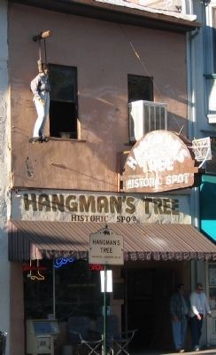
“Hangtown”
This was the site of Elstner’s Hay Yard on which stood the ‘Hangman’s Tree’ where vigilantes executed many men for various crimes. The stump of the tree is under this . . . — — Map (db m10504) HM
Past this point on the Old Coloma Road, running between Sutter’s Fort and his sawmill on the American River, James W. Marshall rode with the first gold discovered at Coloma on Jan. 24, 1848. Traveled by thousands to and from the diggings, this road . . . — — Map (db m11268) HM
On this site the Boston-Newton Joint Stock Association encamped on September 26, 1849. The company left Boston April 16 and arrived at Sutter’s Fort September 27. After a remarkable journey across the continent a rich store of written records . . . — — Map (db m11568) HM
This was the site of a popular roadhouse, where the ponies of the Central Overland Pony Express were changed during July 1, 1860 to June 30, 1861. From here the route of the pony riders continued westward to Folsom and eastward through Rescue, Dry . . . — — Map (db m10442) HM
The water tower was originally built in 1933 and was located at Bakersfield High School on the corner of 14th and C streets. The tower was built to provide water to the campus independent of the city’s water supply and had access to four wells that . . . — — Map (db m237365) HM
The Beale Memorial Clock Tower was a gift to the City of Bakersfield from Truxtun Beale in memory of his mother, Mary Edwards Beale.
Dedicated on April 2, 1904, the clock tower originally stood in the center of the intersection at Chester . . . — — Map (db m170346) HM
Just south of this point stood the Butterfield Overland Stage site known as Kern River Slough. Operating through present Kern County during 1858 – 1861. This famous line ran from St. Louis, Missouri to San Francisco until the outbreak of the . . . — — Map (db m24946) HM
One mile north of here on May 1, 1776, Francisco Garces of the Franciscan Order, crossed Kern River in his search for a shorter route from Sonora, Mexico to Monterey, California. He was the first known explorer to describe this river, which he . . . — — Map (db m24984) HM
Kern County’s oldest residence. Built before Civil War by Thomas Fitzgerald as trading post at junction of two Indian trails. Present Greenhorn Road follows east – west trail (later McFarlane Toll Road) to Kern River mining districts. Town named . . . — — Map (db m25032) HM
Wm. B. Rose, in 1875, a mile east; built an adobe stage station on the site of the Overland Mail Way Station established 1858. From 1853 to 1875 site was known as Rancho Canoa (trough). Originally vaquero camp of the Sebastian Indian Reservation. . . . — — Map (db m20196) HM
The Sebastian or Tejon Indian Reservation (headquarters 10 miles east of here) was established in 1853 by Gen. Edward Fitzgerald Beale as one of several California Reservations. The number of Indians quartered here varied from 500 to 2000. General . . . — — Map (db m108915) HM
Near this spot at the confluence of the north and south forks of the Kern River the Theodore Talbot Party of Captain John C. Fremont’s third expedition to the West camped for several weeks during December 1845 and January 1846. The river was named . . . — — Map (db m25092) HM
The oldest settlement in Tehachapi Valley, known as 'Old Town,' was established here during the 1860s. It was long an important station on the road between Southern California and the San Joaquin Valley. The community began to decline when residents . . . — — Map (db m139964) HM
Oldest building in Lake County. Erected of stone in 1853-4 by Robert Sterling, whose wife was first white woman in Coyote Valley. Rebuilt in 1894. Headquarters of the Guenoc Land Grant and the first store in the valley. — — Map (db m16127) HM
The Old Bull Trail Road ran from Napa Valley to Middletown. It was built by volunteers in the 1850’s. A number of grades were 35 percent. It was an official road in 1861 and abandoned in 1868. St. Helena Toll Road also ran from same points. Was . . . — — Map (db m171749) HM
This route was first used in 1852 by emigrants to Northern California seeking to avoid the hardships of the Lassen Trail. It crossed the desert from the Humbolt River in Nevada, passed this point, and proceeded over the mountains to the town of . . . — — Map (db m10269) HM
This meadow, now a city park, was a welcome stopping place on the Noble Emigrant Trail, pioneered by William H. Nobles in 1851 and first used in 1852. Here, emigrants en route to the Northern California mines were able to rest, refresh their stocks, . . . — — Map (db m10268) HM
Built in July 1854 by Isaac N. Roop. First called Roop's House, and used as stopping place by emigrant trains. It was the locale of the "sagebrush war" fought in 1863 between Plumas County and Lassen County citizens. — — Map (db m10266) HM
Dedicated December 18, 1982
by the Alhambra City Council
and the
Alhambra Redevelopment Agency Board.
This Brown Street Clock
marked the time and location
of Henry E. Wellman Jewelers
since 1913.
The clock has been restored
to its . . . — — Map (db m190603) HM
The Tongva Native American Indian in prayer on top of The Electric Fountain is symbolic of an Indian rain prayer and pays homage to the area’s early inhabitants whose settlements, dating back to the 1500’s, were along the streams that flowed . . . — — Map (db m183120) HM
This buiding, erected by the Gilroy family in 1876, this building was purchased in 1902 by George T. Webber, who operated it as the Western Hotel. The Lancaster Chamber of Commerce was organized in its dining room. Between 1905 and 1913, . . . — — Map (db m53028) HM
A complex of three historic buildings in different architectural styles. The Campbell Apartments at 130 Linden were designed by Parker O. Wright and Francis Gentry in a Spanish Baroque style in 1928. The Lafayette Hotel was a premier art deco hotel . . . — — Map (db m72454) HM
Stoney Point Outcroppings natural site, considered one of the most
picturesque areas in Los Angeles.
Declared 1974, Historic-Cultural Monument No. 132, City of Los Angeles, Cultural Heritage Commission, Cultural Affairs Department. — — Map (db m163865) HM
Ficus Macrophylla
(Moreton Bay Fig)
planted circa 1920.
Declared 2008,
Historic-Cultural
Monument No. 920,
Cultural Heritage Commission, City of Los Angeles. — — Map (db m183767) HM
The oldest building in the city, the adobe was the home of Don Francisco Avila, mayor (alcalde) of Los Angeles in 1810. After his first wife died, Avila married Encarnacion Sepulveda in 1822. He died ten years later. In 1847, during the . . . — — Map (db m163114) HM
Without the determined effort of Christine Sterling and a handful of supporters, the birthplace of the City of Los Angeles would have been lost forever. By 1900 the city center had moved south, leaving the old plaza area to deteriorate. Finally, in . . . — — Map (db m162598) HM
Dedicated to the memory of Christine Witherall Stevenson.
Erected 1923. Declared 1995,
Historic-Cultural Monument No. 617,
City of Los Angeles,
Cultural Heritage Commission,
Cultural Affairs Department. — — Map (db m230075) HM
At this location on August 15, 1958 the first eight stars on the Hollywood Walk of Fame were dedicated to Olive Borden, Ronald Colman, Louise Fazenda, Preston Foster, Burt Lancaster, Edward Sedgwick, Ernest Torrence and Joanne Woodward.
The Walk . . . — — Map (db m204738) HM
Planted circa 1875. Declared Historic Cultural Monument No. 19 by the Cultural Heritage Board, Municipal Art Department, City of Los Angeles. — — Map (db m188853) HM
Juan Rodriquez Cabrillo, exploring for Spain, discovered Alta California and named San Pedro Bay, “Bahia de los Fumos” (Bay of Smokes), October 1542. The smoke on the Bay shore came from the native Suang-Na Indian Fires. Sebastian . . . — — Map (db m127129) HM
His given name is the Trojan Shrine, but he is best-known by his nickname: Tommy Trojan. Probably the most popular and
recognizable member of the Trojan Family, he is a physical and symbolic rallying point for the entire university.
Tommy . . . — — Map (db m129746) HM
This property has been placed on
the State of California Register
of Historical Resources
by the State Historical Resources
Commission, California State Parks,
Office of Historic Preservation. — — Map (db m226804) HM
This site was the location of a combination store, post office, telegraph office, tavern, and stage depot accommodating travelers during the Kern River gold rush in the early 1850s. A regular stop for Butterfield and other early California stage . . . — — Map (db m154273) HM
Francisco Lopez made California’s first authenticated gold discovery on March 9, 1842. While gathering wild onions near an oak tree in Placerita Canyon he found gold particles clinging to the roots of the bulbs. The San Fernando placers and nearby . . . — — Map (db m154261) HM
Established in this vicinity June 11, 1857 by 1st Lieutenant Horatio Gate Gibson, 3rd Artillery, later Brigadier General, US Army. Named by Gibson in honor of his former company commander, Braxton Bragg, later General, C.S.A. Abandoned in October . . . — — Map (db m10585) HM
The last remaining structure and once the original quartermaster’s storehouse and commissary of Fort Bragg Military Post 1857-1864, then located near Laurel and Redwood Avenues. — — Map (db m10586) HM
Since time immemorial, this monolith has been revered by Pomo
people as the home of Frog Woman, the consort of coyote, and a
special being in her own right. For native people it is a place of sacred
power and a reminder of the connection we . . . — — Map (db m221628) HM
This is one of the oldest Protestant churches in continuous use in California. Organized as the Presbyterian Church on November 6, 1859, the building, constructed of redwood, was dedicated on July 5, 1868. — — Map (db m10600) HM
California State Landmark #927
C.A. 1854
[California Registered Historical Landmark description states: One of the oldest of California's Chinese houses of worship in continuous use, the temple may date back as far as 1854, though its . . . — — Map (db m143483) HM
This spot marks the convergence of two pioneer trails widely used by emigrants during the years 1846-1850. The Applegate Trail, established in 1846, led from the Humbolt River in Nevada to the Willamette Valley in Oregon. The Lassen Cut-Off, . . . — — Map (db m10174) HM
General E.R.S. Canby was murdered here in April, 1873, while holding a peace parley under flag of truce with Captain Jack and Indian Chiefs. Rev. Eleazer Thomas, Peace Commissioner, was likewise treacherously slain. — — Map (db m154348) HM
From this fortress Captain Jack and his Indian forces successfully resisted capture by U.S. Army troops from December 1, 1872 to April 18, 1873. Other nearby landmarks of the Modoc Indian War are Canby's Cross, No.110 and Guillam's Graveyard, No.13 — — Map (db m154347) HM
The old Levitt House which became The Bridgeport Hotel and is now the Bridgeport Inn was built in 1877 by Sam Hopkins for Hiram L. Leavitt. Weary travelers in the old west used this historic hotel as a stage and buggy stop to and from the Bodie gold . . . — — Map (db m211809) HM
A distinctive landmark and gathering place used by many early inhabitants of the area for bathing, food preparation, ceremonial and medicinal purposes. It was named “House of the Devil”, by early explorers, for its boiling hot springs, . . . — — Map (db m2950) HM
The Custom House is the oldest government building in California. From 1822 through 1846, Monterey was both the capital city and primary port of entry for Alta California. Cargos of “everything under the sun” were brought ashore and assessed at the . . . — — Map (db m143526) HM
Built between 1844 and 1848 by José Eusebio Boronda, this is an outstanding example of a Mexican era rancho adobe. Virtually unaltered since its construction, it shows many features of the "Monterey Colonial" style which resulted from the fusion of . . . — — Map (db m60397) HM
This historic grist mill known as the “Bale Mill” was erected by Dr. E.T. Bale, Grantee Carne Humana Rancho, in 1846. The mill with its surrounding land was deeded to the Native Sons of the Golden West by Mrs. W.W. Lyman. Restored . . . — — Map (db m18672) HM
Founded in 1862 by Jacob Schram. This was the first hillside winery of the Napa Valley. Robert Louis Stevenson, visiting here in 1880, devoted a chapter of his “Silverado Squatters” to Schramsberg and its wines. Ambrose Bierce and Lilly . . . — — Map (db m52168) HM
Designed by pioneer architects R.H. Daly and Theodore Eisen, this church is an outstanding example of late Victorian Gothic architectural styling. It is the best surviving example in this region of early works associated with Eisen, who later became . . . — — Map (db m18781) HM
Built by Frederick and Jacob Beringer, natives of Mainz, Germany. This winery has the unique distinction of never having ceased operations since its founding in 1876. Here, in the European tradition, were dug underground wine tunnels hundreds of . . . — — Map (db m18734) HM
Established in 1884 by Mexican War Veterans and members of the Grand Army of the Republic who recognized the need for a home for California’s aged and disabled veterans. In January 1897 the Veterans Home Association deeded the home and its 910 acres . . . — — Map (db m18743) HM
Built by Cotton Brothers of Oakland, this steel bridge replaced several wooden bridges washed away in floods. It is the only bridge of the half-through truss design remaining in California. Purdon Crossing was a vital link of the main road from . . . — — Map (db m45068) HM
Headquarters for the largest network of water flumes and ditches in the state. The South Yuba Canal Water Company was the first incorporated to supply water for hydraulic mining. The original ditch was in use in May, 1850, and this company office . . . — — Map (db m10836) HM
This hotel, one of the oldest in continuous operation west of the Rockies, opened for business in August, 1856. Originally known as The “Bicknell Block”. The structure consists of three common-walled buildings of simple brick . . . — — Map (db m12891) HM
Built in the mid 1850’s by John Fippin and John Single. Fippin married Single’s daughter, Julia, in 1867, and they raised 10 children. Local legend has it that one of Lotta Crabtree’s earliest performances was atop the anvil here. The building . . . — — Map (db m10561) HM
Established in 1849 and named in honor of General Zachary Taylor, after the Rough and Ready Company of miners from Wisconsin, this was one of the principal towns of Nevada County. In 1850, articles of secession were drawn up establishing the . . . — — Map (db m10560) HM
The nearby monument was envisioned in 1929 by C. F. McGlashan, Truckee’s foremost resident 1872-1931 and author of the 1880 classic, The History of the Donner Party; P.M. Weddell, who placed wooden signs on the Donner Trail from Verdi, Nevada . . . — — Map (db m176342) HM
While construction on Sierra tunnels delayed Central Pacific, advance forces at Truckee began building forty miles of track east and west of Truckee moving all supplies by wagon and sled. Summit Tunnel was opened in December, 1867. The line reached . . . — — Map (db m23560) HM
The Emigrant Trail in the pioneer days of California came through the low pass to the north, facing this monument. The trail turned west at this point for a distance of twenty-six hundred feet where a tablet describes the route then followed. — — Map (db m176338) HM
The Emigrant Trail in the pioneer days of California turned to the south at this point for approximately three miles, then west across the summit of the Sierras about a mile south of the present railroad.
It was here that the Donner Party missed . . . — — Map (db m176339) HM
The original townsite of Anaheim was surrounded by a living fence of willow trees to keep out the livestock which roamed freely on the open range. This is the site of the gate that was opened to permit travel to and from San Pedro and Los Angeles. — — Map (db m49990) HM
This 1926 structure is an excellent example of Lombard Romanesque Revival architecture. The school site was donated in 1908 to the five year old Huntington Beach Union High School district by the town developers, the Huntington Beach Company. . . . — — Map (db m50021) HM
Vivid reminders of El Toro's past are preserved in Orange County's first historic park. The Serrano Adobe (circa 1883), El Toro Grammar School (1890), St. George's Episcopal Mission (1891), and Harvey Bennett Ranch House (1908) reflect the history . . . — — Map (db m50016) HM
This jail cell was built in 1896 to serve as a holding cell for miscreants on their way to County jail. Originally located on the west side of Camino Capistrano at the intersection with Ortega Highway, it was the scene of several jailbreaks and one . . . — — Map (db m137613) HM
Here on October 10, 1869, his 40th birthday, William H. Spurgeon climbed a sycamore tree to inspect this mustard covered valley. Impressed, he bought 74.9 acres of the Santiago de Santa Ana, and laid out a townsite between First and Seventh, . . . — — Map (db m49991) HM
The World Famous Water Tower was originally built in the late 1800's
to service steam engines that traversed the California Coast. Its
replacement was constructed in the 1940's.
In the 1980's the structure was in danger of being removed . . . — — Map (db m173321) HM
Built by Charles R. Post in 1937 to reclaim farmlands ruined by floods, the Post Brothers' Plow is considered to be the world's largest plow. Measuring 37 ft. long, 12 ft. high, and 11 ft. wide, with a blade of 86 in. it was pulled by five 100 . . . — — Map (db m50008) HM
Between 1849 and 1854, Pioneer Express riders rode this gold rush trail to the many populous mining camps on the American River bars now covered by Folsom Lake. - Beals, Condemned, Dotons, Long, Horseshoe, Rattlesnake, and Oregon - on the route to . . . — — Map (db m10202) HM
(Original marker, which was stolen in 2012. See Photo #1)
Founded in 1849 as 'The Spanish Corral,' Area proved so rich that Biblical name of Ophir adopted in 1850. Most populous town in Placer County in 1852, polling 500 votes. Almost . . . — — Map (db m11922) HM
The spring of 1845 saw the first covered wagons to surmount the Sierra Nevada Mountains. They left this valley, ascended to the ridge and turned westward to Old Emigrant Gap. The wagons were lowered by ropes to the floor of Bear Valley. Hundreds . . . — — Map (db m548) HM
Central Pacific reached Rocklin, 22 miles from its Sacramento Terminus, in May, 1864, when the railroad established a major locomotive terminal here. Trains moving over the Sierra were generally cut in two sections at this point, in order to ascend . . . — — Map (db m11088) HM
Central Pacific graders reached Junction, now Roseville, on November 23, 1863, crossing the line of the California Central, which began building northward from Folsom in May 1858. That line was abandoned in 1868. CP’s track reached Junction April . . . — — Map (db m11079) HM
With the backing of Southern Pacific Railroad magnate Henry E. Huntington, Mount Rubidoux was purchased by Frank Miller of the Mission Inn in 1906. In an attempt to beautify the mountain and to sell residential lots at its base, a road was built and . . . — — Map (db m120431) HM
The original wooden water tower was built here in 1872. This water tower has stood as a beacon since 1936, connecting yesterday, today and tomorrow.
Dedicated as a Galt Historical Landmark
November 11, 1995 — — Map (db m72322) HM
HISTORY
When Spanish governors ruled the California territory, its capitol was moved from town to town between San Diego and Monterey.
San Jose had already been designated the capitol by the time California was granted statehood in 1850. . . . — — Map (db m15017) HM
The historic Capitol was designed by architects M.F. Butler and Reuben Clark. Its style is an adaption of Roman Corinthian architecture. Work began in 1860 and by late 1869 the Capitol was partly occupied. In 1874, construction ended at a cost of . . . — — Map (db m154357) HM
This was the site of the first synagogue on the Pacific Coast, dedicated on September 3, 1852. The building, prefabricated in Baltimore and shipped around Cape Horn in 1849, originally housed the Methodist Episcopal Church, whose trustees sold the . . . — — Map (db m149189) HM
Sutter’s Fort, established by Capt. John A. Sutter in August 1839, marked the Western end of the Coloma Road. Opened in 1847, this road ran from the Fort to Sutter’s sawmill at Coloma. Used by James W. Marshall in January 1848 to bring the news of . . . — — Map (db m11897) HM
On January 12, 1864, President Abraham Lincoln decreed that where the Central Pacific Railroad crossed Arden Creek the western base of the Sierra Nevada began. The hardships of railroad construction through mountains resulted in increased government . . . — — Map (db m18854) HM
Built in 1852 by the Lady Adams Mercantile Co.; named after the brig which brought the partners around the horn. She has survived fires, flood, and being lifted one story. She has served merchants, bankers, and as a “rooming house”. . . . — — Map (db m58582) HM
Harvey Houses were legendary in the history of Western rail travel. Operated by Fred Harvey in conjunction with this Santa Fe Railway, the network of restaurant-hotels set a new standard in quality meal service. Barstow's Spanish-Moorish "Casa Del . . . — — Map (db m50666) HM
In March 1928, the Federal Government established the first and only experimental station in the United States devoted solely to research on the breeding and raising of rabbits on a five-acre property donated by A. B. Miller of Fontana. The station . . . — — Map (db m50670) HM
In June 1851, 500 Mormon Pioneers came through this pass to enter the San Bernardino Valley where they colonized and established a prosperous community. — — Map (db m140423) HM
In 1839 Governor Juan Alvarado granted the 13,000-acre tract called Cucamonga to Tiburcio Tapia, an ex-soldier who was a prominent merchant and alcalde in Los Angeles. A half-mile west of this marker Tapia, employing Indian laborers, immediately . . . — — Map (db m149478) HM
Borax was discovered on the nearby surface of Searles Lake by John Searles in 1862. With his bother, Dennis he formed the San Bernardino Borax Mining Company in 1873 and operated it until 1897. These chemicals in Searles Lake which include borax, . . . — — Map (db m50241) HM
Under the auspices of Knott’s Berry Farm, Buena Park, Calif. Buildings shall be rebuilt on their original sites.
Walter Knott is dedicating Calico Ghost Town to the memory of the heroic silver miners who lived and toiled here.
The . . . — — Map (db m10576) HM
Centered about the “Town of Calico”, The Calico Mining District, which had a peak population of 3,000, produced between $13 and $20 million in silver and $9 million in borate minerals between 1881 and 1907. On April 6, 1881, several . . . — — Map (db m10573) HM
Originally built as the home of San Diego’s John Brown in 1850, the house was converted to a church by Don Jose Aguirre in 1858. Father Antonio D. Ubach , formally a missionary among the Indians, was parish priest here from 1866 to 1907. It is said . . . — — Map (db m11652) HM
The steam ferryboat "Berkeley" was the first successful west coast-built and operated ferry to be driven by a screw propeller as opposed to side-wheels. Built by the famous Union Iron Works of San Francisco in 1898, the ferry operated until 1958 as . . . — — Map (db m51330) HM
Soldiers, sailors, Indians, and Franciscan missionaries from New Spain occupied the land at Presidio Hill on May 17, 1769 as a military outpost. Two months later, Fr. Junípero Serra established the first San Diego Mission on Presidio Hill. . . . — — Map (db m11134) HM
In 1936 almost half of Mint Hill was removed to create a flat base for the Mint.
In 1947 Duboce Avenue east of the Sunset Tunnel was crowded with automobiles as shoppers thronged to the farmers’ market.
The area near Market and Church . . . — — Map (db m128827) HM
The marker is primarily composed of photographs and illustrations and the captions that accompany them. Photographs or illustrations are sequentially numbered from the top.
For ships coming through the Golden Gate, Telegraph Hill could . . . — — Map (db m73350) HM
Fort Point is considered one of the finest examples of military architecture in the United States and is San Francisco’s only major building constructed before the Civil War which has remained basically unchanged since it was completed and . . . — — Map (db m10677) HM
1636 entries matched your criteria. Entries 101 through 200 are listed above. ⊲ Previous 100 — Next 100 ⊳