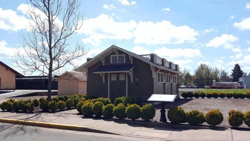
The Incubator House and Poultry Building stood at 26th and Jefferson on the OAC (Oregon Agricultural College, now OSU) campus until 1927, where they formed the headquarters of the Department of Poultry Husbandry.
The Incubator House was the . . . — — Map (db m117612) HM
The Baker's water supply consisted of a hand dug well located close to the cabin. Likely located by dowsing , there is a strong underground stream easily found even today with a 'water-witch.' The well extended down approximately 25 feet and often . . . — — Map (db m114256) HM
"We pitched our tent... remaining at this camp for about one week, feasting on watermelons and good, fresh vegetables right from the garden, which are brought in by the Clackamas County farmers in great abundance." E.W. Conyers on arrival in . . . — — Map (db m114201) HM
The Grove of the States includes a tree representing each state in the USA and the District of Columbia. The idea for the Grove of the States was conceived by Oregon Attorney General Robert Y. Thornton to honor the passage of Lady Bird Jonson's 1965 . . . — — Map (db m127210) HM
This grove of nine trees is a part of the original landscaping planted around the historic 1886 Queen Anne style house of Captain George Flavel. The grove consists of a giant sequoia, ginko, Camperdown elm, bay laurel, pear, and four cork elms. . . . — — Map (db m168306) HM
Oregon's historic Tillamook forest fire of 1933 spread over 240,000 acres of forest land. Fires in 1939 and 1945 brought the total to 355,000 acres. Over 13 billion board feet of timber were killed.
Devastation by these disastrous fires aroused . . . — — Map (db m114418) HM
This 50-acre grove of 250 year-old Douglas-fir & understory hemlock is typical of the forest that covered nearly all of the Coos River drainage until major harvesting began about 1950.
Originating from a large forest fire in about 1770, . . . — — Map (db m237648) HM
Donated by Menasha Corporation
To the City of Coos Bay
340 years old, 210 feet tall
Logged by: LA Logging Inc.
Tree Faller: Silver Creek Logging
2000 Trees Replanted
— — Map (db m114193) HM
The Coos Bay Lumber Co. purchased this 73-ton, 2-8-2 Mikado-type steam locomotive in 1922 from Baldwin Locomotive Works in Philadelphia, Penn.
Engine No. 104 pulled log trains – sometimes as many as 100 cars – from the Powers and . . . — — Map (db m113669) HM
Aircraft proved their military worth during World War I—initially for observation purposes, and later for the support of ground troops and bombing. When the United States entered the war in 1917, air supremacy was hotly contested and airplane . . . — — Map (db m120619) HM
Height: 80+ feet
Circumference: Approximately 80 feet
Age: 300+ years
This grove of old-growth Ponderosa Pines shaded the extensive lawn of the 1901 A.M. Drake home in the future sited of Bend. Drake's Pilot Butte Development Co. . . . — — Map (db m157654) HM
To supply the lumber mills with logs, entire mobile towns were created in the woods to house the men and their families who cut down the trees. The towns were movable camps conveyed by railroad cars. From 1916, these temporary towns, or logging . . . — — Map (db m113935) HM
Geologists say the volcanic activity of this area occurred less than 6000 years ago. Lava which exuded from the south side of this butte flowed to the west and blocked the Deschutes River, deflecting it from its former channel. This formed the . . . — — Map (db m68673) HM
The bustling marketplace you see today, filled with shops, theaters, restaurants, entertainment and recreation was once the site of the largest pine sawmills in the country.
Back in the 1920s, they were busy, noisy and dusty mills, each . . . — — Map (db m113931) HM
Trees were felled in the woods and hauled to the Deschutes River where they floated downstream to the mills.
The final steps of this log-to-lumber journey occurred as the wet lumber, known as green wood, exited the mill on the green chain.
As . . . — — Map (db m113933) HM
Huge trees were felled in the woods and the logs were transported by railroad to town. They were then dropped into the Deschutes River to await their turn in the mill. The river was a perfect storage place for the logs. The natural flow of the . . . — — Map (db m113936) HM
In the beginning...there were old growth trees.
The small community, first called Farewell Bend from the nearby big bend in the Deschutes River, could have been called “Pilot Butte” if the 1901 recommendation of Postmaster William . . . — — Map (db m63089) HM
From the woods to the Deschutes River, the log was hoisted by the bull chain into the mill from the river to the log deck.
It was then directed to the band saw in one of the three head rigs, where the process began.
It was the head sawyer's . . . — — Map (db m113919) HM
The mills may be gone, but their legacy is apparent all around us. The lumber companies spurred Bend's growth and they helped a lot of folks raise their families in this area. Today we see evidence of Mill B every time we look at the three iconic . . . — — Map (db m113932) HM
This majestic pine is the biggest of its species ever recorded. It was a giant before the Oregon Territory was established, enduring centuries of fire, insects, disease, and human impact.
Recently half of its crown was lost to weather, . . . — — Map (db m114266) HM
A Big Piece of Reedsport History
Here, restored by citizens of Reedsport, is one of the largest steam donkeys to work the Oregon woods, the Smith and Watson 12 X 13 compound geared universal yarder. It was placed in service in 1915 . . . — — Map (db m113331) HM
Oxen Replaced Mules And Donkeys –
Steam Donkeys Replaced Oxen
By the early 1900’s steam yarders or steam donkeys, as they came to be known, industrialized logging.
These large steel and cast iron steam machines . . . — — Map (db m113474) HM
This tree was given to Douglas County by Binger Hermann, U.S. Congressman, around the turn of the century. The occasion for the tree donation is not known positively, but research suggests that it was given at a dedication ceremony for the . . . — — Map (db m112587) HM
In 1921 the Forest Service began, using a lookout tree on the Red Mountain in the upper Cow Creek Valley to detect fires in the surrounding mountains and valleys.
The tree was replaced by a cupola style lookout in 1928. This building was moved . . . — — Map (db m113334) HM
These buildings, constructed by the Civilian Conservation Corps (CCC) during the period between 1933 – 1942, are excellent examples of the Depression-era, rustic style of U.S. Forest Service structures.
The building in the upper left . . . — — Map (db m113336) HM
The CCC was created in 1933 to provide young men useful work during the Depression. Camp Canyon Creek (Company 1231) was established in 1937. The CCC built numerous facilities such as District offices, the John Day Compound, fire guard stations, . . . — — Map (db m107548) HM
For the longest time life here in Bear Valley as quiet and change was slow.
Native American seasonal camps gave way to small ranching operations of the first Europeans. In good weather the stagecoach ran through the valley. And in 1895, . . . — — Map (db m108734) HM
After spending a day skidding logs, laying track or building Seneca's first homes, the workers needed a place to call home; temporarily at least.
In 1928 "Camp One" was established southwest of here, and with boxcars for homes, . . . — — Map (db m108735) HM
Back in the early 1920's you may have left the dirt streets and wooden sidewalks of the town of Burns, to walk in these woods, where untouched ponderosa stood tall.
But in a few short years, one of the biggest ever timber sales in the . . . — — Map (db m108836) HM
When the railroad was being built the forest here was a busy place with trees being felled to make ties, and rock being blasted for ballast. In February 1927, forest ranger G. C. Blake reported:
"Yesterday I made the trip from . . . — — Map (db m108872) HM
Pinus lambertiana
When settlers crossed on the Applegate Trail, sugar pine trees dominated this landscape. Native Americans had seasonal camps and purposefully managed the sugar pines, including using a hook-ladder to move up the tiered . . . — — Map (db m112589) HM
In 1860, Martha Hanley planted this weeping willow to commemorate the birth of her son. The willow cutting was obtained from the pioneer Luelling Nursery in the Willamette Valley and delivered by Martha's friend Kit Kearney, an express rider, who . . . — — Map (db m244248) HM
Carya ovata
Mary Louisa Black planted this shagbark hickory near her home in 1866 from nuts she carried from Missouri on the Oregon Trail in 1865. Of the nuts she planted, two grew into trees. This tree is the lone survivor of snow, . . . — — Map (db m112564) HM
Sequoiadendron giganteum
On March 22, 1862, the day of his son Emil's birth, Peter Britt planted this giant sequoia by his home. Britt was a pioneer photographer, skilled horticulturist, and leader in Southern Oregon's lucrative fruit . . . — — Map (db m112590) HM
Peter Britt was one of Jacksonville's best known and respected pioneers. He is remembered for the pictures he took and the plants he grew.
An avid gardener, Britt surrounded his home with ornamental shrubs and exotic trees, which he started . . . — — Map (db m122903) HM
Peter Britt was an extraordinary man of vision and accomplishment. His curiosity, motivation and experimental nature, matched with a keen business sense, allowed him to merge broad-ranging interests into a wide assortment of successful endeavors. . . . — — Map (db m122890) HM
This simple frame building — listed on the National Register of Historic Places - is one of the oldest Forest Service structures in the country. Known for many years as the “tack room,” it has served a variety of purposes since its . . . — — Map (db m113409) HM
This small grove of Comice pear trees are the only remaining of an original planting known as Harry & David Bear Creek Orchards Block 1A. Harry & David Corporation became internationally renowned in 1932 when they began marketing their gift boxes of . . . — — Map (db m113351) HM
With railroad access to distant markets, the orchard industry flourished. Hundreds of thousands of apple and pear trees were planted in the early 1900s, and commercial fruit became the Rogue Valley's major export.
Promoters widely . . . — — Map (db m120989) HM
Pinus jeffreyi
In Oregon, Jeffrey pines are found only in the state's southwest corner. They are especially adapted to local dry, infertile, serpentine soils as seen in the surrounding flat lands and distant mountains. These trees resist . . . — — Map (db m112563) HM
Because of strong harsh, and nearly constant winds, many of the trees here are deformed and stunted. The almost never-ending pressure bends the trunks and branches so the grow away from the wind.
As the trunks thicken with age, they bury the curved . . . — — Map (db m157454) HM
First known as Cook’s Logging Camp. "Old Blue",
Klamath County’s first railroad engine brought
here by horses from Klam[a]thon, 1893. — — Map (db m152414) HM
Fifty acres were planted with two year old Ponderosa pine seedlings in the spring of 1960 after the area was scarified to remove brush. First commercial thinning Oct. 2005 3.7MBF/AC. — — Map (db m113804) HM
Before the railroad came to Klamath County, sawmills were built to provide milled lumber to be used locally. Due to the lack of roads and transportation equipment, most mills were built near water so logs could be floated to the mills.
The . . . — — Map (db m157457) HM
Agriculture
The Klamath Reclamation project began in 1906 with the draining of marshlands, which had been remnants of a prehistoric lake, to supply irrigation water to farmers. The main canal, called the “A Canal,” was first . . . — — Map (db m153545) HM
Pinus ponderosa
When a Japanese balloon bomb exploded at
this site, Elsie Mitchell and her Sunday school
class of five children, out on an early spring
fishing outing, were killed. They were the only
World War II casualties to occur . . . — — Map (db m112595) HM
Paisley was once the site of a seasonal Native American settlement. Northern Paiute and Klamath Indians came to the Chewaucan Marsh and River to harvest local resources, most notably the wapato, Silgittaria cuneata, a plant with . . . — — Map (db m113765) HM
In 1862 Felix Scott led a crew of 50 men who blazed a trail across the Cascade Mountains following an old Indian trail which skirted lava flows.
Scott hoped to use the new route to take supplies to gold fields in Idaho.
His trail was . . . — — Map (db m114245) HM
Early industries in the Florence area were built on the natural resources that the Siuslaw River Valley had to offer. The rivers were filled with swarming salmon and the forests held acres of old growth timber. Those abundant natural resources . . . — — Map (db m93894) HM
At the turn of the century, the wild frontier was rapidly shifting to settled land and the Forest Reserves (predecessor to the Forest Service) quickly became an integral part of life in the region. "Forest Rangers" (a new breed of working men) . . . — — Map (db m112929) HM
Just across the reservoir, Lowell took root in the 1850s at Amos D. Hyland's homestead. First called Cannon, then later dubbed Lowell, the town grew up around Hyland's general store and large hop-processing yard. Hyland also operated a ferry that . . . — — Map (db m112930) HM
Before Columbus sailed to the Americas, this Sitka spruce began its life nourished by a nurse log. As it grew, it shared Cape Creek with the Indians who lived just one-half mile west at their large seasonal campsite by the ocean.
When the . . . — — Map (db m114265) HM
This black walnut was planted c. 1884 by the Zimmerman family who were prominent members of the Aurora Colony. Early Aurora settlers were talented and industrious. Their products gained a wide reputation for excellence during the early days of . . . — — Map (db m244246) HM
Steam donkeys such as this "Tacoma Wide Face Yarder" were a vital part of a logging team's equipment in the 19th century forests of Oregon. Their name is derived from secondary engines called "donkey engines" used on sailing ships to load cargo, . . . — — Map (db m113295) HM