Rivers were the transportation and power for Maine's logging industry from the first sawmill in 1630 in Berwick until 1974. Lewiston's first sawmills were located near the Great Falls. Throughout the year, hardy loggers cut the trees . . . — — Map (db m186026) HM
Welcome to Auburn's Museum in the Streets® Historic Walking Tour.
Auburn's history is a manifold tale of Native Americans and settlers; entrepreneurs and visionaries; industrialization and the American . . . — — Map (db m185956) HM
Welcome to Auburn's Museum in the Streets® Historic Walking Tour.
Auburn's history is a manifold tale of Native Americans and settlers; entrepreneurs and visionaries; industrialization and the American . . . — — Map (db m186022) HM
Welcome to Bonney Park
Located in the heart of downtown Auburn, Bonney Park was named in remembrance of fallen Police Officer Rodney "Rocky" Bonney. Bonney Park features playground equipment and great views of the Androscoggin River. Bonney . . . — — Map (db m185973) HM
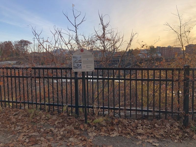
Wabanaki History: From Amitgonpontook to Lewiston-Auburn
During the 1680s several hundred Wabanakis fled the English wars of conquest in the south and gathered here at the town of Amitgonpontook. Nearby fish, farm crops, and . . . — — Map (db m185978) HM
Welcome to Lewiston's Museum in the Streets® historic walking tour.
Along this trail you will discover the rich heritage of Maine's second largest city. Illustrated panels guide you along the Androscoggin River and through the . . . — — Map (db m185985) HM
Welcome to Lewiston's Museum in the Streets® historic walking tour.
Along this trail you will discover the rich heritage of Maine's second largest city. Illustrated panels guide you along the Androscoggin River and through the . . . — — Map (db m186042) HM
Plaque commémorative du premier débarquement des Acadiens àu Madawaska, en juin 1785. Hommages de Leurs Descendants. 15 Août 1934.
English (Google translate): Commemorative plaque of the first landing of the Acadians in Madawaska . . . — — Map (db m148295) HM
English:
Genealogy, massive French & Acadian family reunions link past and future
While some Americans proudly trace their roots to the Mayflower, here Valley roots lead back to 1785 and the first 17 Acadian families. . . . — — Map (db m148199) HM
English:
—Acadians settling where faith, farms, and family could grow— British encourage the settlement of the Madawaska Territory. The British — having lost many American colonies in 1783 — wanted . . . — — Map (db m148194) HM
To mark the site of
1688 Fort Andross 1694
and
1715 Fort George 1737
Also the earliest burial place
where are buried
Benjamin Larrabee
Agent of the Pejepscot Proprietors and
Commander of Fort George. Also
Robert and . . . — — Map (db m51932) HM
Declared a National Historic Site January 1974
Here lie the hardy courageous early settlers, the men and women who founded and defended this area, who made history in civil life, government, law, the arts, education, religion, in the state and . . . — — Map (db m50432) HM
1754: Third Parish, Stroudwater, votes to become a Church of England Parish. Pastor sent to England to be Ordained Priest of that Church.
1763: Third Parish reorganizes as Church of England Parish, under The Rt. Rev'd. Richard . . . — — Map (db m186362) HM
Erected by the Colonists in 1680
Captured by the French and Indians
in 1690. Entire English
settlement destroyed
————
To the memory of these
brave defenders
this tablet placed by
The Daughters of the American Colonists
November . . . — — Map (db m50448) HM
In honor of
George Cleeves
Founder of Portland
1633
Deputy President
of the
Province of Lygonia
1645 - 1659
There landed with
George Cleeves,
his wife Joan,
and daughter
Elizabeth,
his partner
Richard . . . — — Map (db m55535) HM
Fort Sumner Park, located behind you acros North Street, began its history in 1775 during the Revolutionary War. Initially referred to as The Great Fort, and later, as The Citadel, it was commissioned in 1794 as the first . . . — — Map (db m186400) HM
Native Americans harvested this rich estuary, camping on Casco Bay islands to hunt, fish, and dig clams.
Prehistoric spear and harpoon points, fish bones, and shell heaps found on Casco Bay islands help trace ancient peoples' late winter, . . . — — Map (db m186360) HM
The largest 17th century settlement in Cape Elizabeth - which included South Portland and Cape Elizabeth prior to 1895 - was established in 1658 near Spring Point. However, the onset of the French and Indian Wars in 1675 necessitated frequent . . . — — Map (db m55673) HM
Near this hallowed ground our earliest settlers erected in 1722 a garrison-meeting house for worship and protection. This was the beginning of the First Congregational Church of South Portland, which was established on November 10, 1734. . . . — — Map (db m55603) HM
Frenchman Bay extends seven miles between Mount Desert Island and the Schoodic Peninsula, which lies beyond the Porcupine Islands. For centuries, humans have plied these bountiful waters to fish, trade, and enjoy the scenery. In the long struggle . . . — — Map (db m105628) HM
Welcome to Augusta
Indigenous people occupied the Augusta area for thousands of years before European explorers arrived. Little evidence remains of their time here, but patches of forested land along the Kennebec give us a glimpse . . . — — Map (db m186068) HM
[Historical information excerpt at bottom of marker]
Old Fort Western and downtown Augusta sit on the site of ancient Cushnoc, the Abenaki word signifying the head of tide on the Kennebec River. Although according to the archaeological . . . — — Map (db m110823) HM
In commemoration of the first trading voyage of the Pilgrims of Plymouth to the ancient Indian village at Cushnoc on the Kennebec River, 1625, and on this site the establishment of their fur trading post with the Indians, 1628, Jown Howland in . . . — — Map (db m110858) HM
An endless quest for riches brought Europeans to the Kennebec River by 1607 and to Augusta by 1625. In 1628, the Plymouth (Massachusetts) Colony constructed Cushnoc Trading Post on the Kennebec riverbank at the head of navigation, . . . — — Map (db m110861) HM
The Pilgrims' trading post at Cushnoc had enjoyed a monopoly of fur trade with local Abenaki since 1628. In the spring of 1634 a vessel commanded by John Hocking of Portsmouth challenged that monopoly. Arriving at Cushnoc, Hocking . . . — — Map (db m110824) HM
As part of the strategy to expand and strengthen Massachusetts' territorial claims along the Kennebec River, a Boston-based land company, the Kennebec Proprietors, built Fort Western in 1754. Commanded by James Howard, the Fort . . . — — Map (db m110822) HM
Old Fort Western was built in 1754 at Cushnoc, an Abenaki name for the site of an important 17th-century Plymouth Colony trading post. The Old Fort's main house (barrack) is New England's oldest surviving wooden fort building and a symbol of . . . — — Map (db m111208) HM
This blockhouse is the only building that remains of a larger fort complex, built by British-Americans in 1754-1755, to defend the upper Kennebec River Valley from possible attack by the French and their Native American allies.
The . . . — — Map (db m116133) HM
Native Americans inhabited this site at the confluence of the Kennebec and Sebasticook Rivers from at least 5000 years ago, until 1692.
A pilgrim trading post was also located on this site in the 1650s.
Located within Fort Halifax Park is . . . — — Map (db m116136) HM
To commemorate the voyage of
Captain George Waymouth
to the Coast of Maine
in 1605
His discovery and exploration of the
St. Georges River
and planting a Cross on the
northerly shore of this harbor
where the river "trended . . . — — Map (db m54665) HM
Near this site on August 14, 1635,
John Cogswell and family from
Westbury Leigh, Wiltshire, England,
first set foot in America.
They arrived on the ship Angel Gabriel,
which was wrecked here on the
following day in a . . . — — Map (db m35442) HM
Near this site on August 15, 1635
Ralph Blaisdell and family
were shipwrecked.
The ship was the Angel Gabriel
bound from Bristol, England
to Pemaquid.
From here the family
went to York, Maine
and later to . . . — — Map (db m35441) HM
1. Joseph Berry's Fort - West Bath; 2. Col. Noble's Fort - Pleasant Cove, built in 1734, a stockade with a guard house at each corner and another within the enclosure. "Without its protection the farmers did not dare work their fields."; 3. Clarke . . . — — Map (db m52199) HM
Today's peaceful view of the Penobscot River and the community of Bucksport holds few hints of the early conflicts that plagued the area. For nearly two centuries, the river served as a border between clashing interests - French and English, Native . . . — — Map (db m55132) HM
Native Americans first paddled dug-out canoes up and down the Penobscot River about 8,000 years ago. Seeking rich hunting and fishing grounds, these people had come to live on the wooded shores of the river and bay.
Archaeology has revealed . . . — — Map (db m55129) HM
Planted in honor of those who lost their lives in the tragic events on September 11, 2001
The American Liberty elm was named after "The Liberty Tree": Our Country's first Symbol of Freedom. On the morning of August 14, 1765, the people of Boston . . . — — Map (db m55341) HM WM
"...all set to clear the island, to fetch wood, to cut timber, to carry earth & other things necessary for the construction of the buildings."
Samuel Champlain Journal, 1604 (translation)
Pierre Dugua's settlement plans . . . — — Map (db m125214) HM
This model shows the Saint Croix Island colony as depicted by Samuel Champlain. His depiction was idealized. Archeological research has revealed discrepancies in building size and location.
[Sketch caption reads]
Plan for 1604 Saint . . . — — Map (db m125257) HM
"The Sieur de Mons decided to remove elsewhere...to escape the cold and dreadful winter..."
Samuel Champlain Journal, 1605 (translation)
After the terrible winter, Pierre Dugua, Sieur de Mons, ordered his men to take down . . . — — Map (db m125245) HM
St. Croix Island has been presented to the United States of America as a monument to Sieur de Monts and Samuel de Champlain on the North American continent. The creation of this monument has been accomplished as a result of the public spirit and . . . — — Map (db m125115) HM
"...His Majesty commanded the Sieur de Mons to prepare a fresh expedition..."
Samuel Champlain Journal, 1604 (translation)
The newcomers who landed on the island offshore came from France. Their leader was Pierre Dugua, . . . — — Map (db m125161) HM
In 1604, this was the land of the Passamaquoddy. In June, several families would have been camped here harvesting fish and shellfish. Nobody knows what the residents thought when a large ship landed at a nearby island. We do know they helped the . . . — — Map (db m125159) HM
"During the winter a certain malady attacked many of our people...
We could find no remedy..."
Samuel Champlain Journal, 1604 (translation)
When winter came, treacherous ice made crossing to the mainland impossible. . . . — — Map (db m125238) HM
Share the dramatic story of Saint Croix Island. In 1604, over a hundred artisans, soldiers, and gentlemen sailed here from France in a bold attempt to establish a European colony north of Florida. They built a settlement on an island offshore and . . . — — Map (db m125121) HM
Early Settlers of the Pleasant River Known to Have Been in Action Against the British During the Revolution of 1775 to 1783
[Honor Roll of Veterans] — — Map (db m55088) HM WM
Early Jonesboro, known as Chandler's River, was one of the best timbered in the area of what is now the state of Maine. A heavy growth of old pine lined its banks for miles up and down the river. In 1764 an early pioneer, Judah Chandler, built the . . . — — Map (db m183790) HM
This tablet marks the landing place of the company which made the first permanent English settlement in this town, May 20, 1763. The little band consisted of Samuel and Sylvanus Scott, Timothy George, and David Libby, John and Solomon Stone, Daniel . . . — — Map (db m54739) HM
Welcome to Biddeford
An early Industrial Revolution site, Biddeford was settledin 1630 by proprietors John Oldham and Richard Vines. They received their land grant as payment for services to the Plymouth Company in 1629. John . . . — — Map (db m186151) HM
Welcome to Biddeford
An early Industrial Revolution site, Biddeford was settledin 1630 by proprietors John Oldham and Richard Vines. They received their land grant as payment for services to the Plymouth Company in 1629. John . . . — — Map (db m186168) HM
Our
Dead Heroes.
"On fame's eternal
camping ground
their silent tents
are spread,
and glory guards with
solemn round
the bivuac of our
dead."
Maine
admitted
into the Union
1820.
Sumter.
1861. . . . — — Map (db m186175) HM WM
The Indians burned the township of Saco in 1688. Fort Saco was built on the future site of the Laconia Mills to protect the settlers in 1693. The fort served as stables during the construction of the Laconia mills in 1841. Yo Cat Gully . . . — — Map (db m55718) HM
"Squire" Samuel Peirson's House was located on the site of Phillip's garrison house destroyed by the Indians in 1675 during King Phillip's War. The house shown here was erected in 1767 by Jeremiah Hill who died in 1820. Samuel . . . — — Map (db m186155) HM
James Sullivan was born in Berwick, Maine in 1744 and came to Biddeford in 1769. Around 1770, he built a two-room house at the corner of Main and Hill Streets and in 1774, his enlarged house became one of the best in the village. He . . . — — Map (db m186153) HM
Welcome to Kennebunk
The Native American word “Kennebunk” means “long cut bank” and likely refers to Great Hill at the mouth of the Mousam River which would have been an important landmark to those traveling the coast in their . . . — — Map (db m186306) HM
Welcome to Kennebunk
The Native American word “Kennebunk” means “long cut bank” and likely refers to Great Hill at the mouth of the Mousam River which would have been an important landmark to those traveling the coast in their . . . — — Map (db m186327) HM
More than 20 vessls were built on the Mousm River between the years of 1760 and 1790. Most vessels were built here at what was then "The John Butland Shipyard." The largest vessel weighed nearly 240 tons. Many of the earliest . . . — — Map (db m186348) HM
This Colonial Saltbox home was built c.1750 making it one of a handful of colonial homes still left standing in Kennebunk. It was built for Captain James Hubbard who was originally from Berwick, Maine. Hubbard commanded of a company . . . — — Map (db m186339) HM
Near this spot stood the Larrabee Garrison which was constructed between 1714 - 1722 by William and Stephen Larrabee. It embraced more than an acre of ground and had thick timber walls. Within the walls were five houses. During times . . . — — Map (db m186347) HM
It is believed that the Mousam River takes its name from an Indian word, but the true meaning of the word has long been lost. Some speculate that “Mousam” means “Moose”. The face of the river front has changed over the years, as is . . . — — Map (db m186302) HM
The Province of Maine Originally extended from the Merrimac to the Kennebec Rivers, was granted August 10, 1622 to Sir Ferdinando Gorges and Captain John Mason by the Council for New England established at Plymouth by King James I, in 1620. This . . . — — Map (db m85516) HM
The original Staples Inn was erected circa 1730. It was acquired by Elisha Staples in the 1790's. His grandson, Ebenezer C. Staples, opened the farmhouse to visitors circa 1840, and is believed to be the first person in town to take in boarders. . . . — — Map (db m205656) HM
Clark Family
The Clark Farm was the largest and most prosperous farm in 19th-century Wells. Theodore Clark kept a large apple orchard and many sheep on land his family had occupied for generations. In 1820, he renovated his home, creating a . . . — — Map (db m186472) HM
After glaciers retreated from our region 6,000 years ago, Native Americans settling along the coast flourished on its rich resources. When Europeans arrived about 400 years ago and began establishing settlements, they also favored coastal . . . — — Map (db m186467) HM