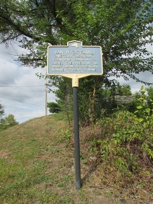
Reformed Dutch
Church of Hyde Park
Established 1789 as the
Stoutenburgh Religious
Society. Oldest continuous
Congregation in Hyde Park.
William C. Pomeroy Foundation 2015 — — Map (db m83232) HM
Founding Families
Considered the oldest residence In the village, this house (1750) was known for generations as the Haight family homestead. Owned by Philip Hart, an early entrepreneur, it was purchased in 1795 by Ebenezer Mott, . . . — — Map (db m140231) HM
From September 20 to November 28, 1778 George Washington, his generals and army of 13,000 were located in or around Fredericksburg, with the John Kane house serving as headquarters. From here emanated George Washington’s strategy of . . . — — Map (db m24555) HM
Oblong Meeting House
Of the Society of Friends
Erected in 1742 south of this road
Present building erected in 1764
First effective action against slavery
taken here in 1767
Occupied as hospital January 1779
By Revolutionary . . . — — Map (db m25026) HM
Mahican and Wappinger Indians once inhabited the area between the Taconic Mountains and the Hudson Valley. Dutch settlers first occupied the river front, so that later comers settled in these highlands. Palatine Germans came from the ill-fated tar . . . — — Map (db m144321) HM
The First Oblong Friends Meeting House was erected on this site in 1742. It was used as a place of worship until 1764. West of the site was the Friends burial ground. During the fall and winter of 1778 the present meeting house was a hospital . . . — — Map (db m25028) HM
A section of the Continental Army of the Revolutionary War was stationed on the western slopes of Quaker Hill from September 16, to November 28, 1778.
The Great Barbecue Barbecue
Occurred on the hillside across this road.
October 17, . . . — — Map (db m24551) HM
This marker denotes the western boundary of Connecticut under an agreement reached in 1683 between Governor Thomas Dongan of New York and Governor Robert Treat of Connecticut.
Later the Treaty of Dover signed on May 14, 1731 moved the western . . . — — Map (db m24980) HM
Carman Mill
A mill stood here as early
as 1784. Processing timber,
wool, apples and grain
with water power. Struck by
lightning & burned in 1936. — — Map (db m144591) HM
Organized 1823. Named to commemorate pine trees that grew on the plains. Part of Northeast 1788. Part of Little Nine Partners 1706. — — Map (db m135793) HM
Established in 1683, Dutchess County was home to New York's second capital during the Revolutionary War and achieved prominence as an important rail hub. Dutchess County is also Franklin D. Roosevelt's birthplace.
Background photo . . . — — Map (db m145004) HM
The river is named for Englishman Henry Hudson, who explored it aboard the Half Moon in 1609. He was searching for an all-water route to Asia for the Dutch East India Company. It was also called the “North River” by the Dutch. . . . — — Map (db m145000) HM
First Settlers in 1687.
New York State Capitol
1778-1783. Constitution of
The United States Ratified
Here By New York, July 26 1788 — — Map (db m168692) HM
Speck Zyn Kill
Dutch for "Speck, his stream". Later called Speck 'n Kill and Speckenkill. Speck, an Indian, owned this land.
State Education Department 1935 — — Map (db m37881) HM
Circa 1760 Stagecoach stop by 1785. Hosted town meetings, 1813, and 1st County Fair, 1817. Now a community center. Sign donated by junior friends — — Map (db m136994) HM
New York State
Explored by Dutch, 1609,
Settled by Dutch, 1624;
Under English Rule After
1664. Named for Duke of
York, Later King James II
State Education
Department 1935 — — Map (db m70550) HM
Unity Island Discovered in 1679 by the men of LaSalle’s expedition, the Senecas knew this island as ”De-dyo-no-guh-doh,” or Divided Island because it was divided by a marshy creek called Smuggler’s Run. Presented in 1798 by the . . . — — Map (db m57108) HM
Near here the Frenchman
Chabert Joncaire in 1758
set up the first white
establishment on the site
of Buffalo.
Evacuated 1759 at the approach
of the British. — — Map (db m57151) HM
The Niagara River between Lakes Ontario and Erie was the natural route to the interior of the continent. Following the arrival of French explorers in 1678, missionaries, traders, troops and settlers traveled by its waters. At the outlet of the . . . — — Map (db m57072) HM
This tablet is erected by the Society of Colonial Wars in the State of New York AD 1912 to commemorate the capture of Fort St. Frédéric and the erection of this fortress AD 1759 by the British and Provincial Army commanded by General Sir Jeffrey . . . — — Map (db m9336) HM
I ❤ NY Adirondack Attractions
Here is just a sampling of attractions
in New York's Adirondacks region. For
information on these and others, go to
iloveny.com or call 800/CALL-NYS.
Adirondack Extreme (Bolton Landing): . . . — — Map (db m162086) HM
Sacred to the memory of the gallant Highlanders of the 42nd Regiment of Foot “The Black Watch” From a regiment a thousand strong 205 died and 287 were wounded July 8, 1758 assaulting the French lines on the heights of Carillon - Their . . . — — Map (db m9579) HM
In 1756 the French erected a mill on the river opposite this spot for sawing and preparing timbers used in Fort Carillon, renamed Fort Ticonderoga when captured by General Amherst in 1759.
General Abercromby used the saw mill as his headquarters . . . — — Map (db m125190) HM
British soldiers who chose not to return to England following the Seven Years War mustered out of the army to settle on land they had seen during the campaigns against the French. The sandy loam soil around Streetroad has sustained a diversity of . . . — — Map (db m19722) HM
Near this spot in 1755-1756 Michel de Chartier de Lotbiniére engineer of Fort Carillon, bridged this stream and harnessed this waterpower for the first time. Sawmills, storehouses and barracks were located here, being within the Seignory of . . . — — Map (db m15590) HM
Major post on Lake George, a small palisaded log fort, built in 1756 to defend Fort Carillon from British attack, & named Camp De Contrecoeur, stood in this vicinity. — — Map (db m45104) HM
The Society of Colonial Wars in the State of New York erected this tablet to commemorate the colonial battles fought in this vicinity. Champlain with Hurons and Algonquins defeated the Iroquois July 30, 1609 near the shore. Montcalm defeated . . . — — Map (db m9560) HM
Near this spot, July 6, 1758
Lord George Augustus Howe
was killed in a skirmish
preceding Abercrombie’s defeat
by Montcalm at Fort Carillon. — — Map (db m6141) HM
Here are interred the bones of Eighteen Colonial Soldiers found near the Old Military Road in Ticonderoga Village on Nov. 1st 1924 — — Map (db m9650) HM
During the 18th century, when nations fought to control the strategic route between the St. Lawrence River in Canada and the Hudson River to the south, the fortification overlooking the outlet of Lake George into Lake Champlain was called “the . . . — — Map (db m9094) HM
To commemorate the heroic gallantry and noble character of George Augustus Viscount Howe Brigadier-General of His Majesty’s Forces in America. Killed near Trout Brook two days before the great battle of Carillon July 6, 1758. His death an . . . — — Map (db m9562) HM
Through this pass to Trout Brook ran an Indian Trail, used by Robert Rogers after Battle on Snowshoes, 1758, on retreat to Fort Wm. Henry — — Map (db m9533) HM
Battling French & Indians and on retreat from Snowshoe Battle in 1758, Rogers' Rangers crossed over this mountain where Rogers staged his legendary escape at Rogers Rock on Lake George. — — Map (db m45765) HM
For hastening to set a crown of freedom on this new land we lie possessed of praise that grows not old. And here were men coequal with their fate who did great things unconscious they were great. Back of Monument: Champlain – Iroquois . . . — — Map (db m15593) HM
On October 3rd, 1889, a workman digging a trench opened by mere accident across the street from this point, a grave which contained the skeleton of a man, and within this grave found, at its head, a stone, now in the Black Watch Library in this . . . — — Map (db m9539) HM
Near this spot stood Louis-Joseph de Gozon Marquis de Montcalm on the 8th of July 1758. With a small force of French troops and Canadian volunteers, he prevented the capture of Fort Carillon by defeating a much superior British and Colonial army . . . — — Map (db m9573) HM
In tribute to the heroism of the troops under the unfortunate Maj. Gen’l. James Abercromby in the attack on the French lines, July 8th, 1758, to mark the capture of Fort Carillon by Lieut. Gen’l. Sir Jeffrey Amherst July 27th, 1759 and, to record . . . — — Map (db m9585) HM
Cultural Heritage- Ancient cultures flourished on abundant natural resources along the Seaway Trail. First Inhabitants Native people have lived here for thousands of years, using the natural resources found on land and in water. . . . — — Map (db m180207) HM
Rechtor Home
Site of home of Nicholas
Rechtor built about 1773.
Revolutionary War soldier
and Captain of Militia in
Tillaborough — — Map (db m132318) HM
Sent to the Province of New York in 1737, by his uncle Sir Peter Warren for the purpose of supervising landed property in the Mohawk Valley, William Johnson engaged in trade with settlers and Indians.
Prospering in mercantile enterprises, he . . . — — Map (db m52124) HM
Hostilities of the Seven Years' War having commenced, Colonel William Johnson was commissioned a Major General of Provincial Forces and assigned to command the Crown Point Expedition against the French, in 1755. After the failure of the other . . . — — Map (db m52121) HM
This structure was built in 1772 as the Tryon County Jail. It was placed on the highest ground in the village in case of Indian attack or war. It was considered one of America's strongest buildings for defense, with massive stone walls impervious to . . . — — Map (db m55351) HM
In efforts to develop great land holdings, he surveyed and laid out the village of Johnstown, built the first public school, and after Tryon County was set off in 1772, ensured the location of the county seat here. Interested in learning, he was a . . . — — Map (db m52094) HM
Grave of Sir William Johnson
Baronet
1715 - MASON - 1774
His Indian name
Warraghiyagey
"he who does much business"
Founder of
Johnstown
St. John's Episcopal Church
St. Patrick's Lodge 4 F.&A.M.
First Free School
Supt. of Indian . . . — — Map (db m54281) HM
A man of strong character. A colossal pioneer. One of the greatest men of his time. Sole superintendent and faithful friend of the Six Nations and their Allies. Their Warragiyaey. Founder of Johnstown. He established here the first free school in . . . — — Map (db m57754) HM
Historic New York
Johnson Hall - 1763
Johnstown
Sir William Johnson (1715-1774), Indian trader, statesman,diplomat and Colonial Empire Builder, in 1763 built Johnson Hall, the center of his estate and the scene of many Indian . . . — — Map (db m5683) HM
Johnson Hall
A man of Sir William’s position required a grand home to impress his many guests who arrived for political, financial, and diplomatic discussions. Commitments in the French and Indian War(1754-63), however, kept him from . . . — — Map (db m136523) HM
New York State purchased Johnson Hall in 1906. At that time, after almost 150 years of changing ownership, only 20 acres remained intact of the original 700+ acre property.
The Johnstown Historical Society, trustee of Johnson Hall in the early . . . — — Map (db m58844) HM
Gaining considerable knowledge of Indian Affairs, his area of responsibility for administration reached from Hudson's Bay Canada to the Carolinas. From the Atlantic to as far west as any Indians were known.
Appointed to deal with Indians, and . . . — — Map (db m52120) HM
Site Of
Romeyn's Mill
Erected 1773 by Sir William
Johnson. Burned During
Revolution. Rebuilt by Col.
Abraham Romeyn. Commander
Montgomery County Militia
— — Map (db m68133) HM
The first in Greene County
stood 100 rods north
Built in 1675 by
Dirck T. Vanvechten
On-Ti-Ora Chapter NSDAR - 2021
Marker first erected 1932 NYSED — — Map (db m209807) HM
Situated on the important Mohawk Valley route between the Hudson River and the Great Lakes, Utica has long been a travel crossroads. Indian trails converged there, and Fort Schuyler was built on the site in 1758. The community which grew . . . — — Map (db m75978) HM
This site was within the stockade of
Fort Dayton
which stood on a slight eminence about
one hundred yards farther north.
The fort was erected by Col. Elias Dayton
in 1776, served as a military base during
the . . . — — Map (db m54270) HM
Fred'ck Staring
Known as Frederick Starns
on VA Frontier; Lost sons &
grandsons in Revolutionary War
1777-80; Patriarch of old
Southern family Starn(e)s — — Map (db m54317) HM
40 mile route taken by Gen. Herkimer Aug. 3-6, 1777 for the relief of Fort Stanwix. The Battle of Oriskany Aug. 6, between Herkimer's men and St. Leger with his Indians was the turning point of the Revolution.
At Fort Dayton, near this . . . — — Map (db m54261) HM
[First Frame of Text]: Fort Dayton
During the American Revolution the residents of this area were protected by Fort Dayton. It stood right here, in the area bounded by North Main, East German, North Washington and Court . . . — — Map (db m54273) HM
Ft. Hendrick
1754-1760
British post guarding
Mohawk Castle. Named for
King Hendrick killed
at Lake George, Sept. 1755
N.Y. State
Historical
Marker — — Map (db m57269) HM
Featured Text on Marker:
Peace following the French and Indian War (1756-1763) provided security on the frontier, and in 1764, Nicholas Herkimer constructed the Georgian style mansion you see here. The house remained in the Herkimer . . . — — Map (db m75328) HM
Since roads were few and were usually poorly maintained, lakes, rivers, and steams became the highways of colonial America. The Mohawk River is a natural break in the Appalachian Mountain chain that runs from Maine to Georgia. It links the Hudson . . . — — Map (db m75974) HM
Mohawk Upper Castle
Archeological Site
has been designated a
National Historic Landmark
This site possesses national significance
in commemorating the history of the
United States of . . . — — Map (db m57270) HM
The bateau (French word for boat) was the favored type of watercraft used to navigate the inland streams, rivers and lakes of New York in the 1700’s. As roads were few and those that were built were hard to travel due to ruts after rain, . . . — — Map (db m75976) HM
In 1710, nearly 3,000 Palatines came to the colony of New York. Originally from an area in southwestern Germany known as the Lower Palatinate, they were displaced when the French attacked and destroyed their lands. They first fled to Holland, then . . . — — Map (db m75322) HM
This park is at the location of the oldest existing milestone in New York City. The New Ultrecht milestone was placed here in approximately 1741 under the reign of George II. The stone, which served as a directional post to travelers, stood at the . . . — — Map (db m30090) HM
Many of the fruits you know and love—cherries, peaches, apricots, pears, plums, and apples—originated in the Middle East, Asia, or Europe. Over centuries, farmers worldwide have bred an amazing diversity of these fruits. Among apples alone, there . . . — — Map (db m204033) HM
902 entries matched your criteria. Entries 101 through 200 are listed above. ⊲ Previous 100 — Next 100 ⊳