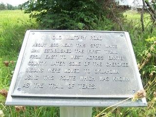
About 1800 near this spot white man established the first trail from East to West across Baxter County. Later some of the Cherokee Indians were moved to Oklahoma using this route which was known as the Trail of Tears. — — Map (db m62248) HM
800 AD • Trace of the Rock People
1808 • Osage Boundary
1815 • Lawrence County
1827-28 • Lovely County
1838 • Trail of Tears
1840 • Trott's Stand
1858 • Old Wire Road
1858-61 • Butterfield Stage Route
1861 • Troop Trails
1862 • . . . — — Map (db m62485) HM
Benton County Hardware, circa 1893, W.J. Doke proprietor. First Motor Co. and first gas station in alley beside store. Recently housed Bentonville Furniture. — — Map (db m54310) HM
Elkhorn Tavern overlooks a highway of vital importance for Arkansas and Missouri during the Civil War. Union and Confederate leaders both wanted this 20-foot-wide dirt road to move men and supplies. Alongside the road ran 3-year-old telegraph . . . — — Map (db m35660) HM
John Butterfield was born in Berne, New York in 1801 and grew up on a farm amid the technological revolution of the first steamboat, the Erie Canal, the steam locomotive, and the electric telegraph.
In 1857, John Butterfield won a lucrative . . . — — Map (db m84484) HM
The Old Wire Road at Mudtown was used by the
Butterfield Overland Mail Co. and both Union and
Confederate soldiers during the Civil War. In
February 1862, Union troops ate food left behind
at a Confederate camp and were sickened. Some
died, . . . — — Map (db m224817) HM
The original Lowell Garage, owned by Thurman Moody, was located on the corner of what is now Lincoln Street and McClure Avenue. The old 71 Highway used to run along Lincoln Street so it was right on the highway, when the new Highway 71 was located . . . — — Map (db m224826) HM
This marker, set on the Butterfield Stagecoach Road, is placed near the spot where the trail crossed the east-west road between Huntsville and the Robinson settlement in western Benton County. John Robinson, a Revolutionary soldier, settled here . . . — — Map (db m68781) HM
This site was donated to the Benton County Historical Society by Scarlett Biggs Wilson and Lara Wilson Rosenblum in honor of their parents/grandparents, Guy and Nell Biggs, early pioneers of the Cross Hollows area. Cross Hollows is recognized for . . . — — Map (db m68789) HM
To commemorate the Centennial passage, through Benton County of the First Westbound Stage coach on the Butterfield Overland Mail Route from St. Louis to San Francisco. Callahan's Tavern, the site of which is about a half a mile northeast of this . . . — — Map (db m216324) HM
Built in the early 1930s by Phillips Petroleum, it was the city's first full-service garage. West of the gas station, it was brick with a wood-framed vaulted ceiling. It was leased to "Hoot" Gipson who operated an auto repair shop and 24-hour . . . — — Map (db m141852) HM
One of the city's earliest gas stations, built in 1927 by W.H. Lewis, it was purchased in 1929 by Independent Oil (became Phillips 66). They remodeled it from a frame structure with rubblestone veneer to Tudor Revival Style. Independent . . . — — Map (db m141850) HM
Settled 1833, was on the much-traveled Carrollton-Forsyth-Springfield road during the Civil War. A training center for Southern troops, it was important in movement of troops and supplies. Guerrilla warfare ravaged the area.
Skirmishes occurred . . . — — Map (db m141597) HM
Professor KALKLOSCH’s Guidebook, published in 1880, states: “The first street of the town was surveyed down the gulch below the spring. A broad avenue connects this street with the famous EUREKA BASIN SPRING. It being the first street it . . . — — Map (db m79755) HM
Ellis Murphy established Murphy's Firestone Tire Service at this site about 1923. Called "Murphy the Tire Man", his services were frequently required to patch inner tubes and repair tires for hundred[s] of automobiles bringing tourists to Eureka . . . — — Map (db m90706) HM
Crescent Spring was revered for its healing waters almost as much as the basin, the legendary Indian Healing Spring. Situated beside the Wagon Road on a hillside with a rocky outcropping described as "crescent" shaped, the spring was soon given . . . — — Map (db m80135) HM
"It being the first street in town... it was named Main Street. But owing to its low elevation and the law of gravitation, the water would find a level in the street, and as the immense travel created an abundance of mud, the street was nicknamed . . . — — Map (db m80153) HM
On this part of Spring Street you can easily see how Eureka Springs follows the natural lines of the landscape. Houses are built right into the bluff on the west side and buildings climb down the steep hillside on the other side. “The houses rise . . . — — Map (db m225187) HM
The Eureka Springs Railroad opened in February, 1883. As the first trains arrived at the original station house, a finely crafted wooden structure, passengers were met by horse drawn carriages and hacks which quickly carried them to the best . . . — — Map (db m80173) HM
Confederate Manufacturing
Arkadelphia was a manufacturing center for Confederate Arkansas early in the Civil War. Gen. Thomas Hindman established a powder works and an arsenal in 1862, producing guns, cannon, bullets, shells, wagons and . . . — — Map (db m96557) HM
Since Crowley's Ridge provided the only natural route for north-south travel across the lowlands of northeastern Arkansas, an Indian trail and later a military road crossed the river here. About 1840 Abraham Seitz established a ferry which was later . . . — — Map (db m4912) HM
The Battle of Mark's Mill, fought here on April 25, 1864, was a complete Confederate victory. General James F. Fagan's Confederate cavalry having surprised and captured a Union army of 2,000 men and 240 wagon loads of supplies. General Powell . . . — — Map (db m121283) HM
Approaching Marks Mills from the south General Joe Shelby's Missouri Division was ordered to move to the right in order to block the Marks Mills to Mt Elba Road preventing The Union forces from escaping across the Saline River.
Guided by . . . — — Map (db m121660) HM
Facts
After getting in the neighborhood of the supply train Gen. Shelby was ordered on the road leading to Mount Elba to intercept the train and attack the front. Cabell's Brigade moved up to the road leading direct to Marks' Mills. As they . . . — — Map (db m121658) HM
One of the oldest settlements in Columbia County. Here Colonel John Dockery had his plantation and home. Here T.P. Dockery, who became a general in the War Between the States, was born and reared. The Caddo Indian Trail from Camden on the Ouachita . . . — — Map (db m121136) HM
The Butterfield stage route
between Saint Louis and San
Francisco passed through the
main street of Van Buren,
Arkansas and crossed the
river at this point.
— — Map (db m96457) HM
First Highway constructed in Arkansas, Hopefield
to Little Rock, extended to Fort Smith and into Indian Territory, (Oklahoma). Built by the United States under supervision of the Quartermasters Department of the United States Army. Survey was . . . — — Map (db m116549) HM
Down the trail from where you are standing is the most well-preserved remaining section of the historic Trail of Tears in Arkansas.
Tradition and heritage run deep jn the collective souls of the Five Southeastern Tribes (Choctaw, Chickasaw, . . . — — Map (db m142034) HM
[Stone monument]
Trail of Tears
1832-1840
Arkansas River valley
routes
Choctaw – Chickasaw
Muscogee Creek
Seminole – Cherokee
[Panel]
Trail of Tears Routes through Franklin County
1. Northern Route through . . . — — Map (db m236869) HM
After crossing the lower slopes of Hot Springs Mountain, this "red" trail connects with Gulpha Gorge Trail on a ridge above Gulpha Gorge Campground. The Short Cut Trail leads to the summit.
Historic Exercise Trail
For the next 0.2 mile . . . — — Map (db m145671) HM
The Tufa Terrace Trail passes historic Ral Spring and follows a fairly level path across the hillside before rejoining the Grand Promenade. From there you can stroll the Grand Promenade or descend past the Thermal Cascade to Arlington Lawn. . . . — — Map (db m145670) HM
Tablet #1 Jenkins' Ferry State Park Act 10 of 1961 authorized this 37-acre state park as a commemorative site and recreation area. The park includes the ferry site where you are standing. The ferry was operated by the Jenkins' family . . . — — Map (db m37304) HM
Military Road
The Military Road, following part of the route of the old Southwest Trail, passed through the heart of Hot Spring County and the Midway community. Now known as Midway Road, the primitive pathway served as a major thoroughfare . . . — — Map (db m178623) HM
Down this road came the settlers who settled Arkansas and the southwest.
What once began as an Indian footpath became a major route of migration for settlers into the Arkansas Territory by 1819.
The trail bypassed the swamps of eastern . . . — — Map (db m221061) HM
Star City was laid off in 1871 as the County Seat of the newly created Lincoln County which was named in honor of President Abraham Lincoln. It was the center of many Indian trails and early roads which ran from Mississippi River landings back into . . . — — Map (db m229496) HM
Anderson Ferry, on Little River 2 miles north of this point, was in operation during the early 1800's. It served the pioneers traveling to southwest Arkansas and Texas on the Old Southwest Trail. Anderson Ferry provided a passage from Old Paraclifta . . . — — Map (db m121276) HM
In 1807, citizens of Crystal Hill built a road to connect Cadron and Arkansas Post. From Cadron the road was built almost due east and continued until they reached the Wattensaw. At the Wattensaw swamps they found an Indian path that led south to . . . — — Map (db m116694) HM
The Spring Bank Ferry operated on the Red River connection Miller and Lafayette counties via state Highway 160. This ferry is recorded in history as being the oldest operating ferry in southwest Arkansas.
According to records from Mrs. Kelly . . . — — Map (db m181760) HM
This plaque placed in honor of
William Richardson Blanton •
James Deas Blanton •
William "Kelley" Blanton, Sr. •
William "Kelley" Blanton, Jr.
Owners/Operators of the Spring Bank Ferry — — Map (db m181621) HM
About a mile south of this point is the natural gap or narrows of the Caddo River, famed in history and legend. A pioneer road through the gap connected Fort Smith with Old Washington and other points, with a toll bridge spanning the river. The . . . — — Map (db m201469) HM
Potts Inn John Kirkbride Potts (1803-1879) was born in Pennsylvania and moved to Arkansas in the 1820s. In 1828 he settled by Galla Creek, eventually acquiring 650 acres of land. Potts went to California in the Gold Rush of 1849: he failed to . . . — — Map (db m225451) HM
This stone is a marker from the old Military Road which extended from Little Rock to Ft. Smith. The marker was found west of Dardanelle in 1940 by Mr. Henry Sellers, District Highway Engineer, while supervising the construction of Arkansas Highway . . . — — Map (db m142032) HM
Construction of this earliest road connecting Memphis with Little Rock began in 1826 under the supervision of Lt. Frederick L. Griffith, U.S. Army. It was completed in 1828 under Lt. Charles Thomas. Miles of swamps and numerous streams made the road . . . — — Map (db m116509) HM
One of the largest public works projects to take place in territorial Arkansas was construction of the Memphis to Little Rock Road, an ambitious effort to allow travelers to cross the dense swamps and Grand Prairie of east Arkansas to reach the . . . — — Map (db m116571) HM
In the early days of Little Rock, the Arkansas River
was the lifeblood of the community. The Little Rock
extended out into the river, pulling the current around
it to form a natural landing basin for boats. The earliest
ferry across the . . . — — Map (db m116539) HM
River Highway
Davidsonville was located on a wedge-
shaped piece of land formed by the
confluence of the Black, Spring, and
Eleven Point rivers, placing it in the
midst of the transportation and trade
superhighways of the era. . . . — — Map (db m170927) HM
The Southwest Trail, which passed this point, was one of the first permanent roads across Arkansas. It ran from Missouri through northeastern Arkansas to Little Rock and on through Washington to Fulton on Red River. Thousands of settlers followed . . . — — Map (db m104050) HM
The Indian parties followed an ancient trail that became known as the Southwest Trail. The primitive trail took the tribal groups by where you are standing. William S. Lockhart was the first permanent settler in the area, arriving in 1815, at a . . . — — Map (db m96596) HM
Devils Backbone Road Cut-Geology
This road cut exposes the upper Fayetteville
Shale, and overlying lower Pitkin Limestone
deposited in a shallow sea covering the southern
Ozark region as the Mississippian Geological
Period ended. As . . . — — Map (db m143764) HM
In 1838, John Rogers, considered the founder of the city of Fort
Smith, laid out 160 acres of his property into town lots. By 1860,
the commercial district of Fort Smith inhabited 12 square blocks
bounded by the river, North Third Street, . . . — — Map (db m236830) HM
In 1824, Congress directed that a military road would be constructed
between Fort Smith in the Arkansas Territory and Fort Towson in
Indian Territory, a distance of 190 miles. Captain B.L.E Bonneville, for
whom Bonneville Dam and the Bonneville . . . — — Map (db m236845) HM
Near this point Highway No. 1 intersects
the route of the Old Military Road which
connected Memphis and Little Rock. Begun
in 1826, this road was built under the supervision of Lieutenant Charles Thomas of the
United States Army. John Pope, . . . — — Map (db m243306) HM
Here on this, the Old Wire Road, was located Fitzgerald's Station on the Butterfield Overland mail route from St. Louis to San Francisco. First trip 1858. Last 1861. Longest and best conducted mail route in the world. 2795 miles. Service twice . . . — — Map (db m59950) HM
• Original trail of early Indians and settlers
• Named for the many early corn flour-woolen mills situated along Spring Creek
• A part of the first Old Missouri Rd. before 1830 to 1858
• Butterfield created present Old Missouri Rd. to the east . . . — — Map (db m224800) HM
Named for Richard Searcy, an early Arkansas territory settler, the city of Searcy was established by the Arkansas State legislature to serve as the county seat in 1837. Early resident and surveyor Israel Moore named the original streets of Searcy . . . — — Map (db m173998) HM
During the 1850s Moses Stinnett and his wife Patsy operated a Stage Coach Station beside the Little Rock Fort Smith Military Road which was located 300 feet East of this
spot. They catered to travelers and in 1858 contracted with Butterfield . . . — — Map (db m198418) HM
This highway, one of the earliest military roads in Arkansas, was named in honor of Jefferson Davis President of the Confederacy by act of the General Assembly of 1925. — — Map (db m170336) HM