Interstate 15 is the latest in a series of roads that have traversed this area since prehistory. Although used for generations by Native Americans, the first recorded use of this route was by the Lewis and Clark Expedition on August 10, 1805. They . . . — — Map (db m124333) HM
Interstate 15 is the latest in a series of roads that have traversed this area since prehistory. Although used for generations by Native Americans, the first recorded use of this route was by the Lewis and Clark Expedition on August 10, 1805. They . . . — — Map (db m124291) HM
The waters of the Beaverhead River opened this southern gateway to Montana through which have passed:
Ancient Indian Trail
Lewis and Clark Expedition 1805-1806
First Missionary, Father DeSmet 1840
Great Beaverhead Wagon Toll Road . . . — — Map (db m145713) HM
On their return journey, the Corps of Discovery divided into two groups at Traveler's Rest, near present day Lolo, Montana. Captain William Clark and his party traveled through today's Big Hole Valley on their way to Camp Fortunate to recover their . . . — — Map (db m124260) HM
The Department of Transportation launched an ambitious program in 1936 to promote the state's scenic, recreational, and historical treasures. The brainchild of department engineer Bob Fletcher, the program included roadside historical markers, . . . — — Map (db m124334) HM
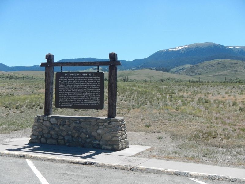
This area once echoed with the sound of creaking wagon wheels, cracking whips, and profanity so intense the mountains vibrated with sulfur! The old wagon road between Montana and Utah passed very close to this rest area. It first saw use in the . . . — — Map (db m124336) HM
(Two panels are on this interpretive stand:)
July 8, 1806
The Way It Used To Be... Way Back
Just over two hundred years ago...
We proceeded down Willards Creek on the S.W. Side about 11 miles...The Country . . . — — Map (db m124268) HM
In 1863, John Bozeman and John Jacobs blazed a new trail through the buffalo rich Powder River Country to the southwest Montana mining camps. The Bozeman Trail, however, could be deadly for the men and women who traveled it. The Lakota and . . . — — Map (db m239251) HM
The Bozeman Trail which crossed Rock Creek near this site, was established by John M. Bozeman and John M Jacobs in 1864 as the shortest route from the east to the Montana gold fields. It was abandoned in 1868. The first trail heard of Texas cattle . . . — — Map (db m190746) HM
Lieutenant General Philip Sheridan and 124 men forged the first documented passage over the Beartooth Mountains in 1881. Once thought impassible, the route was later modified by E. E. Van Dyke - a miner from coal rich Red Lodge, Montana. His route . . . — — Map (db m45244) HM
The Beartooth Plateau contains some of the oldest exposed rocks on Earth and provides a unique window into the history of our planet. About 55 million years ago, this massive block of metamorphic basement rock pushed its way upward nearly two . . . — — Map (db m45251) HM
During the busy 1890s, Great Falls’ business district swarmed with activity. City boosters such as pioneer rancher Robert Vaughn expressed confidence in the town’s future by investing in commercial real estate. Vaughn commissioned an unknown . . . — — Map (db m143679) HM
Streamline Moderne architecture celebrated America’s engineering prowess. The style—which offered an optimistic response to the woes of the Great Depression—promised a better future through technology. Its celebration of speed and . . . — — Map (db m143678) HM
A close look at the Woolworth Building’s upper floors makes evident that it was originally two separate, but closely related edifices. Connecting arches over second-story windows, a decorative metal cornice, and a crowning brick parapet distinguish . . . — — Map (db m143769) HM
Bird Tail Rock to the southeast was one of the most prominent landmarks along the Benton Road between Fort Benton and Helena. An igneous intrusion about 55 million years old, it acquired its name because it resembled a "bird's tail" erect and spread . . . — — Map (db m144027) HM
When John Mullan built a wagon road across western Montana in 1860, he utilized a ford across the Sun River just a few yards west of here that had been used by the Indians for generations.
In 1862, the crossing was the site of a government . . . — — Map (db m101870) HM
The Mullan Road left the Sun River Valley here at a place called "The Leaving." After 1864, the road was better known a the Benton Road, connecting Fort Benton to Helena. Traffic on the road peaked during the late spring and early summers when high . . . — — Map (db m143904) HM
Freight was unloaded at Cow Island when water dropped so low that steamboats could not travers the upper river to Fort Benton. For 130 miles the Cow Island Trail wound along the southern foothills of the Bear's Paw to the junction at Big Sandy then . . . — — Map (db m142562) HM
Another wagon road headed northeast from Fort Bento to the Cypress Hills and Medicine Hat, Alberta. It passed through Big Sandy, on north near Havre and into the Cypress Hills. In 1873 Fort Benton whiskey traders massacred Indians in the Cypress . . . — — Map (db m142558) HM
The road to the southeast leads to the mouth of the Judith River. An early fur post, Fort Chardon was built there in 1844. In 1866 Camp Cooke, the first miliary (sic) post in Montana, was constructed of cottonwood logs, and endured four years of . . . — — Map (db m142559) HM
"Fire" was a cry dreaded by any Westerner, and early Fort Benton was no exception. Flimsy wooden buildings, haystacks, kerosene lamps and primitive stoves created major fire hazards. When city government was organized in 1883, the first steps in . . . — — Map (db m142424) HM
The Fort Benton to Fort MacLeod or "Whoop-up" Trail into Canada was the main artery of commerce in the 1869-1883 era. Twenty yoke of oxen was a team and each team hauled three of the heavy freight wagons loaded with trade goods, calico and whiskey. . . . — — Map (db m142216) HM
Fort Benton was the eastern terminus of the Mullan Military Road. Construction of the road began in the summer of 1859 at Fort Walla Walla, the head of navigation on the Columbia River. Lieutenant John Mullan of the U.S. Topographical Engineers . . . — — Map (db m142484) HM
Within a few steps of this sign the Mullan Road came up Helena Hill from Fort Benton. It wound its way over 600 miles to the head of navigation on the Columbia River at Fort Walla Walla. It was the first federal highway in the Northwest. Covered . . . — — Map (db m141986) HM
Captain John Mullan started surveying the Mullen Road in 1853 and began construction in 1859 of the 624-mile wagon road that linked Fort Benton to the head of navigation on the Columbia. Indian wars slowed him somewhat, but Mullan opened his route . . . — — Map (db m142246) HM
Stages operated from Fort Benton in many directions well into the 20th century. The first routes connected the gold camps of Helena and Virginia City with the river port. In 1866 C.C. Huntley established the route, but was soon bought out by Wells . . . — — Map (db m161659) HM
After the days of the gold rush, the most important trade route from Fort Benton was the Whoop Up Trail. Begun during the whiskey trade, it developed into the major supply route to Alberta and much of Saskatchewan. Whiskey traders carried their . . . — — Map (db m161588) HM
North from Fort Benton ran another wagon road to Canada, the famous Whoop-up Trail. Whiskey traders carried supplies north and brought buffalo robes south to Fort Benton for transport down river by steamboat. Later the Whoop-up Trail supplied the . . . — — Map (db m142018) HM
The Missouri River once flowed northeasterly through this valley to Hudson Bay. During the Bull Lake Ice Age, an ice dam near Loma diverted the river into its current channel. This channel began filling with glacial sediment, preventing the river . . . — — Map (db m142526) HM
Homesteaders, travelers, and railroad crews helped the tiny town of Virgelle thrive during the 1910s. Town founder Virgil Blankenbaker chartered the Virgelle State Bank in 1917 where he, his brother-in-law John G. Chancellor, C. J. McNamara, and . . . — — Map (db m161664) HM
A small community, called Beebe, once existed in this remote, sparsely settled country. It owed its existence to A. J. Maxwell, owner of the Deadwood Stage Line. Maxwell established a stage station here where the Simonson-Patterson Cattle Company . . . — — Map (db m202900) HM
On the Bismarck-Ft Keogh Trail, at various time periods trail was known as Sandstone Bismarck - Ft Keogh Ft Lincoln - Ft Keogh Army Trail during 1879 - 1881
(?) 1873 by civilian freighters and used until the building of Northern Pacific R.R. and . . . — — Map (db m164543) HM
This is the river that many claim is a mile wide, an inch deep, and runs uphill. That statement may be exaggerated, but Captain Clark of the Lewis and Clark Expedition commented on its color and called it "disagreeably muddy." Clark named it the . . . — — Map (db m164270) HM
Built for C. N. and Louise E. Lukes in 1911, the home is also known as the Ed Love House. Lukes was cashier of the Commercial State Bank and after the deaths of C. N. and Louise in 1929, ownership passed to their daughter, Doris Lukes Love, and her . . . — — Map (db m164148) HM
In 1866, the U.S. army established Camp Cooke on the west bank of the Judith River near its confluence with the Missouri near here to protect local settlers from Indian raids. Shortly thereafter, steamboat entrepreneur and trader T.C. Power built a . . . — — Map (db m161914) HM
Mastery over nature or blend with the environment...two different philosophies represented by two different routes.
After the establishment of Glacier National Park efforts began on constructing a road to provide access to the interior of the . . . — — Map (db m108777) HM
Bad Rock Canyon was a popular stopping place for tourists either taking a break from the road or wanting to wet a fishing line in the Flathead River. Some stopped just to enjoy the scenic beauty of the narrow canyon. A natural spring provided . . . — — Map (db m219843) HM
Slightly arched windows, prominent eave returns, a canted front bay, and decorative shingles reflect the care builders took constructing this one-story home. Retired merchant Jacob Bottorf and his wife Emily resided here from the residence's . . . — — Map (db m160391) HM
There were two businesses devoted to automobile repair in Kalispell in 1909, and seven blacksmiths. By 1915, the ratio was almost reversed. Mort Fuller and Harry Jones worked here in one of Kalispell’s three remaining blacksmith shops, while seven . . . — — Map (db m160659) HM
The Craftsman bungalow was brand new to Kalispell when Edward Gay built this beautifully finished home, a classic example of the style, in 1907. The Kalispell Journal reported that among the town’s new homes, the nearly completed Gay residence was . . . — — Map (db m160719) HM
Kalispell architect Fred Brinkman designed this one-of-a-kind neighborhood landmark early in his career in 1924. Known for unique designs, Brinkman’s creativity is particularly evident here in the picturesque lattice used as architectural ornament. . . . — — Map (db m161029) HM
Constructed between 1899 and 1903, this charming American foursquare cottage features a front gable with ornamental shingle work, front windows with decorative muntins, original front door, and decorative scrollwork spanning the front porch. The . . . — — Map (db m160427) HM
Built on a prominent corner lot for blacksmith Chris Kolle and his wife Mary in 1908, this Craftsman style home features many of the design’s characteristic elements. Its wide, sheltering eaves are meant to evoke feelings of coziness and security . . . — — Map (db m160855) HM
This beautiful gable-front-and-wing residence, built for newlyweds John and Sophie McIntosh, captures the best of the exuberant 1890s with a wealth of Queen Anne details. The Flathead Herald-Journal declared upon its completion in 1894 that the . . . — — Map (db m160392) HM
Fire destroyed a small wooden residence, located toward the rear of this lot, in 1910. The prime corner parcel remained vacant for almost thirty years. Kalispell saw a small building boom in the 1930s, as people from areas harder hit by drought and . . . — — Map (db m160269) HM
While most of Montana lost population during the 1930s, Kalispell grew dramatically as people migrated from areas hard hit by drought and economic depression. Contractors like Herbert Yeaw, who built this one-story, wood-sided home, filled the . . . — — Map (db m161031) HM
The Kalispell Bee in 1903 described the newly completed residence of county clerk and recorder James Wiltse Walker as “one of the handsomest dwelling houses in the city.” A classic example of the Queen Anne style, typical architectural elements . . . — — Map (db m160968) HM
The Flathead Monitor declared in 1899 that the west side was way ahead of the east side with “a new residence being started there about every day.” By 1900, streets and sidewalks had replaced the open prairie. This Queen Anne style home . . . — — Map (db m161035) HM
A Glacier Tradition
National parks often seem timeless and are valued for the continuity of experience they offer to generations of visitors. At Glacier National Park, the past and future come together through a fleet of historic buses, . . . — — Map (db m45060) HM
The Bruck, a custom-designed bus-truck, has a unique place in the history of Whitefish and of the Great Northern Railway, an important residence in the life of the town.
Because the Empire Builder and Westerns Star passenger trains . . . — — Map (db m159945) HM
The grand opening of the Bozeman Hotel and Annex in 1891 brought 500 theater-goers to the celebration. A temporary footbridge was constructed across Main Street between the second stories of the hotel and theater so that quests could come and go . . . — — Map (db m191980) HM
On July 14, 1806 Captain William Clark accompanied by 11 members of the expedition party camped about a mile east of here on the flat at the mouth of Kelly Canyon. The next day, Sacajawea guided the party up the canyon on an old buffalo trail to a . . . — — Map (db m98296) HM
First Peoples utilized the valley for over 11,000 years before the arrival of Lewis & Clark, and the others that would follow. Trails brought cattle and homesteaders to an agricultural paradise. The military followed, defending settlers, consuming . . . — — Map (db m29084) HM
Settlers came to the Gallatin Valley on the heels of the first Montana gold strike at Grasshopper Creek near Bannack, Montana, in 1862. As Meriwether Lewis had predicted, farmers found the valley well suited for agriculture. They planted crops and . . . — — Map (db m29078) HM
On August 17, 1959, this area was hit with the most devastating modern geologic disaster in the Rocky Mountains. An earthquake of a magnitude 7.5 on the Richter scale violently shook the earth, triggering a massive landslide, large surface cracks . . . — — Map (db m113832) HM
Prior to 1936, the roads leading from West Yellowstone were not plowed during the winter months, isolating the town from the rest of the world.
Even the Train Stopped Running
The Union Pacific Railroad provided passenger service to West . . . — — Map (db m126999) HM
… there should be erected at once at every camp, good, substantial, permanent buildings of one, two, three and four rooms for just the 'forgotten man'… There should also be constructed at every camp a building for a restaurant or cafeteria where . . . — — Map (db m167201) HM
A Glacier Tradition
National parks often seem timeless and are valued for the continuity of experience they offer to generations of visitors. At Glacier National Park, the past and future come together through a fleet of historic buses, . . . — — Map (db m45054) HM
Chief Mountain, NINA-STA-QUAY, has alway been known to the Blackfeet people. Identified on maps as King Mountain as early as 1796, this outstanding landmark has long been revered for its supernatural powers. Generations of Blackfeet have used Chief . . . — — Map (db m220323) HM
The Flint Creek Valley has, according to archeologist, been the home to humans for around 10,000 years. Fur trappers and traders frequented the valley in the early 19th century. Prospectors discovered gold in the Granite Mountains and on Henderson . . . — — Map (db m212347) HM
Time was when ox and mule teams used to freight along this route. A five-ton truck doesn't look as picturesque but there hasn't been much change in the language of the drivers. bar
Jerk-line skinners were plumb fluent when addressing their teams. . . . — — Map (db m186274) HM
The Lewis and Clark Expedition passed through this canyon of "nearly perpendicular rocks" during its journey up the Missouri in July 1805. Although the men grumbled about mosquitoes and prickly pear cactus, the Corp of Discovery was clearly . . . — — Map (db m141859) HM
The city of Helena started as a group of placer miners' cabins and Main Street follows the bottom of Last Chance Gulch. The gulch is formed by the convergence of Oro Fino and Grizzley Gulches and its colorful history began when gold was discovered . . . — — Map (db m188672) HM
Montana’s original Highway Department building reflects the ascendancy of the automobile in twentieth-century America. As drivers began lobbying for good roads, state government responded, forming the Montana Highway Commission in 1913. Five years . . . — — Map (db m186913) HM
The Montana Highway Patrol was created by an act of the State Legislature and signed into law by Governor Frank Cooney on 14 March, 1935. This building served as the original headquarters from 1935 until the early 1950s.
Governor Frank Cooney . . . — — Map (db m186966) HM
Built by Louis Reeder in the late 1860s thru 1882, Reeder's Alley stands as a memorial to the architecture of the 1870s Helena. Its importance lies not in its splendor, but its quaintness. It is one of Montana's oldest streets and one of her newest . . . — — Map (db m187407) HM
For many thousands of years, travelers of every description have traversed the Blackfoot River corridor. As you drive Highway 200, alongside the boulder-strewn rapids of the fabled Blackfoot River, envision the journeys, some pleasurable, others . . . — — Map (db m219983) HM
Splitting Up the Corps
Captain Meriwether Lewis passed this way in the summer of 1806. Traveling east from their winter on the Pacific Ocean, co-commanders William Clark and Meriwether Lewis stopped near present-day Lolo, Montana. At a . . . — — Map (db m220034) HM
Bison! This great shaggy beast sustained the Indians of the Plains and adjacent areas for thousands of years. And in these parts we call Montana, an ancient network of trails led the Salish, Pend d'Oreille, and related Indian tribes, who . . . — — Map (db m220033) HM
For many years there was no direct route between Helena and Great Falls other than the railroad and the lengthy and treacherous old Benton wagon road. During the Great Depression, the Montana Highway Department built thousands of miles of good paved . . . — — Map (db m141797) HM
The land around Kootenai Falls has been explored and used for thousands of years by the Kootenai or Tunaxa People. The Kootenai tribe made up of seven bands, two in U.S. and five in Canada.
European traders and surveyors were lured to the region . . . — — Map (db m127287) HM
The Ruby River was called the Passamari by the Shoshoni Indians and the Stinking Water by the miners in the early 1860's.
Later, it was mistakenly renamed the Ruby, although the gems found along its length were actually garnets.
The . . . — — Map (db m116998) HM
Motoring was an adventure in the early 20th century and people usually didn't travel very far from home. Most roads were choked with dust during the summers, knee-deep in mud in the rainy seasons, and blocked by snowdrifts in the winters. But as . . . — — Map (db m141491) HM
Trailblazers John Bozeman and John Jacobs opened the Bozeman Trail in 1864 as a shortcut between the Overland Road and the newly discovered Montana gold fields.
The trail began near present Casper, Wyoming and ended just over the Bozeman Pass in . . . — — Map (db m117028) HM
Pete Daly built a log roadhouse at this site in 1863. Unlike most roadhouses of the time, which provided meals, companionship and a place to stay for weary travelers, Daly's was allegedly a hangout for Montana's most notorious criminal gang – the . . . — — Map (db m116999) HM
Gold was the key to the success or failure of many of Montana's mining camps in the 19th century. Roads were almost as important as gold because they made possible the movement of supplies, people, and precious metals between the remote territory . . . — — Map (db m127286) HM
In, early August, 1805, the Lewis and Clark Expedition, westward bound, came up the Jefferson River and passed through this area. The valley was an ancient travel corridor; Lewis noted the presence of an "old Indian road" near the Big Hole River. . . . — — Map (db m116997) HM
Both before and since the passage of Lewis and Clark, the limestone outcrop in front of you served as an important landmark and meeting area. The Shoshone tribe, from whom Sacagawea had been kidnapped as a child, came to this area every summer. By . . . — — Map (db m193132) HM
Many of the rangelands in this valley still look largely as they did even before the Lewis and Clark Expedition walked here. Yet people and animals have traveled through and use the lands around you since prehistoric times. Montana Highway 41, and . . . — — Map (db m193129) HM
Businessmen in Montana Territory were always looking for ways to undercut their competitors. In 1874, the owners of the famous Diamond R Freighting Company tried to steal the lucrative steamboat trade from Fort Benton merchants by building a new . . . — — Map (db m188861) HM
The Mullan Road is carved into the face of the mountains high above the Clark Fork River west of here. Lieutenant John Mullan tried to keep his wagon road as close to the river as possible. But when his work crews ran up against a mountain spur that . . . — — Map (db m123060) HM
During the last ice age about 15,000 years ago, an enormous glacier pushed down from British Columbia and blocked the Clark Fork River in northern Idaho. The glacier functioned as an ice dam creating the largest glacial lake known to have existed, . . . — — Map (db m123059) HM
"Our work ... from the 16th of August to the 4th of December, 1859 consisted of cutting through this densely timbered section of one hundred miles, building small bridge were required, and grading thousands of places.... the work was heavy, and . . . — — Map (db m123025) HM
The Mullan Road is carved into the face of the mountains high above the Clark Fork River west of here. Lieutenant John Mullan tried to keep his wagon road as close to the river as possible. But when his work crews ran up against a mountain spur that . . . — — Map (db m123054) HM
West bound, the trip up Lolo Creek was the start of a remarkably arduous and life-threatening part of the expedition's journey. Eastbound, the passage down Lolo Creek represented victory over one of the most formidable barriers to cross-country . . . — — Map (db m123124) HM
The route that lies west of here, the Lolo Trail, was different from other east-west 19th century Americans trails. It did not witness a flood of cross-county migration. There were no covered wagons here.
Unmapped and shifting over time, it . . . — — Map (db m123123) HM
Despite Civil War turmoil, progress was bravely pushing Westward, leading into the Gilded Age of substantial growth in population and wealth.
Cantonment Wright and Hell Gate
In November 1861, John Mullan established Cantonment . . . — — Map (db m123096) HM
Since the late 1400s and the time of Columbus, explorers from all over the world eagerly sought to discover the legendary water route, or "Northwest Passage," that was rumored to bisect the resource-rich interior of the North American continent. . . . — — Map (db m123330) HM
As the automobile gained popularity in the 1910s, stables and garages existed side by side until motor travel prevailed over horses in the 1920s. The succession of businesses at this address documents the transition that must have been hard on . . . — — Map (db m144459) HM
Visit the interpretive trail across the river and take a pleasant walk on an improve trail or enjoy a picnic. A series of interpretive signs will take you on a journey through time to some fascinating eras of history.Past, present and future The . . . — — Map (db m46260) HM
In 1919, the Duluth, Minnesota Chamber of Commerce sponsored the creation of the Theodore Roosevelt International Highway as a memorial to the recent passing of the former president. An early interstate highway, the route stretched 4,000 miles . . . — — Map (db m142887) HM
The service station industry was still in its infancy when businessman H. Earl Clack began building a network of retail gasoline and bulk oil outlets across the northern plains into the Pacific Northwest. His company headquarters were in Havre, and . . . — — Map (db m142925) HM
Surveyor and Constructor
of The Military Road
from Fort Benton, Montana
to Walla Walla, Wash
completed 1862
Erected under the Auspices of
Montana Society of Pioneers
Contributed by The son and daughters of
Captain . . . — — Map (db m209641) HM
From this overlook you can see areas of very old rock and nearly relatively young deposits. The Big Belt Mountains on the skyline east of Helena Valley in the far distance are primarily composed of Belt Supergroup rocks deposited about 1.4 billion . . . — — Map (db m188669) HM
Constant Guyot built a toll road across the Continental Divide near here in 1867. Because it provided the most direct way over the mountains between Deer Lodge and Helena, it was a popular route for travelers. Guyot's wife ran a two-room . . . — — Map (db m127754) HM
From this point west to the Idaho line, US Highway 12 and I-90 follows the route of a military road located and constructed in Montana between 1859 - 62 by Captain John Mullan. The road was 624 miles long and connected Fort Benton, Montana, with . . . — — Map (db m71950) HM
While the construction of the Northern Pacific Railway was an epic undertaking, the celebration to mark its completion was less than extraordinary. The railroad's president, Henry Villard, planned a last spike ceremony for September 8, 1883 near the . . . — — Map (db m212232) HM
• A conference of businessmen from South Dakota in 1912 met to build a better road between Ipswich and Aberdeen, SD. This led to the development of the Yellowstone Trail which stretched from "Plymouth Rock to Puget Sound". • The Yellowstone Trail . . . — — Map (db m202882) HM
With material and manpower redirected to winning the fight against fascism, commercial and domestic construction practically ceased during World War II. After the war, pent up demand led to a mini construction boom. With very few lots left on the . . . — — Map (db m123588) HM
126 entries matched your criteria. The first 100 are listed above. The final 26 ⊳