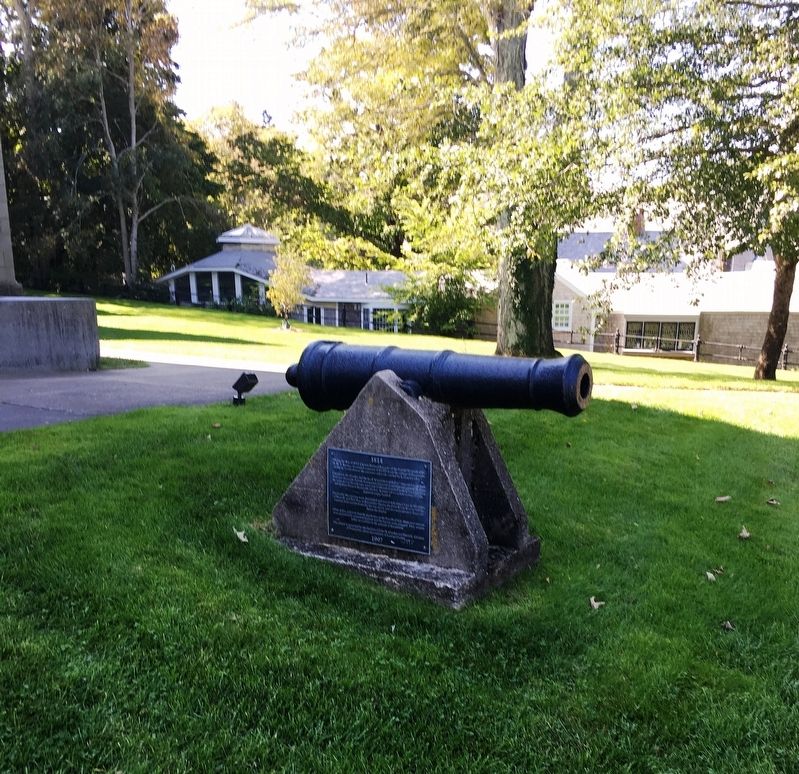
During the War of 1812, Captain Richard Raggett, of the British blockade ship, H.M.S. Spenser, demanded a ransom of $6,000 from the village of Barnstable, or else he would destroy the extensive saltworks owned by Loring Crocker.
Undaunted, . . . — — Map (db m142193) HM WM
This plaque is dedicated to the officers and crew members of the S/S Marine Electric who lost their lives in the line of duty on 12 February 1983.
By Marine Transport Lines, Inc. M.E.B.A District 81 National Maritime Union Masters, Mates and . . . — — Map (db m85581) HM
Dedicated to the U.S.N. Armed Guard and Merchant Seamen of W.W. II who served on ships, carrying the world to victory. In memory of The SS Blackpoint and crew, the last ship sunk in the Atlantic Theatre of War on May 5, 1945 by enemy action. She was . . . — — Map (db m191192) WM
This bell is dedicated to the memory of those who were lost at sea when the SS Pan Oceanic Faith went down in the North Pacific on 9 October 1967. John P. Dunphy ’65 • John M. Ward ’65 • John R. McPhee ’67 • Joseph P. Nowd ’67 • James Bechtold ’67 . . . — — Map (db m85577) HM
"We shall never forget that it was our submarines that held the lines against the enemy while our fleets replaced loses and repaired wounds."
Admiral Chester W. Nimitz — — Map (db m183421) WM
These gallant men served on merchant ships to protect troops and supplies enroute to war zones around the globe a total of 144,970 personnel who served to protect 6,236 ships of which 710 were lost in battle. 1.810 men killed in action and 27 men . . . — — Map (db m183426) WM
United States LST Association
Massachusetts Chapter Inc
In Memory of those Who Served
The Amphibious Forces of the
United States — — Map (db m183561) WM
In Memory of
August Belmont
February 18, 1853 - December 10, 1924
Whose vision, initiative, an indomitable courage made possible the first complete construction of
The Cape Cod Canal
Connecting Buzzards Bay and Cape Cod Bay which was . . . — — Map (db m57668) HM
Chief of Engineers
Award of Excellence
US Army Corps of Engineers
Cape Cod Canal
For exceptional project managemental achievements, and the enhancement of public perception of the corps objectives. — — Map (db m57672) HM
(Front of Marker)
In memory of all U.S. Submarines that are still on patrol.
U.S.S. Trout
State Boat of Massachusetts lost in action February 29th 1944
(Rear Marker)
U.S. Navy Submarines paid heavily for their success in World . . . — — Map (db m57398) HM
Opening to vessel traffic in 1914, the primary purpose of the Cape Cod Canal is to provide a safe, navigable intra-coastal route for vessels, saving 65 – 166 miles of travel around the historically treacherous outer shores of Cape Cod, . . . — — Map (db m158552) HM
William Barclay Parsons, Hon.M.ASCE
Chief Engineer, Cape Cod Canal, 1906-1914
The original construction of the Cape Cod Canal demonstrated the feasibility of constructing and operating a sea-level canal without locks. — — Map (db m57670) HM
Native Americans have harvested fish and shellfish in Chatham waters for millennia. Weirs – stationary structures of twine nets and wooden poles driven into the seabed – were the traditional method for catching finfish and squid. Weir fishing is . . . — — Map (db m234503) HM
The Old Village, encompassing the land between Chatham Harbor on the east and Mill/Little Mill Pond on the west, became the town center in the 1800’s probably due to the Old Harbor area becoming less navigable. A concentration of small stores on . . . — — Map (db m159151) HM
The waters off Chatham are notoriously dangerous because of the treacherous shoals and currents. The need for lights to warn mariners was recognized in early days of the country, and in 1806, nine years after the erection of the first lighthouse on . . . — — Map (db m154912) HM
One of the most spectacular small boat rescues on the east coast of the United States occurred on February 18, 1952. The tanker Pendleton broke in half off the coast of Chatham during a fierce Nor' caster storm. In blinding rain and sixty foot . . . — — Map (db m63406) HM
After 66 days spent in the cramped confines of a small ship pitching and rolling its way from England across the stormy North Atlantic, the Mayflower’s passengers gave thanks. It was the morning of November 9,1620 and they had spotted land - the . . . — — Map (db m141189) HM
In 1836, in response to numerous shipwrecks in the area, 21 residents of Eastham petitioned the Boston Marine Society for a lighthouse. The first Nauset Beach Light Station was built more than 500 feet east of this spot. Because of constant beach . . . — — Map (db m141506) HM
In the days before electronic navigational aids, the waters off Cape Cod with their hidden shoals held many dangers for passing ships, especially at night or during thick weather.
In 1872 the U.S. Life-Saving Service established nine stations . . . — — Map (db m141194) HM
Edward Penniman’s career as a man of the sea began at age 11. At 21, he was harpooning with the New Bedford, Massachusetts whaling fleet. By the time he was 29, he was master of his own whaling ship. Captain Penniman’s seven whaling voyages spanned . . . — — Map (db m111660) HM
A remnant from Cape Cod's agriculture past, this 1850-era hay barge was a common sight among the working dories, skiffs, and catboats of the area. Wide and flat-bottomed, it was rowed, poled, and sailed throughout the shallow marshes. Salt marsh hay . . . — — Map (db m63407) HM
The Kennedys Sailing Tradition
One of the most well-known Kennedy pastimes is sailing, often from Hyannis Harbor into Nantucket Sound. JFK and Jacqueline spent many summers sailing with their family in Hyannis Port. U.S. Senator Ted . . . — — Map (db m157364) HM
Welcome to the Working Waterfront
Hyannis harbor, bustling with all the activities of a working harbor.
In the second largest commercial fishing port on Cape Cod, visitors can watch local fishing fleets off load their cargo & . . . — — Map (db m162477) HM
In the 1800s more than 150 Sea Captains called Hyannis home. Tree lined streets, such as Pleasant Street, or Sea Captain Row, link Main Street to the Harbor. The Old Colony Railroad originally extended to a wharf in The Outer Harbor along what is . . . — — Map (db m162589) HM
The Kennedy’s Contribution to Maritime Heritage
The Cape Cod maritime Museum, to the east, and it’s 1886 Crosby catboat replica, Sarah, docked here at Gateway Marina, was made possible by funding obtained by Senator Edward . . . — — Map (db m157317) HM
President John F. Kennedy loved Cape Cod and its unique natural environment. In 1961, he signed legislation establishing an American treasure, the Cape Cod National Seashore, protecting the fragile coastline from Chatham to Provincetown. The . . . — — Map (db m144005) HM
On November 27, 1898
The Steamer
Portland
With 176 persons aboard
Sank with No Survivors
About Seven Miles Out To
Sea From This Station
At Cape Cod Light
_____ ___ _______
This Memorial Dedicated November 27, 1948
By . . . — — Map (db m141449) HM
All nine of the Cape Cod Lifesaving Stations were a part of the USLSS District 2. In 1872, Sumner I. Kimball, then Chief of the Treasury Department’s Revenue Marine Division, appointed Orleans resident Benjamin Sparrow as Superintendent of . . . — — Map (db m158783) HM
”All the towers leaking bad. Everything all wet and in poor order
Log entry by Keeper Nathan Gill, 1874
Taking care of a lighthouse was demanding. The keeper was tasked with keeping the lights burning no . . . — — Map (db m141388) HM
Both the lighthouse standing here and the cliff in front of you have had to give away to the power of the Atlantic Ocean.
The first lighthouses built here in 1838 were placed over 600 feet east of where you are standing now. As ocean waves ate away . . . — — Map (db m63398)
On January 28, 1915, President Woodrow Wilson signed the law creating the US Coast Guard by combining the Lifesaving Service with the Revenue Cutter Service. The law put the Coast Guard under the Treasury Department in peacetime and under the . . . — — Map (db m158839) HM
Shipwrecks and Lifesaving in Orleans date back to the winter of 1626, approximately 170 years before the incorporation of the Town. During that winter, the Sparrow-hawk, carrying passengers bound for Jamestown from England, was wrecked in the . . . — — Map (db m158793) HM
For nearly two centuries after the Sparrow-hawk rescue, there were no organized efforts to aid those who were involved in shipwrecks off Cape Cod shores. Those who found themselves cast up on the shores or sandbars of Cape Cod were at the mercy . . . — — Map (db m158807) HM
In the years following World War I, the profession of lifesaving changed significantly. The widening of the Cape Cod Canal and the removal of the substantial tolls greatly reduced the amount of shipping traffic off our dangerous eastern shore. . . . — — Map (db m158911) HM
In 1838 the United States Government took action to reduce the number of shipwrecks along this dangerous coast by establishing the Nauset Light.
To make the signal easily recognizable three separate lanterns were set on small brick towers about 150 . . . — — Map (db m234957)
Whales and humans have long shared the coastline of Cape Cod. Native Americans harvested whales the washed up on the beaches, almost exclusively for food, long before the arrival of European colonists. While anchored in what would become . . . — — Map (db m141867) HM
These three lighthouses were part of the Nauset Beach Light Station, which originally stood a quarter mile away, overlooking the Atlantic Ocean. Nicknamed the Three Sisters, this trio of lights provided a landmark for sailors making their way along . . . — — Map (db m63400)
Of all the enemy ships that haunted Provincetown Harbor during the Revolutionary War, perhaps the most fearsome was the huge British man-of-war H.M.S. Somerset. With her 64 mounted guns and crew of 400, she symbolized British tyranny where-ever she . . . — — Map (db m111670) HM
• Established – November 5 1816
• Keeper's house built – about 1876
• Fog bell installed – 1852
• Present fog signal building built – 1876
• Steam fog whistle installed – 1876
• Keeper's house added on to – Approx. 1900
• Present . . . — — Map (db m198218) HM
This Stone Commemorates the Victory of the Schooner “Rose Dorothea” Captained by Marion Perry and Crew, at the Old Home Week Celebration in Boston 1907. This Cup Given by Sir Thomas Lipton for the Winner of this Race can be Seen in . . . — — Map (db m141932) HM
The name Sagamore is defined as "Chief" of an Indian tribe. It was on Sagamore Hill that chiefs of the Wampanoag and Manomet Indians would hold tribal meetings. As you look out toward Cape Cod Bay, the land before you has undergone many changes . . . — — Map (db m57397) HM
Sandwich Town Hall
Built in 1834, this columned Greek Revival, continues to serve as the seat of town government and is one of the oldest town halls in New England. In 2009, the building was beautifully and accurately restored and received . . . — — Map (db m140508) HM
Italian-born Guglielmo Marconi was an inventor who dreamed of a world where signals could be sent wirelessly. He drew upon research, experimentation, and his business acumen to make it happen. From this site on January 18, 1903, Marconi sent the . . . — — Map (db m141493) HM
Site of first United States
Transatlantic Wireless Telegraph Station
Built in 1901-1902
Marconi Wireless Telegraph Company of America
Predecessor of RCA Transmitted January 19, 1903
The First U.S. Transatlantic Wireless Telegram . . . — — Map (db m141100) HM
I have a room all to myself it is Nature.
Henry David Thoreau
The land comprising the Truro Highlands District included an early 1700s farm owned by the Small family, with a windmill for grinding grain. . . . — — Map (db m141541) HM
Since 1828 Nobska Light has provided a familiar beacon for "all who go down to the sea in ships". 87 feet above sea level, Nobska's flash every six seconds is visible 17 miles out to sea. This 28,000 candlepower light used a 1000-watt lamp magnified . . . — — Map (db m120715) HM
Here at the headwaters of the Hoosic River, you are standing beside one of three basins that make up the 500-acre Cheshire Reservoir (also
named Hoosac Lake). In 1866 the river was dammed by the Adams-Cheshire Reservoir Company for the purpose of . . . — — Map (db m185548) HM
Arrowhead
For thirteen years (1850-1863)
the home of
Herman Melville
1819 — 1891
Mariner and Mystic
Author of Moby Dick (written in Pittsfield)
and other tales of the sea.
“Moby Dick is among the . . . — — Map (db m32337) HM
William Bradford
Marine Artist
1823-1892
Built his first studio in 1851 on this site.
The Fairhaven native achieved international fame
as a lecturer and an Arctic painter.
Queen Victoria commissioned Bradford . . . — — Map (db m86796) HM
His explorations and scientific accomplishments dispelled the legend of the tenebrous sea, beaconed the ocean route to India and opened the gateway of the Atlantic to the American continent.
•
This monument in his honor marks the eighth . . . — — Map (db m1617) HM
This 38,030 pound manganese-bronze propeller was manufactured at Philadelphia Navy Yard and was removed from Battleship Massachusetts during her 1998-1999 drydocking. It is one of four. When turning at 185 revolutions per minute, they propelled the . . . — — Map (db m33075) HM
Docked across from you (when not at sea as a sail training and education vessel), Ernestina is one of the oldest wooden sailing vessels afloat. The ship is also one of the last surviving Gloucester fishing schooners, one of only two remaining . . . — — Map (db m86768) HM
For many Cape Verde Islanders, the New bedford
wharf area was the first view of America. At the height
of immegration between 1900 and 1921, more than
a dozen packet boats ran between Cape Verde
and New Bedford, the main port of entry. Packet . . . — — Map (db m86766) HM
Text on the Bronze Plaque
Near this Site
was located the shipyard of
Colonel George Claghorn
Builder of U.S. Frigate Constitution
and Ship Rebecca the first whaler
to double Cape Horn.
His service in the . . . — — Map (db m86782) HM
A one-industry whaling town before the Civil War, New Bedford became a one-industry textile town afterward. Cotton bales and coal, both bound for the city's new textile mills, began to replace oil casks on New Bedford wharves.
Oil casks . . . — — Map (db m86731) HM
The boats you see in the harbor today are mostly commercial fishing vessels - primarily draggers and scallopers; the whaling barks of the past have long since vanished. By the 1930s, just as whaling faded and the textile industry fled to the . . . — — Map (db m86680) HM
Born in Richmond, Virginia, in 1800, Lewis Temple established himself as a blacksmith on the New Bedford waterfront by 1836.
Temple manufactured his first toggle-iron in 1848. Its fastening power revolutionized the catching of whales. The . . . — — Map (db m1616) HM
On the other side of the Bourne Counting House, the granite building in front of you, is Merrill's Wharf, completed in 1847. The wharf then was the longest in New Bedford port. Built by Edward Merrill for an expanding whaling fleet, this wharf . . . — — Map (db m86733) HM
In 1915, in the waning light of whaling's final decade, Emily Howland Bourne financed the construction of a museum building to honor her whaling merchant father, Jonathan Bourne, Jr. This marked the first steadfast effort to preserve New . . . — — Map (db m86657) HM
(Marker on the left side of the door) “In the same New Bedford there stands a whaleman’s chapel and few are the moody fisherman, shortly bound for the Indian or Pacific Oceans who failed to make a Sunday visit to this spot.” Moby . . . — — Map (db m95382) HM
Near this spot in 1767 the first ship built in New Bedford was launched.
The Dartmouth
Francis Rotch, Owner
She was one of the vessels boarded by the Boston Tea Party in 1773
— — Map (db m58183) HM
Home Away from the Sea
Whaling men spent much of their lives at sea. The ship was their home. Back in port, most of the poor, unskilled sailors knew no one in New Bedford and were essentially homeless until the next voyage.
In 1850 the . . . — — Map (db m58197) HM
Saving Mariners' Souls
After months at sea, many whaling men were unable to resist the temptations of this port city. In 1832, the New Bedford Port Society for the Moral Improvement of Seamen opened this mariners' chapel "to protect the rights . . . — — Map (db m58199) HM
Twentieth-Century Whaling-As New Bedford’s whaling industry declined in the 19th century, more than a dozen other nations began hunting whales using “modern” Norwegian methods, with fast, steam-powered vessels and heavy-gauge harpoon . . . — — Map (db m62387) HM
On this toro rests a capstan from the American clipper ship Viking which was wrecked on this island on June 4,1863. Being bound for San Francisco, U.S.A. from Hong Kong, China. Through the intervention of the local authorities and hospitality of the . . . — — Map (db m58179) HM
Whaling Capital-In 1857, ninety-five ships and barks left these wharves on whaling voyages. In that year the industry reached its peak, and half of the worldwide whaling was conducted from the New Bedford customs district. Before petroleum was . . . — — Map (db m62411) HM
During the war, we were getting a dollar and a half a gallon for sperm oil. And then around 1922 there was no more demand for sperm oil....The price of sending a ship to sea doubled and the price of oil dropped about 200 percent....And . . . — — Map (db m86759) HM
Working Waterfront-Standing here during the heyday of whaling you would have seen and heard the bustling of a whaling port preparing for sea: ship carpenters building vessels from great white oak timbers, and caulkers hammering oakum---hemp mixed . . . — — Map (db m62410) HM
The name "Bad Luck" (origin unknown) has been associated with this area since the early 1700's. The Beverly and Kelton families operated a water powered saw mill for many years on the North side of the pond beginning in the 18th century.
Bad Luck . . . — — Map (db m56246) HM
Here were built about 200 ships from small sloops to vessels of 1060 tons which sailed from the Atlantic coast to the China seas.
Dedicated to their memory by
Algernon H Bell •
Carolyn Bell Fenley •
Constance Bell Falconer — — Map (db m56214) HM
Gay Head Light has been placed on the National Register of Historic Places in 1987 by the United States Department of the Interior — — Map (db m221966) HM
The ring of granite stone marks the original 1856 site of Gay Head Light. The bricks are pieces of the walls that mark two corners of the original keeper’s quarters. — — Map (db m178143) HM
For many years this building was the shop
of Manuel Swartz Roberts Boat builder
1881-1963 From its doors came catboats, beach boats, fishing boats, all staunch, all honest, all seaworthy, all partaking of the nature of their builder. Thru . . . — — Map (db m177816) HM
This rock marks the “place on the wayside” where the Rev. Thomas Mayhew Jr., son of Gov. Mayhew, First pastor of the Church of Christ on Martha’s Vineyard, and the first missionary to the Indians of New England, solemnly and affectionately . . . — — Map (db m178097) HM
Ovid Osborn Ward, sculptor, is the great-grandson of Samuel Osborn, Jr. who owned Osborn's Wharf (now the site of the Edgartown Yacht Club) where whaleships, including his own,
returned from their long voyages and were
outfitted to sail again to . . . — — Map (db m177822) HM
Originally built in 1931, this bathhouse was designed in the late Victorian era Craftsman style to compliment the original brick Steamship Authority ferry terminal. The building was made of the best materials and most modern plumbing available . . . — — Map (db m84144) HM
The Marine Hospital Cemetery
This cemetery was established in 1879 for burial of seafarers who perished at sea or
who died at the Marine Hospital after being injured or becoming ill onboard ships
calling at Martha's Vineyard. Most of the . . . — — Map (db m155774) HM
Hospital Point Light was constructed and first lighted in 1872 to help guide vessels into Salem and Beverly Harbors. The original two-story keeper's house and oil house are still being used.
The name Hospital Point stems from a smallpox . . . — — Map (db m21429) HM
One of the most strategic and daring exploits of the patriot cause during the revolution. Part of the troops encamped in the Town of Danvers on the night of September 14, 1775 on their way to Newburyport where they embarked for the Kennebeck and . . . — — Map (db m48470) HM
Dedicated to the those men of Chebacco and Essex who by the skill of mind and hand within sight of this spot created nearly 4000 wooden vessels 1650-1982 — — Map (db m97208) HM
From a large bark or packet ship 200 to 300 feet long, lost at sea. Salvaged by Captain Salvatore Zappa and crew of the fishing vessel Carol Ann in 1988. — — Map (db m193088) HM
Blynman Bridge
1907
In Honor Of
Richard Blynman
First Minister and Leading Citizen
Of Gloucester
Who in 1643 Dug This
Canal Uniting River and Bay
G.H.S. — — Map (db m36363) HM
The first man to sail single
handed from west to east
across the Atlantic Ocean.
A typical Banks dory decked
over, christened Centennial to
commemorate the first centennial
of the founding of the
United States, 1776 . . . — — Map (db m115475) HM
Citizen of Gloucester,
crossed the Atlantic twice,
alone, without any fingers
or toes and part of one foot
missing, all frozen in an
accident at sea.
On June 18, 1899, sailed from
Gloucester, Mass. To
Gloucester, England, on . . . — — Map (db m115478) HM
Charles Heberle (1862-1956) was sent at age 13 from Virginia to Essex, where for three years he was indentured to the Essex Tannery. Once free, he worked nearby for a dairy farmer, Caleb Cogswell.
Soon, Heberle chose waterfront over farm and . . . — — Map (db m115439) HM
In Honor of the Men Who Established Coast Guard Aviation
In May of 1925 On
Ten Pound Island in Gloucester Harbor
Home of the First Continuously Operating Coast Guard Air Station
Growth in Operations and Aircraft Size Forced a Move
To Salem . . . — — Map (db m36437) HM
This bell was used as the fog signal at Eastern Point Light House from June 1933 to Dec 1969.
Cast in Chelsea, MA. gold dust was sprinkled in the mold in order to obtain the right tone. — — Map (db m115484) HM
Used by a 500 ton 3-masted sailing ship, 150 ft in length. Salvaged by Capt. Frank Santuccio of the Fishing Vessel Blue Waters on Nov. 22nd, 1963. — — Map (db m193089) HM
“In Its heyday as a salt fish producer; Gorton's… kept dozens of wharves and acres of flake yards busy with the unloading, filleting, salting, drying, boning, cutting, grinding, smoking, boxing, packaging, and canning of the millions upon . . . — — Map (db m115459) HM
281 entries matched your criteria. The first 100 are listed above. Next 100 ⊳