Early water transportation on the Upper Mississippi River from St. Paul to St. Louis was hindered by fluctuating water levels. In 1878, the Corp of Engineers studied the impact of a reservoir system on the river. The study resulted in the building . . . — — Map (db m207887) HM
This map shows the locations of some of the villages of the 19 Ojibwe Bands whose treaty annuities were paid at Sandy Lake in 1850. Today, these 19 Bands are succeeded by the 12 federally-recognized Bands whose present-day reservations also are . . . — — Map (db m207530) HM
To the native Anishinabe (Ojibwe) and to the white fur traders who bartered with them in the late 1700s and early 1800s, no Minnesota lake had a more strategic location than Big Sandy Lake, which stands at the intersection of two major trade . . . — — Map (db m210859) HM
The Mississippi River was an obstacle to overland travelers attempting to cross to the other side. From 1855 to 1884 a flat bottomed cable ferry was maintained between Anoka and Champlin. For a time two ferry companies operated at this . . . — — Map (db m158388) HM
The Dakota and Ojibwa people believed that the confluence of two great rivers was a sacred place.
The Point was used as an encampment and gathering place for several tribes. It was also a meeting place to form hunting parties going north . . . — — Map (db m70897) HM
The Rum and the Mississippi were highways for the earliest recorded European explorers of Minnesota. Many explorers traveled past The Point and some may have camped here including Radission, Hennepin, Du Luth, Pike, Faribault and Nicollet.
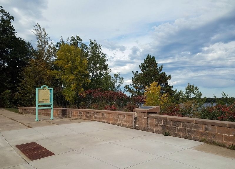
. . . — — Map (db m70569) HM
The white pine forests fell to the logger's ax in the northern Rum River pineries, "Seventy mills in seventy years could not exhaust the white pine I have seen on the Rum River" predicted Daniel Stanchfield, a lumber-wise timber cruiser . . . — — Map (db m70937) HM
The Rum and the Mississippi were river highways for the Dakota, the Ojibwa, European explorers, traders and settlers.
Between 1850 and 1870 the Rum and the Mississippi became "working rivers" for lumbermen. In the fall loggers traveled . . . — — Map (db m70914) HM
The first dam was built here in 1853 of logs and earth fill by Caleb and W.H. Woodbury. It washed away in high water in the Spring of 1854. A second dam was built in 1854 by James McCann. This dam and its pool provided 5 sluiceways for water . . . — — Map (db m70264) HM
Built in 1872 by W.D. Washburn & Co., the mill had an annual production of 16 million board feet of lumber. Combined with the planing mills, dry kilns, etc., the mill employed about 125 men. For 17 years logs from the headwaters of the Rum . . . — — Map (db m242327) HM
The Mississippi River forms a unique and complex ecosystem spanning 2000 miles. From its origin at Lake Itasca in Northern Minnesota to its outlet in the Gulf of Mexico the river encompasses a diversity of life found only in a very few places . . . — — Map (db m70908) HM
The Mighty Mississippi River One of the world’s great rivers, the Mississippi trickles from Minnesota’s Lake Itasca, gathering the waters of the nation’s heartland as it flows to the Gulf of Mexico. On its timeless journey, the river weaves . . . — — Map (db m70952) HM
This lake and the city located on its northern shore received its name from the French word “détroit,” meaning a narrow place in a lake and in this case referred to the bar which divides Little and Big Detroit Lakes. Today this can be seen about . . . — — Map (db m233589) HM
Constructed by dragline in the 1960s, this ditch was used by fishermen as a marina and safe harbor. Shallow water, strong winds and big waves made mooring fishing boats difficult. Docking boats by the campground along the Tamarac River could also . . . — — Map (db m191558) HM
Waskish was named by the Chippewa Indians who hunted, fished, and gathered wild rice along the Tamarack River. The Ojibway word for deer is Wawaskishi, which was shortened to Waskish by the early pioneers. The old town site was located at the . . . — — Map (db m181008) HM
Imagine a tremendous torrent of glacial melt water pushing and then bursting across the continental divide and scouring its way to the Gulf of Mexico. The massive river was, in places, almost two miles wide and 130 feet deep. About 13,000 years ago, . . . — — Map (db m160960) HM
Early European explorers were drawn to the Minnesota River Valley's unique characteristics just like the Native Americans before them. French Fur Trader and Explorer Pierre Charles Le Sueur was the first recorded European explorer of the . . . — — Map (db m237541) HM
Following the usual pattern of river town development, steamboating was essential for Mankato, from its founding in 1852 until the arrival of the first railroad in 1868.
During the heyday of steamboating at Mankato, boats based at St. Paul . . . — — Map (db m129536) HM
Native Americans arrived in the area nearly 11,000 years ago, shortly after the glaciers receded. They lived in small, migratory, family-based groups and used plants and animals from the river valley and nearby uplands. Around 2,500 years ago, . . . — — Map (db m237583) HM
Before the railroads and highways, the river was the best way to get goods and people to the new frontier of southern Minnesota. River transportation was much faster and easier than traveling through the dense forests that covered much of central . . . — — Map (db m236265) HM
In 1899, the Iowa and Minnesota Land & Townsite Company circulated a petition to locate a railroad station in Lake Hanska Township. The petition was signed by 77 people and on October 9, 1899 the village of Hanska was platted in section 24 by Harry . . . — — Map (db m66468) HM
The Sioux Indians called this lake "minne hanska," meaning "long water." The basin of the lake was formed 11,000 to 15,000 years ago by the Wisconsin glacier; the original hard clay bottom is now about 50 feet below the present surface of the . . . — — Map (db m66454) HM
Ole Synsteby was born in Lesja, Gulbrandsdalen, Norway. In the summer of 1873, the Synsteby family migrated to the Lake Hanska area. In 1879 Ole purchased the land which is now designated as Lake Hanska County Park.
The story of . . . — — Map (db m79934) HM
About 5 blocks north of this marker was the location of a very important river crossing for the early settlers of this area, going from the "Shetek Trail" on the south to "Old Leavenworth" and New Ulm on the north side of the Cottonwood . . . — — Map (db m67709) HM
West Newton in 1870 was a thriving town, serving riverboat travel on the Minnesota River. It consisted of a hotel, a livery stable, a brewery, a sawmill, a wagon works, two blacksmith shops, three saloons, and many dwellings that made the town an . . . — — Map (db m66238) HM
The first river steamboat, WEST NEWTON, passed by here in 1853 going upriver with troops to lay out the site of Fort Ridgely. Two days later TIGER and CLARION followed with men and supplies.
For the . . . — — Map (db m66383) HM
The mill, built in 1867 by John Heimerdinger, was down 1/4 mile from Golden Gate on the Ruhe-Heim Creek. It was powered by a pond kept full by many wells, dug by hand. Wheat was ground by stones into flour and feed. — — Map (db m71062) HM
540 acres of land southwest of this point, embracing Silver Creek in Jay Cooke State Park are dedicated to the memory of this pioneer civic leader who made great contributions to the establishment and development of this park.
Lands donated by . . . — — Map (db m53599) HM
Toward the end of the great ice ages about 10,000 years ago, the glacier, which had pushed its way along the trough of Lake Superior, retreated toward the northeast, and near Moose Lake crossed the divide between the Mississippi River and Lake . . . — — Map (db m205057) HM
Two kilometers northwest of here, the St. Louis River flows on its way to Lake Superior. Its broad river valley, visible from this point, is in a western extension of the Lake Superior basin. Over the last two million years, the Lake Superior basin . . . — — Map (db m205010) HM
Watertown is one of the oldest settlements in Minnesota’s south central region. Chief Little Crow of the Dakota Nation and his tribe often camped by the Crow River. At first the Chief and the settlers trusted each . . . — — Map (db m213030) HM
The first excursion train pulled into Walker on August 8, 1896 and the town was ready for the invasion of fishermen from all over the country. Pat McGarry had opened up his White Tent City, consisting of twelve white tents, which became the next . . . — — Map (db m235797) HM
In the early 1900s before the automobile, tourists could book round-trip railroad passage from Minneapolis to Walker for just fifty cents! At its peak in the 1970s, there were over 200 Ma & Pa establishments serving the lake — mostly simply fish . . . — — Map (db m235794) HM
The Minnesota River Valley is a witness to time. Rocks formed 3.8 billion years ago — some of the oldest in the world — lie exposed on the valley floor. These grey, pink and red granite rocks are memorials to a fiery young earth when . . . — — Map (db m69039) HM
The pristine view in front of you would look much different without Walter F. Mondale's passion and tenacity. As Minnesota Attorney General, U.S. Senator, Vice President and an engaged citizen, he has spent a lifetime advocating for the . . . — — Map (db m235503) HM
Logs collected above the dam until they were needed at sawmills downriver.
Photo courtesy of St. Croix National Scenic Riverway (National Park Service)
The Last Log Drive
Large numbers of logs were sluiced . . . — — Map (db m235036) HM
People Of The ValleyWe have evidence of many earlier users of the St. Croix River Valley. Why do you think they decided to come here?
People look for ways to make their lives better. Many people found what they needed along . . . — — Map (db m233090) HM
Look out at the top of the bluffs. Now look down to the river. That height difference represents the power of the St. Croix River. Over the past 15,000 years, the river has carved out this valley.
Nature isn't the only force making changes in . . . — — Map (db m234134) HM
Loggers cutting a large white pine.
From the St. Croix and its tributaries—the Kettle, Snake, Rum, Clam, Trade, and Yellow Rivers—thousands of pine logs were sent downstream. Nearly 100 logging camps upstream supplies logs for sawmills . . . — — Map (db m233538) HM
Before the arrival of the first French, English, or American explorers, people lived in the St. Croix River Valley. They were here before the Ojibwe came from the east, and before the Dakota and Mesquakie Indians guided and traded with the . . . — — Map (db m233179) HM
Wild River State Park gives visitors a sample of the beauty and variety of the landscape in the St. Croix River Valley. It is one of five Minnesota state parks located along the National Wild and Scenic Riverway. Wild River holds evidence of . . . — — Map (db m232715) HM
"The North Country is a siren Who can resist her song of intricate and rich counterpoint?"
(Grace Lee Nute, The Voyageur's Highway, 1941)
Lured by America's premier wilderness canoe region, Lake Superior's rugged shoreline and . . . — — Map (db m222163) HM
The Treaty of 1837, made between Wisconsin Territorial Governor Henry Dodge and the Chippewa nation of Indians, ceded to the United States a large area of Chippewa territories, the St. Croix and its headwaters up to a line 30 miles south of Duluth. . . . — — Map (db m216748) HM
So read the local paper in 1904 as engineers surveyed the Saint Croix River in search of a suitable place to build a hydroelectric project. The falls had long fueled the local lumbering and milling industries, but the Minneapolis General Electric . . . — — Map (db m120099) HM
Old Georgetown A Tranportation Crossroads
In 1857 the Hudson's Bay Company received United States government permission to
ship furs and trade goods across the United States. They contracted with the Burbank
brother's Minnesota Stage . . . — — Map (db m205727) HM
Toward the close of the last or Wisconsin stage of glaciation about 10,000 years ago, the ice front receded from central Iowa toward the north and, in the latitude of Browns Valley, crossed the continental divide between the Mississippi River and . . . — — Map (db m233564) HM
The fertile areas along both banks of the Red River of the North were once the bed of a huge lake known to geologists as Glacial Lake Agassiz. When the last glacier retreated and the lake slowly drained some 9,000 years ago, the plain left behind . . . — — Map (db m156984) HM
Built by James and Wilhelmina Douglas in 1873 and occupied until 1887, James Douglas ran a steam ship line along the Red River and served as Moorhead's first Post Master. — — Map (db m43831) HM
Red River Transportation The Red River Trails were a set of overland routes linking the cities of Winnipeg and St. Paul and the small forts and settlements between them.From 1820 to the 1870s, the trails were used by Metis freight drivers who . . . — — Map (db m100838) HM
The railroad bridge west of this spot marks the location of the first bridge over the Red River. In early 1872, the Northern Pacific Railway built west from Duluth and reached the river — this is where Moorhead was founded. Bridge construction . . . — — Map (db m213595) HM
Discovered by Henry R. Schoolcraft from the summit of this hill July 13, 1832 This tablet is placed by the Society of Colonial Dames of America in the State of Minnesota 1924 — — Map (db m155676) HM
Herein, under the Ordinance of 1787, began the westward expansion of this nation • The American Bill of Rights first nationally recognized • Human slavery prohibited • Primogeniture abolished • And the great new principle of colonies becoming equal . . . — — Map (db m155672) HM
Acquiring a Homestead David S. Patterson came to Itasca in 1889. Patterson made claim to 152 acres, which included the Headwaters of the Mississippi. He purchased the land in 1891 for $191. Patterson's cabin was north of McMullen's cabin near . . . — — Map (db m155671) HM
The romantic 19th century quest for the source of the Mississippi river brought many explorers — among them Zebulon Pike, Lewis Cass, and Giacomo Beltrami — to northern Minnesota. The search ended when Ojibwe chief Ozawindib guided Henry . . . — — Map (db m155665) HM
Originally made from cedar and birch bark, the Canot du Nord functioned as the workhorse of the 18th and 19th century fur trade. These birch bark canoes could carry several tons of trade goods and between 4 and 6 voyageurs, the occupational . . . — — Map (db m235254) HM
You are looking across Gunflint Lake at the Canadian shore. This was one of the international routes taken by the voyageurs in the late 1600's into the 1800's. — — Map (db m231493) HM
Listen! Can you hear echoes from the 1930s, when 200 men of the Civilian Conservation Corps (CCC) used picks and shovels to construct the Cascade River Overlook?
The Overlook, where you stand today, is part of the 118-acre Cascade . . . — — Map (db m203021) HM
The rocks of the North Shore of Lake Superior record the last period of volcanic activity in Minnesota. This volcanism occurred 1.1 billion years ago when the North American continent began to rupture along a great rift valley, which extended from . . . — — Map (db m203069) HM
Henry Mayhew, explorer, prospector, entrepreneur and county commissioner, was credited with developing Gunflint Trail and Grand Marais. Capitalizing on the North Shore's well-established commercial fishing and tourism industries, he constructed the . . . — — Map (db m203209) HM
In 1972 Consolidated Papers, Inc., of Wisconsin Rapids, Wis., ended long distance rafting of pulpwood across Lake Superior. From 1923–1972, Consolidated rafted over two million cords of pulpwood from Minnesota and Canada to Ashland, Wis. Minnesota . . . — — Map (db m203083) HM
Lake Superior Indians recognized the unique nature of this bay long ago, naming it "Kitchi-Bitobig", meaning "double body of water." When white man first settled around this bay, in 1854, a few Indian families lived in tepees and cabins around the . . . — — Map (db m203151) HM
Welcome!
The Point is a broad tombolo which defines the two natural harbors that have made Grand Marais an important spot on Lake Superior's shore for centuries. The 8.4 acre Point was conveyed to the federal government in 1942, and is part . . . — — Map (db m203216) HM
The Grand Portage, or Great Carrying Place, was a key 18th century link between the Pigeon River and Lake Superior, making it also a vital connection between Montreal and the rich fur-bearing lands far to the northwest. Traveled for centuries before . . . — — Map (db m62049) HM
Father Frederic Baraga, learning of a possible
epidemic afflicting the Indians at Grand Portage in 1846, set out in a small boat from Madeline Island in Wisconsin with an Indian guide.
An unexpected storm threatened them, but their lives were . . . — — Map (db m98448) HM
Saganaga Lake is located along the Border Route, an ancient travel route between Lake Superior and the interior waters of Lac La Pluie (Rainy Lake) that is often referred to as The Voyageur's Highway.
Saganaga Lake was an . . . — — Map (db m231492) HM
Saganaga Lake is located along the Border Route, an ancient travel route between Lake Superior and the interior waters of Lac La Pluie (Rainy Lake) that is often referred to as The Voyageur's Highway.
Saganaga Lake was an . . . — — Map (db m232520) HM
The word "portage" is French for "to carry."
Canoe rests were built between 1933 - 1942 in the Superior Roadless Wilderness Area, now known as the Boundary Waters Canoe Area Wilderness (BWCAW), by the Civilian Conservation Corp (CCC). . . . — — Map (db m232921) HM
Legend has it this walleye was caught by Paul Bunyan and Babe the Blue Ox after a three day struggle. Paul finally wrapped his line around Babe's horns and Babe pulled the fish out of Lake Mille Lacs and up onto Garrison Beach. — — Map (db m78403) HM
Names from the fur traders' phrase "The Thousand Lakes Region." This lake is 1250 feet above sea level and covers about 200 square miles. It formerly included much low ground and several adjacent lakes. When visited by Du Luth in 1679, Sioux . . . — — Map (db m78405) HM
The Mississippi River has been a source of recreation for many generations. People have long enjoyed its beauty and marveled at its power.
This is more true than ever today. Boating, hiking, and bird watching all draw people to the river. In . . . — — Map (db m48510) HM
Hasting lies just south and East of the last glaciation. About 20,000 years ago a lobe of ice, called the Superior lobe, advanced from the Lake Superior basin and crossed the ancient bedrock valley of the Mississippi River between St. Paul and . . . — — Map (db m42199) HM
A dynamic force, the Mississippi River changes constantly. Humans have also changed the river, dramatically altering its flow and levels — sometimes with unintended results.
In its natural state, the river once flowed freely across a . . . — — Map (db m48570) HM
From 1856 to 1865, in its first decade of existence, the city of Hastings grew by 2,500 people, enjoying a boom of settlement also experienced by other cities along the Mississippi.
A steady flow of settlers, including many immigrants, . . . — — Map (db m48361) HM
The Mississippi River has provided a habitat for many species of fish and other aquatic creatures for millions of years. Human modifications of the river have had both positive and negative effects on fish populations here. Many types of fish thrive . . . — — Map (db m49277) HM
The Father of Waters
The Mighty Miss
The Great River
Source: Lake Itasca MN 552 River Miles
Mouth: Gulf of Mexico 1788 River Miles
This natural water highway made possible many of man's experiences on the North . . . — — Map (db m47809) HM
For more than 10,000 years, people have lived near the Mississippi River. The first cultures relied on hunting, fishing, and gathering for survival. As early as 1,000 years ago, however, Indian peoples were farming portions of the river valley near . . . — — Map (db m49801) HM
The Mississippi River and its backwaters are home to a vast and diverse array of fish and wildlife. The river's natural fluctuations help create an environment rich in vegetation — providing food and habitat for nesting birds, fish, and . . . — — Map (db m50358) HM
The natural river above Hastings was treacherous for steamboats, with a depth that reached only three and one-half feet in some places. The first efforts of the federal government to improve navigation of the river were wing dams (piles of . . . — — Map (db m48475) HM
The Mississippi River has long been a major artery for trade and transportation.
For thousands of years, Indians traveled on the river by canoe. By the 1850s, rivertowns like Hastings boomed as steamboats brought settlers into the region. The . . . — — Map (db m48589) HM
Ancient oceans, glaciers, and the powerful action of rivers carved the landscape of this region. Millions of years ago, Minnesota was covered by a shallow sea teeming with corals, sponges and shellfish. At the close of the Pleistocene, a time of . . . — — Map (db m228575) HM
The confluence of the Mississippi and Minnesota rivers has always been important to the peoples of this region. Native American cultures moving into Minnesota as early as 12,000 years ago lived along these major rivers. Dakotan groups living here . . . — — Map (db m228716) HM
Mendota occupies a strategic position in the transportation history of Minnesota. Located at the confluence of the Mississippi and Minnesota rivers, Mendota became a central meeting place for river boats traveling along these major waterways. With . . . — — Map (db m229037) HM
A National Scenic Byway
The Great River Road is the longest scenic byway in the nation, stretching nearly 3,000 miles through ten states from the Mississippi River's headwaters in Minnesota to the Gulf of Mexico. For thousands of years, the . . . — — Map (db m199537) HM
Ancient people lived in Minnesota as early as 12,000 years ago. These first inhabitants of the land left behind lasting clues about their cultures. They moved seasonally between camps while hunting and gathering. Often they chose camps near major . . . — — Map (db m229000) HM
Kaposia was first located on the east bank of the Mississippi River on a low terrace below the bluff in present-day St. Paul. It was established after 1750 by a group of Mdewakanton Dakota whose succession of chiefs were each known as Little Crow. . . . — — Map (db m151038) HM
Rice Lake and its surrounding area were popular among early Indians for the abundance of good hunting and the wild rice that grew in the shallow lake waters. Women of the Winnebago tribe harvested the rice even after the first white settlers . . . — — Map (db m196833) HM
Lying at the center of the North American continent, Minnesota embraces three great watersheds -- areas of land from which all surface water eventually flows into a single stream. From Minnesota's watersheds, water runs of in three directions to . . . — — Map (db m156985) HM
This scenic Mississippi River site provided Native Americans food, shelter, and transportation for over 9,000 years. Count Frontenac, the Governor of New France, sponsored the first European explorers to this area in 1680. James (Bully) Wells . . . — — Map (db m47158) HM
Lake Pepin's Shell Game
Celebrated today as a resort area, Lake Pepin had an earlier fame as a clamming center. In the late 1800s and early 1900s, more than 500 clammers worked the lake from their flat-bottomed johnboats, using giant . . . — — Map (db m51948) HM
On July 13, 1890 the steamer Sea Wing, heavily loaded with 215 passengers and crew, left the steamboat landing here for a Sunday excursion down the Mississippi River to Lake City.
The Sea Wing, based in Diamond Bluff, Wisconsin, . . . — — Map (db m49445) HM
This watershed lies entirely within Goodhue County and drains 50,000 acres including portions of Cannon Falls, Vasa, and Belle Creek Townships. The terrain within the watershed changes from gently rolling hills in the southern reaches to the steep, . . . — — Map (db m224623) HM
Settled by a colony that moved from Lowell, Mass. in 1856, this community takes its name from the Zumbro River which flows through it. This stream, called Riviere des Embarras by the French because of a raft of driftwood at its mouth, became . . . — — Map (db m203002) HM
Look over the tree-framed bluff across 12,000 years of human history where native peoples and Euro-American settlers made their home in the river valley. There are many cultural differences between you, the modern-day visitor, and the native people . . . — — Map (db m117489) HM
The original dam was built in 1913 and had 28 steel gates. The gates moved up and down to allow different amounts of water to flow under them. The current dam was completed in 1997 and is fitted with five crest gates. These gates maintain . . . — — Map (db m74833) HM
The Place Where People Want To Go
Back in the late 1900s, farmland stretched along this area below the Edina Mill dam. The pastoral landscape—with its intersection of the creek, grassy fields and woods—became a popular destination. Swimming . . . — — Map (db m198304) HM
River Valleys Take Shape
The two river valleys that meet here were carved thousands of years ago by water flowing from glaciers in the north. Glacial River Warren drained Glacial Lake Agassiz cutting through debris and bedrock to form the . . . — — Map (db m237601) HM
This area around the confluence, or meeting of the Minnesota and Mississippi rivers has been the center of activity in this region for centuries. Generations of people have gathered here to live, work, and recreate.
Native peoples, explorers, . . . — — Map (db m227822) HM
312 entries matched your criteria. The first 100 are listed above. Next 100 ⊳