"the road took us to the most distant fountain of the waters of the mighty Missouri in surch (sic) of which we have spent so many toilsome days and wristless (sic) nights." - Meriwether Lewis, August 12, 1805
What's in a name? . . . — — Map (db m109502) HM
"two miles below McNeal had exultingly stood with a foot of each side of this little rivulet and thanked his god that he had lived to bestride the mighty & heretofore deemed endless Missouri." - Meriwether Lewis, August 12, 1805
Hugh . . . — — Map (db m109500) HM
Captain Grant Marsh (1834-1916), one of the most skilled riverboat pilots on the Upper Missouri
during the steamboat era, figured prominently in both the events leading up to the Battle of the Little
Bighorn and its aftermath.
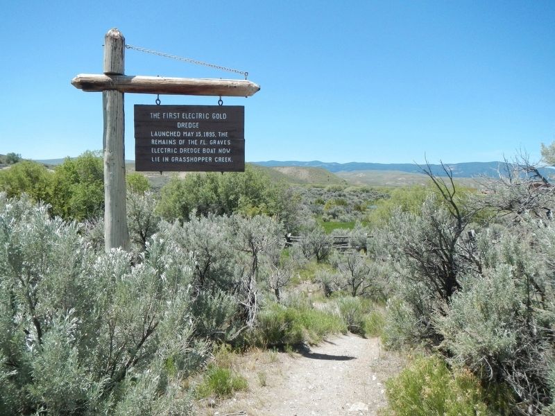
The steamboat . . . — — Map (db m189458) HM
The Lewis and Clark Expedition passed this way on their westward trek across the continent. Expedition members camped on the west side of the Missouri River on July 25, 1805, a short distance upstream from present day Toston Dam.
It was near this . . . — — Map (db m192879) HM
Shortly after the discovery of gold in Confederate Gulch, freighters established a road between Helena and Diamond City. The Missouri River was a barrier to travelers until John Oakes established a ferry in Black Rock Canyon in 1865. A small . . . — — Map (db m141733) HM
"See out at sunrise, the current very strong; passed a remarkable bluff of a crimson coloured east on Starboard intermixed with Stratas of black and brick red slate..."
Imagine canoeing against the Missouri's current, never sure of . . . — — Map (db m192881) HM
Jim Bridger arrived in Montana in 1822 as a member of a Rocky Mountain Fur Co. brigade. For years he had no more permanent home than a poker chip. He roamed the entire Rocky Mountain region and often came through this part of the country. A keen . . . — — Map (db m96630) HM
Hidasta informants described a fall of water on the Missouri River near the mountains, so the Captains expected a short portage. Instead of one waterfall, Lewis happened upon a succession of five, and their hope for a short portage faded. Look . . . — — Map (db m80319) HM
The uppermost of the Great Falls of the Missouri bears west of this point. The name is a modern one derived from an entry for June 14th, 1805 in the journal of Capt. Meriwether Lewis of the Lewis and Clark Expedition. He discovered the falls on that . . . — — Map (db m80427) HM
... the rocks seems to be most happily fixed to present a sheet of the whitest beaten froath for 200 yards in length and about 80 feet perpendicular. — Meriwether Lewis, June 13, 1805
The Great Falls of the Missouri . . . — — Map (db m82766) HM
To avoid the series of waterfalls along the Missouri River north of this point, the Expedition portaged their canoes and several tons of baggage, crossing the highway right here. At the lower camp, some 12 miles NE, the crew made crude wagons, the . . . — — Map (db m143667) HM
Over 150 million gallons of water flow from Giant Springs everyday and cascade into the Missouri River.
The springs occur where cracks in the rocks above the Madison Limestone allow water to leak upward to the land surface. It is similar to a . . . — — Map (db m127798) HM
Lewis and Clark Trail markers follow today's highways, but rivers actually determined most of their route. By the Great Falls, over 2500 miles of Missouri "roadway" had been navigated.
Keeping the Expedition Afloat
During three seasons . . . — — Map (db m143674) HM
Designed to be Portable
In 1803, Captain Meriwether Lewis led an expedition to map a water route west to the Pacific Ocean. Along the way, the Lewis and Clark Expedition uses 26 different boats, but one deserves special mention. . . . — — Map (db m143669) HM
For Meriwether Lewis in 1805, the falls were an obstacle on the journey to the Pacific. To Paris Gibson (near right) the falls were a source of great opportunity. As Gibson laid out the townsite of Great Falls he envisioned dams to harness the falls . . . — — Map (db m126545) HM
”…the men has to haul with all their Strength Wate & art, catching grass & knobes and Stones with their hands to give them more force in drawing on the Canoes & Loads, at every halt, those not employed in repairing the Course, are asleep . . . — — Map (db m126558) HM
Native American tribes followed the buffalo through this area and camped at Giant Springs. The temperature of the spring water stays a consistent 54 degrees all year long, making this a good site for winter camps.
Lewis and Clark Corps of . . . — — Map (db m127799) HM
The Coulson Steamboat Headquarters once stood here. The Coulson Line was the largest early company on the upper river. It ran some of the most immense boats, like the Montana and the Dakota, that were over 250 feet long. Coulson . . . — — Map (db m161592) HM
"Fire" was a cry dreaded by any Westerner, and early Fort Benton was no exception. Flimsy wooden buildings, haystacks, kerosene lamps and primitive stoves created major fire hazards. When city government was organized in 1883, the first steps in . . . — — Map (db m142424) HM
Founded in 1846 as a fur post, Fort Benton is the oldest continuously inhabited settlement in Montana. From its palisaded walls grew the most important transportation center in the Northwest. Trails led to all points of the compass, carrying goods . . . — — Map (db m141987) HM
Founded in 1846 as the fur trade transitioned fro furs to buffalo robes, Fort Benton was both a trading post and a center for distribution of Indian annuities. In the early 1860s, Montana's gold rush and the initiation of steamboat traffic made the . . . — — Map (db m142173) HM
On June 14, 1869 nine sternwheelers moored along this bank, unloading whiskey, gold pans, salt, bacon, boot and miners. Ox teams hauled the freight to faraway points. Wells Fargo coaches took miners to Helena for $25, fights with the Blackfoot were . . . — — Map (db m142060) HM
Opened to the public Nov. 1, 1882 the Grand Union Hotel was Fort Benton's pride, a haven of relaxation in a boisterous frontier town at the head of navigation on the Missouri. Total cost of the finest hostelry between Seattle and the Twin Cities . . . — — Map (db m142061) HM
In the 25 years following the first gold discoveries in western Montana, before railroads arrived in Fort Benton 1887, steamboats made hundreds of trips bringing fortune-seekers and their supplies from St. Louis to Fort Benton. Some of the boats . . . — — Map (db m161580) HM
The original portion of this house, one of the oldest in Montana, was built for I.G. Baker in 1867. Early-day Fort Benton merchant Baker wanted a home, rather than the old fort for the birth of his expected child.
Constructed of rough-sawn . . . — — Map (db m142290) HM
On this day water from the Missouri River rose to this level at this location due to heavy rainfall over Western Montana.
For more information contact
National Weather Service Great Falls, MT
www.weather.gov/greatfalls
Missouri . . . — — Map (db m142408) HM
Keelboats antedated steamboats and used every kind of power–chiefly man–except steam. Propelling them was no idle pastime. The usual method was to set long ash poles on the river bottom, toe the cleated walk and push hard, bow to stern. Crew also . . . — — Map (db m142245) HM
On July 19, 1882 the steamer Rose Bud docked at the Fort Benton levee. That night the residents got their first glimpse of an electric light with a show from the the steamer's big searchlight, much to the chagrin of a prominent local . . . — — Map (db m161581) HM
Just over the brow of this hill, nestled against the banks of the Missouri, is Fort Benton. It was the head of steamboat navigation on the Missouri, the world's innermost port. Below this point is a shelf in the river that prevented further passage. . . . — — Map (db m142011) HM
Part of the remains of Fort Benton's last steam boats.
Baby Rose & City of Fort Benton were both lost on the Missouri after 1900. — — Map (db m142170) HM
This stream flow monitoring station is part of a nationwide system of approximately 7,000 streamflow stations operated by the U.S. Geological Survey (USGS). The USGS has principal responsibility for evaluation of the Nation's water resources by . . . — — Map (db m142410) HM
Across the street stood the first two stores of the T.C. Power Company, the third became the Pioneer Lodge. T.C. Power stepped off the Yorktown about this spot on June 14, 1867 with a tiny stock of merchandise bought "on jawbone," but with . . . — — Map (db m142248) HM
Before there was a Miles City, before there were railroads or even crude trails, there were the rivers. And the mighty Yellowstone would, for a few years, serve as the highway that brought people and their necessities to Miles City. Perhaps the best . . . — — Map (db m163971) HM
Captain Wm. Clark and ten others camped near the mouth of the Tongue River on July 29, 1806. Clark noted the great number of buffalo in the area and reported that the river was so muddy and warm that it was "very disagreeable to drink." Clark . . . — — Map (db m163877) HM
"On our return we shal probably pass down the yellow stone river, which from Indian informations, waters one of the fairest portions of this continent." — Captain Meriwether Lewis, letter to President Thomas Jefferson, dated April . . . — — Map (db m202998) HM
Horses, Canoes and Bull Boats Clark and his party traveled by horse along the north side of the Yellowstone River until July 24, when nine members began a float in two lashed-together canoes built from cottonwoods they found along the river. . . . — — Map (db m202999) HM
July 28, 1806 "Set out this morning at day light and proceeded on glideing down this Smooth Stream passing maney Isld...." July 29, 1806 "in the fore part of the day, I saw great numbers of Buffalow on the banks, … great . . . — — Map (db m203054) HM
Interstate 90 (sic) generally follows the Yellowstone River from Glendive to Livingston, Montana. This river originates south of Yellowstone National Park and terminates when it joins the Missouri River north of here. It is the longest undammed . . . — — Map (db m163818) HM
Constructed during the 1911 half-million-dollar Lewistown building boom, the $20,000 Mackey Building sits directly over Big Spring Creek. A blend of Romanesque and Classical Revival styles, the structure maintains much of its original façade, . . . — — Map (db m143360) HM
The Missouri River is a meandering oasis; a striking contrast to the harsh environment of the surrounding prairie For centuries, American Indians were drawn to this area to hunt game and gather plants. Ancient camps and bison kill sites are evidence . . . — — Map (db m162052) HM
Captains Meriwether Lewis and William Clark arrived at the mouth of the Judith River on May 29, 1895 and named it for Clark's sweetheart, Julia Hancock. Lewis described it as a "handsome river" and noted the recent evidence of Indian encampments . . . — — Map (db m161907) HM
The Mansion was built in 1895 as the home of Mr. & Mrs. Charles E. Conrad. E.C. Conrad was a prominent Missouri River freighter, trader and pioneer during the Gold Rush and Indian Wars and later founded the city of Kalispell. The mansion has 23 . . . — — Map (db m160125) HM
Leaded glass transoms, Tuscan columns, a bay window, and spacious porch spanning the front recall nineteenth- century requirements for a comfortable, homey dwelling. Isabelle and David Sturtevant first owned this early residence, built between 1891 . . . — — Map (db m160860) HM
In 1895 there were no roads along Lake McDonald. Tourists arrived at this dock by wood-fired steamboat after getting off the train at Belton Depot and bumping along in a wagon to Apgar Landing.
The steamboat F.I. Whitney was the first . . . — — Map (db m45061) HM
Lewis and Clark's Corps of Discovery reached the headwaters of the Missouri River and named the three tributaries in July, 1805. With great difficulty the Corps of Discovery fought rapids and troublesome mosquitoes as they pulled their boats . . . — — Map (db m29072) HM
One of Montana’s most amazing historical events occurred near here in 1809. In
September of that year, John Colter and John Potts, former Lewis and Clark Expedition
members, were trapping beaver on the Jefferson River near the headwaters when a . . . — — Map (db m98317) HM
The original townsite of Gallatin City, north of here on the
west side of the combined Madison and Jefferson Rivers,
was selected in 1862. In Feb., 1863 sixty cabins were being
constructed. The river was forded when it was low and a
ferry was . . . — — Map (db m127042) HM
“The object of your mission is to explore the Missouri river, & such
principle stream of it, as, by its course & communication with the
waters of the Pacific ocean… may offer the most direct & practicable
water communication across . . . — — Map (db m99217) HM
Lewis and Clark explored the Missouri River in search of the "Northwest Passage."
"The object of your mission" wrote President Thomas Jefferson to Meriwether Lewis and William Clark "is to explore the Missouri River and such principal . . . — — Map (db m192786) HM
You are standing at the headwaters of the great Missouri River. The Jefferson and Madison Rivers converge with the Gallatin joining one mile downstream to become the Missouri River. Here, the famed explorers accomplished a major goal of their . . . — — Map (db m73542) HM
Approx.. 2 miles north on the Trident Road (#286) is the
confluence of the Jefferson and Madison Rivers. A mile
further downstream you can view the Gallatin River
merging to form the headwaters of the Missouri River, the
longest U.S. river. . . . — — Map (db m99206) HM
Many nations traveled and lived along these banks, giving their own names to
the river. “Missouri” is the official name given by the U.S. Geological Survey. It
dates back to French explorer Jacques Marquette’s journal and 1673 map of . . . — — Map (db m99215) HM
On their upstream journey in 1805, Lewis and Clark traveled through this area in two groups. On his return journey in 1806, Clark's group passed through the Headwaters area on their way to the Yellowstone River.
Sites depicted on this map . . . — — Map (db m206117) HM
"To pass across the Traveler's Rest Creek to the Missouri at the Mouth of the Dearbourn's River is 400 miles nearer that the route we Came..." Captain William Clark, Written at Fort Clatsop
As the Corps of Discovery wintered with the . . . — — Map (db m141921) HM
...we passed the entrance of a considerable river on the Stard side about 80 yds wide being nearly as wide as the Missouri at that place... This handsome bold and clear stream we named in honour of Secretary of war calling it Dearborn's . . . — — Map (db m141923) HM
(Six bronze plaques are mounted on this marker:)
U.S.S. Helena FG-9
1896-1932
The first ship named after the state capital city was the gunboat "Helena." She saw action in Cuban waters during the Spanish-American War . . . — — Map (db m186678) HM WM
Montana's great outdoors was his favorite place, and he helped make it better for all of us be establishing this and many other sites along rivers in the state.
Forrest, a native Montanan, grew up in the depression working hard, raised a family . . . — — Map (db m141802) HM
When Captain Meriwether Lewis and his men arrived in the Jefferson River Valley in August 1805, they explored the tributaries of the Jefferson River (today's Beaverhead River), which was named after President Thomas Jefferson. They named it . . . — — Map (db m193123) HM
As the Corps of Discovery approached this river valley, the convergence of several rivers presented Captains Meriwether Lewis and William Clark with a choice of routes. Lewis and a few men traveled ahead of Clark to investigate the various rivers. . . . — — Map (db m193124) HM
Located 59 miles north of here is Fort Peck Dam, the largest hydraulically-filled earthen dam in the United States. The dam is nearly four miles in length and 250 feet height. It contains 130 million cubic yards of earth, gravel, and rock. The . . . — — Map (db m143333) HM
Long before railroads and highways, rivers were the lifelines of travel and trade. The Lewis and Clark Expedition named and described hundreds of rivers as they mapped their way west.
While the expedition camped about 10 miles south of here, . . . — — Map (db m123333) HM
Rattlesnake Creek enters the Clark Fork River across from this point, completing the journey from its headwaters high in the Rattlesnake National Wilderness Area. Missoula’s first building was a two-room log cabin constructed by William T. Hamilton . . . — — Map (db m130323) HM
The turn of the century decade began one of transition and progress and is considered the first decade of materialism and consumerism.
A Tribute to Milltown Dam
The growth of Montana's lumber industry was dependent on the . . . — — Map (db m123097) HM
In his journals, Captain William Clark described the Yellowstone River, which he translated for the French name, Roche Jaune, as "...120 yds. Wide bold, rapid and deep." Clark and his party followed the Yellowstone River for 19 days to . . . — — Map (db m191657) HM
(Three panels make up this marker:) Yellowstone River:
Haven for Great Hers of Wildlife
July 24, 1806
"Saw emenc number of Deer Elk and buffalow on the banks. Some beaver...for me to mention or give an . . . — — Map (db m191921) HM
On the return journey from the Pacific Ocean, Captains Meriwether Lewis and William Clark took separate routes in Montana. Lewis headed north to explore and Clark headed east toward the three forks of the Missouri/ At the three forks, Sacajawea . . . — — Map (db m191744) HM
This river was named by Captain William Clark of the Lewis and Clark Expedition in honor of John Shields, a member of the party. Captain Clark and his men, guided by Sacajawea, the Shoshone woman, camped at the mouth of the river July 15, 1806, . . . — — Map (db m128299) HM
From its source in central Wyoming to its union with the Yellowstone River, the Powder River is 250 miles long, "a mile wide and an inch deep; to thick to drink and to thin to plow." During World War I, Montana's 91st Division gained national . . . — — Map (db m189210) HM
In 1970, Congress enacted a Wilderness Act and designated 43,000 acres north of Terry in the badlands as a Wilderness Study Area. The Calypso Trail and Scenic View offer a grand look at the badlands area. Father DeSmet met with the Hunkpapa Sioux . . . — — Map (db m203104) HM
The Lewis and Clark Expedition passed by here, westward bound, in May, 1805. Fur trappers and traders followed them a few years later. Steamboats began making it from St. Louis up the Missouri as far as Fort Benton in the early 1860s. Wolf Point was . . . — — Map (db m142947) HM
More than 240 miles (456 km) east of here, Silver Bow Creek tumbles west from the Continental Divide above Butte, Montana. Thus begins the Clark Fork River, which drains more than 22,000 square miles of western Montana before it flows into Idaho. . . . — — Map (db m45194) HM
For thousands of years the Sqelixw—people of the Salish, Pend Oreille and Kalispel tribes—inhabited the valleys of the Clark Fork and other rivers of western Montana. They used their extensive knowledge of the natural world to create and . . . — — Map (db m45190) HM
Columbus, located ten miles west of here, has a rich and colorful history. In 1874, whiskey trader Horace Countryman built a trading post a few miles west of the future site of Columbus. The Crow Reservation was then on the south side of the . . . — — Map (db m190922) HM
n 1878, a local farmer named Alonzo Young established a boat landing on the Yellowstone River several miles east of here. In addition to the boat landing, Young and his wife operated a stage station on the road to Coulson and Fort Keogh. In addition . . . — — Map (db m190926) HM
For over sixty million years during the Cretaceous Period, much of eastern Montana was underwater, covered by an vast inland sea. As the Rocky Mountains formed to the west, it created a broad, flat coastal plain that was home to many different . . . — — Map (db m29123) HM
You are now following the historic trail of the Lewis and Clark Expedition. On his return from the Pacific in July 1806, Captain Clark camped for six days about forty miles downstream, near Park City. The Expedition had been looking for timber . . . — — Map (db m28948) HM
Four underground tunnels were built to move water around the dam, from Fort Peck Reservoir to the Missouri downstream
On June 24, 1937, the dike holding back the Missouri River was blasted with dynamite. Since then, the river has flown . . . — — Map (db m162060) HM
The stretch of land between the Missouri River and Fort Peck Lake is Fort Peck Dam. Built between 1933 and 1940 by the U.S. Army Corps of Engineers during the Great Depression, it is an engineering marvel and a testament to the human spirit. . . . — — Map (db m162110) HM
In memory of those who lost their lives in “The Slide” September 22, 1938 Oliver Bucher John L. Johnson Walter Lubbinge Archie R. Moir Douglas J. Moore Dolphie Paulson Albert V. Stoeser Nelson P. Van Stone . . . — — Map (db m162405) HM
Fort Peck Dam was not intended to produce hydroelectric power when it was originally designed in the early 1930s. After the dam was completed, powerhouses were added to help meet the nation's growing demand for electricity.
Water from Fort . . . — — Map (db m162059) HM
It was a quiet day, September 22, 1938, and work on the Fort Peck Dam was nearing completion. But the quiet would not last. At 1:15 that afternoon, the upstream portion of the east end of the embankment gave way.
As the earth started . . . — — Map (db m162098) HM
River of the "Yellow Stone"
The snowfall in the mountains surrounding Yellowstone National Park feeds the Yellowstone River and its tributaries. Along the Yellowstone River's 678 miles are changes in water temperature, turbidity . . . — — Map (db m167882) HM
The Northern Pacific Railway created Billings, but irrigation made the land productive. The use of the Yellowstone River for irrigation allows for the production of alfalfa, sugar beets, pinto beans, and corn. It also provides water for trees and . . . — — Map (db m168722) HM
The town of Coulson was founded along the north bank of the Yellowstone River in 1877. Residents named the community after the Coulson Steamboat Packet Company, hoping to prosper from expected steamboat traffic. The town hosted a post office, a . . . — — Map (db m168157) HM
The origin of the Yellowstone River name came from early French fur traders who called it La Roche Jaune, the 'River of the Yellow Rock,' after the orange and yellow colored rimrocks rising from the river valley.
The Yellowstone River is led by . . . — — Map (db m168156) HM
At the time of Lewis and Clark's journey, it is estimated that there were from 30 to 60 million free ranging buffalo on America's Great Plains. These animals were the main sustenance of the American Plains Indians as well as a critical food source . . . — — Map (db m165516) HM
Archaeologist Tom Rust, PhD of Montana State University Billings, carried out a detailed archaeological study of the proposed site. Using Modern tools and technology, he made convincing discoveries.
Where Clark's camp symbol was mapped, a . . . — — Map (db m165718) HM
Clark intended to canoe the entire length of the Yellowstone. But, for four days he noted "I can See no timber Sufficently large... to answer my purpose." Then a tragic event happened on the evening of July 18, when Gibson "fell on a snag . . . — — Map (db m165769) HM
"I deturmined to have two Canoes made out of the largest of those trees and lash them together which will cause them to be Study (sturdy)..." - William Clark, July 20, 1806
After traveling by horseback over 100 miles in five days, . . . — — Map (db m165717) HM
At Canoe Camp, the party of thirteen, including Sacajawea and Pomp, were busy carving out the canoe, hunting, dressing skins, making clothing, "as they are nearly naked" and drying meat to provision themselves. "The horses being fatigued . . . — — Map (db m165770) HM
As you walk down the curving sidewalk through the Interpretive Center to the Pillar, notice the narrow strip of concrete that runs near the middle. This represents a map of the Yellowstone River. It runs from the vase of the Bozeman Pass where . . . — — Map (db m165514) HM
At 8 am, Clark and his party arrived at the confluence of the Yellowstone and Missouri Rivers. They formed their camp at the same point between the two rivers where they had encamped on the 26th of April, 1805. They had no way of knowing they were . . . — — Map (db m165511) HM
William Clark left us with very descriptive, consistent and acceptably accurate historical data. Using all of it was the key to success in finding Canoe Camp on the Yellowstone River.
The main objective of the extensive study was to place Clark's . . . — — Map (db m165719) HM