In the eighteenth and nineteenth century, the power of the Winnipesuakee River was harnessed to operate mills up and down its banks. These banks were home to several gristmills, woolen mills, and other textile mills. Many dams existed in this . . . — — Map (db m97231) HM
The Village of Hinsdale From Agriculture to Manufacturing First settled as a farming community, Hinsdale received its New Hampshire charter in 1753. It was named for Col. Ebenezer Hinsdale, a respected early resident who had built a fort . . . — — Map (db m152179) HM
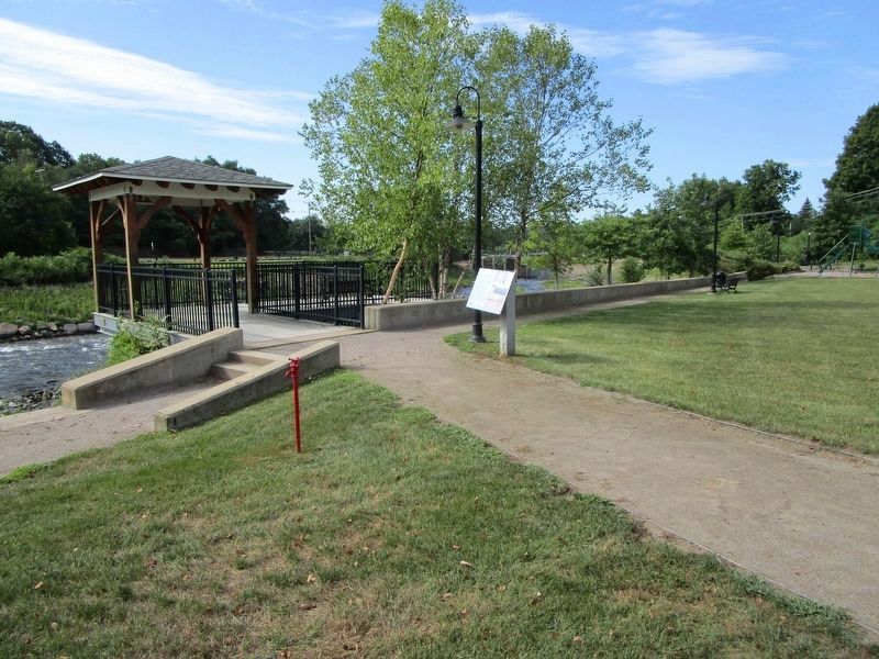
An Ancient Cycle Egg to Adult — Rivers to Ocean American shad, Atlantic salmon, river herring and other fish that migrate from the sea to freshwater to spawn are known as anadromous fish. Their story begins with a small egg — . . . — — Map (db m152184) HM
The waters of the Great North Woods have long been used for travel and transportation. Local bands of Wabanaki, "People of the Dawnland," traveled the Connecticut and Upper Ammonoosuc rivers in dugout, animal skin, and bark canoes. The rivers . . . — — Map (db m151931) HM
Lancaster, founded in 1763, lies on the bed of glacial Lake Coos, formed as the glaciers receded 14,000 years ago. Today, the Connecticut, an American Heritage River, flows along the bottom of the ancient lake.
You stand at a gateway to The . . . — — Map (db m75697) HM
The dramatic process of conveying lumber logs and pulpwood from northern New Hampshire forests to manufacturing centers, by driving them down the Connecticut River, spanned the turn into the Twentieth Century. Hardy crews of "white-water men" . . . — — Map (db m75601) HM
This quiet site once buzzed with activity as the center of Franconia's economy during the time of the Industrial Revolution.
A dam about 200 feet upstream provided water power for an iron smelter across the river and for grist, saw and . . . — — Map (db m116363) HM
Before the arrival of European settlers, the area that is now colburn park was part of a flat, pine-covered expanse formed by the ancient confluence of the Mascoma River and Mink Brook.
With the early settlement of the Town of Lebanon, John . . . — — Map (db m98080) HM
The Samuel Morey Memorial Bridge
erected 1937 by the States of New Hampshire and Vermont assisted by the federal government dedicated 1938.
Captain Samuel Morey, born 1762 died 1843, first successfully applied steam power to the navigation of . . . — — Map (db m155822) HM
This is the site of the longest continuous stream gaging in New Hampshire. Daily measurement of the level of the Pemigewasset River was begun here in 1886 by the Locks and Canals Company of Lowell, Massachusetts, which controlled flowage in the . . . — — Map (db m74576) HM
Baker River Known to Indians as Asquamchumauke, the nearby river was renamed for Lt. Thomas Baker (1682-1753) whose company of 34 scouts from North- ampton, Mass. passed down this valley in 1712. A few miles south his men destroyed a . . . — — Map (db m97232) HM
Samuel Blodgett began a canal to bypass the steep falls in 1793, with money provided by a lottery. The canal was finished in 1807. Mills then sprang up on both sides of the river below the falls. The world renowned Amoskeag Manufacturing Company . . . — — Map (db m64872) HM
The Nashua River, formed over 15,000 years ago by a glacial flow, is responsible for Nashua's rich industrial history, and is vital to Nashua's transportation, leisure, and community. It served as the town skating rink and annual July 4 Tub Race . . . — — Map (db m243819) HM
On this site in 1772 stood Aaron Quimby's tavern
where, on the morning of April 14th, Ebenezer
Mudgett and other men from Weare, incensed at their
impending arrest for cutting pine trees greater than
one foot in diameter, in violation of the . . . — — Map (db m230480) HM WM
Commodore United States Navy Born at Hopkinton New Hampshire October 20, 1835 Died at Boston Massachusetts October 28 1899 Entered the Navy as midshipman October 1, 1851 and served his country with honor forty eight years Genial and lovable as a . . . — — Map (db m76436) HM
Site of
First Ferry
Established by
Capt. Ebenezer Eastman
1727.
--------------
Tucker's Ferry
1785.
--------------
Federal Bridge
1798. — — Map (db m129801) HM
When Europeans settled in New England in the
1620s, the largest Native American tribal group
in the future state of New Hampshire used the
flat lands and bends of the Merrimack River in
present Concord for its central village. . . . — — Map (db m130005) HM
In Memoriam
U.S.S. Maine
Destroyed in Havana Harbor
February 15th 1898
This tablet is cast from metal recovered from the U.S.S. Maine — — Map (db m135887) WM
In February 1937, Hill residents learned that
their village, near the Pemigewasset River,
was to become a flood control reservoir for
the Franklin Falls dam project. By January of
1940, the citizens of Hill formed an association,
purchased . . . — — Map (db m139315) HM
The waters of Suncook River were harnessed in the 1730’s, eventually powering saw and grist mills, forge shops, and paper mills. The first cotton factory, owned by Major Caleb Stark, was built here in 1811. By 1900, Pembroke Mill, Webster Mill, . . . — — Map (db m115837) HM
Portsmouth Harbor was protected by underwater mine fields during both wars. During World War II, this protection was supplemented by an anti-submarine net which stretched across the mouth of the harbor from nearby Fort Stark to Fort Foster in . . . — — Map (db m135299) HM
Nearby Walbach Tower is one of several built along the Atlantic coast during the War of 1812.
Its builder, John de Barth Walbach, came to America from France in 1797. He joined the U.S. Army the following year and rose in rank from a . . . — — Map (db m135298) HM
From Colonial times through World War II to the present day, Fort Point has played a strategic role in the defense of our coastline.
Walbach Tower, built in 1814 during the War of 1812, was one of Fort Point's more interesting but mostly . . . — — Map (db m135300) HM
Site of
Bloody Point Ferry
Operated By
Thomas Trickey
1640 - 1675
Zachariah Trickey
1675 - 1705
John Knight
1705 - 1725
Continued for more than a century by
Capt. Howard Henderson, Sr.
Capt. Howard Henderson, Jr.
Thomas . . . — — Map (db m224510) HM
“This monument is dedicated to the 129 gallant men, military and civilian who went down with their ship off New England’s continental shelf on 10 April 1963”
( The names of the 129 men aboard follow. ) — — Map (db m149119) HM
Jim Sergeant enlisted in the US Navy on June 25, 1964. Following Boot Camp and internal Communications training, Jim served tours aboard the Naval Nuclear Power School, Vallejo, CA; Nuclear Power Training Unit, Schenectady, NY; and USS Tattnall . . . — — Map (db m186281) HM
Photo 1 The memorial bridge was constructed between 1920 and 1923 and demolished in 2012. It was the second bridge built across the fast and deep waters of Portsmouth Harbor. The 1923 bridge was the first vertical lift bridge constructed . . . — — Map (db m97036) HM
This memorial is dedicated to the 78 men who lost their lives serving their country on the submarine USS Capelin SS289 in the Celebes Sea in December 1943 — — Map (db m186259) WM
Between the late 1600s and the mid-1900s this part of the Piscataqua River waterfront played a significant role in the areas marine commerce and shipbuilding economy.
This is the site of the famous Portsmouth Pier.
Chartered in 1798, the 340-foot . . . — — Map (db m115997) HM
In recognition of the dedicated craftsmen of the Portsmouth Naval Shipyard who built and maintain the finest submarines in the world, the crews who sail them and the selfless volunteers whose untiring efforts contribute to the success of Albacore . . . — — Map (db m186282) WM
The Portsmouth Navy Yard was established in 1800 when the federal government perceived a need to expand the Navy in order to counter French privateer attacks against merchant shipping.
It has served varied functions over the years, first . . . — — Map (db m115967) HM
In 1833 a group of prominent Portsmouth merchants organized The Marine Railway Company and installed a set of tracks from the water to the brick machine house still standing near this site. When coupled with two horses, the machinery would, as the . . . — — Map (db m96681) HM
The revival of Portsmouth’s commerce after the American Revolution spurred the development of new roads, bridges, and wharves. In 1795, several leading merchants incorporated as the Proprietors of the Portsmouth Pier.
This private company . . . — — Map (db m116003) HM
The Wharves at Bow and Ceres Streets at the base of Spring Hill (as the site was called) were once bustling hubs of waterfront commerce. Built in the late eighteenth century, the waterfront wharves were most active during the Piscataqua region's . . . — — Map (db m115968) HM
U.S. Navy submarines paid heavily for their success in World War II. A total of 374 officers and 3131 men are on board these 52 U.S. submarines still on “patrol”.
We shall never forget that it was our submarines that held the . . . — — Map (db m149124) WM
On Rindge’s Wharf, Portsmouth,
May 21, 1776,
six weeks before
The Declaration of Independence,
there was launched
The Continental Frigate “Raleigh,”
the First
American Man-of-War
built on the Piscataqua,
keel laid . . . — — Map (db m115998) HM
U.S.S. O9 SS-70
June 20, 1941
Dedicated to the shipmates who lost their lives on the U.S. O9 SS-70 off the coast of Portsmouth, New Hampshire
The names of the 33 U.S. Navy submariners and 2 civilian workers aboard are inscribed. . . . — — Map (db m149123) HM
U.S.S. Squalus SS-192
May 23, 1939
Dedicated to the shipmates who lost their lives on the U.S. Squalus SS-192 off the coast of Portsmouth, New Hampshire
The names of the 22 U.S. Navy submariners and 2 civilian workers aboard are inscribed. . . . — — Map (db m149122) HM
The Bypass was part of a major New Deal project to move U.S. Route 1 traffic away from the congested streets of downtown Portsmouth. The Bypass created a second Piscataqua River crossing into Maine via the Interstate (Sarah M. Long) Bridge. The . . . — — Map (db m235619) HM
This memorial is dedicated to the 86 men who lost their lives serving their country on the submarine USS Albacore (SS-218) 7 November 1944
Barber, Walter H. Jr. •
Baumer, Kenneth R. •
Bigelow, Henry F. •
Blackmon, Edward B. • . . . — — Map (db m231301) WM
About six miles offshore, these nine rocky islands served Europeans as a fishing station before the first mainland settlements were made in 1623. Capt. John Smith (1580-1631) named the group "Smiths Isles" in 1614. The codfish that "shoaled" or . . . — — Map (db m165413) HM
Native American Dugout Canoe
The dugout canoe was made from giant white pines. They were burned hollow then scraped smooth using different kinds of shells gathered from the ocean. The outer part of the canoe was shaped being stone ratchets. . . . — — Map (db m160688) HM
Front Inscription Sp American Memorial
Seal with the following: Cuba Philippine Islands Porto Rico Spanish War Veterans 1898-1902
Right side inscription Privates, 46 names listed
Rear inscription Dedicated by the city of . . . — — Map (db m95560) HM WM
The monument commemorating the Civil War naval hero Admiral David Glasgow Farragut was Saint-Gaudens’ first public commission. It was begun in 1879 and unveiled in Madison Square Park, New York City in 1881, where it still stands.
Here in front . . . — — Map (db m100671) HM