1883 The Spring is Discovered The Healing Spring was discovered by Willie Barker, son of Mr. and Mrs. Eli Barker, according to well-accepted tradition. As the story goes, Willie was helping his father plow corn when his father sent him to the . . . — — Map (db m228778) HM
Colonial home of Colonel Robert Palmer, Surveyor-General of North Carolina 1753-1771 and Collector of Customs for the Port of Bath. Built c. 1744, probably by Michael Coutanche, it is one of the oldest surviving dwelling-houses in the State. . . . — — Map (db m66701) HM
1704-John Lawson surveyed 1st 71 lots in Bath.
1710-Thomas Harding, first recorded shipbuilder in Colony, contracted by Gov. Thomas Cary, to build sloop in Pamlico area.
1715-Harding named Town Commissioner & Vestryman. He owned Lots 27-28 at . . . — — Map (db m226318) HM
Though officially names Windmill Creek, waterway is better known by a name of African American man who lived by early Windmill. — — Map (db m226307) HM
The Original Washington
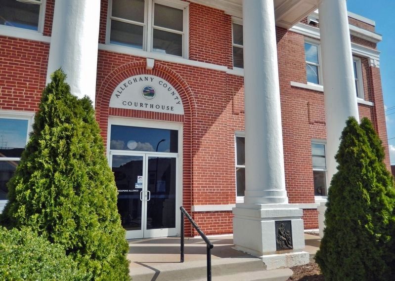
The history of Washington began around 1585 when English explorers first visited the area that would become Washington. The easily navigable waters and excess of natural resources made the area a very successful port . . . — — Map (db m226611) HM
To disrupt Confederate recruiting efforts here in Windsor, the Bertie County seat, three Federal transports steamed from Plymouth on the night of January 29, 1864, under U.S. Navy Lt. Cmdr. Charles W Flusser. USS Whitehead and USS . . . — — Map (db m60627) HM
Windsor's residents slept peacefully the night of January 29-30, 1864, unaware of what the morning would bring, as U.S. Navy Lt. Cmdr. Charles W. Flusser led three gunboats their way to disrupt Confederate recruiting efforts. USS Massasoit . . . — — Map (db m226118) HM
William Gray in 1776 set aside 100 acres at Gray’s Landing for establishing a town. 18th century travelers would have disembarked from sailing vessels docked at the foot of King Street at the old Gray’s Landing site. Visitors to Windsor today, . . . — — Map (db m60629) HM
The Confederate ironclad ram Albemarle, led by Capt. J.W. Cooke, crossed Batchelor's Bay, May 5, 1864, and fought seven Union warships 15 mi. E. — — Map (db m56990) HM
Early channel of trade, its valley long an area of plantations. Frequent floods until 1952; since controlled by Kerr Dam. Old name was "Moratuck". — — Map (db m67521) HM
Union ships chased the blockade runner Ella ashore on Bald Head Island as she tried to enter Old Inlet on December 3, 1864. Over the following two days, Confederate soldiers from Fort Holmes salvaged goods from the derelict vessel before she . . . — — Map (db m165876) HM
U.S.S. Peterhoff served on the Union blockade of the Cape Fear until it was accidentally run into and sunk by the U.S.S. Monticello on March 7, 1864 off bald Head Island’s East Beach. The Peterhoff’s remains are located about . . . — — Map (db m115693) HM
Dedicated to the memory of Catalino Tingzon, interred in Northwood Cemetery, and all Merchant Marine seamen and U.S. Navy Armed Guard on the tanker S.S.John D. Gill torpedoed and sunk off Cape Fear by the German submarine U-158 . . . — — Map (db m4950) HM
Erected during North Carolina’s Tercentenary to Mrs. Jessie Stevens Taylor, 1879–1961. She loved her God, Country and fellow man. She served here as a Voluntary Weather Observer and Storm Warning Display Woman from 1900 to 1961. — — Map (db m4752) HM
Barbadian planter turned pirate made North Carolina his base, 1718. Captured in naval battle few miles east. Hanged in Charleston. — — Map (db m101979) HM
Early in 1861, Buncombe County farmer William Riley Powers joined the Rough and Ready Guards (Co. F, 14th North Carolina Infantry). The regiment was assigned to southeastern Virginia. There, Confederate Gen. Benjamin Huger discharged Pvts. Powers . . . — — Map (db m75532) HM
Until electricity was introduced in the late 1880s, gas and kerosene lamps provided lighting in Public Square—now Pack Square. Horse-head fountains, fed from a reservoir on Beaucatcher Mountain, were affixed to lampposts at the east and west . . . — — Map (db m98364) HM
The French Broad River played a major role in this region’s early development. Initially called the “Broad River” by eighteenth-century French hunters and traders, it was later named the French Broad River. With headwaters on Pisgah . . . — — Map (db m58937) HM
The original dam on this lake, built in 1910, was made of wood. A gift in 1924 from Allen Graham of Greenville, South Carolina, and his mother Mrs. C. E. “Susan” Graham, was used to build the first stone and concrete dam. Mrs. Graham, her . . . — — Map (db m237198) HM
A patriot militia of about 1,500 men crossed this ford heading south on the morning of October 1, 1780. They were pursuing in enemy force led by Major Patrick Ferguson of the British Army. The men came from as far away as present-day eastern . . . — — Map (db m210355) HM
Colonel William Byrd II proposed digging a series of ditches and a channel through the Dismal Swamp in 1728. Construction began on the Dismal Swamp Canal in 1793, after the North Carolina and Virginia General Assemblies passed similar acts for . . . — — Map (db m165196) HM
Dismal Swamp Canal
c. 1805
Has Been Placed on The
National Register
of Historic Places
[Additional block to the right:]
National Historic
Civil Engineering Landmark
The Dismal Swamp Canal
Designated . . . — — Map (db m165189) HM
In order to promote safe navigation of shipping through Beaufort Inlet past numerous shoals and sand bars, the US Lighthouse Board established the Bogue Banks Lighthouse and a navigational beacon on the eastern end of Bogue Banks near Fort Macon . . . — — Map (db m77086) HM
Fort Macon Life-Saving Station
In 1903, the US War Department approved a request from the US Treasury Department to establish a US Life-Saving Service station on the Fort Macon Military Reservation. In 1904 a wood frame hip-roofed station . . . — — Map (db m77083) HM
In March 1862, Union Gen. John G. Parke’s brigade of Gen. Ambrose E. Burnside’ Coastal Division advanced from New Bern to capture Beaufort Harbor and Fort Macon. During March 22-26, Parke’s forces took possession of Carolina City, Morehead City . . . — — Map (db m77046) HM
Welcome to Hoop Pole Creek
Hoop Pole Creek is one of the last remaining natural refuges for fish, wildlife and plant life in Atlantic Beach, NC. This 31-acre property was purchased by the NC Coastal Federation in 1997 through a grant from . . . — — Map (db m77047) HM
(right panel)
Harbor Defenses of Beaufort Inlet, 1941-1944
When the United States entered World War II, the U.S. Army established the “Harbor Defenses of Beaufort Inlet.” Its purpose was to defend the entrance to Beaufort Inlet, . . . — — Map (db m225756) HM
Before the outbreak of the Civil War in 1861, local citizens formed the Beaufort Harbor Guards. These Confederate sympathizers, led by Capt. Josiah Pender, occupied Fort Mason when the sole guard, U.S. Army Ordnance Sgt. William Alexander, quietly . . . — — Map (db m77029) HM
Cape Lookout's diagonal checker patterned lighthouse was completed in 1859 with the best technology available. The double-walled brick construction was designed to support the 163-foot structure. The state-of-the-art Fresnel lens amplified the . . . — — Map (db m226114) HM
(front)
Resident of Beaufort and marine superintendent at Duke University Marine Laboratory, he led the successful search for the ironclad U.S.S. Monitor.
Progenitor of modern warships, the Monitor fought C.S.S. Virginia in the first . . . — — Map (db m213133) HM
The area around Beaufort and Morehead City long has been valued by marine biologists for its research potential. Army surgeons at Fort Macon in the 1870s published articles about marine life. In the 1880s The Johns Hopkins University for six summers . . . — — Map (db m77033) HM
In loving memory and recognition
Menhaden Fishermen Past — Present — Future
This is their livelihood, this is their life — they know the sea, can read God’s weather chart: sun, moon, and stars from memory. The compass points are there . . . — — Map (db m226093) HM
Beaufort, North Carolina, was involved in the Trans-Atlantic human trade and is a documented Middle Passage arrival site.
Enslaved people disembarked at or neat this exact location, now called Topsail Park. Records from 1769 show that one . . . — — Map (db m226078) HM
Launched on Jan. 30, 1862, at the Continental Iron Works in Greenpoint, N.Y., the USS Monitor made history as the Union Navy’s first ironclad warship. It fought the Confederate ironclad CSS Virginia in the first-ever clash between two . . . — — Map (db m213139) HM
The Olive Thurlow, a three-masted, 149-foot barkentine, was built in 1876. She was bound for New York City from Charleston with a load of yellow pine lumber in 1902. During a storm on December 5, she sank in Cape Lookout Bight near the . . . — — Map (db m76683) HM
An estuary is where water from rivers mixes with salt water from the ocean. The country’s second largest estuary is located here within North Carolina’s Back, Core, and Pamlico Sounds. Its water, nutrients, marsh grasses, and sunlight create a . . . — — Map (db m76720) HM
Welcome to the Harkers Island Visitor Center at Cape Lookout National Seashore
Spanning from Ocracoke Inlet to Beaufort Inlet, Cape Lookout National Seashore preserves 56 miles of undeveloped beaches, marsh, and soundside waters along the Outer . . . — — Map (db m76673) HM
Across the shallow waters of Core Sound and Back Sound a low string of islands appears to float on the horizon, barely above the waves. Those islands, along with their soundside marshes and surrounding waters, are the park—Cape Lookout . . . — — Map (db m76717) HM
The 1859 Cape Lookout Lighthouse warns ships about the dangerous Cape Lookout Shoals—sandbars that jut out over 10 miles into the ocean.
Replacing a short, 107-foot 1812 lighthouse, the new lighthouse has double walls. This design . . . — — Map (db m76685) HM
The Marshallberg Harbor was established under
the 1950 Harbor Act of the 8lst Congress and
completed by the Corps of Engineers in 1957.
The Harbor was built for the small boat owners
of MarshallIberg and transient boaters. Since
that time it . . . — — Map (db m189368) HM
Completed in 1932 from Norfolk to Wilmington via Beaufort-Morehead City. Sen. F.M. Simmons of New Bern and Rep. J.H. Small of Washington led effort. — — Map (db m77011) HM
Prelude: On February 8, 1862, Union General Ambrose E. Burnside captured Roanoke Island, key to the important Sound Region of Norteastern North Carolina. On February 10, Elizabeth City fell followed by strategic New Bern on March 14. . . . — — Map (db m31254) HM
Believe it or not, Portsmouth, the small, now-deserted village on this remote island, was once a bustling seaport. North Carolina's colonial legislature chartered Portsmouth in 1733 to serve coastal trade, and for more than two years it was one of . . . — — Map (db m177229) HM
The Middle Passage, part of a larger trade route known as the Triangular Trade, is the route which was used in the trafficking of captive Africans across the Atlantic Ocean to the Americas.
From the 16th to the 19th centuries, approximately 12 . . . — — Map (db m241337) HM
Barrels called Hogsheads were "prized," or filled, with tobacco or flour, rolled down to the Dan River and shipped on "Batteaux," which were flat-bottomed boats. Men who made hogsheads were called "Coopers."
This display is in honor of William . . . — — Map (db m171776) HM
Established 1775 by John Avent (ca.1740-1821). Vital to commerce and travelers crossing the Cape Fear River from Colonial times until 1926 when first bridge was built. — — Map (db m214360) HM
Carved and left by
ancient man in a soapstone
quarry near Nottely River,
4 miles west of Murphy.
Moved here for protection
and study. — — Map (db m99009) HM
The area known as Cannon’s Ferry is a long-standing community that has been shaped by the Chowan river. In 1794, Jacob Cannon of Perquimans County purchased for $126.00 in gold and silver “one-third part of the Land Plantation of Houses and . . . — — Map (db m60669) HM
The Chowan River has played an important role in North Carolina’s history and economy. It is part of the Albemarle-Pamlico Estuarine System (the second largest estuarine system in the United States) and is one of the smaller basins in North . . . — — Map (db m60665) HM
Cannon’s Ferry has a long tradition of herring fishing. Years ago this site had numerous fishing houses where individual fishermen would store their boat and gear and could process their catch.
In the mid 1940S, twelve local fishermen decided . . . — — Map (db m60666) HM
After Union Gen. Ambrose E. Burnside captured Roanoke Island in February 1862, U.S. Navy vessels patrolled the Chowan River from its mouth in North Carolina to Franklin, Virginia, located on the Blackwater River, a tributary. The Chowan River here . . . — — Map (db m231989) HM
The Roanoke River Lighthouse is the last remaining screw pile lighthouse in North Carolina. This type of structure was specifically designed for use in rivers and secured in place by a framework attached to a series of pilings that were screwed . . . — — Map (db m224499) HM
This slip/scoop scraper was used to build ponds in the early 1900s at the hatcheries previous site located a half mile east on the Albemarle sound. It was also variously called the "flip" or "slip" scraper because It was flipped to empty it and . . . — — Map (db m225215) HM
Hewes fought for independence in Continental Congress 1730: Joseph Hewes is born on Mayberry Hill, a 400-acre farm in Kingston, NJ. 1747: Attended Princeton, became a successful merchant in Philadelphia. He . . . — — Map (db m225283) HM
Originally constructed in 1886 by the US Lighthouse Service, the Lighthouse served as a navigational beacon to Mariners on the Albemarle Sound. The Light marked the entrance to the Roanoke River which was the main commercial passageway to the town . . . — — Map (db m34837) HM
The Sea Trading period brought fame and prosperity to Edenton and famous forefathers who saw promise here, chose to stay and, over time, became among our Nation's Leaders: Samuel Johnston (Age: 20, 1753), appointed to first Continental . . . — — Map (db m224497) HM
On March 13, 1862, Union Gen. Ambrose E. Burnside prepared to capture New Bern after seizing Roanoke Island in February. Confederate Gen. Lawrence O’B. Branch defended the city in a line of fortifications located several miles down the Neuse . . . — — Map (db m77003) HM
This cannon was taken from the Ship-of-war Lady Blessington, captured after a sharp engagement during the revolution by an armed privateer belonging to John Wright Stanley of New Bern. Marked by Richard Dobbs Spaight chapter D.A.R. — — Map (db m181639) HM
Located one block to the north, on the north side of Maiden Lane, Scotch Spring was owned by two prominent citizens, Robert Cochran and John Hay, and was a major water source for Fayetteville in the late eighteenth century. Throughout the nineteenth . . . — — Map (db m30998) HM
After the Battle of Elizabeth City and the destruction of the Confederate Mosquito Fleet in February 1862, the Confederates scuttled ships to block the North Carolina cut. The Federals had the same idea to stall Confederate traffic and sent five . . . — — Map (db m56979) HM
Due to its remote location on the Currituck Outer Banks, the Whalehead Club has been used in various ways for national defense. Shortly after Ray T. Adams purchased this property, the Japanese bombed Pearl Harbor (December 7, 1941) and the U.S. . . . — — Map (db m82188) HM
With its gracious proportions, unusual pink color, and sloping rooflines, the Corolla Island boathouse built by Edward Collings Knight Jr. and his wife complemented their main house.
Even more than the main house, the boathouse was the center . . . — — Map (db m10433) HM
Currituck Outer Bankers depended on the land and the water for their livelihoods. Besides waterfowl hunting and fishing, the Sound provided an important transportation route to and from the Currituck mainland and up and down the Banks. The first . . . — — Map (db m91802) HM
When Edward Collings Knight Jr. and his wife, Marie-Louise leBell, purchased this property in 1922, the Lighthouse Club, a hunting club, already existed on land just to the south. After the Knights completed a new private residence in 1925, they . . . — — Map (db m10437) HM
Restoration began in the fall of 1999, revealing wonderful insights into life in this isolated coastal village.
Upon raising the building to repair rotten sills, workers discovered ship timbers in the foundation that were salvaged from . . . — — Map (db m10434) HM
On December 1, 1875, the beacon of the Currituck Beach Lighthouse filled the remaining "dark spot" on the North Carolina coast between the Cape Henry light to the north and Bodie Island to the south. To distinguish the Currituck Beach Lighthouse . . . — — Map (db m114514) HM
A Working Lighthouse
On December 1, 1875 the beacon of the Currituck Beach Lighthouse filled the remaining "dark space" on the North Carolina coast between the Cape Henry Lighthouse to the north and Bodie Island Lighthouse to the . . . — — Map (db m114498) HM
The Whalehead Club has always been associated with wealth and leisure pursuits. When Edward Collings Knight Jr. and his wife, Marie-Louise LeBel, built their residence here in the 1920s, they made it as opulent as possible. The estate included the . . . — — Map (db m10687) HM
The Knights did not choose this location for their hunting retreat randomly. It sits on the Atlantic Flyway, a primary migratory route for waterfowl. Currituck, as in Currituck County, comes from the Native American work carotank or "land of the . . . — — Map (db m10719) HM
Here on June 10, 1863 twigs cracked and leaves rustled in the woods around you as escaped prisoners of war moved cautiously in the dusk. Earlier that day, the troop transport Maple Leaf had steamed away from Fort Monroe, Va., carrying 97 . . . — — Map (db m208580) HM
Currituck County played a vital role in a prisoner-of-war escape in 1863. At 1:30 P.M. on June 10, the troop-transport steamer Maple Leaf sailed from Fort Monroe, Va., for Fort Delaware, carrying 97 captured Confederate officers bound for the . . . — — Map (db m56981) HM
For many years before the war, Currituck Sound was a busy avenue of commerce sheltered from the Atlantic Ocean by the Outer Banks. Vessels carried produce and goods between North Carolina and Virginia. After hostilities began, the sound became . . . — — Map (db m56980) HM
Avon was first called Kinnakeet. The name was changed by the post office in 1883 but locals to this day call themselves Kinnakeeters. The name comes from its first settlers, the Algonquian Indians.
For most of its early existence, Kinnakeet was . . . — — Map (db m190966) HM
"Graveyard of Atlantic." German submarines sank over 100 ships here, 1941 - 42, in the "Battle of Torpedo Junction." Shoals are 3 mi. south. — — Map (db m11400) HM
268 entries matched your criteria. The first 100 are listed above. Next 100 ⊳