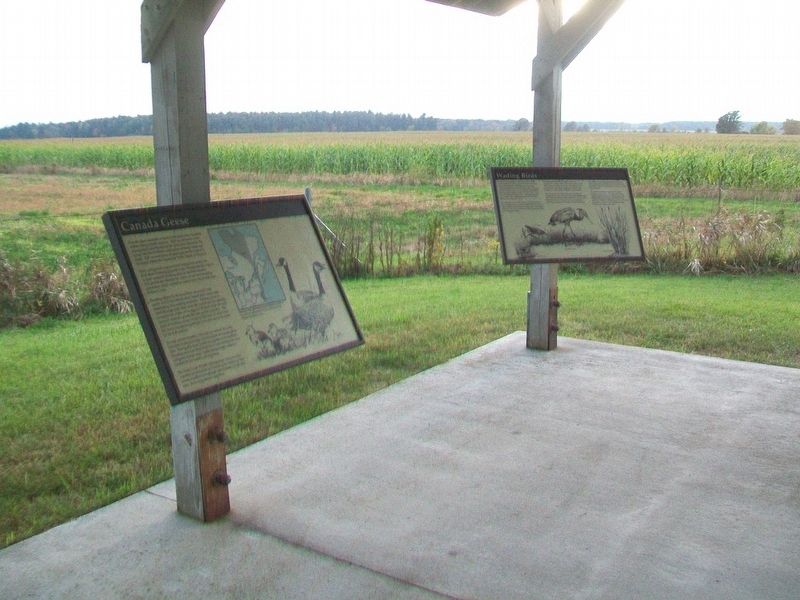
Canada geese assemble at Dead Creek from many locations within eastern North America. They are attracted to this management area because of the protection offered by the refuge and the excellent combination of forage fields and water. Fall . . . — — Map (db m109247)
Near this spot
on the shore of the lake was the
Northern Terminal of the
Crown Point Military Road
built by
Gen. Amherst, in 1759 — — Map (db m109079) HM
Snow geese are relatively new to the Dead Creek refuge, having begun to use the area as recently as 1981. Their numbers have continued to increase annually, and peak populations present here in mid-October exceed 20,000 birds.
Snow geese do not . . . — — Map (db m109245) HM
The Dead Creek Wildlife Management Area (WMA) was established in 1950 to provide breeding and migrational habitat for waterfowl. It is owned by the State of Vermont and managed by the Fish and Wildlife Department. Acquisition and development . . . — — Map (db m109246) HM
As the name implies, "wetlands" are wet areas characterized by soils that are permanently or seasonally saturated with water. They contain a variety of plants, shrubs and trees which have adapted to living in a wet environment. Wetlands are also . . . — — Map (db m109244) HM
Vermont is crossed by a complete system of ancient major routes from the Lake Champlain Valley to the Connecticut River Valley leading eventually to the sea. Paths were first made by migrating herds of animals searching for salt, and later by Native . . . — — Map (db m144471) HM
“ . . . the possession of every thing here depends upon keeping the Command of the Water.” - Maj. Gen. Horatio Gates, July 16, 1776 In front of you is Lake Champlain, at 120 miles long the sixth largest lake in the United . . . — — Map (db m19440) HM
John Larrabee established the first regular ferry here under a grant from the Vermont Legislature when the only business at the site was his tavern. In 1823, the year that the Champlain Canal opened, Larrabee and Samuel Holley built a store and a . . . — — Map (db m15580) HM
Intersection of Rivers and Roads
Imagine traveling hundreds of miles in an ox-drawn wagon along muddy, rock-strewn, deeply rutted roads through the wilderness. In search of new homesteads, early settlers followed the same routes you took to . . . — — Map (db m89157) HM
Victorious commander
of the American Fleet
in the naval battle of
Plattsburg
September 11, 1814
A Gallant Officer
An Exemplary Citizen
A National Hero
Memorial
erected to commemorate
the building by
Commodore Macdonough
of . . . — — Map (db m109195) HM
Below the Otter Creek Falls was the site of Thomas Macdonough's shipyard, where the U.S.S. Saratoga was built in 40 days and other ships launched that defeated the British at the Battle of Plattsburgh, 1814. — — Map (db m75977) HM WM
Jonathon Fenton established a pottery and kiln near this site in 1801. He first made redware from clay found along the banks of the Mettowee River. He then became the first potter in Vermont to make salt-glazed stoneware. In 1810 he moved his . . . — — Map (db m78224) HM
Here in June 1813, a Vermonter, Lieut. Churchill, and men built a parapet and set up a battery. On Aug. 3 a British gunboat and 2 sloops, 1½ miles offshore, began a cannonade. This attack was repulsed in 20 minutes by the American Battery and . . . — — Map (db m75582) HM
In July 1609, Samuel de Champlain became the first European to set eyes on Lake Champlain. Three hundred years later, in July of 1909, communities around Lake Champlain celebrated the tercentenial of Champlain's expedition. Burlington marked the . . . — — Map (db m91649) HM
In 1797, a city planned grid system was laid out for Burlington, incorporating the few transportation routes that existed, including King, Pearl, Church and Battery Streets. At the city’s center, space was reserved for a park (now City Hall Park) . . . — — Map (db m23580) HM
In 1808, the Federal government, reacting to unfair British policies, passed an Embargo Act, forbidding trade with Great Britain. The Champlain Valley relied on trade with British Canada and the Act was unpopular and significant smuggling . . . — — Map (db m98393) HM
Perkins Pier was named for Dr. Charles N. Perkins, a Burlington
physician for over 50 years. Dr. Perkins was born in Burlington
on May 25. 1880, and died in Burlington on June 15. 1959. Dr.
Perkins was a general practitioner, spending his entire . . . — — Map (db m178344) HM
If you were standing here 200 years ago, you'd be all wet. The natural shoreline ends about 500 feet behind you. Burlington's first dock was built here in 1810. Before that the waterfront consisted of raft logs tied to the shore. Cargo delivery was . . . — — Map (db m183081) HM
Honor and Tradition
Name Comm Decomm
USS Vermont (BB 20) 1907 1920
USS Plattsburg (SP 1645) 1918 1919
USS Converse (DD 291) 1920 1930
USS Dewey (DD 349) 1934 1945
USS Clark (DD 361) 1936 1945
USS Mayo (DD 422) 1940 1946 . . . — — Map (db m115267) HM WM
Imagine the year is 1870. You’re standing amongst acres of stacked, milled lumber that crowd the waterfront, destined for ports all over the world. Countless band saws screech and dust fills the air as mills and factories churn out their wooden . . . — — Map (db m176982) HM
Founder of New France. Dedicated July 2, 2009 in celebration of the 400th anniversary of his trip down the lake in the summer of 1609. Champlain College is forever grateful to Trustee Emeritus and friend John W. Heisse Jr., M.D. for commissioning . . . — — Map (db m87969)
Vermont Major Cross-State Route to the Connecticut River From this point, where the Winans launched their steamer "Vermont" in 1808, travelers drive eastward on Route US 2, cutting through the Green Mountain Range at Bolton to the Capitol at . . . — — Map (db m75561) HM
In 1849 an 11,000 year old Beluga Whale was found north of this site in what had been the Champlain Sea. Resident J.G. Thorp collected the bones, and naturalist Zadock Thompson assembled the skeleton now displayed in the Perkins Museum of Geology . . . — — Map (db m75963) HM
Named for Thomas Chittenden, first governor of Vermont and great-great grandfather of Frank Howe. Frank and his father Lucian rebuilt this mill in 1885 changing from grinding with millstones to the new gradual reduction roller process. Grain was . . . — — Map (db m97753) HM
These islands were first seen by a European in 1609, when Samuel De Champlain explored the Lake which bears his name and claimed them for the King of France. Ceded in 1763 to Britain, they became part of the Royal Colony of New York. After 1776, . . . — — Map (db m74516) HM
Huntington Gorge By 1802, John Preston had built a grist mill here at Richmond’s best water-power site. It was operated continuously for a century, last of all by the Robinson family. The Richmond Light and Power Co. converted the mill in 1903 . . . — — Map (db m86802) HM
History
The steamboat Ticonderoga is America's last remaining side paddlewheel passenger steamer with a vertical beam engine. Commissioned by the Champlain Transportation Company, the Ticonderoga was built in 1906 at the . . . — — Map (db m109149) HM
In testimony to the
courage and ability of
Robert Francis, Foreman
Donald Francis • Wayne Spear • Nathan Johnson
Clifford Francis • Forrest Emmons
This lighthouse was dismantled
on Colchester Reef, transported . . . — — Map (db m109472) HM
The Lighthouse was located a mile off Colchester Point in Lake Champlain, marking the location of three reefs: Colchester Reef, Colchester Shoals, and Hogback Reef. The building was designed in 1869 by Albert Dow, a Burlington, Vermont, resident, . . . — — Map (db m109444) HM
Preservation of the Colchester Reef Lighthouse for future generations was made possible by a gift from Frederick A. McCarthy in loving memory of his mother Myrtle Button who was born in the Lighthouse in 1888 — — Map (db m109471) HM
The Sawmill building houses the Trescott-Shepard sawmill originally located in South Royalton, Vermont. The water-powered mill was built in the late 1700s on Mill Brook by Jeremiah Trescott and his partner, Captain Stevens. Trescott's descendants, . . . — — Map (db m109483) HM
1906•Shelburne, Vermont•Original owner: Champlain Transportation Company •Moved to museum: 1955 The 220-foot Ticonderoga is America's last remaining walking beam side-wheel passenger steamer, and a National Historic Landmark. Serving a . . . — — Map (db m97385) HM
Called from his Gilman parish to serve as a Chaplain in World War II, First Lieutenant Fox died when the Dorchester was torpedoed in the North Atlantic. Giving his life jacket to a soldier, he perished with three other chaplains, in one of the most . . . — — Map (db m77604) HM
Only Town in the World so Named Chartered 1761 • Settled 1764 Capt. Peter Powers discovered Guildhall Falls in 1754 Frontier during French & Indian War Col. Ward Bailey built first blockhouse First wing dam built on Connecticut River Seat of . . . — — Map (db m151899) HM
Pioneer Railroad Planner John A. Poor’s dream of an International Railway connecting Montreal, Canada with the Ice-free harbor of Portland, Maine became a reality on July 18, 1853, when the first through trains met at this great halfway point on . . . — — Map (db m75118) HM
When the Champlain Canal was
completed in 1823 and shipping to
the south opened up a huge market
to the West, St. Albans merchants
benefited from the boom. Canal
boats sailed south up the Lake to
Whitehall, and once the sails . . . — — Map (db m140057) HM
These islands were first seen by a European in 1609, when Samuel de Champlain explored the Lake which bears his name and claimed them for the King of France. Ceded in 1763 to Britain, they became part of the Royal Colony of New York. After 1776, . . . — — Map (db m75482) HM
From here, "The Chazy Landing Ferry," completed the major automobile route across northern Lake Champlain from Isle La Motte, VT, to Chazy Landing, NY, before the Rouses Point-Alburgh bridge was built. In 1905 Will Sweet designed, built, owned, and . . . — — Map (db m74718) HM
James Wilson, a Bradford farmer and self-taught engraver, in early 1800’s made and sold the first geographical globes in the U.S. Adm. Chas. Clark, born here in 1843, was Captain of the “Oregon”, which sailed around the Cape Horn to . . . — — Map (db m65832) HM
Samuel Morey, resident of Orford and later Fairlee, successfully operated a steamboat on the Conn. River in 1793. Making over 4000 experiments, this early scientist patented an internal combustion engine in 1826 to anticipate the age of the motor . . . — — Map (db m32118) HM
Strafford was granted its charter on August 12, 1761. Land near here was chosen for the town's first settlement by its earliest pioneers, Ezekiel Parish and Frederick Smith. Both men with their families established homesteads in this vicinity by . . . — — Map (db m107647) HM
The Clyde River and its wetlands are one or the most diverse ecosystems in the Northeast. The bog sedge-dominated landscape is classified as an intermediate fen, a globally rare natural community.
The Clyde River was a major Native American . . . — — Map (db m221722) HM
On this site, on June 6, 1810 settlers dug an outlet to the north from what was then known as Long Pond. The retaining bank collapsed, causing all water from the 1.5-mile long pond to be discharged toward Barton River, and on to Lake Memphremagog, . . . — — Map (db m75120) HM
Newport was first organized as a town on October 25, 1781, though its charter was not issued until October 30, 1802, when it was granted to Nathan Fish and George Duncan under the name Duncansboro. It was not until November 16, 1816 when a small . . . — — Map (db m122741) HM
[Front]
For thousands of years, the waterways of the Northeast Kingdom provided the best travel routes across the rugged landscape. Lake Memphremagog is a hub which connects the northeast's major waterways: Lake Champlain to the west, the St. . . . — — Map (db m122629) HM
For both the original Native Americans and the earliest settlers, Lake Memphremagog was important for transportation and portage, but it also would develop an illustrious history as a tourist destination. Once fronted by the grand Memphremagog . . . — — Map (db m122683) HM
The last of a dozen mills that dotted Mill River during the 18th & 19th century. Kingsley Grist Mill stands just upstream of the 1870 Town lattice truss covered bridge.
Kingsley's Mill, the only mill ever designed and built by nationally known . . . — — Map (db m74431) HM
A sawmill was built in 1798 by Pittsford's Woodruff family about 275 feet to the north on Sugar Hollow Brook, a Furnace Brook tributary. The mill was replaced and a dam built c.1870 by the Norse family. An ice house was added, with ice cut from the . . . — — Map (db m97284) HM
Otter Creek was a passageway for Native Americans traveling across what is now Vermont from the Connecticut River to Lake Champlain. They called the falls here “The Great Falls” which at 123’ are the highest in Vermont. John Sutherland, . . . — — Map (db m77971) HM
The Village of Bellows Falls, within the Town of Rockingham, has served as a river and overland crossroad for commerce and travel by foot, stagecoach, riverboat, train, truck and automobile.
With wood, brick, iron, steel, and stone, . . . — — Map (db m65789) HM
At 140 years old, Creamery Bridge is a local treasure both for its history and aesthetics. Brattleboro Recreation & Parks Department is tasked with stewarding the structure and the site (a ask greatly supported by volunteers as well!). Since . . . — — Map (db m230513) HM
At 140 years old, Creamery Bridge is a local treasure both for its history and aesthetics. Brattleboro Recreation & Parks Department is tasked with stewarding the structure and the site (a ask greatly supported by volunteers as well!). Since . . . — — Map (db m230514) HM
This lakeside meadow was a 1777 campground for Rindge NH troops en route to Mount Independence and Fort Ticonderoga to fight Burgoyne's invading British army. The 1776 Crown Point Road linking Fort No. 4 on the Connecticut River to Lake Champlain . . . — — Map (db m78159) HM
In 1826 gold nuggets were first discovered in Newfane and Somerset, Vt. In 1851, ‘49er Matthew Kennedy discovered gold in Buffalo Brook at Plymouth. By 1855, a “gold rush” was underway here and in Bridgewater, Vt. Prospectors staked . . . — — Map (db m78161) HM
Salmond Bridge was built by James F. Tasker c1880. This 54' multiple king post structure spanned the Black River near Stoughton Pond and was named after the Salmond family living near the bridge. It remained in this area until 1959, when it was . . . — — Map (db m73918) HM