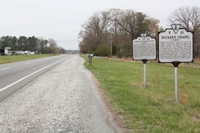
Near here lived Anthony and Benjamin Rucker,
inventors of the James River batteau, which
superseded the double dugout canoe and rolling
road for transporting tobacco hogsheads. These
long (about 50 or 60 feet), double-ended vessels
dominated . . . — — Map (db m46342) HM
The Amherst County Bateau
Anthony Rucker of Amherst County invented the James River bateau, which was patented in 1821. Thomas Jefferson described one of Rucker's boats as 50 feet long by 6 feet wide with a 13.5-inch draft. a bateau could . . . — — Map (db m179522) HM
A Lock Canal
When a river was too swift or shallow for navigation, shippers used canals with lift locks. The canals paralleled the river, using it as a water source.
(image)
(not to scale) river surface, canal and lock sites. . . . — — Map (db m137538) HM
This lift lock, built in 1848, is 15 feet wide, 21 feet deep top to bottom, and 100 feet between gates. It lowered or lifted boats 13 feet allowing them passage to and from the river. The bottom is covered with original pine planking and walls are . . . — — Map (db m137528) HM
Canal Water was obtained from a dam on the James River six miles upstream. Battery Creek (under the present railroad bridge) did not flow into the canal as is does today. Since it is now the only water source for the restored lock, the water level . . . — — Map (db m137536) HM
These handles open or closed sluice gates which admitted water to lock.
When water level was equalled on both sides of gates they were opened by pushing on lever arms.
Gates closed at an angle pointing upstream so water pressure sealed . . . — — Map (db m137539) HM
The James River flows through the mountains at this location, creating a water gap in the Blue Ridge. This type of formation is characteristic of Appalachian geography. The Blue Ridge forms the eastern wall of the Appalachian Mountain system from . . . — — Map (db m161498) HM
This home incorporates the original log house built about 1800 by William Carlin. It is one of the earliest structures remaining in Arlington. At one time, Carlin had been a tailor in Alexandria whose clients included George Washington. Mr. Carlin’s . . . — — Map (db m56352) HM
Four Mile Run winds through local history–and has been dramatically altered by human impacts.
1. For the region's first inhabitants, the Chesapeake Bay and its tributaries provided transportation and an annual harvest of migratory . . . — — Map (db m151025) HM
"Before us is the broad and beautiful river, separating two of the original thirteen States, which a late President [Andrew Jackson]... desired to span with arches of ever-enduring granite, symbolical of the firmly established union . . . — — Map (db m142186) HM
To the Brave Hearts Who gave their lives, May we all know the peace For which they died. Dedicated by No Greater Love, February 28, 1992. — — Map (db m12331) WM
Northwest faceCoast Guard Emblem
Semper Paratus - 1790
United States Coast Guard
World War
Northeast face
Officers and Men U.S. Coast Guard Cutter Tampa Sunk by enemy submarine in Bristol Channel . . . — — Map (db m15386) WM
This living memorial has been
placed in honor of all officers,
sailors and marines who served
aboard the Heavy Cruiser
U.S.S. Salem
Flagship of the U.S. Sixth Fleet
1949-1959 — — Map (db m137232) WM
To the memory of all sailors who served aboard the destroyer
USS Frank E. Evans DD 754
"May we never forget the ship
the crews who proudly sailed her
and those who paid the ultimate price
while serving their country"
"Lest . . . — — Map (db m137231) WM
Herein rest those who lost their lives in the sinking of USS Serpens World War II January 29, 1945.
Edwin A Ables EM2 USCGR
• John C Aiken III LT USCGR
• Roy G Anderson PHM2 USCGR
• Edwin F Antkowiak COX USCGR
• Lawrence L Arndt CPL . . . — — Map (db m24123) HM
The Clarendon Elementary School was built in 1910 to serve the growing Clarendon neighborhood. The two-story symmetrical building was designed with a central hall and four classrooms on each floor. The school was renamed in 1925 to honor Matthew . . . — — Map (db m49434) HM
Glenmore was built c.1906 as a summer and weekend retreat for the William F. Roberts family. It was designed by Washington, D.C. architect Appleton P. Clark. The original log construction and wood shingles have since been covered with stucco. The . . . — — Map (db m134966) HM
Virginians voted overwhelmingly for secession form the Union on May 23, 1861. Overnight, Union Army troops stationed in Washington, D.C., moved to occupy what is now Arlington County. The main body of the troops crossed the Potomac River via the . . . — — Map (db m134982) HM
Near this point the Alexandria Canal crossed Four Mile Run, connecting Alexandria docks and railyards to Georgetown and western Maryland from 1843 to 1886. To the east were the turnpike and railroad. In 1896 the Washington, Alexandria and Mount . . . — — Map (db m22469) HM
Rendering of organizational insignia 1942 · We Led The Way · 1945 In memory of our fallen comrades who sacrified their lives in the service of their country while serving in the United States Navy and Army Amphibious Scouts and Raiders . . . — — Map (db m15183) WM
Through the dark of night, an enslaved worker named Jim Parks could see the Union Army advancing. "Like bees-a-coming," 14,000 troops moved across the Potomac River. They captured Arlington House on May 24, 1861. The Union Army occupied this key . . . — — Map (db m204419) HM
In honor of the men of the Army 1st Engineer Special Brigade, 4th Infantry Division, VII Corps Headquarters, and Navy 11th Amphibious Force Convoy T-4, who suffered and perished on April 28, 1944. While conducting “Exercise Tiger” at Slapton Sands, . . . — — Map (db m36655) WM
Original marker: The officers and crew attached to the U. S. Steamer Lancaster, Flag Officer J. B. Montgomery, on her first cruise in these seas, erect this monument in memory of shipmates who died and are buried here.
Bronze . . . — — Map (db m100123) WM
The United States Battleship MAINE exploded and sank in Havana Harbor, Cuba on February 15, 1898. The rallying cry, "Remember the MAINE" swept the nation, inciting public opinion and precipitating the Spanish-American War. In March, . . . — — Map (db m10977) HM
In memory of our fallen comrades who sacrificed their lives in the service of their country while serving in the United States Navy with Naval combat demolition units and underwater demolition teams during World War II. — — Map (db m93172) WM
These trees are dedicated to the men and women serving their country on the island of Oahu, Territory of Hawaii on December 7th, 1941
Remember Pearl Harbor — — Map (db m137208) WM
In memory of all U.S. Sailors, Coast Guardsmen and Marines of African and Asian-Pacific Descent who honorably served officers as cooks, stewards and messmen on U.S. Navy ships and bases and who valiantly manned battle stations during World War II . . . — — Map (db m70767) WM
In memory of those who sacrificed their lives on the
USS Underhill (DE-682)
Sunk: July 24, 1945 -- 112 crewmen lost
Dedicated: July 24, 1997 by
Shipmates, Family and Friends — — Map (db m137958) WM
Roaches Run Waterfowl Sanctuary, a nature preserve that hosts many species of migratory birds, included a designed recreational road pull-off parking area intended as a feature of the Mount Vernon Memorial Highway, the original portion of the . . . — — Map (db m156767) HM
This wall is a reminder of racial segregation in the historically African American community of Hall's Hill. During construction of the Woodlawn Village subdivision in the 1930s, a wall of various materials and heights was built here to separate . . . — — Map (db m157671) HM
The oldest trees in this forest probably began growing around 1865. Before that time, most of the trees along Arlington's Palisades were cut down to establish a clear line of sight for the Civil War fortifications surrounding Washington. The most . . . — — Map (db m186870) HM
This natural spring was referred to as the "Indian Spring" by local farmers in the early 1900's who found arrowheads and other artifacts left behind by the land's former occupants.
Today, many springs in Arlington have gone dry as the . . . — — Map (db m197944) HM
[Left panel:]
Four Mile Run and Flooding
The population of the neighborhoods near Four Mile Run grew extensively in the 1940s and 1950s, following World War II. Many new buildings and roads were constructed covering more . . . — — Map (db m147126) HM
Fort C.F. Smith was constructed in 1863 on farmland appropriated from William Jewell. The fort was named in honor of Gen. Charles Ferguson Smith, who was instrumental in the Union victory at Fort Donelson, Tennessee in 1862. The fortification was . . . — — Map (db m5101) HM
Fort C.F. Smith was constructed in 1863 on farmland appropriated from William Jewell. The fort was named in honor of Gen. Charles F. Smith, who was instrumental in the Union victory at Fort Donelson, Tennessee, in 1862. Fort Smith extended the . . . — — Map (db m175256) HM
This waterwheel is known as an overshoot wheel. It is driven by the buckets at the top of the wheel.
Manufactured by the Fitz Waterwheel Co. Hanover Pa. — — Map (db m172841) HM
There has been a mill on this site continuously since 1771. The present mill building was erected in 1900 and now is the home of the Waterwheel Restaurant. — — Map (db m172842) HM
The 6th Engineer Special Brigade (ESB) was formed in January of 1944 from the 1116th Engineer Combat Group (147th, 149th, and 203rd Engineer Combat Battalions). Colonel Paul Thompson assumed command of the 10,000-man unit soon thereafter. The . . . — — Map (db m240793) HM WM
The first resident landscape architect and planner of the Blue Ridge Parkway. It was his vision, imagination, and creative talents in the Parkway's formative stages that made the Blue Ridge Parkway unique. — — Map (db m9743) HM
Most of the 1,100 officers and men of the Royal Australian Volunteer Naval Reserve who took part in Operation Neptune on D-Day did so aboard British ships. Some also served as commanders of one of several landing flotillas or motor torpedo boats. . . . — — Map (db m240076) HM WM
The Belgian Section of the Royal Air Force was
officially recognized as a Belgian Force on June 4, 1942. On D-Day, some two years later, Belgium's 350th Squadron took part in the aerial defense of both Gold and Sword Beaches. In the hours . . . — — Map (db m240072) HM WM
20 January 1883 ~ 2 January 1945
Naval Commander, in Chief of the Allied Naval Expeditionary Force
Entering the Royal Navy from Colchester Royal Grammar School in 1898, Bertram Ramsay rose to midshipman a year later. His first . . . — — Map (db m240289) WM
On D-Day 15,000 troops in Canada's 3rd Infantry
Division landed on Juno Beach under the operational control of the British 1st Corps. The Royal Canadian Air Force committed 39 strategic and tactical squadrons on D-Day, flying 230 sorties of the . . . — — Map (db m240071) HM WM
In February 1944, soon after the arrival of Generals Eisenhower and Montgomery in England to lead Operation Overlord, planning for the D-Day invasion accelerated and expanded. To the three Norman beaches already selected as invasion sites, they . . . — — Map (db m240329) HM WM
The four chaplains giving the National D-Day Memorial field chapel its name were among 4 soldiers, merchant seamen, naval armed guard, coast guardsmen, and civilian workers embarked for Greenland aboard USAT Dorchester . At 0100 hours on 3 . . . — — Map (db m241069) HM WM
Officially organized on 10 December 1917 at Camp Greene, North Carolina, the Fourth Infantry Division was constituted from Regular Army units. The Ivy Division joined the Allied Expeditionary Force and served with distinction in five World War I . . . — — Map (db m240777) HM WM
Limiting its naval and military commitment primarily to the Balkans and Mediterranean, Greece nevertheless did deploy two Royal Hellenic Navy corvettes for Operation Neptune. Those vessels escorted convoys to Juno, Gold, and Sword Beaches. As was . . . — — Map (db m240018) HM WM
Following the disastrous raid at Dieppe on the French coast in August 1942, Allied commanders realized that while a port would be essential to any invasion of occupied France, it need not necessarily be wrested from enemy hands. Instead, the idea of . . . — — Map (db m241116) HM WM
The modest Dutch military force that escaped to England when the Netherlands fell did not participate in Operation Overlord. A cruiser, HMNS Sumatra, and two gunboats did represent the Dutch Navy in Operation Neptune. The two gunboats fired . . . — — Map (db m240038) HM WM
>br>About 30,000 members of the Royal New Zealand Air Force were in Operation Overlord. Squadrons of New Zealand's fighters and bombers flew in every phase, the former performing with particular efficacy above Omaha Beach on D-Day. Some 4,000 . . . — — Map (db m240047) HM WM
Ten warships of the Royal Norwegian Navy in exile took part in Operation Neptune. The Svenner! a brand new destroyer, was struck midship by a German torpedo at H-1 and went down in a quarter-hour. The Norwegian Merchant Navy also committed . . . — — Map (db m240052) HM WM
Mindful of Germany's September 1, 1939
invasion of Poland, the government-in-exile was eager for its forces to participate in D-Day. Polish ground troops did not deploy until later, but the Polish Wing of the 84th Royal Air Force Group and a Polish . . . — — Map (db m240057) HM WM
Commissioned at Camp Bradford, Virginia, in late March of 1943 under Commander John F. Curtin, the 2nd Naval Beach Battalion (NBB) was the most seasoned of the three NBBs to participate in the D-Day assault on Normandy. The 2nd NBB, along with the . . . — — Map (db m240769) HM WM
Commissioned on 5 October 1943 at Camp Bradford, Virginia, under Commander L. C. Leever, the 7th Naval Beach Battalion (NBB) was later filled with unassigned sailors and men drawn from the 1st, 2nd, 3rd, and 6th NBBs. At full strength, NBBs . . . — — Map (db m240855) WM
Commissioned on 9 October 1943 at Camp Bradford, Virginia, under Commander Eugene C. Carusi, USNR, the 6th Naval Beach Battalion (NBB) moved to Fort Pierce, Florida, for amphibious-warfare training. On D-Day, the 6th NBB would number about 400 . . . — — Map (db m241610) HM WM
On D-Day the US First Army comprising two
corps (five divisions with auxiliary units and services - about 73,000 troops) landed on and around Omaha Beach, Utah Beach, and the
Cotentin Peninsula. The US provided 16.5 percent of the Allied warships . . . — — Map (db m240078) HM WM
Little recognized in popular histories of the Second World War, the U.S. Navy Armed Guard (USNAG) and U.S. Merchant Marine (USMM) played a central role in transporting the personnel and material the Allies needed to achieve victory. In the process . . . — — Map (db m241168) HM WM
Facing a shortage of men to build additional ships and create new bases and facilities in the wake of the 7 December 1941 bombing of Pearl Harbor, the Secretary of the Navy petitioned the U.S. Congress in January 1942, to establish a women’s . . . — — Map (db m241200) HM WM
On D-Day the British Second Army composed of two corps (including three British divisions with auxiliary units and services - some 62,000 Britons) landed on and around Gold Beach, Sword Beach, and along the Orne River toward Caen. The UK provided . . . — — Map (db m240058) HM WM
In our public memory of D-Day, the role of the United States Coast Guard too often goes unremarked. While Coast Guardsmen served in smaller numbers than their counterparts in the Army, Navy and Merchant Marine, their service was a vital ingredient . . . — — Map (db m241206) HM WM
The United States Naval Academy was established in 1845 at Annapolis, Maryland. Its mission is to develop midshipmen morally, mentally, and physically, and to imbue them with the highest ideals of duty, honor, and loyalty, and to provide the nation . . . — — Map (db m242249) HM WM
One of three American battleships in Operation Neptune, USS Arkansas was the oldest battleship in the U.S. Navy. She was laid down at Camden, New Jersey, on 25 January 1910, launched on 14 January 1911, and commissioned on 17 September . . . — — Map (db m241073) HM WM
USS Augusta, CA-31
“Augie Maru”
Awarded Three Battle Stars for World War II Service
Laid down on 2 July 1928, USS Augusta launched on 1 February 1930. Commissioned at the Norfolk Navy Yard on 30 January 1931, Augusta . . . — — Map (db m241119) HM WM
The British evacuation from Dunkirk, France, in 1940 made clear the need for ocean-going vessels capable of loading and landing large quantities of troops, cargo, and vehicles on an unimproved shore. The British Admiralty got busy and began design . . . — — Map (db m241161) HM WM
Laid down on 4 November 1912 by the Fore River Shipbuilding Company at Quincy, Massachusetts, USS Nevada launched on 11 July 1914. With Capt William S. Sims in command, Nevada commissioned on 11 March 1916, joined the Atlantic . . . — — Map (db m241101) HM WM
Named for LTJG Ralph McMaster Rich, posthumous recipient of the Navy Cross for "capable and aggressive leadership" during the Battle of Midway, USS Rich was laid down on 27 March 1943 at the Defoe Shipbuilding Company in Bay City, Michigan. . . . — — Map (db m241110) HM WM
The second battleship to bear the name, USS Texas was laid down at Newport News, Virginia, on 17 April 1911, launched on 18 May 1912, and commissioned on 12 March 1914, with Captain Albert W. Grant commanding. Without benefit of a shakedown . . . — — Map (db m241084) HM WM
Mr. W.E. Stevens was a man of soil. He and his wife maintained a farm six miles outside the City of Bedford, Virginia. After the United States entered the Second World War, the government soon revived the World War I practice of victory gardening. . . . — — Map (db m243621) WM
When George Washington stood here in 1772, he sought a way to open a water route to the West. Traveling over the region’s most rugged mountains was time consuming and dangerous. New settlers needed a more efficient way to transport goods like . . . — — Map (db m95959) HM
The James River flows from the mountains through Lynchburg and Richmond to the coast. It is the largest river in Virginia and, historically, one of the state’s most important transportation corridors. Before the Civil War, investors built a canal . . . — — Map (db m95958) HM
Appalachian Power Company constructed Smith
Mountain and Leesville Dams between 1960 and
1963 to generate hydroelectric energy. The waters
of the Roanoke and Blackwater Rivers formed Smith
Mountain Lake, one of two resulting reservoirs,
which . . . — — Map (db m104439) HM
The Great Valley Road, which carried many settlers of European descent through Virginia beginning in the 1740s, crossed the James River nearby. This intersection gave rise to Pattonsburg, established north of the river in 1788 and named for early . . . — — Map (db m233096) HM
The town was established in 1811 and named for Colonel John Buchanan, pioneer and soldier. It was incorporated in 1833. Its importance consisted in its being the western terminus of the James River and Kanawha Canal, which reached the town in 1851. . . . — — Map (db m23810) HM
Buchanan, Virginia is the western terminus of the James River & Kanawha Canal. Considered one of Virginia’s most remarkable engineering feats ever attempted, the Canal’s beginnings stretch back to 1785, when George Washington appeared before the . . . — — Map (db m55794) HM
Looney's Ferry, established in 1742, was the first crossing over James River in this region. On the other side of the river was Cherry Tree Bottom, home of Colonel John Buchanan, and above the mouth of this creek stood Fort Fauquier, 1758-1763. — — Map (db m23823) HM
A branch of the Nottoway, named for the huge fish once caught in it. William Byrd, returning from the expedition to survey the Virginia-North Carolina boundary line, camped on this stream in November, 1729. — — Map (db m62406) HM
Did you know… A raindrop falling in the Meherrin River Watershed will travel over 200 miles before reaching the Atlantic?!
Watersheds are the collective web of tributaries and surrounding land draining to a common waterbody, such as a major . . . — — Map (db m94364) HM
Here was Moomaw’s Landing, on the North River Canal. In May 1863 the packet Marshall passed here bearing the body of General Thomas J. (“Stonewall”) Jackson to Lexington. Mrs. Robert E. Lee used the canal in 1865 to join her husband at . . . — — Map (db m50374) HM
The town was established in 1744 and was one of the principal shipping points on the Rappahannock River in colonial times. In December, 1862, Burnside, commanding the Army of the Potomac, considered crossing the river here but finally moved up to . . . — — Map (db m21457) HM
This site represents an important part of the heritage and development of Caroline County. After the chartering of the town of Port Royal in 1744, this excellent harbor served the large tobacco trade between local plantations and London. A warehouse . . . — — Map (db m22248) HM
Based on artifacts excavated in and around Port Royal, archaeologists estimate that the area was inhabited as early as 11,000 years ago. At the time the English arrived, the area was occupied by tribes united in a confederacy ruled by Powhatan. The . . . — — Map (db m57545) HM
"Forged by mountains, river and America's desire for progress, the 57-mile New River Trail State Park provides you unparalleled opportunities for physical, intellectual and spiritual adventures."
(left panel)
Sustaining a Credible Illusion
The Jamestown settlement was facing a severe food shortage in November of 1607. Captain John
Smith set out to trade for corn with the Indians living along this river. He traveled from . . . — — Map (db m46511) HM
In mid-June 1864, Grant abandoned his works at Cold Harbor and marched to Petersburg, a vital rail center. A mile south of here, at Wilcox Wharf (now Lawrence Lewis Jr. Park), steamboats ferried the troops and wagons of two corps across the James . . . — — Map (db m9407) HM
The Herring Creek area was settled in 1619, as a portion of Westover, and a portion of Berkeley Hundred. The point where the James River Road, present-day Route 5, crossed Herring Creek was known as "The Wade." Landmarks have included Harrison's . . . — — Map (db m9288) HM
Lane to Site of First Thanksgiving in America. First whiskey distillery 1621. One of the first ship yards in the New World. 18 gun man of war was constructed here for the Revolutionary War. Lincoln landed here in 1862 to confer with General . . . — — Map (db m175925) HM
This area was settled before 1622 by George Shinehow. Tobacco warehouses and docks were located at Swineyards and Willcox Wharf. A post office was established at Swineyards in 1848 and later located at Willcox Wharf. Landmarks have included Bethany . . . — — Map (db m9405) HM
Westover Plantation was established in 1619, part of the rapid agricultural expansion that followed several years of mere subsistence for the English at Jamestown. Often, the English co-opted fields already cleared by Natives for farming or as . . . — — Map (db m30228) HM
On 22 June 1864, more than 5,000 Union cavalrymen under Brig. Gens. James Wilson and August Kautz left Petersburg, newly under siege, to cut Confederate supply lines. Moving along the South Side and Richmond & Danville Railroads, they tore up track . . . — — Map (db m182492) HM
This is the Deep Creek Lock of the Dismal Swamp Canal, the northern end of the waterway linking the North Carolina sounds with Hampton Roads and the Chesapeake Bay. Deep Creek village evolved on the canal to serve workers, boatmen, and the . . . — — Map (db m165286) HM
1600s: Woodlands, Marshes and the Great Bridge
The rich forests and fields south of the Elizabeth River and in northeastern North Carolina gave the early settlers in the late 1600s bountiful yields of shingles, naval stores, lumber, grain . . . — — Map (db m211244) HM
This 7,900-pound anchor was manufactured in 1861 by the Naval Yard Foundry in Washington, D.C., and most likely belonged to the USS Hartford, a Union warship immortalized at the Battle of Mobile Bay on August 5, 1864, when Admiral David Glasgow . . . — — Map (db m54957) HM
Marshall Parks, Sr.
1786-1840
The Dismal Swamp Canal, located about six miles west of here, officially opened in 1805. Dug completely by hand, its shallow depth limited navigation to flat boats and lighters manually poled or towed from . . . — — Map (db m54956) HM
The Canal Becomes a Federal Government Waterway
Competition from the railways and the re-structured Dismal Swamp Canal Company signaled the downfall of the Albemarle and Chesapeake Canal Company in 1910. By 1913, Congress, recognizing the . . . — — Map (db m48964) HM
991 entries matched your criteria. Entries 101 through 200 are listed above. ⊲ Previous 100 — Next 100 ⊳