(Legend to Points of Interest to on the Hilo Bay map:)
➊ Kānoe Heiau Kānoe Heiau was one of six major lauakini or sacrificial heiau on the island of Hawai'i dating back to ancient times.
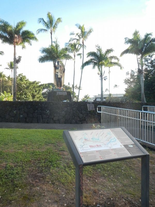
➋ Naha . . . — — Map (db m111236) HM
The sanctuary lies within the shallow, warm waters surrounding the main Hawaiian Islands and is one of the world’s most important humpback whale habitats.
Most of the North Pacific humpback whale population migrates nearly 3,000 miles to Hawaiian . . . — — Map (db m72000)
This sacred pond was built with lava rock and coral mortar in the mid 1800's. It once served as a bathhouse for the royal families. Fresh water empties into Ki’ ope pond through underground springs along the edges of the wall. Because of its rich . . . — — Map (db m123291) HM
Kauikeaouli and Nāhi'ena'ena
An inscribed stone tablet commemorates the nearby birth site of Kauikeaouli who went on to rule Hawai'i as King Kamehameha III. His sister, Princess Nāhi'ena'ena, was also born in Keauhou about . . . — — Map (db m110300) HM
The mystical turtle, Kauila, makes her home in the Ka’u District at Punalu’u Bay. According to Hawaiian mythology, Kauila was empowered with the ability to turn herself from turtle into human form and would play with the children along the . . . — — Map (db m129454) HM
With the first cattle arriving in the Hawaiian Islands in 1793 as gifts for King Kamehameha I, it was not long before they overpopulated and plundered the countryside from the mountains to the seashores. Determined to bring them under control and . . . — — Map (db m108949) HM
The Hawaiian goddess Hi’iaka compared the
peak of volcanic cone of Diamond Head to the
dorsal fin of the ‘ahi fish, thus the Hawaiian name
for Diamond Head is Le’ahi.
This site was once the Dillingham Home, the
beachfront house of Harold . . . — — Map (db m111326) HM
Surrounded by this open landscape, one can imagine the huge coconut grove known as Helumoa. Planted by Chief Kakuhihewa around the 15th century, the grove once had nearly 10,000 trees. Kahuamokomoki was an area nearby that served as a sporting . . . — — Map (db m73416) HM
Fish were easily netted from the ponds near Pi‘inaio Stream.
In ancient times, the
area was home to many Hawaiian families, who enjoyed the offerings in its bountiful waters. It was not unusual to see native men and women fishing, . . . — — Map (db m13127) HM
A hybrid between a False Killer Whale & Atlantic Bottlenose Dolphin.
Born May 15, 1985.
She shows her whale heritage in her dark coloration, bodylength, width, and large teeth.
Her profile is unique blend of both parents with a short, . . . — — Map (db m82138) HM
The Nene is a native Hawaiian Goose that lives in the wild on the islands of Hawaii and Maui. This rare State bird is believed to have descended from the Canada Goose, and isolated on these islands for thousands of years, it has evolved into a . . . — — Map (db m71754) HM
The trail climbs to the top of a volcanic cinder cone for views of the Haleakala Wilderness Area and the highest peaks of the Big Island. At first glance the trail environment seems nothing but barren rock. Yet these rocks are living habitat for . . . — — Map (db m71765) HM
This ranch wall stacked stone by stone in the late 1800s, represents an investment in the land. Stretching for two miles, it guided cattle through the harsh landscape of Haleakala to pasture lands on the east and west sides of Maui. The ranching era . . . — — Map (db m71762) HM
The Hawaiian Islands are very isolated. Colonizing species arrived, against overwhelming odds, by wind, waves, or wings as a small group or flock, or even just a single individual. A species survival depended upon ability to find suitable food and . . . — — Map (db m71756) HM
Navigators! Visually, the open ocean is a featureless environment. This makes it difficult to use sight for navigation. Hammerhead sharks can travel vast distances across the ocean by detecting electromagnetic fields around the Earth. . . . — — Map (db m71861) HM