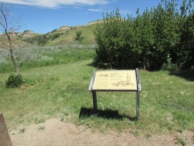
The drought and depression of the 1930’s hit the badlands region hard. Small landowners, no longer able to eke out a living, sold their lands to the government with the hope of finding a new start elsewhere. Throughout the country, men were out of . . . — — Map (db m88610) HM
Behind the visitor center is an old, rustic cabin. Architecturally insignificant, a person might wonder why it is here. To understand, step over the threshold and walk inside the building that housed a future president at a pivotal moment in . . . — — Map (db m87230) HM
He laid the foundation of the National Park Service, defining and establishing the policies under which its areas shall be developed and conserved unimpaired for future generations. There will never come an end to the good that he has done. — — Map (db m87237) HM
Early explorers to the Red River Valley discovered a wide range of wildlife living along the Red River. One could have easily spotted a moose, American elk, mink or even a black bear. Although these animals may be uncommon now, there is a variety . . . — — Map (db m240286) HM
Chelsey and Polly Dinkins played a major role in the construction and operation of this dam and National Wildlife Refuge known as Lake Ilo.
Chelsey Dinkins was the foreman of the Works Progress Administrations (WPA) crew that built the dam in . . . — — Map (db m152944) HM
The Red River Valley is well known for long, harsh winters, But the winter of 1996-97 was unlike any before. Eight blizzards battered the area during a seemingly endless winter. The blizzards, which the Grand Forks Herald named, started with . . . — — Map (db m169712) HM
On April 4, "Hannah" swept in, bringing a thick coat of ice that covered everything, followed by seven inches of wet, heavy snow, 70 mile per hour winds, and subzero temperatures.
The flood fight halted. Sandbags froze. Powerlines fell as . . . — — Map (db m169713) HM
Flood predictions from the National Weather Service continued to rise, and a community struggled to keep up. As residents battled the Red River, city officials fought to keep people safe. New and strange sounds engulfed the cities; civil defense . . . — — Map (db m169717) HM
On this date, ten years after the Flood of 1997, the City of Grand Forks proudly marks the completion of its flood protection project. As the nation watched, the people and property of Grand Forks were devastated by the Flood of 1997. The . . . — — Map (db m169729) HM
Remembering the record flood of 1979, when the Red River crested at 48.8 feet - more than 20 feet above its 28 foot flood stage - Grand Forks and East Grand Forks started raising the levees on both sides of the river.
By March, thousands . . . — — Map (db m169714) HM
On the morning of Friday, April 18, the river found a path into Lincoln Park. Water rushed down Lincoln Drive and swamped the levee from behind, and by late afternoon only the rooftops peeked out above the murky, swirling water. Floodwaters . . . — — Map (db m169716) HM
The Coteau Rangeland is an area of glacial potholes located in the central flyway, which makes this a favorite spot for migratory nesting wildlife including the Sandhill Crane. The crane is the oldest living species of birds and has existed . . . — — Map (db m169176) HM
The drought and depression of the 1930’s hit the badlands region hard. Small landowners, no longer able to eke out a living, sold their lands to the government with the hope of finding a new start elsewhere. Throughout the country, men were out of . . . — — Map (db m88634) HM
Throughout history livestock growing has depended upon abundant grasslands. An unused sea of grass in this region attracted cattlemen who brought large herds here in the early 1880’s. Damage from overstocking and overgrazing brought a quick . . . — — Map (db m88637) HM
The badlands you see here were so named because they were badlands to travel over before modern roads were built. A part of the Northern Great Plains the area has been carved by rain, wind and running water of the Little Missouri River. These layers . . . — — Map (db m96782)
Concretions are spheres of mineral matter once surrounded by rock of a different composition. They occur when a cementing material forms around a center of organic matter such as a leaf, twig, shell or tooth. As the softer surrounding material . . . — — Map (db m227464) HM
Standing Rock
Standing Rock, a sacred site to the Native people of this region, is called "Inyan Bosndata" in the Santee language.
The rock itself is what geologists call
metamorphic gneiss (pronounced
"nice")—a combination of . . . — — Map (db m177311) HM
An Ancient Sea Eastern North Dakota was covered by the
Western Interior Seaway between sixty
and ninety million years ago. This warm
subtropical sea was less than 500 feet
deep and stretched from the Arctic
Ocean to the Gulf of . . . — — Map (db m183997) HM
Native Prairies
A carpet of grass once covered 400,000
square miles of North America-one-
third of the vast region stretching from
Ohio to the Rockies and from Canada to
Texas. Today, native prairie is difficult to
find-you are standing . . . — — Map (db m177586) HM
In 1909 an aggressive newcomer showed up on the Dakota grasslands. Originally, from Europe, leafy spurge (Euphorbia esula) prefers the prime real estate of the badlands – streambeds, wooded draws, and drainages – and has . . . — — Map (db m88606) HM
The National Park Service and its neighbors wage a costly campaign to contain the spread of noxious weeds by fighting back on several fronts. Mowing, prescribed fires, spraying chemicals, and new insect allies – all contribute to restore the . . . — — Map (db m88607) HM
Chase Lake National Wildlife Refuge (NWR) was established by President Theodore Roosevelt on August 28, 1908, as one of the first national wildlife refuges in the country.
Since then, the pelican population has grown steadily. Today, Chase Lake . . . — — Map (db m162974) HM
The North American Waterfowl Management Plan (NAWMP) is an international plan developed to conserve waterfowl and migratory birds in North America. The Plan was established in 1986 and is supported by Canada, Mexico, and the United States. As part . . . — — Map (db m163091) HM
You are standing in the Missouri Coteau, a band of sharply rolling hills marked by potholes and grasslands. Coteau is the French word for "little hill." This unique landscape lies within the Prairie Pothole Region, and ranges from 10 to 50 miles . . . — — Map (db m163092) HM
The Crystal Springs Waterfowl Production Area (WPA_ is part of an extensive network of protected wetlands and uplands that are home to a rich diversity of wildlife. Acquired in the 1960s, this area is one of thousands of WPAs that were purchased . . . — — Map (db m163093) HM