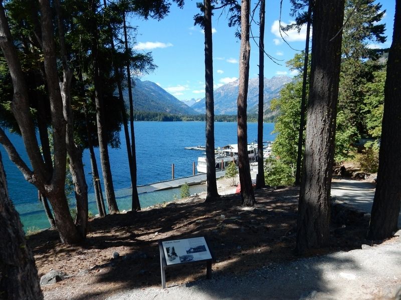
In the 1880's and 90's miners ventured up-lake searching for gold, silver, copper, and other metals. Wealth eluded them, but the scenic beauty of Lake Chelan and the Stehekin Valley made a fasting impression on all who passed through.
By 1900 . . . — — Map (db m196820) HM
The Celilo Falls Trail, now known as The Nez Perce Trail passed through Dayton near this site. For centuries this was the path used by the Indians, trappers, missionaries and the new settlers. Most notable was the Lewis and Clark Corps of Discovery. . . . — — Map (db m158967) HM
The eruption of Mount St. Helens on May 18, 1980 triggered a huge landslide causing a powerful, laterally directed blast. A pyroclastic flow consisting of rock fragments, highly charged gas and super heated steam, devastated almost 150,000 . . . — — Map (db m146049) HM
Humans have been part of this landscape for at least 10,000 years. By the time European explorers entered the Salish Sea in the late 1700s, the Lower Skagit people had [utilized] Whidbey Island for millenia, living in mobile and established . . . — — Map (db m179286) HM
This Douglas Fir is about
700 years old. It would,
therefore, have been a
sapling about 200 years before
Columbus discovered America.
—————————————
Restored October 1986
This slab was found near Perrigo's Lake in the early 1930's . . . — — Map (db m179324) HM
You are standing in the nation's first historical reserve, a unique unit of the National Park Service.
The Reserve was originally championed by a group of concerned residents in the 1970s when Ebey's Prairie was subdivided for large-scale . . . — — Map (db m179320) HM
From the end of the Lake Ozette Road, 2 trails lead to the ocean beaches. One, the Indian Village Trail, leads to the site of an abandoned Ozette Indian village at Cape Alava. For over 2000 years, Cape Alava was home to the Makah Indians. . . . — — Map (db m179353) HM
The swirling waters that pass in and out of the narrow channels between Whidbey Island and Fidalgo Island have captivated visitors to this area for thousands of years. Salish Native American tribes were the first human inhabitants of these . . . — — Map (db m74012) HM
It's hard to imagine Deception Pass without the bridge. But until 1935, the gap between Fidalgo Island and Whidbey Island could only be crossed by boat. In 1924 a small ferry called the Deception Pass began running between Yokeko Point . . . — — Map (db m74083) HM
When the federal government transferred 1,700 acres of land on Fidalgo Island and Whidbey Island to the State of Washington in 1925, Deception Pass State Park was barely an idea. For decades, the land had been a military reservation set aside . . . — — Map (db m74085) HM
Chief of the Clallam Indians
A Friend of the White People
From this rock
he gave warning of danger
and saved them
from massacre in 1856 — — Map (db m179770) HM
Founder of Admiralty Aububon
who led the effort to save
Protection Island as a
sanctuary for nesting seabirds
A gift from Audubon members & friends,
Eleanor's family, Friends of the Arts, and the
City of Port Townsend Public . . . — — Map (db m179412) HM
Here in the wind-buffeted rain shadow of the Olympic Mountains grow colorful relics of the last ice age. The tiny prairie before you is a remnant of once extensive grasslands that followed the retreat of continental ice over 10,000 years ago. . . . — — Map (db m179767) HM
Before the shoreline was filled to create the marina, Point Hudson was a popular clamming beach for S'Klallams and a landing point for tribes from locations across the Olympic Peninsula.
Change began as soon as settlers arrived, but grew . . . — — Map (db m179751) HM
It is believed that for thousands of years Point Hudson was used as a seasonal home by the Native American tribes, particularly Klallam and Chemakum. Presence of a freshwater lagoon, a wide variety of shellfish and other seafood easily obtained . . . — — Map (db m179746) HM
This point of land is formed of rocks and sand constantly in motion carried here by wind and waves. These sediments, eroding from nearby glacial bluffs, converge here from the northwest and the south before moving along the spit into deeper . . . — — Map (db m179749) HM
This site is the last remaining vestige of the natural prairie that spanned the qatáy Valley, between wetland areas. Relatively dry, upland areas of the valley provided camas bulbs (qʷɬúʔi in Klallam and Camassia quamash in Latin) . . . — — Map (db m179762) HM
After signing the 1855 Point No Point Treaty, it was clear that there had been some misunderstandings, and the federal government was failing to follow through on its funding promises. Some of the Tribes of Washington rose up against what they saw . . . — — Map (db m179769) HM
Looking south, view Kilisut Harbor and Indian Island, now Naval Magazine Indian Island. Archeological evidence shows that Indian Island was an important location to the ancestors of the S’Klallam and Chimacum people for over 1,500 years. For . . . — — Map (db m179600) HM
Where does your water come from?
Nestled in the "rainshadow" of the Olympic Mountains, Port Townsend gets surprisingly little rain and is surrounded by salt water. In the late 1800s water was scarce and expensive. Early residents . . . — — Map (db m179693) HM
Carkeek Park is an urban oasis. The salt water beach, the salmon bearing stream, wetlands, forest, picnic tables, play areas and miles of trails welcome visitors with new discoveries year round.
The land once occupied by early Salish peoples . . . — — Map (db m102488) HM
Before Euro-Americans arrived, Native people crossed the mountains on rugged trails to visit relatives, trade with other tribes, and gather food for winter. Later, prospectors, sheepherders, settlers and early Forest Service rangers used the same . . . — — Map (db m71657) HM
Scotch Creek Basin, bordered by Schalow Mt. on the west and by Dunn Mt. and the Lime belt on the east, provided an ancient Indian trail to the Sinlahekin valley and north to Canada. Contorted sediments in the landmark Barnett Bluff are evidence . . . — — Map (db m223520) HM
The Chinook people have lived along the Pacific Coast for countless generations — in fact, the Chinook say their ancestors were here at the end of the last ice age, when the waters and forests were very different. The people of this place would have . . . — — Map (db m177409) HM
This area at the mouth of Donkey Creek was once the village site of the S'Homamish Indians. Gig Harbor was then known as Tua'wILkel or Twa-wal-kut.
As part of the Puget Salish people of the Pacific Northwest, the S'Homamish spoke a form of . . . — — Map (db m179871) HM
The settlement of Gig Harbor by white people actually began on the east side of the harbor. Samuel Jerisich arrived in Gig Harbor in 1867 and built a small cabin on the east side of the bay near the sandpit. Later, the Jerisich family moved to . . . — — Map (db m179983) HM
Puget Sound: Fast Facts
• The Puget Sound is the second largest estuary in the United States, after the Chesapeake Bay.
• A "sound" is an arm, inlet, or recessed portion of the sea.
• Advancing glaciers carved out the Puget Sound . . . — — Map (db m179931) HM
This corner is rich in local history. When the first white men settled in Gig Harbor, they shared the bay with the Native American people who lived in a village on this corner. In the mid 1880s, the Indians permitted the use of one of their . . . — — Map (db m179889) HM
SETTLING THE WATERSHED
Historically, Crescent Creek watershed was altered by human settlement through logging and farming. Today shoreline development continues to alter the watershed.
PHOTO: Dr. Hiram Herbert Rust on Crescent Creek . . . — — Map (db m179917) HM
Chum Salmon
[informational and not transcribed]
What's With All Those Barrels?
The barrels you see next to Donkey Creek are part of a Remote Site Incubator (RSI) system which was initiated by local commercial fishermen in . . . — — Map (db m179873) HM
THE NATURAL DYNAMIC
Ship Harbor was formed by natural forces over thousands of years. It is maintained as a natural landform by the continued dynamic balance of these same forces. Preservation of this area requires that physical, chemical, . . . — — Map (db m74126) HM
The extent of glaciation is one of the features that distinguishes the North Cascades from the rest of the Cascade Range. The northernmost reaches of the range were covered by huge continental glaciers, nearly a mile thick in places, resulting in . . . — — Map (db m196816) HM
The 1980 lateral blast shot hot rock, ash and debris northward at hundreds of miles per hour. For three minutes, the blast pummeled slopes facing the volcano, like those on your right, leaving few survivors. Slopes closest to the volcano were . . . — — Map (db m190631) HM
This landscape is a monument to the Earth’s power.
The incredible story began on March 20, 1980, when magma began rising into Mount St. Helens. The volcano’s summit diverted the magma sideways, shoving the northern slope outward at a rate of . . . — — Map (db m84949) HM
You are looking at a past and future old-growth forest. On May 18, 1980, the lush ecosystem flanking the north side of Mount St. Helens was buried beneath a massive landslide, and covered repeatedly with searing avalanches of hot gases and . . . — — Map (db m158992) HM
On May 18, 1980, the eastern edge of the searing lateral blast
rolled up and over ridges to your right. It tore through the Clearwater Valley, lifting just behind where you stand. The blast left a gray patchwork of fallen and standing dead . . . — — Map (db m84911) HM
The Olympic Mountains began life 35 million years ago as part of the ancient sea floor that thrust against the North American plate. Inexorable geologic forces fractured and folded these layers of rock and lifted them high into the air. Erosion . . . — — Map (db m75486) HM
Geology
The landscape you see from Lighthouse Park has been shaped by geologic processes. These processes have been working slowly and steadily over the past 2 million years of the Quaternany period, a long episode of creation and . . . — — Map (db m178911) HM
Use of the Spit in Mukilteo
This area is within the traditional territory of the Snohomish who, along with the Snoqualmie, Skykomish and other allied tribes and bands, are Salish-speaking indigenous peoples that lived along the shoreline . . . — — Map (db m178832) HM
Coast Salish peoples, here for thousands of years before settlers arrived, shared a strong belief in the existence of "myth age," when beings sharing both human and animal qualities roamed the earth. According to legend, a Changer . . . — — Map (db m179253) HM
In 1853, Washington's territorial governor Isaac Stevens identified 30 different Indian tribes in the Puget Sound area. A presidential order directed him to sign treaties with them. The Point Elliott Treaty, signed on this waterfront in 1855, . . . — — Map (db m179257) HM
This 12 foot 5 inch diameter log
is from a Douglas Fir felled in the
Lake Roesiger District by
Lervick Logging Company, June 15, 1940.
It is estimated to be 620 years old. — — Map (db m178922) HM
The early 1970s were a time of growing environmental awareness and a worldwide desire to reduce pollution, recognize and protect endangered species and take better care of the planet. Spokane and its river became a perfect venue for this . . . — — Map (db m148696) HM
"There can be no greater issue than that of conservation in this country." —Theodore Roosevelt, 1912 In 1973, the Washington State Legislature recognized that haphazard growth and the spread of urban development was encroaching upon, or . . . — — Map (db m154277) HM
The Spokane River originates at Lake Coeur d'Alene, flowing about 112 miles through seven dams in its journey west to Lake Roosevelt and the Columbia. For native people, the river provided fish, spiritual sustenance and a gathering place. Today, the . . . — — Map (db m148679) HM
Early Encounters, Early Hypotheses
The Mima Mounds intrigues travelers and explorers in the 1800s as described in their journal entries.
MAY 20, 1841
Charles Wilkes, commander of the United States Exploring Expedition from . . . — — Map (db m71769) HM
After flowing in an underground tunnel for over 120 years, a section of Padden Creek is open to the daylight again.
The Padden Creek Daylighting project restores fish passage, reduces flooding risk, and improves water quality in our . . . — — Map (db m177810) HM