Guided to Hiddenwood Cliff by Sioux and Arikara scouts, General George Armstrong Custer and the 7th Cavalry camped on this famed buffalo hunting spot on July 8, 1874. The Custer Expedition was on its way to the Black Hills in South Dakota and . . . — — Map (db m113252) HM
The Yellowstone Expedition of 1876, organized to suppress the hostile Sioux, marched from Fort Abraham Lincoln May 17, 1876.
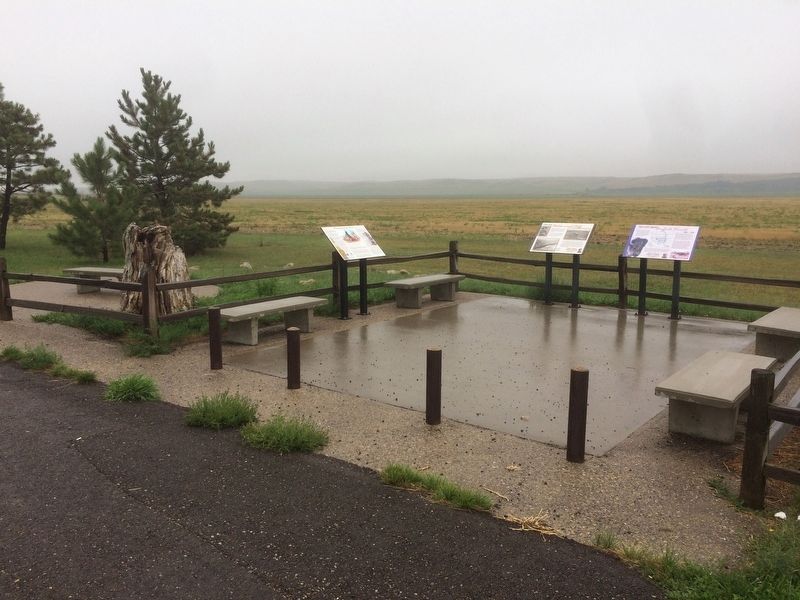
The Expedition camped at the junction of Davis Creek and the Little Missouri River, four miles south of Medora on May . . . — — Map (db m154256) HM
The Little Missouri Badlands have always been ideal habitat for wildlife. American Indians hunted these lands for centuries. The first known white explorers, the La Verendrye brothers, ventured into the badlands in 1742. Trapper Jean Baptiste La . . . — — Map (db m87992) HM
Pierre Bottineau, son of Charles Joseph Bottineau, a French-Huggenot and Marguerite Adhik Songab (Clear Sky Woman) a Lake of the Woods Chippewa, was born near the mouth of the Turtle River (twelve miles north of Grand Forks, North Dakota). . . . — — Map (db m231815) HM
Double Ditch Indian Village, overlooking the Missouri River, was a large earthlodge village inhabited by Mandan Indians between AD 1490 and 1785. The remains of earthlodges, midden mounds (trash heaps), and two fortification ditches are clearly . . . — — Map (db m154709) HM
Double Ditch Indian Village, overlooking the Missouri River, was a large earthlodge village inhabited by Mandan Indians between AD 1490 and 1785. The remains of earthlodges, midden mounds (trash heaps), and two fortification ditches are clearly . . . — — Map (db m154710) HM
Sakakawea Sakakawea has become a recognized name as part of the Lewis and Clark expedition. Although her name is famous, few facts remain to document her life and contributions to the voyage. When Lewis and Clark met Sakakawea in 1804 she was . . . — — Map (db m43838) HM
Square Buttes is a prominent and imposing landmark along this stretch of the Missouri River. The buttes take their name from their corresponding physical characteristics and robust form that is visible on the horizon eight miles to the north. . . . — — Map (db m154069) HM
Early explorers to the Red River Valley discovered a wide range of wildlife living along the Red River. One could have easily spotted a moose, American elk, mink or even a black bear. Although these animals may be uncommon now, there is a variety . . . — — Map (db m240286) HM
Established in the spring of 1883 by a colony from New York state and named for the Hudson River. A railroad right-of-way was planned to serve the town from the east. Three years later the Northern Pacific and Northwestern railways met on the . . . — — Map (db m175276) HM
Lake Jessie was named for Jessie Benton, daughter of Senator Benton of St. Louis. This lady later became the wife of Lt. John C. Fremont, who with the J. N. Nicollet exploring party camped a half mile northeast of here on the bluff, on July 25, 26. . . . — — Map (db m200661) HM
People have lived in the area now called North Dakota for over 12,000 years. The people of prehistoric
times were nomadic hunters and gatherers. More recent Native American tribes of this area include the Mandan, Arikara and Hidatsa. These . . . — — Map (db m164407) HM
In December of 1804 the temperature dipped and snow began to fall. Despite waking to an unrelenting cold the Corps of Discovery continued to work on the finishing touches of Fort Mandan, went hunting and preformed the never-ending job of gathering . . . — — Map (db m162597) HM
One of the earliest forms of Missouri River transportation was the bull boat. Used primarily by the Mandan, Hidatsa, and Arikara tribes, bull boats served as the main watercraft for natives living along the river banks. These boats were both built . . . — — Map (db m235041) HM
Winter 1804-1805
Named for the nearby Indians, Fort Mandan was winter quarters for the Lewis and Clark Expedition. Sited by Captain Clark on November 2, 1804, the fort was built in a triangular shape from cottonwood logs cut in . . . — — Map (db m162536) HM
Fort Mandan, 1804-05 Winter Quarters of the Lewis and Clark Expedition, also was the birthplace of the son born to Sakakawea and her French husband Charbonneau, interpreter for the explorers. The "Bird Woman" helped guide Lewis and Clark to their . . . — — Map (db m162595) HM
The Mandan Winter
"If we eat you Shall eat, if we Starve, you must Starve also."
Mandan Chief Sheheka-shote, to Captains Lewis and Clark, November 1, 1804
With those words, Chief Sheheke-shote (White Coyote), . . . — — Map (db m162953) HM
Privates John Shields, William Bratton and Alexander Willard manned the blacksmith shop at Fort Mandan. These men provided repair work to native tools, such as sharpening iron hoes and knives and fixing trade kettles.
The Mandan and Hidatsa who . . . — — Map (db m162950) HM
While preparing for the expedition to the Pacific, Meriwether Lewis visited Philadelphia for instructions in natural sciences, astronomical navigation and field medicine. It is believed that it was during this period that Lewis purchased Seaman, his . . . — — Map (db m36352) HM
Eighteen years before the establishment of the Mandan Village of Mih-tutta-hang-kush, a settlement of a different kind was being built a few miles northwest of this point. In November 1804, the Lewis and Clark Expedition began construction of their . . . — — Map (db m162530) HM
With 168 days and 1,600 miles behind them, the Lewis and Clark Expedition arrived near the Knife River Villages. Captain William Clark wrote:
October 27, 1804
"came too at the Village on the L.S. this village is situated on an eminance . . . — — Map (db m33610) HM
Concretions are spheres of mineral matter once surrounded by rock of a different composition. They occur when a cementing material forms around a center of organic matter such as a leaf, twig, shell or tooth. As the softer surrounding material . . . — — Map (db m227464) HM
Sunday, October 21, 1804 A driving northeast wind, cold temperatures, and freezing rain and snow led Lewis and Clark to seek shelter after only 7 miles. During the day, they passed the mouth of the Heart River learning from their Arikara . . . — — Map (db m44707) HM
Slant Village was occupied by the Mandan, an agricultural Indian tribe, and received its name because of the sloping ground upon which it was situated. The village embraced about seven or eight acres of ground and the most recent survey of the site, . . . — — Map (db m153125) HM
In January 1931, a U.S. Geological Survey determined the center of North America in Pierce County. The center is marked with a monument or cairn that is pyramid form in shape. It is 21 feet high, 6 feet wide at its base, and setting on a . . . — — Map (db m138195) HM
Standing Rock
Standing Rock, a sacred site to the Native people of this region, is called "Inyan Bosndata" in the Santee language.
The rock itself is what geologists call
metamorphic gneiss (pronounced
"nice")—a combination of . . . — — Map (db m177311) HM
The Inyan Bosendata of the Dakota
Indians used this site as a place
for ceremonials and offerings.
In 1839 the explorers Nicollet and
Fremont noted this landmark on the
maps of that date. The state geographic board has designated this
place . . . — — Map (db m175432) HM
Native Prairies
A carpet of grass once covered 400,000
square miles of North America-one-
third of the vast region stretching from
Ohio to the Rockies and from Canada to
Texas. Today, native prairie is difficult to
find-you are standing . . . — — Map (db m177586) HM
Straight ahead of you and down along the bank
of the river is the approximate location of the ferry
crossing that served Fort Abercrombie.
This photograph shows the ferry as it crosses
the Red River. You are in roughly the same spot
as the . . . — — Map (db m176610) HM
(THEN)
In 1804, President Thomas Jefferson sent Captains Meriwether Lewis and William Clark and their "Corps of Discovery" to explore the American West and record "the dates at which particular plants put forth or lose their flower, of . . . — — Map (db m143024) HM
Meriwether Lewis and William Clark were among the first to recognize the suitability of this site for a trading post. Their expedition (1804-1806) passed through this area on its way to the Pacific Coast.
The explorers noted that the riverbank . . . — — Map (db m143237) HM
Thursday and Friday, April 25 and 26, 1805
Rich wildlife heralded the expedition's arrival at the Yellowstone-Missouri confluence. Impatient, Lewis ascended the south bluff to view the "wide and fertile vallies." He camped Thursday . . . — — Map (db m143038) HM
Musquetors excessively troublesom - William Clark (who used 19 different spellings for the pests)
Buzzzz. Mosquitoes make us reach for the insect repellent, since being bitten by a mosquito can be anything from annoying to deadly. . . . — — Map (db m143012) HM
The Countrey in every direction is plains. -- William Clark
This area held large herds of bison, elk, and deer, which had grazed on grasses and shrubs for millennia. Chief among the native grasses were big bluestem, buffalo grass, and . . . — — Map (db m143204) HM
The object of you mission is to explore the Missouri river & such principal stream of it, as by its course and communication with the waters of the Pacific ocean, whether the Columbia, Oregon, Colorado, or any other river may offer the most . . . — — Map (db m143239) HM
Captain Lewis
Thursday, April 25, 1805
On the Missouri River, near the entrance of the Yellowstone River
"...I ascended the hills from whence I had a most pleasing view of the country, particularly of the wide and fertile . . . — — Map (db m143037) HM