To settle a wager among the trappers who were making their first winter rendezvous in Cache Valley, Bridger floated alone in a bull boat down Bear River to its outlet to determine the river's course in the late autumn or early winter of 1824, thus . . . — — Map (db m152315) HM
Curlew Valley, named after the curlew snipe that nests here, extends from Snowville, Utah, to the Idaho towns of Stone and Holbrook. The first recorded White men were Peter Skene Ogden's large party of trappers, who camped on Deep Creek . . . — — Map (db m240521) HM
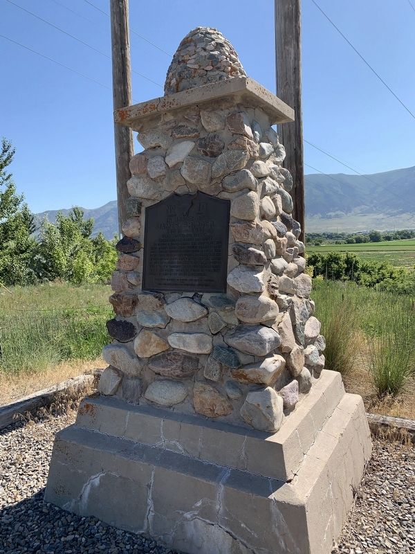
To commemorate an important episode in the early history of the west and to honor the scouts and explorers of earlier days, this monument was erected. In this vicinity in the winter of 1825-26 a cache containing 75 bales of furs, mostly beaver, . . . — — Map (db m149775) HM
When John Wesley Powell first looked out across the Green River, it was warm, silt-laden and swift. Floods scoured the area each spring, triggering the breeding cycle of many fish and creating sand and gravel bars in which the fish would lay their . . . — — Map (db m149088) HM
Explorers John C. Fremont and Kit Carson observed several antelope on the island during their 1845 journey, thus giving Antelope Island its name. This was the beginning of the island's recorded history.
An Island of Interest
Herdsman, . . . — — Map (db m243429) HM
As evidenced by visible shorelines along the east mountains and Antelope Island, Great Salt Lake is the remnant of ancient Lake Bonneville. Lake Bonneville existed from about 14,000 to 32,000 years ago and covered 20,000 square miles of Utah, . . . — — Map (db m243431) HM
In commemoration of the Catholic Priest, Father Escalante, who in 1776 came into Utah. He crossed the Green River at Jensen and camped two days at that place. His diary shows that he camped at the junction of the Strawberry and Duchesne rivers . . . — — Map (db m72764) HM
Suspicious of the strange Indian leading them ever farther west into unknown territory, the two Spanish priests and their party of horsemen struggled through the canyon of the Strawberry River. Fray Francisco Atanacio Dominguez and Fray Silvestre . . . — — Map (db m239630) HM
When the Mormons fled to Utah in 1847, they were looking for a place nobody else wanted. From Salt Lake City, Brigham Young “called” them to colonize towns and cities all over the great West. The last call came August 22, 1877, when . . . — — Map (db m147829) HM
In the 1870s, the Mormon Settlers came east across the Wasatch Plateau to the high mountain deserts of Castle Valley and the San Rafael Swell. It was the last place Mormon colonizer Brigham Young called his people to settle. They were seeking new . . . — — Map (db m147828) HM
At this location in January of 1854, the Great Pathfinder of the American West, John C. Fremont, and 21 other men found themselves in the middle of winter. The explorers were part of Fremont's last expedition of the American west.
Having left . . . — — Map (db m134347) HM
The first organized attempt to conquer the swirling rapids and precipitous walled canyons of the Green and Colorado Rivers was made by Major John Wesley Powell, Civil War hero and explorer.
Warned by Indians and mountaineers they would never . . . — — Map (db m102089) HM
Henry Mountains Isolated, rugged and remote, the Henry Mountains became the last mountain range to be surveyed in the lower 48 states. In 1872 on John Wesley Powell's second expedition to the area, Powell's bother-in-law, Almon H. Thompson, . . . — — Map (db m141736) HM
The Last Frontier ”No animal without wings could cross the deep gulches in the sandstone basin at our feet. The stream which we had followed and whose course soon became lost in the multitude of chasms before us was not the one we were . . . — — Map (db m146681) HM
In 1871, this region was part of the last uncharted territory in the continental United States. That year, Major John Wesley Powell launched the Second Powell Expedition to explore and map this frontier, continuing the work he had begun three years . . . — — Map (db m74763) HM
In April 1855, forty one men under the leadership of Alfred N. Billings were called to establish a mission in the Elk Mountains. They left Salt Lake City May 7, 1855, arrived at Grand River June 11, and selected the site for a settlement. By July . . . — — Map (db m95090) HM
In May 1869, Major John Wesley Powell set out on a remarkable mission: to explore the uncharted canyons and waters of the Green and Colorado rivers. Powell, a geology professor and one-armed Civil War veteran, began the journey with nine novice . . . — — Map (db m156085) HM
Human activities have changed the face of Canyonlands. Livestock grazing in the late 19th century altered plant communities. The roads and seismic lines you see below were constructed in the 1950s in a search for uranium and oil. Mining and grazing . . . — — Map (db m95081) HM
Father Silvestre Velez de Escalante with Father Dominguez and eight others, first white men to enter the Great Basin, left Santa Fe July 29, 1776 in attempt to reach Monterey. Abandoning attempt, party passed thru Cedar Valley October 12 on return . . . — — Map (db m241635) HM
On July 29, 1776, Fathers Francisco Atanasio Dominguez and Silvestre Velez de Escalante led an exploration party of ten horsemen from Santa Fe, New Mexico, to establish an overland route to Monterey, California, while spreading the Catholic faith to . . . — — Map (db m59514) HM
Jefferson Hunt
This site marks one of the most controversial events in the history of 1849. Here, a large group deserted wagon train leader, Jefferson Hunt, and headed west toward present day Enterprise, Utah. Their subsequent trek is . . . — — Map (db m239744) HM
This area, a part of the Great Basin, has evolved from the time of Lake Bonneville. It has known Anasazi Indian civilizations as evidenced by nearby ruins. It has seen the Dominguez-Escalante expedition of 1776 which passed west of this valley. It . . . — — Map (db m59620) HM
Seeking a suitable railroad route through the central Rockies, John C. Freemont and Company reached Parowan February 6, 1854.
These are Freemont's own words, "We were all so feeble we could barely drag ourselves down the trail, but the Mormons . . . — — Map (db m59610) HM
As a young man, Parley P. Pratt left his farming roots to become a traveling preacher, during which time he was converted and baptized into the Mormon Church. As a faithful saint, Pratt went on a number of Church missions, served as a member of the . . . — — Map (db m1424) HM
Southern Utah Expedition of 1849
Realizing the limited resources for pioneer settlements in the Salt Lake Valley and surrounding settlements in 1849, and the potential of many more immigrants arriving in the next few years, Brigham Young . . . — — Map (db m59582) HM
Between 1829 and 1848, traders from Santa Fe used the Spanish Trail which passed through Parowan to transfer dry goods and captured Indian slaves to Los Angles, where they were exchanged for horses.
The trail was pioneered between 1776 and 1831 . . . — — Map (db m59580) HM
This monument has two markersPlaque A: (Side of monument)
Bullion Beck and Champion Mining Company Headframe
This massive sixty-five foot Montana-type headframe is the only remnant of the Bullion Beck and Champion Mining . . . — — Map (db m75433) HM
From 1870 to 1876 Major Wesley Powell and assistant Almon H. Thompson of the U.S. Colorado River Explorations, established headquarters at Kanab. On this spot they erected a stone foundation and raised a tent which housed a telescope, by which means . . . — — Map (db m94948) HM
In memory of Isaac Behunin,
Mormon Pioneer, Early Utah Settler and
Credited with the naming of Zion Canyon
Early Mormon Pioneer
Isaac Behunin was born October 20, 1803 in Richland, New York to Albert and Nancy Lord Bohanan (Bohannon). . . . — — Map (db m40465) HM
Settlement of Long Valley and Mt. Carmel
The first written account of the exploration of Long Valley was given by John D. Lee in 1852. Coming from Parowan, the explorers were under the direction of Bishop John R. Smith. James Lewis kept the . . . — — Map (db m40584) HM
Segments of the old Indian trails between St. George and Long Valley were used by Mormon pioneers to settle Long Valley in 1864 and for its resettlement in 1871 following Indian conflicts. The trail divided just east of present-day Colorado City, . . . — — Map (db m74733) HM
Old Spanish Trail
Where you are standing, Antonio Armijo and 60 men once ventured from New Mexico to California hoping to find a new trade route in 1829. Following established Native American trails, the explorers traveled through dry, . . . — — Map (db m95009) HM
Father Escalante camped here October 2, 1776. His exploring party of ten men headed by Father Francisco Dominguez and map-maker Pacheco preached to the Indians and charted a northern route between Santa Fe, New Mexico and Monterey, California. They . . . — — Map (db m1439) HM
In 1853, Captain John W. Gunnison was selected to lead an expedition to find a trans-continental railroad route. He followed the Old Spanish Trail through Salina Canyon, over the mountains to Pahvant Valley, and upon reaching Fillmore, visited his . . . — — Map (db m69536) HM
The written history of the Intermountain Region begins in 1776 with the remarkably accurate diary of Father Escalante, a Spanish Franciscan priest. He and Father Dominguez, together with eight companions, were the first white men known to have been . . . — — Map (db m69579) HM
The Rocky Mountain Fur Company, headed by Milton G. Sublette, David E. Jackson and Jedediah S. Smith, conducted a fur trading rendezvous in this vicinity in June-July, 1827, taking 130 bales of beaver furs for shipment to St. Louis by pack train. . . . — — Map (db m66970) HM
On 19 July 1847, scouts Orson Pratt and John Brown climbed the mountain and became the first Latter-day Saints to see the Salt Lake Valley. Due to illness, the pioneer camp had divided into three small companies. On 23 July, the last party, led by . . . — — Map (db m150080) HM
After 4 1/2 miles of fighting boulders and brush along streambed, Donner Party gave up here, and on August 22, 1846, climbed steep hill to southwest. A survivor wrote, "We doubled teams, almost every yoke in the train (of 23 wagons) being required . . . — — Map (db m41380) HM
From this point, looking northward, one has a clear view of ensign peak, a round hill, projecting up from the low range of which it is a part. On July 26, 1847, two days after the Mormon Pioneers entered this valley, Brigham Young and party climbed . . . — — Map (db m125020) HM
Fur trappers and traders were the first white men in this locality. William H. Ashley and men arrived in the spring of 1829.
The principal leaders were
James Bridger - Etienne Provost
Jedediah S. Smith
James Bridger, discoverer of . . . — — Map (db m124920) HM
In 1776, the first non-native explorers entered Utah. They were led by Franciscan Fathers, Francisco Antanazio Dominguez and Silvestre Velez de Escalante, who hoped to establish a new trail from New Mexico to their California missions. After . . . — — Map (db m225317) HM
Ensign Peak provided Brigham Young's 1847 exploring party with a good view of the Salt Lake Valley. Cradled between the Oquirrh Mountains to the west and the Wasatch Range to the east, the valley was covered with tall grass, sagebrush, and desert . . . — — Map (db m225194) HM
The Donner Party led by George and Jacob Donner and James F. Reed passed here and crossed Jordan River nearby about September 2, 1846.
This party, consisting of 81 persons, 35 of them children, was delayed 2 weeks building a road via emigration . . . — — Map (db m152455) HM
In the summer of 1847, this site, known then as the "Old Fort," was the first permanent Anglo-Saxon settlement in the west. It was here that the American Flag was first raised. This Sesquicentennial Flag Pole is raised as a tribute to the pioneers . . . — — Map (db m35269) HM
First white men to explore the intermountain region were Catholic fathers
Francisco Atanasio Dominguez and Francisco Valez de Escalate
accompanied by Don Juan Pedro Cisneros. Don Bernardo Miera y
Pacheco. Don Joaquin Lain, Lorenzo Olivares, . . . — — Map (db m173392) HM
"Left camp late this day on acct. of having to find a good road or pass through the Swamps of the utah outlet finally succeeded and encamped on the East Bank of Utah outlet making 5 [miles]"
James F. Reed, August 23, 1846 — — Map (db m154074) HM
December 23, 1879 “The snow fell about eight inches...”
December 24, 1879 “... we had cooked the last food we had, consisting of a slap jack baked in a frying pan and about one inch thick.”
December 25, 1879 “ it was Christmas day 1879, which . . . — — Map (db m199568) HM
William H. Jackson of the United States Geological and Geographical survey conducted the first formal archeological exploration of the Comb Ridge area. Originating in the Colorado Territory, Jackson and his team reached Comb Ridge by following . . . — — Map (db m95034) HM
As winter storm approached, four nearly starved scouts, George Hobbs, George Morrill, Lemuel Redd, Sr. and George Sevey, sought shelter for the night in this area on December 27, 1879. The scouts were exploring for a feasible route for the 250 . . . — — Map (db m95035) HM
In 1879, at age 17, Parley R. Butt was one of 26 men who scouted possible routes for the San Juan Mission and established Montezuma Fort. A few months later, he traveled with the main group of pioneers as they blazed the Hole-in-the-Rock road. In . . . — — Map (db m95041) HM
Bluff was the first settlement of the white man in San Juan County and its first county seat. It was founded April 6, 1880 by the San Juan Mission "called" by the L.D.S. Church to establish friendly relations with the Indians. A small band of . . . — — Map (db m95043) HM
Newspaper Rock is a petroglyph panel etched in sandstone that records approximately 2,000 years of early man's activities. Prehistoric peoples, probably from the Archoic, Basketmaker, Fremont and Pueblo cultures, etched on the rock from B.C. to . . . — — Map (db m4615) HM
Kane Springs, San Juan County, was a major water stop along the historic Spanish Trail, in use from 1829 to 1848. Large trade caravans halted here and drank from the abundant spring waters. In autumn months, pack trains carried woolen textiles and . . . — — Map (db m95080) HM
June 15, 1873 Brigham Young called Albert K. Thurber and George W. Bean, Indian interpreters, WM. B. Pace, William Jex and others to explore Grass Valley for settlement and make peace with the Indians. Chief Tabioonah accompanied the party and acted . . . — — Map (db m142661) HM
The Old Spanish Trail, supposedly the “longest, crookedest, mot arduous pack mule route in the history of America,” passed through this valley. Launched in the late 18th century the trail was used by caravans from New Mexico carrying . . . — — Map (db m147708) HM
An Historic Trade Route Passed This Way
In the early 1800s, thousands of men, mules, and horses plodded along a well-travelled trail that paralleled Fish Lake. Can you imagine the dust, noise, and smells of a trading caravan on the move?
. . . — — Map (db m137030) HM
From the late 1840s through the 1860s, an exodus of more than 70,000 Mormons passed by here on their way to their "New Zion" in Utah. Starting from Nauvoo, Illinois in February, 1846, the first group of at least 13,000 Mormons crossed into Iowa to . . . — — Map (db m67626) HM
This is a two-sided marker
Front Side:
Two hundred years ago, while thirteen eastern colonies were giving birth to the United States of America, a small party of Spanish explorers was forging its way through the vast expanse of virgin . . . — — Map (db m148811) HM
Fray Francisco Silvestre Velez De Escalante and Fray Francisco Atanasio Dominguez, two Catholic Priests of the Franciscan Order accompanied by their attendants
Don Juan Pedro Cisneros - Lucrecio Muniz
Don Dernardo Miera Y Pacheco - Andres . . . — — Map (db m149097) HM
The Dominguez-Escalante expedition looking for a route between Spanish New Mexico and California were the first white men to enter Utah Valley. They camped a few miles north of this site on September 23, 1776, and spent several days exploring and . . . — — Map (db m75294) HM
On July 29, 1776, Fathers Dominguez and Escalante with their party of 10 left Santa Fe, New Mexico to find a new route to Monterey, California. After nearly 1000 miles they and their two native guides reached the mouth of Spanish Fork Canyon on . . . — — Map (db m148618) HM
A Spanish priest, the first white man
to look upon this valley, camped with
his comrades beside the Spanish Fork,
September 23, 1776.
---------------
Placed to perpetuate the memory of that event
by the
Spirit of Liberty Chapter . . . — — Map (db m148729) HM
On July 29, 1776, Fathers Francisco Atanasio Dominguez and Silvestre Valez de Escalante led an exploration party of ten horsemen from Sante Fe, New Mexico to establish an overland route to Monterey, California, while spreading the Catholic faith to . . . — — Map (db m148739) HM
On September 18, 1850, the first pioneers arrived in Springville and camped on this lot. Covered with tall grasses and supplied with plenty of spring water, bordered on the east by lofty mountains, on the west by the sparkling waters of Utah Lake, . . . — — Map (db m148671) HM
An arduous 1,200-mile route between Santa Fe and Los Angeles, the "Old Spanish Trail" passed through Mountain Meadows during its heyday, between 1830 and 1848. The trail served traders who loaded their pack mules with woolen goods from Santa Fe each . . . — — Map (db m114259) HM
The confluence of Ash and LaVerkin Creeks with the Virgin River is important in the history of this region. Footsteps long forgotten have passed through this region. Some have been remembered but most have faded with time. Roaming bands of Indians, . . . — — Map (db m59447) HM
The confluence of Ash and LaVerkin Creeks with the Virgin River is important in the history of this region. Footsteps long forgotten have passed through this region. Some have been remembered but most have faded with time. Roaming bands of Indians, . . . — — Map (db m59449) HM
October 13, 1776:"We set out southward from the small river and campsite of Nuestra Senora del Pilar ("Our Lady of the Pillar" – Kolob Canyon of Zion Canyon National Park)…" and…"We traveled a league and a half to the south, . . . — — Map (db m59468) HM
In 1858, Nephi Johnson, one of Brigham Young's scouts, with a party of Indian guides arrived at the mouth of the canyon. Due to superstition, the Indians refused to enter the canyon. Nephi Johnson, alone, followed up river to the Narrows, a place . . . — — Map (db m74630) HM
Erastus Snow was born in St. Johnsbury, Vermont in 1818. He entered the Salt Lake Valley on July 21, 1847, in advance of the first company of Mormon Pioneers. He was ordained an Apostle, at the age of thirty. As a missionary for the Church of Jesus . . . — — Map (db m59168) HM
In 1826 Jedediah Smith, searching for a route to California, entered what is now Washington County by crossing the black ridge north of here then following Ash Creek to the Virgin River. He followed the Virgin River through the Virgin River . . . — — Map (db m241351) HM
Antonio Armijo was a Spanish Mexican explorer and merchant who in 1829 and 1830 led an expedition to find a trade route between New Mexico and Los Angeles. This was the first trading expedition between New Mexico and Los Angeles. It was so . . . — — Map (db m241344) HM
In November 1849 a little-known expedition was sent by Brigham Young to explore southern Utah for possible future settlement. This fifty-man party was led by Apostle Parley P. Pratt.
On Tuesday, January 1, 1850, twenty horse-mounted . . . — — Map (db m241342) HM
In the fall of 1849, Brigham Young formed the Southern Exploring Company led
by Parley P. Pratt. Through that winter the compnay of 50 men explored potential town sites and resources from Nephi to present day St. George as part of Young's plan . . . — — Map (db m241416) HM
Until the late 18th Century, Zion's only visitors were the original inhabitants of the region. The earliest appearance of Europeans came in 1776 when the Dominguez-Escalante expedition after abandoning their quest for an overland route to . . . — — Map (db m80538) HM
In 1853, Lt. Colonel John C. Fremont mapped a new trail and made daily astronomical observations from Green River to Parowan, Utah. In his party of 22 were: S.N. Carvalho, artist and daguerreotypist, Mr. Von Egloffstein, topographer with assistants . . . — — Map (db m138061) HM
Outstanding explorer, Trapper, Trader and devout Christian. Came to Utah with Wm. H. Ashley's expedition in 1824.
Started first successful overland journey through Utah to the pacific coast from this vicinity August 22, 1826.
Substantially . . . — — Map (db m149967) HM