On Mamalahoa Highway (Hawaii Route 19) near Pauahi Street, on the right when traveling east.
(Legend to Points of Interest to on the Hilo Bay map:)
➊ Kānoe Heiau Kānoe Heiau was one of six major lauakini or sacrificial heiau on the island of Hawai'i dating back to ancient times.
➋ Naha . . . — — Map (db m111236) HM
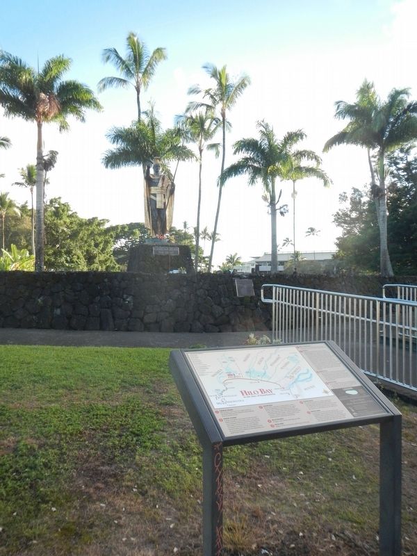
On Waianuenue Avenue (County Route 200) near Ululani Street, on the left when traveling east.
Traditions tell us that the larger Naha Stone was brought by canoe to Hilo from the chiefly valley of Wailua on Kaua'i by Chief Makali'inuikuakawaiea centuries ago. The stone had a place of honor at one of several heiau in Hilo and was said . . . — — Map (db m111114) HM
Near Kupipi Street, 0.1 miles north of Keahole Airport Road, on the right when traveling south.
These three dancers convey the grace and power of Hula Kahiko, the ancient dance of Hawai'i. The flow of their skirts and the harmony of their movements capture the rhythm of the dance which highlighted many sacred and ceremonial occasions. Just . . . — — Map (db m190119) HM
Near Kupipi Street, 0.4 miles north of Keahole Airport Road, on the right when traveling south.
In Hawai'i, the lei, a garland of flowers, coveys respect, love, friendship, and continuity of life. It may be created from a wide variety of local flora and is offered on many occasions calling for a special token. The giving of leis as a floral . . . — — Map (db m190121) HM
A heiau (temple) at Pu’ukohola was built long before Kamehameha started construction on the heiau that you see. This showed great vision and strategy on the part of the kahuna (priests). The heiau was physically very prominent and imposing on the . . . — — Map (db m71886) HM
Welcome to Pu’ukohola Heiau, one of the most famous heiau (temples) in the Hawaiian Islands. This heiau is an integral component of the traditional Hawaiian social, political, and religious systems, and a significant place in the history of King . . . — — Map (db m71874) HM
Near Alii Drive, 0.5 miles north of Kamehameha III Road, on the left when traveling north.
This archaeological site has been identified as a men's house associated with a person of chiefly rank who resided at the Lonoikamakahiki Residence. Hydration-Rind dating performed by the Bishop Museum indicated that the major portion of this site . . . — — Map (db m39410) HM
Near Alii Drive, 0.5 miles north of Kamehameha III Road, on the left when traveling north.
This archaeological site is known as the Inikiwai Heiau. It is sometimes known as the Pahe'ehe'e Ku'ula.
Hawaiian Fishermen built these shrines on promontories along the seashore or near ponds and streams. These shrines are a place for . . . — — Map (db m39305) HM
Near Kaleiopapa Street near Ehukai Street, on the right when traveling north.
Kauikeaouli and Nāhi'ena'ena
An inscribed stone tablet commemorates the nearby birth site of Kauikeaouli who went on to rule Hawai'i as King Kamehameha III. His sister, Princess Nāhi'ena'ena, was also born in Keauhou about . . . — — Map (db m110300) HM
On Alii Drive at King Kamehameha III Road, on the left when traveling north on Alii Drive.
Moku (island districts) were traditionally subdivided into smaller land wedges called ahupua'a. Generally, these ahupua'a extend from the mountain to the sea and contain all the resources needed for sustainable living. . . . — — Map (db m39438) HM
Near Kaleiopapa Street near Ehukai Street, on the left when traveling north.
Cultural historian Henry E.P. Kekahuna was born on Maui in 1881 when many ancient Hawaiian traditions were still in practice. He listened and learned the stories of old. He explored and mapped many areas throughout Hawai'i in the 1950s. His . . . — — Map (db m110310) HM
Near Alii Drive, 0.5 miles north of Kamehameha III Road, on the left when traveling north.
This archaeological site is known as the Lonoikamakahiki Residence.
It is believed that during different periods of time, four great Hawaiian kings lived at this site. These kings were Umi, Lonoikamakahiki, Kalaniopuu, and . . . — — Map (db m39409) HM
Near Ninole Loop Road, 1 mile Mamalahoa Highway (Hawaii Route 11) when traveling east.
The mystical turtle, Kauila, makes her home in the Ka’u District at Punalu’u Bay. According to Hawaiian mythology, Kauila was empowered with the ability to turn herself from turtle into human form and would play with the children along the . . . — — Map (db m129454) HM
Near Chain of Craters Road (at milepost 16.3) near Hilina Pali Road, on the left when traveling south.
The residents of this area did the best they could to live and survive and make do with what they had. This was the only life they knew. - Samual Kaho'ohualana, Kama'aina (Native born resident)
Hawaiians, native to these ahupua'a . . . — — Map (db m110974) HM
On Chain of Craters Road (at milepost 16.3) near Hilina Pali Road, on the left when traveling south.
'Ano 'ai ke aloha ia 'oukou no ke kipa 'ana am i Pu'uloa. Hele mai a 'ike me ke aloha a me ka mahalo.
With aloha, we welcome you to Pu'uloa - a place we honor and cherish. Please stay on the marked trail and boardwalk, for once this site and its . . . — — Map (db m110973) HM
Near Chain of Craters Road (at milepost 16.3), on the left.
Honor the profound importance of Pu'uloa and its petroglyphs holds for many native Hawaiians - the past, present, and the future. Respect that importance by staying on the boardwalks so that their stories may live forever.
Ancient . . . — — Map (db m110976) HM
Near Chain of Craters Road (at milepost 16.3) near Hilina Pali Road, on the left when traveling south.
We come to Pu'uloa because we want what's best for our keiki (children). Pu'uloa holds two of my children's piko, There kūpuna (elders) brought them here and created the puka where there piko would rest, sealed under a stone These two . . . — — Map (db m110978) HM
Near Old Mamalahoa Highway near Old Onomea Road, on the right when traveling north.
The village of Kahali'i was located on this large point of land which extends into Onomea Bay. Though the village is gone, the descendants of Kahali'i still remember some of the legends concerning the area's landmarks. One story tells of the . . . — — Map (db m110862) HM
Near Crater Rim Drive near Mauna Loa Road, on the left when traveling west.
Oli (chants) and mo'olelo (stories of this region recount the celebrated battle between Pelehonuamea (Pele, the volcano deity) and her sister, Hi'iakaikapoliopele (Hi'iaka), that erupted here at the summit of Kīlauea.
After a series of . . . — — Map (db m111041) HM
On Holoholokai Beach Park Road, on the right when traveling west.
Man has always left his mark. Symbols in rock were left by many early civilizations. Te Puako Petroglyph site is one of the largest and finest concentrations of the mysterious symbols left in Hawai‘i. It is likely that many of these petroglyphs . . . — — Map (db m3029) HM
On King's Trail, on the right when traveling north.
Before you lies one of the major concentrations of ancient rock carvings in the Hawaiian Islands. Boundaries were not crossed casually in old Hawaii, and the thousands of surface carvings here, just north of the border between the ancient kingdoms . . . — — Map (db m4247) HM
Near Akoni Pule Highway (Hawaii Route 270), on the left when traveling north.
The ahupua'a is a traditional land division that runs mauka from the mountains to makai (seaward). The ahupua'a of Lapakahi encompasses more than 2,000 acres along the leeward slopes of the Kohala Mountains. The distance from the upland forests . . . — — Map (db m110324) HM
From olden times Waikīkī was viewed not only as a place of peace and hospitality, but of healing.
There was great mana (spiritual power) in Waikīkī. Powerful kahuna la‘au lapa‘au (or physicians) lived here. Throughout the . . . — — Map (db m13225) HM
Near Holomoana Street south of Ala Moana Boulevard.
The legendary surfer Duke Kahanamoku often strolled the sands of Waikīkī Beach fronting what is now Hilton Hawaiian Village Beach Resort & Spa, 1959.
In ancient times, the coastal plain where you now stand was known as . . . — — Map (db m13082) HM
On Kalaukaua Ave, on the left when traveling west.
Legend says these stones are the living legacy of four powerful Tahitian healers who once resided near this site at a place called Ulukon. From the court of the Tahitian chief, the names of the four were Kapaemahu, Kapuani, Kinohi, and Kahaloa. . . . — — Map (db m73116) HM
On Ala Moana Boulevard (Hawaii Route 92) at Kalia Road, on the right on Ala Moana Boulevard.
Chief Ma‘likūkāhi, who reigned over the island of Oahu in the mid-1400s, resided in Waikīkī and used it as his seat of government. He was greatly loved by his subjects who enjoyed unprecedented peace and prosperity. Ali‘i . . . — — Map (db m13200) HM
On Menehune Road north of Hawaii Highway 50, on the left when traveling north.
The row of hewn stone along the inner side of the road is a remnant of one wall of a water-course which is said to have been made by the MENEHUNES (Hawaiian dwarves or Brownies)
The stones were brought from Mokihana
There is an old . . . — — Map (db m27646) HM