The Alexandria Almshouse was a publicly-funded poorhouse and workhouse where the needy could find refuge and the courts often sentenced people for vagrancy or indebtedness. Residents worked hard for their sustenance. The Almshouse was built about . . . — — Map (db m133930) HM
Prince Hall Masonry originated in Massachusetts in 1775 when a lodge attached to the British army initiated Prince Hall and 14 other free black men as Freemasons. Universal Lodge No. 1, the first Prince Hall lodge in Virginia, was established in . . . — — Map (db m134455) HM
Potomac Yard was once part of a vast, wooded landscape overlooking the Potomac River. The original 6,000-acre tract (about 9 square miles) was passed down through generations of the John Alexander family and divided among surviving spouses and . . . — — Map (db m115672) HM
African Americans established "The Fort," a community that continued here after the Civil War (1861-1864) for nearly a century into the Civil Rights Era of the 1960s. The place received its name from The Fort's location around the remnants of . . . — — Map (db m149722) HM
The Civil War (1861-1865) opened the door for opportunity and civil rights for African American Virginians, about 90 percent of whom were enslaved in 1860. The upheaval from battles and the federal presence in Alexandria and eastern Fairfax . . . — — Map (db m149734) HM
In 1884, James F. Jackson purchased the largest parcel in "The Fort," a post-Civil War African American community. He paid $300 for his 11.5 acres with the "western slope of a bank of Fort Ward." James and wife Catherine (Katie/Kittie), natives . . . — — Map (db m149737) HM
In 1939, Samuel Javins conveyed the land which was referred to as "Oakland Church lot" nine years earlier, to the Oakland Baptist Church, after the death of his wife, Florence McKnight Javins. She inherited the property from her mother, Harriet . . . — — Map (db m81223) HM
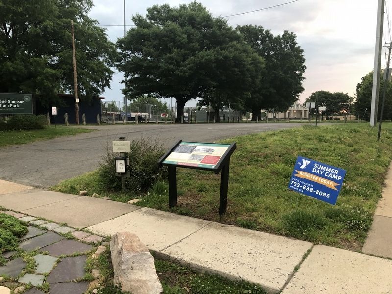
Several residents of "The Fort" community were founders of the Oakland Baptist Church, which is located at the intersection of King Street and Braddock Road. The congregation started worshiping in a bush arbor as Oak Hill Baptist Mission in 1888 . . . — — Map (db m81185) HM
Few facilities in Northern Virginia offer the variety of recreation options presented by Cameron Run Regional Park. Lying adjacent to the Capital Beltway in Alexandria, Cameron Run is serenity carved among glass and metal — a day long vacation of . . . — — Map (db m197469) HM
Clara Shorts Adams and Robert Adams conveyed a quarter-acre to the Falls Church School District of Fairfax County in 1898 for the purpose of educating African American children. The one-room "Colored School Building at Seminary" was the first . . . — — Map (db m167217) HM
Text, upper half of marker panel:
This house, built by Emmanuel Jones by 1888, stands at the corner of a block that witnessed the extremes of 19th century African American experience. From a slave trading company to significant . . . — — Map (db m46124) HM
Under this plaza is the concrete floor of a gas station, the construction of which desecrated many graves. The flooring was kept in place to protect the graves that may remain below. — — Map (db m188799) HM
On 17 Dec. 1785, George Washington endowed a school here in the recently established Alexandria Academy “for the purpose of educating orphan children.” In 1812, an association of free African Americans founded its own school here in space vacated by . . . — — Map (db m813) HM
Securing the Capital
On May 24, 1861, Gen. Winfield Scott ordered eleven regiments of Union troops from Washington, D.C., across the Potomac River, where they captured Arlington and Alexandria.
After their defeat in July at Manassas, . . . — — Map (db m92113) HM
Alfred Street Baptist Church is home to the oldest
African American congregation in Alexandria,
dating to the early 19th century. It has served as a
prominent religious, educational, and cultural
institution. In 1818, the congregation, then . . . — — Map (db m14623) HM
African Americans escaping slavery found refuge in Alexandria after Union troops occupied the city in 1861. The Rev. Clement “Clem” Robinson established the First Select Colored School in 1862. Hundreds of students registered for day and . . . — — Map (db m98079) HM
The Contrabands and Freedmen Cemetery Memorial is dedicated to honoring more than 1,700 people of African descent buried here during and following the Civil War, as well as those who may have been laid to rest after the cemetery officially . . . — — Map (db m77244) HM WM
Seeking freedom and a chance to begin a new life thousands of African Americans fleeing slavery flooded Civil War-era Alexandria. The city was quickly overwhelmed, and as living conditions grew dire, many perished from disease and deprivation. In . . . — — Map (db m86652) HM
The Douglass Cemetery Association was founded in 1895 as a non-denominational, segregated cemetery for Alexandria's African American community. The Douglass Cemetery is named in memory of Frederick Douglass, who was an American abolitionist, . . . — — Map (db m140586) HM
We are not contrabands, but soldiers of the U.S. Army. We have cheerfully left the comforts of home, and entered into the field of conflict, fighting side by side with the white soldiers…
As American citizens, we have a right . . . — — Map (db m87058) HM
Isaac Franklin and John Armfield leased this brick building with access to the wharves and docks in 1828 as a holding pen for enslaved people being shipped from Northern Virginia to Louisiana. They purchased the building and three lots in 1832. From . . . — — Map (db m72628) HM
Federal authorities established a cemetery here for newly freed African Americans during the Civil War. In January 1864, the military governor of Alexandria confiscated for use as a burying ground an abandoned pasture from a family with Confederate . . . — — Map (db m122082) HM
Many of the African Americans who fled to Alexandria to escape enslavement and those already living here succumbed to disease and deprivation during and shortly after the Civil War. Carts bearing the dead entered the cemetery along a path in this . . . — — Map (db m188795) HM
During the Civil War, Freedmen's Cemetery extended into the middle of South Washington Street. Each tan stone in the sidewalk marks a grave identified by archaeologists investigating the location of the original cemetery. — — Map (db m188794) HM
Named for Toussaint L’Ouverture, the Haitian
revolutionary. L’Ouverture Hospttal opened early
in 1864 near the Freedmen’s barracks in Alexandria
to serve sick and injured United States Colored
Troops (USCT). Designed by the U.S. Army, . . . — — Map (db m108153) HM
During the Civil War, 217 was the headquarters of the L'Overture Hospital. It was named after Tousaint L'Overture — Hispaniola's (Haiti) slave revolt leader. Patients were African American Union Soldiers & “contrabands” (escaped . . . — — Map (db m74279) HM WM
At the end of the 18th century, African Americans constituted half of the congregation at Alexandria's Trinity Methodist Episcopal Church. With support from Trinity, black members founded a separate congregation early in the 1830s, and their . . . — — Map (db m127781) HM
Alexandria, occupied by Union troops during the Civil War, became a refuge for African Americans escaping slavery. Before the war ended, about 50 former slaves founded the Shiloh Society, later known as Shiloh Baptist Church. Members held services . . . — — Map (db m91684) HM
The area around duke street between Hooff's Run and the base of Shuter's Hill was once known as "West End." Originally subdivided and sold by John and Thomas West in the 1780s, West End became a thriving community well positioned for commerce along . . . — — Map (db m72367) HM
During the Civil War, Alexandria's population swelled with more than 20,000 enslaved African Americans fleeing Confederate territory for safety behind Union lines. Initially called Contrabands because they were considered "property" taken during . . . — — Map (db m127734) HM
Travel the Chinquapin Trek
The Chinquapin trek takes you back in time. Interpretive signs discuss the process associated with the formation of Taylor Run and forest succession. Illustration of trees, plants and wildlife assist you in . . . — — Map (db m150802) HM
R. Arliner Young, zoologist, was born in Clifton
Forge. After graduating with a B.A. from Howard
University and an M.S. from the University of
Chicago, she became the first African American
woman to earn a doctorate in zoology when she . . . — — Map (db m207670) HM
Amelia County is largely indebted to one woman for bringing formal education and religion to African Americans after the Civil War. In 1865 Mrs. Samantha Jane Neil left her home in Pennsylvania to search for her husband’s body. He had been a . . . — — Map (db m20239) HM
Amelia County is largely indebted to one woman for bringing formal education and religion to African Americans after the Civil War. In 1865 Mrs. Samantha Jane Neil left her home in Pennsylvania to search for her husband's body. He had been a . . . — — Map (db m180249) HM
Russell Grove Presbyterian Church and the Russell Grove School were established as a result of the efforts of Mrs. Samantha Jane Neil, a Presbyterian missionary and teacher of African-American children after the Civil War. At first the school . . . — — Map (db m28927) HM
Russell Grove Presbyterian Church and the Russell Grove School were established as a result of the efforts of Mrs. Samantha Jane Neil, a Presbyterian missionary and teacher of African American children after the Civil War. At first the school . . . — — Map (db m180251) HM
Union cavalry under Gen. Henry E. Davies, Jr. left Gen. Philip H. Sheridan’s column near Jetersville on April 5, 1865, on a reconnaissance mission against the Army of Northern Virginia. Davies swept by here, rode through Paineville, and four Miles . . . — — Map (db m28834) HM
Amherst County opened Central High School here in 1956 to serve African American students. The school, established at the same time as the all-white Amherst County High School, was built in an effort to create "separate but equal" facilities despite . . . — — Map (db m179501) HM
Heavy rains early in 1854 left the James River and the treacherous Balcony Falls in full flood. On 21 January the towrope of the canal boat, Clinton, snapped. Washed over the Mountain Dam and through successive falls, its passengers became . . . — — Map (db m96744) HM
Historical and architectural evidence suggests this cabin house enslaved and free African Americans both before and after the Civil War. It has been in continuous use since it was constructed around 1840. More than two dozen cabins once stood on . . . — — Map (db m179532) HM
West Africans developed the forerunners of the modern banjo. Free and enslaved Africans in the Americas later made similar stringed instruments, typically of animal hides, gourds, wood, and gut or horsehair. Black musicians who lived near here, . . . — — Map (db m172200) HM
In 1929-30 the Appomattox training school was built on this site with funds raised by Mozella Price, who served as Supervisor of Appomattox Counter Negro Schools from 1919 to 1963. It was a cinder block building, employing four teachers. At the . . . — — Map (db m29969) HM
In 1929-30, the Appomattox County Training School was built on this site with funds raised by Mozella Jordan Price, who served as the supervisor of Appomattox County Negro Schools from 1919 to 1963. It was a cinder-block building employing . . . — — Map (db m181143) HM
Before and during the Civil War, educational opportunities in Rural Virginia were often limited. The wealthier families employed a tutor or sent their children to boarding academies such as the nearby Union Academy. In such schools students . . . — — Map (db m169313) HM
Nearby is buried Joel Walker Sweeney (ca. 1810-1860), the musician who redesigned this African instrument into the modern five-string banjo that is known today. Although slaves apparently added the fifth string to what had been a four-strong . . . — — Map (db m30076) HM
The first school for African Americans in Appomattox County began near here. Before the Civil War's end, educational opportunities in rural Virginia were often limited for White residents and practically nonexistent for African Americans, . . . — — Map (db m181152) HM
Brothers Henry and Thomas Bocock built this house in 1848. Henry was the County Clerk of Appomattox (1845-1860). Thomas served as a U. S. Congressman from 1847 to March 1861, when he became the only Speaker of the Confederate House of . . . — — Map (db m234617) HM
Mozella Jordan Price was instrumental in improving the education and quality of life for African Americans in Appomattox County. Mrs. Price was educated in Farmville schools, attended Boydton Institute, Virginia State College, and earned a . . . — — Map (db m29971) HM
Mozella Jordan Price was instrumental in improving the education and quality of life for African Americans in Appomattox County. Mrs. Price was educated in Farmville schools and attended Boydton Institute and Virginia State College (now known . . . — — Map (db m181146) HM
Obverse:
Reached the North Pole on April 6, 1909, with Robert E. Peary and four Polar Eskimos.
[Caption with image of group at Pole:] Ooqueah, Ootah, Henson, Egingwah, Seegloo.
Matthew Alexander Henson Re-interment . . . — — Map (db m11773) HM
Albert Irvin Cassell designed the George Washington Carver Apartments, located on this site from 1943 to 2015. Cassell was a distinguished architect in the Washington, D.C. region known for his association with Howard University and his designs . . . — — Map (db m190466) HM
The George Washington Carver Apartments, on this site from 1943 to 2015, were named for the prominent African American scientist and inventor, George Washington Carver and designed by Albert I. Cassell, a distinguished African American architect . . . — — Map (db m190464) HM
Harry W. Gray was born into slavery at Arlington House, where he learned to work with brick and stone. He built this two-story red brick townhouse in 1881 on an original ten acre homestead. The design was based on homes he had seen in Washington, . . . — — Map (db m69188) HM
Ellen Bozman fought hard for the rights of others. In the 1950s, she worked to eliminate school segregation in Virginia and provided support to the families of the first black children to enter a desegregated school in Arlington. — — Map (db m216120) HM
In 1900, the Virginia state legislature passed a law that required separation of races in public spaces. This included schools, restaurants, hotels and public transportation—which at that time was primarily the use of trains. This was nicknamed . . . — — Map (db m214186) HM
At 2:30 pm on June 9, 1960, the first day of lunch-counter protests in Northern Virginia, six individuals from Howard and Duke Universities helped challenge discrimination at commercial eating establishments in the state by beginning a . . . — — Map (db m195249) HM
On February 2, 1959, Stratford Jr. High became the first racially integrated school in Virginia. The long battle to integrate Virginia's public schools followed the U.S. Supreme Court's 1954 decision in Brown v. Board of Education, which held that . . . — — Map (db m55729) HM
"It was time that Negroes were treated equally with whites, time that they had a decent school, time for the students themselves to do something about it. There wasn't any fear. I just thought — this is your moment. Seize it!" . . . — — Map (db m175257) HM
"[I had to] explain to [my son] that Stratford was for white children and he could not attend because he was a colored boy. I knew then that with the help of others, I had to fight to help change the 'Separate but Equal Laws.'" . . . — — Map (db m175263) HM
"Out of integration of schools here in Arlington, many of us have gone on to do great things. We are proud to have done the things we've done."
Edward Leslie Hamm, Jr., 2019
The U.S. Government erected 40 sandstone markers on the boundaries of the District of Columbia in 1791 and 1792. The boundary survey was initiated by President George Washington and executed by Andrew Ellicott, who became Surveyor General of the . . . — — Map (db m172542) HM
Selina Norris lived at Arlington House and served as the personal maid and later head housekeeper for Mary Custis Lee. Norris was the second generation of her family to be enslaved by the Lee family, as were her children until their emancipation . . . — — Map (db m190468) HM
Arlington During the Conflict
By the mid-20th century, there was an overwhelming housing and transportation problem in Arlington County as the population more than doubled from 57,040 in 1940 to 135,449 in 1950. Thousands moved to . . . — — Map (db m236047) HM
Outbreak of the Great War
Tensions had been simmering in Europe for decades prior to the assassination of Archduke Franz Ferdinand of the Austro-Hungarian Empire by a Serbian nationalist in June 1914. The ensuing Austro-Hungarian . . . — — Map (db m236023) HM
America Joins the War
On September 1, 1939, Nazi Germany invaded Poland; two days later, Great Britain, France, and a number of other allies declared war on Germany. War already had been underway in Asia between Imperial Japan and . . . — — Map (db m236042) HM
Following the end of the Civil War, Fort Runyon was dismantled, the garrison sent home, and the land returned to its owner, James Roach. Squatters — among them freed blacks — occupied the vacant fort, scavenging its timbers for building . . . — — Map (db m134989) HM
Did you know? Benjamin Banneker was a…
★ Son of freed slaves from Baltimore, Maryland
★ Member of the first appointed team to survey the nation's capital, Washington, D.C.
★ Pioneered innovative agricultural . . . — — Map (db m198327) HM
Dedicated in memory of the United States Colored Troops, citizens, freed slaves, and contraband of Freedman's Village by the descendants and friends. — — Map (db m15009) HM WM
World War I
France 1918
Meuse-Argonne
*
World War II
Italy 1944-45
Rome-Arno
North Apennines
Po Valley
***
"I do not ask that Thou shall front the fray,
And drive the warring foemen from my sight;
I only ask O Lord, by . . . — — Map (db m11882) WM
This garden fed the Custis and Lee families, their many guests, the enslaved house workers, and even the Federal Army. It provided for the family from early spring to late fall.
The harvest included fruits and vegetables such as berries, . . . — — Map (db m93092) HM
When the Civil War broke out, the Potomac River—to your right—became the dividing line between North and South. Shortly after Robert E. Lee resigned from the US Army in 1861, Union soldiers seized Arlington House.
Sixty years later, a nation . . . — — Map (db m204431) HM
Dedicated to all African American Veterans of the Korean War, 1950-1953, for your valor, pride, patriotism and professionalism.
Your pioneering efforts and sacrifices have contributed immensely to the development of today's Soldiers, . . . — — Map (db m11216) WM
Dedicated to the Buffalo Soldiers, 9th and 10th Cavalry, and the 24th and 25th Infantry Regiments (Colored Troops) for valiant service in the Spanish-American War. They charged up San Juan Hill and El Caney, Cuba with Teddy Roosevelt and the Rough . . . — — Map (db m11889) WM
Unlike the planters in the lower south, the Custis and Lee family grew mostly food crops on this 1,100 acre plantation as well as at two other sites. George Washington Park Custis limited the cultivation of cotton and tobacco because they were . . . — — Map (db m70676) HM
Robert E. Lee, a soldier and scholar, once lived at Arlington House and managed the plantation on this land. After Lee took command of the Confederate Army of Northern Virginia, the Union Army seized his home. Union soldiers buried their casualties . . . — — Map (db m204425) HM
Through the dark of night, an enslaved worker named Jim Parks could see the Union Army advancing. "Like bees-a-coming," 14,000 troops moved across the Potomac River. They captured Arlington House on May 24, 1861. The Union Army occupied this key . . . — — Map (db m204419) HM
The kitchen garden put food on the table at Arlington House. As blackberries and tomatoes ripened in the summer heat, squash and artichokes branched out leafy and green. Here enslaved gardeners turned the soil, digging for turnips, carrots, and . . . — — Map (db m204472) HM
Selina Gray, her husband, and their eight children lived in the room to your right. She was Mrs. Lee's personal maid and later the head housekeeper. Her parents had been Mt. Vernon slaves, so she grew up steeped in the lore of George Washington. . . . — — Map (db m70500) HM
Arlington National Cemetery began when the Civil War casualties overwhelmed area cemeteries. Three years after the Lees fled their home, Quartermaster Montgomery Meigs ordered the bodies of Union soldiers to be strategically buried around Mrs. . . . — — Map (db m204423) HM
The yard behind the mansion churned with a flurry of daily chores and demanding labor. Enslaved people crossed dirt paths here, their arm is packed with garden produce and supplies for field workers toiling in the 1,100 plantation acres. Close . . . — — Map (db m194393) HM
"The footprints of the Montford Point Marines were left on the beaches of Roi-Namur, Saipan, Guam, Peleliu, Iwo Jima, and Okinawa. The tides and winds have, long ago, washed them out into the seas of history; but, “The Chosen Few” . . . — — Map (db m11472) HM
Archeology and oral history informs interpretation and historic preservation at Arlington House. Investigations in the 1980s and early 2000s revealed that the home's original cellar was used to store food. Surveys also revealed packed earth . . . — — Map (db m194407) HM
In memory of all U.S. Sailors, Coast Guardsmen and Marines of African and Asian-Pacific Descent who honorably served officers as cooks, stewards and messmen on U.S. Navy ships and bases and who valiantly manned battle stations during World War II . . . — — Map (db m70767) WM
Selina Gray, the daughter of Leonard and Sallie Norris, was a second generation Arlington slave. For a number of years, Selina was the personal maid of Mrs. Robert E. Lee. By 1861, Salina had become the head housekeeper at Arlington. When Mrs. . . . — — Map (db m194390) HM
The "Buffalo Soldiers" "We can; we will!" "Ready and Forward!" 9th Cavalry 1891-1894 10th Cavalry 1931-1949
Fort Myer Buffalo Soldiers From 1891 to 1894 Troop K of the 9th Cavalry Regiment was stationed here as a reward for their valor on . . . — — Map (db m41109) HM
Selena Gray was born into slavery in December 1823, the daughter of Leonard and Sallie Norris. She learned to read and write as a personal maid for Mary Lee. In the same parlor where the Lees wed, Selena married Thornton Gray, and enslaved stable . . . — — Map (db m213563) HM
Past the rose garden, about a 10-minute walk from here, rows of houses curved around the land once owned by the Lee family. This was Freedmen's Village, a temporary community of former slaves established in 1863. Most who lived here risked their . . . — — Map (db m204471) HM
Two hundred strategic bomber escort missions over Europe with the 15th Air Force without the loss of a single bomber to enemy aircraft, 1944-45, a record unsurpassed.
Dedicated in their memory, 10 November 1995. — — Map (db m13838) WM
1831 Mary Custis marries Robert E. Lee.
1862 Custis slaves emancipated.
1863 Freedman's Village established at Arlington.
1925 Congress authorizes restoration of Arlington House.
1955 Arlington House officially . . . — — Map (db m204429) HM
During the Civil War, many escaped and freed slaves traveled north seeking refuge in Union camps. Thousands crowded into the Federal City. The number of refugees quickly overwhelmed the area’s resources. Overcrowding and disease became prevalent. In . . . — — Map (db m5293) HM
After the outbreak of the Civil War, escaped slaves sought refuge at Union Camps and thousands crowded into the Federal City. In response to the unhealthy conditions in Washington, the government selected a site on Arlington Heights in May, 1863, to . . . — — Map (db m6409) HM
Enslaved here
Nancy
Female
Born ca. 1775
Died ca. 1831 - 1840
Enslaved here
Name unknown
Male
Born ca. 1806 - 1820
Enslaved here
Name unknown
Male
Born 1844 — — Map (db m238963) HM
Artist and landscape designer Walter Hood took inspiration for the design of the John Robinson, Jr. Town Square from the surrounding history of Green Valley. Over the course of six years, Hood engaged residents and community leaders in the design . . . — — Map (db m214447) HM
Wheelhouse explores the industrial history of the Jennie Dean Park site through the lens of the great American pastime—baseball. Inspired by the mill that stood in this location in the early 1700's and the park's rich recreational . . . — — Map (db m214512) HM
1617 entries matched your criteria. Entries 101 through 200 are listed above. ⊲ Previous 100 — Next 100 ⊳