On Mamalahoa Highway (Hawaii Route 19) near Pauahi Street, on the right when traveling east.
Kamehameha the Great was born in the 1750s and rose to become one of the most important figures in Hawaiian history. He lived during a period of great transition in Hawaiian society, having witnessed the arrival of the first Westerners when he was . . . — — Map (db m111235) HM
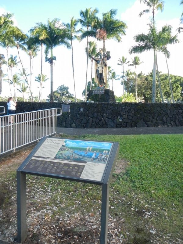
Near Kaahumanu Place near Palani Road, on the left when traveling north.
Upon this paepae (stone platform) is a representation of Ahu;ena Heiau. Restored by Kamehameha I upon the unification of the pae'aina (island chain), he rededicated Ahu'ena to Lono, the god of peace and prosperity. The Hale O Lono (House of Lono) . . . — — Map (db m110669) HM
Near Kaleiopapa Street, 1 mile north of Alii Highway, on the right when traveling north. Reported permanently removed.
Kauikeaouli was born within this enclosure March 17, 1814 the second son of Kamehameha I and Keopuolani. His reign (1825-1854) was the longest in the history of the Kingdom. While a minor, his kingdom knew the firm regency of Queen Ka'ahumanu, . . . — — Map (db m172848) HM
On Alii Drive at Sarona Road, on the right when traveling north on Alii Drive.
Hulihe‘e Palace
Construction of Hulihe‘e Palace was completed in 1838. Hulihe‘e was the gracious residence of Governor John Adams Kuakini and a favorite retreat for Hawai‘i’s royal families. Kuakini oversaw the construction of both . . . — — Map (db m39424) HM
On Kaahumanu Place near Palani Road, on the left when traveling north.
Kamakahonu
After uniting the Hawaiian kingdom, Kamehameha I returned to rule from his compound at Kamakahonu (lit. eye of the turtle) from 1812 until his death in 1819. 'Ahu'ena Heiau, the religious temple that served Kamehameha was rebuilt . . . — — Map (db m110665) HM
Near Alii Drive near Kahikina Lane, on the left when traveling north.
This sacred pond was built with lava rock and coral mortar in the mid 1800's. It once served as a bathhouse for the royal families. Fresh water empties into Ki’ ope pond through underground springs along the edges of the wall. Because of its rich . . . — — Map (db m123291) HM
On Kaleiopapa Street near Ehukai Street, on the right when traveling north.
Kauikeaouli, the second son of Kamehameha I and Keōpūolani, was born within this enclosure. Stillborn, he was cleansed in the water of Ka'opa Spring at the edge of the bay and revived as he laid upon the large rock to the left. . . . — — Map (db m110292) HM
Near Kaleiopapa Street near Ehukai Street, on the right when traveling north.
Kauikeaouli and Nāhi'ena'ena
An inscribed stone tablet commemorates the nearby birth site of Kauikeaouli who went on to rule Hawai'i as King Kamehameha III. His sister, Princess Nāhi'ena'ena, was also born in Keauhou about . . . — — Map (db m110300) HM
On Kaleiopapa Street near Ehukai Street, on the right when traveling north.
The Kamehameha Dynasty
As a young man, Kamehameha was a proven warrior and political strategist who rose to power with the support of the chiefs of Kona and unified the island of Hawai'i under his leadership in the late 1700a. He embraced . . . — — Map (db m110302) HM
Near Waikoloa Beach Drive near Ku'uali'i Place, on the right when traveling north.
Kamehameha ("The Lonely One") the Great was born in Hohala on the island of Hawai'i. Uniting all the major islands under one rule in 1810, he established himself as a fierce warrior, and wise and compassionate leader to his people. — — Map (db m108954) HM
Near Waikoloa Beach Drive near Ku'uali'i Place, on the right when traveling north.
Liholiho ascended the throne at a time when foreign influences, and new standards and ideas were propelling the Hawaiians into the modern western world. During his reign, the kapu system was abolished and the missionaries arrived, brining . . . — — Map (db m108956) HM
Kauikeaouli was a strong leader and contributed the greatest number of reforms during his 30 year reign, the longest in the history of Hawai'i. His mild manner, good judgement, and solid character made him a King loved and greatly respected by his . . . — — Map (db m108951) HM
Near Waikoloa Beach Drive near Ku'uali'i Place, on the right when traveling north.
Alexander Liholiho, grandson of Kamehameha the Great, brought a great appreciation for etiquette and ceremony to court. He and his wife Emma Rooke showed great concern for the welfare of their people and established the Queen's Hospital . . . — — Map (db m108952) HM
Lot Kamehameha favored a stronger monarchy and placed much of the power back into the hands of royalty. He was the last ruler to bear the name of the great conqueror and was credited with many public improvements and acquisition of much land. . . . — — Map (db m108957) HM
Near Waikoloa Beach Drive near Ku'uali'i Place, on the right when traveling north.
The grandson of a half-brother of Kamehameha the Great, he became the first king to be elected. Well-educated, Lunalilo was very popular with the people and became the first Hawaiian to leave his property to charity. — — Map (db m108964) HM
Near Waikoloa Beach Drive near Pohakulana Place, on the right when traveling east.
Kalama Hakaleleponi Kapakuhaili was the daughter of ali'i (royalty) Kaihekukui and Iahu'ula. She married Kauikeaouli Kamehameha III, who introduced the division and disbursement of traditional lands known as the "Great Mahele." A very well-educated . . . — — Map (db m110410) HM
Near Waikoloa Beach Drive near Pohakulana Place, on the right when traveling east.
Lydia Liliuokalani Kamaka'eha Paki Dominis sister of Kalakaua, adopted by Paki and Konia, married John O. Dominis. Declared heir apparent on April, 11, 1877 following the death of her brother Prince Leleiohoku II. Ascended to the throne on January . . . — — Map (db m110420) HM
Also known as Tamehamalu, Victoria Kamāmalu was the daughter of Kamehameha I and married Liholiho Kamehameha II. Only 5 years after he took the throne, the King and Queen sailed to London for a state visit with King George IV. While in England, . . . — — Map (db m110409) HM
Near Spencer Beach Park Road, 0.2 miles west of Kawaihae Road (Hawaii Route 270), on the right when traveling west.
Build a heiau on Pu'ukohola, the "hill of the whale," dedicate it to your war god, and you will achieve your dream — you will rule the islands. Responding to this prophecy told by Kapoukahi, a famous seer, Kamehameha built the heiau . . . — — Map (db m172849) HM
On South King Street north of Punchbowl Street, on the right when traveling south.
King Kamehameha I (c. 1758–1819) is generally recognized as the most important figure in Hawaiian history. He was a wise ruler who enacted laws to protect the defenseless and to bring order to the newly united kingdom. An astute statesman, he . . . — — Map (db m13581) HM
On South King Street, on the right when traveling south.
'Iolani Palace is a living restoration of the offical royal residence for the Kalakaua Dynasty that ruled the Kingdom of Hawai'i from 1874 to 1893. King Kalakaua, who resigned for 17 years, built the palace in 1882 as a symbol of Hawaii's civilized . . . — — Map (db m74148) HM
On Punchbowl Street, on the left when traveling east.
In the middle of an otherwise dry and barren plane, existed a sacred spring on these grounds, reserved for use by high chiefs and chiefesses only. Legend tells us that among the high ranking who enjoyed the privilege of bathing in the large circular . . . — — Map (db m74144) HM
On Punchbowl Street at South King Street, on the left when traveling south on Punchbowl Street.
King Kamehameha V died on December 11, 1872, without naming a successor to the throne. Prince William Charles Lunalilo was the highest ranking Chief at that time. Instead of claiming his birthright to the throne, he wanted the people to choose their . . . — — Map (db m13788) HM
Olympic swimming champion Duke Kahanamoku (1890–1986) spent much of his youth here in Kālia with his mother’s family, the Paoas. The family owned most of the 20 acres which the Hilton Hawaiian Village now occupies.
It is said that it was . . . — — Map (db m13188) HM
On Kalakaua Avenue, on the left when traveling west.
Raised in Waikiki, Duke was a full blooded Hawaiian, who symbolized Hawai'i to millions of people. He developed into an Olympic Champion and the world's fastest swimmer. Between 1912 and 1932 he won three gold medals, two silver and a bronze in four . . . — — Map (db m73257) HM
Surrounded by this open landscape, one can imagine the huge coconut grove known as Helumoa. Planted by Chief Kakuhihewa around the 15th century, the grove once had nearly 10,000 trees. Kahuamokomoki was an area nearby that served as a sporting . . . — — Map (db m73416) HM
From olden times Waikīkī was viewed not only as a place of peace and hospitality, but of healing.
There was great mana (spiritual power) in Waikīkī. Powerful kahuna la‘au lapa‘au (or physicians) lived here. Throughout the . . . — — Map (db m13225) HM
On Kalakaua Avenue, on the left when traveling west.
Prince Jonah Kuhio Kalaniana’ole, the son of High Chiefess Kekaulike Kinoiki II and High Chief David Kahalepouli Pi’ikoi, was born on March 26, 1871 at Ho’ai, Kaua’i. His mother died soon after his birth and he and his two older brothers were hanai . . . — — Map (db m73117) HM
On Kalakalua Avenue at Kukio Avenue and Kuamoo Street, on the left when traveling south on Kalakalua Avenue.
(tablet on back of base)
David Kalākaua was born on November 16, 1836. He succeeded to the throne on February 12, 1874, and ruled with his queen, Kapi‘olani. King Kalākaua was the catalyst for the revival and flowering of . . . — — Map (db m13586) HM
Near Kilauea Road, 1.8 miles north of Hawaii Route 56.
May the glimmer of both this historic lighthouse, guiding ships to safe harbor, and the legacy of Senator Daniel K. Inouye, illuminating the voices of Hawaii citizens, always continue to serve as beacons of hope.
'Ike vision, Lawelawe . . . — — Map (db m65776) HM
On Lawai Road south of the traffic circle on Poipu Road (Hawaii Route 520), on the right when traveling west.
Prince Jonah Kūhiō Kalaniana‘ole was born in a grass hut near this spot to Princess Kinoike Kekaulike and High Chief David Kahalepouli Pi‘ikoi. He became a delagate to U.S. Congress after Hawai‘i became a Territory in 1900, serving for 19 . . . — — Map (db m12778) HM