This site, first developed by James
D. Farwell in 1858, in 1877 became
the grand estate of Robert R.
Thompson, founder of the
Oregon Steam Navigation Co.
and Alameda's artesian water
works. Thompson's new mansion,
completed in 1881, burned . . . — — Map (db m157011) HM
Charlie Tillman, born in 1907, has lived in Alameda since 1909. Charlie served as a member of the White House Conference on Aging from 1973 to 1975. He was a member of the California Commission on Aging from 1981 to 1983.
Charlie served on the . . . — — Map (db m219370) HM
Home of the 14 – 15 Year Old Babe Ruth World Series Campions
1985 Alameda Babe Ruth All-Stars
Brian Cavalli • Andy Craig • Sam Flores • John French • Ryan Jensen • Ted Langowski • Steve Manzo • Eric Marshall • Mickey Mullen • Scott Rapposelli • . . . — — Map (db m220116) HM
This plaque marks the location of an 1890 seawall on the Alameda shoreline. Behind you are the stairs where bathers went down to the beach. The wall was built by architect Joseph A. Leonard, who constructed many homes here during the 1890s. . . . — — Map (db m62215) HM
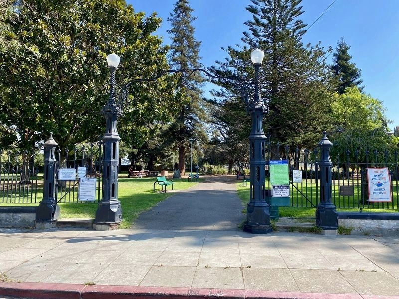
Jean Sweeney
In 1998, Jean Sweeney walked out in this 27-acre former Alameda Belt
Line railroad yard for the first time. Struck by the silence and what a gem
of nature it was, she said, "This has got to be a park.” She saw this as . . . — — Map (db m157024) HM
For decades the dumping of construction debris of a growing industrial society filled in the marshes and tide flats of the Albany Waterfront.
An unsightly peninsula began to form...hidden from the main stream of urban life.
In 1984 the dumping . . . — — Map (db m197620) HM
The explosive powder industry developed around San Francisco during the Civil War to
supply California's gold mines. A powder plant opened at Albany's remote Fleming Point in
1879. Others on the north side of Albany Hill followed. Nobel Depot, . . . — — Map (db m174552) HM
City of Berkeley Landmark
designated in 2001
In 1919 John and Ada Hinkel donated seven hillside areas to the City of Berkeley in appreciation of the Boy Scouts’ service to the nation during the First World War. Before making their gift, the . . . — — Map (db m53849) HM
Berkeley's original shoreline was about where Second Street and the eastern side of Aquatic Park are located today. In 1853 a private wharf was built at the foot of what is now Delaware Street, and a working waterfront with factories and piers . . . — — Map (db m155983) HM
In the early spring of 1968, a handful of community members led over
120 of their Historic McGee-Spaulding District neighbors in petitioning
the city to buy this property for use as a tot lot and to prevent further
apartment development in this . . . — — Map (db m191127) HM
Berkeley's Ohlone Dog Park, situated along a strip of land cleared in the 1960s
for BART undergrounding, is widely considered the world''s first dog park.
Development plans for the area were upended when activists occupied and
dubbed the strip . . . — — Map (db m137042) HM
From 1902 to 1979 the Santa Fe railroad company used this land for both industrial shipping and passenger
service. The railroad tracks that once passed through here were part of a nine mile strip of land that went from
Richmond to Oakland. After . . . — — Map (db m153776) HM
This ten-acre park is on the site where Dublin was originally settled in 1850.
Within the park are the:
Murray Schoolhouse, 1856
Old St. Raymond Church, 1859
Sunday School Barn, c. 1860
Kolb’s Old House, c. 1870
Hay Barn, c. 1900
Kolb . . . — — Map (db m201625) HM
Tassajara Creek Regional Trail
Tassajara Creek/Ridge Trail
(5.54 Miles): This unpaved and paved regional trail extends from the lowlands of Tassajara Creek in Alameda County to the ridgeline above Dougherty Valley in Contra Costa . . . — — Map (db m204577) HM
The Kolb’s purchased their first tractor 1943. The introduction of tractors to mechanize agriculture resulted in a reduction of the heavy efforts of plowing and harrowing before planting, which were often backbreaking tasks for human and draft . . . — — Map (db m201560) HM
In 1877, across the railroad tracks from here, Edward Wiard
built a dance pavilion on top of an ancient shell mound, either
oblivious to, or choosing to ignore, its cultural significance to
the indigenous people. Thus, Shell Mound Park was . . . — — Map (db m239056) HM
For over 85 years, from 1920 to 2007, the area in front of
you was the site of a large Sherwin-Williams paint factory.
The only remaining structure is "Building I-31", the brick
and concrete building at Horton Street and Sherwin Avenue.
The . . . — — Map (db m238890) HM
You are at the southern end of the Emeryville Greenway, a rails-to-trails project that converted a former interurban passenger and
freight rail line to a pedestrian and bicycle trail across Emeryville.
The Greenway was originally an . . . — — Map (db m238893) HM
Emeryville is situated on Huchiun, the name of the unceded ancestral land of the Chochenyo-speaking
Ohlone people, the original inhabitants of this region. This open space was once the site of the largest of more than 425 sacred ancestral burial . . . — — Map (db m238882) HM
Boxed Tree Forest
These oak trees were planted in boxes waiting to be sold when the Roedings operated California Nursery Company. Eventually the trees rooted into the ground creating a unique forest of boxed trees. Over the years, local . . . — — Map (db m208707) HM
The historic buildings on the property – the Vallejo Adobe, President’s House, Office Building and Packing Shed - make up the historic core of the site, and were the center of the nursery operation; the place where orders were placed, materials . . . — — Map (db m208904) HM
The primary purpose of the California Nursery Historical Park Master Plan is to tell the story of the California Nursery Company to current and future generations through the sharing of the site’s remaining historic buildings, majestic . . . — — Map (db m208557) HM
For many years the California Nursery was one of the state’s leading nurseries. Established in 1884 by John Rock, the nursery originally covered 463 acres. Through constant experimentation, including the introduction of new fruits, Rock made a . . . — — Map (db m208908) HM
The California Nursery is closely associated with John Rock and George C. Roeding. In 1884, a German immigrant named John Rock purchased 463 acres on a site that is today known as the community of Niles in Fremont. He moved his start-up nursery . . . — — Map (db m208919) HM
The California Nursery property includes noteworthy landscape features, such as the many mature trees, in addition to historically and architecturally significant buildings like the garden store. Unfortunately, due to years of use and multiple . . . — — Map (db m208714) HM
The adobe slowly deteriorated and a large crack developed in an end wall. The roof caved in, exposing the vulnerable adobe bricks which began to disintegrate. Local historian and preservationist, Robert B. Fisher, M.D., raised an alarm, and in . . . — — Map (db m211567) HM
Henry Curtner, an enterprising American, arrived at Mission San Jose in 1852. He worked for farmers in the area. In 1856 Curtner returned home to Indiana to marry Lydia Kendall. By 1868 he was able to purchase the portion of Rancho Agua Caliente . . . — — Map (db m211572) HM
After the missions were secularized by Mexico, their lands were divided into ranchos, which were granted to the “Californios” who had served the Spanish and Mexican governments.
In 1836 the lands around this park were granted to Fulgencio . . . — — Map (db m211569) HM
Between 1860 and the 1920s, the Meeks grew grains, green peas, corn, sugar beets, cucumbers, blackberries, and currants. Most of their land was in orchards of almonds, oranges, apricots, peaches, prunes, plums, and cherries. Meek’s land was . . . — — Map (db m210340) HM
This park is dedicated to the Hunt Brothers Cannery and the people of Hayward whose industry and loyalty made the cannery a success.
Established on this site in 1896 by Will and Joseph Hunt. By the mid 1940's, Hunt Brothers Cannery became the . . . — — Map (db m195817) HM
The Don Castro lagoon and adjacent lake were created in 1964 when the Alameda Flood Control and Water Conservation District dammed San Lorenzo Creek. Today the lagoon is supplied with water from EBMUD. A large shallow area is roped off for children. . . . — — Map (db m198391) HM
In 1869, William Meek’s success and expanding family motivated him to build a house worthy of his standing in the community. The resulting mansion is almost 7,000 square feet and has 19 rooms spread out over three floors. The house became the . . . — — Map (db m210988) HM
Owner of the first Japanese restaurant in Hayward California (Kokeshi)
A caring and giving person, known for her generosity and kindness. She exemplifies the American dream. We will all miss her and never forget her. — — Map (db m207577) HM
“…is a handsome mode of architecture, and symmetrically planted ground, sinuous walks and drives, the sturdy, primeval oaks, the rare and ever looming exotics, and the large attractive fountain surround the place with and air of elegance, wealth, . . . — — Map (db m210886) HM
There were many outbuildings on the Meek Property. In the early 1890s, the family built the carriage house for carriages and horses. The interior of the carriage house has been restored to replicate how the original building might have looked when . . . — — Map (db m210345) HM
Long before there were supermarkets, pharmacies and hardware stores, Ohlone people found or made everything they needed from the natural world. They used the roots, stems, leaves, seeds and fruits of plants and trees in the making of food, medicines . . . — — Map (db m204557) HM
1890
Buckley's Vineyard
Christopher Augustine Buckley's Winery was built in 1890 and a brandy distillery was added in 1897. The original 100 acre site was one of the larger early vineyards in the Livermore Valley. After its expansion . . . — — Map (db m233018) HM
The City of Livermore dedicates this park to the Livermore Stockmen's Rodeo Association, Livermore residents and veterans of this valley who have served our country with dedication and honor in its many wars and conflicts.
The city makes this . . . — — Map (db m195393) WM
The Edward R. Campbell Bridge is a physical testament to the power of elected officials building bridges that benefit not only their constituents, but all future generations. Alameda County Supervisor Edward R. Campbell, having spent most of his . . . — — Map (db m204561) HM
This land has attracted people's interest for millennia. A network of ancient trade routes once linked indigenous people of these different regions: the Ohlone tribe of the San Francisco Bay Area, the Bay Miwoks of the Delta and Mt. Diablo, and the . . . — — Map (db m231000) HM
Old Bridge and New Pier
As you walk onto the pier before you, constructed in 2019, you are stepping onto a
piece of transportation history. This pier is built upon two pylons that supported the original San Francisco Bay Bridge near the . . . — — Map (db m159373) HM
The idea for the Chinese junk (boat) came
from the voyage of the real junk "Free
China” from Taiwan to San Francisco in
1955. The idea originally involved the purchase
of an actual junk for the playground, but
eventually developed into a . . . — — Map (db m157313) HM
1853
Oakland was shaped
by seven GREEN SQUARES
Downtown’s living rooms
now only five
Parks bring out the
Goodness of good people — — Map (db m72832) HM
Welcome to the Morcom Amphitheater of Roses,
originally the Morcom Rose Garden. This Jean Street
entrance is wheelchair accessible. This map uses icons to indicate such accessible features, including the Sensory Garden.
The Morcom Amphitheater . . . — — Map (db m157307) HM
Joaquin Miller Park was formed in 1917 when the City of Oakland and its citizens – led by The California Writers Club – purchased 68 acres from the estate of Joaquin Miller, the noted 19th century “Poet of the Sierras” and . . . — — Map (db m71737) HM
Designated a protected feature of the Lakeside Park and Wildlife Refuge
A City of Oakland Landmark
Clubhouse constructed 1926
Green No1 Dedicated 12 Jun 1912
Green No2 Dedicated 13 Oct 1923
Green No3 Dedicated 23 Mar 1935
Mosaics by . . . — — Map (db m218476) HM
First Official Wildlife Refuge in the United States
Established as a State Game Refuge in 1870
Remodeled 1962
Oakland City Council
John C. Houlihan, Mayor • Felix F. Chialvo, Vice Mayor • Harry R. Lange • Fred Maggoria • Dan Marovich • . . . — — Map (db m218623) HM
The Shepherd Canyon Corridor Plan was created by the City of Oakland in 1975 to
provide a vision for the development of the Canyon after CALTRANS dropped plans
for Highway 77 along the former Sacramento Northern Railroad Right of Way. The
Oakland . . . — — Map (db m185619) HM
15 Seconds
On October 17, 1989 at 5:04 pm the Loma
Prieta earthquake rocked the Bay Area.
Measuring 7.1 in magnitude, the earth
shook for 15 seconds. In those 15 seconds
a section of the Bay Bridge fell, a fire began
in the Marina and . . . — — Map (db m154538) HM
“Loves Labor Lost,” a comedy by William Shakespeare, was the first play performed in the Eucalyptus Amphitheater in the spring of 1908. Set in a grove of trees for which it was named, the theater had a unique stage from which some of . . . — — Map (db m72377) HM
In 1877, a prospectus for home sites in Piedmont Park showed a rustic wooden bench near the Piedmont Springs grotto. This bench began a tradition which was continued when Frank C. Havens renovated the park in 1890s, installing not only rustic . . . — — Map (db m72298) HM
In May 1907, patrons of the arts from around the Bay Area descended on Piedmont Park for the opening of the Piedmont Art Gallery. On display were 375 oil, pastel and watercolor paintings in four separate galleries.
Under the guidance of . . . — — Map (db m72320) HM
In 1867 the pink mineral springs which oozed from Bushy Dell Canyon began to attract visitors to Piedmont Park and the surrounding community. Generation after generation the park has changed to reflect the community that surrounds it, creating . . . — — Map (db m72297) HM
The first recorded visitor to the sulphur springs grotto is Isaac Holmes, a retired U.S. Senator from South Carolina, who reportedly installed a bathtub in Bushy Dell canyon in the early 1860s in order to take alfresco baths for his rheumatism. . . . — — Map (db m72378) HM
In her memoir about life in Piedmont, Elsie Whitaker Martinez remembered fishing with her brothers in the Piedmont Heights in the 1880s. A myriad of streams found their way from Alta, Scenic, Pacific and Mountain Avenues. Most fed into the city’s . . . — — Map (db m72321) HM
One of the first improvements made by Frank Havens to Piedmont Springs Park was the construction of a living hedge maze modeled on those like Hampton Court in England. An article in the Oakland Herald in December 1904 shows a winding drive . . . — — Map (db m72376) HM
was founded at this site in 1919 by Walter M. Briggs. His wife, Mary Phillips Briggs, named the dairy after the meadowlark birds that were commonly seen perched on fence posts.
Benches donated by the Takens family
Dedicated to the . . . — — Map (db m196200) HM
The Heritage House has been the center of historical horse racing activities in the Livermore – Amador Valley for over 90 years. Built around 1900, it is the sole remaining structure from the days of the privately-owned racing business that . . . — — Map (db m112794) HM
Since the operation of Chabot reservoir in 1876, four different water companies have managed the lake. Their staff led colorful lives on this hill as they kept an eye on this valuable resource.
In 1904, William Dingee, then head of CCWC, . . . — — Map (db m71707) HM
The giant drums in front of you were designed and built in 1888 as part of the filtration plant that processed water from Lake Chabot. Water was forced through these sand filters to remove impurities. Named after the engineer who designed them, . . . — — Map (db m71649) HM
In February 1874 a large Chinese work force entered this woodland setting to begin construction of San Leandro Reservoir. Later renamed Lake Chabot after its French-Canadian originator Anthony Chabot, the dam was built using techniques Chabot . . . — — Map (db m71648) HM
Summer after summer the Washoe Indian people visited the valley. Eventually their idyllic retreat was discovered.
During the winter of 1844 Captain John Fremont may have seen this place during his crossing of the Sierra. Fremont’s diary of his . . . — — Map (db m11001) HM
This marker is made up of three separate panels.
[Panel 1:]
The Road
From a narrow dirt wagon road to a scenic byway, the Carson Route has evolved over time to meet the needs of generations of travelers and our changing means of . . . — — Map (db m45050) HM
Completed in 1868, the home featured many surprisingly modern conveniences including running water, flush toilets, an acetylene gas lighting system, eight fireplaces, and wall-to-wall carpeting. The pink stucco mansion was designed by San Francisco . . . — — Map (db m29644) HM
The rail yard housed the depot, a water tank, a stockyard, as well as a siding and spur. A motorcar house was located further up the track. The depot was retired on January 19, 1960.
The coming of the railroad was the major event that sparked . . . — — Map (db m29674) HM
Spurs and Branding Irons
California Cowhides are Big Business
After Spain's rule in the New World ended in 1821, the newly
established government of Mexico began the process of distributing
the mission lands. The area where you . . . — — Map (db m185763) HM
INDIANS have lived in the greater Bay Area for thousands of years. Black Diamond was located in the backcountry between three tribes: Chupcan (Concord), Volvon (Clayton), and Ompin (Pittsburg). All spoke the Bay Miwok language. With the arrival . . . — — Map (db m198457) HM
HISTORY
Round Valley Regional Preserve was once home to California Indians. It was probably a boundary between several different tribal groups, an area where members of East Bay and San Joaquin Valley groups met periodically to trade and . . . — — Map (db m199528) HM
Don Salvio Pacheco was born on July 15, 1793 in Monterey, Alta California. After serving in the Monterey Militia for many years, he petitioned the Territorial Deputation Council of the Mexican government for a Land Grant in 1834. With the possession . . . — — Map (db m206217) HM
Crockett Ranch Staging Area is the gateway to 1,300 acres of scenic and secluded parkland that make up Crockett Hills Regional Park. Long held as private ranchland, the area has always offered a quiet counterpoint to the hustle and bustle of the . . . — — Map (db m190311) HM
Ranching has long been a way of life in these
hills. With steep terrain, and water in scarce
supply, the area has always favored cattle grazing
over cultivation of water-intensive crops.
The region once formed part of the vast . . . — — Map (db m190310) HM
Bret Harte became famous for writing short stories about the Gold Rush era. In 1863 he wrote "A Legend of Monte Diablo." Later in 1870, he authored "The Luck of Roaring Camp" and then "A First Family of Tassajara" in 1892.
From October through . . . — — Map (db m199441) HM
Originally owned by August Hemme in 1852, just after
California achieved statehood, this land was purchased in 1911
by the San Francisco Protestant Orphanage Asylum.
Camp Swain was built to give foster children a warm summer
away from cold . . . — — Map (db m153113) HM
The large outcrop with the staircase and cables is Sentinel Rock. The Civilian Conservation Corps (CCC) installed the steps and railings on Sentinel Rock sometime berween 1933 and 1942. It is now a popular climbing rock.
One of the responses of . . . — — Map (db m199523) HM
Within a three-foot thick sandstone bed, seen on both sides of the trail, is a layer of rock containing fossil Turritella aedificata snails. Note the slender tapered shape that has led to calling them “Tower Shells.” They are also . . . — — Map (db m200818) HM
These eucalyptus trees mark the route of the narrow gauge California and Nevada railroad chartered in 1884 to connect California to the Nevada mines.
Only 23 miles of track were completed by 1891 from Emeryville to Bryant now Orinda. In addition . . . — — Map (db m133653) HM
In 1988, a massive oil spill from the nearby Shell Refinery
inundated the Carquinez Strait and downstream marshes
including McNabney Marsh. As a result of a settlement with
a number of agencies, Shell Oil paid over $12 million into a
Natural . . . — — Map (db m145095) HM
Ranch home of John Muir 1838- 1914, explorer, naturalist, author and foremost advocate of forest protection and of national parks. The John Muir Trail through the High Sierra, Muir Woods National Monument and Muir Glacier in Alaska are named for . . . — — Map (db m51132) HM
America's rapid progress in the early 1900s threatened
to destroy wild places like Yosemite. In response, John
Muir demanded a system to protect our natural
treasures. Muir's tireless writing and campaigning
created five national parks and an . . . — — Map (db m191930) HM
As far back as the late 1800s, parties were often held at local schoolhouses and parks, as well as private homes and hotels. The tradition of having festivities at the old Orinda School Playground, now the Orinda Community Park, continues today with . . . — — Map (db m222680) HM
Alvarado Park (Grand Canyon Park) was established
in 1909 and soon became a popular destination for
visitors from throughout the Bay Area. From the mid-1930s to 1943 Richmond installed the park's rock and
concrete walls, barbecue pits, and stone . . . — — Map (db m146005) HM
A Popular Gathering Place for 200 Years
Alvarado Park has long been a popular spot to gather.
Native Americans lived here and ground acorns on the
site. Later, Spanish settlers came to picnic at what they
called Arroyo Cañada (stream . . . — — Map (db m146445) HM
The Willie Mays
Junior Giants Fields
are dedicated with affection and appreciation
on this day of May 21st in the year 2022
Willie Howard Mays Jr., nicknamed "The Say Hey Kid"
is a former New York and San Francisco Giants
"Hall of . . . — — Map (db m211935) HM
Born in San Francisco in 1918, Byron Athan joined the Army in 1941, and retired in 1964, as a Lieutenant Colonel. He served during WWII in the Pacific Theater and at the Pentagon. Byron enrolled in law school at the University of San Francisco prior . . . — — Map (db m202056) HM
At Forest Home Farms, much of the food was home grown. The Boones grew vegetables for their own use and raised cattle on a leased ranch in Livermore which they brought to the meat house, in front of you, for processing. This structure was . . . — — Map (db m202114) HM
History of the San Ramon Valley Fire Protection District
The San Ramon Valley Fire Protection District is a product of many
years of development, as our beautiful valley has grown from a rural
farming area to a vibrant community with a . . . — — Map (db m155605) HM
Welcome!
Forest Home Farms was one of many ranches in the San Ramon Valley in the early 1900s. Originally part of a Mexican land grant, the property was farmed, built upon, and subdivided over the years. In 1899, 163 acres were purchased by . . . — — Map (db m202115) HM
Man power or animal power – that was the choice for most farmers up until the 1930s to till, sow and reap their crops. Gas engines existed from the early 19th century but were only able to do stationary farm and household chores like grinding grain, . . . — — Map (db m202111) HM
Getting a drink of water in the early 20th century was not as easy as it is today. You couldn’t just turn on a tap. You had to use a windmill to extract groundwater which was then fed into a holding tank. The water flowed by gravity to a cast iron . . . — — Map (db m202059) HM
In 1906, the Meese family opened a 10-acre group picnic site, Ramona Park, on their ranch
next to the Southern Pacific Railroad line, thus opening the first "park” in the San Ramon
Valley. Ramona Park's location west of the Iron Horse . . . — — Map (db m156284) HM
There was always work to be done on the ranch. Each year the Boones ran a walnut processing operation which included washing, hulling, and drying for local walnut farmers. Travis Boone owned one of the few hay harvesters in the valley. At the end . . . — — Map (db m202113) HM
Minnie Boone purchased Forest Home Farms in 1899. The Boone House was built in 1900 and is a Dutch Colonial style home with 5375 square feet and 22 rooms. The older north wing of the home is Gothic style and pre-dates the Boone’s ownership to the . . . — — Map (db m202102) HM
A farm is a complicated endeavor to run. Equipment must be maintained, repaired and stored; crops must be planted, harvested, and kept dry until needed; and farm animals must be fed and sheltered. Specialized buildings are needed, serving many . . . — — Map (db m202106) HM
In 1932 The Glass House was purchased by Pierre and Gracieuse Elissondo along with 103 acres from the estate of Loretta Glass, the last Glass family member to occupy the house. The Elissondos raised their own two children as well as many foster . . . — — Map (db m202055) HM
Animals were an essential part of the ranches and farms of the last century. Horse were especially important to farm life, for they provided transportation, pulled plows, and other farm equipment, hauled cargo, and even powered machines that did . . . — — Map (db m202108) HM
This inclined shaft, known as Eureka Slope, was the entrance to the Eureka Coal Mine. Between 1860 and 1895, more than 150,000 tons of coal were hoisted to the surface. The slope is 290 feet long and descends at a pitch of 32 degrees. It was fitted . . . — — Map (db m198217) HM
When James Pomeroy Howe died in
1970, at the age of 91, he left behind
not only his estate and its history, but
also a legacy of intriguing stories of his
adventures here and abroad.
While growing up in Kansas Jim Howe longingly
dreamed of . . . — — Map (db m153429) HM
659 entries matched your criteria. The first 100 are listed above. Next 100 ⊳