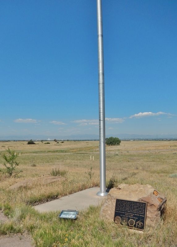
In 1942, women and men of the U.S. Army built this Arsenal that helped achieve victory in WWII and the Cold War. With thanks to our partners, the U.S. Army, Shell Oil Company and their contractors, we dedicate this flagpole to the employees of . . . — — Map (db m119380) HM
The Fourteeners
There are 58 peaks in the Colorado Rocky Mountains that are above 14,000 feet in height. While 54 are generally acknowledged to be "14ers", most people who want to climb them want to climb all 58. They are contained in six . . . — — Map (db m119395) HM
The pattern of ownership of 1545 Wazee Street symbolizes the development of Denver's rail age boom as an industrial and supply city requiring large scale warehousing. Its first owner and occupant, Henry Lee, was an agriculturist, pioneer gardener . . . — — Map (db m27242) HM
The first man to rob the Denver Mint was “Small Bad Jim” – James Clark. The gold bars were so heavy that he began dropping them only one mile away in what is now Cheesman Park. Six days later, the desperado was captured 25 miles south of Colorado . . . — — Map (db m100808) HM
The D&F Tower at the corner of 16th and Arapahoe Streets is all that remains of the Daniels & Fisher department store that stood on this block.
After its construction in 1911, the D&F Tower was for many years the tallest building in Denver. . . . — — Map (db m135103) HM
This tablet is the property of the State of Colorado ——— Most historical of Denver’s municipal parks. Created in 1882. This site was homesteaded in 1862 by “Potato” Clark. Jim Beckwourth, Mulatto “Daredevil”, erected a home in 1860 .6 . . . — — Map (db m203446) HM
This tablet is the property of the State of Colorado ——— On the northwest shore of Sloan’s Lake was Manhattan Beach popular amusement park of the Gay Nineties, with a theater, boating, dancing, and specialties. Opened . . . — — Map (db m203490) HM
Imagine standing here in a tropical hardwood forest 55 million years ago. The forest and ancient soils were later covered by white sandstone of uplifted and later eroded Pikes Peak Granite. The sandstone is known as the Dawson Arkose Formation. Its . . . — — Map (db m135458) HM
The Town of Castle Rock is named after Rock Park, a historic natural landmark and perhaps the most visible open space property in Castle Rock. Since 1935, this important landmark has been famous for the annual starlighting ceremony. Rock Park became . . . — — Map (db m232534) HM
This land you are standing on was already rich in history when General
William Jackson Palmer founded the City of Colorado Springs in 1871.
This land was home to American Indian people for thousands of years.
Cheyenne Creek and its majestic . . . — — Map (db m208668) HM
In 1879, General William Jackson Palmer, the founder of Colorado Springs, convinced his friend, Charles Elliot Perkins to purchase land in Garden of the Gods. Perkins eventually bought a total of 480 spectacular acres surrounding the Gateway Rocks, . . . — — Map (db m135547) HM
In 1879, General William Jackson Palmer, founder of Colorado Springs, convinced his friend Charles Elliot Perkins to purchase land in Garden of the Gods. Perkins eventually bought a total of 480 spectacular acres surrounding the Gateway Rocks, . . . — — Map (db m135646) HM
Given to
the City of Colorado Springs
in 1909
by the children
of
Charles Elliott Perkins
In fulfilment of his wish
that it be kept forever
free to the public — — Map (db m135023) HM
This rock formation, called Sentinel Rock, is a geologic treasure. It is composed of two types of rock - a fine sandstone and a gravelly conglomerate. The various layers in this rock were deposited 275 million years ago. During that time, ancient . . . — — Map (db m135022) HM
To those men who lie forever secure in their
youth and courage. The record of their achievement,
to which they gave the full measure of sacrifice,
is here-with dedicated.
Normandy-Southern France-Holland
Bastogne-Rhine River
Respectfully . . . — — Map (db m170109) WM
A Fitting Name
This amazing chasm was originally known as the "Grand Cañon of the Arkansas," which was sometimes confused with the "Grand Canyon of the Colorado." In the summer of 1874, Charles Savage, a famous railroad photographer from . . . — — Map (db m232533) HM
Vacationers driving wagons and Model T Ford's rumbled up this road in the 1920s to spend a week or more at Sophie and John Holzswarth's Trout Lodge. After each day's fishing, guests strolled to the "Mama" Cabin-the largest building to the left where . . . — — Map (db m162341) HM
One of the Kawuneeche Valley's first dude ranches once thrived here. In 1917, German immigrants Sophia and John G. Holzwarth built their homestead here, after wartime prohibition closed their saloon in Denver. Originally ranchers, they began hosting . . . — — Map (db m162343) HM
Automobiles Come to Grand Lake (panel 1)
The number of automobiles had become so large that in 1913 the State of Colorado began issuing its first license plates. The 1915 dedication of Rocky Mountain National Park drew 2000 people, . . . — — Map (db m129881) HM
Grand Lake was formed by glacial action, the ice gouged back into the mountains to the east. As the climate warmed, the glacier melted irregularly, leaving ridges of clay and rocks called moraines. Moraines edge the west and north shore, and are . . . — — Map (db m129855) HM
The Kawuneeche Valley is prime moose habitat. Wetlands along the Colorado River support aquatic plants, willows, and Aspen that moose eat. Moose frequented here, then were hunted out of the area by the early 1900s. In the late 1970s, the Colorado . . . — — Map (db m164288) HM
When the town of Grand Lake was platted in 1881, Grand Avenue was designed to be 100 feet wide. Although traffic congestion was not a problem, extra space was allowed for rodeos and horse races.
The Public Square was often used for community . . . — — Map (db m129840) HM
In 1882 P.H. Smith settled in Grand Lake. He built a hotel and also operated a sawmill, carpentry shop, and a large resort. Around 1915, along with the Alfred Eslick family, he built this Motor Court, designed to accommodate both visitors and their . . . — — Map (db m129857) HM
The Rapid Growth
The second largest wildfire in Colorado history, the East Troublesome Fire, was first reported on October 14, 2020. Originating northeast of Kremmling, it continued to burn eastward for about two weeks. The peak spread . . . — — Map (db m242392) HM
The Smith Eslick Cottage Court (panel 1)The Smith-Eslick Cottage Court is believed to be the oldest original-condition motel in the United States. Built at about the same time as the 1915 opening of Rocky Mountain National Park and the . . . — — Map (db m129879) HM
Entrepreneur P.H. Smith brought his family to Grand County from Kansas. In 1893 he started a sawmill in Grand Lake and acquired several local properties.
A skillful craftsman, P.H. Smith built many significant structures, including the Grand . . . — — Map (db m129883) HM
It's said that Grand Lake has always had tourists. Even the original visitors, the Ute and Arapaho for example, would come in the summer to hunt and fish in the largest natural lake in Colorado, but would leave when winter approached. Then, as now, . . . — — Map (db m129882) HM
On October 30, 1919, a group of thirty returned soldiers met at the Court House to formulate plans for an American Legion post. The Charter of which was granted November 22, 1919. The Post was named Bruce-Frew, honoring two men from Gunnison . . . — — Map (db m158730) HM
The Independent Order of Odd Fellows, IOOF, is an international fraternal organization that was founded on the North American continent in 1819. The command of the IOOF is to "visit the sick, relieve the distressed, bury the dead and educate . . . — — Map (db m158806) HM
This sign was place[d] on Monarch Pass
in 1916 by the DAR to commemorate
the Gunnison Country's abundance
of rainbow trout in the Gunnison River.
————————————— . . . — — Map (db m158558) HM
Even before this area was protected as a national recreation area, anglers came to this stretch of the Gunnison River in search of the legendary trout. Guest ranches and fishing resorts lined the river prior to the construction of Blue Mesa . . . — — Map (db m158551) HM
Before there was a reservoir here, three towns existed along the banks of the Gunnison River. The Denver & Rio Grande Railroad hauled both freight and passengers to the towns of Iola, Cebolla, and Sapinero. Sightseers came for the Rocky Mountain . . . — — Map (db m158858) HM
Before there was a reservoir here, three towns existed along the banks of the Gunnison River. The Denver & Rio Grande Railroad hauled both freight and passengers to the towns of Iola, Cebolla, and Sapinero. Sightseers came for the Rocky Mountain . . . — — Map (db m158865) HM
The Ute Indians who inhabited what is now Colorado, Utah, and northern New Mexico were organized into small family bands. They migrated seasonally between the mountains and the deserts and foothills in search of game and wild plants and to . . . — — Map (db m177848) HM
Devoted family man and visionary businessman.
John Brisben Walker is personally responsible for the way much of the front range looks in this area. In his quest for the perfect place to build a home for his family, he preserved thousands . . . — — Map (db m141095) HM
Morrison Fossil Area has been designated a National Natural Landmark This site possesses exceptional value as an illustration of the Nation's natural heritage and contributes to a better understanding of the environment 1973 National . . . — — Map (db m155600) HM
Erected through the cooperation of Federal, State and local governments by Works Progress Administration. Dedicated to the enrichment of human lives. A record of permanent achievement. — — Map (db m155601) HM
In 1937 the City and County of Denver built Alameda Parkway as the main route to Red Rocks Park. The construction exposed dinosaur tracks, but for many years geologists and members of the public observed them without studying them in detail. In . . . — — Map (db m155602) HM
Principle construction by Civilian Conservation Corps Company 1848, SP-13C, Mt. Morrison, CO.
1936 - 1941
Dedicated as a memorial to all who served at Mt. Morrison and to the 3 million who served in the CCC nation-wide, 1933 - 1942. The CCC . . . — — Map (db m57683) HM
Red Rocks Park is a national Historic District on the National Register of Historic Places. The Trading Post and the Amphitheater are Denver Landmarks. The Trading Post, an example of the Pueblo-style architecture, is made of brick and stucco and . . . — — Map (db m57641) HM
Grasslands are some of the most biologicaly productive but endangered ecosystems on
Earth, and are the major ecosystem in the
Great Plains. The prairie is integral in shaping this cultural landscape. It supports the interaction and survival of . . . — — Map (db m185037) HM
We ran up the creek with the cavalry following us…The dry bed of the stream was
now a terrible sight: men, women, and children lying thickly scattered on the sand, some dead and the rest too badly wounded to move… George . . . — — Map (db m181944) HM WM
In the 1940's and 50's, Climax not only had the highest post office and standard-gauge railroad in the nation, but also one of the state's premier ski areas. The trails of the first area in Colorado to be lit for night skiing were located on the . . . — — Map (db m122836) HM
By the time Charles Senter staked his claims on Bartlett Mountain in 1879, the trout were gone from Ten Mile Creek. It had been altered by smelting and mining that took place long before Climax began operations. Today, the trout are back.
. . . — — Map (db m122749) HM
Whose feet walked here first? As you walk this trail, imagine walking with you are other visitors, very different from those you would see today. They carry all their necessary gear: tools, food, clothing, and shelter. Rocky Mountain National Park . . . — — Map (db m162062) HM
Elk descend to this meadow and other lowlands when
higher elevations are blanketed by snow in fall, winter,
and spring. Preferring forests by day, elk are most often
seen grazing here at dawn or dusk.
By 1900, elk were hunted out of this area. . . . — — Map (db m164275) HM
The Beaver Meadows Visitor Center reflects the legacy of one the world's most creative architects, Frank Lloyd Wright. After Wright's death the firm he founded, Taliesin Architects, designed the building you see before you. Architect Thomas . . . — — Map (db m167993) HM
Over the years, Hidden Valley has been the site of many different kinds of human uses. Each has left its own changes on the face of the land - visible or invisible. Part of the forest was logged, and a sawmill operated here in the late 1800’s. Logs . . . — — Map (db m162486) HM
What is a “Park?"
In the early 1800s, French-speaking trappers
called broad mountain meadows “parques,'
meaning enclosures. Later, ranchers used these
large, open basins to graze livestock. Today,
Rocky Mountain National . . . — — Map (db m164185) HM
The mountain index on this rock is a memorial to Roger Wolcott Toll Superintendent of Mount Rainer National Park 1919-1921 *** of Rocky Mountain National Park 1921-1928 of Yellowstone National Park 1929-1935 Civil Engineer ** Naturalist . . . — — Map (db m162344) HM
Little Horseshoe Park was the site of the first Civilian Conservation Corps (CCC) camp west of the Mississippi River. In May 1933, CCC workers set up a base in the meadow below to house about 200 men.
This camp’s laborers became known as the . . . — — Map (db m162063) HM
Drill, blast, then pick up the rubble. Drill, blast, then pick up the rubble. Workers repeated this process off and on for three summers to carve through these gneiss and shist layers and create Rock Cut. Trail Ridge Road, constructed from 1929 to . . . — — Map (db m163425) HM
He laid the foundation of the National Park Service. Defining and establishing the policies under which its areas shall be developed and conserved unimpaired for future generations. There will never come an end to the good that he has done. — — Map (db m88995) HM
[Left side historical photo captions read]
With his climbing partner Rae Kennedy, and photographer Whipple Chester, John Otto became the first person to summit Independence Monument.
Otto had been in the area five years by then. When he arrived . . . — — Map (db m159662) HM
He laid the foundation of the National Park Service defining and establishing the policies under which its areas shall be developed and conserved unimpaired for future generations. There will never come an end to the good that he has done. — — Map (db m159637) HM
Does the shape of Independence Monument help tell the park's erosional story? It depends on your viewpoint. From here the monolith appears to be shaped like a tower, but the sideview shows that it is the remaining piece of a rock wall between . . . — — Map (db m159647) HM
Twenty-three mile Rim Rock Drive was built almost entirely by using picks, shovels, and sheer muscle to remove massive rock and debris. The engineering skill of the workers can be seen today in the tunnels and stonework. With construction came a . . . — — Map (db m159715) HM
With around 20 switchbacks, this old road was once called the "crookedest road in the world." In 1961, the Serpents Trail was converted to a hiking trail, quickly becoming a local favorite. The scenic path curves back and forth through Wingate . . . — — Map (db m159612) HM
This building was constructed in 1925, and served as an elementary school until
1965. It and the adjoining park, formerly known as Cottonwood, were named the
Whitman School and Whitman Park, in honor of frontier missionary Marcus
Whitman, who . . . — — Map (db m120079) HM
"Echo Park Dam would back water so far that ... Echo Park and its magnificent rock formations would be submerged. Dinosaur National Monument as a scenic
spectacle would cease to exist." Shall We Let Them Ruin Our National . . . — — Map (db m163444) HM
"A wilderness, in contrast with those areas where man and his own works
dominate the landscape, is hereby recognized as an area where the earth
and its community of life are untrammeled by man, where man himself is
a visitor who does not . . . — — Map (db m163443) HM
Welcome to Cortez, Colorado, and the San Juan Skyway — a 232-mile loop drive that will take you into the heart of the San Juan Mountains on state-maintained, paved highways.
The San Juan Skyway was designated a Forest Service Scenic . . . — — Map (db m160180) HM
Ancient Valley Cultures
Their homes may now be less visible than the cliff dwellings of their Mesa Verde neighbors, but the ancient farmers of southwestern Colorado were far more numerous. By the twelfth century perhaps 12,000 people tilled . . . — — Map (db m153392) HM
Clockwise, from top left:
Six ancestral Puebloan villages dating to around A.D. 1200 can be visited at Hovenweep National Monument although only Square Tower Sites are easily reached. The other sites are more remote and are not . . . — — Map (db m153391) HM
The cliff dwelling across the canyon is named for Mary Tileston Hemenway who funded the first scientific archaeological expedition in the southwest. At the time cultural objects were often removed for souvenirs or profit. Hemenway's support provided . . . — — Map (db m153346) HM
A traveler in 1892 described a trail on the ridge before you as the Crinkly Edge Trail. In 1911, just five years after the park was established, the trail became the Knife Edge Road, a new section of the main park road. Although scenic, the road was . . . — — Map (db m153342) HM
Montezuma Valley (below you) and Mesa Verde (where you now stand) were once part of the Ancestral Pueblo homeland. Between 600 and 1280 CE*, hundreds of villages and farming communities thrived on the mesas, plateaus, and canyons that form this . . . — — Map (db m153343) HM
Although silent today, Cliff Palace is a reflective reminder of a people who settled
among these cliffs, canyons, and mesa tops for a time, and then migrated to establish
new communities and neighborhoods further south. Here, for 700 years, they . . . — — Map (db m153355) HM
You are standing at the Ouray Fault, the first step in the formation of Box Cañon Falls. Millions of years ago a deep crack in the earth caused the harder rocks to move upward, while the soft sedimentary rocks to the north moved downward. As you . . . — — Map (db m191376) HM
Dubbed Bayou Salado by early European explorers, South Park is one of four high-altitude mountain parks in Colorado.
The view from Wilkerson Pass looks down to a great flat plain, perhaps the best-known mountain park in the state.
The name, . . . — — Map (db m153273)
Water is a precious commodity here and throughout the West.
Forests, fisheries, wetlands, waterfowl populations, and recreation all rely on healthy
watersheds. In addition, the Forest Service manages watersheds in this area that provide large . . . — — Map (db m153269) HM
Although Pikes Peak is not the highest peak in Colorado, it may be the best known, thanks to "America the Beautiful."
On Pikes Peak, Katharine Lee Bates was inspired to write a song that praises the natural beauty of this country. As you look . . . — — Map (db m153280) HM
History
The Independence Pass Foundation (IPF) was founded in 1989 by Aspen teacher and biologist Bob Lewis (1921-2005). IPF is a tax-exempt nonprofit that is supported entirely by grants and private donations.
Mission
IPF's mission . . . — — Map (db m152917) HM
Purpose
The "Top Cut” of Independence Pass refers to the section of road directly across the valley from this viewpoint. During the 1920s, highway construction and subsequent
erosion heavily damaged the slopes above and below the road. . . . — — Map (db m152914) HM
The Continental Divide is the topographic line that separates the Pacific and Atlantic Ocean drainages. The Divide in North America runs down the spine of the Rocky Mountains between Alaska and Mexico over the highest points between the drainages. . . . — — Map (db m152921) HM
The Independence Pass corridor is home to irreplaceable natural habitat, much of which is protected by federally-designated Wilderness Areas. Wilderness is off-limits to motorized recreation and mountain bikes but provides important low-impact . . . — — Map (db m152924)
Welcome to the second oldest national forest in the United States. President Benjamin Harrison set aside the White River Timber Land Reserve in 1891, in a bold step towards protecting forests on the American frontier. Wide open and wild, . . . — — Map (db m163892) HM
”My people roamed all over this country… over these mountain passes. They gathered to hunt buffalo and went back to the lower country when winter was approaching.” ~Eddie Box Senior Southern Ute Tribe At the dawn of history, . . . — — Map (db m163893) HM
You've just stepped into Colorado's Kingdom - a delightful trip back in time with all of today's modern conveniences and amenities. Here you'll find one of the world's premier resorts with outstanding four-season activities to please everyone's . . . — — Map (db m58003) HM
This family circle of fossilized redwood stumps grew out of the single trunk of an older parent tree. The three trunks are ancient clones, or genetically identical copies, of that parent tree. Modern coastal redwoods also reproduce by stump . . . — — Map (db m240610) HM
Within a few steps is the transition from a dry meadow into a cooler forest of Douglas-fir, spruce, and common juniper. The moisture content is higher here. Though you're looking south, you are standing on a north-facing slope. North-facing slopes . . . — — Map (db m158502) HM
As outcrops of shale weather, they separate into paper-thin sheets, exposing fossils on their surfaces. Within these delicate pages, a chapter of Earth's history unfolds.
Size played a key role in determining what was preserved at Florissant. The . . . — — Map (db m158439) HM
Open stands of ponderosa pine, Douglas fir, and quaking aspen now dominate the slopes of the Florissant valley. The ecosystem has changed since the days of the dense redwood forests. There are more open grasslands and the cold temperate forest is . . . — — Map (db m158433) HM
"One of the wonders of this part of the world is the 'Petrified Forest'...between Colorado Springs and Fairplay. This remarkable relic...bids fair to disappear very shortly, unless the...tourists cease their work of destruction. Everyone must . . . — — Map (db m158483) HM
To uncover the geologic history of the Florissant region, you must peel back the surface and examine the rock layers below. Sediments are deposited layer upon layer, with the oldest at the bottom and the youngest on top. Because of this principle . . . — — Map (db m158482) HM
Pikes Peak is the huge mountain you see across the valley. On a clear day, you can see two distinct areas on the mountain—a darker band of forest and a lighter colored treeless area. These different layers called "life zones" are a . . . — — Map (db m158493) HM
A grassroots effort
Beneath this valley is one of the richest fossil deposits in the world. Imagine instead this valley filled with a housing subdivision. There would be no open space, no trails, no scientific research, and no . . . — — Map (db m158376) HM
Core samples from Sequoia affinis fossil stumps contain remarkably well-preserved annual growth rings. Locked within those concentric rings are clues about past growing conditions in the Florissant valley.
The stumps at Florissant have . . . — — Map (db m158428) HM
Just beyond the circular wooden fence in front of you is a young ponderosa pine tree growing out of the top of an ancient petrified redwood tree stump. The huge redwood tree was buried by a volcanic mudflow and was later exposed by erosion. The . . . — — Map (db m158515) HM
You are standing in the Florissant valley surrounded by ponderosa pine forests. But 34-35 million years ago, this was the site of Lake Florissant. The twelve-mile-long lake was formed when volcanic mudflows dammed a stream that flowed south . . . — — Map (db m158489) HM
Rich Cultural History
The legacy of many different cultures and people can be found along the Byway. Native
American Indian tribes who lived here for centuries prior to settlement have left traces of their life ways in the earth, trees and . . . — — Map (db m153243) HM
Lincoln Park was established during the founding of Greeley in 1870. It represents successful town planning and urban design efforts by Greeley's founders. The 10-acre park was designed initially to be the cultural and social focus of the city. . . . — — Map (db m222038) HM