Near West Main Street, 0.1 miles west of South Chestnut Street, on the right when traveling east.
Side 1
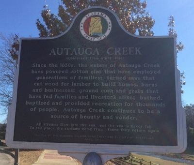
Water has always played a significant role in the history of Prattville. Daniel Pratt chose the location for his new town because of the proximity to Autauga Creek and the Alabama River. This area was referred to as an . . . — — Map (db m70815) HM
(Front): Daniel Pratt CemeteryFinal resting place of early Alabama industrialist Daniel Pratt, 1799-1873, and wife Esther Ticknor Pratt, 1803-1875. He was from New Hampshire and she, Connecticut. Married 1827 at Fortville, Jones County, . . . — — Map (db m168941) HM
On South Court Street at West Main Street, on the right when traveling south on South Court Street.
Located within Daniel Pratt Historic District, this park overlooks Autauga Creek and the manufacturing complex around which this New England style village developed. Daniel Pratt founded Prattville in 1839, and patterned the town after those of his . . . — — Map (db m27958) HM
On Maple Street at Pletcher Street, on the right when traveling west on Maple Street.
The plank road was constructed of large pine logs, sawed lengthwise and laid round-side down. Daniel Pratt built the road for public benefit and to provide transportation from the Pratt Cotton Gin Factory to Washington on the Alabama River. Over . . . — — Map (db m27983) HM
On East Main Street at South Memorial Drive (U.S. 31), on the right when traveling east on East Main Street.
Once the world's largest plant manufacturing cotton gins.
Founded 1833 by Daniel Pratt, the greatest industrialist of Alabama prior to 1860. Pratt's many industries were of great aid to Confederacy during Northern blockade. — — Map (db m70799) HM
On Bridge Street at Gin Shop Hill Road, on the right when traveling west on Bridge Street.
Daniel Pratt, Prattville’s founding father, constructed an imposing home and garden within a quarter-mile of this site on Autauga Creek, near his industrial complex. The large home was designed and erected by Pratt himself, a noted architect / . . . — — Map (db m27985) HM
On West 2nd Street east of McMillan Avenue, on the right when traveling east.
Side 1
In 1860, the center of commerce in Baldwin County ran along the rivers with the remainder of the county mostly wilderness. In 1861, with secession declared, the Alabama Legislature allocated funds to finish the stalled Mobile . . . — — Map (db m100846) HM
On County Road 49 at Swift Coles Lane, on the left when traveling south on County Road 49.
The Charles Swift Family
Charles Swift came to Alabama in 1880 and married Susan Roberts in 1885. He developed a successful lumber business, including a sawmill here on the Bon Secour River. The Swifts raised their eleven children in this . . . — — Map (db m122465) HM
On Scenic Highway 98 (Alternate U.S. 98) near Zundel Road, on the right when traveling south.
The Baldwin County Historic Development Commission was petitioned on October 15, 2012, for Historic Site Designation, pursuant to the authority conveyed by the Act No. 80-497, as amended by Act No. 89-960, and during their October 21, 2012 meeting, . . . — — Map (db m154449) HM
The first Fairhope pier was built in 1895. In the early years, the wooden pier served as a commercial dock for the bay boats. The first concrete pier was built in 1968 and remained in use until being severely damaged by Hurricane Ivan in 2004 and . . . — — Map (db m128891) HM
On North Hickory Street at Municipal Park Drive, on the right when traveling south on North Hickory Street.
As early as 1889 settlers came to this community, then known as Bennett, to farm. In 1891, John E. Loxley, from Michigan, opened a lumber mill he named 'Bennett Mill'. The settlement was later renamed Loxley, honoring the timber merchant.
The . . . — — Map (db m234691) HM
On Sibley Street, 0.1 miles west of U.S. 98, on the left when traveling west.
In 1839, Cyrus Sibley of Massachusetts acquired land on the eastern shore of Mobile Bay. Eight years later, a village was formally platted, surveyed, and was called 'Sibley City'. In 1852, it was renamed 'Montrose' as a tribute to the Scottish Duke . . . — — Map (db m234963) HM
On Orange Beach Boulevard (Alabama Route 161) at John M Snook Drive, on the right when traveling south on Orange Beach Boulevard.
The community of Orange Beach goes back to at least
1838, as evidenced by property deeds. As an incorporated
city, it is quite young. Following Hurricane Frederic on
September 12, 1979, with all its publicity, Orange Beach
was 'discovered'! . . . — — Map (db m122462) HM
On Perdido Beach Boulevard (Alabama Route 182) 0.1 miles east of Tannin Boulevard, on the right when traveling east.
Romar Beach began as a large homestead property with three miles of beachfront spanning from Gulf State Park to Hwy 161 in Orange Beach. The original property now covers only 480 feet. It was a true homestead and the owners were required to ‘till . . . — — Map (db m122463) HM
On Danner Circle west of Confederate Drive, in the median.
Born in Winchester, Virginia, he moved to Missouri where at age 17 he enlisted in the State Guard. In 1861 he became a Private in the Confederate States Army, was captured during the Battle of Wilson's Creek and escaped.
Captain Danner . . . — — Map (db m100880) HM
On Alabama Route 225, 1.2 miles north of Interstate 65, on the right when traveling north.
Site of one of Alabama’s first sawmills. In 1811, Joshua Kennedy engaged Jesse Ember to build two water-powered sawmills, convertible to grist mills, for a total of $1400. The mills were operated by Kennedy through 1820; were burned twice, once by . . . — — Map (db m66379) HM
On County Road 32 at State Route 59, on the right when traveling west on County Road 32.
Summerdale
The Summerdale area was settled in the early 1850's by several families of Scotch and Irish descent. By 1900, the town had a church, a saw mill, a turpentine business, and a hotel. Many families of different nationalities moved . . . — — Map (db m188733) HM
On Alabama Route 10, 0.3 miles west of County Road 41, on the right when traveling west.
The Pea River Electric Membership Corporation was energized on this site on June 8, 1939. This rural electric cooperative was organized under an executive order signed by President F. D. Roosevelt on May 11, 1935.
Rural members of Barbour, Dale . . . — — Map (db m71804) HM
On North Midway Street, on the right when traveling north.
This unusual house was built 1859 – 1861 by Benjamin Franklin Petty, a carriage and furniture merchant, who was a native of New York and a pioneer settler of Clayton. It was patterned after a design made popular by Orson S. Fowler’s book A . . . — — Map (db m39121) HM
On Blue Springs Street, on the right when traveling west.
The Central of Georgia Railroad completed a track spur connecting Eufaula, Alabama and Ozark, Alabama in the spring, 1890. The present site of Clio, Alabama was originally a water station known as Adkison Head. Old Clio was a small settlement with a . . . — — Map (db m200616) HM
Near East Broad Street east of North Livingston Avenue.
A primary factor in the eventual expulsion of the Creeks from their ancestral homeland was the fact that their territory was some of the best suited in the nation for the production of cotton. Containing enormous tracts of productive soils, a long . . . — — Map (db m101658) HM
On South Eufaula Avenue (U.S. 431) near West Barbour Street, on the right when traveling south.
Cowikee Cotton Mills, which operated on this site for over 100 years, was for decades Eufaula’s largest employer. The mill began in 1888 as the Eufaula Cotton Mill. In 1909 the Comer family purchased the business and renamed it Cowikee Cotton Mills. . . . — — Map (db m89606) HM
On West Barbour Street, on the left when traveling west.
Built between 1856 and 1860 by Edward Brown Young and his wife, Ann Fendall Beall, this was one of the first of the great Italianate style homes constructed in Eufaula. It later became the home of the builders’ daughter, Anna Beall Young, and her . . . — — Map (db m33759) HM
On North Eufaula Avenue (U.S. 431) 0.1 miles north of Broad Street, in the median.
Built by John Hart about 1850, the Hart House is recognized as an outstanding example of pure Greek Revival architecture. Hart (c. 1805-1863) moved from New Hampshire and became a prominent merchant and farmer. When constructed, the house was on the . . . — — Map (db m48376) HM
On East Broad Street east of North Livingston Avenue, in the median.
William Thomas "Tom" Mann
1932-2005
Family man, entrepreneur and bass angler legend, Tom Mann, achieved fame as a fishing lure designer/manufacturer and helped put Lake Eufaula on the map with his popular television shows. With an . . . — — Map (db m113682) HM
On Furnace Road (County Road 62) south of Montevallo Road (State Route 25).
The Bibb County Iron Company under the direction of C. C. Huckabee of Newbern, Alabama, constructed a furnace here and poured the first iron in November 1862. Within a year, the Confederate government purchased the works and completed a second and . . . — — Map (db m37090) HM
Near State Park Road south of Furnace Road (County Route 62), on the right when traveling south.
Wilson Hayes constructed this typical farm house for his wife and six children just south of Six Mile around 1900. After he moved to Oklahoma c. 1915, his daughter Ollie and her husband Levert Rotenberry lived in the home until 1928. Between 1928 . . . — — Map (db m37136) HM
On State Park Road south of Furnace Road (County Road 62), on the left when traveling south.
Originally located off Patton Chapel Road in what is today Hoover, Alabama, the Sunshine and Dorothy Morton house was moved to the Brierfield Park in March 2005 by the Morton family and restored over the next two years by restoration specialist . . . — — Map (db m37177) HM
On Cahaba River Drive (County Road 24), on the right when traveling north.
One and a half miles northeast of here, the mining town of Belle Ellen was established by the Bessemer Coal, Iron and Land Company in the fall of 1895 and named for Henry F. DeBardeleben's daughter, Belle, and wife, Ellen. DeBardeleben was a noted . . . — — Map (db m37226) HM
On Blocton Bypass (County Road 24) 0.1 miles east of Primitive Ridge Road, on the left when traveling east.
Blocton
Centered around the coke ovens, Blocton, first called Gresham, was the Cahaba Coal Mining Company town founded by Truman H. Aldrich in 1883-84. Other company officers included W. A. Clark of Muscatine, Iowa, and Cornelius Cadle, Jr., . . . — — Map (db m37228) HM
On Cahaba River Drive (County Road 24) at Piper Road, on the right when traveling south on Cahaba River Drive.
Piper
The town of Piper was established in 1901 a half mile northeast of here by the Little Cahaba Coal Company, named for Oliver Hazzard Perry Piper, a partner of industrialist Henry F. DeBardeleben. Two coal mines were opened in 1901 and . . . — — Map (db m83225) HM
Near Blocton Bypass (County Road 24) west of Griffin Town Road, on the right when traveling west.
The railway system was an important part of the iron and steel industry and the operation of the Blocton coke ovens. The ovens were constructed with rails on top for the charging car, often called a larry. There were rails between each row of ovens . . . — — Map (db m215680) HM
Near Blocton Bypass (County Road 24) west of Griffin Town Road, on the right when traveling west.
History of coke ovens
In the park are four rows of the remains of the Cahaba Coal Company's coke ovens. These beehive block ovens were not the earliest coke producing units in the Cahaba Coal Field but may very well have been the largest . . . — — Map (db m215677) HM
On Main Street at Walter Owens Drive, on the left when traveling east on Main Street.
West Blocton began as a business and residential community adjoining the Cahaba Coal Mining Company's town of Blocton in 1883-84. West Blocton incorporated in 1901. Eugene D. Reynolds was the first mayor, 1901-1904, followed by Dr. L.E. Peacock, . . . — — Map (db m72283) HM
Near Blocton Bypass (County Road 24) west of Griffin Town Road, on the right when traveling west.
Coke ovens, such as the ones you see in the park, are used to convert coal into coke, a cleaner burning fuel that produces little smoke. Construction here started in the late 1880's, with 140 ovens producing coke by 1889. The end buttresses that . . . — — Map (db m215681) HM
On 6th Street South (U.S. 231) at Champion Road, on the right on 6th Street South.
John Hanby came in 1817 and found a rich seam of brown iron ore. Named Champion in 1882 when Henry DeBardeleben and James Sloss bought land and brought L&N Railroad causing county seat to be moved from Blountsville to Oneonta in 1889. Most ore was . . . — — Map (db m28362) HM
On Ingram Avenue East at 2nd Street South, on the right when traveling east on Ingram Avenue East.
The origin and development of Oneonta was due to the coming of the Birmingham Mineral Railroad, a part of the Louisville & Nashville Railroad. Because of the presence of iron ore, limestone and coal in the area, there was always a great potential . . . — — Map (db m156406) HM
On Halso Mill Road (County Route 59) 0.1 miles south of Mt. Zion Road (County Road 65), on the left when traveling south.
The Butler County Electric Membership Corporation was formed as a rural electric cooperative in Greenville in July 1938. The first home receiving electricity from the cooperative was located near here.
The Cooperative's original Board of . . . — — Map (db m70756) HM
On West Commerce Street (Alabama Route 10) at Bolling Street, on the left when traveling west on West Commerce Street.
Side 1
West Commerce Street Historic District
The completion of the railroad in the late 1850s brought this District into being. The District grew into a major trade center between Montgomery and Mobile. The capital accumulated . . . — — Map (db m70753) HM
On East 10th Street west of Kirkwood Avenue, on the left when traveling east.
Outstanding local industrialist as President, Kilby Steel Company; Chairman, Board of Directors, Alabama Pipe Company; President, City National and Anniston National Banks. Served as Mayor of Anniston (1905-09); State Senator (1911-15); Lieutenant . . . — — Map (db m35758) HM
On Gurnee Avenue south of 12th Street, on the right when traveling south.
Block 148, the block on which you are standing, was first developed in 1880 when three identical brick houses were constructed at the southeast corner of the block as rental properties for workers at the nearby factories. This 1888 Bird's Eye View . . . — — Map (db m217433) HM
On Gurnee Avenue south of 12th Street, on the right when traveling south.
In 1917, Block 148 appeared much as it did thirty years earlier. The only new addition was the Chero-Cola Bottling Company on West 12th Street. However, the surrounding blocks, which had been residential or had remained undeveloped, saw some major . . . — — Map (db m217673) HM
On Quintard Avenue at East 17th Street, on the right when traveling north on Quintard Avenue.
The Legacy of the Military
On the other side of Anniston, the Army constructed an Ordnance Depot on 15,000 acres west of the city during WWII. Over time, the depot evolved into the region's largest employer. The economic and community . . . — — Map (db m106619) HM
On West 15th Street west of Walnut Avenue, on the right when traveling west.
This district was once the economic and social hub of Anniston's African American community. In its heyday (1940-1950), the District was a "city within a city," with businesses that catered to the black community. Grocery stores, restaurants, . . . — — Map (db m106650) HM
On Pelham Road (Alabama Route 21) at 5th Street NE, on the right when traveling north on Pelham Road.
Dean of American College Presidents
President of Jacksonville State Normal-State Teachers College 1899-1942
During an Educational Renascence in the South he was in the forefront of the Alabama Educational System
President 1st National Bank . . . — — Map (db m29922) HM
On Public Square West (State Highway 21) south of Clinton Street Southwest, on the left when traveling south.
Jacob Forney III lived and operated a thriving mercantile establishment at Jacksonville from 1835-56 on the south-east corner of the square. He and his wife Sabina Swope Hoke were the parents of nine children.
1. Daniel Peter - b. Feb. 24, 1819, . . . — — Map (db m36450) HM
On University Circle west of North Pelham Road (State Highway 21), on the right.
Lawyer, Industrialist, Patriot
Brigadier General, U.S.A.
Gen. Burke helped rebuild
Alabama’s mining & manufacturing
interests after the Civil War.
He helped establish the Catholic
Church at Jacksonville.
His home, . . . — — Map (db m36424) HM
On A Street Southwest near H Avenue Southwest, on the right when traveling west.
In 1905, local businessman Henry P. Ide joined with out-of-state investors and built the Ide-Profile Cotton Mill. Along with the mill, the company established the Profile Mill Village, which originally began as 40 homes for workers. The company . . . — — Map (db m195730) HM
On Pelham Road North at Clinton Street Southwest, on the left when traveling north on Pelham Road North.
Since 1890 the financial interests of this area have been served by The First National Bank and its predecessor The Tredagar National Bank (an institution of the "Boom" days of Jacksonville)
Organizers were Peyton Rowan, President, Jos. . . . — — Map (db m29480) HM
On Janney Road, 0.1 miles east of Spring Road, on the left when traveling east.
The furnace was constructed by Montgomery businessman Alfred A. Janney, reportedly using slaves brought from Tennessee by a "Dr. Smith." The furnace was completed and ready to produce pig iron when, on July 14, 1864, a Union cavalry raiding force of . . . — — Map (db m25544) HM
On Main Street at Mc Kibbon Street, on the right when traveling north on Main Street.
[Top plaque]
This property has been
placed on the
National Register
of Historic Places
by the United States
Department of the Interior
[Bottom plaque]
301 Main Street
has been placed on the
Alabama Register
of . . . — — Map (db m217258) HM
On Main Street south of East Oak Street, on the right when traveling north.
The town of Oxford was first incorporated by the Alabama legislature in 1852. The original boundaries included a one square mile area enlarged in 1860. Oxford became active as a cotton and trading center but during the Civil War growth slowed, and . . . — — Map (db m106591) HM
On 5 Points Fredonia Road (County Road 222) east of County Road 267, on the right when traveling east.
From its foundation, Fredonia was the educational and trade center for northeast section of Chambers County. "The Southern Military Academy" was established in the village by the state legislature and forced to close by the civil strife. Sixteen . . . — — Map (db m197957) HM
On North Lanier Avenue at 1st Street, on the left when traveling north on North Lanier Avenue. Reported missing.
Known as Bluffton from about 1835-1893. Bluffton was incorporated in 1865. Name changed to Lanett, town of Lanett incorporated 1893. Its charter was approved in 1895. Early records mention academies, two near this site. The Presbyterian Church was . . . — — Map (db m92061) HM
On Boulevard at Combs Street, on the right when traveling south on Boulevard.
Built in 1916, the kindergarten was one of five original public buildings in the Fairfax Mill Village. Each mill village had an efficient, attractive, and well kept kindergarten for children ages four to six. LaFayette Lanier, Sr. was the . . . — — Map (db m71634) HM
On 20th Avenue (U.S. 29) 0.1 miles north of 61st Street West, on the right when traveling east.
Cornerstones of Chattahoochee Mfg. Co., Langdale, Ala., and Alabama & Georgia Mfg. Co., River View, Ala., were laid on August 1, 1866. Mills used Chattahoochee River water power for operation of spindles and looms. Planters and businessmen of . . . — — Map (db m71637) HM
The Confederate States of America in 1862 commissioned the Noble Brothers of Rome, Georgia to erect a cold blast furnace to produce needed pig iron for the war effort.
The skilled labor was detailed from Confederate army personnel. It is . . . — — Map (db m83267) HM
On County Road 251, 0.1 miles north of County Road 714, on the left when traveling north.
Built in late 1862 by the Noble brothers, Cornwall Furnace was named for a similar blast iron furnace in James Noble's home state of Pennsylvania. The pig iron ingots produced from this facility were taken to the Noble Foundry in Rome where they . . . — — Map (db m156264) HM
On County Road 251, 0.1 miles north of County Road 714, on the right when traveling north.
The furnace was constructed 1862-1863 by the Nobles Brothers Foundry from Rome, GA using financing from the Confederate States of America. Slave labor was used to dig a half mile canal upstream to the Chattooga River, which powered the airblast. A . . . — — Map (db m156261) HM
On West Main Street (Business U.S. 411) at Tol Street, on the right when traveling west on West Main Street.
Inventor of the early typewriter—the pterotye. Born in 1831, Union Dist., S.C., died in 1905, grave 2 miles west. While registered in chancery and later editor of the National Democrat near this siteabout 1860, developed his first writing . . . — — Map (db m115571) HM
The McClung brothers, J.B. and Thomas, homesteaded land on Johhny's Creek in the 1800s. The two brothers harnessed power from water that flowed over the falls to operate a sawmill and grist mill. The McClung's two mills and blacksmith shop played . . . — — Map (db m212844) HM
On Shinbone Valley Road (County Road 127) 2 miles south of Alabama/Georgia State Line when traveling south.
In 1902, a coal mine was opened at Lake Lahusage in neighboring DeKalb County. The mined coal was carried by a "dinky line" to the brow of Lookout Mountain at Five Points in Cherokee County. The TAG railroad built a spur line about 2½ miles in . . . — — Map (db m202239) HM
Col. Charles Rattray served in the 57th Ill. Infantry. He served in Sherman's command at Gaylesville in October 1864. He fell in love with Theodora McWhorter and promised to return and marry her when the war ended. He was a man of his word. His . . . — — Map (db m202257) HM
On County Road 15 at State Route 35, on the right when traveling north on County Road 15.
In February 1937, W.P. Brown & Sons Lumber Co. signed a contract with Alabama Power for an estimated 20,000,000 feet of saw timber. The south end of Brown's property is located 1,000 feet back of this marker and extended northward ¾ mile. Brown . . . — — Map (db m114741) HM
On County Route 48, 0.2 miles south of County Route 600, on the left when traveling south.
(side 1)
Put into blast by noted Southern ironmaster Moses Stroup in 1852, the Round Mountain Furnace was the fourth oldest blast furnace in Alabama. It was the first furnace to make use of red fossiliferous iron ore.
Driven by steam . . . — — Map (db m139401) HM
On County Route 29 at County Route 45, on the right when traveling north on County Route 29.
Put into blast on June 1, 1874, the furnace would change ownership two times prior to being purchased by the Bass Foundry and Machine Co. of Fort Wayne, Indiana in 1880. A rail spur was built from the furnace to Selma, Rome and Dalton Railroad at . . . — — Map (db m114842) HM
On County Route 8, 3 miles east of County Route 45, on the left when traveling east.
Located 500 yards southeast of this marker. Incorporated in 1888, Bluffton was promoted as a future iron center of the South, due to large iron ore deposits and four furnaces within a four mile radius. The town soon boomed due to an influx of . . . — — Map (db m140001) HM
Near Mitchell Dam Road, 0.5 miles east of County Road 93.
Named by the Board of Directors
of
Alabama Power Company
to honor
James Mitchell
President 1912-1920
Major modifications to this project were completed in 1985. Three new generating units with a total capacity of 150,000 kilowatts . . . — — Map (db m72486) HM
On Paragon Road (County Road 16) 2 miles west of State Route 17, on the left when traveling west.
On January 2, 1944, the State of Alabama granted Hunt Oil Company a permit to drill the A.R. Jackson Well No. 1 at this location near Gilbertown. Hunt Oil Company was owned by the famous oil man, H.L. Hunt of Dallas, Texas. Drilling commenced on . . . — — Map (db m80351) HM
On U.S. 84 at River Street, on the right when traveling west on U.S. 84.
The Clarke-Washington Electric Membership Corporation was organized near this site on March 2, 1936, by some 83 members from Clarke and Washington Counties. This was the first rural electric cooperative organized in Alabama under an executive order . . . — — Map (db m80356) HM
On Commerce Street (Alabama Route 177) at Magnolia Drive, on the right when traveling west on Commerce Street.
Side 1
First home of Creek and Choctaw Indians, Jackson’s first pioneer settlers arrived about 1800. The little village was first called Republicville, then Pine Level, before its incorporation by an act of the Mississippi Territory . . . — — Map (db m101591) HM
On Commerce Street (Alabama Route 177) at Magnolia Drive, on the right when traveling west on Commerce Street.
First village called Republicville. Town laid out in 1815 by Pine Level Land Company and named Pine Level. Incorporated 1816 and renamed Jackson for General Andrew Jackson. First commissioners, David Taylor, David White, Reuben Saffold, Peregrin . . . — — Map (db m101589) HM
519 entries matched your criteria. The first 100 are listed above. Next 100 ⊳