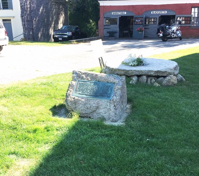
Original Settler with the Barnstable Colony in 1640.
Selected Grand Juror, Hayward, Constable, and Highway
Surveyor. Served with Militia of the Colony of New
Plymouth. In 1658, he built and operated one of the
First Grist Mills in . . . — — Map (db m140492) HM
Opening to vessel traffic in 1914, the primary purpose of the Cape Cod Canal is to provide a safe, navigable intra-coastal route for vessels, saving 65 – 166 miles of travel around the historically treacherous outer shores of Cape Cod, . . . — — Map (db m158552) HM
Placed in memory of Captain David F. Ryder, born on Bar Cliff Avenue in 1915, who fished out of this harbor for 56 years. Always a hook fisherman, he and his partners landed their catches from the wooden boats "Betty", "Alice" & "Nancy", "Alice & . . . — — Map (db m234501) HM
Native Americans have harvested fish and shellfish in Chatham waters for millennia. Weirs – stationary structures of twine nets and wooden poles driven into the seabed – were the traditional method for catching finfish and squid. Weir fishing is . . . — — Map (db m234503) HM
The Old Village, encompassing the land between Chatham Harbor on the east and Mill/Little Mill Pond on the west, became the town center in the 1800’s probably due to the Old Harbor area becoming less navigable. A concentration of small stores on . . . — — Map (db m159151) HM
A 2-6-0 coal fired steam locomotive coupled to a string of freight cars wait for departure at the Chatham Railroad Depot in 1932. The Chatham Railroad Company constructed seven miles of tracks as a branch line with stations in Chatham, South . . . — — Map (db m159095) HM
From the Municipal Fish Pier, the
Chatham commercial fishing fleet, the
Cape's largest, heads to the Atlantic.
Most days, the hard-working fleet
brings in high-quality seafood-over
25 million pounds a year-destined
for local, national, and . . . — — Map (db m234502) HM
This wind powered grist mill was built in 1797 by Colonel
Benjamin Godfrey on a hill by his home on Stage Harbor Road
Overlooking the Mill Pond, where it served the growing needs of
Chatham residents for corn meal, a staple among early . . . — — Map (db m159325) HM
Inviting guests to step through the massive jawbones of a whale may seem an unusual way to say, “Welcome to our home.” But for Captain Edward Penniman, there could be no more appropriate greeting. Born in Eastham, Captain Penniman earned . . . — — Map (db m111659) HM
Edward Penniman’s career as a man of the sea began at age 11. At 21, he was harpooning with the New Bedford, Massachusetts whaling fleet. By the time he was 29, he was master of his own whaling ship. Captain Penniman’s seven whaling voyages spanned . . . — — Map (db m111660) HM
Why is it called "Teaticket"?
The Wampanoag Indians named this area "Tataket," which translates roughly as "At the principal tidal stream." Fresh water springs here flowed to the ocean and provided an abundance of fish.
The Wampanoag
. . . — — Map (db m234486) HM
One of a pair of grinding stones found on property once owned by the Brooks family in Harwich Center. By the 18th century the town boasted as many as eight grist mills where local farmers could take their grain to be ground. — — Map (db m157856) HM
In the 1800s more than 150 Sea Captains called Hyannis home. Tree lined streets, such as Pleasant Street, or Sea Captain Row, link Main Street to the Harbor. The Old Colony Railroad originally extended to a wharf in The Outer Harbor along what is . . . — — Map (db m162589) HM
The Town Center of Hyannis - where town business & commerce meet culture & history
Walkway to the Sea
The Village Green was originally designed as a common for the school buildings that are now town offices. It is a place to . . . — — Map (db m162551) HM
Hyannis Harbor, Then …
The sandy peninsula of Cape Cod, a distinctive “arm and elbow” reaching into the Atlantic Ocean, was created by glacial deposits during the ice age more than 23,000 years ago. The Cape offered a . . . — — Map (db m166627) HM
Main Street, Hyannis in the 1960s was filled with activity. Shops were bustling, and supporters of John F. Kennedy, running for president, lined the streets. Since JFK based much of his campaigning out of the Kennedy Compound in Hyannis Port, . . . — — Map (db m144001) HM
Early tenants included the U.S. Post Office, New England Telephone and Telegraph, Cape and Vineyard Electric Co., Barnstable County National Bank, F.W. Woolworth, & W.T. Grant. The West Barnstable Brick Company provided Many Of The Original . . . — — Map (db m142677) HM
All nine of the Cape Cod Lifesaving Stations were a part of the USLSS District 2. In 1872, Sumner I. Kimball, then Chief of the Treasury Department’s Revenue Marine Division, appointed Orleans resident Benjamin Sparrow as Superintendent of . . . — — Map (db m158783) HM
East Orleans Country Store, built prior to 1835 by William Myrick. Later owned by Myrick, Doane & Crosby. Sold in 1858 to lot Higgins and moved to the present site. Run until 1935 by Samuel Higgins. — — Map (db m141678) HM
French – Atlantic cable company Cape Cod station 1890 – 1959. Oldest cable on Atlantic bed. From storm isolated Cape, first world news of steamer Portland lost off Truro with 200 lives; flashed from Orleans to Brest, France and back over . . . — — Map (db m77557) HM
Built circa 1720 in South Orleans, later moved to the center of town. It was moved to Hyannisport in 1897. In 1983, the structure was given to the Orleans Historical Society by the Groves family. The society then donated it to the town. Dismantled . . . — — Map (db m59979) HM
”All the towers leaking bad. Everything all wet and in poor order
Log entry by Keeper Nathan Gill, 1874
Taking care of a lighthouse was demanding. The keeper was tasked with keeping the lights burning no . . . — — Map (db m141388) HM
On January 28, 1915, President Woodrow Wilson signed the law creating the US Coast Guard by combining the Lifesaving Service with the Revenue Cutter Service. The law put the Coast Guard under the Treasury Department in peacetime and under the . . . — — Map (db m158839) HM
The submarine telegraph cable known as Le Direct provided communication between Europe and North America without intermediate relaying. In a remarkable feat of oceanic engineering, the cable was laid in the deepest waters of the Atlantic Ocean . . . — — Map (db m141616) HM
Shipwrecks and Lifesaving in Orleans date back to the winter of 1626, approximately 170 years before the incorporation of the Town. During that winter, the Sparrow-hawk, carrying passengers bound for Jamestown from England, was wrecked in the . . . — — Map (db m158793) HM
In the years following World War I, the profession of lifesaving changed significantly. The widening of the Cape Cod Canal and the removal of the substantial tolls greatly reduced the amount of shipping traffic off our dangerous eastern shore. . . . — — Map (db m158911) HM
In 1872, the United States Lifesaving Service (USLSS), a unit of the US Treasury Department, established nine lifesaving stations on Cape Cod. One of these stations was in Orleans, on Nauset Beach just opposite the south end of Ponchet (now . . . — — Map (db m158775) HM
Whales and humans have long shared the coastline of Cape Cod. Native Americans harvested whales the washed up on the beaches, almost exclusively for food, long before the arrival of European colonists. While anchored in what would become . . . — — Map (db m141867) HM
Thomas Dexter began building gristmills on this site in 1637.
The mill you see here today started operating in about 1654.
The early settlers of Sandwich brought their corn to “The Grist Mill”
to be ground into meal, . . . — — Map (db m140436) HM
First Church of Christ
A congregational chapel was first built on this site in 1813 and replaced in 1847 with this lovely Greek revival with a spire said to be reminiscent of the London spires designed by Christopher Wren. It is one of . . . — — Map (db m234497) HM
Sandwich Town Hall
Built in 1834, this columned Greek Revival, continues to serve as the seat of town government and is one of the oldest town halls in New England. In 2009, the building was beautifully and accurately restored and received . . . — — Map (db m140508) HM
Here stood one of the world’s greatest pioneer radio stations, Marconi’s South Wellfleet wireless, or “Old CC.” Unfortunately, the historic station was dismantled and abandoned in 1920, and the ocean has eroded away over half the land . . . — — Map (db m141102) HM
Guglielmo Marconi successfully transmitted wireless telegraph signals as early is 1890 – between tin plates mounted on post in his father’s garden in Italy. He was only sixteen years old.
Inspired by short range successes, Marconi . . . — — Map (db m141101) HM
(north face)
Big Business of Cotton Cloth
This engraving appeared at the top of the company's letterhead c.1921.
For 68 years, the Berkshire mills were the largest employer in town and, at one time, the second largest . . . — — Map (db m185552) HM
Side 1
The Plunkett brothers - W.B. (William Brown) and C.T. (Charles Timothy) - lived most of
their lives on Park Street. Their father - W.C. (William Caldwell) - was a successful textile manufacturer who built a large mansion there. . . . — — Map (db m233027) HM
In a righteous cause they have won immortal glory
and have nobly served their nation in serving mankind
[Died in service]
William Douglas • Martin Lauer • Lambert Lenhardt
[Honor Roll of Veterans]
Joseph Abraham • Richard Adam • . . . — — Map (db m118640) WM
In recognition of her outstanding leadership as a pioneer crusader for woman's rights and equality. Miss Anthony's life was rooted in the nineteenth century struggle to reform American democracy and society. Her campaign for woman's suffrage . . . — — Map (db m118588) HM
The Railroad Solved A Problem
Farming in this valley was profitable for only a select few. So, the entrepreneurial and mechanically inclined living in the valley built small textile mills powered by waters flowing off the hills. But they . . . — — Map (db m232704) HM
(side 1)
Why McKinley
The McKinley Monument was dedicated on October 19, 1903, two years after he was assassinated in Buffalo, N.Y. He visited Adams on three occasions: once as Governor of Ohio and twice as President of the United . . . — — Map (db m234458) HM
Here at the headwaters of the Hoosic River, you are standing beside one of three basins that make up the 500-acre Cheshire Reservoir (also
named Hoosac Lake). In 1866 the river was dammed by the Adams-Cheshire Reservoir Company for the purpose of . . . — — Map (db m185548) HM
On 20 March 1886 William Stanley provided alternating current electrification to offices and stores on Main Street in Great Barrington, Massachusetts. He thus demonstrated the first practical system for providing electrical illumination using . . . — — Map (db m154428) HM
Memorial Street Light
erected by
Massachusetts Electric Company
June 28, 1986
in recognition of
William Stanley
and his contributions to the
Electric Utility Industry — — Map (db m58987) HM
William Stanley
1858 1916
Inventor
His genius made Great Barrington the first community to be lighted by alternating current in March 1886.
Monument erected by the Rotary Club of Great Barrington on its fiftieth anniversary.
May 18th . . . — — Map (db m58972) HM
William Stanley (1858-1916) devised an innovative electric distribution system using an alternating-current transformer. His laboratory was in Horace Day’s rambling, vacant rubberwear factory, the foundation of which is just visible on the . . . — — Map (db m107662) HM
Historically, the economy of Lee has been based on two industries, paper and marble. Paper making began in 1806. By the Civil War, Lee produced more paper than anywhere else in the US. In 1867, the Smith Paper Company manufactured the first wood . . . — — Map (db m184849) HM
On July 11, 1774, the people of New Marlborough Township assembled in their first Meeting-House here to record their opposition to certain acts of the British Parliament. On that day – nearly a year before the Battle of Bunker Hill – . . . — — Map (db m136846) HM
In the year 1834, a handsome coach of the “Red Bird” line drew up here and set down its passengers for an overnight stay at the Village Inn. With this event, thereafter a daily occurrence, new Marlboro became the bustling midway station on the . . . — — Map (db m136847) HM
has been designated a
Registered National
Historic Landmark
under the provisions of the
Historic Sites Act of August 21, 1935
This site possesses exceptional value
in commemorating or illustrating
the history of the United . . . — — Map (db m118819) HM
The Shakers, perhaps more than any other religious movement, embraced purity of design and consummate craftsmanship in everything they created. These banners represent a sample of the typical and joyful Shaker palette. As you tour this National . . . — — Map (db m118818) HM
Site of first cabin built by Isaac Stratton in 1762; first tavern, built by Samuel Sloan in 1767; town meetings in second story hall built by John Jordan in early 1830's. — — Map (db m118574) HM
Built 1772 as a farmhouse and tavern. Benedict Arnold slept here May 6, 1775 enroute to help Ethan Allen take Fort Ticonderoga. Bread baked here for Battle of Bennington, Aug. 16, 1777. — — Map (db m118657) HM
A mill dam was first built on this site in 1746. About 1799, William White, Sr. built a stone water-powered cotton mill for himself and three of his sons, Phineas, William and Benjamin. That mill, one of the earliest in the country, burned down . . . — — Map (db m16723) HM
These arches replace the last wooden bridge on the main line constructed in 1880
Henry A. Whitney pres't.
Albert A. Folsom sup't.
George F. Folsom Eng'r. — — Map (db m55671) HM
Built in 1827 by Col. Willard BlackintonStone Placed
by Attleboro Historic Commission
Given to the city of Attleboro
by
Mr. and Mrs William A. Nerney
1970 — — Map (db m72444) HM
Lowney Common
Graciously donated to the Citizens of Mansfield in 1917 by
Walter M. Lowney
1855 - 1921
Internationally known candy manufacturer
Founder and president of the Walter M. Lowney Company
He was . . . — — Map (db m159211) HM
Docked across from you (when not at sea as a sail training and education vessel), Ernestina is one of the oldest wooden sailing vessels afloat. The ship is also one of the last surviving Gloucester fishing schooners, one of only two remaining . . . — — Map (db m86768) HM
A fine example of late 19th century commercial architecture, this warehouse was erected in front of the Andrew Robeson mansion and housed an auction business selling everything from antique furniture to ships. WHALE acquired the . . . — — Map (db m107415) HM
For many Cape Verde Islanders, the New bedford
wharf area was the first view of America. At the height
of immegration between 1900 and 1921, more than
a dozen packet boats ran between Cape Verde
and New Bedford, the main port of entry. Packet . . . — — Map (db m86766) HM
Captain Paul Cuffe
Paul Cuffe (1759-1817) was a sea captain, merchant, philanthropist, community leader, civil rights advocate and abolitionist.
Here are some significant details about his life.
Westport, MA: site of the . . . — — Map (db m77468) HM
London
Cuffe sought support in London from the African Institution - a group that was committed "to stimulating trade with Africa, without itself trading, to promote African education and improved farming methods, and to be a . . . — — Map (db m86901) HM
The view down Centre Street has changed little over the years, and no street in New Bedford served the whaling industry longer. Little finery can be seen in the facades of these buildings, for this was a working waterfront, where utility overrode . . . — — Map (db m58182) HM
Text on the Bronze Plaque
Near this Site
was located the shipyard of
Colonel George Claghorn
Builder of U.S. Frigate Constitution
and Ship Rebecca the first whaler
to double Cape Horn.
His service in the . . . — — Map (db m86782) HM
On this site in 1936, Cape Verdean and Portuguese dockworkers formed Locals 1413 and 1465 of the International Longshoremen’s Association (ILA). Prior to organizing, these dockworkers were chosen daily, based only on their physical ability, and had . . . — — Map (db m1614) HM
Text on Front side of Monument:
Dedicated as a Tribute
to the
sturdy whalemen who early won fame
for New Bedford
and their successors who,
inheriting ideals and resourcefulness
gave to the city new prominence . . . — — Map (db m86677)
Seeing Double
As you gaze across Water Street toward the eight-pillar institution, compare closely what you see in the photograph with what stands here today. Built in 1831, the building was designed by architect Russell Warren. For 61 years the . . . — — Map (db m58192) HM
A one-industry whaling town before the Civil War, New Bedford became a one-industry textile town afterward. Cotton bales and coal, both bound for the city's new textile mills, began to replace oil casks on New Bedford wharves.
Oil casks . . . — — Map (db m86731) HM
The boats you see in the harbor today are mostly commercial fishing vessels - primarily draggers and scallopers; the whaling barks of the past have long since vanished. By the 1930s, just as whaling faded and the textile industry fled to the . . . — — Map (db m86680) HM
Born in Richmond, Virginia, in 1800, Lewis Temple established himself as a blacksmith on the New Bedford waterfront by 1836.
Temple manufactured his first toggle-iron in 1848. Its fastening power revolutionized the catching of whales. The . . . — — Map (db m1616) HM
On the other side of the Bourne Counting House, the granite building in front of you, is Merrill's Wharf, completed in 1847. The wharf then was the longest in New Bedford port. Built by Edward Merrill for an expanding whaling fleet, this wharf . . . — — Map (db m86733) HM
Has been designated a registered National Historic Landmark
Under the provisions of the historic sites act of August 21, 1935 this site possesses exceptional value in commemorating or illustrating the history of the United States — — Map (db m58196) HM
In 1915, in the waning light of whaling's final decade, Emily Howland Bourne financed the construction of a museum building to honor her whaling merchant father, Jonathan Bourne, Jr. This marked the first steadfast effort to preserve New . . . — — Map (db m86657) HM
The outward appearance of the brick and brownstone building diagonally in front of you has changed little over the years. However, the signs identifying the ownership and use of the structure have changed repeatedly. It was originally built as a . . . — — Map (db m62358) HM
Change of Address
Andrew Robeson, whaling merchant and steadfast abolitionist, built this Federal-style house in 1821 on a lot on North Second Street, diagonally behind you. The estate, with its conservatory, gardens, surrounding elm trees, . . . — — Map (db m77505) HM
Wealth with a Conscience
Early whaling merchants lived in elegant houses along this street. But by the time Benjamin Rodman built this Federal style home in 1821, many of his wealthy friends were moving uphill away from this shoreside . . . — — Map (db m76980) HM
Home Away from the Sea
Whaling men spent much of their lives at sea. The ship was their home. Back in port, most of the poor, unskilled sailors knew no one in New Bedford and were essentially homeless until the next voyage.
In 1850 the . . . — — Map (db m58197) HM
Twentieth-Century Whaling-As New Bedford’s whaling industry declined in the 19th century, more than a dozen other nations began hunting whales using “modern” Norwegian methods, with fast, steam-powered vessels and heavy-gauge harpoon . . . — — Map (db m62387) HM
“A Dead Whale or a Stove Boat”
(inscription on back) In honor of the whalemen whose skill, hardihood and daring brought fame and fortune to New Bedford and made its name known to every seaport on the globe. • Gift of W.W. . . . — — Map (db m1626) HM
Whaling Capital-In 1857, ninety-five ships and barks left these wharves on whaling voyages. In that year the industry reached its peak, and half of the worldwide whaling was conducted from the New Bedford customs district. Before petroleum was . . . — — Map (db m62411) HM
During the war, we were getting a dollar and a half a gallon for sperm oil. And then around 1922 there was no more demand for sperm oil....The price of sending a ship to sea doubled and the price of oil dropped about 200 percent....And . . . — — Map (db m86759) HM
This historic area along Stony Brook was named Chartley before 1700. The name is thought to be related to the iron business, which thrived in this area.
In 1695, the Taunton North Purchase granted to Thomas and James Leonard land along the . . . — — Map (db m55989) HM
Built by James Leonard
Originally owned by twenty-three
of Taunton's first settlers
Operated 1777 to 1876 by
Hon. Josiah Dean
and his descendants as sole owners
Erected 1950
by Bertha Dean
Adelaide Lord Livingstone
Daughter and . . . — — Map (db m87253) HM
Former site of the Anawan House, once called the Lewis Tavern built ca. 1835 as a rest stop for travelers between Taunton and Providence Plantations.
The Anawan House and inn served the public until July 1970. In February 1971 the building was . . . — — Map (db m55683) HM
In 1720, Jonathan Bliss moved here from South Rehoboth and established a sawmill on the East Branch of the Palmer River with a homestead nearby. This homestead was one of the first in the area, and Bliss called it " my farm in the woods" the mill . . . — — Map (db m56247) HM
The ruins of the old dam are all that remain of the once busy Perry Turning Mill. This mill originally operated as a saw mill in a joint venture by Aaron Cole and Ezra Perry. Perry bought out Cole's share in he early 1800's, and raised the dam, and . . . — — Map (db m56249) HM
Nearby runs Mine Brook named after an iron mine established here in 1696 by the Leonards, a famous iron monger family from Norton and Taunton.
The ore dug at this site called bog iron, was found in the swamp and brook. The Leonards hauled the ore . . . — — Map (db m55679) HM
in 1810 a group of Rehoboth Citizens established Palmer River Manufacturing Company. A cotton spinning mill on the site of the old Joshua Smith grist and saw mill the mill was enlarged about 1826 and began manufacturing fine cotton cloth, as the . . . — — Map (db m44924) HM
It was known as Butterworth Falls in the colonial days. Deacon Thomas Carpenter and later the Perry family maintained the saw-gristmill-turning shop here for almost 200 years — — Map (db m55686) HM
Founded by Josiah Millerd in 1731. For over 140 years neighborhood farmers had their corn ground into meal and their logs sawn into lumber at this mill. — — Map (db m55917) HM
Here were built about 200 ships from small sloops to vessels of 1060 tons which sailed from the Atlantic coast to the China seas.
Dedicated to their memory by
Algernon H Bell •
Carolyn Bell Fenley •
Constance Bell Falconer — — Map (db m56214) HM
(A Chinese Huai tree - Sophora japonica) Brought from China in a flower pot in 1837 by Captain Thomas Milton to grace his new home then being built. This is believed to be the largest of its kind on the continent. — — Map (db m177815) HM
404 entries matched your criteria. The first 100 are listed above. Next 100 ⊳