The 1928 Natchez City Directory lists Italian immigrant Sam Anzalone as operating a grocery store at 158-160 St. Catherine Street where he sold gasoline for 21 cents a gallon. Many of the late- nineteenth-century Italian immigrants farmed and sold . . . — — Map (db m114509) HM
300 North Martin Luther King Street (above) is home to the city's oldest funeral business.Robert D. Mackel (below) opened Bluff City Undertaking in 1898 at the corner of Jefferson and North Rankin Streets. About 1911 he relocated the business to . . . — — Map (db m108600) HM
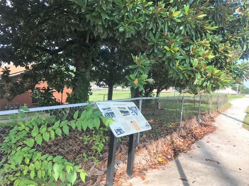
Professional dealers, traffickers and speculators, by purchase, by hook, crook and sometimes outright kidnapping, tore apart mothers, fathers, daughters, sons, brothers, sisters, uncles, aunts, cousins, babies, young children, relations and friends . . . — — Map (db m114508) HM
Site of the printery of “father of Mississippi journalism.” Printed first book in state, 1799. Became first public printer and in 1802 founded famed newspaper, “Mississippi Herald.” — — Map (db m70851) HM
Bontura, built in 1851, was the home of Robert Smith, a free African American who ran the city’s most successful carriage business in the 1850s. The house stands at the head of Silver Street, which leads to Natchez Under-the-Hill. Smith . . . — — Map (db m87179) HM
Built ca. 1836, this structure, a National Historic Landmark, is a fine example of the Greek Revival style. A Banker’s House attached to the rear insured security & gives the structure an unusual and practical plan. — — Map (db m79346) HM
[Panel 1:]
Natchez in the Center of Slavery
Slavery is central to American history. The labor of enslaved African Americans built much of the nation’s wealth and enabled it to gain its economic independence. The enslavement of people . . . — — Map (db m41533) HM
This 1866 view of High Street shows two houses, but one is no longer standing. The surviving house in the foreground has porches with the kind of sawn wooden railing that is called “gingerbread,” because it looks like the . . . — — Map (db m127099) HM
John Smith, a partner in the contracting firm of Neibert and Gemmell, built this brick cottage in 1838. The John Smith House is named for two owners with this same common name. In this 1866 photograph, evergreen trees obscure the front of . . . — — Map (db m127078) HM
Zion Chapel African Methodist Episcopal (A.M.E.) Church was built in 1858 as the Second Presbyterian Church, a mission of First Presbyterian Church. Zion Chapel acquired the building in 1866, when Hiram R. Revels served as pastor. The . . . — — Map (db m127093) HM
Ethel Clagett and Mabel Porter were among the first women in America to own a car dealership that was not inherited from a male spouse or relative. They opened their dealership in 1914 on Main Street and moved to a larger new facility on . . . — — Map (db m108610) HM
The Protection Steam Fire Company No. 3 built a grand firehouse in 1902 at the corner of Main and Canal streets (no longer standing). During the 1800s and early 1900s, volunteers provided fire protection in Natchez as in most American . . . — — Map (db m127086) HM
The Old Natchez Post Office was built in 1904 on the site of William Johnson's Main Street barbershop. Before his 1851 death, Johnson also owned two other barbershops in town. He used both freed and enslaved black workers who served only . . . — — Map (db m127074) HM
The dramatic looking Natchez Hotel (no longer standing) was built in 1891. Within a few years, parts of the building began to disappear in stages. The tent-like dome went first in a storm, and a 1926 fire destroyed most of the structure. . . . — — Map (db m127090) HM
Edelweiss is a Swiss Chalet-style building which dates to 1883. The house offered both a great view of the Mississippi River and a convenient location for the family of its first owner, Joseph O'Brien, a coal-dealer at Natchez . . . — — Map (db m108807) HM
Oldest building in Natchez. Standing before 1789. Operated as a tavern, stage stop, and mail station at the end of Natchez Trace. Now owned and restored by the Pilgrimage Garden Club of Natchez. — — Map (db m127081) HM
First settled by French, 1716-29. Lasting growth came with Britain, 1763-1779, and Spain, 1779-98. Cotton and trade made it commercial and cultural capital of Old South. — — Map (db m4479) HM
The Spanish built Silver Street about 1790 to connect the town to the riverfront below. In the 1800s, Natchez Under-the-Hill was a major port on the Mississippi River. Natchez exported and imported agricultural goods, with cotton being . . . — — Map (db m127108) HM
Chartered in 1809 as the only bank in Mississippi Territory and given a monopoly as the official state bank in 1818. It occupied this site in 1826 but was supplanted by Planters' Bank in 1831. Closed solvent. — — Map (db m70854) HM
John J. Nosser, Mayor of Natchez from 1962 to 1968, was born in Lebanon in 1899 and immigrated to the United States in 1919. Mississippi welcomed a number of Lebanese immigrants who became some of the most successful businessmen in their . . . — — Map (db m114458) HM
Pictured (left to right) are the Stallone sons, Hugo, Serviglio, Premo, and Meno. All of the sons worked on St. Catherine Street. Hugo operated a grocery store, where his brother Serviglio also worked. Premo opened a plumbing and electrical . . . — — Map (db m115624) HM
The house to your left, completed in 1841, was built by William Johnson. Born a slave in 1809 in Natchez and freed in 1820, Johnson learned the profession of barbering from his brother-in-law. At an early age, he owned a barbershop and later . . . — — Map (db m92857) HM
Axel Voss spoke little English when he emigrated in 1925 from Copenhagen, Denmark. He worked as a mechanic for Chris Anderson and John T. Belt, who founded A-B Motor Company in a backyard garage at 114 St. Catherine. The first Voss business venture . . . — — Map (db m103882) HM
William Johnson
1809-1851
was a free African American Businessman and Diarist. His diary, covering the period from 1835-1851 and published in 1951, contains an extensive description of everyday pre-Civil War life; it is a valuable . . . — — Map (db m34877) HM
(Marker #1)
A National Road
Natchez in the extreme south-western corner of the United States was threatened by Spain in 1800 and later by France and Great Britain.
President Jefferson in 1801 decided that a road from Nashville . . . — — Map (db m87267) HM
Across the Parkway behind you is a portion of the Old Natchez Trace - - a wilderness road that originated from a series of trails used by the southeastern Indian tribes. The Natchez Trace was politically, economically, socially, and militarily . . . — — Map (db m87265) HM
Built ca. 1801 and operated as a tavern by
Charles De France and Richard Fletcher,
the two-story, wood frame building
that stood here housed Mississippi's
territorial legislature from at least 1808
to 1811. At the time, Washington was . . . — — Map (db m136948) HM
By 1810, most travelers along the Natchez Trace were Kaintucks
heading home.
Kaintucks – farmers and boatmen from the Ohio and
Mississippi river valleys – floated crops and other goods
to market in New Orleans or the bustling, edgy river . . . — — Map (db m244210) HM
"The array of modern machinery, representing a vast outlay of capital, the little army of men and women - chiefly the latter - working together in concentration and harmony that denote superb administration, the high-ceilinged, . . . — — Map (db m183943) HM
Named Dayton in 1884 in honor of David Day who gave the R.R. right-of-way. In 1917, Foster Creek Lumber & Mfg. Co. mill & town of Stephenson est. here. In 1934, named for L.O. Crosby who bought the vast co. holdings. — — Map (db m96180) HM
"Redbud Springs" in Indian days. Later named for Polish-American patriot. Chartered, 1836. On Natchez Trace near geographical center of state. Trade activity gave it title, "Beehive of the Hills." — — Map (db m140798) HM
First hotel built in the Village of Mound Bayou
"In the matter of sanitary surroundings, in the way of rooming
arrangements, and culinary excellence with the matter of
dining, the service at the Newton Hotel will satisfy the
mostly . . . — — Map (db m90470) HM
Organized by Charles Bank
Building dedication led by Booker T. Washington
More than 15,000 attended dedicatory event
Constructing Architect: Thomas W. Cook
Construction Foreman: W. H. Cook — — Map (db m90504) HM
Mound Bayou businessman and physician Theodore Roosevelt Mason Howard (1908-1976) founded and led Mississippi's pre-eminent civil rights organization in the 1950s, the Regional Council of Negro Leadership. A charismatic speaker and mentor to . . . — — Map (db m90148) HM
Louis Leflore first traded with the Choctaw Indians at a bluff now part of Jackson Mississippi. About 1812 he established his stand 900 feet to the northeast on the Natchez Trace.
Because of the storekeepers nationality, the area was often . . . — — Map (db m87485) HM
Pigeon Roost Creek, to your left, is a reminder of the millions of migrating passenger pigeons that once roosted in trees in this area. The species has been completely destroyed.
One mile east where the Natchez Trace crossed the creek, . . . — — Map (db m87484) HM
This water wheel was originally built for Mr. and Mrs. J. L. Peacock of Mendenhall Ms., in 1948 and was donated by them to this park in 1971.
The wheel was built for the purpose of generating electricity by water power that operated a . . . — — Map (db m104095) HM
212-14 Carrol. Ca. 1840 Greek Revival. One of the finest commercial/residential buildings from this era in Mississippi today. The center doorway opens to a stairhall which leads to the residence area upstairs. — — Map (db m139356) HM
600 Block of Market. Ca. 1828-40. Federal/Greek Revival. This grouping of buildings had commercial space on the ground floor and either storage or living space above. Washington Hall at 601-09 Market was formerly a hotel. — — Map (db m139468) HM
• Claiborne County native educated in local schools and Alcorn A & M College
• First black citizen elected to the Claiborne County Board of Education - 1969 to 1974
• Operated a successful business on this site
• Owned an . . . — — Map (db m104424) HM
405 Market. 1810-20 Federal. This large brick structure was one of the well known inns along the Natchez Trace. The famous actor Joseph Jefferson was a guest here. This is one of the oldest buildings in Claiborne County. — — Map (db m139471) HM
702 Market. 1840 Greek Revival. This bank closed its doors during the Civil War but reopened afterwards as a hotel. Since 1890 it has been used for its original purpose. The hexastyle portico features unfluted Doric columns. — — Map (db m139458) HM
On April 1, 1966, the local chapter of the National Association for the Advancement of Colored People (NAACP) imposed an economic boycott on the majority of the white-owned businesses in Port Gibson/Claiborne County. In the months leading up to the . . . — — Map (db m104340) HM
Center of early trade on Chickasawhay River with Gulf Coast. Served during Civil War as location of hospital and prison camp and temporary refuge of the State Government. — — Map (db m84213) HM
Front
Since 1944 the Riverside Hotel has provided lodging for traveling musicians. It was home to some, including Sonny Boy Williamson II, Ike Turner, and Robert Nighthawk. Before that, the building served African Americans of the . . . — — Map (db m90062) HM
Front
This neighborhood, known since the turn of the twentieth century as the New World, was a breeding ground for ragtime, blues, and jazz music in Clarksdale's early days as a prosperous and adventurous new cotton town, when . . . — — Map (db m90060) HM
First built in 1926 by the Elks Club of
Clarksdale, this property was sold in
1933 to William Mhoon Wilkerson,
who developed it into a popular
tourist destination. At its height, the
Moon Lake Club property included a
restaurant, hotel-style . . . — — Map (db m235158) HM
Site of cotton & woolen mills
set up, 1866, by J. M. Wesson.
Burnt, 1873; rebuilt, expanded &
operated by Col. Ed.
Richardson & Capt. Wm. Oliver
with 2,000 employees. Closed
1910 & dismantled 1919. — — Map (db m122614) HM
Site of a hotel since 1864, this structure was built ca. 1877. Known originally as the Richardson House, the hotel was owned by Mississippi Mills, a once-flourishing textile mill founded by J.M. Wesson in 1864. — — Map (db m122512) HM
These buildings are the remnants of
Bonhomie, a company-owned sawmill town
that thrived from 1915 to 1938. The Tatum
Lumber Company established a mill here
in 1915, drawing laborers and their
families to the area. During its height,
Bonhomie . . . — — Map (db m175897) HM
Named for grocer, hotel owner-operator, community leader. Republican 6th Cong. District. Chairman 1924-1940. National Convention Delegate 1936. Leader of Black MS Republicans 1920-1940. ------------------------------------------------------- Wood . . . — — Map (db m175992) HM
Established here in what was then
Perry County on February 8, 1887,
with D. L. Carter as the first
Postmaster. Discontinued on
September 11, 1893, but reestablished
on January 10, 1894, with J. S.
Doyle as Postmaster. Named for
F. M. Morris . . . — — Map (db m206581) HM
In 1898, E.E. Bolen established a nursery and orchard company in George County. Other wholesale nurseries were established in the early 1900s. The production of ornamental plants, trees and shrubs has since become a thriving commercial industry in . . . — — Map (db m56545) HM
The Clark Cemetery was established by
W.M.B. Clark (1809-1881) in 1879 with
the burial of С.С. McInnis, born in 1804.
It is the final resting place of a number
of Greene County businessmen, legislators,
county officials and . . . — — Map (db m122334) HM
Located in the northern part of Bay St. Louis, the area known as Cedar Point developed in the late 1880s when G.W. Dunbar and Sons built a seafood cannery near the end of Dunbar Avenue. In 1909, the Peerless Oyster Co. opened at the present-day site . . . — — Map (db m187779) HM
Hancock County Bank opened on October 9, 1899. Weeks later the bank's board of directors purchased this property at the corner of Main Street and South Beach as the site of a new headquarters. Bay St. Louis's first two-story brick building, the . . . — — Map (db m108455) HM
Developed by Rocketdyne, the H-1 rocket engine burned liquid oxygen and propellant RP-1, a kerosene derivative. A cluster of eight H-1 engines powered the Saturn S-1B rocket's first stage, providing a total of 1.6 million pounds of thrust. — — Map (db m107987) HM
Founded here in 1848, Logtown was home to the Weston Lumber Company, founded in 1889, which became one of the largest lumber milling operations in the United States during the 1920s. By 1961 the last 250 residents were removed to make way for the . . . — — Map (db m107866) HM
Located at this site, Brown's Vineyard, established 1874, was a popular resort during the late 19th and early 20th centuries. The wine, produced on site from scuppernong grapes, was marketed and sold across the United States. The vineyard, which . . . — — Map (db m49061) HM
According to local tradition, the "Pirate House," located here, was built as early as 1802 and was frequented by famed pirate Jean Lafitte and his associates. Later remodeled as a Greek Revival structure, the house is believed to have a secret . . . — — Map (db m108459) HM
In 1880, self-made entrepreneurs Lazaro Lopez, F. William
Elmer, William Gorenflo, James Maycock, and William K. M.
Dukate formed a company that would launch Biloxi's seafood
industry. Inexperience did not thwart the partners. Dukate
traveled to . . . — — Map (db m102241) HM
Barq's root beer was created by Edward C. Barq, Sr. in 1898 and produced on this site until 1936, when the operation moved to Lameuse Street. A Mississippi Gulf Coast favorite, the number of franchise bottlers grew to over two hundred by 1950. . . . — — Map (db m68425) HM
Built here in 1934 as part of a U.S. Coast Guard base, the barracks was an E-shaped, Spanish Colonial Revival style building made of reinforced concrete. Arcaded porches lined the building's
wings and central pavilion, which had an octagonal . . . — — Map (db m102175) HM
The Greek Revival mansion once located here was a "raised cottage" (meaning it was composed of a frame upper story set upon an above-ground brick basement to
protect the wooden portion from moisture and insects.) Probably built ca. 1850 for Peter . . . — — Map (db m68423) HM
The development of downtown Biloxi paralleled the economic
growth of the city. Biloxi's first economic boom occurred during the
antebellum period when daily stops by a steamboat packet between
New Orleans and Mobile turned the small village into . . . — — Map (db m102243) HM
The development of downtown Biloxi is a direct reflection of the economic growth of the city. During early and mid-19th century homes on small lots and hotels occupied the area. Attracted by the population density, merchants began to establish . . . — — Map (db m91146) HM
Originally on this site was the Slavic Benevolent Association Lodge, a 13,000 sq. ft. structure with a meeting hall accommodating 600 people. Known as the Slavonian Lodge, the building served as a social center for the large number of ethnic Slavs . . . — — Map (db m102174) HM
During the early 19th Century, the Biloxi peninsula was sparsely populated
with a few French speaking families. The 1827 establishment of steamboat
service between New Orleans and Mobile, via Lake Pontchartrain, served
as a catalyst for the . . . — — Map (db m102223) HM
S. 3 mi. Once center of wool industry. Here on July 16, 1910, three rural schools formed Woolmarket Vocational High School, considered to be the first consolidated high school in the state. — — Map (db m20010) HM
Before roads and bridges, trading-posts were essential on the Bay Pierre and Celina Harvey built their home on this site, acquired from her father Joe Moran. In the 1830s, along with their children and a black female with child, they completed their . . . — — Map (db m122403) HM
In February 1699, men exploring the Bay under Captain Pierre LeMoyne's command, found no settlements. In the 1720s, one of three colonial brickyards were developed near this site. Dominic Ladner gained title to this section (22) from the Spanish, . . . — — Map (db m122402) HM
In 1721 the French colonial headquarters made its fourth move on
the Coast: Old Biloxi to New Biloxi with the intentions of building
a permanent fort of bricks. Abundant ideal brick clay, was discovered
here, the best of four resource sites. . . . — — Map (db m122401) HM
In 1834 Dominique Ladnier sold a strip of land adjacent to the
Sanchez strip to Pierre Quave. The most practical location for a
town on the Bay was at this strip, because of the Bay channel
and its Proximity to the most suitable ferry landing . . . — — Map (db m122434) HM
N. 1 mi. Founded c. 1800. Famed, 1840-1900, for foundries, sawmills & shipyard; Coast's first newspaper, "Democrat" (1846); and many fine academies. Here Jeff. Davis attended Polar Star Lodge, founded in 1852. — — Map (db m81006) HM
On April 20, 1925, the Magnolia Route opened with a forty-hour, 1,000 mile endurance drive from Gulfport to Chicago. This route was designed to bring more commerce and tourism to Mississippi. — — Map (db m80995) HM
Oldest commercial building on Jeff Davis Avenue. Built in 1924 by Hancock County Bank as its second branch. Located in Long Beach primarily to serve this area's growing truck farming industry. Because of the Great Depression, the branch was moved in . . . — — Map (db m81049) HM
Arrival of L&N Railroad in 1880's made possible Long Beach's development as a truck farming center. James Thomas and W. J. Quarles in 1884 began truck farm industry by raising and shipping green beans to northern markets. During next 25 years, over . . . — — Map (db m81047) HM
The lots and streets from the original
survey of 1829 are known today as Olde
Towne Clinton. In 1824, Charles Lawson, a
federal land surveyor, purchased land in
Hinds County. After his death in 1826, his
nephew and heir, Charles Lawson Jr., . . . — — Map (db m178441) HM
Built in 1927 by the New Orleans Great
Northern Railroad, this freight depot
served various railroads, including the
Gulf, Mobile & Ohio, until 1972, when rail
operations ceased. The Merchants
Company, a wholesale grocer, leased the
building . . . — — Map (db m219750) HM
Front
Malaco Records, one of America’s foremost labels in the fields of southern soul, blues, and gospel, was founded at this site in 1967. Malaco’s studio was the first state-of-the-art recording facility in Mississippi. The label . . . — — Map (db m90193) HM
To improve communication to the Old Southwest, the Natchez Trace was declared a post road in 1800. Afterwards, with Choctaw permission, improvements to this section of the Old Trace began. In 1805, the Choctaw allowed inns, known as stands, to be . . . — — Map (db m87361) HM
Front
Scott Radio Service Company, located at 128 North Gallatin Street, just north of this site, was one of the first businesses in Mississippi to offer professional recording technology. The Jackson-based Trumpet record label used . . . — — Map (db m90196) HM
Two of Jackson’s historic hotels once stood at this site. The Eagle Hotel, originally a tavern, was built in 1823. Andrew Jackson was a guest here in 1840. Alexander McClung, editor and Mexican War hero, committed suicide at the hotel in 1855. The . . . — — Map (db m51178) HM
In 1938, the Mississippi Geological Survey in cooperation with the W.P.A.
undertook a geological survey in ten counties. Assistant state geologist
Fredric F. Mellen supervised several county surveys in search of good
ceramic clays. Mellen . . . — — Map (db m185390) HM
Built ca. 1908 as a private residence for
Cyrus C. Warren, vice president of the
Warren-Godwin Lumber Company, this
Colonial Revival mansion was designed
by the Chicago architectural firm of
Spencer & Powers. Known as the Warren-
Gunter . . . — — Map (db m115367) HM
The Jitney Jungle grocery store chain was
founded in 1919 by the McCarty and Holman
families. In 1933, Jitney No. 14 held its
grand opening in this Tudor Revival
building designed by Emmett Hull. The
building, called "The English Village," . . . — — Map (db m115335) HM
The Gowdy community was first settled prior to 1903. Named for Mr. W.B. Gowdy, former president of the Delta Cotton Oil and Fertilizer Plant. This African American community was awarded its own U.S. postal stop in 1915. The Gowdy community is . . . — — Map (db m71366) HM
(Left Panel)
Lower Choctaw Boundary
The line of trees to your left has been a boundary for 200 years. It was established in 1765 and marked the eastern limits of the Old Natchez District. This boundary ran from a point 12 . . . — — Map (db m87312) HM
Began in 1820s as trading post. Incorporated in 1836. County seat of Holmes County since 1834. In 1907 the first Corn Club in the United States was organized here by W.H. (Corn Club) Smith. — — Map (db m140843) HM
Front
The names of Turner’s Drug Store (located on this corner) and the Easy Pay Store across the street are etched into blues history as sponsors of some of the first radio programs in Mississippi to feature Delta blues. In 1947-48 . . . — — Map (db m77270) HM
Also known as the Cates-Gaither House, this one-story Greek Revival-style planters cottage was built in ca. 1859 by ship builder and merchant Pleasant Cates. The heavy framing includes original pegged joints. Named for the cedar trees on the . . . — — Map (db m96773) HM
A.J. Staub Jr. and W.G. Stewart opened Staub-Stewart Hardware Company on this site on July 18, 1924. Joseph Edwin Staub, a hardware clerk, convinced the owners in 1941 to allow him to form J. E. Staub & Company, a construction company. J. E. Staub . . . — — Map (db m205430) HM
W. 1 mi. Here, 1887~1904, G.A. & J. T. Holley bridged gap between rural schools and colleges for many who distinguished themselves in law, education, & business. — — Map (db m117204) HM
The West Pascagoula Creosote Works, at this site, was the first continuously operated creosote treatment plant in the nation. Established in 1874 to protect railroad bridge timbers against rot and the toredo worm, the plant was open until 1978. . . . — — Map (db m16726) HM
This sawmill operated on this site from 1867 till 1906, employing more than twenty local citizens and producing more than 30,000 board feet of lumber per day at its peak. The sawmill was well situated with easy access to the river, railroad, . . . — — Map (db m16754) HM
Built c. 1867, by Fernando Upton Gautier and his wife, Theresa Fayard Gautier. The Gautiers moved to this area from Biloxi and established the F. Gautier and Sons Sawmill in 1866. The house is built from native pine cut at the sawmill, which closed . . . — — Map (db m16756) HM
Invented and operated by members of pioneer Krebs family at least two decades before the Whitney gin. Family burial ground is on site of Old Spanish Fort. — — Map (db m102185) HM
239 entries matched your criteria. The first 100 are listed above. Next 100 ⊳