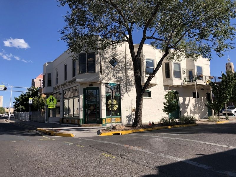
The Champion Grocery and Meat Market was
established in 1904 by Italian immigrants Alessandro
and Amadeo Matteucci. The store was long
considered one of the finest in New Town. Alessandro
Matteucci operated the store until 1938, he and . . . — — Map (db m236168) HM
One of Albuquerque's Italian community centers and one of the city's early grocery stores.
Site No. 521
A Registered Cultural Property
State of New Mexico — — Map (db m236167) HM
Martineztown is at the crossroads of El Camino Real de Tierra Adentro and Tijeras Canyon Trail, two important trade routes begun by Native Americans. The trail though Tijeras Canyon linked the Rio Grande Valley to the plains east of . . . — — Map (db m189456) HM
Designed by Henry Trost and built about 1910 for merchant-politician Spitz and family, its Prairie Style harks back to the Midwest.
SR 371
A Registered Cultural Property
State of New Mexico — — Map (db m236303) HM
Microsoft, Inc., founded at this site
in 1975 - and headquartered in Albuquerque
until 1979 - was established by Paul G. Allen
and Bill Gates. The opportunity to write a
version of BASIC for the MITS Altair drew
them to the area and sparked . . . — — Map (db m180827) HM
The Central Bank Building shown in this 1905 view stood at
the northwest corner of Gold Avenue and Second Street.
Central Bank and other financial establishments at Gold and
Second gave the intersection the name "Bankers' Corner.
Central . . . — — Map (db m236623) HM
This view of Gold Avenue, looking west from First
Street, was taken about 1890 during the New Mexico
Territorial Fair parade. Gold Avenue was the financial,
professional, and governmental center of downtown
Albuquerque. The domed building at the . . . — — Map (db m235908) HM
Harvey Girls
In 1883, the Fred Harvey Company hired women to serve in its diners and hotels along the Atchison, Topeka and Santa Fe Railway. Thousands of respectable, intelligent women were recruited from the Midwest and East Coast to come . . . — — Map (db m45326) HM
Hotel Alvarado was constructed in 1902 and demolished in 1970 in spite of local efforts to preserve it. The hotel and depot complex, shown in this 1908 photograph looking west, was designed by Santa Fe Railroad architect Charles Whittlesey in . . . — — Map (db m45446) HM
This photograph shows the 1898 Territorial Fair
parade passing along the 300 block of Railroad
(Central) Avenue. Railroad Avenue was the main
thoroughfare of Albuquerque's New Town, and it
linked the railroad depot to Old Town Plaza. . . . — — Map (db m236626) HM
The corner of Railroad (Central) Avenue and Front (First) Street was prime real estate in 1882. The railroad had built its depot here in 1880, spurring the founding of Albuquerque's New Town. This view shows the first hotels, saloons, and stores . . . — — Map (db m235904) HM
Opened in 1935 as part of the Pig Stand chain, it offered “Wholesome Food and Service” to walk-in and drive-in customers.
SR 1566
A Registered Cultural Property
State of New Mexico — — Map (db m235896) HM
In the 1920s and 1930s, a dairy was in operation at this location along the Rio Grande. In the 1940s, the land was known as the Hedges Farm. The Hedges family grew alfalfa and corn for their horses and other livestock. J.W. and Lola Hedges built . . . — — Map (db m182214) HM
The first vineyards in North America were planted in New Mexico during the 17th century by Spanish settlers. They grew Mission grapes to make wine for religious ceremonies and other varieties for eating. For nearly three centuries, vineyards and . . . — — Map (db m182157) HM
Ben Abruzzo
1930 – Rockford, Illinois
Pat Abruzzo
1932 – Rockford, Illinois
1985 – Albuquerque, New Mexico
Ben Abruzzo was one of those rare individuals who undertake great enterprises – adventures of the human spirit which . . . — — Map (db m120091) HM
When there was no bridge over the Rio Grande, people swam, forded or floated across to the other side. The stretch of river south of Albuquerque was known as the "Armijo crossing" or the "Atrisco Forde" and was trusted as a good place to cross . . . — — Map (db m186086) HM
(English:)
Look south. From the earliest days of the New Mexico frontier, the road before you was the Royal Road, the only link to the greater world. Travel on the 1600-mile course was filled with dangers - robbery, Indian attacks, . . . — — Map (db m187796) HM
(English:)
Captain Cristobal Baca and Don Pedro Gomez Duran y Chavez arrive in San Gabriel colony from Mexico City.
Our story might begin with Josefa Baca, a bold young woman who bought the land on which you are . . . — — Map (db m187794) HM
Juliana Gutierrez y Chaves Hubbell
1833-1839
Juliana was a member of two prominent early Spanish families in New Mexico and a descendant of Josefa Baca, the original owner of the land comprising present-day Pajarito. In 1849, at the age . . . — — Map (db m188222) HM
Imagine the sounds of chickens, the smell of horses and bustling of human activity. You are standing at the entrance of the plaza, which offers a sense of the historical layout that changed throughout time but was typical of the Spanish colonial . . . — — Map (db m185573) HM
This community is part of the Pajarito Land Grant, which can be traced to 1746 when Spain controlled present-day New Mexico. Covering 47,000 acres between the Rio Grande and Rio Puerco, it is one of the 69 New Mexico land grants confirmed by the . . . — — Map (db m185522) HM
Albuquerque's South Valley serves as a thriving community, full of history and cultural traditions. This marker is informed by oral histories collected from residents whose families lived and continue to live in the South Valley, some for at least . . . — — Map (db m186095) HM
Due to the strategic location of our town, folks have always found it a pleasant place to stop, rest, and refresh… The first merchant in town had such a demand for home made pies and they were of such quality that they became justly famous… Local . . . — — Map (db m170399) HM
Listed on the National Register of Historical Places, contractor
David Young Tomlinson began construction on this house in 1910
and completed it in 1912, the same year New Mexico became a state.
Taking cues from Frank Lloyd Wright's Prairie-style . . . — — Map (db m235388) HM
In the frontier west, Pat Garrett has to be considered as one of the most famous and effective of legendary law officers. Six feet, five inches tall, he was an imposing and implacable foe of western criminals. An honest and honorable lawman, . . . — — Map (db m73452) HM
President Franklin Delano Roosevelt implemented the “New Deal,” a plan for ending the Great Depression. His economic program was was based on relief, recovery, and reform and included the introduction of the Works Progress Administration . . . — — Map (db m104410) HM
Roswell’s first general store and post office stood near this spot. The building was constructed by Van C. Smith in 1870 and hosted a somewhat famous postmaster, Ash Upton, who was a political player in the Lincoln County War and the ghost writer . . . — — Map (db m102896) HM
Located just north of the great lava bed known as the malpais, Grants began as a coaling station for the Santa Fe Railroad. Around 1880 it was known as Grant's Camp, after the Canadian bridge contractor Angus A. Grant. In 1950, the area's vast . . . — — Map (db m36472) HM
Located just north of the great lava bed known as the malpais, Grants began as a coaling station for the Santa Fe Railroad. Around 1880 it was known as Grant's Camp, after the Canadian bridge contractor Angus A. Grant. In 1950, the area's vast . . . — — Map (db m36473) HM
This drill bit was used at Crownpoint N.M. to drill a 10 ft. diameter shaft 2,234 ft. The drill cutters weigh 30,000 lbs. Total assembly weight is 443,000 lbs. One third of its weight was used for cutting purposes. The rest of the weight as a . . . — — Map (db m164162) HM
This bucket was used to retrieve gold & silver ore as well as miners from the depths of the Fannie mine at Mogollon, NM Donated by Red & Nina Waldie Family 2006 — — Map (db m186517) HM
Economic Impacts
Laguna, like many pueblos, had a strong and self-sufficient agricultural system well into the twentieth century. After World War II, farming and sheep herding started to decline, although some families continue these . . . — — Map (db m184206) HM
Business Along Route 66
As traffic along the road increased, Laguna community members began to sell or trade items at roadside stands within the Pueblo and on adjoining lands to the east and west. Community members built shade structures . . . — — Map (db m184000) HM
The Saint James Hotel
Has been placed on the
National Register
Of Historic Places
By the United States
Department of the Interior
1872 — — Map (db m45779) HM
The discovery of gold on Baldy Mountain in 1866 brought such a rush of fortune-seekers to the Moreno Valley that “E-town” became a roaring mining camp almost overnight. Because of water and transportation problems, and a decline in ore . . . — — Map (db m45751) HM
Built in 1896 by the Smith brothers, Scottish immigrant coal miners, the Palace Hotel became the crowning jewel of the many holdings acquired by the frugal Smiths. Nearly lost by fire in 1932, the Palace was purchased and restored by the Tinnie . . . — — Map (db m196359) HM
Traveling on the Santa Fe Trail, the commercial road which ran 900 miles between Franklin, Missouri, and Santa Fe, New Mexico, could be long, hard, and dangerous. Obtaining water was sometimes a problem and, along with breakdowns and bad weather, . . . — — Map (db m156697) HM
A native of Kaskaskia, Ill, a fur trader and trapper who by industry, good fortune and trading became sole owner in 1864 of the largest single tract of land owned by any one individual in the United States.
Maxwell founded the First National Bank . . . — — Map (db m73719) HM
This is the oldest documented brick building in New Mexico.
Augustin Maurin (of French descent) initiated construction in 1860 using burned brick from his own kiln. He was murdered by robbers in his adjoining apartment in 1866.
The heir, Cesar . . . — — Map (db m196768) HM
"He was born with compassion" is the way John R. Gray was described by his daughter, Terry Gray Chandler, and is remembered by those who knew him. His outward appearances portrayed him as a gruff cowboy, but he was known as a benefactor in his town, . . . — — Map (db m235349) HM
Mack Chase got his start in the oilfield in 1945 at the young age of 14. After graduating from Artesia High School, he went straight to the field full time on a pulling unit, then into two years of service in the United States Army in the early . . . — — Map (db m235351) HM
“It is my boiled-down, concentrated, solidified and undiluted opinion that the oil development in this Valley so far is only a preliminary skirmish compared with the artillery that will soon follow.” – Martin Yates, Jr., 1924
The brochures . . . — — Map (db m235362) HM
Dedicated to the men and women who take the risks and do the work to find, produce and refine New Mexico oil and gas. This monument of a 1950s drilling rig is unveiled in celebration of the 80th anniversary of the Illinois #3, the first commercial . . . — — Map (db m61445) HM
The Illinois State #3 was the first commercial oil well drilled in Southeast New Mexico and the first on state-owned lands in New Mexico.
The oil sand, or "pay," was drilled into on April 9, 1924. At some time in late April or May, the well . . . — — Map (db m235360) HM
After meeting up in the Artesia-area oil patch on a number of occasions, Mack Chase and Johnny Gray decided to go into business together. In 1972, they formed Marbob Energy Corporation, named after their wives, Marilyn Chase and Bobbie Gray. The oil . . . — — Map (db m235352) HM
Van was a worker's worker and this sculpture is dedicated to all the oilfield workers who make this industry great.
Van Stratton Welch was born in 1880 in a log cabin in Allegheny County, New York, the son of a Civil War veteran and oil barge . . . — — Map (db m235359) HM
The massive concrete flume in the distance carries water from the Pecos River to irrigate much of the farmland in this area. It is a vital link in an extensive irrigation system which made possible development of the region's agricultural . . . — — Map (db m61458) HM
Since ancient times, Man has harnessed the power of the wind. The earliest known use of wind power is the sailboat, and this technology played an important role in the development of sail-type windmills. Windmills have been around for at least . . . — — Map (db m157899) HM
Copper has been mined here since 1804. For five years, development by Francisco Manuel Elguea resulted in some 6,000,000 pounds of copper being transported annually to Mexico City by mule train. Brief periods of activity were halted by Apache . . . — — Map (db m38216) HM
Once the seat of Grant County, Pinos Altos, survived conflicts with the Apache. A gold discovery in 1860 by three 49ers from California stimulated a boom that led to the establishment of this mining camp which produced over $8,000,000 of gold, . . . — — Map (db m38230) HM
The Santa Rita copper mine owes its success to modernization programs that began in the 1980s and continue to this day. Mining occurs at the Santa Rita Mine 24-hours a day, 365 days a year. Since 1910, more than two billion tons of material have . . . — — Map (db m157896) HM
In 1909, a consortium of mining engineers and geologists formed the Chino Copper Company. It was here at the Santa Rita Mine that they introduced new mining technology and techniques including the new concept of "open-pit" mining. It took steam, . . . — — Map (db m157889) HM
Reclamation is an important part of modern mining techniques. Freeport-McMoRan has obtained permits from the state of New Mexico to close and reclaim areas to ensure that the environment is protected and the mining areas are fully reclaimed. . . . — — Map (db m157898) HM
Before you is the Santa Rita copper mine, one of the oldest mines in North America.
The Santa Rita Mine, of Chino Operations, is owned by Freeport-McMoran Copper and Gold Inc. Chino produces copper and molybdenum.
An Industry . . . — — Map (db m71523) HM
With the arrival of the railroads in 1898, the Santa Rita Mining Company was able to make a number of major technological advances to mine and process copper ore. The Santa Rita Mining Company was the first to start mining after the arrival of the . . . — — Map (db m157895) HM
From the earliest times, surface ore in this area attracted Native Americans who used the natural copper to make ornaments, trade goods, and weapons. In 1799, during the Spanish colonial period, an Apache Indian showed Jose Manuel Carrasco an . . . — — Map (db m157877) HM
The early years of mining were turbulent, with numerous explorers and adventurers attempting to conduct mining operations here. Fur trappers Sylvester Pattie and son James tried their hand at mining copper and used the underground mines to store . . . — — Map (db m157881) HM
Once a lush, grassy cienega ("see-EN-eh-ga") or wetland, this valley has attracted humans for at least a thousand years. Mining activity in the region began in 1804 with Spanish development of the Santa Rita del Cobre mine twelve miles . . . — — Map (db m169745) HM
A renewed appreciation for our history revitalizes downtown Silver City. From Main Street to dump to riverside park, the colorful history of the Big Ditch is now embraced and celebrated. From Dump to Oasis For most of the 20th century, the Big . . . — — Map (db m169779) HM
Returned to this, its original location through the generosity of Wells Fargo Bank, successor to the American National Bank, which occupied this corner for 55 years.
The Town of Silver City
Council Members
Mayor Terry Fortneberry
Judy . . . — — Map (db m38308) HM
Silver City is located in the midst of rich mineral deposits. The Santa Rita Copper Mines, opened in 1805, were the second such mines operating in what is now the U.S. A silver strike in 1870 began the commercial mining for which the area is still . . . — — Map (db m38231) HM
Originally La Fiesta Café, Joseph's was opened in 1956. It has fed locals and tourists along Route 66 through three generations of Campos.
Recognized by Hampton Hotels Save-a-Landmark program as a site worth seeing — — Map (db m189205) HM
Established in 1959, the Silver Moon Café has gained legendary status as a Route 66 landmark eatery. It is world renowned for its signature Mexican dishes and American favorites. The restaurant has been featured in a number of print and TV news . . . — — Map (db m183588) HM
Smugglers once crossed this area with mule trains of contraband from Mexico, to be traded for merchandise in Arizona. In the summer of 1881, a group of Mexican smugglers was killed in Skeleton Canyon by members of the Clanton gang, including Old Man . . . — — Map (db m37770) HM
The infamous Clanton Gang had two crude dugouts here in the 1880s that served as hideouts and a base for wide-ranging outlaw activities, particularly in connection with the Curly Bill Gang’s depredations along the Smugglers’ Trail that passed by . . . — — Map (db m37771) HM
Located at the north end of the Pyramid Mountains, near the old stage stop at Mexican Springs, Shakespeare was first known as Pyramid Station. Later named Ralston, a diamond swindle caused its collapse in 1874. The town was revived as Shakespeare in . . . — — Map (db m38243) HM
The El Paso and Southwestern railroad was constructed in 1902 by Phelps, Dodge and Company, to link El Paso, Texas with the copper mines of Bisbee, Arizona. New Mexico Highway 9, the "Border Route", between Columbus and Rodeo, parallels the rail . . . — — Map (db m34856) HM
Following earlier oil discoveries in the Lea
County area, Ronald K. DeFord, of Midwest
Refining Co., now Amoco, came to Hobbs
to survey for a new drilling site. Drilling began
October 12, 1927, oil was discovered at
4,065 feet, and the new well . . . — — Map (db m235222) HM
A completion of the Discovery Well of the Hobbs Pool six miles south, April 12, 1929 focuses attention upon the potential of New Mexico as a major source of oil and natural gas. Steady development under the state conservation program, gradually . . . — — Map (db m61424) HM
Clarence E. (CE) & Mae Dallas opened the Dallas Cash Grocery in 1926 on their ranch (founded in 1910) at Caprock, NM.
To keep the store stocked CE & sons often traveled 5 days in a wagon drawn by a team of horses – 2 days to Roswell, one . . . — — Map (db m73465) HM
In late November, 1880, William “Billy the Kid” Bonney, David Rudabaugh and William Wilson were hiding out near here at a store and tavern operated by James Greathouse and a partner named Kuch. The night of November 27, they were . . . — — Map (db m45908) HM
Originally built by the Army in 1876 as four separate buildings, these adobe structures replaced older laundress quarters attached to the barracks. In 1928, they were joined together to create seven apartments for hospital staff.
‘Four women . . . — — Map (db m85351) HM
This building, like most others on the parade ground, was first constructed in 1855 as a single story, stone structure. It included an Adjutant’s office, library, and guard house. Later remodels added a second floor and arched porch. It was known as . . . — — Map (db m85802) HM
On the site located 100 yards west of this sign resided the L.G. Murphy Sutler Store (the post trader). Begun in 1866 by Lawrence G. Murphy and Emil Fritz (both former Dragoons stationed at Fort Stanton), it was a large, rambling, adobe structure of . . . — — Map (db m123794) HM
In one of the Lincoln County War’s earliest violent encounters, John H. Tunstall was shot and killed at a nearby site on February 18, 1878. Tunstall’s death set off a series of violent reprisals between his friends, among whom was William . . . — — Map (db m46009) HM
Owned by Montano family, one of first in Lincoln. Operated as a general store by Jose Montano, neutral in Lincoln County War. Its 25 man garrison of McSween men, led by Martin Chaves, were driven out by Col. Dudley and troops in July fight. — — Map (db m45972) HM
Jose Montaño mercantile from the late 1860s to CA 1885. Museum of New Mexico.
Site no. 12
A Registered Cultural Property
State of New Mexico — — Map (db m235390) HM
Built in 1874, as place of business and residence of L.G. Murphy & Co., a dominant factor in area in 1870's, and headquarters of the Murphy faction during Lincoln County War. Firm failed, and store became county gov't and judicial center for 33 . . . — — Map (db m119775) HM
Built in 1888 by J.J. Dolan, who took part in the L.C. War on the Murphy side, and afterwards was conspicuous in county affairs. In later times the building served as a hotel, the most familiar name being Bonito Inn. — — Map (db m45961) HM
J.H. Tunstall and A. A. McSween erected-1877. A focal point in Lincoln County War in which both partners were slain. Despite looting by Seven Rivers group, building continued as a store under pioneer merchants, notably John M. Penfield. — — Map (db m45991) HM
Part original structure. Famous landmark for 100 years. Originally grist and sawmill. Used as rendezvous by William H. Bonney (Billy, the Kid), Pat Garrett, Johnny Riley, J.J. Pershing (then Lt. at Ft. Stanton) and other historic figures. — — Map (db m46014) HM
Famous New Mexico landmark for over 100 years. Original building still stands and water turns massive water wheel during the summer. Billy the Kid, Pat Garrett and General Pershing visited here. Turn on NM 48, 2.7 miles to west, then proceed 1.4 . . . — — Map (db m46011) HM
Albert J. Connell In Lieu Entry: October 1930 Ashley Pond bought H. H. Brook's ranch in January 1917. That same year, Pond hired Albert J. (A. J.) Connell to be the director of the newly formed Los Alamos Ranch School. The school did not own all the . . . — — Map (db m156673) HM
Harold H. Brook Homestead Entry: August 1908 Los Alamos Ranch School Purchase: 1917 Harold Hemingway Brook was an agronomist from Illinois who came to Santa Fe for treatment of tuberculosis. He recovered enough to apply for homestead entry in . . . — — Map (db m156686) HM
Los Alamos National Laboratory is a multi-disciplinary laboratory operated by the University of California for the Department of Energy. It encompasses more than 43 square miles of mesas and canyons in northern New Mexico. The laboratory has a . . . — — Map (db m156698) HM
101 North Third Street (circa 1887)
Adequate transportation has been the answer to successful business entrepreneurs in the Gallup area as early as the late 1880's. Clinton N. Cotton, a shrewd Yankee trader and businessman, concluded that . . . — — Map (db m184301) HM
Miners hand-loaded coal cars, like this one, deep underground. Several cars hitched together were called a "trip." When full, a "trip" of coal cars were hoisted to the surface and dumped into larger railroad cars. The "hoist" and cars displayed here . . . — — Map (db m184317) HM
Gallup, New Mexico, the Indian Capital of the World is known as the epicenter of Native American history, art, culture and tradition in the southwest.
Europeans, Asians, and Mexicans came to build the railroad, and many stayed on to mine coal. . . . — — Map (db m184299) HM
Gallup has some of the Southwest's largest trading posts and one of the best strips of neon signs you'll see anywhere on old Route 66," boasts the website Road Trips USA.
Neon signs are part of Gallup's heritage and once the calling card . . . — — Map (db m184303) HM
One by one new brick buildings changed the look for downtown Gallup. Railroad Avenue had to keep pace with the eastern style buildings being erected along Coal Avenue. Maroon glazed tile became the sign of storefront modernization. With the . . . — — Map (db m184296) HM
218½ West Historic Highway 66 (circa 1895)
One of Gallup's oldest standing buildings housed activities for nearly one-half a century modeling a significant course for early development of this railroad and mining opportunity.
Kitchen's . . . — — Map (db m184298) HM
[Top]
Donated to the City of Gallup
on December 16, 1986
by
C.P.S. Associates
(The Caviggia, Petranovich and Smith Families)
[Bottom]
The Rex Hotel
circa 1900
has been placed on the
National . . . — — Map (db m236477) HM
This mill was built in the 1870s by Vicente Romero. In 1851 he established the La Cueva Ranch by purchasing land from several grantees of the Mora Land Grant which had been conceded by Governor Albino Pérez in 1835. According to legend Vicente . . . — — Map (db m73281) HM
This ranching community was established by Vicente Romero in the early 1850s. The grist mill was built in the 1870s. Its proximity to Fort Union and the Santa Fe Trail helped the ranch develop into one of the region’s most important commercial . . . — — Map (db m73280) HM
191 entries matched your criteria. The first 100 are listed above. The final 91 ⊳