Near North Christopher Columbus Boulevard south of Race Street, on the right when traveling north.
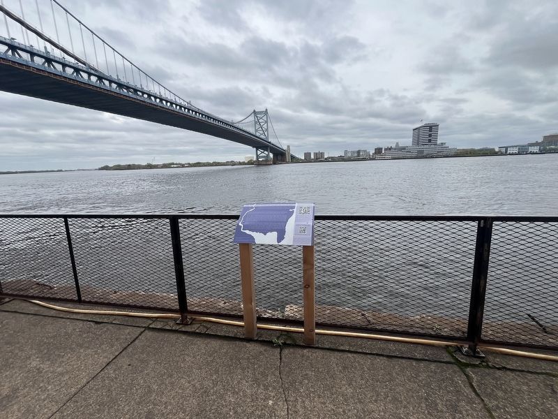
The river in front of you and its tributary on the other side of the city, the Schuylkill River, are tidal. Twice a day, Philadelphia's banks shift by 6-8 feet, and water from the ocean mingles with freshwater from upriver. The city, bounded by . . . — — Map (db m245202) HM
On North 7th Street just north of Arch Street, on the left when traveling north.
Born in Philadelphia, Locke was the first African American Rhodes Scholar and was considered the Dean of the Harlem Renaissance. A Central High School and Harvard graduate, he was a celebrated Howard University professor, writer, philosopher, and . . . — — Map (db m192777) HM
On Arch Street just west of North 7th Street, on the right when traveling west.
Physician, professor of natural history at the University of Pennsylvania. Author of first American botany textbook. In 1803, he taught natural history to Meriwether Lewis in preparation for Lewis & Clark Expedition, 1803 - 1806. He lived here. — — Map (db m24649) HM
On Race Street near North 7th Street, on the left when traveling east.
Chinatown. Chinatown is just steps away, centered on Arch & Race Streets between 9th and 13th Streets. From a small laundry shop that opened at 913 Race Street in 1870, Chinatown has grown to a cultural and social hub for more than 250,000 . . . — — Map (db m192985) HM
On this site stood The first United States Mint
First public building authorized by the United States Government This plaque dedicated for the Bicentennial of the U.S. Mint 1792-1992
First Mint: 1792-1833 7th Street between Market & Arch . . . — — Map (db m24441) HM
Near North 6th Street (U.S. 30) north of Race Street, on the right when traveling south.
The Franklin Square Fountain was originally built in 1838 after City Council passed a resolution in 1837 calling for a fountain of "grand dimensions." It was the centerpiece to the Square in the late 19th century. It is thought to be the longest . . . — — Map (db m192984) HM
On Arch Street at North 7th Street, on the right when traveling west on Arch Street.
The African American Museum of Philadelphia (AAMP), located at the northwest corner of 7th and Arch Streets, was built in 1976 in celebration of the nation's bicentennial and was designed by African American architect Theodore Cam of . . . — — Map (db m192779) HM
On N. 17th Street at Arch Street, on the right when traveling south on N. 17th Street.
Who on March 5,1770, was killed by British Troops
in Boston while protesting conditions
under the crown
These whispers of freedom grew into the crescendo of
The Declaration of Independence and the first ringing
of The Liberty Bell in . . . — — Map (db m163549) HM
On Arch Street just east of North 4th Street, on the left when traveling east.
About the Mural:
This mural project was a partnership of Mural Arts Philadelphia, the Philadelphia Fire Department (PFD), the PFD Family Association and Wawa to honor and celebrate the first responders in the city of Philadelphia. The PFD's . . . — — Map (db m210980) HM WM
Near Market Street (County Road 2004) west of South 3rd Street, on the left when traveling west.
1723
- 3rd Street
- County Jail and Workhouse built in 1721.
- Building built by Wm. Boulding, 1708-1709.
- Building built by Wm. Boulding, 1708-1709.
- Built by John Read (Franklin's future father-in-law), 1715.
- Built by Henry . . . — — Map (db m214220) HM
On Walnut Street (County Road 3006) just east of South 4th Street, on the right when traveling west.
The re-created garden you see here incorporates many features of formal gardens in the 1700s. Neat pathways, geometric flower beds, small orchards, and gazebos are characteristic of early Philadelphia gardens.
Volunteers from the . . . — — Map (db m213969) HM
On Market Street (County Road 2004) at South 4th Street, on the right when traveling east on Market Street.
This image from 1860 looks west on the south side of the 400 block of Market Street. This view shows the dominance of businesses offering clothing and accessories on this block including White Hall Clothing, George B. Bains Trunks, Valises & . . . — — Map (db m213965) HM
Near S 4th Street, on the left when traveling south.
“Behind each house is a little court or garden, where usually are the necessaries … the kitchen, stable, etc. are all placed in buildings at the side or behind …”
An accurate portrait of home life in . . . — — Map (db m106433) HM
Near Walnut Street (County Road 3006) east of South 4th Street, on the right when traveling west.
Working together, city and federal governments carried out sweeping changes as part of a broad urban renewal project in the 1950s and 60s. Homeowners had to maintain their properties or face eviction, dilapidated buildings were demolished, and . . . — — Map (db m227597) HM
On Market Street (County Road 2004) east of South 2nd Street, on the right when traveling east.
From a newspaper printing press on this site, the Declaration of Independence first went out to Americans and the world working from a copy of Thomas Jefferson's manuscript, editor John Dunlap printed broadside copies which were sent July 5, . . . — — Map (db m191853) HM
On Arch Street just west of North 3rd Street, on the left when traveling west.
A Revolutionary Religion
The Religious Society of Friends emerged out of the English Civil War in the mid-1600s. Quakers broke away from the dominant Church of England and were harshly persecuted for their faith. As a result, many Quakers . . . — — Map (db m210904) HM
Near Arch Street just east of North 4th Street, on the left when traveling west.
About the Meeting House
Quakers accounted for a substantial portion of the early Philadelphia population. As their community grew, so did the need for a larger worship space. Discussions about building a meetinghouse on the Arch Street . . . — — Map (db m210916) HM
Founded nearby in 1812, it is the oldest natural science institution in the Americas. It remains an invaluable resource for the study of life on Earth, with outstanding exhibits and scientific collections. Relocated to Logan Square in 1876, part of . . . — — Map (db m83404) HM
On Chestnut Street at Front Street, on the right when traveling east on Chestnut Street.
To this day, all over Ireland the landscape bears mute testimony to the events that occurred in the horrific period from 1845-1850. Starvation graveyards offer silent tribute to the millions of Irish men, women, and children buried in unmarked . . . — — Map (db m102387) HM
On Chestnut Street east of 4th Street, on the left when traveling east.
Leading abolitionist in the 18th century, his writings influenced the antislavery movement worldwide and federal abolition legislation. A teacher and Quaker, he educated blacks in his home, 1750-70, and opened a secondary school for girls in 1754. . . . — — Map (db m192904) HM
On South 3rd Street, on the left when traveling north.
Entrepreneur and philanthropist Drexel created the world's first trans-Atlantic banking network from an office first located here. It financed many U.S. railroads and businesses of the industrial era. Founder of Drexel University. — — Map (db m9532) HM
The Arch Street Meeting House stands as an enduring symbol of the people who created Pennsylvania as a "Holy Experiment." Built to house the men's and women's Yearly Meetings, the business sessions of the Religious Society of Friends for . . . — — Map (db m9324) HM
The meetinghouse was built in 1804 on a burial ground granted by William Penn in 1701. It has been continuously used as a place of worship and center for activities of the Religious Society of Friends (Quakers) of the Philadelphia region. — — Map (db m82899) HM
On Arch Street just west of North 3rd Street, on the left when traveling west.
The Arch Street Meeting House was built between 1803 and 1811 on land that is the ancestral home of the Lenape, or Delaware Nation. It has been an anchor of Quaker community and activism ever since.
Located in the heart of Old City, Arch . . . — — Map (db m210898) HM
On Arch Street just west of North 3rd Street, on the left when traveling west.
Where does the name Quaker come from?
Quaker was originally a nickname to describe how worshipers would "quake" when the spirit moved them during worship.
Why are there so many Quakers in Pennsylvania?
Pennsylvania was founded as . . . — — Map (db m210900) HM
On Arch Street just west of North 4th Street, on the left when traveling east.
A Community is Built
Quakers searching for a place to call home mainly came to Philadelphia from Great Britain and Europe. They joined Swedish immigrants who had already established a settlement decades before. Before these colonists . . . — — Map (db m210973) HM
On Arch Street just west of North 4th Street, on the left when traveling west.
Quaker City
William Penn founded the Colony of Pennsylvania as a home for Quakers and other persecuted groups. Penn ran his colony with Quaker principles that emphasized basic freedoms rarely experienced elsewhere. Penn chose the name . . . — — Map (db m210976) HM
On North 4th Street just south of Arch Street, on the left when traveling south.
Where does the name Quaker come from?
Quaker was originally a nickname to describe how worshipers would "quake" when the spirit moved them during worship.
Why are there so many Quakers in Pennsylvania?
Pennsylvania was founded as . . . — — Map (db m212564) HM
On North 4th Street just south of Arch Street, on the left when traveling south.
The Arch Street Meeting House was built between 1803 and 1811 on land that is the ancestral home of the Lenape, or Delaware Nation. It has been an anchor of Quaker community and activism ever since.
Located in the heart of Old City, Arch . . . — — Map (db m212565) HM
On Chestnut Street east of Front Street, on the right when traveling east.
The New World was often hostile to this flood of impoverished Irish immigrants. In America's cities, including Philadelphia, they arrived to face the native "Know-Nothing" movement, which defined "American" in terms that excluded the newly . . . — — Map (db m102396) HM
On South 3rd Street, on the left when traveling north.
During the 1790s, when Philadelphia was the capital of the United States, the Auditor of the United States rented a house on this site for his office. The Auditor, a member of the well-developed hierarchy of the Treasury Department, carefully . . . — — Map (db m106746) HM
On Chestnut Street, on the left when traveling east.
Printer, author, inventor, diplomat, philanthropist statesman, and scientist. The eighteenth century's most illustrious Pennsylvanian built a house in Franklin Court starting in 1763, and here he lived the last five years of his life. — — Map (db m9535) HM
Credited with making the first stars and stripes flag, Ross was a successful upholsterer. She produced flags for the government for over 50 years. As a skilled artisan, Ross represents the many women who supported their families during the . . . — — Map (db m82895) HM
Near Arch Street just east of North 3rd Street, on the right when traveling west.
Betsy Ross was born on January 1, 1752 on a farm in New Jersey. She was the eighth of 17 children born into the Quaker family of Rebecca and Samuel Griscom. Her father, a successful carpenter, moved his family to Philadelphia when . . . — — Map (db m212571) HM
Near Arch Street just east of North 3rd Street, on the right when traveling west.
Betsy experienced the tragic loss of loved ones far too often. Two of her seven daughters died as infants. Her mother, father and a sister died within days of each other during the Yellow Fever Epidemic.
Betsy was 24 when her . . . — — Map (db m212573) HM
On Arch Street just east of North 3rd Street, on the right when traveling west.
Born Elizabeth Griscom of Quaker parents, January 1, 1752, Betsy Ross attended Friends Schools until her apprenticeship as an upholsterer. Marriage on November 4, 1773 to John Ross, an Anglican, caused her to be read out of Meeting. Ross was a . . . — — Map (db m212567) HM
Near Arch Street east of N 3rd Street, on the right when traveling west.
This house where Betsy Ross made the first American Flag was restored to its original colonial condition through the patriotic generosity of a Son of the American Revolution A. Atwater Kent of Philadelphia and was rededicated as a shrine of American . . . — — Map (db m106155) HM
On Bladens Court north of Elfreth's Alley, on the right when traveling north.
This small alley originated between 1749 and 1752. It served two properties that faced onto Front Street whose owners wanted outside access to their backyards. Each of the owners paid half of the cost of paving and cleaning the nine-foot . . . — — Map (db m146126) HM
On Market Street (County Road 2004) west of North 2nd Street, on the right when traveling west.
This bank, opened as a branch office of the State Bank of Camden, N.J. on December 10, 1813 is the oldest interstate branch office of any bank in the United States. Established to accommodate Jersey farmers and merchants, its quarters were . . . — — Map (db m214090) HM
Near Chestnut Street, on the right when traveling east.
…for the purpose of obtaining instruction in the science of architecture and assisting such of their members as should by accident be in need of support, or the widows and minor children of members… By-laws of the Carpenters' . . . — — Map (db m9653) HM
On Chestnut Street (County Road 3008) east of South 4th Street, on the right when traveling east.
Delegates from the First Continental Congress met here on 1774 to resolve grievances with Great Britain. Escalating differences between the colonies and King George III led to the American Revolution.
Built between 1770 and 1774 to showcase . . . — — Map (db m192888) HM
On South 4th Street at Library Street, on the right when traveling north on South 4th Street.
Follow in the footsteps of the First Continental Congress and discover historic Carpenters' Hall, showcase for the 18th century building trades and design. — — Map (db m213968) HM
On Chestnut Street (County Road 3008) east of Strawberry Street, on the right when traveling east.
A Quaker, he is considered America's first important novelist. His Gothic fiction depicts Philadelphia life and inspired Edgar Allan Poe and Nathaniel Hawthorne. As an author, editor, and historian, he addressed women's rights, slavery, and . . . — — Map (db m232170) HM
On North 2nd Street at Filbert Street, on the right when traveling south on North 2nd Street.
Founded, 1695. Erection of present building begun in 1727. Bells were brought from England in 1754. Among the noted persons buried here are James Wilson and Robert Morris, Signers of the Declaration of Independence, and Bishop White. — — Map (db m9330) HM
On North 2nd Street at Church Street, on the right when traveling south on North 2nd Street.
The very existence of Christ Church and the elegant majesty of this building is a testament to the success of William Penn's "Holy Experiment." His Charter of Privileges allowed all denominations freedom of worship, even the Church of England from . . . — — Map (db m9331) HM
Whereas the honorable Continental Congress have resolved to declare the American Colonies to be free and independent states … it will be proper to omit those petitions from the liturgy wherein the King of Great Britain is prayed for . . . — — Map (db m9354) HM
On Church Street just west of North 2nd Street, on the right when traveling west.
This fence was presented to Christ Church on its 225th anniversary, November 15th, 1920, by the firm of Morris, Wheeler & Co., all the partners being lineal descendants of Samuel Wheeler who made the original gates and fence on the Second Street . . . — — Map (db m192967) HM
On South 2nd Street just north of Walnut Street (County Road 3006), on the right when traveling south.
The elite of Philadelphia built this tavern to drink, dine, and dance—among their own.
Business and politics were on the menu and deals were often sealed with drinks. Delegates to the Continental Congress dined here, and in 1787, members of . . . — — Map (db m227599) HM
On Front Street south of Ionic Street, on the left when traveling south.
During the first hundred years of Scottish immigration to the Americas, Philadelphia was the largest city in the British colonies, and the second largest city in the British empire. As such, its booming port was a natural destination for emigrant . . . — — Map (db m102341) HM
On Arch Street west of North 2nd Street, on the left when traveling west.
Born of white, Black and Native American descent, he bought his freedom and became a baker of bread for Revolutionary troops. A founder of the Free African Society, he later opened a school for Black children while living here. — — Map (db m6423) HM
On Chestnut Street at 3rd Street, on the right when traveling east on Chestnut Street.
This bronze sculpture replicates John Trumbull’s famous painting Declaration of Independence that is displayed in the Rotunda of the United States Capitol. It depicts the presentation of the draft of the Declaration of Independence to the . . . — — Map (db m106148) HM
On North 2nd Street at Elfreth's Alley, on the right when traveling north on North 2nd Street.
An exceptional collection of early American structures, built 1720s-1830s, the alley contained the homes and shops of diverse artisans. Later, working-class immigrants lived here and labored in nearby industries. Residents began preservation efforts . . . — — Map (db m144928) HM
On North 2nd Street at Quarry Street, on the right when traveling north on North 2nd Street.
A prominent Philadelphia Quaker whose diaries (1758-1807) offer a substantial historical account of events and everyday life of the era. In her home, east of here, she chronicled the 1777 British invasion of Philadelphia and other events related to . . . — — Map (db m192969) HM
Near Chestnut Street, on the right when traveling east.
Delegates walking to Carpenters' Hall (to your left) for meetings of the First Continental Congress in 1774 passed an aging wood house at this site. The two-story house was built about 1706 for bodice-maker Nathan Fawcitt. The Fawcitt House, like . . . — — Map (db m9658) HM
On South 3rd Street south of Chestnut Street, on the left when traveling north.
Secretary of the Treasury Alexander Hamilton was the force behind creation of the First Bank of the U.S. The Bank paid off the Revolutionary War debt and guided the new United States through unstable financial times. This impressive Federal style . . . — — Map (db m146127) HM
Near Chestnut Street, on the right when traveling east.
The distinctions between Virginians, Pennsylvanians, New yorkers, New Englanders are no more. I am not a Virginian but an American.—Patrick Henry, Carpenters' Hall, 1774
In 1774 the American colonies felt . . . — — Map (db m9656) HM
Near Market Street just east of South 4th Street, on the right when traveling east.
"… I sent you two saucepans, plated inside with silver instead of tinning. I bought them at Sheffield, because i thought they would please you …"
Ben to Deborah Franklin
London, Feb. 27, 1760
"I wonder you put up the oven . . . — — Map (db m192907) HM
I am got into my niche, after being kept out of it 24 years by foreign employments. 'Tis a very good house that I built so very long ago to retire into ....
Signature - Benj Franklin 1786
On Market Street (County Road 2004) just east of South 4th Street, on the left when traveling west.
Benjamin Franklin went to and from his house through this original passage.
Benj. Franklin Bache Privy Pit
1787
322 Market St.
Franklin Privy Pit
1787
318 Market St.
Henry Frogley Water Well Circa 1720 320 Market St. . . . — — Map (db m192965) HM
On Chestnut Street (County Road 3008) just east of South 4th Street, on the left when traveling east.
Benjamin Franklin's elegant three story home once occupied this courtyard from 1765 to 1812. Today, two steel framed "ghost houses" outline the site of Franklin's home and his grandson's printing office. Viewing scopes let you see the surviving . . . — — Map (db m192891) HM
On Market Street (County Road 2004) just west of South 3rd Street, on the right when traveling east.
Franklin Court & Museum
Benjamin Franklin's elegant three story home once occupied this courtyard from 1765 until 1812.
Explore a modern museum dedicated to Franklin's incredible life and legacy just below the site of this . . . — — Map (db m191872) HM
On Market Street (County Road 2004) just east of South 4th Street, on the right when traveling east.
Franklin Court & Museum
Benjamin Franklin's elegant three story home once occupied this courtyard from 1765 until 1812.
Explore a modern museum dedicated to Franklin's incredible life and legacy just below the site of this house. The . . . — — Map (db m191873) HM
On Chestnut Street (County Road 3008) east of South 4th Street, on the right when traveling west.
Benjamin Franklin built three of these five reconstructed townhouses as rental properties in the 1780s. Visit a working reproduction 18th century print shop, book bindery, and newspaper office (320/322). Explore an exhibit on archeology (318), and . . . — — Map (db m192889) HM
This brick-lined, circular "necessary" (privy) pit was probably built when Franklin expanded his house in 1786-87
A stone drain connecting to a vertical brick pipe conveyed waste into the pit either from Franklin's "water closet", "bathing . . . — — Map (db m79214) HM
On Market Street (County Road 2004) just east of South 4th Street, on the right when traveling east.
These buildings are the last remaining structures owned by Benjamin Franklin in Philadelphia. Franklin built numbers 316, 318, and 322 Market Street in the late 1780s as rental properties. The construction also created an arched carriageway to . . . — — Map (db m227591) HM
While in his teens, Franklin arrived in Philadelphia from Boston and walked up Market Street past a block of shops owned by tailors, saddle-makers, joiners, wig-makers, inn-keepers and printers.
Eventually he built his home in this very . . . — — Map (db m79213) HM
This meetinghouse was erected in 1804. It is used for weekly, Monthly, Quarterly, and Yearly meetings of Friends. The ground was first used for burial purposes under patent issued by William Penn in 1701. — — Map (db m9326) HM
On Market Street (County Road 2004) west of North 2nd Street, on the right when traveling west.
In this alley called Grindstone was located the Union Fire Company the first organized group of firemen in America
Founded by
Benjamin Franklin
1736 — — Map (db m214092) HM
On South 2nd Street south of Chestnut Street, on the left when traveling south.
Born in 1671, she married William Penn, 1696. They lived at Pennsbury, and in the Slate Roof House here, 1699–1701. During his final illness, 1712–18, and until her death, 1726, she was Pennsylvania’s acting proprietor. She was the only . . . — — Map (db m32305) HM
Near S 4th Street, on the left when traveling south.
The grassy depression in front of you marks the location of Dock Creek, a spring-fed, tidal stream that flowed here when Philadelphia was founded. Its waters emptied into the Delaware River about four blocks ahead of you. By 1767, city wastes had . . . — — Map (db m106435) HM
Near Chestnut Street (County Road 3008) east of South 4th Street, on the left when traveling east.
On this site Godey's Lady's Book was brought into national prominence by Sarah Josepha Hale, its editor from 1837 - 1877. Mrs. Hale built the publication into the first great women's magazine with a mass circulation. Its peak circulation of more . . . — — Map (db m192892) HM
On Front Street south of Ionic Street, on the left when traveling south.
The Celtic influence permeated the British Islands several centuries before Christ, affecting the languages and culture of modern-day Ireland, Scotland, Wales, and England. The Roman invasions of Britain resulted in the culture in southern Britain . . . — — Map (db m102321) HM
Near Market Street just east of South 4th Street, on the right when traveling east.
In 1812, when Franklin's grandchildren no longer wished to maintain his house, it was torn down to develop a street with a row of modest rental houses on each side.
Protected by this street bed since that time was this fragment of the . . . — — Map (db m192947) HM
Near North 4th Street just south of Arch Street, on the left when traveling south.
A garden walkway established by members of Philadelphia Yearly Meeting of the Religious Society of Friends on land provided by Penn for Friends in 1693 in his "greene country towne," - Philadelphia — — Map (db m210932) HM
On Chestnut Street at Front Street, on the right when traveling east on Chestnut Street.
To fully understand The Great Hunger, its impact on the Irish people, and the resulting diaspora of the Irish nation, it is essential to examine both the history of Ireland and events leading up to the catastrophe. The twelfth century marked . . . — — Map (db m102348) HM
In honored memory of Jacob Broom, Signer of United States Constitution by the Delaware State Society, NSDAR, in This bicentennial year 1987 — — Map (db m9352) HM
On South 2nd Street at Walnut Street (County Road 3006), on the left when traveling south on South 2nd Street.
This is a reconstruction of the John Drinker house built before 1760 on a lot purchased in 1751 of Israel Pemberton.
It was known as the Krider Gun Shop for over a century. Rob't Fulton lived here, 1786. William Penn granted the . . . — — Map (db m220515) HM
In 1782 this congregation built Philadelphia's first synagogue at this site. Established about 1740, it had first worshiped in rented quarters here. The congregation built a larger synagogue 1824, and has been elsewhere in the city since 1860. — — Map (db m82838) HM
Benjamin Franklin 1706 – 1790
Titled: Keys To Community,
by Philadelphia sculptor James Peniston,
Dedicated October 5, 2007
Peniston’s one-ton bronze sculpture is textured with casts of 1,000 keys collected from . . . — — Map (db m106217) HM
An Irish Catholic who emigrated to Philadelphia in 1784, Carey was a prominent printer and publisher and prolific writer. He was an influential political economist and nationalist, promoting the purchase of American goods over imports, a strong . . . — — Map (db m83443) HM
On Chestnut Street at Bank Street, on the right when traveling east on Chestnut Street.
Formed nearby in 1827 as the first central labor council in the nation; recognized as the beginning of American labor movement. Represented workers as a class, not by craft. Advocated for ten-hour day; engaged in political activism and workers' . . . — — Map (db m9534) HM
(Large image of Cupola)
Merchants' Exchange Building is based on Classical Greek architecture
Choragic Monument of Lysicrates
(Image of stereograph)
Illustrated above in a 1907 stereograph, the Choragic Monument of Lysicrates in . . . — — Map (db m137684) HM
On Front Street south of Ionic Street, on the left when traveling south.
This Monument to Scottish Immigrants seeks to provide a broad perspective on the rise and the movement of the Scots over many continents and centuries. On either side of this Monument you will find Standing Stones which will assist you in . . . — — Map (db m102332) HM
On Front Street south of Ionic Street, on the left when traveling south.
Scottish Immigrant Family Sculpture
Seal of the St. Andrew's Society
Bas relief of Scottish Immigrants and Tun Tavern
Bas relief of Signers of the Declaration of Independence
Terry Jones, Sculptor
His Grace, The Duke of Argyll, . . . — — Map (db m102342) HM
On North 4th Street at Arch Street on North 4th Street.
George Washington died on Dec. 14, 1799. Congress set Dec. 26 as a day of formal mourning in Philadelphia, the nation's capital from 1790 to 1800. The national funeral was in Zion Lutheran Church--located at this site, 1766-1870-- and among those . . . — — Map (db m43006) HM
On North 4th Street at North Marginal Road, on the right when traveling south on North 4th Street.
Born and trained in Italy, this artist executed some of the first fresco paintings in America, beginning in the 1830s. His commissions decorated many grand homes, Catholic churches, and public buildings such as the Merchant’s Exchange Building on . . . — — Map (db m135996) HM
On Race Street just east of North 4th Street, on the right when traveling east.
The Old First Reformed church, United Church of Christ, was organized in 1727 by the Rev. George Michael Weiss, who arrived in Philadelphia on the ship William and Sarah, along with about 400 persons from the German Palatinate. The first church, . . . — — Map (db m192971) HM
On North 4th Street at North Marginal Road, on the left when traveling south on North 4th Street.
Old St. George's
In 1729, in Oxford, England, a group of fiery, compelling preachers began the religious movement that would become Methodism. Preaching a message of repentance and conversion, men like Captain Thomas Webb and Francis Asbury led . . . — — Map (db m135998) HM
On Market Street at Front Street, on the right when traveling east on Market Street.
In hopeless circumstances at home, the Irish fled their homeland by the hundreds of thousands each year. From 1845-1855, nearly a quarter of the population emigrated, mostly from rural, Catholic, often Irish-speaking areas of Ireland. They . . . — — Map (db m102391) HM