Anderson, Robert B. 1839-1863, Company C, 1st Ohio Valunteer Infantry, Civil War • Applegate, Aaron H. 1835-1898, Company B, 120th Ohio, Volunteer Infantry, Civil War • Armstrong, James A. 1844-1865, Company B, 65th Ohio Volunteer Infantry, Civil . . . — — Map (db m239994) WM
As the Battle of New Market unfolded on May 15, 1864, Confederate Gen. John C. Breckinridge's men heavily assaulted the left flank of Union Gen. Franz Sigel's army. Sigel counterattacked, sending Gen. Julius Stahel's cavalry charging down the . . . — — Map (db m158184) HM
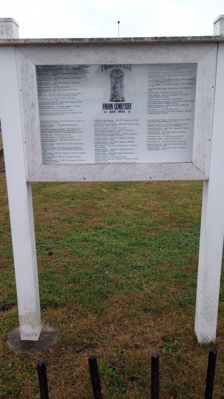
Bullet - marked tombstones in this cemetery show evidence of a brisk skirmish here Oct. 26, 1863, when Gen. P.J. Osterhaus's first division of Sherman's Corps came under fire from Gen. S.D. Lee's Confederate troops. CSA artillery on a hill near a . . . — — Map (db m83329) HM
Union soldiers occupied Batesville twice during the Civil War. Gen. Samuel Curtis's Army of the Southwest camped near this site in May 1862 while threatening Little Rock. Union troops were impressed with the town's culture and appearance, saying . . . — — Map (db m70557) HM
As the Civil War began, the Caroline Home Guard formed at Austin on June 29, 1861. The “Austin Rifles” became Co. I, 5th Arkansas Infantry, C.S.A. Both Union and Confederate troops camped at Austin during the war and Federal troops tore . . . — — Map (db m116330) HM
Civil War in Newton County Several military actions took place in Newton
County during the Civil War. On Jan. 10, 1863, Union
troops attacked and destroyed a large saltpeter
works on the Buffalo River. Skirmishes were fought
June 14 and Nov. . . . — — Map (db m225345) HM
The Sharp Family and the Civil War
Ephraim Sharp, namesake of Sharp County, and his brother William were prominent Evening Shade businessmen when the Civil War began. William served in the state legislature in 1860 and opposed Arkansas’s . . . — — Map (db m170472) HM
Defending Camp Nelson
Designed to hold the middle of Camp Nelson's northern line, Fort Jackson is 280 feet deep and 300 feet wide with breastworks ten feet high. It is a lunette — a four-sided, unenclosed fort. It is one of . . . — — Map (db m171681) HM
Oliver H. Perry and his wife, Frances, built this house in the mid-1850s. Frances, known to family and friends as Fannie, was the daughter of Robert and Mary Sappington Scott, the largest landowners of what became Camp Nelson.
Built in the . . . — — Map (db m169971) HM
In the year 1861 the legislature of Maryland, called into extraordinary session by Governor Thomas Holliday Hicks, held session in this building owned by the Evangelical Reformed Church (now the Evangelical and Reformed - United Church of Christ). . . . — — Map (db m118973) HM
About 4 p.m. Oct. 23, 1864 after their victory at Westport the Union leaders met here for consultation. Included were Generals Curtis, Blunt, Pleasonton and Dietzler; Gov. Carney and Sen. Jim Lane of Kansas. The Confederates had lost over 1,000 men . . . — — Map (db m20598) HM
Civil War Event - August 15, 1861
During the night, a military force comprised of 250 Zouaves of the 8th Missouri Infantry Regiment and an artillery piece with its 13 men arrived from Cape Girardeau. They were under the command of Major . . . — — Map (db m143584) HM
Side 1
Island Veterans of the Civil War
1st Regiment North Carolina Infantry
(Names not transcribed)
Soldiers of the 17th, 32nd or 33rd Regiments North Carolina Troops
(Names not transcribed)Side 2 . . . — — Map (db m146058) HM WM
On July 26, 1863, Brigadier General John Hunt Morgan's plan to direct his Confederate raiders through Salineville had to be altered quickly when his scouts reported that Union troops occupied the village. Major General Ambrose Burnside, commander of . . . — — Map (db m173477) HM
After a skirmish with Union forces on July 26, 1863, Brigadier General John Hunt Morgan regrouped the several hundred Confederate raiders who remained with him and turned east. Morgan's route down this valley was aimed toward East Liverpool on the . . . — — Map (db m173479) HM
The sad remnant of Confederate Brigadier General
John Hunt Morgan's Raiders – amounting to fewer
than 350 men – was brought to bay at this site on
July 26, 1863. Morgan's Raid had taken 25 days
of hard riding that covered about 950 miles . . . — — Map (db m173481) HM
Around 3 pm on the afternoon of July 23, 1863, Brigadier General John Hunt Morgan and about 600 Confederate raiders entered Cumberland. Morgan and a handful of his officers found respite at the Globe House. Others entered the home of a Dr. Stone.
. . . — — Map (db m171901) HM
Confederate Brigadier General John Hunt Morgan and his remaining raiders arrived at Campbell’s Station (now Lore City) near dawn on the morning of July 24, 1863.
The raiders entered the home and warehouse of John Fordyce at this former . . . — — Map (db m171079) HM
In July 1963, intelligence on the position of Brigadier General John Hunt Morgan and his Confederate raiders as they rode across southern Ohio was in constant flux. Conflicting reports initially ordered Union Colonel William Wallace of the 15th Ohio . . . — — Map (db m171149) HM
In the twilight of July 13, 1863, flames from the New Baltimore bridge lit the northwest sky. Slow-moving columns of dusty cavalrymen approached Bevis crossroads from the shadows Confederate Brigadier General John Hunt Morgan's Raiders quietly . . . — — Map (db m133650) HM
Georgetown was usually a quiet place, but as Confederate Brigadier General John Hunt
Morgan and about 500 raiders approached shortly before 4 am on July 25, 1863, it was
alive with activity,
Morgan's advance brought out a body of more than . . . — — Map (db m173471) HM
On July 24, 1863, Brigadier General John Hunt Morgan ordered his 500 remaining Confederate
raiders to burn the Cambridge Road bridges to the west. This delayed pursuing Union forces
long enough to allow four hours for a much-needed stop at . . . — — Map (db m208741) HM
After leaving Old Washington, Confederate Brigadier General John Hunt Morgan and about 500
remaining cavalrymen were soon slowed down by several skirmishes, including one at Hanna's Mill.
Morgan's men were by now relegated to using farm . . . — — Map (db m208740) HM
By July 25, 1863, Brigadier General John Hunt Morgan and his Confederate raiders knew that their pursuers were closing in. Major General Ambrose Burnside, directing the Union
pursuit from his Cincinnati headquarters, decided to change his . . . — — Map (db m173473) HM
By July 25, 1863, Brigadier General John Hunt Morgan and his Confederate raiders
were being pursued by a large array of Union forces under Brigadier General James M.
Shackelford. This force included the 14th Illinois Cavalry, 1st Kentucky U.S. . . . — — Map (db m173476) HM
Brigadier General John Hunt Morgan and 600 Confederate cavalrymen entered Deerfield Township, Morgan County, about dusk on July 22, 1863. Morgan rested his men for the night at the John Weaver Farm near the Island Run headwaters.
General Morgan . . . — — Map (db m173463) HM
On the morning of July 23, 1833, Brigadier General John Hunt Morgan and 600 Confederate raiders rode down Island Run Road to the Muskingum River just below Eagleport where Island Run forms a small island. Farmers and young boys in Rokeby Lock, on . . . — — Map (db m173466) HM
Confederate Brigadier General John Hunt Morgan's approximately 600 raiders
arrived in Rokeby Lock late in the morning of July 23, 1863, having crossed
the river from Eagleport.
One column of raiders, led by Morgan himself, used a ferryboat to . . . — — Map (db m173467) HM
"On every side the passion, rage and frenzy of fearless men or reckless boys devoted to slaughter or doomed to death! The same sun that a day before had been shining to cure the wheat-sheaves of the harvest of peace, now glared to . . . — — Map (db m99768) HM
The foundation in front of you is all that remains of Casper Henry Dustman’s antebellum barn, a building that stood here during the Battle of Gettysburg. Typical of barns in this area, the wood-framed section was larger than the foundation, which . . . — — Map (db m118902) HM
"There was no use in fighting any longer. The enemy had deployed and we were trapped. The town was before us, the enemy on either side, and behind us."
—Col. John Musser, 143rd Pennsylvania Infantry
In the summer of 1863, Alexander Riggs and his family lived in a house that stood before you, directly across the Chambersburg Pike from Mary Thompson’s. Like most of Gettysburg’s dwellings, the Riggs house was caught up in the whirlwind of battle, . . . — — Map (db m118903) HM
"Three more acres or less on which are erected a one and a half story stone dwelling house and frame stable … directed and sold and struck off the same unto Thaddeus Stevens, trustee of Mary Thompson, for the sum of sixteen . . . — — Map (db m99848) HM
In mid-July 1863, Mathew Brady and his crew set up a stereoscopic, wet-plate camera here and recorded what is arguably the most iconic of all Civil War photographs. The photo had been widely reproduced for more than a century when historian William . . . — — Map (db m105962) HM
"This house was within the Rebel lines. Occupying an elevated position from which the Federal lines could be seen with a field glass, and being at a safe distance from our guns, it was selected by General Lee and his staff as his . . . — — Map (db m100012) HM
Confederate Gen. John Bell Hood hoped to block the road in front of you—the Columbia Turnpike—and cut off Union Gen. John M. Schofield's force at Columbia from a larger Federal army to the north at Nashville. Confederate divisions under Gens. . . . — — Map (db m209595) HM
By 3 P.M. on November 29, 1864, Union Gen. John M. Schofield realized that his command was in great danger. The bulk of his army was posted near Columbia, Tennessee, while Confederates Gen. John Bell Hood’s troops were north of him, approaching . . . — — Map (db m208632) HM
After nightfall, Confederate Gen. Edward Johnson's division began moving into position on the left of Gen. William B. Bate's division. Johnson, whose unit was part of Gen. S.D. Lee's corps, had been ordered forward from the vicinity of Rutherford . . . — — Map (db m209788) HM
Confederate Gen. John Bell Hood hoped to block the road in front of you—the Columbia Turnpike—and cut off Union Gen. John M. Schofield's force at Columbia from a larger Federal army to the north at Nashville. Confederate divisions under Gens. . . . — — Map (db m209589) HM
Union Lt. Col. Percy Wyndham advanced his command from Brandy Station and centered his attack on this spot. To your right, the 1st New Jersey Cavalry ascended the slope. The 1st Maryland Cavalry occupied the center, and to your left, circling around . . . — — Map (db m97501) HM
On the evening of June 8, 1863, Confederate Gen. J.E.B. Stuart and his headquarters staff camped on the northern edge of Fleetwood Hill. Early the next morning, heavy gunfire from the direction of Beverly's Ford (three miles to your left rear), . . . — — Map (db m97490) HM
Confederate Gen. J.E.B. Stuart realized that his headquarters here was overrun and that Gen. William E. Jones's Brigade was fighting to survive. Stuart ordered Gen. Wade Hampton's Brigade to fall back from the St. James Church line and recapture . . . — — Map (db m97495) HM
Driven from Fleetwood Hill, the Union cavalry pulled back toward the Rappahannock River and halted just beyond cannon range. Observing that the sullen Federals refused to depart, Confederate Gen. J.E.B. Stuart consolidated his defensive line around . . . — — Map (db m97494) HM
The 1863 campaigns for Chancellorsville, Gettysburg, Bristoe Station, and Mine Run exacted an immense toll upon the Army of the Potomac. Union Gen. George G. Meade deemed it vital to rest his command. War Department officials also used this . . . — — Map (db m97493) HM
The commanding view from Fleetwood Hill rendered this “Famous Plateau” an ideal observation post during the war. Today the view looks much as it did in the 1860s.
1. COLE’S HILL
During the winter of 1864, Federal Second Corps . . . — — Map (db m154527) HM
John Strode, a prominent Revolutionary War gun manufacturer, built his manor house, Fleetwood, in the late 1700s. Strode was a friend of President Thomas Jefferson, who often stayed here when traveling between Monticello and Washington, D.C. The . . . — — Map (db m97488) HM
Col. H. Judson Kilpatrick formed his brigade on an open plateau to the southeast of Fleetwood Hill, 900 yards from here. He soon received orders to support Lt. Col. Percy Wyndham's Brigade, now fiercely engaged with Gen. William E. Jones's Brigade . . . — — Map (db m97499) HM
The commanding view from Fleetwood Hill rendered this “Famous Plateau” an ideal observation post during the war. Today the view looks much as it did in the 1860s.
1. STONY MOUNTAIN
The headwaters of the Rapidan River flow from . . . — — Map (db m131546) HM
On January 25, 1863, Union general Joseph "Fighting Joe" Hooker replaced Gen. Ambrose E. Burnside as the fifth commander of the demoralized eastern armies in less than two years. On taking charge of the Army of the Potomac, Hooker implemented . . . — — Map (db m154485) HM
On March 17, 1863, Union Gen. William W. Averell led 2,100 horsemen to the northern bank of the Rappahannock River at Kelly's Ford, four miles in front of you, under orders to "rout or destroy" Confederate Gen. Fitzhugh Lee and his cavalry command . . . — — Map (db m154487) HM
George C. Hupp, Sergeant in K Company,
8th Illinois Cavalry, was wounded at Brandy
Station Battlefield on June 9, 1863. In his
Memory Great-Great-Great Grandson William J.
Hupp, Glen Ellyn, Illinois, happily made a
leadership . . . — — Map (db m154528) WM
"The rattle of musketry, the shouting, cheering and yelling was deafening. The smoke of battle ... made it impossible to see but a short distance. The leaves and small limbs were falling thick and the bark from the timber flying in every . . . — — Map (db m184967) HM
While Union Gen. Christopher C. Augur's division battled in the cornfield to your left, Union Gen. Alpheus S. Williams launched his own attack across the field where you now stand, which was then broken by shocks of tall wheat. The death of Gen. . . . — — Map (db m184365) HM
"The infantry were posted in line of battle on the right of the battery, and cheerfully awaited the order which would bring them more actively into the deadly conflict." —Gen. John Pope, USA
"I have come to help whip the Yankees . . . — — Map (db m185346) HM
"My command did not want to back out. We had backed out enough." —Gen. Nathaniel P. Banks, USA
"Banks is in our front and he is generally willing to fight. And he generally gets whipped." —Gen. Thomas "Stonewall" Jackson, CSA . . . — — Map (db m183957) HM
"A shell passed through [Gen. Charles S. Winder's] side and arm, tearing them fearfully. He … lay quivering on the ground. He had issued strict orders that morning that no one, except those detailed for the purpose, should leave his . . . — — Map (db m184368) HM
"As we came over the brow of the hill our men were fearfully mowed down, but not one faltered. … Our musketry was without any cessation, and theirs was the same. The balls came in perfect sheets around us, besides this, flank . . . — — Map (db m184366) HM
Three days after the battle, after cease-fire, Stonewall Jackson's force withdrew to Gordonsville. At least 405 men were buried on the field. All but one, N.B. Phillips, were in unmarked graves.
The Union army occupied the field for about a . . . — — Map (db m184367) HM
"Every point of the enemy's [line] was carefully felt and examined for a weak point; none such, however, was found."
—Gen. John F. Hartranft, USA
"Our boys went into line with their accustomed cheer, and the yankees seeing our . . . — — Map (db m184682) HM
"We expected to 'rush' the rebels, but on reaching the creek we found it too deep for fording, and the enemy in good rifle-pits on the other bank, about 25 yards away."
—Pvt. Richard McBride, 190th Pennsylvania Infantry, USA
"The . . . — — Map (db m184870) HM
"Time is passing and Richmond is still not ours. I think it cannot be long now before the tug will come which, if it does not secure the prize, will put us where the end will be in sight."
—Gen. Ulysses S. Grant, USA
"The only . . . — — Map (db m184324) HM
"Newspapers try to make the best of our [failed] 'reconnaissance.' This affords a vast deal of amusement, considering there were greater exertions and preparations made for this expedition than any previous one."
—Col. Charles S. . . . — — Map (db m184895) HM
"We have set what we call Johnny catchers ... long poles set into the ground with the upper end about as high as a man's head and they are so thick that a rabbit could not crawl through."—Corp. Andrew W. Burwell, 5th Wisconsin . . . — — Map (db m155596) HM
From here at Fort Welch, you can see the ground over which soldiers struggled during three distinct battles. On October 2, 1864, Federals advanced across the ground to your left in an attempt to capture the key Confederate intermediate supply route, . . . — — Map (db m85935) HM
“The charge of Major-Gen. Wright’s veterans under cover of the darkness and mist … will forever live in history as one of the grandest and most sublime actions of the war.”—Sgt. Newton J. Terrill, 14th New Jersey Infantry, USA
“The . . . — — Map (db m184489) HM
"There is every indication that a heavy force is being massed in our front, and if a charge is made, this line cannot possibly be held by these few men."
—Unidentified North Carolina picket, CSA
"Nothing could be seen, nothing . . . — — Map (db m184517) HM
"Gentlemen we are going to have a h—l of a fight at early daylight ... if any of you have anything to say to your folks, wives, or sweethearts make your story short and get what sleep you can."—Col. James Hubbard, 2nd Connecticut Heavy . . . — — Map (db m184633) HM
As the enemy must have massed on the right of our line, they must have left their own line weak. How would it do for us to attack along the whole length of our line?"
—Gen. Horatio G. Wright, USA
"The enemy swarmed up to the . . . — — Map (db m184530) HM
"When a man is on picket at night he is monarch of all he surveys. No one living has more absolute power than he. His word is law."—Corp. Lewis Bissell, 2nd Connecticut Heavy Artillery, USA
"I have seen veterans of three full . . . — — Map (db m85913) HM
"No doubt a few more days will settle the fate of Petersburg. I shall be glad to welcome the dawn of peace, for I am tired of bloodshed."
—Col. Elisha Hunt Rhodes, 2nd Rhode Island Infantry, USA
"A very small effort on the part . . . — — Map (db m184650) HM
“The charge of Major-Gen. Wright’s veterans under cover of the darkness and mist … will forever live in history as one of the grandest and most sublime actions of the war.”—Sgt. Newton J. Terrill, 14th New Jersey Infantry, USA . . . — — Map (db m184488) HM
Elements of three Union armies moved through the Shenandoah Valley in the spring of 1862, while a fourth army marched up the Virginia Peninsula toward Richmond. Together, these two wings comprised a pincer movement against the Confederate . . . — — Map (db m172827) HM
You are standing on one of the pivotal battlefields of the Shenandoah Valley campaign. Here, on May 8, 1862, Confederate Gen. Thomas J. "Stonewall" Jackson and his 6,000 men defeated Union Gens. Robert C. Schenck's and Robert H. Milroy's . . . — — Map (db m172816) HM
Loudoun County experienced continuous Union and Confederate activity during the war. Carter's Mill Road, in front of you, provided access to the agricultural abundance of Oatlands and other farms south and east of here, where the use of slave . . . — — Map (db m124387) HM
“There was a sudden commotion in the train ahead and several of the ambulances turned and came back in confusion. General [George H.] Steuart promptly ordered them back to their places, faced the brigade into line to the left and deployed . . . — — Map (db m116476) HM
“[It was] … as warm a contest as this regiment was ever engaged in. … It seemed as if the enemy was throwing minie-balls upon us by the bucket-full, when the battle got fairly under way.” — Member of the 3rd North Carolina Infantry, CSA . . . — — Map (db m116530) HM
“In the fight of Johnson’s Division on last Friday I was under as warm a musketry fire as I have experienced for a good while—certainly worse than I have been in since Sharpsburg.” — Lt. Col. Alexander S. “Sandie” Pendleton, CSA
“One . . . — — Map (db m43170) HM
“The ground in my front for about 500 yards was thickly wooded and brushy, and beyond that was a cleared field owned by a man named Payne.”—Gen. Edward Johnson, CSA
“On account of the density of the undergrowth in the woods and the . . . — — Map (db m181505) HM
“We gained a slight rise in the land behind an old worm fence. The enemy had fallen back under cover of a piece of woods well in our front. Soon they came out in splendid battle array, with waving banners, and charged our position. It was a . . . — — Map (db m43165) HM
“Several efforts were made to charge the hostile line, but as these attempts were made by single brigades, without proper deliberation and without co-operation on the part of the other forces to the right and left, they naturally resulted in . . . — — Map (db m43168) HM
“Gen. [Edward] Johnson … cheered us on to the fight with ‘Hurrah for North Carolina, go it North Carolina—give it to them boys!’ … The Federals were as thick as black birds in our front.” — Capt. Thomas Boone, 1st . . . — — Map (db m116478) HM
“We soon struck the Yankee skirmishers and drove them back through the woods to an open field, where we ran into French’s entire corps and into about the hottest place that could be imagined.” — Capt. William B. Colston, 2nd . . . — — Map (db m43167) HM
“The promptness with which this unexpected attack was met and repulsed reflects great credit upon General Johnson and the officers and men of his division.” — Gen. Robert E. Lee, CSA
“The delay in the movements of the Third Corps, . . . — — Map (db m42085) HM
“The brave officers and men of this division, attacked by a greatly superior force from an admirable position, turned upon him and drove him from the field, which he left strewn with arms, artillery and infantry ammunition, his dead and . . . — — Map (db m42089) HM
On December 13, 1862, Union and Confederate troops clashed here, on muddy fields dubbed the "Slaughter Pen." Union Gen. William B. Franklin had 65,000 troops, but employed only two divisions, numbering 8,000 men, under Generals George G. Meade . . . — — Map (db m21106) HM
In November 1862, Union Gen. Ambrose E. Burnside led his 115,000-man army southward toward Richmond, the Confederate capital. Delayed by tardy pontoon boats, Burnside was slow to cross the Rappahannock River, which allowed Confederate Gen. Robert . . . — — Map (db m21109) HM
The Civil War in Spotsylvania County is steeped in McGee family history. Reuben McGee, the patriarch, lived behind you on the opposite side of Lick Run. Among Reuben McGee's five sons were one ardent Confederate (Reuben McGee, Jr.), two Southern . . . — — Map (db m75954) HM
Among the Union troops facing the closing grip of Confederate forces were the experienced veterans of the 5th New York Infantry and the novice soldiers of the 146th New York Infantry. The Confederates, however, did not discriminate between “green” . . . — — Map (db m158939) HM
The Rebel Band plays in the distance a triumphant air, as if to mock the sorrow of my heart. — Friedrich Emil Grossman, USA
As the sun dipped below the horizon in front of them, Confederate generals disagreed on whether to advance to . . . — — Map (db m75957) HM
The shell(s) fell pretty thick around me at first but that soon stopped and I went on operating." — Surgeon John Shaw Billings
As the Union army fell back, the structures atop this ridge made convenient targets for Confederate . . . — — Map (db m75955) HM
They tore up five of our sheets and about 12 dresses and undergarments into strips for bandage. — Harriet McGee
Union Surgeon John Shaw Billings moved his field hospital to the relative safety of Absalom McGee's house, which stood on . . . — — Map (db m75956) HM
You are standing near the center of the most successful Union attack at the Battle of Fredericksburg. Two Union divisions, Gen. George G. Meade's on your left and Gen. John Gibbon's on your right, advanced into this field and soon encountered the . . . — — Map (db m213836) HM
When Gen. George G. Meade's division surged unexpectedly forward through the fields on your left, Gen. John Gibbon's men scrambled to advance on Meade's right. Gibbon arranged his forces and ordered Gen. Nelson Taylor's brigade to attack the . . . — — Map (db m208810) HM
With artillery projectiles flying in every direction, Union Gen. George G. Meade galloped through the fields in front of you, encouraged his men, and looked for an opportunity to attack. When Union artillery blew up two Confederate ammunition . . . — — Map (db m21169) HM
Just before 2 p.m., Gen. John Gibbon ordered Col. Adrian Root's men to cross the railroad in front of you and enter the woods beyond. With flags in front and bayonets fixed, Root's and remnants from Taylor's and Lyle's brigades advanced through a . . . — — Map (db m217982) HM
"For my part the more I think of that battle, the more annoyed I am that such a great chance should have failed me."
— Gen. George G. Meade, USA
"Our cannon flamed and roared, and the roar of musketry was terrific. The . . . — — Map (db m213705) HM
Before the battle, Confederate artillerists used a lone tree on this ridge as a mark to establish a "killing range," to punish any Federals who attacked. As Gen. George G. Meade's men surged past the unassuming tree, the Confederates trapped Union . . . — — Map (db m21171) HM
With the failure of Gen. Nelson Taylor's advance, Gen. John Gibbon sent in Col. Peter Lyle's Brigade. Taylor shifted some of his remaining regiments to the right and joined in Lyle's assault. Together, Taylor and Lyle formed a six-regiment front and . . . — — Map (db m158780) HM
16396 entries matched your criteria. The first 100 are listed above. Next 100 ⊳
* Inflectional forms of words are their plurals, singulars, and possessives as well as gramatical tenses and similar variations.