84 entries match your criteria.
Entries Containing the Word «mariposa»
By Barry Swackhamer
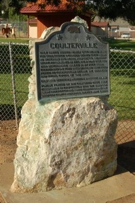
Coulterville Marker
RANKED BY RELEVANCE, THEN GEOGRAPHICALLY
| 1 ► California, Mariposa County, Coulterville — 332 — Coulterville — |
| On State Highway 49, on the left when traveling south. | |||
| 2 ► Mexico, Estado de Mexico, Villa Victoria — Old City Hall — Mariposa Monarca — |
| On Calle Lazaro Cardenas (Route 14) at Calle Guadalupe Victoria, on the right when traveling north on Calle Lazaro Cardenas. | |||
| 3 ► California, Mariposa County, Fish Camp — A New Vision for an Ancient Grove — Mariposa Grove of Giant Sequoias — Yosemite National Park — |
| Near Mariposa Grove Road, 2.1 miles east of Wawona Road (California Route 41). | |||
| 4 ► California, Mariposa County, Fish Camp — Celebrating the Mariposa Grove — Mariposa Grove of Giant Sequoias — Yosemite National Park — |
| Near Mariposa Grove Road, 2.1 miles east of Wawona Road (California Route 41). | |||
| 5 ► California, Mariposa County, Fish Camp — Sustaining the Mariposa Grove — Mariposa Grove of Giant Sequoias — Yosemite National Park — |
| Near Mariposa Grove Road, 2.1 miles east of Wawona Road (California Route 41). | |||
| 6 ► California, Mariposa County, Mariposa — Mariposa County Court House — Erected 1854 — |
| On Bullion Street south of 10th Street, on the right when traveling south. | |||
| 7 ► California, Mariposa County, Mariposa — Mariposa County Court House — |
| On Bullion Street south of 10th Street, on the right when traveling south. | |||
| 8 ► California, Mariposa County, Mariposa — 670 — Mariposa County Courthouse — |
| On Bullion Street south of 10th Street, on the right when traveling south. | |||
| 9 ► California, Mariposa County, Mariposa — Mariposa County’s Old Stone Jail — |
| On Bullion Street, on the left when traveling south. | |||
| 10 ► California, Mariposa County, Mariposa — Mariposa Independent Order Odd Fellows Hall — |
| On 6th Street at State Highway 140 on 6th Street. | |||
| 11 ► California, Mariposa County, Mariposa — Mariposa Meat Market — |
| On Central Yosemite Highway (California Route 140) south of 6th Street, on the right when traveling south. | |||
| 12 ► California, Mariposa County, Mariposa — Mariposa Museum and History Center — Golden Key Mine Stamp Mill — Mariposa Gazette Building, Counts House — |
| On Jessie Street at 12th Street, on the left when traveling north on Jessie Street. | |||
| 13 ► California, Mariposa County, Hornitos — Cavagnaro General Store — |
| On Bear Valley Road (County Road J16), on the left when traveling south. | |||
| 14 ► California, Mariposa County, Hornitos — St. Catherine Catholic Church — |
| On St. Catherine Street, 0.3 miles east of High Street, on the right when traveling east. | |||
| 15 ► California, Mariposa County, Mariposa — 518 — Agua Fria — |
| On State Highway 140 east of Yaqui Gulch Road, on the left when traveling east. | |||
| 16 ► California, Mariposa County, Mariposa — Capital Saloon — |
| On Central Yosemite Highway (California Route 140), on the right when traveling south. | |||
| 17 ► California, Mariposa County, Mariposa — St. Joseph’s Catholic Church — |
| On First Street near Bullion Street. | |||
| 18 ► California, Mariposa County, Mariposa — The Townsite of Agua Fria, California — |
| On Aqua Fria Road, 0.4 miles north of California Highway 140, on the left when traveling north. | |||
| 19 ► Mexico, Estado de Mexico, Temascaltepec, San Mateo Almomoloa — Piedra Herrada Monarch Butterfly Reserve — |
| Near Carretera Toluca-Valle de Bravo, on the right when traveling west. | |||
| 20 ► California, Mariposa County, Coulterville — Coulterville Hotel — |
| On Yosemite Boulevard (State Highway 132) at State Highway 49, on the right when traveling south on Yosemite Boulevard. | |||
| 21 ► Mexico, Querétaro, Jalpan de Serra, Tancama — The Copper Butterfly Building — Tancama Archaeological Zone — |
| Near Jalpan de Serra - Xilitla Highway (Route 120), on the left when traveling east. | |||
| 22 ► California, Mariposa County, Mariposa — Bridgeport — |
| On Old Highway Road, on the right when traveling east. | |||
| 23 ► California, Mariposa County, Mariposa — La Mineta 1850 - Princeton 1854 - Mount Bullion 1862 — |
| On Princeton Road at Highway 49 Frontage Road on Princeton Road. | |||
| 24 ► California, Mariposa County, Mariposa — 323 — Mormon Bar — |
| On Fairgrounds Road east of California Highway 49, on the right when traveling east. | |||
| 25 ► California, Mariposa County, Yosemite National Park — Big Tree — Sequoiadendrion giganteum — |
| Near Village Drive north of Northside Drive, on the right when traveling north. | |||
| 26 ► California, Mariposa County, Bear Valley — May Rock — |
| On State Highway 49, on the right when traveling south. | |||
| 27 ► California, Mariposa County, Mariposa — Fremont Adobe — |
| On St. Charles Street (California Route 140) at 5th Street, on the left when traveling north on St. Charles Street. | |||
| 28 ► California, Fresno County, Fresno — The Basque Hotel |
| On Mariposa Street at F Street, on the left when traveling north on Mariposa Street. Reported missing. | |||
| 29 ► California, Tuolumne County, Columbia — Prosper Rocher Brewery — |
| On Jackson Street, 0 miles Columbia Street, on the right when traveling east. | |||
| 30 ► California, Fresno County, Reedley — Major James D. Savage — |
| On Reed Avenue, 0.2 miles south of East Adams Avenue, on the right when traveling south. | |||
| 31 ► California, Mariposa County, Wawona — 4 — Yosemite Valley's First Visit by White Men |
| Near Wawona Road (State Highway 41), on the left when traveling east. Reported missing. | |||
| 32 ► California, Mariposa County, Mariposa — St. Joseph's Catholic Church — |
| On 2nd Street. | |||
| 33 ► California, Mariposa County, Mariposa — The Ophir Mines |
| On Mount Ophir Road. Reported missing. | |||
| 34 ► California, Mariposa County, Yosemite National Park — A View Through Time — Tunnel View - Yosemite National Park — |
| Near Southside Drive, on the right when traveling east. | |||
| 35 ► California, Mariposa County, Yosemite National Park — 790 — Yosemite Valley — 1864-1964 — |
| Near Village Drive north of Northside Drive. | |||
| 36 ► California, Stanislaus County, Roberts Ferry — Roberts Ferry — |
| On Yosemite Boulevard (State Highway 132) at Roberts Ferry Road, on the right when traveling east on Yosemite Boulevard. | |||
| 37 ► California, Tulare County, Visalia — Venice School — |
| On Road 180 at Avenue 312, on the left when traveling north on Road 180. | |||
| 38 ► California, Fresno County, Firebaugh — 10 — Andrew Davidson Firebaugh — Firebaugh's Ferry — |
| On Q Street at 15th Street, on the left when traveling south on Q Street. | |||
| 39 ► California, Fresno County, Fresno — 28 — John Charles Fremont — |
| Near West Kearney Boulevard, 0.3 miles west of South Bryan Avenue. | |||
| 40 ► California, Los Angeles County, Altadena — Zane Grey Estate — |
| On Mariposa Street east of Marengo Avenue, on the right when traveling east. | |||
| 41 ► California, Mariposa County, Bear Valley — 5999 — Fremont’s Fort — |
| On State Highway 49, on the right when traveling south. | |||
| 42 ► California, Mariposa County, Bear Valley — Mrs. E. Trabucco Store — |
| On State Highway 49 north of Bear Valley Road, on the right when traveling south. | |||
| 43 ► California, Mariposa County, Hornitos — 333 — Hornitos — |
| On Mechanic Street at Bear Valley Road (Road J16), on the right when traveling west on Mechanic Street. | |||
| 44 ► California, Mariposa County, Hornitos — Indian Gulch — Established 1849 — |
| On Indian Gulch Extension, 0.2 miles south of Indian Gulch Road, on the right when traveling south. | |||
| 45 ► California, Mariposa County, Mariposa — A Shrine to Justice in California — |
| On Bullion Street south of 10th Street, on the right when traveling south. | |||
| 46 ► California, Mariposa County, Mariposa — Mt. Buckingham School — |
| On Darrah Road at Triangle Road on Darrah Road. | |||
| 47 ► California, San Benito County, San Juan Bautista, San Juan Bautista State Historic Park — Vicky’s Cottage — Closed to the Public — |
| Near Second Street north of Washington Street, on the right when traveling north. | |||
| 48 ► California, Mariposa County, Cathey's Valley — Cathey's Valley — |
| Near State Highway 140, on the right when traveling east. | |||
| 49 ► California, Mariposa County, Yosemite National Park — The Ahwahneechee — |
| Near Northside Drive, on the right when traveling west. | |||
| 50 ► Mexico, Ciudad de México, Colonia Extremadura Insurgentes — 16 — Atlante from Chichén Itzá, Yucatán — |
| Near Avenida Insurgentes Sur just south of Avenida Porfirio Díaz, on the right when traveling south. | |||
| 51 ► Mexico, Ciudad de México, Colonia Tlatelolco — Favor request…and talent for the gods — Solicitud de favores…y dones para los dioses — |
| 52 ► California, Calaveras County, Murphys — Maj. James D. Savage — |
| Near Main Street. | |||
| 53 ► California, Madera County, Madera — Madera — Spanish for "Lumber", The First Industry — |
| On Highway 145 at Road 400, on the right when traveling west on Highway 145. | |||
| 54 ► California, Mariposa County, Bear Valley — Bear Valley — |
| On State Highway 49 south of Bear Valley Road, on the left when traveling south. | |||
| 55 ► California, Mariposa County, El Portal — 527 — Site of Savage’s Trading Post — |
| On CA Highway 140, on the right when traveling east. | |||
| 56 ► California, Mariposa County, Fish Camp — The Surviving Tunnel Tree — |
| On Mariposa Grove Road. | |||
| 57 ► California, Mariposa County, Mariposa — John Trabucco Building — |
| On California Route 140, on the right when traveling north. | |||
| 58 ► California, Mariposa County, Yosemite National Park — Olmsted Point — A Family Legacy — |
| On Tioga Pass Road (California Route 120), on the right when traveling east. | |||
| 59 ► California, Merced County, Le Grand — The Old Millerton Road Crossed Here — |
| On Yosemite Highway (California Route 140) 2 miles east of North Cunningham Road, on the right when traveling east. | |||
| 60 ► California, Santa Clara County, Santa Clara, Central San Jose — Captain Harry Love — |
| Near North Winchester Boulevard. | |||
| 61 ► California, Stanislaus County, Oakdale — Langworth — |
| On State Highway 108 at Langworth Road, on the left when traveling west on State Highway 108. | |||
| 62 ► California, Mariposa County, Hornitos — Hornitos — “Little Ovens of the Mother Lode” — |
| On High Street near St. Catherine Street, on the left when traveling south. | |||
| 63 ► California, Mariposa County, Mariposa — Agua Fria — |
| On State Highway 140 east of Yaqui Gulch Road, on the left when traveling east. | |||
| 64 ► California, Santa Clara County, Hollister — 1843 - Rancho de San Luis Gonzaga - 1931 — |
| Near Whiskey Flat Road/Trail. | |||
| 65 ► California, Tulare County, Springville — Battle Mountain — |
| On Balch Park Road, 12 miles east of CA-190 (California Highway 190), on the right when traveling east. | |||
| 66 ► California, Ventura County, Ventura — 632 E. Thompson Boulevard — Mitchell Block Historic District — |
| On East Thompson Boulevard. | |||
| 67 ► Guatemala, Petén, Flores — Tikal Archaeological Park — |
| On Carretera 3, on the left when traveling west. | |||
| 68 ► Mexico, Hidalgo, Tula de Allende — The Temple of Pyramid B — |
| Near Tula-Pachuca Carretera just north of Entrada a Zona Arqueológica. | |||
| 69 ► California, Fresno County, Reedley — Wagon Bridge — 1885 - 1929 — |
| On Kings River Road, 0.1 miles south of Manning Avenue when traveling east. | |||
| 70 ► California, Stanislaus County, Roberts Ferry — Roberts Ferry History Walk — |
| On Roberts Ferry Road, 0.2 miles south of Yosemite Boulevard (California Highway 132). | |||
| 71 ► California, Fresno County, Fresno — 873 — Site of the Fresno Free Speech Fight — |
| Near Mariposa Street at Fulton Street. | |||
| 72 ► California, Amador County, Jackson — In Memoriam: The '49ers — |
| On Court Street at Summit Street on Court Street. | |||
| 73 ► California, San Bernardino County, Big Bear City — 5 Stamp Mill — Big Bear Valley Historical Museum — |
| Near Greenway Drive, 0.3 miles north of Big Bear Boulevard, on the right when traveling north. | |||
| 74 ► Texas, Bexar County, San Antonio, Main/Military Plaza — 25 — The New Blossoming of San Pedro Creek — |
| On West Commerce Street at Camaron Street, on the right when traveling west on West Commerce Street. | |||
| 75 ► Alaska, Ketchikan Gateway Borough, Ketchikan — When 'Steam was Queen' — |
| On Front Street at Mission Street, on the right when traveling south on Front Street. | |||
| 76 ► California, Alameda County, Emeryville — Two Emeryville Pioneers — Edward Wiard and Joseph S. Emery — |
| Near Hubbard Street. | |||
| 77 ► California, Mariposa County, Coulterville — I.O.O.F Lodge 104 — |
| 78 ► California, San Francisco City and County, San Francisco, South Beach — The Matson Line — |
| On The Embarcadero near Bryant Street, on the right when traveling north. | |||
| 79 ► Mexico, Hidalgo, Tula de Allende — Toltec Architecture and Art |
| Near Calle Tollan just west of Calle Entrada a Zona Arqueológica, on the left when traveling west. Reported permanently removed. | |||
| 80 ► Illinois, Cook County, Chicago, Lincoln Park — Chicago is Natural — Chicago es Natural — |
| Near North Boulevard. | |||
| 81 ► Texas, Brewster County, Terlingua — Chisos Mine and Terlingua — Big Bend Snapshot History — |
| On Terlingua Ghost Town at Ivey Road, on the left when traveling north on Terlingua Ghost Town. | |||
| 82 ► El Salvador, San Salvador — Claudia Lars — (1899-1974) — |
| 83 ► Mexico, Estado de Mexico, Teotihuacán, Teotihuacán de Arista — Palacio de Quetzalpapalotl — |
| Near Estado de Mexico Route 132 just east of Puerta 3 Ruta de Acceso, on the right when traveling north. | |||
| 84 ► Mexico, Ciudad de México, Hervidero y Plancha, Centro Histórico — José María Lafragua — |
| Near Calle San Fernando, on the right when traveling west. | |||
* Inflectional forms of words are their plurals, singulars, and possessives as well as gramatical tenses and similar variations.