In 1838 over 850 Potawatomi Indians were forced by gunpoint off their homeland in Indiana and ‘marched’ approximately 660 miles to the State of Kansas for relocation — causing approximately 42 deaths along the way.
Oct. 6, Day 33 of the forced march from their Indiana homeland, 850 Potawatomi Indians camped nearby after traveling 18 miles that day. As the barren land only allowed one choice for encampment, it was named "Hobson's Choice". Water on route was . . . — — Map (db m181376) HM
From October 8-10, 1838, more than 800 Potawatomi Indians were encamped here in Quincy, Illinois and directly across the Mississippi River in Missouri. They were being forced to march from Southern Michigan and Northern Indiana to Eastern Kansas . . . — — Map (db m150021) HM
From 1818 through 1851 groups of American Indians were forcibly removed from states on the east side of the Mississippi River to territories on the west side. One of these removals was the Potawatomi Trail of Death, conducted by William Polke, . . . — — Map (db m181375) HM
On October 7, 1838 nearly 850 Potawatomi Indians camped near here on Mill Creek on the forced removal from Indiana to Kansas. The diary records that they traveled 12 miles that day A child died. — — Map (db m181377) HM
Some 800 Potawatomi were forcibly removed by U.S. and Indiana officials from near Plymouth, Indiana and taken to eastern Kansas in 1838. Enroute 39 recorded deaths occurred. This tragic event became known as the “Trail of Death”. The . . . — — Map (db m32503) HM
Over 800 Potawatomi were forcibly removed from near Plymouth, Indiana by U. S. And Indiana Officials and taken to eastern Kansas in 1838. This historic event was named the “Trail of Death” after the tragic occurrence of 39 recorded . . . — — Map (db m33251) HM
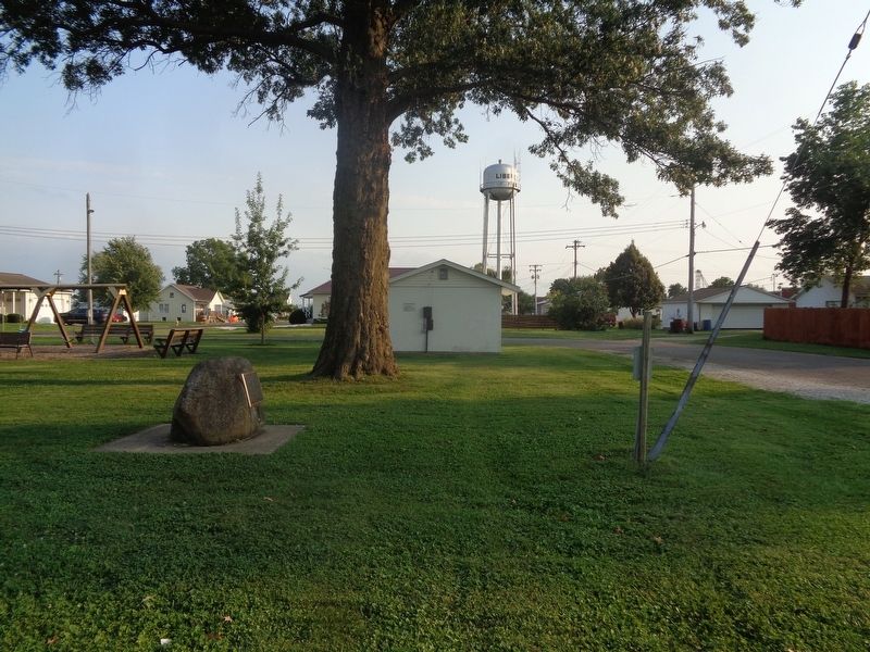
Over 800 Potawatomi encamped at Sidney after their forced removal by U.S. and Indiana officials from near Plymouth, Indiana. They were being marched to eastern Kansas. Two people died at Sidney, including a child. A total of 39 Potawatomi tragically . . . — — Map (db m33248) HM
Forcibly removed from northen Indiana to eastern Kansas, over 800 Potawatomi encamped here, cared for sick, and were allowed to hunt; 2 children and 1 woman died; 39 deaths occurred along the entire route.
Sponsors: Hanson Engineers, . . . — — Map (db m33284) HM
We honor the pioneers and the three Native Americans who died here while on the Trail of Death march in 1838 and are buried in this cemetery — — Map (db m33255) HM
About 800 Potawatomi Indians camped at Pyatt’s Point during a forced march from Twin-Lakes, Ind. To the reservation on the Osage River, Kansas. One woman, three children were buried during this stop. — — Map (db m33262) HM
On Oct. 5, 1838, about 800 Potawatomi Indians camped at McKee’s Creek near here on the forced removal from Indiana to Kansas, known as the Trail of Death. They crossed the Illinois River by ferry. Leaving the river they had to seek water, because of . . . — — Map (db m135378) HM
Potawatomi
Trail of Death
Sept 4 - Nov 4, 1838
McCoys Mill
Encampment
During a drought, 850 Potawatomi Indians were force-marched more than 600 miles from Indiana to Kansas. 40 died, mostly children.
After a 17 mile march from the . . . — — Map (db m32537) HM
Potawatomi
Trail of Death
Sept 4 - Nov 4, 1838
Island Grove
Encampment
During a drought, 850 Potawatomi Indians were force-marched more than 600 miles from Indiana to Kansas. 40 died, mostly children.
After a 6 mile march from McCoy's . . . — — Map (db m32538) HM
On Sept. 29, 1838, 800 Potawatomi Indians marched through Springfield on the forced removal from Indiana to Kansas. Although many had died and they faced severe hardship, they were encouraged by Judge Polke and Chief I-o-weh to exhibit pride, so . . . — — Map (db m34320) HM
Approximately 800 fatigued Potawatomi camped in this area on September 28, 1838, on a forced removal from Indiana to Kansas. Two children died during the night. Chief I-O-Weh led his people through the town of Springfield the next day. — — Map (db m156778) HM
In 1838 the northern Potawatami tribes and many Indians from other tribes were forcibly relocated to Eastern Kansas.
The first point to encampment in Illinois on the march westward was near the North Fork River in Danville.
This monument is . . . — — Map (db m32501) HM
Here at Chief Winamac's old village, about 900 Potawatomi Indians camped on their forced removal from Indiana to Kansas. A child and a man died here during the encampment. They also left behind 24 too sick to continue. — — Map (db m35399) HM
On September 11, 1838, about 850 Potawatomi Indians camped at Pleasant Run, having traveled 17 miles that day on the forced removal from Indiana to Kansas. — — Map (db m35400) HM
Rev. Benjamin Marie Petit, of the City of Rennes, France, arrived as the Catholic missionary to the Potawatomi Indians in northern Indiana in November 1837. By June 1838, he had learned much of their difficult language and their culture, and had . . . — — Map (db m35500) HM
Extending from Michigan City to the Ohio River at Madison. Begun by the state in 1832 with funds obtained from sale of land granted by the Potawatomi Indians. Opened northern part of state to settlers. — — Map (db m35346) HM
On September 5, 1838, nearly 850 Potawatomi Indians marched single file through Rochester on the forced removal from Indiana to Western Territory (Kansas). Three chiefs were transported in a jail wagon: Menominee, Black Wolf, and Pepinewa. There . . . — — Map (db m35501) HM
Built in 1834 by William Polke, first white settler in Fulton County, this is the oldest and first frame house in the county and the first frame house built north of Wabash River. It was called the White House and was a stagecoach inn on the . . . — — Map (db m35327) HM
In memory of Chief Menominee and his band of 859 Pottawatomie Indians removed from this Reservation Sept. 4, 1838 by a company of soldiers under command of General John Tipton, authorized by Governor David . . . — — Map (db m36122) HM
Site of
Pottawatomie Indian Church
at
Chi Chi Pi Ou Ti pe Twin Lakes
First Church in Marshall County
erected 1827 by Father Badin.
First Catholic Priest ordained in U. S.
1838 the Indians were moved westward
and the Chapel was . . . — — Map (db m35326) HM
Two miles east, on north bank of Twin Lakes, some 800 Potawatomi Indians were collected in August 1838 and forced to begin their long march to new homes in the West. Many perished on the way. — — Map (db m2307) HM
Archaeological evidence suggests that Chief Menominee's Village was located approximately 2½ miles southeast of here on the northern bank of the Yellow River near Wolf Creek. — — Map (db m240659) HM
Indiana to Kansas, September 4 - November 4, 1838 The 1811 Battle of Tippecanoe on this site was decisive, leading to the loss of their homelands and the removal of Indians from Indiana. At Gunpoint, about 850 Potawatomi passed this location . . . — — Map (db m6433) HM
Over 850 Potawatomi Indians camped here on the Wabash River in Tippecanoe County, Indiana, Sept. 13, 1838, on the forced removal from Indiana to Kansas. There were 106 sick so two doctors were called in, Drs. Ritchie & son. Sanford Cox later wrote . . . — — Map (db m33811) HM
In 1838 some 800 Potawatomi Indians, being forcibly removed from Marshall County to Kansas, camped along this road, the LaGrange-Logansport State Road. On this “trail of death”, scores of Native Americans suffered and died. The mother of Chief . . . — — Map (db m33812) HM
On September 15, 1838, about 860 Potawatomi Indians camped near here on the forced removal from Indiana to Kansas. They had to camp by a dirty stream. Two small children who died on the trek from Williamsport were buried at this camp. — — Map (db m32495) HM
In 1838 a band of over 800 Potawatomi Indians were forcibly removed from their homeland in Northern Indiana and marched to Eastern Kansas. Many died along the trail during the two month trek. This mournful caravan traveled this road on September 14, . . . — — Map (db m9307) HM
About 850 Potawatomi Indians camped here near Williamsport September 14, 1838. Two deaths occurred in the evening. Three chiefs were transported in a jail wagon because they refused to leave their beloved homeland in Indiana. — — Map (db m32620) HM
The removal of the Potawatomi Indians from northern Indiana to Kansas took place Sept. - Nov. 1838. Nearly 900 Indians were rounded up by soldiers and marched at gun point for 61 days. So many died on the way and were buried by the roadside that . . . — — Map (db m70609) HM
Rev. Benjamin Marie Petit, of the City of Rennes, France, arrived as the Catholic missionary to the Potawatomi Indians in northern Indiana in November 1837. By June 1838, he had learned much of their difficult language and their culture, and had . . . — — Map (db m70652) HM
Father Benjamin Marie Petit, a missionary to the Potawatomi in northern Indiana, accompanied them on the forced removal in 1838. He ministered to their needs, both spiritual and physical. He baptized the dying children, "whose first step was . . . — — Map (db m70635) HM
The rock lined pits in this area pre-date the arrival of the Potawatomi Indians. Theories are that they may have been used for seed or food storage. The rocks here are shaped differently than any other in the area and their origin is uncertain. . . . — — Map (db m70575) HM
[Map] Designates 1838 'Trail of Death' route from Indiana to present day Osawatomie, Kans.
In September 1838 over 850 Potawatomi Indian people were rounded up and marched at gunpoint from their Indiana homeland. Many walked the 600-mile . . . — — Map (db m70654) HM
Some of the Jesuit priests who lived and served here
Fr. Christian Hoecken • Fr. Francis Renaud • Fr. Felix Vanquickenborne • Fr. Peter John Verhaegen • Fr. Peter Desmet • Fr. Fleix [sic] Verreydt • Fr. John Baptist Smedts • Fr. Herman Aelen . . . — — Map (db m70638) HM
Sugar Creek Mission
1839 - 1849
Potawatomi Settlement
after a forced march from
Northern Indiana
A Journey Called
"Trail of Death" — — Map (db m70574) HM
Potawatomi Tribal members were marched from Indiana in 1838 to be relocated on Indian Territory lands. The march was long and arduous. Many Potawatomi, especially children and the elderly, died of illness along the way. Those who survived the . . . — — Map (db m33946) HM
The Native America tribe that is called the Potawatomi originally lived in the heavily forested region of the northern Great Lakes with their close relatives the Ojibwe and Ottawa tribes in what is now the state of Michigan. The rapidly expanding . . . — — Map (db m34792) HM
This city and college take their name from St. Mary's Catholic Mission founded here by the Jesuits in 1848 for the Pottawatomie Indians. These missionaries, who had lived with the tribe in eastern Kansas from 1838, accompanied the removal to this . . . — — Map (db m122966) HM
Of Pottawatomie Indian and French ancestry, Louis Vieux was an early resident of this area. Probably born near Lake Michigan, Vieux, with a portion of the Pottawatomies, moved to Iowa and later Indianola, Kan., near Topeka. In 1847 or 1848, Vieux . . . — — Map (db m32608) HM
On Oct. 24, 1838 about 800 Potawatomi Indians camped near Carrollton on forced emigration from Indiana to Kansas. Cold was intense on the prairie. — — Map (db m198474) HM
On Oct. 23, 1838, about 800 Potawatomi Indians camped near here on the forced removal from Indiana to Kansas. They camped at Thomas' encampment. Having marched 10 miles after ferrying the Grand River. Wet bottom lands and severe cold made the march . . . — — Map (db m198473) HM
On Oct. 22, 1838, about 800 Potawatomi Indians began ferrying the Grand River as they walked from Indiana to Kansas on the forced removal. By dark all the Indians and many of the wagons were over the river and ferried the rest the next day. — — Map (db m198471) HM
(front:)
In remembrance of the forced removal of the Potawatomi (Neshdabe) people from their homes in northern Indiana to Miami County, Kansas in 1838
(reverse:)
This historical landmark was made possible by the Eagle . . . — — Map (db m200147) HM
In 1838, 823 Potawatomi Indians camped near Blue River on the forced removal from Indiana to Kansas. Capt. Hull's group of 23 Indians, 5 horses and 3 wagons were attached to the body of emigration under Judge Polke. — — Map (db m200330) HM
On October 26, 1838 about 800 Potawatomi Indians being forcibly removed from Indiana camped on the river bank opposite Lexington. They ferried the Missouri River on October 27 and were marched on to Northeast Kansas.
This monument is in memory . . . — — Map (db m90921) HM
On Saturday October 27th the Potawatomi Indians camped in Wellington at the Little Schuy Creek (Big Sni).
On Sunday October 28, a Potawatomi child died. — — Map (db m200328) HM
About 800 Potawatomi Indians camped near here on See's Creek on Oct. 22, 1838 on a forced removal from northern Indiana to eastern Kansas. Two or 3 Indians were placed under guard. Health good so no medicine administered to them. Horses grazed in . . . — — Map (db m243900) HM
Indiana to Kansas 1838
On Oct. 11, 1838, 850 Potawatomi Indians camped at Pleasant Spring near Palmyra on the forced removal from Northern Indiana to Eastern Kansas. They passed through Palmyra at 10 o'clock October 12. That night they camped . . . — — Map (db m36351) HM
On Oct. 11, 1838 the emigration moved from the encampment of the last two days. The march was pleasant and without the occurrence of any difficulties. Potawatomi Indians numbering 850 camped here at Pleasant Spring near Palmyra, Mo. Capt. J. Holman . . . — — Map (db m243899) HM
On Oct. 8-10, 1838, about 800 Potawatomi Indians camped here on the west side of the Mississippi River, after crossing by steam-ferry from Quincy. They were enroute to Kansas, being forcibly removed from Indiana. Three children died Oct. 8. Wagons . . . — — Map (db m181374) HM
On October 17 & 18, 1838 about 850 Pottawatomie Indians camped near Huntsville, on their way from northern Indiana to Kansas; a forced march accompanied by soldiers. Having traveled 13 miles in cold rain, a flooded camp caused them to stay a second . . . — — Map (db m96113) HM
Designates 1838 Potawatomi "Trail of Death" route starting in Indiana, crossing Illinois and Missouri, and ending at present day Osawatomie, Kansas.
In September 1838, over 850 Potawatomi Indian people were rounded up and marched at gunpoint . . . — — Map (db m198476) HM