On Arizona Route 389 at Cane Beds road, on the right when traveling north on State Route 389.
Segments of centuries-old Indian trails between St. George and Long Valley were used by Mormon pioneers in 1864 to settle Long Valley and its resettlement in 1871 following Indian conflicts. The trail
divided at the area of this marker; the . . . — — Map (db m131299) HM
The first meetinghouse in Phoenix for The Church of Jesus Christ of Latter-day Saints (Mormons) was built on this site by the three-hundred-member congregation of the Phoenix Ward. At the time, J. Robert Price was bishop.
Since their beginning . . . — — Map (db m27613) HM
Near Rim of the World Highway (California Route 18) 0.3 miles west of Highway 138, on the right when traveling west.
In the spring of 1852, over one hundred Mormon men donated a full thousand man-days of arduous labor, to construct a road up Waterman Canyon, past this spot, and into the prime timber, where some of their enterprising bethren established six . . . — — Map (db m154361) HM
On East 97th South near South 15th East, on the right when traveling west.
A special tribute to Joseph Allen Taylor and his son Chet, who were the first to develop the potato cellar in 1909. At this time the Russet Burbank had been introduced to the Taylors. They planted the first 20 ares just to the west. The . . . — — Map (db m140510) HM
On Riverside Drive at Memorial Drive, on the right when traveling south on Riverside Drive.
The idea of the hospital was conceived by Heber C. Austin with construction commencing in 1919, though the completion of the building was delayed because of a depressed economy.
On 22 October 1923, the hospital was dedicated by President Heber J. . . . — — Map (db m109826) HM
On West 2nd South near South 3rd West, on the right when traveling west.
In February of 1883, Colonizer and Bishop Thomas E. Ricks commissioned Andrew A. Anderson to survey Rexburg City. This block was set aside as the Public Square. In the early days of colonization, settlers camped here before moving to their permanent . . . — — Map (db m140590) HM
Ground was broken on May 14, 1911 by the Church of Jesus Christ of Latter-day Saints to construct a tabernacle for the purpose of holding conference, baptisms, and other special meetings. President Joseph F. Smith dedicated the tabernacle eight . . . — — Map (db m84346) HM
Near Jacks Valley Road/Main Street (Nevada Route 206) near Genoa Lane.
In early June, 1850, a party of Mormons led by Abner and Thomas Blackburn, Hampton S. Beatie and Joseph Dumont, established a trading post about a mile to the north of this site. In September, as they returned to Salt Lake City, a party of Bannock . . . — — Map (db m20698) HM
On East 700 South at S 400 E, on the right when traveling east on East 700 South.
In 1942, Bushnell General Hospital was built in Brigham City by the federal government to treat World War II wounded. The hospital closed in 1946 after 13,000 army personnel were treated there.
In 1950, the Bureau of Indian Affairs coverted . . . — — Map (db m240490) HM
On East 100 North at North 400 East, on the right when traveling east on East 100 North.
In 1876, Harriet Snow, Box Elder Stake Relief Society President, was asked by the LDS General Relief Society President, Emmeline B. Wells, to join with women's groups throughout the LDS Church to gather and store wheat against a time of need from . . . — — Map (db m240493) HM
Lorenzo Snow was born 3 April, 1814, in Mantua, Ohio, a son of Oliver and
Rosetta Snow. He joined the Church of Jesus Christ of Latter Day Saints in June of 1836 at the age of 22. He crossed the plains, captained his wagon company, and arrived . . . — — Map (db m240492) HM
On South 200 West, on the left when traveling south.
The same sun, moon and stars shone over these everlasting hills when old Lake
Bonneville's waters reached midway up these mountains. Later, native American
hunters roamed these lands which they called Woebequachee. Here they fished Pe-
Ogway . . . — — Map (db m240491) HM
On 400 West 700 North at 400 W 700 N, on the right when traveling east on 400 West 700 North.
Soon after the first white families settled at Box Elder, they built a temporary fort to protect themselves from Shoshone Indian attacks.
The Davis Fort was named after their leader, William Davis and consisted of a row of simple log . . . — — Map (db m240496) HM
Ford was used by Indians, Fur Tappers and Mountain Men. About 1853 Ben Hampton and Wm. Godbe operated a ferry for emigrant traffic. The site became a "home station" successively for stages of Oliver & Conniver, Ben Holladay, and Wells-Fargo. About . . . — — Map (db m105494) HM
On Orchard Drive at Mill Street, on the right when traveling north on Orchard Drive.
The Heber C. Kimball Gristmill, the foundation of which can be seen just east of this monument, was in operation from 1852 until 1892, using these burr-type gristmill stones. When the use of roller mills was introduced, mills of this type were no . . . — — Map (db m125133) HM
On West 200 South, 0.1 miles west of South 300 West, on the right when traveling west.
Ellen (Nellie) Purcell was born November 6, 1846 in Tintwhistle, England. At 9 she, with her parents and sister Margaret (Maggie), 14, began the trek from Iowa to Salt Lake Valley in 1856 with the Edward Martin Handcart Company.
Early snows . . . — — Map (db m59517) HM
On Main Street at 100 South, on the right when traveling north on Main Street.
Seeking a suitable railroad route through the central Rockies, John C. Freemont and Company reached Parowan February 6, 1854.
These are Freemont's own words, "We were all so feeble we could barely drag ourselves down the trail, but the Mormons . . . — — Map (db m59610) HM
On West 200 South at 200 West and 200 South, on the right when traveling north on West 200 South.
This site marks the southwest corner of the old Parowan adobe fort. It was constructed at the direction of LDS leader Brigham Young, to help secure the new pioneers as they developed the mother town of Southern Utah. Conceptualized in 1851, the . . . — — Map (db m240472) HM
From 1877 to 1927, members of the Church of Jesus Christ of Latter-day Saints traveled this route to be united in eternal marriage in the St. George Utah Temple. Thus, the route was named the “Honeymoon Trail.”
Families came from . . . — — Map (db m95008) HM
On South 100 East (U.S. 89) at East 300 South, on the left when traveling south on South 100 East.
On this corner stood the Grand Old House with its beautiful flower garden. It was built and planted by Israel and Charlotte Cox Heaton in 1913.
This couple are of elite pioneer heritage. In the Grand Old House they hosted many family gatherings . . . — — Map (db m130687) HM
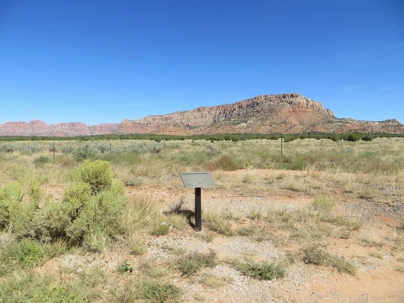
On U.S. 89, 0.6 miles south of Utah Route 9, on the left when traveling south.
Segments of the old Indian trails between St. George and Long Valley were used by Mormon pioneers to settle Long Valley in 1864 and for its resettlement in 1871 following Indian conflicts. The trail divided just east of present-day Colorado City, . . . — — Map (db m74733) HM
On 8400 West (Utah Route 111) at 4100 South, on the right when traveling north on 8400 West.
In Commemoration of the First Communities Established on the West Side of Salt Lake Valley and the First Major Industry of Utah.
In 1853 Abraham Coon, an early Mormon pioneer, explored a canyon in the Oquirrh Mountains on the west side of . . . — — Map (db m35077) HM
Near 5300 South, on the right when traveling west.
Gold, silver, copper, lead and zinc were found at Alta, Park City, and Tintic in the years 1864 to 1869. Since no smelting was done in the state or the surrounding area, smelters had to be built. Billy Morgan built the first smelter at 5189 South . . . — — Map (db m124034) HM
The first known residents of the Riverton area were the Yo No Indians, a poor tribe living along the Jordan River. Well-worn trails extended from Utah Lake where various tribes wintered, to Bear Lake where they rendezvoused during the summer. Much . . . — — Map (db m34682) HM
On Evergreen Avenue (3425 South), on the right when traveling east.
In 1824-26 the first black man came into Utah Territory. He was a trapper for the Rocky Mountain Fur Company. His name was James Beckworth. In succeeding years many black people would follow to contribute to the development of Utah, socially and . . . — — Map (db m1379) HM
Perhaps one of the longest living and prominent residents of the area, known as Parley’s Hollow, now officially Parley’s Historic Nature Park, was Joseph Dudler. About 1864, he settled in this location. Here he built his home. It was two stories, . . . — — Map (db m124023) HM
Early in 1870, Joseph Dudler, owner and operator of the inn which was on the ground level of his house, built a brewery in back of his house here in Parley’s Hollow. To provide for this, in addition to the brewery proper, located on adjacent . . . — — Map (db m124024) HM
Parley's Creek, originally known by the Indian name Obit-Ko-Ke-Che Creek, was the largest stream of water which flowed from the Wasatch Mountains into the valley. This creek had beginnings high in the Wasatch Mountains to the north near what became . . . — — Map (db m123769) HM
World renowned mining and metallurgical engineer, eminent business executive, benefactor and loyal friend of Utah and its people.
Guided by an inspired vision, he applied and developed processes for the beneficiation of low grade porphyritic . . . — — Map (db m72780) HM
On Main Street north of 100 South, on the right when traveling north.
At this location on October 18 1861 stood the telegraph pole, shown on above plaque, on which telegraph wires were joined which spanned a continent and united two oceans.
On that date the first two telegrams transmitted were as follows: . . . — — Map (db m35085) HM
Near South Main Street north of Local Road 200S, on the right when traveling north.
Pony Express Division Headquarters
Here, Ben Ficklin, General Superintendent, and Major Howard Egan and James C. Bromley, Division Superintendents, had their headquarters.
The Following Were Honored Utah Riders
Howard Egan • . . . — — Map (db m200662) HM
On E 2100 South, on the right when traveling east.
The foundation work on the Salt Lake Temple was nearing completion and soon would be ready for the granite upper walls. The four day trip from the quarry with oxen-drawn wagons could not possibly provide stone as quickly as it was needed. To . . . — — Map (db m1420) HM
(150 Years). Winter Quarters, Nebraska to the Valley of the Great Salt Lake,
April 21, 1997 to July 22, 1997.
On a cold rainy morning in April 1997, modern day pioneers left Florence, Nebraska, the old winter quarters, to re-enact the . . . — — Map (db m1449) HM
Near Carlisle Park Lane, on the right when traveling south.
In the 1850’s and 1860’s, three brothers, Joseph, John, and Richard Carlisle, settled in this location between 700 West and Jordan River. Their endeavors included farming, dairying, and planting mulberry trees to raise silk worms. They developed a . . . — — Map (db m124303) HM
In 1855, upon the counsel of Brigham Young, Joseph Harker, with John and Samuel Bennion, hand-dug the lower ditch to irrigate the farmland on the river bottoms west of the Jordan River.
A small rock dam was constructed on the Jordan River at . . . — — Map (db m123573) HM
On this site, 6200 South and Redwood Road, in the year 1905 stood the 64th District School House. It was a red brick building consisting of two large rooms on the west side and a single large room on the east side.
The name of the school was . . . — — Map (db m41348) HM
On 1825 West (State Highway 48) 0.1 miles south of 7800 South (State Highway 48), on the right when traveling south.
The Salt Lake and Utah Railroad—better known in Utah as the “Orem Line”—extended from Salt Lake City through the city of South Jordan, at this location, and to Payson, a distance of 67 miles. A branch line of 9 miles in . . . — — Map (db m35549) HM
On 1825 West, 0.1 miles south of 7800 South (Utah Highway 48), on the right when traveling south.
In 1849 Governor Brigham Young sent Apostle John Taylor on a mission to France to investigate industries that could be successfully established in the New Mountain Empire. There he met Philip De Lamare, a man of exceptional talents and substantial . . . — — Map (db m35548) HM
On Navajo Twins Drive west of U.S. 191, on the right when traveling west.
Bluff was the first settlement of the white man in San Juan County and its first county seat. It was founded April 6, 1880 by the San Juan Mission "called" by the L.D.S. Church to establish friendly relations with the Indians. A small band of . . . — — Map (db m95043) HM
On U.S. 89 at Birdseye Road (Route 89), on the right when traveling south on U.S. 89.
Looking east to the red ledges you can see the quarry, originally operated by the Mormon Church and others in the 1880's to the 1940's as the Nebo Rock Works, Thistle Rock Works and Birdseye Marble Quarry.
The stone polishes to a high degree and is . . . — — Map (db m101133) HM
On Utah Route 120 at Interstate 70, on the left when traveling north on State Route 120.
This old lime kiln is the best preserved of seven kilns constructed north of Richfield during the late 1880′s. It was built by John Kyhl for Jens Larsen Jenson, a Swedish immigrant. The lime was used in the construction of homes, churches and . . . — — Map (db m74841) HM
On East 200 North, 0.1 miles east of North Center Street, on the left when traveling east.
Arza Adams (1804-1889), pioneer millwright from Canada, came to Utah Valley with other pioneers to settle this area in 1850, soon after the first pioneers arrived in the Salt Lake Valley in 1847. Arza built a waterpowered “grist” mill on . . . — — Map (db m149970) HM
During the winter of 1850-51, Arza and Sabina Adams moved their family of seven children here from Mill Creek, Salt Lake Valley. They built a log cabin across the street east of where you stand. Journals tell that Arza built a grist mill near his . . . — — Map (db m149842) HM
On North Center Street, on the right when traveling south.
This cabin was built by John Austin in 1868 on Bull River (3500 North Center). John’s son Parley married Charlotte Butt in 1884. They moved into the cabin which had been vacated by Parley’s parents. In the late 1890’s Parley built a home in Lehi and . . . — — Map (db m150068) HM
On South 200 West south of West 100 South, on the right when traveling south.
Site of the first meetinghouse of the Church of Jesus Christ of Latter-day Saints in Lehi, Built in 1855. Replaced in 1972. Also used for civic meetings and upper rooms for school. — — Map (db m149979) HM
On East 900 North west of North 900 West, on the right when traveling west.
Lott Russon, Sr. was born January 1, 1829, and Eliza Round was born October 21, 1830, in England. The couple married December 25, 1850, and converted to The Church of Jesus Christ of Later-day Saints (LDS/Mormon) two years later. To support his . . . — — Map (db m150069) HM
On Mill Pond Road at Pioneer Crossing, on the right when traveling south on Mill Pond Road.
The Lehi factory of the Utah Sugar Company, of the Church of Jesus Christ of Latter-day Saints, occupies a pre-eminent place among early sugar mills in America. As historian Leonard Arrington has written: “It was the first sugar-beet factory . . . — — Map (db m149976) HM
On South 100 East, on the right when traveling north.
Not all Federal Troops fought Confederates during the Civil War. Some were posted in the West to protect Union interests. Battles and skirmishes in the West were considered part of the Civil War. *
The 3rd Reg. California Volunteer Infantry . . . — — Map (db m149573) HM WM
On Mountain View, on the right when traveling north.
Harrisburg Historic Pioneer Cemetery
Honoring Early Harrisburg Pioneers and Their Infants and Children
Surname Given name Middle/Maiden Birth Death
Cox Willard Glover 13 Feb 1887 7 Aug 1887 •
Dailey Sarah Jane Wilson 21 Dec 1830 22 Oct 1873 . . . — — Map (db m243199) HM
1893–1904
This monument is near the spot where a celebration took place on August 6, 1904. After nearly eleven years of arduous work on the canal, water was ready for diversion onto the land.
“Five or six wagon loads of . . . — — Map (db m1329) HM
The construction of the Hurricane Canal is one of Utah's proudest stories of pioneer determination. This canal, built completely by hand, opened the Hurricane Bench to farming and the establishment of the town of Hurricane.
In 1893 two local men, . . . — — Map (db m59363) HM
Hurricane had its humble beginning in the year 1906 with the coming of eleven families to establish their homes. These first settlers were the families of T. Maurice Hinton, Ira E. Bradshaw, Anthony Jepson, Thomas Ison, Bernard Hinton, Erastus Lee, . . . — — Map (db m1461) HM
On North Main Street, 1.3 miles north of Utah Route 9, on the right when traveling north.
The confluence of Ash and LaVerkin Creeks with the Virgin River is important in the history of this region. Footsteps long forgotten have passed through this region. Some have been remembered but most have faded with time. Roaming bands of Indians, . . . — — Map (db m59447) HM
Near Utah Route 59, 1.2 miles east of Main Street, on the left when traveling east.
Segments of the old Indian trails between St. George and Long Valley were used by Mormon pioneers to settle Long Valley in 1864 and for its resettlement in 1871 following Indian conflicts. This trail scaled the Hurricane Fault on the Johnson Twist. . . . — — Map (db m74618) HM
When first conceived, the Hurricane Canal seemed like an impossible dream. Beginning at a point seven miles up the Virgin River, water had to travel through flumes, tunnels, and over deep ravines. The canal had to hang on steep, unstable cliffs and . . . — — Map (db m1328) HM
Near Utah Route 59, 1.2 miles east of Main Street, on the left when traveling east.
When first conceived, the Hurricane Canal seemed like an impossible dream. Beginning at a point seven miles up the Virgin River, water had to travel through flumes, tunnels, and over deep ravines. The canal had to hang on steep, unstable cliffs and . . . — — Map (db m74617) HM
Buggies, such as the one before you, were an important part of early America. As the name implies, Doctors' Buggies were used by physicians but they were also a popular choice for many others as well. Buggies were dearly prized and generally kept in . . . — — Map (db m59373) HM
On Center Street, 0.6 miles west of Utah Route 9, in the median.
The confluence of Ash and LaVerkin Creeks with the Virgin River is important in the history of this region. Footsteps long forgotten have passed through this region. Some have been remembered but most have faded with time. Roaming bands of Indians, . . . — — Map (db m59449) HM
On Interstate 15 at milepost 33, on the right when traveling north.
October 13, 1776:"We set out southward from the small river and campsite of Nuestra Senora del Pilar ("Our Lady of the Pillar" – Kolob Canyon of Zion Canyon National Park)…" and…"We traveled a league and a half to the south, . . . — — Map (db m59468) HM
Water—the lack of it and too much of it—was the greatest challenge to Dixie’s early Mormon settlers. When the original company of families entered the St. George valley late in 1861, they had little more than two small springs to reply . . . — — Map (db m1395) HM
On North Main Street at St. George Boulevard, on the right when traveling north on North Main Street.
Brigham Young was prophet and president of the Church of Jesus Christ of Latter-day Saints for 30 years. During those three decades he directed the establishment of more than three hundred communities throughout the American West. It was "Brother . . . — — Map (db m59229) HM
Near this spot, in the fall of 1859, Brigham Young statesman and leader of the
Mormon people, silently gazed at Pine Valley Mountain, and then the valley and
hills of black lava and vermilion rock before him. He saw in vision a . . . — — Map (db m241415) HM
Across the street west, and 2 blocks south of here, stands the building originally known as the St. George Academy. After the turn of the century Southern Utah citizens realized a great need for higher education in this isolated corner of the state. . . . — — Map (db m1392) HM
On North Main Street at St. George Boulevard, on the right when traveling north on North Main Street.
On this site in 1867, Erastus Snow began construction on a four-story, adobe home which later became known as the "Big House." Snow, an LDS apostle, was the presiding Mormon leader during the colonization of St. George. The "Big House" was an . . . — — Map (db m59233) HM
Built just five years after St. George was settled, the Gardeners’ Club Hall is considered to be the oldest public building standing in the city. This small, unassuming adobe building predates the courthouse, the Tabernacle and the Temple by several . . . — — Map (db m1385) HM
In 1826 Jedediah Smith, searching for a route to California, entered what is now Washington County by crossing the black ridge north of here then following Ash Creek to the Virgin River. He followed the Virgin River through the Virgin River . . . — — Map (db m241351) HM
The seat of county government was originally established at Fort Harmony from 1856 until 1859. It was then moved to the city of Washington until 1863 when St. George became the County Seat. By 1866, work had begun on the Washington County . . . — — Map (db m1391) HM
At a time of colonization, colonizors of the Dixie Cotton Mission were struggling to survive, their leaders planned a higher priority on culture. The Mormon Prophet, Joseph Smith, taught that “man is that he might have joy.” His . . . — — Map (db m1393) HM
Less than a year after St. George was settled, residents were directed by Brigham Young to “build a building as soon as possible which would be commodious, substantial and well furnished with a seating capacity of 2,000.” The building, . . . — — Map (db m1387) HM
When the Mormon pioneers arrived in Utah, they had left behind 2 temples—one in Kirkland, Ohio, and one in Nauvoo, Illinois. Work began on a temple in Salt Lake City in 1853, but was delayed for various reasons. Desirous of having a temple . . . — — Map (db m1386) HM
In the fall of 1849, Brigham Young formed the Southern Exploring Company led
by Parley P. Pratt. Through that winter the compnay of 50 men explored potential town sites and resources from Nephi to present day St. George as part of Young's plan . . . — — Map (db m241416) HM
When the first settlers arrived in St. George late in 1861, school was held in a wagon box, a tent, a willow shack, or whatever shelter could be improvised. By 1864, the first of four ward houses was completed. It was not until nearly the end of the . . . — — Map (db m1389) HM
Jacob Hamblin, pioneer. missionary and friend to the Indians, planted cottonseed in the fertile river bottoms near here in 1855. A settlement was established the next year called Tonaquint, after a local band of Indians that were located there. . . . — — Map (db m241414) HM
The first regularly scheduled overland passenger flight in the USA was made by Western Air Express on May 23, 1926, from Salt Lake City to Los Angeles. This 50-foot concrete arrow was one of four here in the St. George area, placed every 10 miles, . . . — — Map (db m59016) HM
On East Merriam Street (U.S. 26) at Lawton Avernue on East Merriam Street.
Between the years 1847 and 1868, most of the approximate 80,000 Mormon Pioneers passed through Fort Laramie. This was the first stop for the vanguard company after leaving Winter Quarters, (near Omaha) Nebraska.
In June, 1847, after following a . . . — — Map (db m79776) HM