116 entries match your criteria. The first 100 are listed. The final 16 ⊳
Mormon Pioneer Trail Historical Markers
As many as 80,000 people migrated to Utah via the Mormon Pioneer Trail from 1847 until the Transcontinental Railroad was completed. It shares much of its route with the Pony Express Trail, the Oregon Trail, the California Trail, and the Union Pacific portion of the Transcontinental Railroad.
By Syd Whittle, May 14, 2016
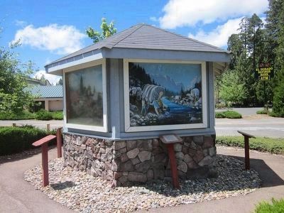
The Mormon Emigrant Trail Marker and Painting Depicting the Event
Shortly after James W Marshall discovered gold at Sutter's Mill, his Mormon laborers were re-called to the Great Salt Lake Valley, Utah. On April, 9, 1848, a plan was devised to cut a wagon trail through the uncharted Sierra Nevada frontier. The . . . — — Map (db m94636) HM
Cajon Pass, separating the San Bernardino and San Gabriel ranges, has long been an important natural gateway. It is traversed by Indian trails, emigrant routes, railroads, and a superhighway. Early in the nineteenth century it became the southern . . . — — Map (db m119252) HM
In June 1851, 500 Mormon Pioneers came through this pass to enter the San Bernardino Valley where they colonized and established a prosperous community. — — Map (db m140423) HM
Erected in honor of the brave pioneers of California in 1917 by pioneers Sheldon Stoddard, Sydney F. Waite, John Brown Jr., George Miller, George M. Cooley, Silas C. Cox, Richard Weir, Jasper N. Corbett — — Map (db m157687) HM
On June 1851, the first major group of 520 Mormon settlers entered Southern California at Baldy Mesa Ridge in the West Cajon Pass. This location is northwest of Highway 138, about four miles from the Palmdale Freeway offramp. The Wagon Route ran . . . — — Map (db m51259) HM
Most early Bear Lake settlers came from Britain. One was the first woman convert to the LDS church in Europe.
Born in Preston, England, Aug. 24, 1806. Ann Elizabeth Walmsley Palmer was baptized July 30, 1837. An invalid, she was carried into the . . . — — Map (db m99318) HM
In 1846, about 13,500 Mormon pioneers fled Nauvoo, Illinois, in search of religious freedom. They departed in phases to prepare the way for those who would follow. Their journey started by crossing the Mississippi River. They traveled about 1,300 . . . — — Map (db m244071) HM
Near here, the Mormon exodus to the Rocky Mountains began on February 4, 1846 in seven years, members of The Church of Jesus Christ of Latter-day Saints, commonly called the Mormons, had built Nauvoo to a size comparable to Chicago, with . . . — — Map (db m55440) HM
On the anniversary of the 200th year celebration of the Prophet Joseph Smith, and the 175th anniversary of the establishment of the Church of Jesus Christ of Latter Day Saints, this monument of His prophets Joseph Smith and Brigham Young has been . . . — — Map (db m55439) HM
Nauvoo was the Latter-day Saints' home for seven years. But they faced increasing conflict with their neighbors. Church leaders planned to leave Nauvoo in the spring of 1846. Latter-day Saints gathered supplies, built wagons, and organized into . . . — — Map (db m244060) HM
Completed in 1843, the Mansion House was the second Nauvoo residence of Joseph Smith and his wife Emma. A hotel wing was added and opened in late 1843. The hotel was leased to Ebenezer Robinson in January 1844. As part of the lease agreement, the . . . — — Map (db m55435) HM
In 1841 church members were commanded to build two “houses,” a house for the Lord (the Nauvoo Temple) and a house for man to be known as the Nauvoo House. It was to be “a delightful habitation for man, and a resting-place for the weary traveler.” . . . — — Map (db m55433) HM
Nauvoo was once the site of a Sauk and Fox village. After the Indians moved west of the Mississippi, promoters attempted to develop town sites here but the marshy bottom lands attracted few settlers.
In 1839, the Mormon Prophet Joseph Smith . . . — — Map (db m55432) HM
The original Red Brick Store opened for business on January 5, 1842, with Joseph Smith as owner and proprietor. The main floor was a general store. At the back on this floor, Bishop Newell K. Whitney had an office where people could pay their bills . . . — — Map (db m55437) HM
This two-story, two-room log block house was located on the original 135 acres purchased from local farmer Hugh White and may date to 1803. Joseph Smith moved here in the spring of 1839 with his wife Emma; sons Joseph III, Frederick Granger . . . — — Map (db m55434) HM
Beginning in February of 1846, the vanguard of the Church of Jesus Christ of Latter-day Saints (the Mormons) struggled across southern Iowa on the way to their "New Zion" in the Rocky Mountains.
The trek from Nauvoo, Illinois, to Kanesville . . . — — Map (db m93813) HM
Beginning in February of 1846, the vanguard of the Church of Jesus Christ of Latter-day Saints (the Mormons) struggled across southern Iowa on the way to their "New Zion" in the Rocky Mountains.
The trek from Nauvoo, Illinois, to Kanesville . . . — — Map (db m93882) HM
Determined and authenticated
by the Historical Department of Iowa, 1911.
This monument was erected in 1917 by the
Iowa Daughters of the American Revolution
in memory of the pioneers who followed
this trail and its tributaries.
We cross . . . — — Map (db m93819) HM
Marker Front: The land on which Iowa City is located was a wilderness when it was selected and surveyed for the capital of the Territory of Iowa in 1839. The cornerstone of the new capitol building was laid by Governor Lucas on July 4, 1840. . . . — — Map (db m224357) HM
The Mormon Trail The Mormons of Nauvoo, Illinois, forced from their homes following the murder of their prophet, Joseph Smith, Jr., began their trek across Iowa in 1846 on the way to the Great Salt Lake Valley. From their first permanent . . . — — Map (db m224588) HM
From the late 1840s through the 1860s, an exodus of more than 70,000 Mormons passed by here on their way to their "New Zion" in Utah. Starting from Nauvoo, Illinois in February 1846, the first group of at least 13,000 Mormons crossed into Iowa . . . — — Map (db m72391) HM
Marker Front: The land on which Iowa City is located was a wilderness when it was selected and surveyed for the capital of the Territory of Iowa in 1839. The cornerstone of the new capitol building was laid by Governor Lucas on July 4, 1840. . . . — — Map (db m224362) HM
Determined and authenticated by the Historical Department of Iowa, 1911. This monument was erected in 1917 by the Iowa Daughters of the American Revolution in memory of the pioneers who followed this trail and its tributaries. We cross the prairie . . . — — Map (db m176631) HM
This Marker Commemorates The Early Trails Across Mills Co. Dragoon 1835 Mormon 1846 Stagecoach 1850 And Honors The Valiant Pioneers Who Travelled Them — — Map (db m93052) HM
Hyde Park was a small farming community just west of here, founded in 1847 by Mormon pioneers. It was named for Orson Hyde, an Apostle of The Church of Jesus Christ of Latter-Day Saints who took up residence here when he returned that spring from . . . — — Map (db m93960) HM
This historic cemetery of Kanesville (now Council Bluffs) was created as the resting place for the mortal remains of several hundred Mormon pioneers. From 1846 to 1853, thousands of members of The Church of Jesus Christ of Latter-Day Saints (the . . . — — Map (db m93973) HM
This Boulder commemorates the early travel upon the Mormon Trail through Kanseville, now Council Bluffs and is dedicated to the memory of the throngs who crossed Iowa in advance of settlements. Here thousands of pioneers encamped awaiting pasturage . . . — — Map (db m45065) HM
(front of main marker)
Mt. Pisgah - Mormon Pioneer Way Station
Between 300 and 400 Mormon pioneers perished here from 1846 to 1852. Having been driven from their homes by armed mobs, they stopped here on their westward trek, named it . . . — — Map (db m20995) HM
Beginning in February of 1846, the vanguard of the Church of Jesus Christ of Latter-day Saints (the Mormons) struggled across southern Iowa on the way to their "New Zion" in the Rocky Mountains.
The trek from Nauvoo, Illinois, to Kanesville . . . — — Map (db m90402) HM
Near here, located in a grove of young hickory trees, was an important rallying point in 1855 and 1856 for members of The Church of Jesus Christ of Latter-Day Saints (Mormon), then emigrating to the Rocky Mountains.
The campground, really a . . . — — Map (db m55363) HM
Between 1846 and 1869, thousands of Mormon immigrants traversed the Great Plains enroute to sanctuary in the Great Basin of the Rocky Mountains. The main route ran through Nebraska, paralleling the Platte River.
A cholera epidemic in the fall . . . — — Map (db m43936) HM
From the late 1840s through the 1860s, an exodus of more than 70,000 Mormons passed by here on their way to their “New Zion” in Utah. Starting from Nauvoo, Illinois in February 1846, the first group of at least 13,000 Mormons crossed into Iowa to . . . — — Map (db m86778) HM
The Mormon Pioneer Trail from Nauvoo, Illinois to the Rocky Mountains passed here April 17, 1847. In this vicinity a military-type organization was formed with Brigham Young, Lieutenant General; Stephen Markham, Colonel; John Pack and Shadrach . . . — — Map (db m58566) HM
Forced to leave their homes along the Mississippi, the Mormons began arriving in the Missouri River Valley in June of 1846. By September, nearly 4,000 refugees had begun to settle in for the winter - laying out blocks and streets, building cabins . . . — — Map (db m90578) HM
Florence was a small town with a big history. The Oto, Missouri, and Omaha Indians lived and hunted here. Frenchmen, Canadians and Spaniards traded along the Missouri river. Lewis and Clark's Corps of Discovery made their first contact with Indians . . . — — Map (db m90529) HM
This Bridge is on the Mormon Pioneer Trail from Nauvoo, Illinois, to the Rocky Mountains. Driven from their homes by mobs, many of the dispossessed Mormon people crossed the Mississippi River on the ice in February, 1846. From these refugees five . . . — — Map (db m90469) HM
Fleeing heated religious and political hostility and persecution, many members of The Church of Jesus Christ of Latter-day Saints (widely known as Mormons) abruptly fled their homes in Nauvoo, Illinois in February 1846. Unprepared for the cold of . . . — — Map (db m90577) HM
From the late 1840s through the 1860s, an exodus of more than 70,000 Mormons passed by here on their way to their "New Zion" in Utah. Starting from Nauvoo, Illinois in February 1846, the first group of at least 13,000 Mormons crossed into Iowa to . . . — — Map (db m90464) HM
Here in 1846 an oppressed people fleeing from a vengeful mob found a haven in the wilderness. Winter Quarters, established under the direction of the Mormon leader Brigham Young, sheltered more than 3,000 people during the winter of 1846-1847. . . . — — Map (db m90527) HM
Fleeing heated religious and political hostility and persecution, many members of The Church of Jesus Christ of Latter-day Saints (widely known as Mormons) abruptly fled their homes in Nauvoo, Illinois in February 1846. Unprepared for the cold of . . . — — Map (db m3705) HM
Religious freedom, An American ideal, has on occasion been denied certain sects because of prejudice. Mormons were once persecuted and forced from their homes. The north bank of the Platte River served as the exodus route for thousands of members of . . . — — Map (db m45171) HM
From 1847 to the 1860s, the Mormon migration along the Great Platte River Road marked a distinctive chapter in the history of westward expansion. In contrast to the random migrations of individual families or companies that characterized much of . . . — — Map (db m79695) HM
Mormons traveled the Great Platte River Road to fulfill a religious mission. In the 1840s members of the Church of Jesus Christ of Latter Day Saints.(Mormons) moved westward to escape religious persecution. Beginning in 1847 they crossed the Plains . . . — — Map (db m50787) HM
Mormon pioneers enroute from winter quarters, (Omaha) to the valley of the Great Salt Lake, under the leadership of Brigham Young, camped near here May 11, 1847. While in this vicinity William Clayton made a distance-measuring device which when . . . — — Map (db m180898) HM
Lone Tree, a giant, solitary cottonwood, was a noted Platte River landmark as early as 1833. Standing on the north side of the river some three miles southwest of present Central City, the tree was visible at great distance. Several travelers . . . — — Map (db m53229) HM
For thousands of Mormons, the great pioneer trail along the north bank of the Platte which paralleled the river about a mile south of here was an avenue of escape from persecution and a roadway to a new life.
Brigham Young led the first mass . . . — — Map (db m53233) HM
Member Mormon Martin Handcart Company Mary Murray Murdoch “Wee Granny” Born Scotland Oct. 13, 1782 Died near Chimney Rock, Neb. Oct. 2, 1856 “Tell John I died with my face toward Zion.” Dedicated by the Murdoch Family . . . — — Map (db m87318) HM
Fleeing heated religious and political hostility and persecution, many members of The Church of Jesus Christ of Latter-day Saints (widely known as Mormons) abruptly fled their homes in Nauvoo, Illinois in February 1846. Unprepared for the cold of . . . — — Map (db m195175) HM
Court House Rock was first noticed by explorer Robert Stuart in 1812 and quickly became one of the guiding landmarks for fur traders and emigrants traveling to the California, Oregon and Utah Territories. It is a massive monolith of Brule Clay and . . . — — Map (db m79388) HM
Brigham Young and his company of Mormon Pioneers camped about 1,000 feet west of this point May 24, 1847. They were enroute from Nauvoo, Illinois and Winter Quarters, Nebraska to the Valley of the Great Salt Lake, which they reached July 24, 1847. . . . — — Map (db m79387) HM
Mormon emigrants traveling west along the north sided of the North Platte River saw many topographical features that were not visible from the south side of the river. These features served as landmarks that guided the Latter-day Saints along their . . . — — Map (db m79386) HM
Narcissa Whitman, trail-blazer and martyred missionary, is one of the great heroines of the frontier West. In 1836 she and Eliza Spalding, following the north side of the Platte on horseback, became the first white women to cross the American . . . — — Map (db m223469) HM
Genoa, named by the Mormon Pioneers, was among several temporary settlements established by the Church of the Latter Day Saints in 1857, along the 1000-mile trail from Florence, Nebraska to Salt Lake City. These settlements were to serve as . . . — — Map (db m179388) HM
In 1847, Brigham Young led 143 men, 2 women, and 3 children west along the Platte River, then southwest into Utah. By the 1860s, an exodus of more than 70,000 other Mormons followed this trail to their "New Zion." Today, a marked 1,624-mile auto . . . — — Map (db m53192) HM
From the late 1840s through the 1860s, an exodus of more than 70,000 Mormons passed by here on their way to their “New Zion” in Utah. Starting from Nauvoo, Illinois in February 1846, the first group of at least 13,000 Mormons crossed into Iowa to . . . — — Map (db m79440) HM
Rebecca Winters, daughter of Gideon Burdick, a drummer boy in Washington’s army, was born in New York State in 1802. She was a pioneer in the Church of Latter Day Saints, being baptized with her husband Hiram in June 1833. . . . — — Map (db m86666) HM
From the late 1840s through the 1860s, an exodus of more than 70,000 Mormons passed by here on their way to their “New Zion” in Utah. Starting from Nauvoo, Illinois in February 1846, the first group of at least 13,000 Mormons crossed into Iowa to . . . — — Map (db m86779) HM
In memory of Rebecca Burdick wife of Hiram Winters. She died a faithful Latter Day Saint, Aug. 15, 1852, Aged 50 Yrs. While making that memorable journey across the plains with her people to find a new home in the far distant Salt Lake Valley, she . . . — — Map (db m88671) HM
Mormon Migration, Kirkland Camp On July 28, 1838, the first and largest company of Mormon pioneers to migrate west camped along the Mad River near this site. Known as Kirtland Camp, the 515 members of The Church of Jesus Christ of Latter-day . . . — — Map (db m97244) HM
On 19 July 1847, scouts Orson Pratt and John Brown climbed the mountain and became the first Latter-day Saints to see the Salt Lake Valley. Due to illness, the pioneer camp had divided into three small companies. On 23 July, the last party, led by . . . — — Map (db m150080) HM
This monument was erected July 23, 1933, and marks the last camp site of the first company of Mormon Pioneers, under the leadership of President Brigham Young, before entering the Salt Lake Valley, July 24, 1847. — — Map (db m41379) HM
This is the Place Monument, dedicated July 24, 1947, commemorates the arrival of the Mormon pioneers into the valley of the Great Salt Lake one hundred years before, and also the role of others—Spanish Catholic fathers, trappers and fur traders, . . . — — Map (db m1525) HM
Historic Corridor
Modern roads and highways often follow historic transportation corridors. In the mid 1800s, the California, Mormon Pioneer, and Pony Express Trails all passed through this canyon. Today, Interstate 80 in Echo Canyon . . . — — Map (db m67627) HM
From the late 1840s through the 1860s, an exodus of more than 70,000 Mormons passed by here on their way to their "New Zion" in Utah. Starting from Nauvoo, Illinois in February, 1846, the first group of at least 13,000 Mormons crossed into Iowa to . . . — — Map (db m67626) HM
Under the Leadership of Brigham Young
the "Mormon" Pioneers
Exploring Their Way to the Valley of
The Great Salt Lake
Passed here July 15 to 20, 1847. Orson Pratt's advance company reached here July 15, others following at . . . — — Map (db m150075) HM
Between June 9, 1856, and July 6, 1860, ten separate Handcart Companies left Iowa
City, Iowa, or Florence, Nebraska to their land of Zion in the Utah Territory. There were
653 handcarts and 50 wagons.
Nearly 3,000 souls, some with babes in arms, . . . — — Map (db m59369) HM
Ice Slough is a small stream that flows into the Sweetwater River five miles east of here. In front of this point is a slough (i.e. a marsh or shallow un-drained depression). This slough gave the name to the stream east of here. In the "Ice Slough" . . . — — Map (db m62076) HM
Originally called the Emigrant Road, the Oregon Trail was the main route of westward expansion from 1812 to 1869. An estimated 500,000 people journeyed past here in search of new lands and new lives in the West.
Because of its unique shape, . . . — — Map (db m62092) HM
Split Rock was a relay station during the turbulent 18 month life of the Pony Express. The Express operated at a gallop, speeding mail across the West in only 10 days. However, because of the "talking wire," its days were numbered. The telegraph . . . — — Map (db m69603) HM
Shoshone, Arapaho, Crow and Sioux Indians occupied this pleasant valley long before the Oregon Trail, which changed their cultures and life styles forever. This led to tragic warfare and the eventual loss of country they had called their own.
. . . — — Map (db m69602) HM
The Oregon Trail was American’s main street west. Building upon American Indians footpaths, emigrants bound for the Pacific Northwest used the trail. They were soon followed by Mormons fleeing persecution, gold seekers rushing to California and the . . . — — Map (db m95744) HM
At 7000 feet above sea level, Rocky Ridge is the highest point on the Mormon and Oregon Trails. This elevation, lack of water, and rugged landscape presented a challenge to early pioneers. The trail over Rocky Ridge is approximately two miles long . . . — — Map (db m96621) HM
From where you're standing South Pass doesn't look all that remarkable. But compared to the rugged Wind River Mountains, it can easily be recognized as a type of gateway.
Nevertheless, crossing the Continental Divide into "Oregon Country" was a . . . — — Map (db m67020) HM
Even after the discovery of South Pass in 1824, it was years before the route was used extensively. Fur trapper/trader William Sublette brought a small caravan of wagons to South Pass in 1828. While his party did not take wagons over the pass, they . . . — — Map (db m67021) HM
South Pass was discovered in 1812 by a small band of Astorians led by Robert Stuart as they traveled east with dispatches for John Jacob Astor. It was “rediscovered” in 1824 by a party led by Jedediah Smith as they searched for a winter . . . — — Map (db m80501) HM
The trail over South Pass is a transportation corridor which served many purposes. In addition to being the route to Oregon and California, it was used by Mormon pioneers and by the Pony Express.
A great exodus to the Salt Lake Valley in 1847 . . . — — Map (db m67019) HM
With South Pass behind them, Oregon and California-bound travelers faced the second half of their journey. The roughest travel was yet to come. From Missouri to South Pass, emigrants were able to follow rivers. But from South Pass to Oregon and . . . — — Map (db m67018) HM
The Twin Mounds are a minor landmark along the Trail. These low hills on either side of the Trail helped keep emigrants headed in the right direction on the final climb to South Pass.
After the wagons passed between the Mounds, they fanned out . . . — — Map (db m237435) HM
The James G. Willie Handcart Company was rescued on October 21, 1856 by a rescue party sent by Brigham Young. 21 members of the Willie Company perished in this valley due to a severe winter storm and lack of clothing and food. Captain Willie left in . . . — — Map (db m96622) HM
Oregon-Mormon Trail
and Sixth Crossing
of Sweetwater River
Willie Handcart Company rescue site, 21 October 1856 and burial site of John Winford and eight others from that company
John Linford
Born 28 August 1808 England
Died . . . — — Map (db m95742) HM
Late in the year of 1856, the Willie and Martin Handcart Companies and the Hunt and Hodgetts Wagon Companies left Iowa City for their journey westward. Near this spot, these companies crossed the Sweetwater River for the sixth time, thus the name . . . — — Map (db m95743) HM
Between the years 1847 and 1868, most of the approximate 80,000 Mormon Pioneers passed through Fort Laramie. This was the first stop for the vanguard company after leaving Winter Quarters, (near Omaha) Nebraska.
In June, 1847, after following a . . . — — Map (db m79776) HM
Many emigrants journals and diaries from the 1840s to 1860s mention experiences such as; “nooning,” camping for the night, crossing over, or burying a loved one on the banks of Rawhide Creek. Of these experiences, death and disease were . . . — — Map (db m79704) HM
1336 miles - Nauvoo, Illinois to the Salt Lake Valley (Second plaque below:)
"Whether I live or whether I die all is well, all is well"
Elizabeth Rutledge 1806 - 1852 — — Map (db m98358) HM
The grave of F.R. Fulkerson was noted by forty-niner J.G. Bruff on July 26, 1849, as he traveled through what he termed "Pass of the Rattle-Snake Mountain to the left of Devil's Gate." The survival of the large granite boulder used as the Fulkerson . . . — — Map (db m66997) HM
Thousands who traveled the Oregon Trail in central Wyoming were unaware that they were the beneficiaries of a long series of geological events. The granite peaks around you are mountains that rose, sank and then were buried in sand and ashy . . . — — Map (db m62149) HM
Two miles to the northwest nestled at the foot of the Sweetwater Rocks, lies Martin's Cove. Here Captain Edward Martin's exhausted company of Mormon handcart emigrants sought shelter from a severe early winter storm in 1856. The Martin Company, low . . . — — Map (db m95501) HM
Survivors of Captain Edward Martin's Handcart Company of Mormon emigrants from England to Utah were rescued here in perishing condition about Nov. 12, 1856. Delayed in starting and hampered by inferior carts it was overtaken by an early winter. . . . — — Map (db m95487) HM
Many travelers along the Oregon, California, and Mormon Pioneer trails relied on maps and reports made by explorers or guides who knew the way. William Clayton provided early emigrants with a detailed written record of his travels. As a member of . . . — — Map (db m91950) HM
Many travelers along the Oregon, California, and Mormon Pioneer trail relied on maps and reports made by explorers or guides who knew the way. William Clayton provided early emigrants with a detailed written record of his travels. As a member of . . . — — Map (db m95600) HM
“….A Company have gone back about three miles to make two canoes on which they intend to build a boat to be used here till the next company comes up. Another company also went about half a mile up the river to make slabs or puncheons to lay on . . . — — Map (db m91693) HM
From the late 1840s through the 1860s, an exodus of more than 70,000 Mormons passed by here on their way to their “New Zion” in Utah. Starting from Nauvoo, Illinois in February 1846, the first group of at least 13,000 Mormons crossed . . . — — Map (db m91708) HM
The North Platte River that we see today is considerably different than the river that the 1847 pioneer party had to cross. As series of dams upstream from this site strictly regulates the flow of water on a year round basis.
(Map of Platte . . . — — Map (db m91704) HM
Called Bitter Cottonwood Creek because of the groves of cottonwood trees growing there, this location was a welcome relief for emigrant pioneers as they traveled along the relatively treeless road to the west in the 1840s, 50s, & 60s. Many pioneer . . . — — Map (db m147855) HM
This marks a fork in the trail, right to Oregon, left to Utah and California.
1812, Robert Stuart and eastbound Astorians used South Pass gateway.
1824, Eleven westbound Ashley-Henry men led by Jedediah Smith and Thomas Fitzpatrick.
. . . — — Map (db m67035) HM
This point on the trail is called the Parting-of-the-Ways. The trail to the right is the Sublette or Greenwood Cutoff and to the left is the main route of the Oregon, Mormon, and California Trails. The Sublette Cutoff was opened in 1844 because it . . . — — Map (db m96684) HM
Trail ruts at this site were mistakenly identified as the Parting-of-the-Ways where emigrant parties separated on their journeys to Oregon, California, or Utah.
The actual Parting-of-the-Ways is approximately 10 miles west of this spot. . . . — — Map (db m237433) HM
In July 1844 the California bound Stevens-Townsend-Murphy wagon train, guided by Isaac Hitchcock and 81-year old Caleb Greenwood, passed this point and continued nine and one half miles southwest from here, to a place destined to become prominent . . . — — Map (db m67036) HM
116 entries matched your criteria. The first 100 are listed above. The final 16 ⊳