303 entries match your criteria. The first 100 are listed. ⊳
The Historic National Road Historical Markers
“The Road that Built the Nation.” The first (1811) federally funded road in the U.S. ran from Baltimore, Maryland to Vandalia, Illinois.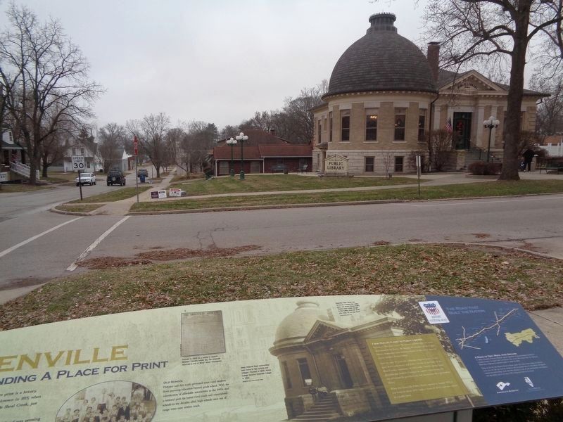
By Jason Voigt, January 3, 2020
Greenville Marker
| 1 ► Illinois, Bond County, Greenville — Greenville — Finding a Place for Print — |
| On North 4th Street at West Main Street, on the right when traveling south on North 4th Street. | |||
| 2 ► Illinois, Bond County, Greenville — History of Greenville-Bond County — |
| On 3rd Street (Illinois Route 127) at Main Street, on the right when traveling north on 3rd Street. | |||
| 3 ► Illinois, Bond County, Greenville — Wells Judd Tire Sales — |
| On North 2nd Street just south of West Oak Street, on the right when traveling south. | |||
| 4 ► Illinois, Bond County, Mulberry Grove — Mulberry Grove — The Shake Rag Stop — |
| On West Main Street (Illinois Route 140) just east of North Maple Street (Illinois Route 140), on the right when traveling east. | |||
| 5 ► Illinois, Bond County, Pocahontas — Pocahontas — Muscle, Metal, and Merchandise — |
| On State Street at Park Street, on the right when traveling east on State Street. | |||
| 6 ► Illinois, Bond County, Smithboro — Smithboro — Now Boarding for Henderson Station — |
| On 2nd Street west of Washington Street, on the left when traveling west. | |||
| 7 ► Illinois, Clark County, Casey — Casey — A Tale of Two Cities — |
| On East Main Street west of 2nd Street, on the right when traveling east. | |||
| 8 ► Illinois, Clark County, Casey — The Development of Casey — |
| On West Main Street west of South Central Avenue (Illinois Route 49), on the right when traveling west. | |||
| 9 ► Illinois, Clark County, Casey — The Early Settlement of Cumberland — |
| Near North 10th Street north of East Alabama Avenue, on the right when traveling north. | |||
| 10 ► Illinois, Clark County, Marshall — Marshall — Archer's Avenue — |
| On North 8th Street west of Michigan Avenue (Illinois Route 1), on the right when traveling south. | |||
| 11 ► Illinois, Clark County, Marshall — Old Stone Arch Bridge — |
| On National Road (Avery Avenue) (U.S. 40) east of Oak Crest Road, on the right when traveling west. | |||
| 12 ► Illinois, Clark County, Marshall — The Archer House — National Historic Landmark — |
| On Archer Avenue west of Michigan Avenue (Illinois Route 1), on the right when traveling east. | |||
| 13 ► Illinois, Clark County, Martinsville — Martinsville — The Merchants of Main Street — |
| On East Main Street west of Mill Street, on the right when traveling east. | |||
| 14 ► Illinois, Clark County, Martinsville — The Linn Family / The Rowe Foundry Anvil — |
| On East Main Street at Mill Street, on the left when traveling east on East Main Street. | |||
| 15 ► Illinois, Cumberland County, Greenup — "The Road that Built the Nation" — |
| On Cumberland Road north of U.S. 40, on the right when traveling east. | |||
| 16 ► Illinois, Cumberland County, Greenup — Cumberland County Covered Bridge — |
| On Cumberland Road north of U.S. 40, on the right when traveling east. | |||
| 17 ► Illinois, Cumberland County, Greenup — Greenup — Rails and Trails — |
| On West Cumberland Street (Illinois Route 121) west of Mill Street, on the right when traveling east. | |||
| 18 ► Illinois, Cumberland County, Greenup — Old to New: Bridges over the Embarras River — |
| On Cumberland Road north of U.S. 40, on the right when traveling east. | |||
| 19 ► Illinois, Cumberland County, Greenup — Site of Barbour Inn — |
| On West Cumberland Street (Illinois Route 121) west of Mill Street, on the right when traveling east. | |||
| 20 ► Illinois, Effingham County, Altamont — Altamont — Rising from the Prairie — |
| On East Cumberland Road (U.S. 40) at South Ewing Street, on the left when traveling west on East Cumberland Road. | |||
| 21 ► Illinois, Effingham County, Dexter — National Road — |
| Near Interstate 70, 5 miles east of Farina Road, on the right when traveling west. | |||
| 22 ► Illinois, Effingham County, Effingham — Effingham — Crossroads of Opportunity — |
| On East Jefferson Avenue west of South 3rd Street (U.S. 45), on the left when traveling east. | |||
| 23 ► Illinois, Effingham County, Montrose — Montrose — Drummers, Drays and Railroad Days — |
| On National Road (U.S. 40) east of Montgomery Street, on the left when traveling east. | |||
| 24 ► Illinois, Effingham County, Teutopolis — Teutopolis — A Community Built On Faith — |
| On West Main Street (U.S. 40) west of Pearl Street, on the right when traveling west. | |||
| 25 ► Illinois, Fayette County, Brownstown — Brownstown — Twin Pumps — |
| On East Cumberland Road (U.S. 40) at South 3rd Street, on the right when traveling east on East Cumberland Road. | |||
| 26 ► Illinois, Fayette County, St. Elmo — St. Elmo — Planes, Trains, and Automobiles — |
| On East Cumberland Road (U.S. 40) at South Olive Street, on the right when traveling east on East Cumberland Road. | |||
| 27 ► Illinois, Fayette County, Vandalia — Cumberland Road — |
| On 4th Street at Gallatin Street, on the right when traveling north on 4th Street. | |||
| 28 ► Illinois, Fayette County, Vandalia — Madonna of the Trail — The National Old Trails Road — |
| On Gallatin Street at 4th Street, on the left when traveling east on Gallatin Street. | |||
| 29 ► Illinois, Fayette County, Vandalia — Vandalia — End of The Road — |
| On Gallatin Street just west of South 4th Street, on the right when traveling west. | |||
| 30 ► Illinois, Fayette County, Vandalia — Welcome to the National Road Interpretive Center — Vandalia, Illinois — |
| On South 5th Street just north of West Gallatin Street, on the right when traveling north. | |||
| 31 ► Illinois, Fayette County, Vandalia — William C. Greenup — Aug. 28, 1785 - June 10, 1853 — |
| 32 ► Illinois, Madison County, Collinsville — Collinsville — Main Street of America — |
| On North Combs Avenue just north of West Main Street, on the left when traveling south. | |||
| 33 ► Illinois, Madison County, Highland — Highland — Fresh Horses and New Courses — |
| On Broadway, 0.1 miles west of Swallow Lane, on the right when traveling west. | |||
| 34 ► Illinois, Madison County, St. Jacob — St. Jacob — The St. Louis Wagon Road — |
| On Park Drive just south of West Main Street, on the right when traveling south. | |||
| 35 ► Illinois, Madison County, Troy — Crossroads of Transportation — |
| On East Market Street (Illinois Route 162) at South Hickory Street, on the right when traveling east on East Market Street. | |||
| 36 ► Illinois, Madison County, Troy — Troy — Cabins, Coaches and Coal Mines — |
| On East Center Street (Illinois Route 162) at Cheshire Road, on the left when traveling east on East Center Street. | |||
| 37 ► Illinois, St. Clair County, Collinsville — Cahokia Mounds — The Road to America's Oldest City — |
| On Ramey Drive, 0.3 miles south of Collinsville Road, on the right when traveling south. | |||
| 38 ► Illinois, St. Clair County, Fairmont City — Fairmont City — The Road to America — |
| On North 44th Street south of Collinsville Road, on the right when traveling north. | |||
| 39 ► Indiana, Clay County, Brazil — You Are Here — Historic National Road / Make History, Drive It — The Road That Built the Nation — |
| On East National Avenue (U.S. 40) west of Forest Avenue (Indiana Route 59), on the left when traveling east. | |||
| 40 ► Indiana, Hancock County, Greenfield — Information on the Move — Historic National Road / Make History, Drive It — The Road That Built The Nation — |
| On South State Street (U.S. 40) at South State Street (Indiana Route 9), on the left when traveling west on South State Street. | |||
| 41 ► Indiana, Hendricks County, Plainfield — Eat — Historic National Road / Make History, Drive It — The Road That Built the Nation — |
| On West Main Street (U.S. 40) west of West Street, on the right when traveling east. | |||
| 42 ► Indiana, Henry County, Knightstown — A Gargantuan Undertaking — Historic National Road / Make History, Drive It — The Road That Built The Nation — |
| On East Main Street (U.S. 40) at North Washington Street, on the right when traveling west on East Main Street. | |||
| 43 ► Indiana, Henry County, Knightstown — The National Road — West |
| On National Road (U.S. 40) west of West Street, on the right when traveling west. Reported missing. | |||
| 44 ► Indiana, Marion County, Indianapolis, Downtown — Marion County — Organized in 1822 — Named for Francis Marion — |
| Near North Blackford Street north of Indianapolis Cultural Trail, on the right when traveling north. | |||
| 45 ► Indiana, Marion County, Indianapolis, Downtown — National Road Legacy Project — |
| Near Central White River Trail south of Downtown Canal Walk, on the right when traveling north. | |||
| 46 ► Indiana, Marion County, Indianapolis, Downtown — Politicians, Poets, and Lion Tamers — Historic National Road — The Road That Built the Nation — |
| Near Central White River Trail at Indianapolis Cultural Trail, on the right when traveling west. | |||
| 47 ► Indiana, Marion County, Indianapolis, Downtown — Vigo County — Organized in 1818 — Named for Francis Vigo — |
| Near North Blackford Street north of Indianapolis Cultural Trail, on the right when traveling north. | |||
| 48 ► Indiana, Marion County, Indianapolis, Downtown — Wayne County — Organized in 1811 — Named for Anthony Wayne — |
| Near North Blackford Street north of Indianapolis Cultural Trail, on the right when traveling north. | |||
| 49 ► Indiana, Marion County, Indianapolis, Irvington — Historic National Road — National Road in Marion County — Opening Up the West — |
| On Old National Road (U.S. 40) at North Layman Ave., on the right when traveling west on Old National Road. | |||
| 50 ► Indiana, Marion County, Indianapolis, Mile Square — Historic National Road / Make History, Drive It — The Road That Built The Nation — |
| On West Washington Street at Senate Avenue, on the right when traveling west on West Washington Street. | |||
| 51 ► Indiana, Marion County, Indianapolis, Mile Square — Indiana's Main Street — Historic National Road — The Road That Built The Nation |
| On West Washington Street west of North Meridian Street, on the left when traveling west. Reported damaged. | |||
| 52 ► Indiana, Marion County, Indianapolis, Mile Square — The National Road / Indiana Centennial — |
| On W. Washington Street. | |||
| 53 ► Indiana, Marion County, Indianapolis, Wayne — Site of "Masonic Well" — |
| On West Washington Street (U.S. 40) at Bridgeport Road, on the left when traveling west on West Washington Street. | |||
| 54 ► Indiana, Putnam County, Coatesville — Destination Indiana — Historic National Road / Make History, Drive It — The Road That Built the Nation — |
| On U.S. 40 east of Indiana Route 240, on the right when traveling east. | |||
| 55 ► Indiana, Vigo County, Terre Haute — 84.1998.1 — Crossroads of America — |
| On U.S. 40 at North Seventh Street (Old U.S. 41), on the right when traveling west on U.S. 40. | |||
| 56 ► Indiana, Vigo County, Terre Haute — Destination Anywhere — Historic National Road / Make History, Drive It — The Road That Built the Nation — |
| Near Robinwood Lane north of Wabash Avenue (U.S. 40). | |||
| 57 ► Indiana, Vigo County, Terre Haute — Historic National Road / Make History, Drive It — The Road That Built the Nation — |
| On Wabash Avenue west of Schaal Avenue, on the right when traveling west. | |||
| 58 ► Indiana, Wayne County, Cambridge City — 89.1992.2 — Cambridge City — |
| On West Main Street (U.S. 40) at Foote Street, on the left when traveling west on West Main Street. | |||
| 59 ► Indiana, Wayne County, Cambridge City — Huddleston House — 1839 1940 — |
| On National Road (U.S. 40), on the left when traveling east. | |||
| 60 ► Indiana, Wayne County, Centerville — Pike Towns — Historic National Road / Make History, Drive It — The Road That Built The Nation — |
| On E. Main Street (U.S. 40) at N. First Street, on the right when traveling west on E. Main Street. | |||
| 61 ► Indiana, Wayne County, Richmond — Historic National Road / Make History, Drive It — The Road That Built the Nation — |
| On Old National Road (U.S. 40) at Industrial Parkway, on the left when traveling west on Old National Road. | |||
| 62 ► Indiana, Wayne County, Richmond — Madonna of the Trail — |
| On East Main Street (U.S. 40) near North 22th Street, on the left when traveling east. | |||
| 63 ► Indiana, Wayne County, Richmond — Madonna of the Trail — Side Marker — |
| On East Main Street (U.S. 40) at North 22nd Street, on the right when traveling west on East Main Street. | |||
| 64 ► Indiana, Wayne County, Richmond — The First Toll Gate — |
| On East Main Street (U.S. 40) near North 22th Street, on the left when traveling east. | |||
| 65 ► Maryland, Allegany County, Cumberland — “The Narrows” — |
| On National Highway (Alternate U.S. 40), on the right when traveling north. | |||
| 66 ► Maryland, Allegany County, Cumberland — Church of St. Patrick, Cumberland — |
| On North Centre Street at Market Street, on the right when traveling west on North Centre Street. | |||
| 67 ► Maryland, Allegany County, Cumberland — Crossroads of America Mural — |
| On Canal Street, 0.1 miles north of West Harrison Street, on the left when traveling north. | |||
| 68 ► Maryland, Allegany County, Cumberland — Cumberland — Town Map and Directory — |
| On Canal Street just north of West Harrison Street, on the left when traveling north. | |||
| 69 ► Maryland, Allegany County, Cumberland — Cumberland — |
| On Great Allegheny Passage, 0.1 miles north of Baltimore Street, on the left when traveling north. | |||
| 70 ► Maryland, Allegany County, Cumberland — Cumberland Gateway Westward — Fort Cumberland Trail — |
| Near Greene St.. | |||
| 71 ► Maryland, Allegany County, Cumberland — The Narrows — An Easier Route for the National Road — The Historic National Road - The Road That Built The Nation |
| On National Highway (U.S. 40), on the right when traveling north. Reported permanently removed. | |||
| 72 ► Maryland, Allegany County, Cumberland — The Narrows — An Easier Route for the National Road — The Road That Built The Nation — |
| On National Highway Southwest (Alternate U.S. 40) 0.4 miles north of North Mechanic Street, on the right when traveling north. | |||
| 73 ► Maryland, Allegany County, Cumberland — The National Road — The Road that Built the Nation — The Road That Built The Nation — |
| On W. Harrison Street, on the right when traveling south. | |||
| 74 ► Maryland, Allegany County, Cumberland — The Old National Pike — Fort Cumberland Trail — |
| On Greene St. at Bridge Street on Greene St.. | |||
| 75 ► Maryland, Allegany County, Cumberland — Where the Road Began — The Historic National Road - The Road That Built the Nation — |
| On Greene Street at Bridge Street on Greene Street. | |||
| 76 ► Maryland, Allegany County, Flintstone — Martins Mountain — Sunday Drivers and “Tin-Can Tourists" — The Historic National Road - The Road That Built The Nation — |
| Near Pleasant Valley Road Northeast. | |||
| 77 ► Maryland, Allegany County, Frostburg — Blazing Braddock's Road |
| On Historic National Road (Alternate U.S. 40), on the left when traveling west. Reported missing. | |||
| 78 ► Maryland, Allegany County, Frostburg — Frostburg — The Frost Family Legacy — The Historic National Road - The Road That Built The Nation |
| On East Main Street (Alternate U.S. 40) east of Broadway, on the left when traveling east. Reported permanently removed. | |||
| 79 ► Maryland, Allegany County, Frostburg — Frostburg — The National Road, Coal and Fancy Hotels — The Historic National Road - The Road That Built The Nation |
| On East Main Street west of Water Street, on the right when traveling east. Reported permanently removed. | |||
| 80 ► Maryland, Allegany County, Frostburg — Frostburg — The National Road, Coal and Fancy Hotels — The Road That Built The Nation — |
| On West Main Street (U.S. 40) west of South Water Street, on the left when traveling west. | |||
| 81 ► Maryland, Allegany County, Frostburg — Frostburg — The Frost Family Legacy — The Road That Built The Nation — |
| On East Main Street (Alternate U.S. 40) 0.1 miles west of Depot Trace, on the right when traveling west. | |||
| 82 ► Maryland, Allegany County, Frostburg — The Naming of Frostburg — |
| On Depot Street. | |||
| 83 ► Maryland, Allegany County, La Vale — "The Gateway to the West" — |
| On National Highway (Alternate U.S. 40) 0.4 miles west of Winchester Road (Maryland Route 53), on the left when traveling west. | |||
| 84 ► Maryland, Allegany County, La Vale — First Toll Gate House — |
| On National Highway SW (U.S. 40), on the left when traveling west. | |||
| 85 ► Maryland, Allegany County, La Vale — The La Vale Toll House — The Historic National Road - The Road That Built The Nation |
| Near National Highway SW (U.S. 40), on the left when traveling west. Reported permanently removed. | |||
| 86 ► Maryland, Allegany County, La Vale — The La Vale Toll House — The Road That Built The Nation — |
| On National Highway (Alternate U.S. 40) 0.4 miles west of Winchester Road (Maryland Route 53), on the left when traveling west. | |||
| 87 ► Maryland, Allegany County, La Vale — The National Road — (Called The Cumberland Road) — |
| On National Highway (Alternate U.S. 40) west of Mary Court, on the left when traveling west. | |||
| 88 ► Maryland, Allegany County, Little Orleans — Town Hill Overlook — The Beauty Spot of Maryland — The Historic National Road - The Road That Built The Nation |
| On National Pike (U.S. 40), on the left when traveling west. Reported permanently removed. | |||
| 89 ► Maryland, Allegany County, Little Orleans — Town Hill Overlook — The Beauty Spot of Maryland — The Road That Built The Nation — |
| On National Pike Northeast (Scenic U.S. 40) at Tower Road, on the right when traveling east on National Pike Northeast. | |||
| 90 ► Maryland, Baltimore, Bromo Arts District — The Baltimore & Frederick-Town Turnpike — A Transportation Revolution started here — The Road That Built The Nation — |
| On West Baltimore Street west of North Eutaw Street, on the left when traveling east. | |||
| 91 ► Maryland, Baltimore, Carroll-South Hilton — Bridging Gwynns Falls — |
| On West Baltimore Street, on the right when traveling west. | |||
| 92 ► Maryland, Baltimore, Carroll-South Hilton — Gwynns Falls Valley — From Work to Play — The Historic National Road - The Road That Built The Nation — |
| Near Frederick Avenue (Maryland Route 144), on the right when traveling west. | |||
| 93 ► Maryland, Baltimore, Downtown — The Baltimore & Frederick-Town Turnpike — A Transportation Revolution started here — The Historic National Road - The Road That Built The Nation |
| On West Baltimore Street, on the left when traveling east. Reported permanently removed. | |||
| 94 ► Maryland, Baltimore, Inner Harbor — The Port of Baltimore — The National Road begins and ends here — The Historic National Road - The Road That Built The Nation — |
| Near Pratt Street. | |||
| 95 ► Maryland, Baltimore, Irvington — Irvington — The Last Stop before Baltimore — The Historic National Road - The Road That Built The Nation — |
| On Frederick Avenue (Maryland Route 144) at Woodington Road on Frederick Avenue. | |||
| 96 ► Maryland, Baltimore, Pigtown — Railroads Eclipse a National Road — “Thus will scientific power conquer space.” — The Historic National Road - The Road That Built The Nation |
| Near West Pratt Street (U.S. 40). Reported permanently removed. | |||
| 97 ► Maryland, Baltimore, Pigtown — The National Road — The Road that Built the Nation — The Historic National Road - The Road That Built The Nation |
| On West Pratt Street (U.S. 40). Reported permanently removed. | |||
| 98 ► Maryland, Baltimore, Pigtown — The National Road — The Historic National Road, America's First Federally Funded Highway — |
| On South Poppleton Street just south of West Pratt Street, on the left when traveling south. | |||
| 99 ► Maryland, Baltimore, Pigtown — The Underground Railroad — The Historic National Road, America's First Federally Funded Highway — |
| On South Poppleton Street just south of West Pratt Street, on the left when traveling east. | |||
| 100 ► Maryland, Baltimore County, Catonsville — 6-Mile Marker on the National Road — 1787 — |
| On Frederick Road (Maryland Route 144), on the right when traveling west. | |||
303 entries matched your criteria. The first 100 are listed above. Next 100 ⊳