Between 1855 and 1884, there stood on this square, a two-story brick courthouse that was known as Missouri's "second Confederate capitol." It was here that members of the state legislature gathered between Oct. 29 and Nov. 7, 1861 to complete a . . . — — Map (db m44605) HM
On April 3, 1860, the Pony Express started from this neighborhood on its historic run to the West. Eight months after the Pony Express joined East and West, the country split North to South when South Carolina seceded. Missouri, including St. . . . — — Map (db m48063) HM
The Hotel Patee House opened in 1858 as St. Joseph’s finest hotel. It later served as the national Pony Express headquarters, the local Union Army headquarters, a women’s college and a factory. The building is now a National Historic Landmark. . . . — — Map (db m47441) HM
Jefferson City witnessed many dramatic events during the Civil War. In the early months of the war, Secessionists and Unionists engaged in a tense contest for dominance. It ended in the hasty flight of the elected pro-Southern government and its . . . — — Map (db m62402) HM
On June 17, 1861, the Battle of Boonville took place at this and other locations along this road. By most standards of warfare, the Battle of Boonville was more truly a skirmish or demonstration than a full blown battle. But small conflicts can . . . — — Map (db m46060) HM
The Battle at Chalk BluffDown the hill from this marker is the place where four brigades of Confederates, led by Brig. Gen. John Sappington Marmaduke, crossed the St. Francis into the safety of Arkansas on May 1-2, 1863. The clash with Union troops . . . — — Map (db m18141) HM
The Battle of Springfield
This location is the approximate site of Fort No. 4. During the Civil War, this four-sided earthen fort served as the main defensive work during the Battle of Springfield. This battle occurred during the raid, or . . . — — Map (db m173594) HM
The Battle of Independence was fought at this and other locations on Aug. 11, 1862. On that day, a force of Confederate soldiers launched a dawn surprise attack on the Union garrison stationed at Independence and compelled it to surrender. It was . . . — — Map (db m34924) HM
General Orders No. 11:
The Revenge of Depopulation
The building in front of you (401 Delaware Street) opened for business in the spring of 1860 as the Pacific House Hotel, one of Kansas City's most up-to-date hotels. During the war years, . . . — — Map (db m54013) HM
On Oct. 21, 1861, the Battle of Fredericktown was fought just south of this location. Gen. M. Jeff Thompson set the stage for the Battle of Fredericktown in mid-October 1861 when he led the 1st Division, Missouri State Guard, to disrupt the Iron . . . — — Map (db m208338) HM
The Eagle Bearers in Missouri
In late 1861, the Eighth Wisconsin Infantry joined many other units from Midwestern states moving through the Federal hub in St. Louis, Mo. The Eighth Wisconsin was known as the "Eagle Regiment" after its mascot, . . . — — Map (db m208339) HM
The Palmyra Massacre
The Palmyra Massacre was a grim ending to Confederate Col. Joseph Porter's 1862 recruiting campaign in northeast Missouri. Besides recruiting local men for the Confederate army, Porter attacked Union outposts and patrols . . . — — Map (db m55390) HM
North and west of this location, the Battle of Belmont was fought on November 7, 1861. It was the first battle in which Ulysses S. Grant commanded an army. He had recently been promoted to Brigadier General and placed in command of the federal . . . — — Map (db m17763) HM
At this location, and at other locations up and down stream, the Siege of New Madrid and the Island No. Ten campaigns took place during the months of March and April of 1862. Union victories here ensured Federal control of the middle Mississippi . . . — — Map (db m12342) HM
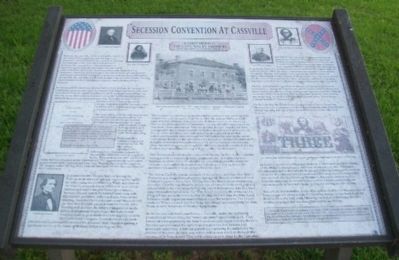
Directly in front of this marker, at the corner of Washington and Spring Streets, there stood in 1861 a two-story frame building that served as a Masonic Hall. In this building, known as Missouri's "first Confederate Capitol," there occurred a . . . — — Map (db m45775) HM
First Battle of Newtonia
At or near this location, the First and Second Battles of Newtonia were fought. The First Battle of Newtonia occurred on Sept. 30, 1862 when Union forces attempted to dislodge a large force of Confederates who . . . — — Map (db m65017) HM
Second Battle of Newtonia
A few miles southwest of this location, the Second Battle of Newtonia was fought on Oct. 28, 1864. The conflict came near the end of Maj. Gen. Sterling Price’s celebrated invasion of Missouri. With the Federals . . . — — Map (db m65018) HM
Fort Wyman and the Defense of the Railroad
Fort Wyman was the first of two artillery field fortifications built by the Union army at Rolla, signifying the importance of the railroad terminus to the northern was effort in Missouri.
The . . . — — Map (db m139747) HM
A lack of Confederate military presence in Missouri led Southern sympathizers to form guerrilla groups to harass Union soldiers and pro-Union citizens. Depending on which side you asked, these bushwhackers were either heroes or criminals. They . . . — — Map (db m157096) HM
The federal arsenal at St. Louis was established on this site in 1827. Located three miles south of the city, it replaced the aging Fort Belle Fontaine, which had served since 1805. The arsenal furnished ordnance stores (arms, accouterments and . . . — — Map (db m189736) HM
Carondelet and the Eads Ironclads
On Oct. 12, 1851, the USS Carondelet slid down the ways at James Eads' Union Iron Works in the village of Carondelet, south of St. Louis. It was the first ironclad warship built by the United States, launched . . . — — Map (db m139708) HM
During the Civil War, Bloomfield was a geographically commanding point in southeastern Missouri due to its location atop Crowley's Ridge, the only high ground separating two nearly impenetrable swamps. Whoever held Bloomfield controlled movements on . . . — — Map (db m207550) HM
Action at Dry Wood Creek, Sept. 2, 1861
Following the Southern victory at Wilson's Creek near Springfield (Aug. 10, 1861), Maj. Gen. Sterling Price led the pro-Confederate Missouri State Guard, which numbered about 10,000 men, north to . . . — — Map (db m39842) HM