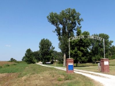
Near County Road 44, 0.5 miles west of County Road 31, on the right when traveling west.
Jackson Cemetery
Established 1827
A Historic Cemetery Listed in Indiana's Cemetery and Burial Grounds Registry of the Indiana Department of Natural Resources
Installed 2005 Indiana Historical Bureau and William Tuffs Chapter . . . — — Map (db m68575) HM
On County Road 8, 0.3 miles east of County Road 131, on the right when traveling east.
Bonneyville Cemetery
Established 1848
A Historic Cemetery Listed in Indiana's Cemetery and Burial Grounds Registry of the Indiana Department of Natural Resources
Installed 2005 Indiana Historical Bureau and William Tuffs . . . — — Map (db m68707) HM
Cathcart Cemetery
Established circa 1834
A Historic Cemetery Listed in Indiana's Cemetery and Burial Grounds Registry of the Indiana Department of Natural Resources
Installed 2005 Indiana Historical Bureau and William Tuffs . . . — — Map (db m68706) HM
On County Road 123 at County Road 2, on the left when traveling south on County Road 123.
Trout Creek Cemetery
Established circa 1850
A Historic Cemetery Listed in Indiana's Cemetery and Burial Grounds Registry of the Indiana Department of Natural Resources
Installed 2005 Indiana Historical Bureau and Elkhart . . . — — Map (db m68638) HM
Elkhart County Home Cemetery
Established 1887
A Historic Cemetery listed in Indiana's Cemetery and Burial Grounds Registry of the Indiana Department of Natural Resources
Installed 2004 Indiana Historical Bureau, Elkhart . . . — — Map (db m68362) HM
On County Road 44, 0.3 miles east of County Road 7, on the left when traveling east.
Bull Cemetery
Established circa 1848
A Historic Cemetery Listed in Indiana's Cemetery and Burial Grounds Registry of the Indiana Department of Natural Resources
Installed 2009 Indiana Historical Bureau and James G. Hermsen . . . — — Map (db m68576) HM
On Silver Island Road (County Road 850 W) south of Blue Island Drive (County Road W1000S), on the right when traveling south.
Silver Island Cemetery
Established 1832
A Historic Cemetery Listed in
Indiana’s Cemetery and Burial Grounds
Registry of the Indiana Department of
Natural Resources
Installed 2013 Indiana Historical Bureau . . . — — Map (db m77555) HM
Established 1840 A Historic Cemetery Listed In Indiana's Cemetery and Burial Grounds Registry of The Indiana Department of Natural Resources — — Map (db m63745) HM
On County Road W600S, 0.1 miles east of County Road S300W, on the right.
A Historic Cemetery Listed in Indiana’s Cemetery and Burial Grounds Registry of the Indiana Department of Natural Resources
Installed 2019 by the Weaver Historical Landmark Committee and the Indiana DNR – Division of Preservation and . . . — — Map (db m168286) HM
On County Road W 200N, 0.4 miles east of County Road N 600W, on the right when traveling east.
Highland Cemetery
Established 1861
A Historic Cemetery Listed in Indiana's Cemetery and Burial Grounds Registry of the Indiana Department of Natural Resources
Installed 2011 Indiana Historical Bureau and Harrison . . . — — Map (db m75540) HM
On County Road N 300W, 0.1 miles north of County Road W 1350N, on the left when traveling north.
Brumbaugh Cemetery
Established 1840
A Historic Cemetery Listed in Indiana's Cemetery and Burial Grounds Registry of the Indiana Department of Natural Resources
Installed 2009 Indiana Historical Bureau and Jefferson Township . . . — — Map (db m75291) HM
On County Road N 250E at E. Bowser Road, on the right when traveling north on County Road N 250E.
Mount Pleasant Cemetery
Established 1882
A Historic Cemetery Listed in Indiana's Cemetery and Burial Grounds Registry of the Indiana Department of Natural Resources
Installed 2010 Indiana Historical Bureau and Van Buren . . . — — Map (db m75290) HM
On County Road E 900N at County Road N 200E, on the right when traveling north on County Road E 900N.
Salem Cemetery
Established 1844
A Historic Cemetery Listed in Indiana's Cemetery and Burial Grounds Registry of the Indiana Department of Natural Resources
Installed 2010 Indiana Historical Bureau and Van Buren Township . . . — — Map (db m75289) HM
Near E. Epworth Forest Road at County Road N 975E, on the right when traveling east.
Greider / Oak Grove Cemetery
Established 1868
A Historic Cemetery Listed in Indiana's Cemetery and Burial Grounds Registry of the Indiana Department of Natural Resources
Installed 2009 Indiana Historical Bureau and . . . — — Map (db m75276) HM
Near County Road N 850E, 0.2 miles south of County Road E 500N, on the right when traveling north.
Mock Cemetery
Established 1832
A Historic Cemetery Listed in Indiana's Cemetery and Burial Grounds Registry of the Indiana Department of Natural Resources
Installed 2009 Indiana Historical Bureau and Tippecanoe Township . . . — — Map (db m75278) HM
On N. Main Street (State Road 13) at 4th Street, on the right when traveling north on N. Main Street.
North Webster Cemetery
Established 1842
A Historic Cemetery Listed in Indiana's Cemetery and Burial Grounds Registry of the Indiana Department of Natural Resources
Installed 2009 Indiana Historical Bureau and Tippecanoe . . . — — Map (db m73305) HM
Near State Road 13 at Lincoln Highway, on the right when traveling north.
Washington / Union Cemetery
Established 1853
A Historic Cemetery Listed in Indiana's Cemetery and Burial Grounds Registry of the Indiana Department of Natural Resources
Installed 2011 Indiana Historical Bureau and Washington . . . — — Map (db m73306) HM
On N. Mill Street at W. High Street, on the left when traveling north on N. Mill Street.
Syracuse Cemetery
Established 1836
A Historic Cemetery Listed in Indiana's Cemetery and Burial Grounds Registry of the Indiana Department of Natural Resources
Installed 2011 Indiana Historical Bureau and Syracuse Cemetery . . . — — Map (db m73207) HM
Near 12B Road, 0.3 miles west of Juniper Road, on the right when traveling west.
Roberts Cemetery
Established 1849
A Historic Cemetery Listed in Indiana's Cemetery and Burial Grounds Registry of the Indiana Department of Natural Resources
Installed 2012 Indiana Historical Bureau and LaPaz Lions Club, . . . — — Map (db m75824) HM
On W. Center Street, 0.2 miles west of Fribley Street, on the right when traveling west.
Early Bourbon Cemetery
Established 1839
A Historic Cemetery Listed in Indiana's Cemetery and Burial Grounds Registry of the Indiana Department of Natural Resources
Installed 2012 Indiana Historical Bureau and LaPaz Lions . . . — — Map (db m75763) HM
On 10th Road, 0.3 miles Gumwood Road when traveling east.
Mount Pleasant North Cemetery
Established 1837
A Historic Cemetery Listed in Indiana's Cemetery and Burial Grounds Registry of the Indiana Department of Natural Resources
Installed 2012 Indiana Historical Bureau and LaPaz . . . — — Map (db m75768) HM
Near 10th Road, 0.3 miles east of Gumwood Road, on the right when traveling east.
Mount Pleasant South Cemetery
Established 1920
A Historic Cemetery Listed in Indiana's Cemetery and Burial Grounds Registry of the Indiana Department of Natural Resources
Installed 2012 Indiana Historical Bureau and LaPaz . . . — — Map (db m75769) HM
Near S. Bourbon Street, 0.1 miles south of W. Douglass Street, on the right when traveling south.
Parks IOOF Cemetery
Established 1860
A Historic Cemetery Listed in Indiana's Cemetery and Burial Grounds Registry of the Indiana Department of Natural Resources
Installed 2012 Indiana Historical Bureau and LaPaz Lions Club, . . . — — Map (db m75538) HM
Near State Road 331 at 11A Road, on the right when traveling south.
Pleasant Hill Cemetery
Established 1893
A Historic Cemetery Listed in Indiana's Cemetery and Burial Grounds Registry of the Indiana Department of Natural Resources
Installed 2012 Indiana Historical Bureau and LaPaz Lions . . . — — Map (db m75821) HM
On 12B Road at Hawthorn Road, on the left when traveling west on 12B Road.
Salem Cemetery
Established 1838
A Historic Cemetery Listed in Indiana's Cemetery and Burial Grounds Registry of the Indiana Department of Natural Resources
Installed 2012 Indiana Historical Bureau and LaPaz Lions Club, . . . — — Map (db m75822) HM
On 8th Road, 0.2 miles east of Chestnut Road, on the left when traveling east.
Sandridge Cemetery
Established 1889
A Historic Cemetery Listed in Indiana's Cemetery and Burial Grounds Registry of the Indiana Department of Natural Resources
Installed 2012 Indiana Historical Bureau and LaPaz Lions Club, . . . — — Map (db m75765) HM
On Lincoln Highway, 0.1 miles east of S. Iris Road, on the right when traveling west.
Hindel Cemetery
Established 1849
A Historic Cemetery Listed in Indiana's Cemetery and Burial Grounds Registry of the Indiana Department of Natural Resources
Installed 2012 Indiana Historical Bureau and LaPaz Lions Club, . . . — — Map (db m75539) HM
On 12th Road, 0.1 miles west of Michigan Road, on the left when traveling west.
Taber Cemetery
Established 1835
A Historic Cemetery Listed in Indiana's Cemetery and Burial Grounds Registry of the Indiana Department of Natural Resources
Installed 2012 Indiana Historical Bureau and LaPaz Lions Club, . . . — — Map (db m75825) HM
On County Road 500W north of County Road 450N, on the left when traveling north.
Potts Cemetery
Established 1810
A Historic Cemetery Listed in
Indiana’s Cemetery and Burial Grounds
Registry of the Indiana Department of
Natural Resources
Installed 2013 Indiana Historical Bureau
and . . . — — Map (db m68779) HM
On Riley Road north of Wayne Drive, on the left when traveling north.
Lakeview Cemetery
Established 1867
A Historic Cemetery Listed in Indiana's Cemetery and Burial Grounds Registry of the Indiana Department of Natural Resources
Installed 2008 Indiana Historical Bureau and City of . . . — — Map (db m68837) HM
On Hixon Road North north of County Road 275 S, on the left when traveling north.
Hixon Cemetery
Established 1853
A Historic Cemetery Listed in
Indiana’s Cemetery and Burial Grounds
Registry of the Indiana Department of
Natural Resources
Installed 2008 Indiana Historical Bureau
and . . . — — Map (db m60476) HM
On Madison Street at Strawberry Road, on the left when traveling south on Madison Street.
Montezuma Cemetery
Established 1818
A Historic Cemetery Listed in
Indiana’s Cemetery and Burial Grounds
Registry of the Indiana Department of
Natural Resources
Installed 2008 Indiana Historical Bureau
and . . . — — Map (db m60473) HM
On River Road (extension of North Jefferson Street) north of Poplar Street, on the left when traveling north.
Oakland Cemetery
Established 1862
A Historic Cemetery Listed in
Indiana’s Cemetery and Burial Grounds
Registry of the Indiana Department of
Natural Resources
Installed 2007 Indiana Historical Bureau
and . . . — — Map (db m60472) HM
On East High Street east of South Erie Street, on the right when traveling east.
Rockville Cemetery
established 1824
A Historic Cemetery Listed in
Indiana’s Cemetery and Burial Grounds
Registry of the Indiana Department of
Natural Resources
Installed 2012 Indiana Historical Bureau
and . . . — — Map (db m59850) HM
Near Chicago Trail at Walnut Road, on the left when traveling east.
Hamilton Church Cemetery
Established 1830
A Historic Cemetery Listed in Indiana's Cemetery and Burial Grounds Registry of the Indiana Department of Natural Resources
Installed 2013 Indiana Historical Bureau and Schuyler . . . — — Map (db m73866) HM
On North Rainsville Road south of State Road 26, on the left when traveling south.
Hooker Cemetery
Established 1834
A Historic Cemetery Listed in
Indiana’s Cemetery and Burial Grounds
Registry of the Indiana Department of
Natural Resources
Installed 2006 Indiana Historical Bureau
and . . . — — Map (db m60273) HM