The Blue Ridge Parkway is a national parkway, a scenic roadway and protected corridor of surrounding parkland, managed by the National Park Service. The limited-access road travels 469 miles through 29 counties in North Carolina and Virginia in the Blue Ridge Mountains.
On Blue Ridge Parkway at the High Piney Spur Overlook (at milepost 218.6), 1.8 miles the Virginia state line, on the left when traveling south.
The knoll low on the ridge to the right boasts this celestial name. It is well known locally that hunters often sat about a night fire there while they followed the chase in the lowlands. They knew which hound held the lead by the . . . — — Map (db m104662) HM
Robert Lee Doughton, for whom Doughton Park is named, was born in Alleghany County, North Carolina, November 7, 1863. An original and leading advocate of the establishment and development of the Blue Ridge Parkway, he was a member of the United . . . — — Map (db m91786) HM
Near Cherry Street just east of Grayson Street, on the right when traveling east.
Crouse Park Sparta and Alleghany County have a rich heritage of music, crafts and agriculture. Crouse Park, including the Crouse House before you, was donated to the town in 1969. The Park hosts the Crouse House Pickers Monday night jam . . . — — Map (db m182942) HM
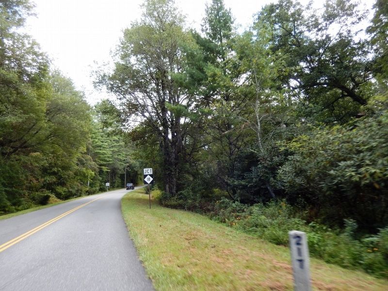
On Blue Ridge Parkway (at milepost 232.5), 3 miles west of U.S. 21, on the left when traveling south.
The massive gray rock before you is Stone Mountain, formed about 350 million years ago from intense heat and pressure deep within the earth. Centuries of erosion uncovered the rock and sculptured it into the curious shape it is today.
At one . . . — — Map (db m140553) HM
On Blue Ridge Parkway (at milepost 236.9), on the right when traveling south.
For thousands of years Native Americans cultivated the fertile valleys of the Blue Ridge region including North Carolina. Employing techniques such as “slash and burn” to clear small areas of forested land and fertilize the soil, the . . . — — Map (db m123230) HM
On Blue Ridge Parkway (at milepost 266.8), on the right when traveling south.
Mount Jefferson looms high over the town of Jefferson for which it is named. It was formerly called Negro Mountain because run-away slaves supposedly hid out there while fleeing north. The summit and slopes of the mountain now make up Mount . . . — — Map (db m140555) HM
On Blue Ridge Parkway (at milepost 394) at North Carolina Highway 191, on the right when traveling north on Blue Ridge Parkway.
The French Broad River played a major role in this region’s early development. Initially called the “Broad River” by eighteenth-century French hunters and traders, it was later named the French Broad River. With headwaters on Pisgah . . . — — Map (db m58937) HM
Near Assembly Drive at Georgia Terrace, on the left when traveling north.
Woolly Adelgid Devastation The hemlock woolly adelgid is an invasive aphid-like species which was accidentally imported to Virginia on nursery stock around 1951. Adelgids insert long sucking mouthparts into the base of needles and . . . — — Map (db m237796) HM
On Blue Ridge Parkway (at milepost 411), 0.9 miles north of U.S. 276, on the right when traveling north.
Nestled in the valley below is the Cradle of Forestry in America, the birthplace of science-based forest management and a living legacy made possible by George and Edith Vanderbilt of the nearby Biltmore Estate. Some 87,000 acres of the Vanderbilt's . . . — — Map (db m123232) HM
On Road to Waterrock Knob north of Blue Ridge Parkway, on the right when traveling north.
Named in honor of R. Gerry Browning, 1884 – 1966. Location and Claims Engineer and Parkway Consultant for North Carolina State Highway Commission, 1925 – 1964. His forceful presentation of the high quality scenery found in North . . . — — Map (db m58935) HM
On Blue Ridge Parkway (at milepost 422.8), on the left when traveling east.
The United Daughters of the Confederacy in cooperation with the United States Forest Service planted this 125 acre forest as a living memorial to the 125,000 soldiers North Carolina provided the Confederacy. The 125,000 Red Spruce tree forest was . . . — — Map (db m123435) WM
On Blue Ridge Parkway (at milepost 325.9), 1.5 miles east of Altapass Highway, on the left when traveling south.
Apple butter, apple cider, applesauce, apple pie! There were few home grown products more useful to the mountain farmer than apples. Cuttings from favorite trees were often taken from place to place when the family moved or children left home. Today . . . — — Map (db m140612) HM
On Blue Ridge Parkway (at milepost 349.2), 2.7 miles north of South Toe River Road, on the right when traveling north.
The 8000-acre Curtis Creek tract before you was the first parcel of land acquired under the Weeks Act. This act was signed by President Taft in 1911 and authorized buying parcels of land that would become eastern National Forests. This tract also . . . — — Map (db m183160) HM
On Blue Ridge Parkway (at milepost 328.6), 1.2 miles south of Altapass Highway, on the left when traveling south.
The hills and valleys before you may seem quiet, rounded with age and blanketed with thick forests. But if you listen closely between the distant sounds of a train whistle, you may hear the sounds of fiddles, banjos and strings bands that still ring . . . — — Map (db m183172) HM
On Blue Ridge Parkway (at milepost 328.6), 1.2 miles south of Altapass Highway, on the left when traveling south.
The old Clinchfield Railroad loops and tunnels through the Blue Ridge Mountains before you. Construction of this difficult section began in 1905 when 4,000 workmen, mainly Russian, German and Italian immigrants, began blasting and hammering their . . . — — Map (db m123180) HM
On Blue Ridge Parkway (at milepost 327.3), 0.2 miles east of Altapass Highway, on the left when traveling south.
The scenic mountain highway idea originated long before the Blue Ridge Parkway project began. In 1906, Joseph Hyde Pratt, North Carolina's State Geologist, proposed a toll road following the crest of the Ridge mountains from Marion, Virginia to . . . — — Map (db m140600) HM
On Blue Ridge Parkway (at milepost 467.9), 1.2 miles north of U.S. 441, on the left when traveling north.
From here you can see the Qualla Boundary, the 56,000-acre home of the Eastern Band of Cherokee Indians. It borders Great Smoky Mountains National Park and Blue Ridge Parkway. The Cherokee originally held over 140,000 square miles in parts of eight . . . — — Map (db m150379) HM
On Blue Ridge Parkway (at milepost 467.9), 1.2 miles north of U.S. 441, on the left when traveling north.
The Blue Ridge Parkway is a collection of diverse and inspiring places. The 469-mile road links Shenandoah National Park to Great Smoky Mountains National Park. Like a long beautiful ribbon connecting distinctive gems, the Parkway joins high . . . — — Map (db m150299) HM
Near Blue Ridge Parkway (at milepost 422.4), on the right when traveling north.
The bare rock profile named Devil's Courthouse is sinister in appearance and legend. Its "devilish" look has contributed to the many folk tales surrounding this mountain.
Within the mountain is a cave where, legend claims, the devil holds . . . — — Map (db m70413) HM
On Blue Ridge Parkway (at milepost 431), 8 miles south of Lake Logan Road (North Carolina Highway 215), on the left when traveling south.
What killed the trees? The balsam wooly adelgid, a pinhead-size insect native to Europe, is responsible. It began attacking the Fraser fir forests here in the 1970s. The red spruce, unaffected by the adelgid, survives in the midst of this . . . — — Map (db m58934) HM
Near Blue Ridge Parkway (at milepost 417), on the right when traveling north.
Like a gigantic mirror, Looking Glass Rock reflects a dazzle of sunlight when water collects on its granite face. This display is especially spectacular in winter when the water turns to ice.
Looking Glass Rock is a pluton formed by underground . . . — — Map (db m70420) HM
Near Blue Ridge Parkway (at milepost 294), 2 miles west of U.S. 221, on the left when traveling south.
Moses H. Cone Memorial Park preserves the country estate of Moses Cone, a prosperous textile entrepreneur, conservationist, and philanthropist of the Gilded Age. Its centerpiece is Flat Top Manor, a gleaming white 23-room mansion of almost 14,000 . . . — — Map (db m123231) HM
Flat Top Manor, once the home of textile magnate Moses H. Cone and his family, presides over the former Cone Estate—3,600 acres of forests, meadows and rolling farmlands.
Moses Cone, whose hobbies included road-building and cultivating . . . — — Map (db m20349) HM
Near Blue Ridge Parkway (at milepost 294), 2 miles west of U.S. 221, on the left when traveling south.
Flat Top Manor was the summer home of Moses and Bertha Cone. Known as “the Denim King,” Moses built his fortune with textile mills, which produced denim fabric for companies such as Levi Strauss. Completed in 1901, the home featured central . . . — — Map (db m227307) HM
On Blue Ridge Parkway (at milepost 239), on the left when traveling south.
All the materials Martin Brinegar needed for building a cabin were here on this farm—trees, rocks, even clay. Martin Brinegar began building this cabin in 1886. Working in his spare time, it took him three years to finish the original cabin . . . — — Map (db m162094) HM
On Blue Ridge Parkway (at milepost 239), on the left when traveling south.
Caroline Brinegar had to plan ahead for many months to make a garment. She made her family's clothes from a fabric called linsey-woolsey that she wove on her loom. Linsey-woolsey is woven from wool yarn and linen (flax) thread. The wool made the . . . — — Map (db m162096) HM
On Blue Ridge Parkway (at milepost 239), on the left when traveling south.
The Brinegars were not famous or rich, but they were important to their families and neighbors. In 1876 Martin Brinegar purchased this 125 acre farm from Henderson Crouse, Caroline Joines' uncle, for $200. Two years later Martin and Caroline were . . . — — Map (db m162097) HM
Near Blue Ridge Parkway (at milepost 85.6) at Peaks Road (Virginia Route 43).
By the mid-1800s, the village of Mons, which is Latin for mountain, had grown up around the Peaks of Otter. There was a church, a school, two mills, and a hotel. The small community provided services to tourists who had discovered the Peaks of Otter . . . — — Map (db m134491) HM
Near Blue Ridge Parkway (at milepost 86), 0.4 miles north of Peaks Road (Route 43).
The first resident landscape architect and planner of the Blue Ridge Parkway. It was his vision, imagination, and creative talents in the Parkway's formative stages that made the Blue Ridge Parkway unique. — — Map (db m9743) HM
On Blue Ridge Parkway (at milepost 76.5), on the left when traveling south.
The parkway reaches its highest elevation in Virginia - - 3950 - - on Apple Orchard Mountain. Wind, ice and snow of raging winter storms have pruned this mountaintop forest, giving it an “Old Apple Orchard” appearance. This . . . — — Map (db m95966) HM
On Blue Ridge Parkway near Peaks Road (Virginia Route 43).
(preface)
On May 26, 1864, Union Gen. David Hunter marched south from Cedar Creek near Winchester to drive out Confederate forces, lay waste to the Shenandoah Valley, and destroy transportation facilities at Lynchburg. His raid was part of . . . — — Map (db m55780) HM
Near Blue Ridge Parkway (at milepost 86), 0.6 miles Peaks Road (Virginia Route 43).
Built in the early 1800's, this simple mountain cabin was operated as an inn, or "ordinary", from about 1830 until about 1850. Here the widowed Polly Woods catered to the "ordinary" needs of the weary mountain traveler -- a hot meal, a comfortable . . . — — Map (db m9655) HM
Near Blue Ridge Parkway (at milepost 64), on the left when traveling south.
When George Washington stood here in 1772, he sought a way to open a water route to the West. Traveling over the region’s most rugged mountains was time consuming and dangerous. New settlers needed a more efficient way to transport goods like . . . — — Map (db m95959) HM
Near Blue Ridge Parkway (at milepost 64), on the left when traveling south.
The James River flows from the mountains through Lynchburg and Richmond to the coast. It is the largest river in Virginia and, historically, one of the state’s most important transportation corridors. Before the Civil War, investors built a canal . . . — — Map (db m95958) HM
On Blue Ridge Parkway, on the left when traveling south.
Straight ahead are SharpTop Mountain and Flat Top Mountain. They are two of the three prominent summits that surround the Peaks of Otter area, approximately 6.5 miles distant. No one knows for certain why the area is called the Peaks of Otter. The . . . — — Map (db m95955) HM
On Blue Ridge Parkway (at milepost 95.4), on the right when traveling north.
The Appalachian Trail crisscrosses the Blue Ridge Parkway for 100 miles in Virginia. Farther south, it winds through the Great Smoky Mountains. The trail usually follows the crest of the Appalachian chain, occasionally descending into scenic . . . — — Map (db m134499) HM
On Blue Ridge Parkway (at milepost 203.9), 2.2 miles north of Lambsburg Road (Virginia Route 620), on the right when traveling north.
The agricultural lease program More than 4,000 acres of Blue Ridge Parkway lands are leased to neighboring farmers who use the land for pasture and for crops such as cabbage, corn, oats and hay. The agricultural lease program began in the . . . — — Map (db m183036) HM
On Blue Ridge Parkway (at milepost 169), on the right when traveling south.
The Blue Ridge Parkway showcases some of America's best rural and natural landscapes. Rocky Knob is known for its pastoral, or agricultural, countryside. The topography of this plateau differs from much of the Parkway. Here generations of family . . . — — Map (db m140516) HM
Near Blue Ridge Parkway (at milepost 176.2), 0.2 miles south of Mabry Mill Road SE (Virginia Route 603), on the left when traveling south.
This building has three sections. The center section houses a gristmill; the wing to your left contains a sawmill, while the section to your right houses a woodworking shop. Ed Mabry built the original mill and both additions about 1910. In the . . . — — Map (db m174585) HM
Near Blue Ridge Parkway (at milepost 176.2), 0.2 miles south of Mabry Mill Road SE (Virginia Route 603), on the left when traveling south.
More than a century ago, log cabins were a common sight in Appalachia and in other rural areas of the eastern United States. Samuel and Elizabeth Matthews built this cabin near Galax in 1869. Made largely of oak, it has one room on each of its two . . . — — Map (db m174592) HM
Near Blue Ridge Parkway (at milepost 176.2), 0.2 miles south of Mabry Mill Road SE (Virginia Route 603), on the left when traveling south.
Simon the tanner used this horse-powered machine to grind oak and hemlock bark for tanning. Mixed with water this ground bark produced “bark liquor” for “tanning hides.” — — Map (db m174587) HM
Near Blue Ridge Parkway (at milepost 176.2), 0.2 miles south of Mabry Mill Road SE (Virginia Route 603), on the left when traveling south.
Rarely seen today, the blacksmith shop was a vital home industry in Ed Mabry’s time. Here “Uncle Ed” cleverly fashioned wagon tires, andirons, tools, and various other iron objects for himself and his neighbors. — — Map (db m174591) HM
Near Blue Ridge Parkway (at milepost 176.2), 0.2 miles south of Mabry Mill Road SE (Virginia Route 603), on the left when traveling south.
Although operating a mill was never easy, Ed Mabry faced special challenges. For one, the quantity of running water, which turned the overshot wheel and powered all the equipment in the mill, was barely adequate. To increase his supply, Mabry built . . . — — Map (db m174583) HM
Near Blue Ridge Parkway (at milepost 176.2), 0.2 miles south of Mabry Mill Road SE (Virginia Route 603), on the left when traveling south.
Take one hollow log “Ash Hopper” filled with ashes. Filter water through ashes to produce lye. Add old fat to lye solution and boil in iron pot. The result: homemade soap. — — Map (db m174590) HM
Near Blue Ridge Parkway (at milepost 176.2), 0.2 miles south of Mabry Mill Road SE (Virginia Route 603), on the left when traveling south.
Freshly sawed lumber must be dried evenly to prevent warping and checking. Ed Mabry used a rack similar to this for drying lumber. — — Map (db m174586) HM
Near Blue Ridge Parkway (at milepost 176.2), 0.2 miles south of Mabry Mill Road SE (Virginia Route 603), on the left when traveling south.
This mill was built about 1910 by Edwin B. Mabry, a jack-of-all-trades who had been a chairmaker, a miner, a coal company blacksmith, and a farmer. He and his wife, Mintoria Lizzie Mabry, operated the mill until 1936, grinding corn and sawing lumber . . . — — Map (db m165417) HM
Near Blue Ridge Parkway (at milepost 176.2), 0.2 miles south of Mabry Mill Road SE (Virginia Route 603), on the left when traveling south.
These stones are from a quartz conglomerate obtained at Brushy Mountain Quarry, Blacksburg, VA. They were shaped at the quarry, but the miller “dressed” or sharpened them with homemade “chisels.” — — Map (db m174584) HM
Down this path you will find buildings,
farm implements and other displays that
document rural life in Appalachia over
a period of about 100 years. Most were
restored and arranged here during the
1940s and 1950s.
These displays illustrate . . . — — Map (db m11083) HM
Near Blue Ridge Parkway (at milepost 176.2), 0.2 miles south of Mabry Mill Road SE (Virginia Route 603), on the left when traveling south.
Making sorghum molasses became popular during the Civil War, when supplies of sugar and corn syrup were interrupted. The practice continues today in many communities, where the sweet smell of boiling sorghum can be enjoyed in the cool October air. A . . . — — Map (db m174589) HM
Near Blue Ridge Parkway (at milepost 176.2), 0.2 miles south of Mabry Mill Road SE (Virginia Route 603), on the left when traveling south.
Many settlers and early residents brought with them the knowledge and the custom of making whiskey. Although tax laws and, for a while, Prohibition made the activity illegal, moonshiners have always operated in the mountains and other areas of the . . . — — Map (db m174588) HM
On Blue Ridge Parkway at Howardsville Turnpike, on the right when traveling south on Blue Ridge Parkway.
Low passway across Blue Ridge, elev. 1909. Served the buffalo, Indian, and covered wagon. Thomas Jefferson came via stage coach in 1818 to Rockfish Tavern. He presided over a prominent group who resolved to locate the University of Virginia "in the . . . — — Map (db m71553) HM
On Blue Ridge Parkway, 3 miles south of Campbells Mountain Road (Virginia Route 814), on the left when traveling south.
In June and July during corn-choppin time, this cliff serves the folks in White Rock community as a time piece. Twenty minutes after sunlight strikes the rock face, dusk falls on the valley below — — Map (db m61338) HM
On Blue Ridge Parkway (at milepost 168), 2.8 miles south of Parkway Lane South (Virginia Route 8), on the left when traveling south.
Rising to 3,972 feet, Buffalo Mountain is an old and familiar landmark to local residents. Mothers would tell their children that they could go anywhere in a day as long as they could see "the buffalo." The great hump towers a thousand feet above . . . — — Map (db m134597) HM
On Blue Ridge Parkway (at milepost 168.8), 3.5 miles south of Parkway Lane South (Virginia Route 8), on the left when traveling south.
The gorge is best seen from Rocky Knob's summit, where one can look into the valley 1800 feet below. An old road parallels the creek through the gorge. Initially a trail and later a wagon road, the old road has reverted to its former use as a hiking . . . — — Map (db m134594) HM
Near Blue Ridge Parkway (at milepost 129.6), on the right when traveling south.
The city of Roanoke — the historic crossroads of western Virginia — lies in the distance. First established in 1825, it was called "Big Lick" after a nearby marsh where animals found abundant salt licks.
In the early 1880s, the little . . . — — Map (db m140526) HM
On Blue Ridge Parkway (at milepost 34.4), on the right when traveling north.
Early in the 20th century lumber companies built narrow gauge railroads far into the mountains. This railroad, which was 50 miles long, carried more than 100 million board feet of logs to the mill. It was built in 1919-1920 and a section has been . . . — — Map (db m169022) HM