On Military Avenue (U.S. 69), on the right when traveling south.
On Oct. 6, 1863, Gen. James Blunt and about 125 men from the 3rd Wisc. Cav. and the 14th Kans. Cav. stopped at the creek before coming into Ft. Blair. They were caught in a surprise attack from the rebel forces of William Quantrill. Nearly 100 of . . . — — Map (db m80214) HM
On 6th Street near Military Avenue (U.S. 69), on the left when traveling east.
First burial site for victims of the Baxter Springs Massacre and the attack on Ft. Blair. In 1869, the bodies were moved to the National Cemetary plot west of town. — — Map (db m37836) HM
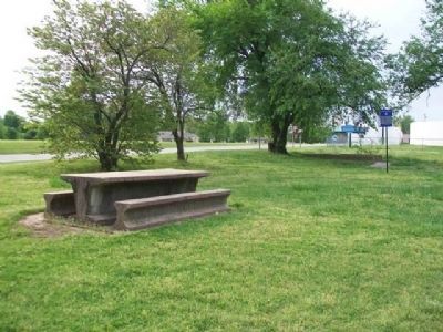
On Oak Crest at Fairview Avenue, on the right when traveling east on Oak Crest.
Camp Logan was a 100 acre site of annual G.A.R. reunions attended by veterans of the Civil War between 1883-1914. An amphitheater holding 2000 people was located directly ahead. The surrounding hills were campsites for thousands of veterans and . . . — — Map (db m80220) HM
In 1870-71, the victims of the attack on Fort Blair and the Battle of Baxter Springs were disinterred from a site near the fort and reinterred in this newly designated national cemetery plot, officially National Cemetery #2. — — Map (db m171037) HM
On North Willow Avenue north of West A Street, on the right when traveling north.
In a field to the east, Blunt's military band wagon overturned while trying to escape the guerillas. The bandsmen were shot and their bodies were burned in the wagon. — — Map (db m170671) HM
On East Avenue near 6th Street, on the right when traveling south.
Fort Blair, constructed as a garrison for soldiers guarding the Military Road, was attacked by rebel forces of William Quantrill on Oct. 6, 1863.
Although greatly outnumbered, Lt. James Pond and men from the 3rd Wisc. Cav. and Kans. 2nd Colored . . . — — Map (db m37838) HM
On Washington Avenue at 10th Street, on the left when traveling north on Washington Avenue.
Near this site, Quantrill's men attacked and killed several men from the fort engaged in target practice. Among them were Johnny Fry, an Army scout who had earlier won fame as the first Pony Express rider, and Lt. Ralph Cook, officer in charge of . . . — — Map (db m80331) HM