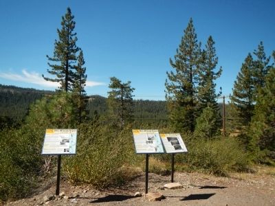
The 20 mile museum consists of
thirty-two interpretive signs placed
along Old Highway 40 from the
Eagle Lakes exit to over the Summit below Rainbow Bridge.
On Donner Pass Road, on the right when traveling east.
History
Today people travel swiftly along I-80 to their destinations in the Sierra, many times not even staying overnight. When they do stay overnight it is most likely in hotels or rental houses.
It was not always that way. Before I-80 . . . — — Map (db m81970) HM
On Donner Pass Road, on the right when traveling east.
History
Love - Excitement - Pathos - Humor. It’s all in “The Gold Rush” which was filmed at Sugar Bowl (and Truckee).
“The Gold Rush,” written, produced, directed, and starring Charlie Chaplin was one of . . . — — Map (db m81934) HM
On Donner Pass Road, on the left when traveling east.
History
“I don’t believe I have adequate words to describe the real beauty of Donner Pass. As we stood looking down I had a floating sensation… I lost all fear as I looked at one of the most beautiful blue lakes (Donner Lake) I have . . . — — Map (db m81894) HM
On Donner Pass Road, on the right when traveling east.
History
“new addition… modern design… large new ski hut… semi-rustic design… oiled pine walls … ideally suited to skiers’ requirements… central heating… Norden awaits the opening of the winter sports season.” So advertised . . . — — Map (db m81875) HM
On Donner Pass Road, on the left when traveling east.
History
The Washoe Tribe lived on the eastern face of the Sierra Nevada mountains for more than 6,000 years. They didn’t actually call themselves the Washoe Tribe, though. They called themselves the Waashiw (Wa-she-shu) tribe, meaning . . . — — Map (db m81899) HM
On Donner Pass Road, on the right when traveling east.
History
The bridge “eliminated for all time the terrors of the Donner grade from the state highway system of California.”
Automobile travel could be a harrying affair in the old days and Donner Summit was a difficult route. . . . — — Map (db m81898) HM
On Donner Pass Road, on the right when traveling east.
History
When Bill Klien, who would transform skiing himself, invited Hannes Schroll to Donner Summit from Yosemite in 1937, the ski industry was about to change. Hannes was a dare-devil champion skier whose yodels as he tore down mountains . . . — — Map (db m81933) HM
On Donner Pass Road at Old Donner Summit Road, on the right when traveling east on Donner Pass Road.
History
The current building at the head of Donner Pass on Old 40 was built for the Division of Highways in 1931 to serve as a dormitory for highway workers. That was the first winter the road was plowed and on-call workers needed . . . — — Map (db m81881) HM
On Sugar Bowl Road near Donner Pass Road, on the right when traveling south.
History
The coming of the railroad made it easy for well-heeled tourists to visit Donner Summit and with the building of a large hotel, they came. Whole families came to enjoy the summit and stay for weeks at a time.
The first Summit . . . — — Map (db m81880) HM
On Donner Pass Road, on the right when traveling east.
History
Summit Valley has been the scene of human activity for thousands of years because it is a natural crossing of the Sierra. Native Americans traveled the valley moving from winter to summer residences. They left grinding rocks and . . . — — Map (db m81971) HM
On Donner Pass Road, on the right when traveling east.
History
William Wilson Wurster was the most “influential unknown architect in California.” He designed many houses and buildings such as Ghirardelli Square, Cowell College at UC Santa Cruz, as well as other U.C. and Stanford . . . — — Map (db m81939) HM
History
The ritual of arriving in early morning by train and taking the 15 minute ride in tractor drawn sleighs was in place for more than ten years after Sugar Bowl opened in 1939. It was the only way to get to Sugar Bowl. It was a cold . . . — — Map (db m81936) HM
History
Theodore Judah, who plotted the Central Pacific’s route over the Sierra and for whom Mt. Judah was named, thought it was only the mountains that needed conquering as the Central Pacific headed east to meet up with the Union Pacific. He . . . — — Map (db m81977) HM
On Donner Pass Road, on the left when traveling east.
History
It was a race. The Union and Central Pacific Railroads were crossing the continent with steel rails each trying to build the most miles and so get the most money from the government. The rugged Sierra and its winter climate were . . . — — Map (db m81883) HM
On Donner Pass Road, on the right when traveling east.
History
Because there were three lodges built on Forest Service land in the early 1930’s, they have always been referred to as the Tri-Lodges. The first of the three lodges built was der Naturfreund in 1931 (right). This is a private lodge . . . — — Map (db m81969) HM
On Sugar Bowl Road near Donner Pass Road, on the right when traveling south.
History 1866 - Right here
Bam, bam, quarter turn; Bam, bam, quarter turn; Bam, bam, quarter turn; all day long, three shifts a day, day after day, week after week. Chinese workers pounded away at the solid granite. One worker held a star . . . — — Map (db m81878) HM