1752 entries match your criteria. The first 100 are listed. ⊳
E Clampus Vitus Historical Markers
The Ancient and Honorable Order of E Clampus Vitus (ECV) is a fraternal organization dedicated to the preservation of the heritage of the American West, especially the history of the Mother Lode and gold mining regions of the area. More than 1,400 markers point the way to the past.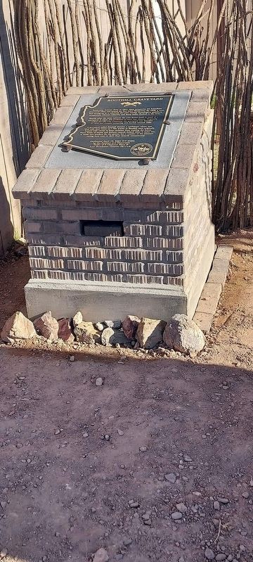
By Lost Dutchman Chapter No. 5917+4 E Clampus Vitus
Boothill Graveyard Marker
| 1 ► Arizona, Cochise County, Tombstone — Boothill Graveyard — |
| 2 ► Arizona, Cochise County, Tombstone — Tombstone, Arizona — "The Town Too Tough To Die" — |
| On Allen Street, on the right when traveling east. | |||
| 3 ► Arizona, Coconino County, Parks — Beale Wagon Road — America’s Great Camel Experiment 1857-1858 — |
| On Forest Service Road 100, on the right when traveling west. | |||
| 4 ► Arizona, Coconino County, Williams — Williams, Arizona — |
| On Grand Canyon Avenue at North Pine Street, on the right when traveling east on Grand Canyon Avenue. | |||
| 5 ► Arizona, Gila County, Jakes Corner — Jakes Corner - An Arizona Stage Stop — |
| On State Highway 188, 3.3 miles south of State Highway 87, on the right when traveling south. | |||
| 6 ► Arizona, Gila County, Young — The Pleasant Valley War a.k.a. The Graham-Tewksbury Feud — Circa 1882 - 1892 — |
| On Desert to Tall Pines Highway / Young Highway Road (State Highway 288). | |||
| 7 ► Arizona, La Paz County, Bouse — 89 — 736th Tank Battalion (M) SP — |
| On Broadway Avenue (Arizona Route 72 at milepost 27) south of Main Street, on the right when traveling west. | |||
| 8 ► Arizona, La Paz County, Bouse — 738th Medium Tank Battalion, Special — World War II — 1943 – 1945 — |
| On Broadway Avenue (Arizona Route 72 at milepost 27) south of Main Street, on the right when traveling west. | |||
| 9 ► Arizona, La Paz County, Bouse — 95 — 739th Tank Battalion (SP) (ME) — |
| On Broadway Avenue (Arizona Route 72 at milepost 27) south of Main Street, on the right when traveling west. | |||
| 10 ► Arizona, La Paz County, Bouse — 90 — 740th Tank Battalion — Daredevil Tankers — |
| On Broadway Avenue (Arizona Route 72 at milepost 27) south of Main Street, on the right when traveling west. | |||
| 11 ► Arizona, La Paz County, Bouse — 155 — 748th Tank Battalion — "The Rhinos" — |
| On Broadway Avenue south of Main Street, on the right when traveling north. | |||
| 12 ► Arizona, La Paz County, Bouse — A & C Mercantile Company — |
| On Broadway Avenue (Arizona Route 72 at milepost 27), on the left when traveling west. | |||
| 13 ► Arizona, La Paz County, Bouse — 86 — Camp Bouse — The 526th A. I. B. - Canal Defense Light Project — Desert Training Center - California – Arizona Maneuver Area — |
| On Broadway Avenue (Arizona Route 72 at milepost 27) south of Main Street, on the right when traveling west. | |||
| 14 ► Arizona, La Paz County, Bouse — 88 — Camp Bouse — The 701st Tank Battalion — |
| On Broadway Avenue (Arizona Route 72 at milepost 27) south of Main Street, on the right when traveling west. | |||
| 15 ► Arizona, La Paz County, Bouse — 96 — Camp Bouse — The 554th Ordnance - Heavy Maintenance Company (Tanks) — 9th Tank Group CDL Project — |
| On Broadway Avenue (Arizona Route 72 at milepost 27) south of Main Street, on the right when traveling west. | |||
| 16 ► Arizona, La Paz County, Bouse — 114 — George L. Wendt — Headquarters Company — 526 Armored Infantry Battalion — |
| On Broadway Avenue (Arizona Route 72 at milepost 27) south of Main Street, on the right when traveling west. | |||
| 17 ► Arizona, La Paz County, Bouse — 120 — In Memory of Eight Ball - Morale Officer — Equus asinus — Camp Bouse — |
| On Broad Street (Arizona Route 72 at milepost 27) south of Main Street, on the right when traveling west. | |||
| 18 ► Arizona, La Paz County, Bouse — Monument Row — |
| On Broadway Avenue (Arizona Route 72 at milepost 27) south of Main Street, on the right when traveling west. | |||
| 19 ► Arizona, La Paz County, Bouse — 119 — The 526th Armored Infantry Battalion — World War II — |
| On Broadway Avenue (Arizona Route 72 at milepost 27) south of Main Street, on the right when traveling west. | |||
| 20 ► Arizona, La Paz County, Cibola — 104 — Cibola Arizona |
| Near Cibola Road at Baseline Road. Reported missing. | |||
| 21 ► Arizona, La Paz County, Cibola — 103 — Colorado River Ferries — |
| Near Cibola Road at Baseline Road. | |||
| 22 ► Arizona, La Paz County, Ehrenberg — 41 — Ehrenberg Cemetery — |
| On Ehrenberg Poston Highway north of Interstate 10. | |||
| 23 ► Arizona, Maricopa County, Aguila — Robson's Mining World — |
| Near Robsons Ranch Road west of Arizona Highway 71. | |||
| 24 ► Arizona, Maricopa County, Phoenix, Central City — Jacob Waltz — |
| On 13th Avenue at West Jefferson, on the right when traveling north on 13th Avenue. | |||
| 25 ► Arizona, Maricopa County, Queen Creek — Rittenhouse Elementary School — |
| Near South Ellsworth Road south of East Queen Creek Road. | |||
| 26 ► Arizona, Maricopa County, Wickenburg, Whispering Ranch — Vulture Gold Mine — |
| Near Vulture Mine Road, 12 miles south of Grand Avenue (Route 60). | |||
| 27 ► Arizona, Mohave County, Chloride — Arizona and Utah / Western Arizona Railway — |
| On Elkhart Avenue east of County Highway 125, on the right when traveling east. | |||
| 28 ► Arizona, Mohave County, Chloride — Chloride — "Oldest Silver Mining Town in Arizona" — |
| On 2nd Street, on the left when traveling south. | |||
| 29 ► Arizona, Mohave County, Chloride — Metcalf Baker - Andrew Judson — |
| Near Magnolia Street, on the right when traveling south. | |||
| 30 ► Arizona, Mohave County, Kingman — Camp Beale Springs Arizona — |
| On Fort Beale Road at Wagon Trail Road, on the left when traveling north on Fort Beale Road. | |||
| 31 ► Arizona, Mohave County, Kingman — El Trovatore Motel — |
| Near East Andy Devine Avenue (Old U.S. 66) north of Airfield Avenue, on the right when traveling north. | |||
| 32 ► Arizona, Mohave County, Kingman — Hotel Brunswick — |
| On East Andy Devine Avenue (Business Interstate 40), on the right when traveling west. | |||
| 33 ► Arizona, Mohave County, Littlefield — 121 — The Old Spanish Trail — 1829 - 1848 — |
| On County Highway 91 at Old Pioneer Road on County Highway 91. | |||
| 34 ► Arizona, Mohave County, Oatman — Arizona Hotel — |
| On Oatman-Topock Hwy, on the right when traveling north. | |||
| 35 ► Arizona, Mohave County, Oatman — Gold Road Mine — |
| On Oatman -Topock Highway (Historic Route 66) (County Road 10). | |||
| 36 ► Arizona, Mohave County, Oatman — 80 — Oatman Arizona and its Burros — |
| On Oatman -Topock Highway / Main Street (Old Route 66 at Rock Hound Road, on the left when traveling north on Oatman -Topock Highway / Main Street (Old Route 66. | |||
| 37 ► Arizona, Pima County, Ajo — 10 — The Mine Manager's House — Ajo, Arizona — |
| Near West Greenway Drive. | |||
| 38 ► Arizona, Pinal County, Apache Junction — Dons's Camp — |
| On East Peralta Road, 5.6 miles east of Superstition Freeway (U.S. 60). | |||
| 39 ► Arizona, Pinal County, Apache Junction — Goldfield Mining District — Arizona — |
| On East Apache Trail (Arizona Route 88 at milepost 199) east of North Mountain View Road, on the right when traveling east. | |||
| 40 ► Arizona, Pinal County, Apache Junction — Jacob Von Walzer — 1808 – 1891 — Lost Dutchman Gold Route — |
| Near North Apache Trail at Old West Highway. | |||
| 41 ► Arizona, Pinal County, Florence — Granville H. Oury — |
| Near East Adamsville Road, 1.2 miles west of South Main Street. | |||
| 42 ► Arizona, Pinal County, Red Rock — 2 — Red Rock Post Office — |
| On East Cam Correo south of Interstate 10, on the right when traveling east. | |||
| 43 ► Arizona, Pinal County, Superior — Robert Taylor 'Bob' Jones — February 8, 1884 – June 11, 1958 — |
| On Main Street, on the right when traveling west. | |||
| 44 ► Arizona, Pinal County, Superior — US 60 History Trail — |
| On U.S. 60 at milepost 226.3, on the left when traveling east. | |||
| 45 ► Arizona, Yavapai County, Bagdad — Bagdad Copper Mine — |
| On Main Street (State Highway 96E) 4.5 miles north of State Highway 97N, on the right when traveling north. | |||
| 46 ► Arizona, Yavapai County, Clarkdale — United Verde Copper Company Smelter — |
| On 1st N Street at North 9th Street, on the right when traveling west on 1st N Street. | |||
| 47 ► Arizona, Yavapai County, Congress — Congress, Arizona — |
| On Santa Fe Road, on the right when traveling south. | |||
| 48 ► Arizona, Yavapai County, Congress — CY 6028 — The Song of the “Peavine” — |
| On South Santa Fe Road. | |||
| 49 ► Arizona, Yavapai County, Jerome — Jerome, Arizona — Too Strong to Die — |
| On Main Street (Arizona Route 89A), on the right when traveling east. | |||
| 50 ► Arizona, Yavapai County, Kirkland — Kirkland Bar and Steakhouse — Kirkland, Arizona — |
| On Skull Valley - Kirkland Road, 0.1 miles north of Kirkland Road, on the right when traveling north. | |||
| 51 ► Arizona, Yavapai County, Kirkland — Malvina Lode Claim — Mineral Survey No. 4158 — |
| On Arizona Route 89 at milepost 295, on the right when traveling north. | |||
| 52 ► Arizona, Yavapai County, Prescott — 8 — Arizona Pioneers' Home — |
| Near McCormick Street. | |||
| 53 ► Arizona, Yavapai county, Prescott — Simmons, Arizona — |
| Near Williamson Valley Road (at milepost 21) near West Mint Wash Pass Road. | |||
| 54 ► Arizona, Yavapai County, Prescott — VFW Bucky O'Neill Post No. 541 — |
| Near North Arizona Avenue near East Willis Street. | |||
| 55 ► Arizona, Yavapai County, Prescott National Forest — Cleator, Arizona — |
| On Crown King Road (Route 259), on the left when traveling north. | |||
| 56 ► Arizona, Yavapai County, Seligman — Beale Wagon Road — Seligman, Arizona — |
| On Chino Street (Arizona Route 66) at Main Street, on the right when traveling east on Chino Street. | |||
| 57 ► Arizona, Yuma County, Dateland — 111 — Datelan Army Air Field — |
| On Ave 64E near Interstate 8, on the left when traveling south. | |||
| 58 ► Arizona, Yuma County, Dateland — 110 — Hyder Divisional Camp-Horn Divisional Camp Desert Training Center — California-Arizona Maneuver Area — United States Army — |
| On Ave 64E near Interstate 8, on the left when traveling south. | |||
| 59 ► Arizona, Yuma County, Yuma — Camp Laguna — Desert Training Center — California – Arizona Maneuver Area — |
| On East Imperial Dam Road, 0.5 miles west of U.S. 95, on the right when traveling east. | |||
| 60 ► Arizona, Yuma County, Yuma — Castle Dome Mining District — 1864 - 1979 — |
| Near Castle Dome Mine Road, 10 miles east of U.S. 95. | |||
| 61 ► Arizona, Yuma County, Yuma — Flora Temple Mine — |
| On U.S. 95. | |||
| 62 ► California, Alameda County, Alameda — Croll's — |
| On Central Avenue at Central Avenue, on the right when traveling north on Central Avenue. | |||
| 63 ► California, Alameda County, Castro Valley — Rowell Ranch — |
| Near Dublin Canyon Road near Schaefer Ranch Road, on the right when traveling east. | |||
| 64 ► California, Alameda County, Dublin — 1914 Rasmussen House 1990 — |
| On San Ramon Road south of Silvergate Drive, on the right when traveling south. | |||
| 65 ► California, Alameda County, Dublin — 1943 Fleet City 1946 — Shoemaker, California — |
| On Iron Horse Parkway near Martinelli Way, on the right when traveling east. | |||
| 66 ► California, Alameda County, Dublin — Amador Valley Hotel — (Later the Dublin Hotel) — |
| On Donlon Way at Dublin Boulevard, on the right when traveling south on Donlon Way. | |||
| 67 ► California, Alameda County, Dublin — Don Jose Maria Amador — Soldier - Explorer - Pioneer - Rancher — |
| On San Ramon Road, 0.1 miles north of Dublin Boulevard, on the right when traveling south. | |||
| 68 ► California, Alameda County, Dublin — Heritage Park & Museums — |
| 69 ► California, Alameda County, Dublin — Mape Memorial Park — |
| Near Calle Verde Road at Mape Way. | |||
| 70 ► California, Alameda County, Dublin — Site of the Dougherty Station Hotel — |
| On Dublin Boulevard at Donlon Way, on the right when traveling west on Dublin Boulevard. | |||
| 71 ► California, Alameda County, Fremont, Mission San Jose — D26 — Ehrman General Store — |
| On Mission Boulevard near Mission Tierra Place, on the right when traveling south. | |||
| 72 ► California, Alameda County, Fremont, Mission San Jose — Washington Hotel — |
| On Mission Boulevard south of Washington Boulevard, on the right when traveling north. | |||
| 73 ► California, Alameda County, Hayward — I.D.E.S. Council Hayward #14 — Irmandade do Divino Espirito Santo — Brotherhood of the Divine Holy Spirit — |
| On C Street at 1st Street, on the right when traveling east on C Street. | |||
| 74 ► California, Alameda County, Hayward — The McConaghy Estate — |
| Near Hesperian Boulevard near Bookman Road, on the left when traveling south. | |||
| 75 ► California, Alameda County, Hayward — The Meek Mansion — |
| On Boston Road near Hampton Road, on the left when traveling north. | |||
| 76 ► California, Alameda County, Livermore — Joaquin Murrieta and Murrieta's Well — |
| Near Mines Road. | |||
| 77 ► California, Alameda County, Livermore — Livermore Southern Pacific Depot — |
| Near Railroad Avenue near 1st Street. | |||
| 78 ► California, Alameda County, Livermore — Livermore Town Hall Jail and Firehouse — |
| On First Street at McCloud Street, on the right when traveling north on First Street. | |||
| 79 ► California, Alameda County, Livermore — Tolliver Airship — |
| On Terminal Circle, on the left when traveling west. | |||
| 80 ► California, Alameda County, Livermore — 957 — Wente Bros. Winery — |
| Near Tesla Road. | |||
| 81 ► California, Alameda County, Newark — Carter Brothers — |
| On Thornton Avenue near Sycamore Street, on the left when traveling west. | |||
| 82 ► California, Alameda County, Niles — Completion of the Transcontinental Railroad — Niles, California — |
| Near Niles Boulevard near J Street. | |||
| 83 ► California, Alameda County, Oakland — Amelia Mary Earhart — |
| Near Earhart Road south of Langley Street. | |||
| 84 ► California, Alameda County, Oakland, Chabot Park — Dunsmuir House — |
| Near Peralta Oaks Court. | |||
| 85 ► California, Alameda County, Oakland, Downtown Oakland — The History of the Site of the Shade Tree — |
| On 5th Avenue near Embarcadero, on the right when traveling west. | |||
| 86 ► California, Alameda County, Oakland, Merriewood — Kennedy Tunnel — |
| On Skyline Boulevard, on the right when traveling north. | |||
| 87 ► California, Alameda County, Oakland, Piedmont Avenue — Key Route Train Station — |
| On 41st Street near Piedmont Avenue, on the left when traveling south. | |||
| 88 ► California, Alameda County, Oakland, Produce and Waterfront — Jack London — January 12, 1876 – November 22, 1916 — |
| On Water Street, on the left when traveling east. | |||
| 89 ► California, Alameda County, Pleasanton — Gay 90's Pizzeria — |
| On Main Street at Abbie Street, on the right when traveling north on Main Street. | |||
| 90 ► California, Alameda County, Pleasanton — Gold Creek — The Great Gold Discovery of 1871 — |
| Near Pleasant Hill Road at Chestnut Way. | |||
| 91 ► California, Alameda County, Pleasanton — J. W. Kottinger’s Barn — Pleasanton Heritage Site - 1852 — |
| Near Ray Street. | |||
| 92 ► California, Alameda County, Pleasanton — The Heritage House — |
| On Fairgrounds Road. | |||
| 93 ► California, Alameda County, San Lorenzo — San Lorenzo Pioneer Cemetery — |
| On College Street near Usher Street, on the left when traveling east. | |||
| 94 ► California, Alameda County, Sunol — Niles Canyon Railway — |
| Near Kilkare Road near Main Street, on the left when traveling north. | |||
| 95 ► California, Alameda County, Sunol — Sunol — |
| On Main Street, on the right when traveling east. | |||
| 96 ► California, Alpine County, Bear Valley — Old Emigrant Road — |
| Near Station House Road just west of Toll Gate Road. | |||
| 97 ► California, Alpine County, Kirkwood — 40 — Kirkwood's — |
| Near Carson Pass Scenic Byway (State Highway 88). | |||
| 98 ► California, Alpine County, Kirkwood — Snowshoe Thom(p)son — (John Tostensen) — A True Pioneer — |
| On Carson Pass Scenic Byway (State Highway 88), on the right when traveling east. | |||
| 99 ► California, Alpine County, Markleeville — Alpine Hotel — |
| On State Highway 4/89 at Montgomery Street, on the right when traveling south on State Highway 4/89. | |||
| 100 ► California, Alpine County, Markleeville — Hangman's Bridge & Vigilante Justice — |
| On School Street. | |||
1752 entries matched your criteria. The first 100 are listed above. Next 100 ⊳