The Crooked Road: Virginia’s Heritage Music Trail Historical Markers
Old time mountain music, bluegrass, and gospel is from Appalachia, and in Virginia these roads on this trail are dotted with historic and contemporary music venues, musicians and fretted instrument makers. Historically isolated, the region retained its strong musical legacy by passing traditions down through musical families to an appreciative community. Many of these markers broadcast a short audio program to your car’s FM radio.
By Mark Hilton, September 10, 2017
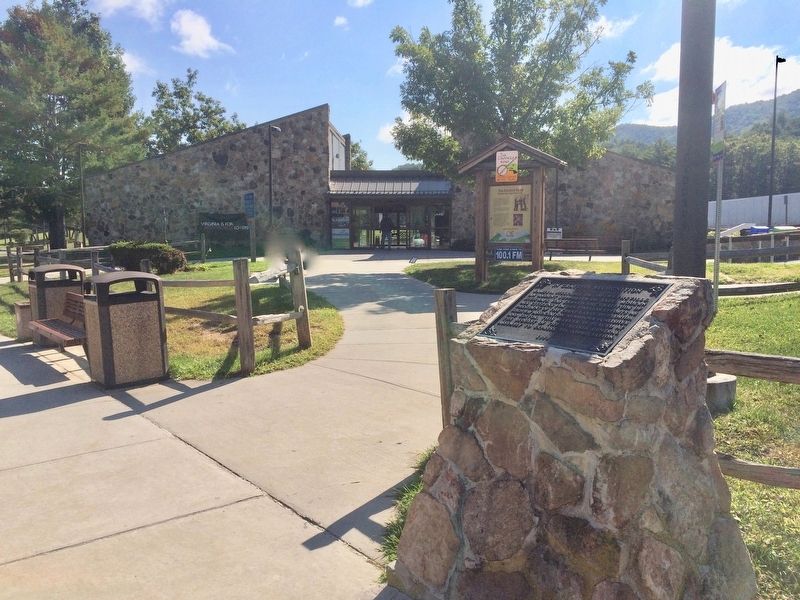
The Crooked Road Marker at the Rocky Gap Welcome Center on I-77.
Near Interstate 77 at milepost 61 south of North Scenic Highway (State Route 606).
From the Blue Ridge Mountains to the Coalfields
region, Southwest Virginia is blessed with historic
and contemporary music venues, musicians, and
fretted instrument makers. Historically isolated, the
region retained its strong musical legacy by . . . — — Map (db m108225) HM
On Island Road (Interstate 81) 1 mile north of Exit 74, on the right when traveling north.
Bristol. In 1927 the Victor Talking Machine Company sent a portable studio to Bristol, and music publisher Ralph Peer advertized for traditional musicians wishing to try their hand at recording. The test pressings of the resulting “Bristol . . . — — Map (db m67275) HM
On East Stuart Drive (Old U.S. 58) east of Floyd Pike (U.S. 221), on the right when traveling east.
Caroll County. Carroll County has been richly productive of traditional musicians for generations. Legendary musical families have lived in Carroll since the late colonial period, including the Stonemans, Meyers, Meltons, and Edmonds families. . . . — — Map (db m104638) HM
From the Blue Ridge Mountains to the Coalfields region, southwest Virginia is blessed with historic and contemporary music venues, musicians, and fretted instrument markers. Historically isolated, the region retained its strong musical legacy by . . . — — Map (db m90701) HM
On Dickenson Highway (Virginia Route 83) east of Red Onion Prison Road (Virginia Route 361), on the right.
Dickenson County.The traditional music of Dickenson County has a
special sound. Based upon tones from the
Primitive Baptist and “Dunkard“ churches, this
sound has influenced singers in the string bands of
the region. The most . . . — — Map (db m90774) HM
On Franklin Street (Virginia Route 40) just south of North Main Street (Business U.S. 220).
Franklin County. Welcome to Franklin County, the eastern gateway to The Crooked Road, a journey through Southwest Virginia's musical heritage that winds through the Appalachian Mountains for 265 miles. Franklin County has always been a cultural . . . — — Map (db m71564) HM
On East Stuart Drive (U.S. 221) at New River Trail State Park, on the right when traveling south on East Stuart Drive.
Galax. Much of America’s music was invented in Virginia, and Galax and surrounding communities have long been an epicenter for the keeping of historic sounds and the creation of new ones. Greenberry Leonard lived in the Old Town section of . . . — — Map (db m68284) HM
On Grayson Parkway (U.S. 58/221) at Forestry Lane (Wild Turkey Lane), on the right when traveling west on Grayson Parkway.
America's commercial country music began in a cotton mill in Fries in 1923. Mill hand Henry Whitter traveled to New York and recorded a hit, "The Wreck of the Old '97". In 1924 a second mill hand, Ernest V. Stoneman, went north to record. They were . . . — — Map (db m208656) HM
On East Main Street (U.S. 58) at Morton Drive, on the right when traveling west on East Main Street.
Independence. Grayson County is noted for traditional music and altitude. Four of Virginia’s five highest mountains are to be found here. In 1850 Grayson County was in the midst of controversy concerning the location of the county seat. As a . . . — — Map (db m72616) HM
On Highlands Parkway (U.S. 58) at Grayson Highland Lane, on the right when traveling west on Highlands Parkway.
Grayson County. Western Grayson County has produced fine traditional musicians, performers at school entertainments, fiddlers’ conventions, and community gatherings for many generations. Among them was the old-time string band, the Rugby Gully . . . — — Map (db m70778) HM
On HIghlands Parkway (U.S. 58) close to Old Park Road (County Route 754), on the right when traveling west.
Whitetop, Mt. Rogers. Visible at great distances, Whitetop Mountain was known as the “Meadow Mountain” in colonial times. With a climate similar to southern Canada, this beloved mountain is Virginia’s second highest peak and immediately . . . — — Map (db m71555) HM
On Wharton Lane at Norton Coeburn Road (U.S. 283), on the left on Wharton Lane.
Norton. Norton has produced important musicians for a
century. Songwriter and ballad singer Kate O’Neill
(later Kate Peters Sturgill) grew up here, began a
string band in 1914, taught hundreds to play guitar,
and was a pioneer on radio. . . . — — Map (db m90885) HM
On Business U.S. 58 at Blue Ridge Parkway, on the right when traveling west on U.S. 58Business .
Meadows of Dan. Patrick County is named for a fiddler, Patrick Henry, and is where the Piedmont Plateau meets the Blue Ridge Mountains. Settled in Revolutionary times, it has always been a musical place. Stuart, the county seat, is named for a . . . — — Map (db m104623) HM
On Orby Cantrell Highway (U.S. 58), on the right when traveling north.
(Right Side):Speers Ferry Historically the Clinch River served as a major avenue for settlement and opened up the area of southwestern Virginia, Tennessee, and Kentucky. Among other settlers, Daniel Boone lived along the banks of this . . . — — Map (db m36087) HM
On South Beaver Dam Avenue just south of West Laurel Avenue (U.S. 58), on the left when traveling south.
Respected keepers of musical traditions have lived in Damascus or nearby for many years. Among them, blind balladeer Horton Barker who went to the White House to sing for President and Mrs. Roosevelt in the 1930s. Walter "Sparkplug" Hughes was a . . . — — Map (db m209485) HM
On Gilley Avenue East (Alternate U.S. 58) east of Hamblen Street South, on the right when traveling east.
Big Stone Gap. Big Stone Gap takes its name from a large stone, visible
in a gap. Wagoners who followed Daniel Boone’s trail
said: “It’s a day's ride from the Big Stone Gap to
Cumberland Gap.” Fiddlers, banjo players, and . . . — — Map (db m90913) HM
On Orby Cantrell Highway (U.S. 23) at Potter Town Road (County Route 667), on the right when traveling south on Orby Cantrell Highway.
From the Blue Ridge Mountains to the Coalfields region, southwest Virginia is blessed with historic and contemporary music venues, musicians, and fretted instrument makers. Historically isolated, the region retained its strong musical legacy by . . . — — Map (db m90782) HM
On East Main Street (County Route 640) at Tacoma Avenue SE on East Main Street.
Wise. Known variously through the years as Big Glades, Gladesville, and Gladeville, Wise took its current name in 1924 after Henry Alexander Wise, Governor of Virginia before the Civil War. Located on the road between Union
Kentucky and the . . . — — Map (db m90857) HM