111 entries match your criteria. The first 100 are listed. The final 11 ⊳
Butterfield Overland Mail Historical Markers
The Butterfield (or Southern) Overland Mail was a mail and passenger stage service from St. Louis, Missouri, and Memphis, Tennessee, to San Francisco, California. It operated from September, 1858 to March, 1861 and is considered the nation’s first transcontinental mail service. This series includes markers about the Butterfield Overland Stage that generally follow the route of the mail line. The route was designated a National Historic Trail in 2023.
In 1857, the government awarded John Butterfield a contract to carry mail by stagecoach between St. Louis and San Francisco. The 2,800-mile route was to be traversed within 25 days. A year later, as the stagecoaches prepared to roll, Butterfiled . . . — — Map (db m100817) HM
The Apache Pass Stage Station was built of stone in July 1858. Within its 6-8 foot-high walls were a kitchen-dining room, sleeping rooms, a storage room for feed and weapons, and a mule corral with portholes in every stall. The stage stopped here . . . — — Map (db m100814) HM
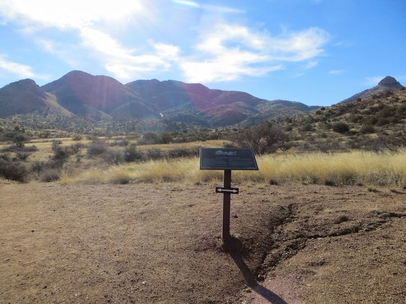
This valley owes its name to the two springs located one mile north of this monument. From 400 A.D. to 1450 A.D. indigenous Indians farmed the region. Their bedrock mortar pits remain on the nearby hill. Later Chiricahua Apaches, Spaniards, . . . — — Map (db m37768) HM
The San Antonio and San Diego Mail Line began service across Arizona to the Pacific coast in July, 1857. Its route included a stop here near the Dragoon spring. The San Antonio Line was commonly known as the "Jackass Mail" because mules were used . . . — — Map (db m76940) HM
During his 1774 exploratory trip, Anza made friends with Chief Olleyquotequiebe (Anza called him “Palma”) of the Quechan Indians, who controlled the river crossing. The Quechans welcomed the 1775 colonizing expedition and supplied . . . — — Map (db m158365) HM
John Butterfield was born in Berne, New York in 1801 and grew up on a farm amid the technological revolution of the first steamboat, the Erie Canal, the steam locomotive, and the electric telegraph.
In 1857, John Butterfield won a lucrative . . . — — Map (db m84484) HM
Mar. 20, 1839 Trail of Tears Mar. 8, 1847 Robinson's Crossroads First Post Office Feb. 5, 1858 Name changed to Bloomington Sept. 18, 1858 Butterfield Stage Stop to 1861 Dec. 9, 1862 Civil War Skirmishes Aug. 24, 1864 "Camp Mudtown" Mar. 9, 1881 . . . — — Map (db m33712) HM
This marker, set on the Butterfield Stagecoach Road, is placed near the spot where the trail crossed the east-west road between Huntsville and the Robinson settlement in western Benton County. John Robinson, a Revolutionary soldier, settled here . . . — — Map (db m68781) HM
This site was donated to the Benton County Historical Society by Scarlett Biggs Wilson and Lara Wilson Rosenblum in honor of their parents/grandparents, Guy and Nell Biggs, early pioneers of the Cross Hollows area. Cross Hollows is recognized for . . . — — Map (db m68789) HM
To commemorate the Centennial passage, through Benton County of the First Westbound Stage coach on the Butterfield Overland Mail Route from St. Louis to San Francisco. Callahan's Tavern, the site of which is about a half a mile northeast of this . . . — — Map (db m216324) HM
The Butterfield stage route
between Saint Louis and San
Francisco passed through the
main street of Van Buren,
Arkansas and crossed the
river at this point.
— — Map (db m96457) HM
Potts Inn John Kirkbride Potts (1803-1879) was born in Pennsylvania and moved to Arkansas in the 1820s. In 1828 he settled by Galla Creek, eventually acquiring 650 acres of land. Potts went to California in the Gold Rush of 1849: he failed to . . . — — Map (db m225451) HM
Commemorating arrival of the first Butterfield Overland mail coach, St. Louis to San Francisco, arrived in Fort Smith at John Rogers City Hotel, North 2nd and A Streets, 2:00 a.m. September 19, 1858. — — Map (db m236790) HM
Here on this, the Old Wire Road, was located Fitzgerald's Station on the Butterfield Overland mail route from St. Louis to San Francisco. First trip 1858. Last 1861. Longest and best conducted mail route in the world. 2795 miles. Service twice . . . — — Map (db m59950) HM
Andrew Davidson Firebaugh was born in Virginia in 1823. He served with the Texas Mounted Riflemen in the Mexican War. Coming to California in 1849, he fought in the Mariposa Indian War under Major James D. Savage on the expedition that discovered . . . — — Map (db m229464) HM
This site was originally called Mechanicsville, gradually changing to Humphrey Station after Miles Humphreys' store. Miles Humphreys came to California to join his brother John after the Civil War and saw an opportunity by opening his store at this . . . — — Map (db m28272) HM
Five miles southwesterly from this point, on both sides of Fresno
Slough, is the site of Fresno City. Fresno City gradually arose
at the head of navigation of Fresno Slough and existed from
approximately 1855 to 1875. The town served as a . . . — — Map (db m175903) HM
Gordon’s Ferry was an overhead cable type of ferry operated during the 1850’s by Major Gordon. An adobe station house was located on the south bank of Kern River, just a few yards to the west of this marker. It was also a station on the Butterfield . . . — — Map (db m25149) HM
Just south of this point stood the Butterfield Overland Stage site known as Kern River Slough. Operating through present Kern County during 1858 – 1861. This famous line ran from St. Louis, Missouri to San Francisco until the outbreak of the . . . — — Map (db m24946) HM
Two and one half miles east of this point, on a small flat south of Poso Creek, is the site of one of six stagecoach stations in Kern County belonging to the Butterfield Overland Mail Company. The Butterfield Company operated along a southern route . . . — — Map (db m168620) HM
Six miles east of this point was the site of the Butterfield Stage Line station Sinks of Tejón. Operating through present Kern County during 1858-61, this famous line ran from St. Louis, Missouri to San Francisco until the outbreak of the Civil War. — — Map (db m144943) HM
Founded in 1856 by L.A. Whitmore who operated first Kings River ferry crossing. After 1858 town became stopping place for Butterfield stages. Toll bridge superseded ferry in 1873. On December 26, 1873, Tiburcio Vasquez and bandit gang made bold raid . . . — — Map (db m158224) HM
Near this spot stood the Bella Union Hotel, long a social and political center. Here, on October 7, 1858, the first Butterfield Overland Mail stage from the East arrived 21 days after leaving St. Louis. Warren Hall was the driver, and Waterman . . . — — Map (db m59812) HM
This block is the site of:
First brick school house in Los Angeles known as School No. 1, built 1854-1855;
Butterfield Overland Mail Company office and corral, 1858-1861;
Office of U.S. Quartermaster, 1861;
Corral for camels from Fort . . . — — Map (db m164547) HM
This dwelling, built in 1849 by Don Vincente de la Osa, was a favored stopping place for the numerous travelers on El Camino Real. It stands on land that is part of the one-square-league Rancho El Encino granted in 1845 by Governor Pio Pico to three . . . — — Map (db m131161) HM
Near this site of the Los Angeles Dam and reservoir were located a Butterfield Stage station, 1861 - 1874; San Fernando Valley’s first English-speaking school, 1860 - 1883; and its first post office, 1869 - 1874. — — Map (db m127534) HM
Beneath this park rest the stone foundations and floor tiles of the historic adobe where Mexican General Andres Pico and U.S. Lieutenant Colonel John C. Fremont signed the Treaty of Cahuenga on January 13, 1847. Signing the Treaty ended the . . . — — Map (db m126025) HM
This site was the location of a combination store, post office, telegraph office, tavern, and stage depot accommodating travelers during the Kern River gold rush in the early 1850s. A regular stop for Butterfield and other early California stage . . . — — Map (db m154273) HM
Initially a Landmark
On this site there was a single willow tree on the banks of a slough. The willow could be seen for miles around and the vaqueros named the landmark “Palo Solo”, renamed by the immigrant pioneers as Lone Willow.
Stage . . . — — Map (db m176284) HM
This route was used by Luiseño and Gabrieleño Indians, whose villages were nearby. Leandro Serrano established a home here in 1820. Jackson and Warner traveled the road in 1831, and Frémont in 1848. It was the southern emigrant road for gold seekers . . . — — Map (db m82468) HM
Where mail was delivered, horses changed and passengers given rest and a meal. First stage carrying overland mail left Tipton, Missouri on Sept. 15, 1858 and, passing through Temescal arrived in Los Angeles onOct. 7, 1858.
First dedicated by . . . — — Map (db m82155) HM
This site is a watering hole that was available for the horses and mules of the
Butterfield Overland Mail Line, known to most as the "Butterfield Stage". The main route for these mail-bearing stagecoaches closely followed the Temecula Creek which . . . — — Map (db m153366) HM
Near this spot once stood the home of Isaac Williams, first American settler in this valley, about which on September 26-27 1846, was fought the first important engagement in California of the war with Mexico.
This was also the site of the Chino . . . — — Map (db m379) HM
This site sits at the base of the prominent Red Hill Landmark. The early historic importance of the property stems from its proximity to a reliable water source, Cucamonga Creek, and to its location on the major roadway between Los Angeles and San . . . — — Map (db m117911) HM
The old way variously known as Sonora, Colorado River or Southern Emigrant Trail and later as Butterfield Overland Mail Route traversed Box Canyon just east of here. January 19, 1847, the Mormon Battalion, under command of Lt-Col. Philip St G Cooke, . . . — — Map (db m51580) HM
Here was a palm-studded desert resting place, 1826-1866, for Mexican pioneers, mountain men, the Army of the West, Mormon Battalion, Boundary Commission, Forty-Niners, Railway Survey, Butterfield Overland Mail stages, and California Legion. It was . . . — — Map (db m51578) HM
Here the southern trail of explorers, trappers, soldiers, and emigrants crossed ancient trade routes of Kamia, Cahuilla, Diegueno, and Luiseno Indians. On the flat southwest across the creek, Warren F. Hall built and operated the San Felipe home . . . — — Map (db m51583) HM
This pass, Puerta, between the desert and the cooler valleys to the north, was used by the Mormon Battalion, Kearny's Army of the West, the Butterfield Overland Mail Stages, and emigrants who eventually settled the west. The eroded scar on the left . . . — — Map (db m145313) HM
A reconstruction (1934) of Vallecito Stage Station built in 1852 at the edge of the Great Colorado Desert. It was an important stop on the first official transcontinental route, serving the San Diego-San Antonio ('Jackass') mail line (1857-1859), . . . — — Map (db m51579) HM
One of the chief remaining landmarks of famous old stage line. Coaches and spring wagons carried passengers and mail. Stations were built at 20-mile intervals. The first stage on the line left St. Louis on September 15, 1858. — — Map (db m51582) HM
Occupied in 1858 by Warren Hall, Divison Superintendent, Butterfield Overland Mail which operated between San Francisco and the eastern termini, St. Louis and Memphis, from September 15, 1858 to March 2, 1861. The first mail stage from the east . . . — — Map (db m51093) HM
In 1844, Gov. Manuel Micheltorena granted 44,322 acres to Juan Jose Warner who built this house. Gen. Kearny passed here in 1846; Mormon Battalion in 1847. First Butterfield Stage stopped at this ranch on Oct. 6, 1858 enroute from Tipton, Mo. to San . . . — — Map (db m51084) HM
Two plaques, one above the other
First Business Structure
Public necessity in 1964 required the demolition of the historic house referred to by the accompanying plaque; this marker is placed to perpetuate its memory and to . . . — — Map (db m93314) HM
On September 16, 1857, John Butterfield, a New Yorker, received a contract with the U.S. Post Office Department to establish reliable transportation between Missouri and San Francisco.
As a young man he joined with Henry Wells and William . . . — — Map (db m57988) HM
A toll road was built over Pacheco Pass in 1857 by Andrew D. Firebaugh. Later in that same year he built a tavern near this site, which became a Butterfield transcontinental stage stop. In 1859 the Pacific and Atlantic Company built a telegraph line . . . — — Map (db m54036) HM
[The Morgan Hill Centennial Project is a very unusual ‘marker’. It was created to celebrate the 100th anniversary of the incorporation of the City of Morgan Hill. One starts at the center of the marker and then proceeds along an expanding spiral . . . — — Map (db m46097) HM
"One-eye Charley Parkhurst,” working as a driver for stage lines came to California seeking fortune in the gold fields until around 1860. Charley was small, slim and wiry. When he spoke it was in an oddly high-pitched voice. Charley died 1879 in a . . . — — Map (db m62585) HM
One and one-half miles northwest of this point the settlement of Fountain Springs was established before 1855. It was at the junction of the Stockton-Los Angeles Road and the road to the Kern River gold mines. From 1858 to 1861, Fountain Springs was . . . — — Map (db m51865) HM
Running north and south, following an older Indian Trail is the route taken by many Spanish expeditions, American trappers, traders and parties of exploration. It was the major inland route of gold seekers to the northern and southern Mines and was . . . — — Map (db m51868) HM
This route, following an earlier emigrant trail, was laid out in the 1850’s as part of the Stockton-Los Angeles Road. It was used by the Butterfield Overland Mail stages between St. Louis and San Francisco from 1858 to 1861. This was the first . . . — — Map (db m143279) HM
Here Peter Goodhue operated am emigrant trail stopping place on the banks of the Tule River from 1854 to until the river changed its course in 1862. This became a Butterfield Overland Mail Stage Station, 1858-61. It was kept in 1860 by R. Porter . . . — — Map (db m10461) HM
At this place, near midnight Oct. 8, 1858, Visalians greeted with an anvil salute, the first coach of the pioneer line to arrive from St. Louis. The Visalians' hearty welcome caused the only "through" passenger to remark "They ought to be remembered . . . — — Map (db m34511) HM
Cassville, the last town
on the route of
the Butterfield Mail in Missouri,
was not a relay station
but the coaches stopped
for mail and passengers — — Map (db m80212) HM
Warsaw, in Benton County, 55 miles from the Tipton Terminus, was a relay and meal station. Accommodations were provided by the Lemon, later Campbell House, and Nichols Tavern. Its building still stands. — — Map (db m140840) HM
The John C. Ashmore Relay Station in northwest Christian County stood in Polk Township, 152 ½ miles from the Tipton Terminus. It was the only station in the county. — — Map (db m99690) HM
Site of Gen. Nicholas Smith's tavern on Boonville Road, earliest outlet of Springfield, also station of Butterfield Stage Route carrying first overland mail from St. Louis to Pacific Coast. Government subsidy $600,000 yearly. First mail left St. . . . — — Map (db m43089) HM
The John I. Smith Relay Station was 172 ½ miles from the Tipton Terminus and stood in northeast Barry County, about 7 miles west of Crane. — — Map (db m99688) HM
[Front]
Historic town in the annals of western transportation, Tipton, in 1858-59, was the eastern stagecoach terminus of the famous Butterfield Overland Mail. N.Y. expressman John Butterfield (1801-69), under contract to carry mail and . . . — — Map (db m62481) HM
The George Shackelford Relay and Meal Station stood ½ miles south of Syracuse in Morgan County. In 1859, when the railroad reached Syracuse, it succeeded Tipton as Stage terminus. Civil War activity closed the terminus in March, 1861. — — Map (db m61425) HM
Today you can get a package from St. Louis to California in less than 24 hours. But before planes and trains, speedy deliveries to the West went by stagecoach.
Henry Wells, William Fargo, and John Butterfield capitalized on the country's rapid . . . — — Map (db m124961) HM
Stagecoaches of the Butterfield Overland Mail Co. began carrying passengers and mail from St. Louis to San Francisco, across southern New Mexico, in 1858. The 2,795-mile journey took 21-22 days. In 1861 the service was re-routed through Salt Lake . . . — — Map (db m6553) HM
On November 16, 1854, a detachment from nearby Fort Fillmore raised the U.S. flag here confirming the Gadsden Purchase; thus the Gadsden territory was officially recognized as part of the United States. In 1858, the Butterfield stage began its run . . . — — Map (db m38149) HM
This is the original La Posta. The only station that remains standing on the Butterfield Trail. For more than a century and three quarters, these old adobe walls have withstood the attack of elements and men and have sheltered such personalities as . . . — — Map (db m126894) HM
Here crossed the first road to Southern California opened for wagons by Capt. Cooke, who passed here in command of the Mormon Battalion, Nov. 1846 – later it became the California Emigrant Road – from 1858-1861, the route of the . . . — — Map (db m38302) HM
On September 16, 1857, the John Butterfield Company received a Federal contract to transport mail from Missouri to San Francisco in under 25 days. Semiweekly service began a year later. Twelve relay stations lined the Butterfield Trail in Indian . . . — — Map (db m64072) HM
Butterfield Overland Mail site of Nail's CrossingHere was located a stage stand of the Butterfield Overland Mail route, under act of Congress, March 3, 1857. First mail service arrived here in September 1858, enroute to San Francisco, service . . . — — Map (db m40707) HM
Skullyville was founded in 1832 while removal of Choctaws to what is now Oklahoma was in process. First Choctaw Agency in the West was established here with Major F.W. Armstrong as agent.
The name Skullyville was derived from Choctaw word . . . — — Map (db m64486) HM
Beginning in 1858, the Butterfield Overland Stage connected St. Louis, Missouri to Los Angeles, California. The route entered Indian Territory at Fort Smith, and coaches carried passengers and mail across 192 miles following the Texas Road and . . . — — Map (db m172956) HM
Established by the United States Army, October 28, 1852, as a protection to frontier settlers against Indians. Named in honor of
Lieutenant T.L. Chadbourne,killed at Resaca de la Palma, May 9, 1846. Occupied by Federal troops, 1852-1859; . . . — — Map (db m77861) HM
Passed near this site, providing for the first time combined passenger and mail service between Pacific and Atlantic Coasts. Operating west from St. Louis and Memphis, John Butterfield’s company used 1350 horses and mules and 90 Concord coaches and . . . — — Map (db m77944) HM
One mile southeast to Fort Chadbourne, a station on the Butterfield Mail and Stage Line, which linked St. Louis and San Francisco, 1858-1861. The fort was established in 1852, occupied until its surrender to State forces in 1861, and garrisoned at . . . — — Map (db m143124) HM
Passed near this site, providing for the first time combined passenger and mail service between Pacific and Atlantic coasts. Operating west from St. Louis and Memphis, John Butterfield’s company used 1,350 horses and mules and 90 Concord coaches and . . . — — Map (db m83088) HM
Gainesville was a station on the Southern Overland Mail Line (Butterfield Route), which provided semi-weekly mail and stage service between St. Louis and San Francisco, 1858-1861. The line was 2795 miles long – one of the longest stage . . . — — Map (db m96750) HM
One of the most important sites in the old west. Named for skulls pointing toward crossing. Only ford for many miles where animals could enter, drink and leave Pecos River safely. Elsewhere deep banks would trap them. Ford mapped 1849 by Capt. R. B. . . . — — Map (db m68928) HM
Butterfield Overland Mail
First Overland Mail Route from St. Louis, Missouri to San Francisco, California.
As a forerunner of the Pony Express and Transcontinental Railroad, the Butterfield Overland Mail was the first successful . . . — — Map (db m61507) HM
Built in 1858 as a station on the Butterfield overland mail route St. Louis to San Francisco · Abandoned in 1859, when the line was shifted to the Davis Mountain route. — — Map (db m116734) HM
Dedicated to the Airmen who, like the stage drivers before them, challenged the elements through this pass with the pioneer spirit and courage which resulted in a vast system of airline transport known as "American Airlines". . . . — — Map (db m30349) HM
Only dependable water supply in miles of arid terrain. Used by Indians for centuries. Named for either Maj. Jefferson Van Horne (who passed here en route to establish fort at El Paso, in 1849), or for Lt. J.J. Van Horn (stationed here to fight . . . — — Map (db m73296) HM
The Butterfield Overland Mail was a mail and passenger stagecoach service that linked the Western and Eastern states. John Butterfield, president of the Overland Mail Company, won a federal government contact in 1857 to take and deliver mail twice . . . — — Map (db m68170) HM
Pioneer Plaza was the center of public activity in early El Paso. A United States military guard was posted here in the late 1870s to defend citizens from Apache Indian attacks, and military bands performed in the plaza.
An irrigation ditch . . . — — Map (db m37807) HM
In the mid-19th century, mail traffic between the eastern United States and the western states and territories was accomplished via Panama and Cape Horn. In 1857, Congress authorized the postmaster to contract a new overland mail service. The . . . — — Map (db m73214) HM
[Millstone marker text is damaged]
Here passed
Marcy's California Trail 1849
Butterfield Trail 1858
Rededicated [November 22,] 2013
Moved and restored by
Love Monument Company
in cooperation with
Judge Drew Bynum
and . . . — — Map (db m73220) HM
The Diamond Station was a stop along the nearly 700 mile stretch across the Lone Star State for the Butterfield Overland Mail Stage Line Company. The Butterfield Overland Mail Company held the U.S. Mail contract for the first cross-country trek from . . . — — Map (db m96733) HM
Here ran the Southern Overland
Mail Line connecting St. Louis and
San Francisco with semi-weekly
stage and mail service, 1858-1861
The length of the route, 2,795
miles, and the superior service
maintained made this a pioneer
enterprise . . . — — Map (db m119273) HM
Established November 26, 1867 by the United States Army to defend the frontier against the Indians. A mail station on the Butterfield Overland Stage Line 1858-1861. Abandoned as a military post May 23, 1878 — — Map (db m138158) HM
By 1850 new settlers and travelers to the California Gold Rush were moving across Texas. This movement on the open plains increased hostilities between the newcomers and the Indians. The U.S. Army’s solution was a fort, called the Post on the Clear . . . — — Map (db m74736) HM
Established November 14, 1851
Abandoned April 6, 1854
Repaired and Used by Southern Overland Mail, 1858-1861
Sub-Post of Fort Griffin in 1871 and 1872
A thriving village which grew up in its vicinity after the Civil War served as . . . — — Map (db m74737) HM
Over these tracks passed the Butterfield Stage, 1858-1861, providing for first time in history a combined passenger and mail service from Atlantic to Pacific coast. Operating westward from St. Louis and Memphis, John Butterfield's company used 1,350 . . . — — Map (db m61274) HM
Used as a watering place and camping ground by Indians since pre-Columbian times, the springs were possibly visited about 1536 by Spaniard Cabeza de Vaca on his wanderings through Texas. The expedition of Juan de Mendoza, with his party of . . . — — Map (db m201800) HM
Here crossed the undated Comanche Trail from Llano Estacado to Mexico. In 1850 John R. Bartlett while surveying the Mexican boundary found the crossing marked by skulls of horses; hence the name “Horse Head”. The Southern Overland Mail . . . — — Map (db m53225) HM
One of the few spots where pioneer travelers could cross the Pecos River by fording. At Emigrants' Crossing, the deep, treacherous river flows over exposed rock. It is one of only three fords in a 60-mile segment of the stream, and was the one . . . — — Map (db m61266) HM
Used by emigrants and the Southern (Butterfield) Overland Mail which linked St. Louis and San Francisco with semi-weekly mail, 1858-1861. Headquarters in 1855 of Captain John Pope, supervisor of the drilling of the first deep well west of the 98th . . . — — Map (db m80284) HM
From 1858 until the outbreak of the Civil War in 1861, a station of the Butterfield Overland Mail route was located here. Despite a brief existence, it was an important stop on the early stage line that reached from Missouri to California. Stages . . . — — Map (db m105201) HM
The Butterfield Overland Mail, the first public transportation facility spanning the area from the Mississippi to the Pacific with passenger and mail service, 1858-61, used the 2400-foot peak to the northeast as a beacon. The drivers and passengers . . . — — Map (db m77734) HM
111 entries matched your criteria. The first 100 are listed above. The final 11 ⊳