Atchison, Topeka and Santa Fe Railway Historical Markers
Initially chartered through the Kansas Territorial Legislature in 1859, the Civil War delayed initial construction until 1868. Spanning the plains, the railroad ultimately stretched to California, and played an important role in the growth of the American southwest. The Santa Fe merged with Burlington Northern in 1995.
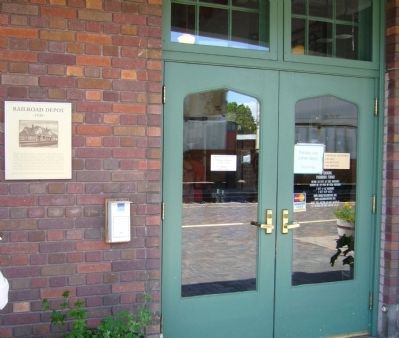
The facility was originally constructed in 1925-1926 by the Atchison, Topeka and Santa Fe Railroad as the passenger station for the Flagstaff stop. The City of Flagstaff acquired the building in 1992 using city of Flagstaff Bed, Board & Booze tax . . . — — Map (db m78739) HM
On West Jackson Street at 5th Avenue when traveling south on West Jackson Street.
The Santa Fe Freight Depot was constructed in 1929 by the Atchison Topeka and Santa Fe Railroad Company.The depot is a unique example of a reinforced concrete structure. Like other buildings on Jackson Street, the freight depot reflects the . . . — — Map (db m73075) HM
On Andy Devine Avenue (Business Interstate 40) at 4th Street, on the right when traveling east on Andy Devine Avenue.
This building has been placed on
The National Register of
Historic Places
By the United States Department of the Interior.
Atchinson, Topeka & Sante Fe
Railroad Depot
Built 1907
Kingman's early existence depended upon the . . . — — Map (db m29412) HM
On West Andy Devine Avenue (Old U.S. 66) at North 1st Street, on the right when traveling west on West Andy Devine Avenue.
Engine 3759
Engine No. 3759, is a mighty steam engine from an era nearly 100 years ago. An era of iron horses that sped across thousands of miles; an era that has always been entwined with Kingman. But just what is No. 3759, besides one of . . . — — Map (db m194743) HM
On Lewis Avenue (Business Route 40) at 5th Street, on the right when traveling west on Lewis Avenue.
Ash Fork is located near the 35th Parallel where, in the 1850's the Army Corps of Topographical Engineers began surveying a future railroad route. Camels were imported and used as beasts of burden, adding to the colorful history of the region. A . . . — — Map (db m33442) HM
On Central Valley Highway at Poso Avenue, on the right when traveling north on Central Valley Highway.
This building originally located four blocks southeast of
this site was opened for use and dedicated October 11, 1917.
Until closed in 1978, this building served as Shafter’s
gateway to the world as the mail, Western Union Telegraph,
express, . . . — — Map (db m130325) HM
Near Baldwin Avenue, 0.3 miles south of U.S. 210, on the right when traveling south.
Constructed about 1890 in Rancho Santa Anita by Atchison Topeka & Santa Fe Railroad on its transcontinental main line. Elias J. “Lucky” Baldwin donated right-of-way and bricks in exchange for agreement to stop trains, maintain a depot . . . — — Map (db m120309) HM
Constructed by California Southern Railroad (a Santa Fe subsidiary),
built 1896.
Declared 1988, Historic-Cultural Monument No. 339, City of Los Angeles, Cultural Heritage Commission, Cultural Affairs Department. — — Map (db m205594) HM
This house was constructed in 1868 by Isaac J. Harvey, before the arrival of the railroad, before the town's founding when only twelve other structures stood. Salinas City grew and the Harvey family helped lay its foundation. With son Benton, Isaac . . . — — Map (db m118242) HM
Harvey Houses were legendary in the history of Western rail travel. Operated by Fred Harvey in conjunction with this Santa Fe Railway, the network of restaurant-hotels set a new standard in quality meal service. Barstow's Spanish-Moorish "Casa Del . . . — — Map (db m50666) HM
On East Main Street (Business Interstate 15) at Barstow Road on East Main Street.
In the late 1800’s to 1930’s, rail travel was considered the choice of transportation, Fred Harvey had set up a string of dining rooms and boarding houses for Santa Fe passengers.
In 1911, Mr. Harvey opened million dollar “Casa Del . . . — — Map (db m50535) HM
On East Main Street (Business Interstate 15) at Barstow Road on East Main Street.
In 1885, the California Southern R.R. Co. connected with the Atlantic and Pacific R.R. line on the Mojave River creating Waterman Junction.
Being named for Governor Waterman, owner of Waterman Mine and a mill nearby.
A post office was . . . — — Map (db m107132) HM
On National Trails Highway at Crucero Road, on the right when traveling east on National Trails Highway.
...and they shall beat their swords into plowshares, and their spears into pruning hooks: nation shall not lift up sword against nation, neither shall they learn war any more. Micah 4:3
With the end of World War II and the onset of the Cold . . . — — Map (db m78521) HM
On Quinn Court at G Street, on the right when traveling west on Quinn Court.
Formerly one of the grandest Harvey House Hotel, Restaurant & Santa Fe Train Stations. The hotel and restaurant were open from 1908 to 1949. The train station closed in 1988.
Recognized by Hampton Hotels Save-A-Landmark program as a site . . . — — Map (db m33445) HM
On West 3rd Street west of K Street, on the right when traveling west.
Atchison Topeka & Santa Fe railway built San Bernardino‘s first permanent train depot in 1886 to meet the growing number of rail passengers and to house its Los Angeles division administrative and freight offices. This two-and-a-half-story wooden . . . — — Map (db m124518) HM
Near Bay Marina Drive west of West 23rd Avenue, on the right when traveling west.
This National City California Southern Railroad Depot, built in 1882, served as the first Pacific Coast Terminus Station of the Santa Fe Railway System's Transcontinental Railroad. The station was the West Coast general office and figured . . . — — Map (db m120892) HM
On South San Joaquin Street, on the right when traveling south.
Santa Fe Railway acquired its route from Bakersfield to Stockton from the San Francisco-San Joaquin Valley Railroad, known locally as the "Valley Road." This line, when completed in 1898, was the only railroad competing with Southern Pacific . . . — — Map (db m195082) HM
On County Road 3A, 4.5 miles south of U.S. 24, on the right when traveling south.
Lt. Zubulon M. Pike and his men, who traveled through this area in November and December 1806, were the first American explorers to view the Arkansas River Canyon now known as the Royal Gorge. A small party from the Maj. Stephen H. Long expedition . . . — — Map (db m34858) HM
To commemorate the birthplace
of
The Atchison, Topeka & Santa Fe
Railway Company in Atchison, Kansas
February 11, 1859
From this small beginning - a rail line connecting Atchison and Topeka, Kansas - a great transportation system . . . — — Map (db m44788) HM
On Main Street (U.S. 281) at 23rd Street, on the left when traveling north on Main Street.
Donated to the City of Great Bend this 18th day of Sept., 1956 by the Atchison, Topeka and Santa Fe Railway Company.
History
Purchased in July 1919 from Baldwin Locomotive Works at Eddystone, Pennsylvania at a cost of $69,000. Used in . . . — — Map (db m59846) HM
Chase County, named after Salmon P. Chase, who was a United States Senator from Ohio and Chief Justice of the Supreme Court of the United States, was organized in 1859 in the Kansas Territory.
James Fisher, from Columbiana County, Ohio was the . . . — — Map (db m45683) HM
On Cottonwood Street (State Highway 177) at the railroad crossing, on the right when traveling south on Cottonwood Street.
Originally named Cottonwood Station, Strong City received its current name from W.B. Strong, president of the Atchison, Topeka and Santa Fe Railroad. This was an important railroad town and was also known for its stone quarries and stone . . . — — Map (db m45592) HM
On Summit Street (U.S. 77) north of Maple Avenue, on the left when traveling north.
Engine 2542 was built in 1910 by the American Locomotive Company in Pittsburgh, PA., for the Kansas City, Mexico and Orient Railway. In 1929, the Atchison, Topeka and Santa Fe Railway purchased the KCM & O Line and assigned this engine to the . . . — — Map (db m60487) HM
On Central Avenue at Front Street, on the left when traveling north on Central Avenue.
For decades, Dodge City's existence was tied to the railroad. When the first train arrived on the newly-laid Atchison, Topeka & Santa Fe Railroad tracks in September 1872, stacks of buffalo hides were already waiting to be transported to eastern . . . — — Map (db m65283) HM
On Front Street at 2nd Avenue, on the left when traveling west on Front Street.
This map depicts businesses known to have existed along Dodge City's Front Street between 1878 and 1882. As the town grew, other establishments were located farther north of Front Street, as well as south of the railroad tracks. Modern street . . . — — Map (db m65272) HM
On Tecumseh Street, on the right when traveling west.
The Leavenworth, Lawrence & Galveston was the first railroad built south of the transcontinental Union Pacific which passed through Lawrence. Building the 30 miles of track to Ottawa in 1867-8 was difficult. Veterans of the UP construction, . . . — — Map (db m50753) HM
Created to reclaim this historic riverfront for the citizens of Leavenworth and to recall its prominent role in the development of the American West.
————————
When Leavenworth was established in . . . — — Map (db m42138) HM
On Esplanade Street at Delaware Street, on the left when traveling north on Esplanade Street.
The railroad era began in the eastern part of the United States in the 1830's when the Baltimore and Ohio Railroad opened with thirteen miles of track. Most of the lines were built in the Northeast and Old Northwest.
The first Kansas Territorial . . . — — Map (db m42155) HM
On Aztec Lane, 0.2 miles east of 18th Avenue, on the left when traveling west.
This Centennial Memorial, erected in gratitude to God, commemorates the coming to America of the Swiss-German Mennonites in the Fall of 1874 from Volhynia, a former Polish province, in the present Russian Ukraine. It symbolizes the Christian . . . — — Map (db m57109) HM
On SW Taylor Street north of SW Huntoon Street, on the left when traveling north.
Founder and Mayor of Topeka. Influenced the selection of this city as the capital of Kansas. Organized the Atchison, Topeka, and Santa Fe Railroad Company, obtained the original charter in the year 1859. Promoted the early development of Kansas and . . . — — Map (db m63886) HM
The Pauline Depot, constructed by the Atchison Topeka and Santa Fe Railroad Company at a cost of $985, is a typical small town Santa Fe Railroad station that served the public during the early 1900's. This depot was located in Pauline, seven . . . — — Map (db m65023) HM
On 1st Street SW at Gold Avenue SW, on the right when traveling north on 1st Street SW.
Harvey Girls
In 1883, the Fred Harvey Company hired women to serve in its diners and hotels along the Atchison, Topeka and Santa Fe Railway. Thousands of respectable, intelligent women were recruited from the Midwest and East Coast to come . . . — — Map (db m45326) HM
On 1st Street SW, on the right when traveling north.
Hotel Alvarado was constructed in 1902 and demolished in 1970 in spite of local efforts to preserve it. The hotel and depot complex, shown in this 1908 photograph looking west, was designed by Santa Fe Railroad architect Charles Whittlesey in . . . — — Map (db m45446) HM
On West Oklahoma Avenue, 0.1 miles west of South 2nd Street, on the left when traveling west.
The Santa Fe, completed in 1887, was the only railway into Oklahoma Territory and the only direct connection with the "outside" world during the hectic days of 1889. The first depot was a small red frame building located on the west side of the . . . — — Map (db m141930) HM
The Atchison, Topeka, and Santa Fe Railroad gave birth to Edmond, Oklahoma in terms of location and name on April 22, 1889. During road construction it was known as Mile 103 or "Summit," a side track stop on a high point (elev 1198 feet) of the . . . — — Map (db m171180) HM
On East 8th Street at Avenue A, on the right when traveling east on East 8th Street.
Fred Harvey, a native of England, began operation of his Santa Fe Railroad dining rooms in 1876. In 1900 a Harvey House opened in Somerville, Divisional Headquarters of the Santa Fe Line. The 2-story, galleried structure was 260 ft. long and . . . — — Map (db m74294) HM
On South Main Street south of 1st Street, on the right when traveling south.
The 1920s oil boom brought increased business to this railroad town, and a new depot was built here in 1928. The structure exhibits elements of the Prairie School, Mission, and Tudor styles of architecture. Prominent features include bracketed . . . — — Map (db m55888) HM
Near Farm to Market Road 503, 1 mile south of U.S. 267, on the right when traveling south.
The Atchison, Topeka and Santa Fe railroad established a railway line about eight miles southwest of Coleman in 1904. The town of Valera developed in the area around the train depot. Its business district, established parallel to the railroad, . . . — — Map (db m94422) HM
On Depot Lane at East Elm Street, on the right when traveling north on Depot Lane.
By the end of the 19th Century Gainesville was established as one of the state's major rail centers. This depot was built about 1902 to handle the increased traffic on the Gulf, Colorado, and Santa Fe Railroad. The red brick structure contained a . . . — — Map (db m97595) HM
On Santa Fe Place at 26th Street, on the right when traveling west on Santa Fe Place.
In 1874 Galveston County voters narrowly approved $500,000 in bonds to finance construction of a railroad line from the city of Galveston that would bypass Houston, its business rival, and reach across Texas and beyond to Santa Fe, New Mexico. Henry . . . — — Map (db m59386) HM
Near North 20th Street at East Woodrow Road, on the right when traveling north.
Representing the Santa Fe Railroad, W.B. Storey, Jr. bought the future townsite of Slaton on April 15, 1911. The railroad's plans included a roundhouse, switch lines, depot and Harvey House, making Slaton a center for area rail transport. Rail . . . — — Map (db m73587) HM
On South 9th Street at West Garza Street, on the left when traveling south on South 9th Street.
The town of Slaton traces its history to the Santa Fe Railroad. O.L. Slaton, a Lubbock businessman and banker, was instrumental in securing the right-of-way for the railroad through this area. When the new town was laid out in 1911, it was named for . . . — — Map (db m73608) HM
On Railroad Avenue at Texas Avenue, on the left when traveling east on Railroad Avenue.
The city of Slaton has historic ties to the railroad. For decades the site was ranchland until the Santa Fe Railway sought a location for a division point to service trains. The Santa Fe bought the land in April 1911, naming the townsite for . . . — — Map (db m73588) HM
On Polk Street at West 9th Ave., on the right when traveling south on Polk Street.
Built in 1928-30 at a cost of $1,500,000, this structure was designed by Santa Fe Railroad architect E. A. Harrison. The 14-story building was the tallest in Amarillo until the 1970s, and housed the offices and division headquarters of the Santa Fe . . . — — Map (db m40843) HM
On 26th Street at College Avenue (Texas Highway 350), on the right when traveling west on 26th Street.
In 1909, when rail service was vital to economic growth, Scurry County had one line (the Roscoe, Snyder & Pacific) but lacked connections to distant markets. Local residents backed C. W. Post of Garza County who gave $50,000 to attract the . . . — — Map (db m88836) HM
On West Broadway west of Railroad Avenue, on the right when traveling west.
The town of Tulia, established in 1887 on the Tule Ranch division of the JA ranch, received an economic boost in the early 20th century with the arrival of the railroad. When Tulia began, the nearest rail connection was more than 100 miles away in . . . — — Map (db m91162) HM
On Chadbourne Street at Hardeman Pass, on the right when traveling south on Chadbourne Street.
The Kansas City, Mexico, and Orient Railway Company (KCM&O) built this depot in 1909-10. The KCM&O was one of three connecting railroads promoted by mining and railroad entrepreneur Arthur E. Stilwell. The proposed rail system ran 1,600 miles . . . — — Map (db m71889) HM